

Current Snapshot
For all the latest updates visit: DisasterAWARE
1800x1080ec
2e
301448_earliest_reasonable_toa_34k
goes18_ir_11E_202608301545_lat17.3-lon-121.7
11E_tracks_latest
301444_earliest_reasonable_toa_34L
goes18_ir_11E_202608301545_lat17.3-lon-121.7

12E_tracks_latest
2e
7e
1800x1080e
7c
2w
20W_301200sair
himawari9_ir_20W_202608301540_lat34.1-lon165.9
20W_tracks_latest
21W_301200sair
himawari9_ir_21W_202608301540_lat31.1-lon166.0
21W_tracks_latest
22ww
himawari9_ir_94W_202608301530_lat20.6-lon132.8
94W_tracks_latest
himawari9_ir_96W_202608301610_lat22.0-lon117.7
96W_tracks_latest
By PDC’s Senior Weather
Specialist Glenn James

The Pacific Disaster Center’s (PDC Global) Sunday, August 30, 2026, Tropical Cyclone Activity Report…for the Pacific Ocean, the Indian Ocean, and adjacent Seas.
Tropical Cyclones
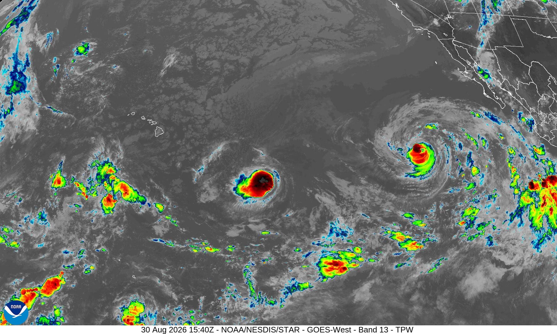
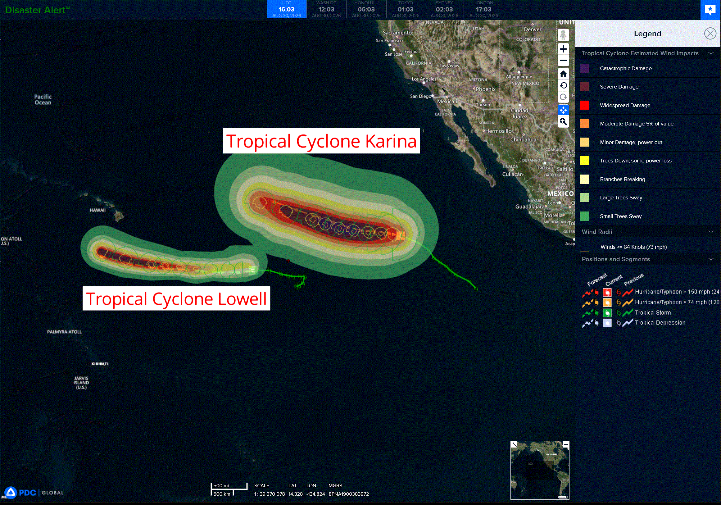
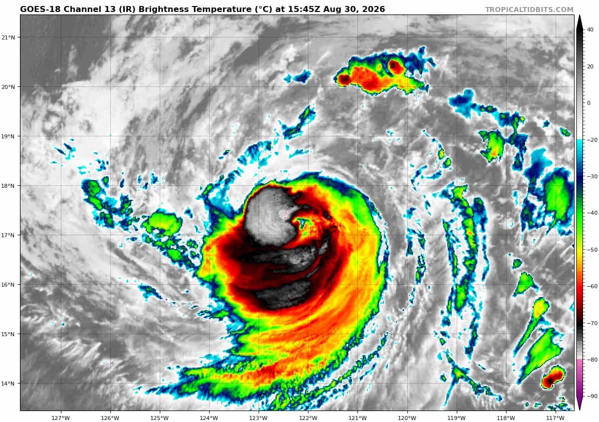
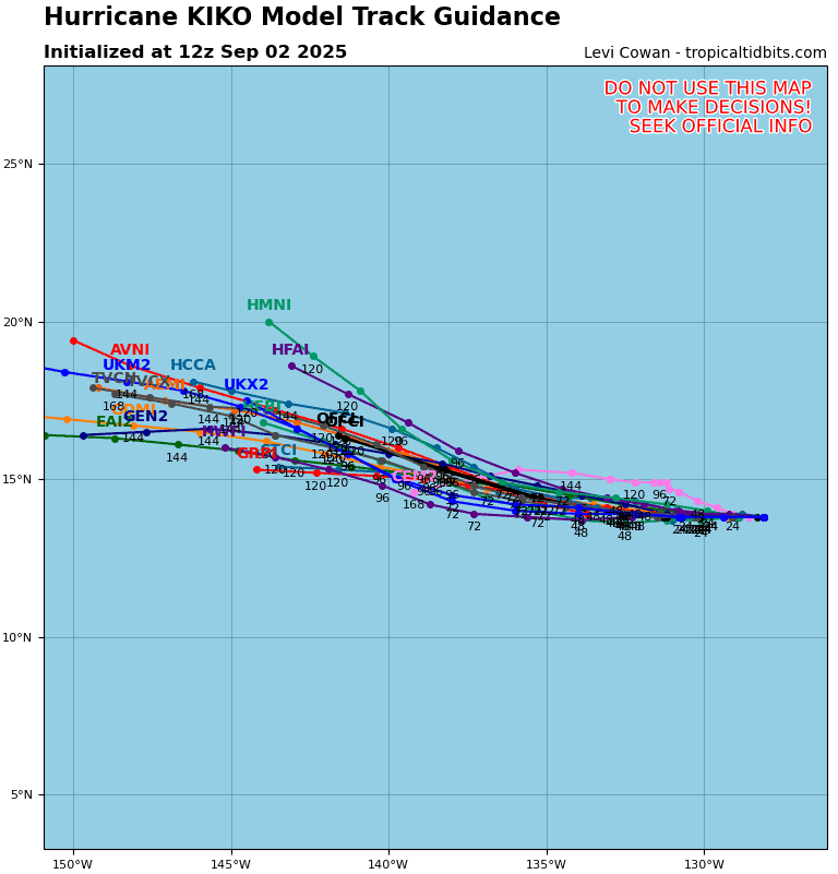
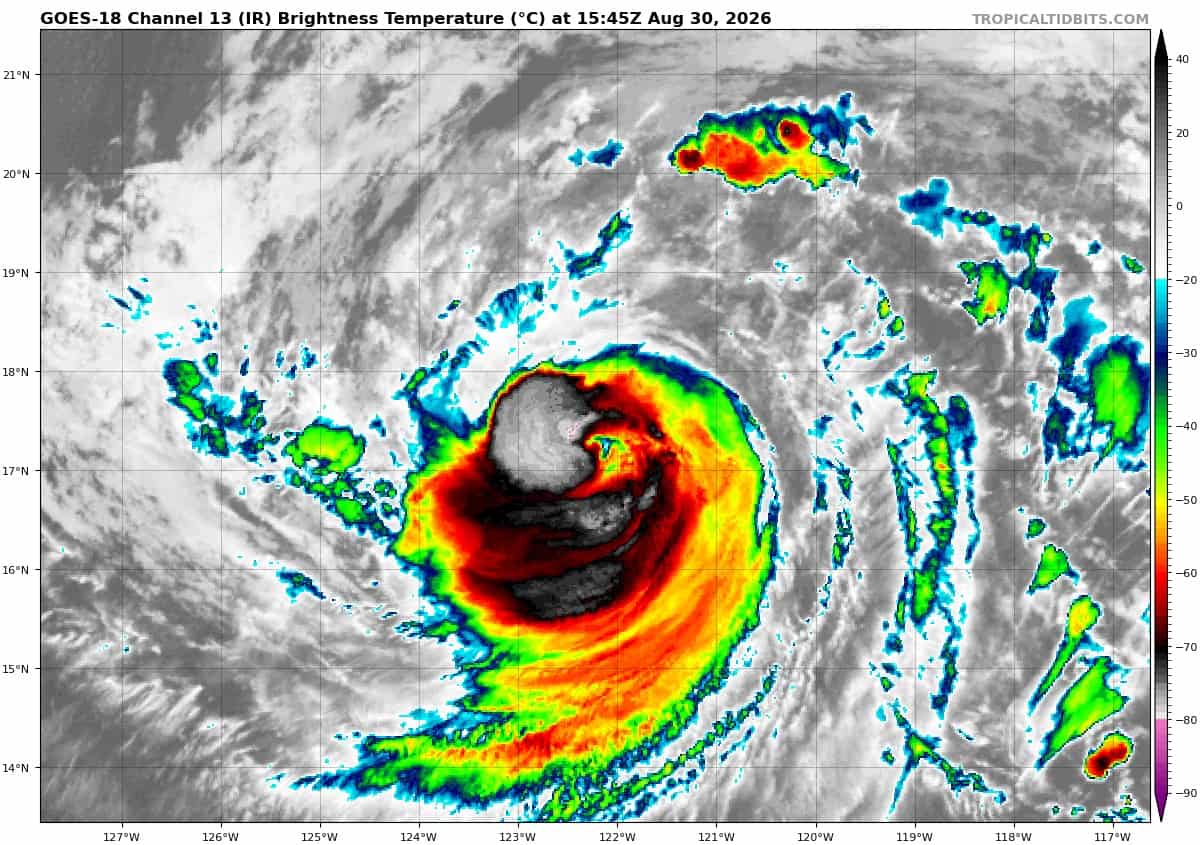
Tropical Cyclone 11E (Karina) is located about 880 miles west-southwest of the southern tip of Baja CA
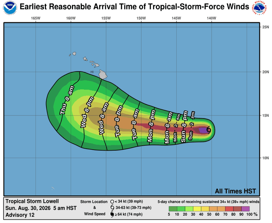
Tropical Cyclone 12E (Lowell) is located about 1070 miles east-southeast of Hilo, Hawaii
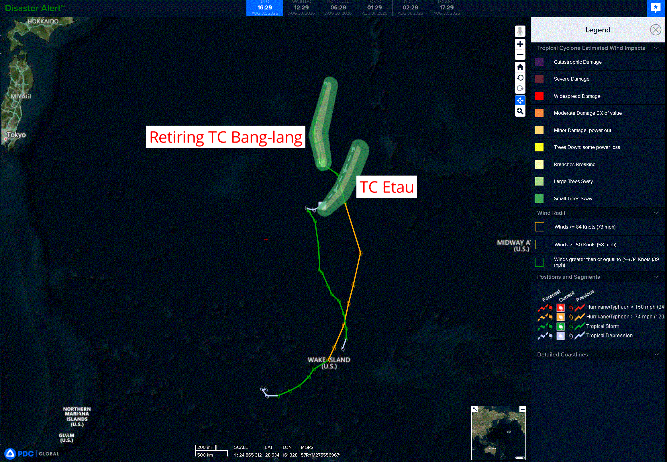
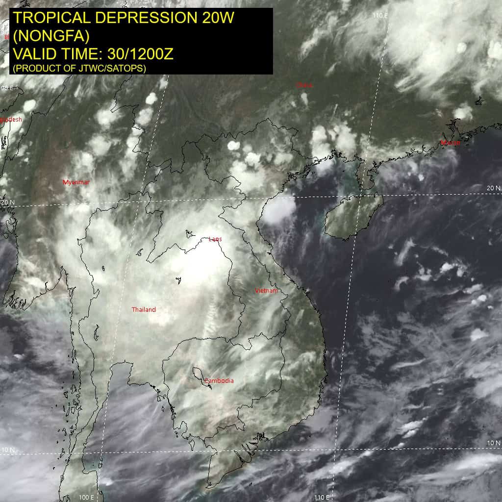
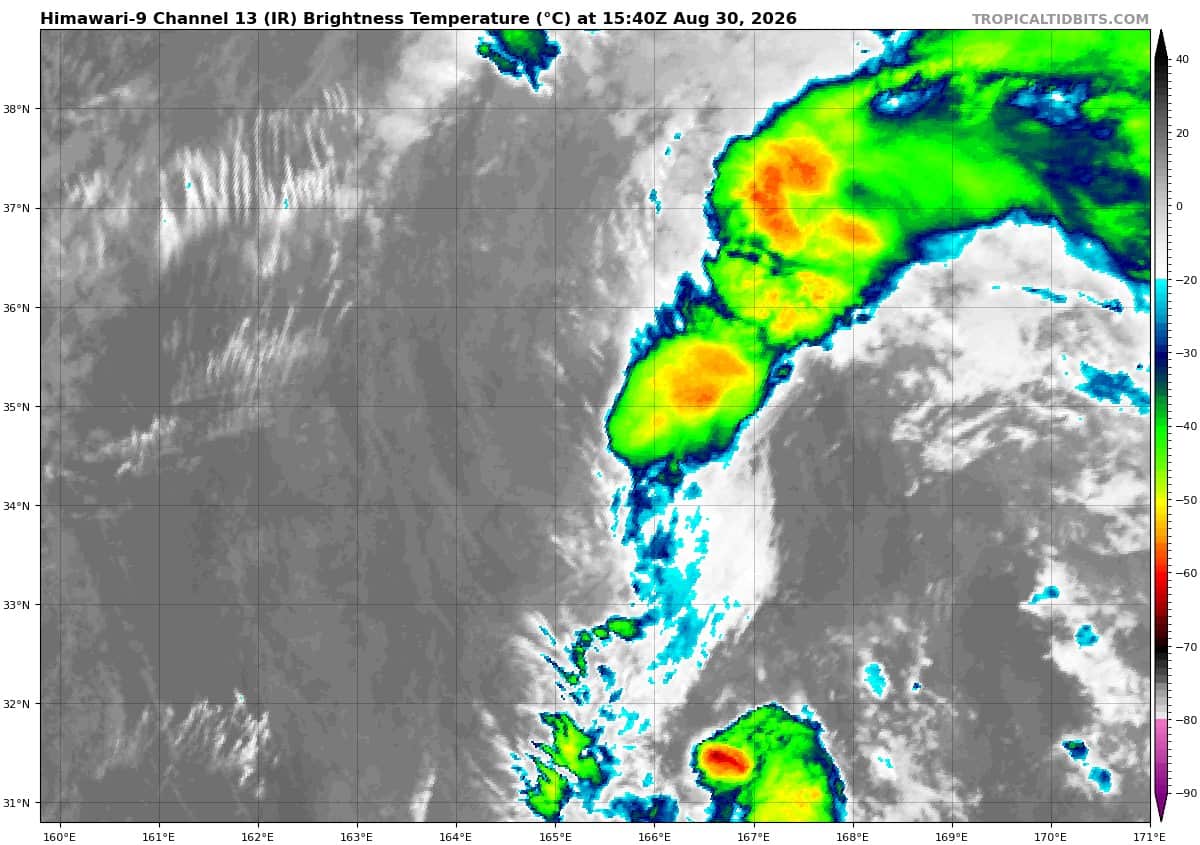
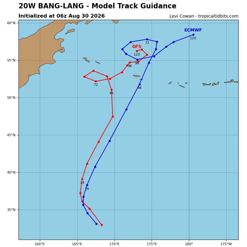
Tropical Cyclone 20W (Bang-lang)…is located approximately 889 NM north of Wake Island – Final Warning
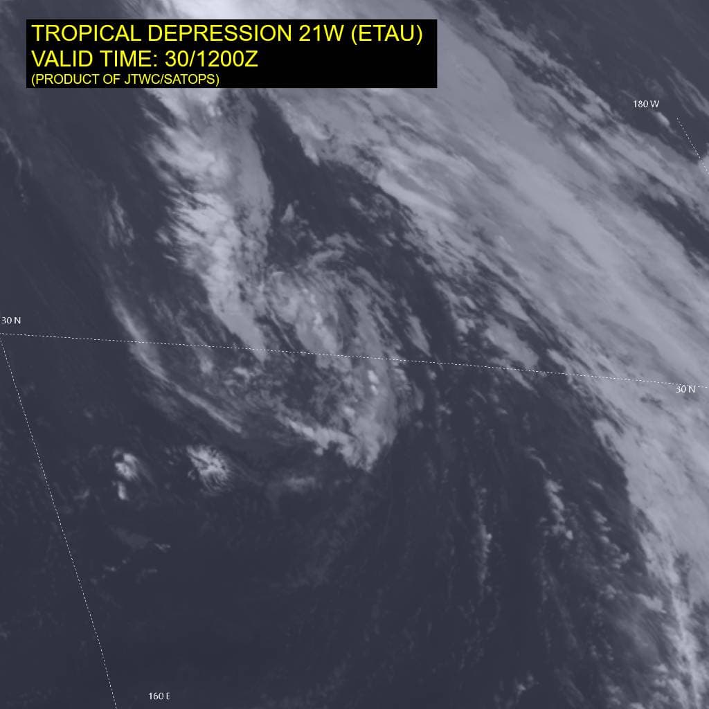
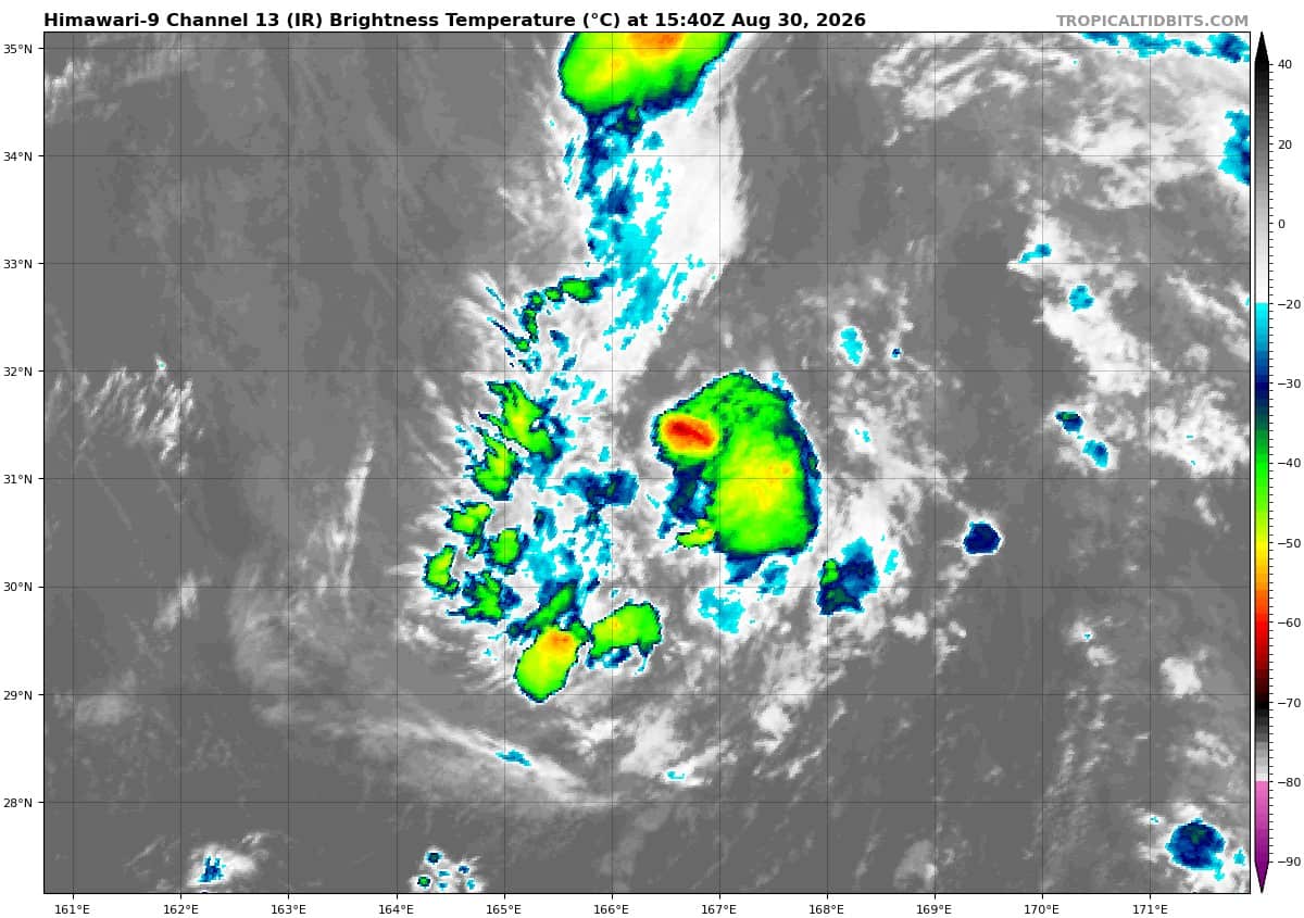
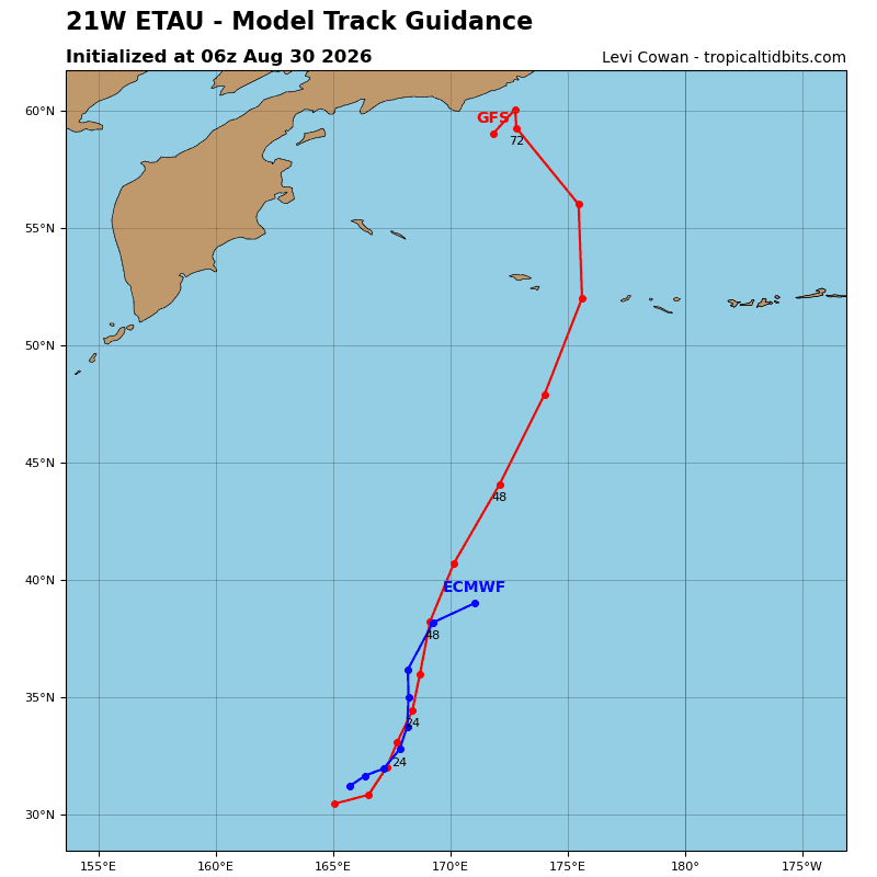
Tropical Cyclone 21W (Etau) …is located approximately 709 NM north of Wake Island
Northeast Pacific:
Tropical Cyclone 11E (Karina)
KARINA EXPECTED TO BECOME STRONGER AS IT MOVES OVER THE OPEN PACIFIC OCEAN
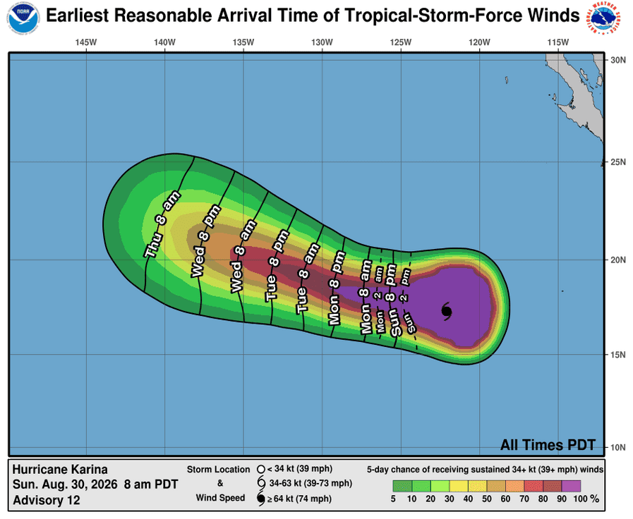
According to the NHC advisory number 12…
Karina is moving toward the west-northwest near 9 mph (15 km/h). A slower westward to west-northwestward motion is expected during the next few days. Maximum sustained winds are near 80 mph (130 km/h) with higher gusts. Steady to rapid strengthening seems likely, and Karina is forecast to become a major hurricane in a day or so. Hurricane-force winds extend outward up to 25 miles (35 km) from the center and tropical-storm-force winds extend outward up to 230 miles (370 km). The estimated minimum central pressure is 980 mb (28.94 inches).
HAZARDS AFFECTING LAND
SURF: Swells generated by Karina will affect portions of the coast of southwest Mexico and the Baja California Peninsula for the next couple of days. These swells are likely to cause life-threatening surf and rip current conditions.
Tropical Cyclone 12E (Lowell)
LOWELL CONTINUING WESTWARD INTO THE CENTRAL PACIFIC
According to the NHC advisory number 12…
Lowell is moving toward the west near 13 mph (20 km/h), and a general westward motion is expected during the next two to three days. Maximum sustained winds are near 50 mph (85 km/h) with higher gusts. Gradual strengthening is expected during the next few days, and Lowell could become a hurricane by Monday or Monday night. Tropical-storm-force winds extend outward up to 70 miles (110 km) from the center. The estimated minimum central pressure is 1000 mb (29.53 inches).
>>> Well offshore of Southwestern Mexico:
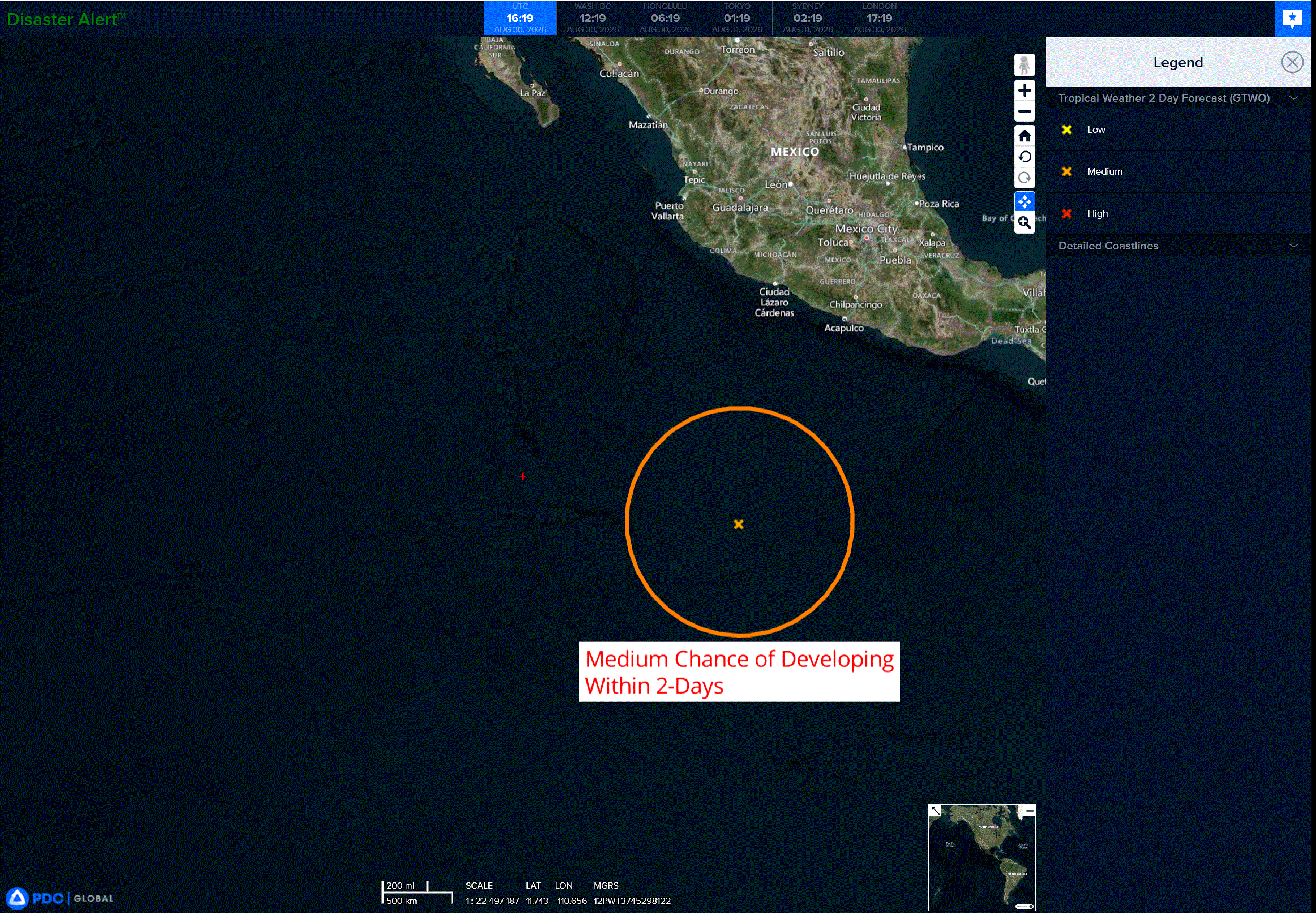
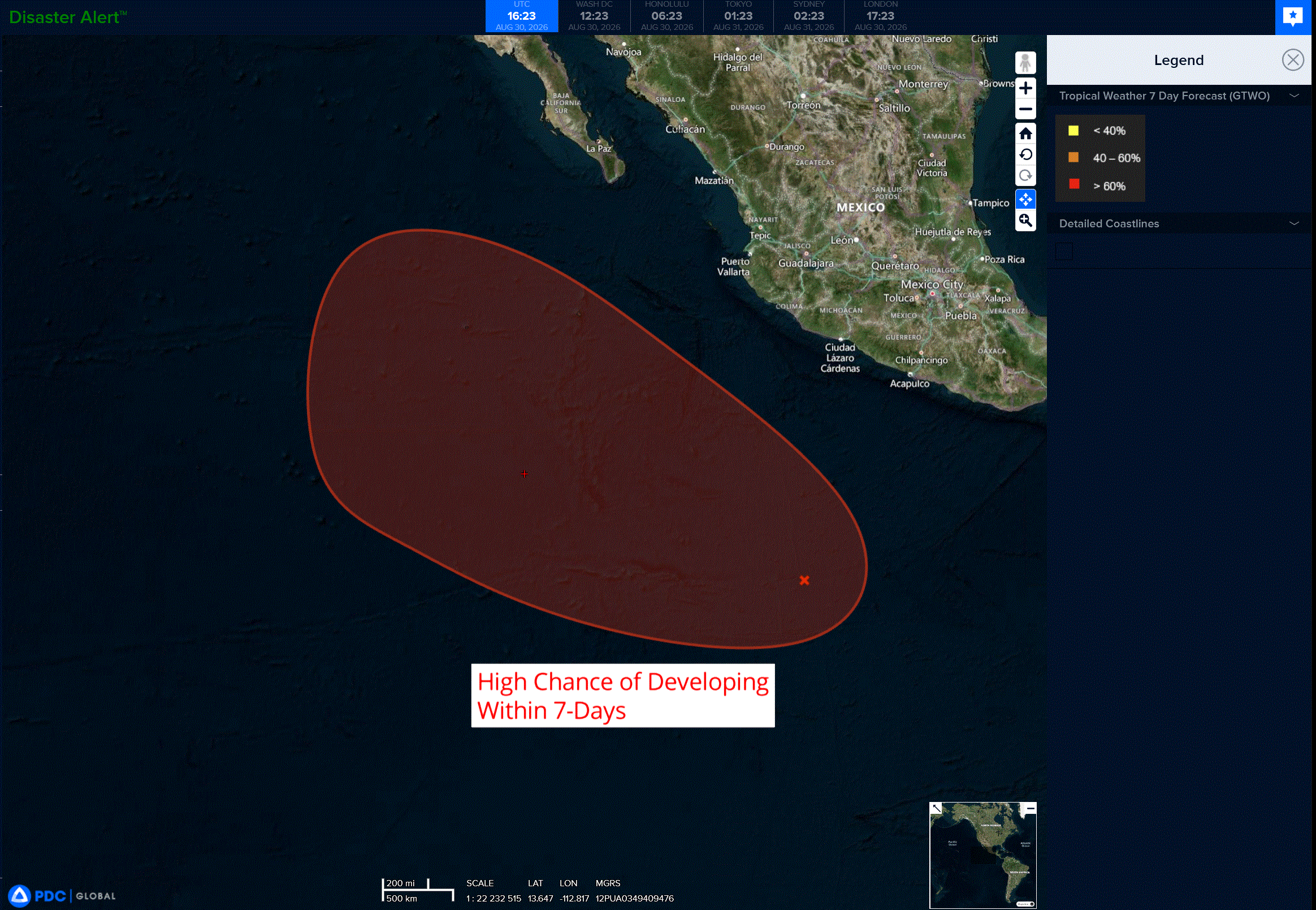
An area of disturbed weather, associated with a tropical wave, is located well to the south of southwestern Mexico. This system is expected to continue to move west-northwestward to northwestward at 10 to 15 mph. Environmental conditions appear favorable for gradual development of this system, and a tropical depression is likely to form during the early to middle part of next week.
* Formation chance through 48 hours…medium…60 percent
* Formation chance through 7 days…medium…90 percent
Central North Pacific:
>>> Central Pacific:
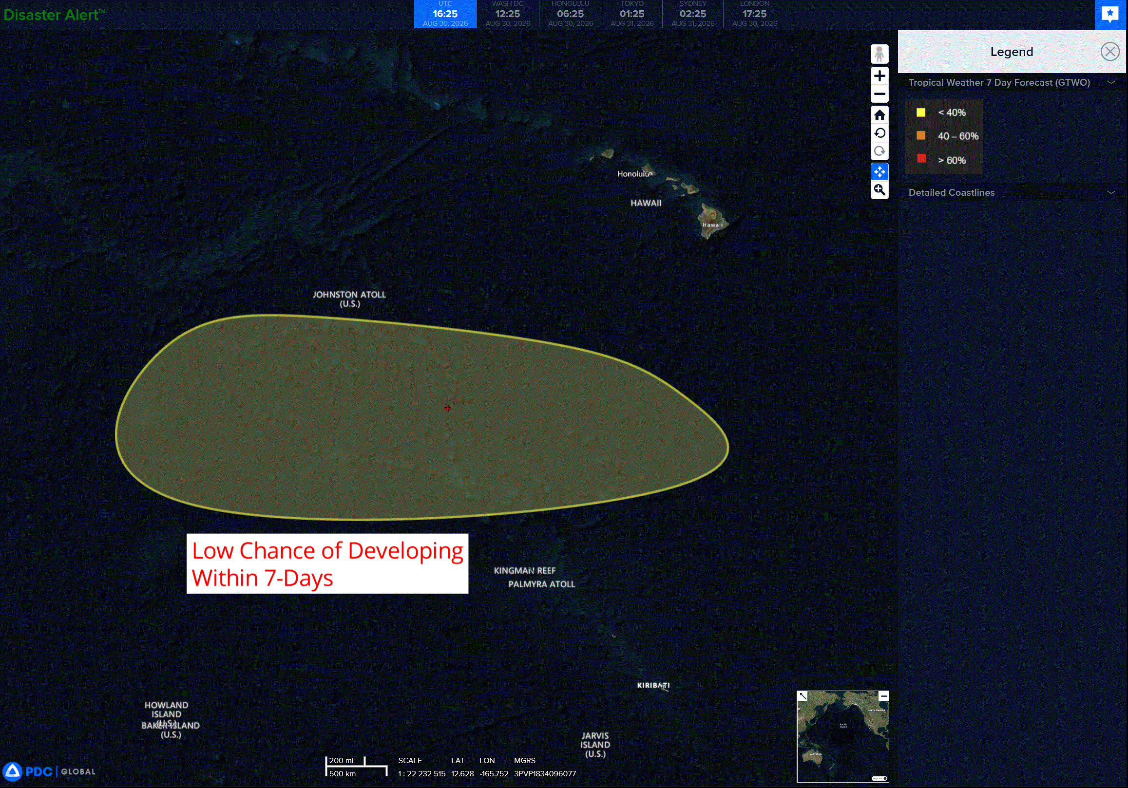
An area of low pressure could form well south or southwest of the Hawaiian Islands in the next couple of days. Some gradual development is possible thereafter while it moves slowly westward across the central Pacific.
* Formation chance through 48 hours…low…near 0 percent
* Formation chance through 7 days…low…30 percent
Western Pacific, Indian Ocean, and adjacent Seas:
Western Pacific
Tropical Cyclone 20W (Bang-lang) – Final Warning
According to the JTWC warning number 18…Sustained winds were 35 knots with gusts to 45 knots
The system has continued to rapidly weaken as it interacts with tropical depression 21w located 180 nm to the south. Deep convection persists along the northern and eastern periphery. The system will undergo subtropical transition as it traverses sea surface temperatures below 26 degrees celsius, while an upper-level trough resides overhead.
As the proximity to td 21w increases, an extensive ridge centered east of the dateline will pull the system northward over cooler waters and into a more baroclinic environment. The forecast calls for slow weakening as convection persists due to a colder tropopause and strong poleward outflow aloft.
Tropical Cyclone 21W (Etau)
According to the JTWC warning number 15…Sustained winds were 30 knots with gusts to 40 knots
Animated enhanced infrared (eir) satellite imagery depicts a compact, partially exposed low-level circulation center (llcc) with meager convective activity flaring along the southeast periphery. This tiny surface circulation was captured by a 300941z ascat-c pass, which measured winds near 30 kts in the southeast quadrant.
An upper-level low presently sits overhead, severely restricting outflow aloft. The system is also traversing marginally warm sea surface temperatures (sst) of 26-27 degrees celsius and is surrounded by dry air. Tthese environmental factors are unfavorable for tropical cyclone development. consequently, the convective activity has been minimal, leaving the llcc increasingly fragile.
Having completed a 180-degree southward loop induced by the Fujiwhara Effect, td 21w has begun to turn poleward as its distance from ts 20w increases. This poleward motion will now be driven by the steering influence of a large anticyclone positioned over the central north pacific. Although the llcc is unraveling, the forecast holds the intensity at 30 kts for the next 36 hours. The circulation will become embedded in 25-30 kts of southerly low-level flow. the eventual demise of the tropical system will be driven by two competing, though not mutually exclusive, factors.
First, the poleward track will bring the system over progressively cooler sst and into a more baroclinic environment, causing it to gradually acquire subtropical characteristics. The second factor involves the survivability of the llcc. The fragile circulation could dissipate before subtropical transition is complete. The current forecast of 36 hours in duration may be generous, and it is quite possible that the circulation could devolve into an open wave by 24 hours or sooner.
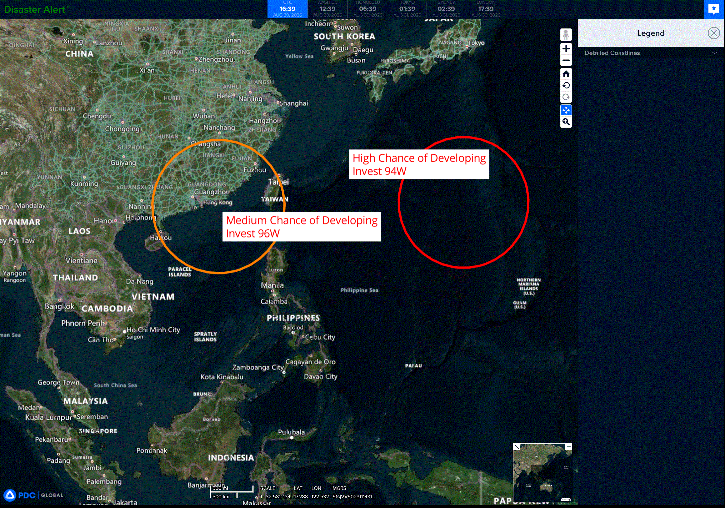
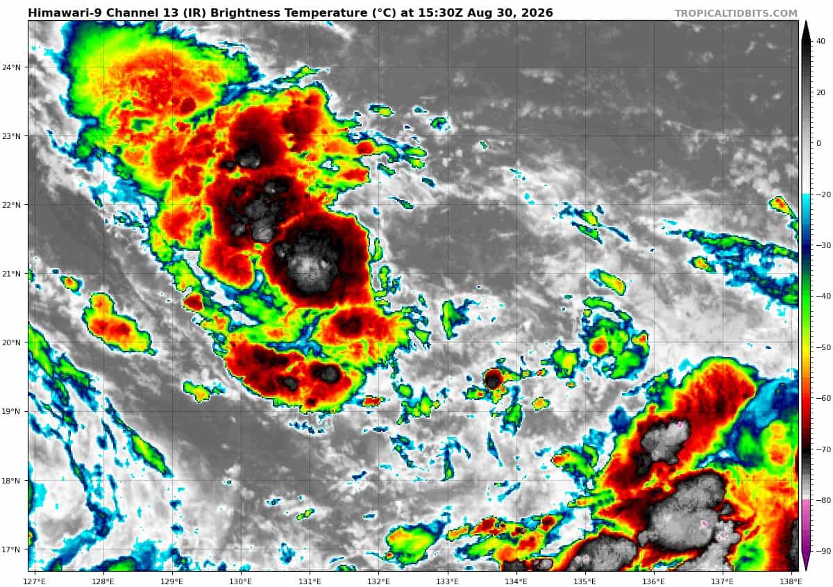
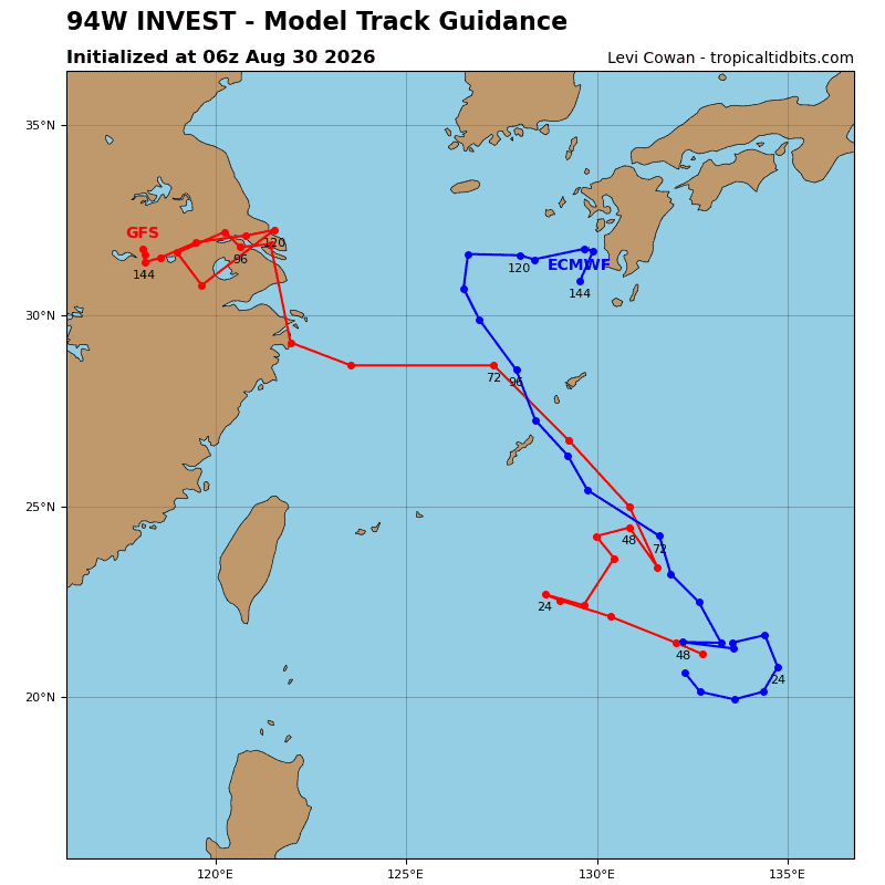
>>> There’s an area of disturbed weather that’s being referred to as Invest 94W, which is located approximately 785 NM northwest of Guam
The system is currently classified as a monsoon depression, generally characterized as a large cyclonic circulation, greater than 600nm diameter, with elevated winds over the southeastern periphery and a weak core of light winds.
Animated enhanced infrared satellite imagery depicts a broad low-level circulation center obscured by persistent convection along the western and southern extent of the system. A 292347z metop-b bullseye ascat revealed weak winds near the center of 94w, surrounded by elevated winds up to 25 kts.
The environmental analysis of the area indicates conducive conditions for development with low (10-15 kts) vertical wind shear (vws), warm (29-30 c) sea surface temperatures, plentiful moisture, and a strong equatorward outflow in the upper levels. Only a slight tightening of the wind field is needed to designate the system as a tropical depression.
The majority of global and ensemble members indicate that 94w will have a short window to consolidate, after which time, the closed circulation will open up. 94w currently lies along a trough that extends from Taiwan to the Mariana Islands. Over the next few days, development of additional, northwest-tracking circulations along this trough will be possible. That may lead to more direct impacts to the Ryukyu Islands.
while this scenario is supported by ensemble systems, the specific impacts will be predicated on the evolution of these subsequent circulations, which have not yet formed. Therefore, significant uncertainty exists for tropical cyclone potential over the next few days as it relates to the region of the East China Sea.
Maximum sustained surface winds are estimated at 20 to 25 knots.
Minimum sea level pressure is estimated to be near 1002 mb.
The potential for the development of a significant tropical cyclone within the next 24 hours is high.
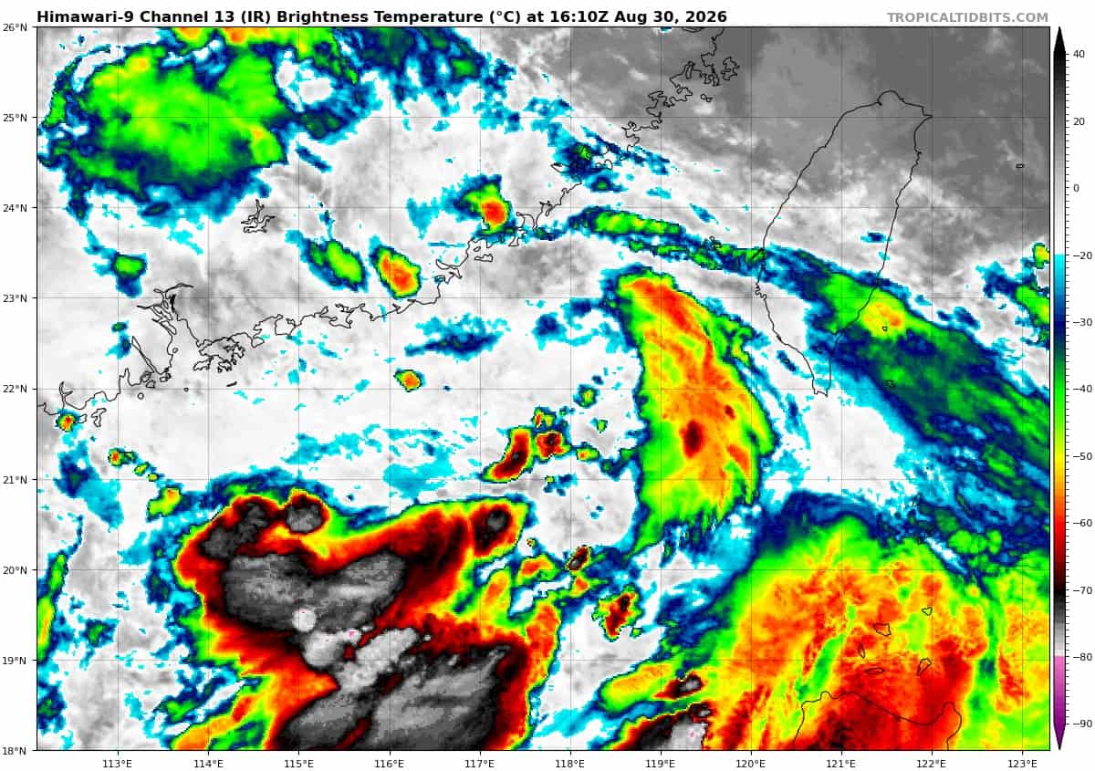
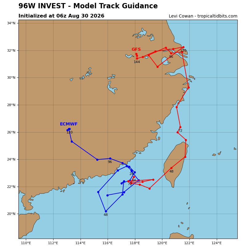
>>> There’s another area of disturbed weather that’s being referred to as Invest 96W, which is located approximately 161 NM east of Hong Kong
Animated enhanced infrared satellite imagery depicts a mid-level circulation southwest of the Taiwan Strait obscuring the lower-level circulation. The convective activity is becoming better organized, with short, curved
bands wrapping around the southeastern periphery. A 301301 metop-c ascat pass reveals elevated winds along the east-southeasterly periphery of a broad low-level circulation.
Environmental analysis of the area is favorable with low (10-15 kts) vertical wind shear, warm (28-29 c) sea surface temperatures, good equatorward outflow aloft, and robust amounts of moisture in the atmosphere.
Global deterministic models agree on steady to rapid development of the system. Global ensemble models are in disagreement with regards to the track, with gfs portraying a more eastward motion, while ecens depicts a turn northward with landfall quickly following.
Maximum sustained surface winds are estimated at 18 to 23
knots.
Minimum sea level pressure is estimated to be near 998 mb.
The potential for the development of a significant tropical cyclone within the next 24 hours is medium.