

Current Snapshot
For all the latest updates visit: DisasterAWARE
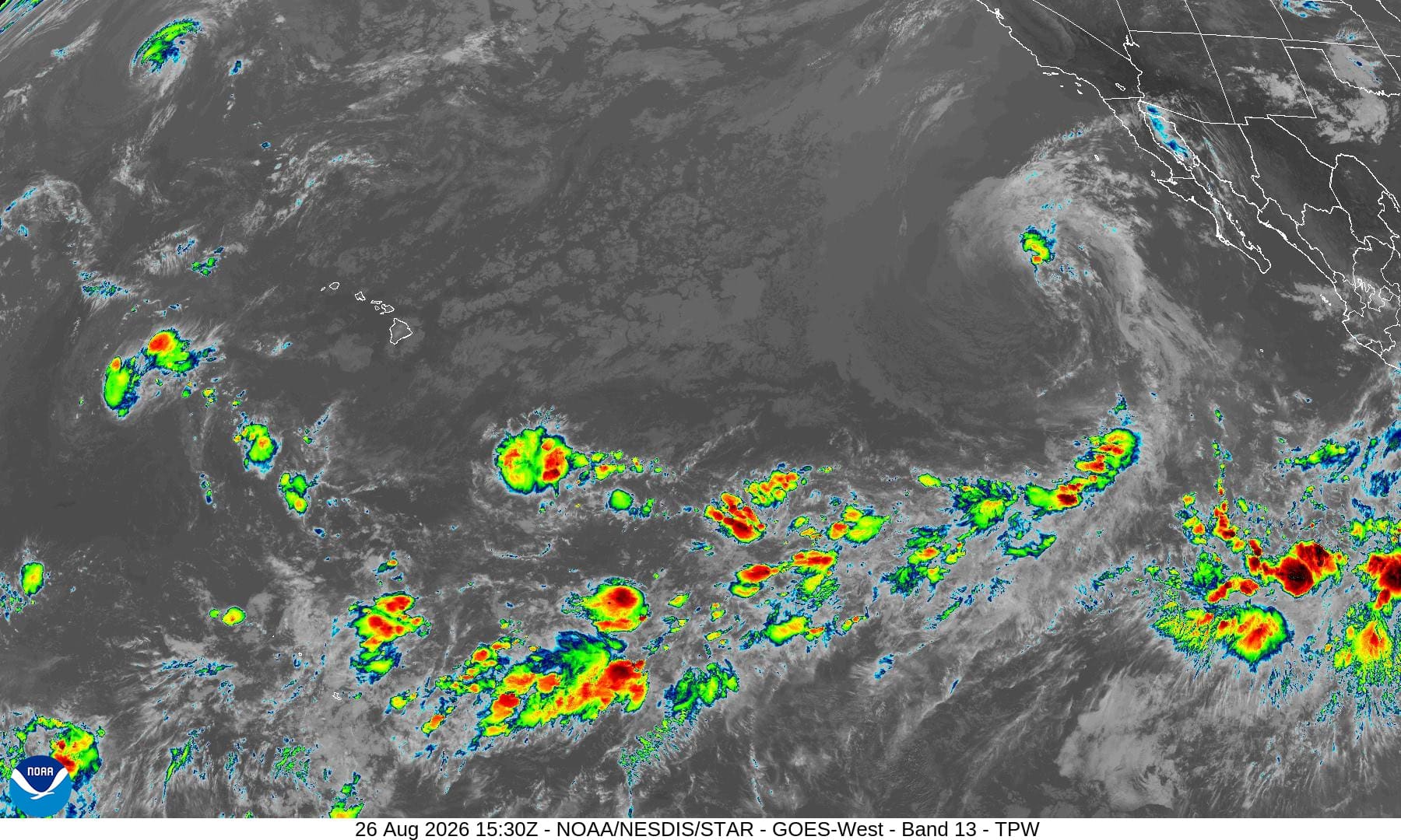
1800x1080ec
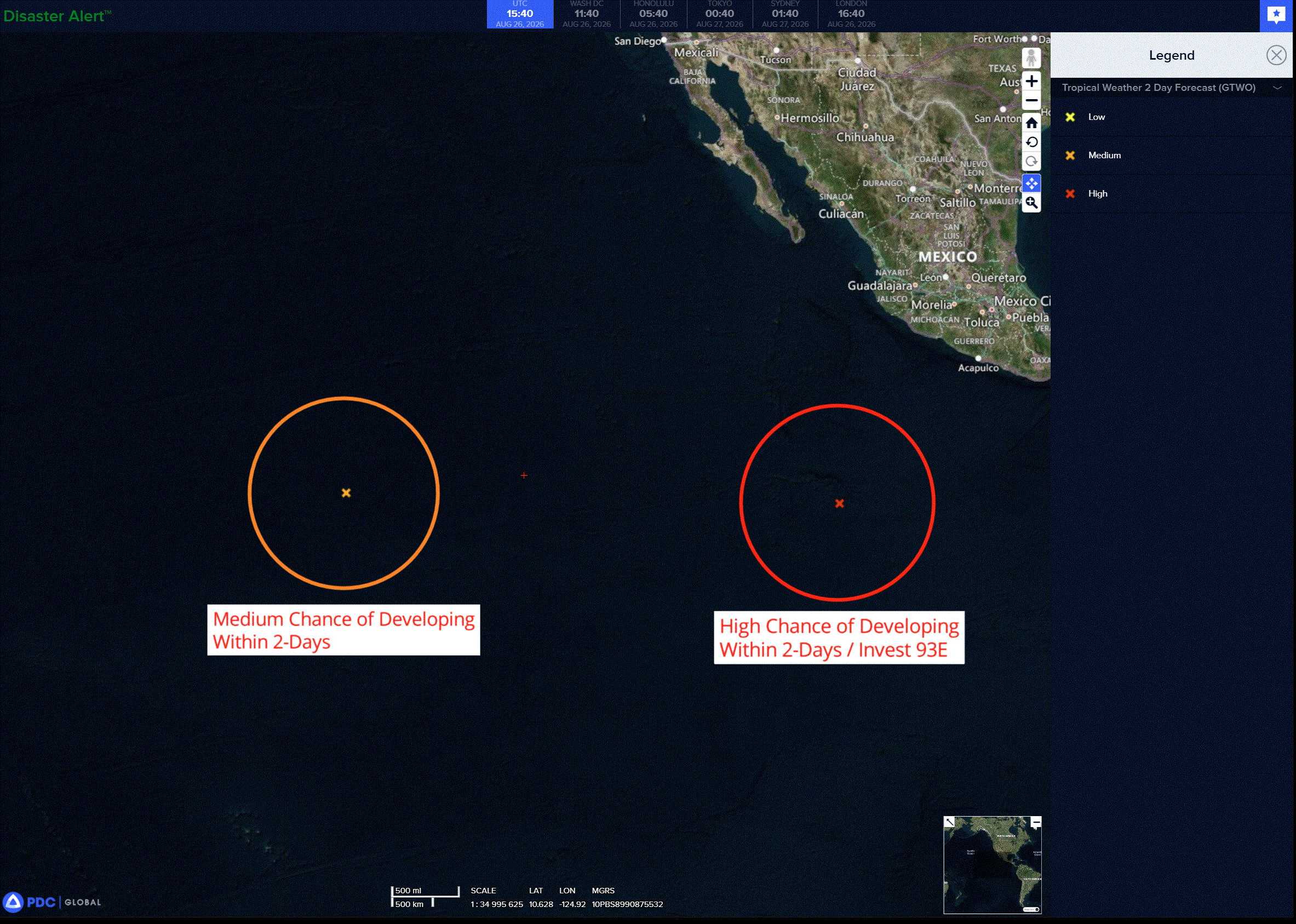
2e
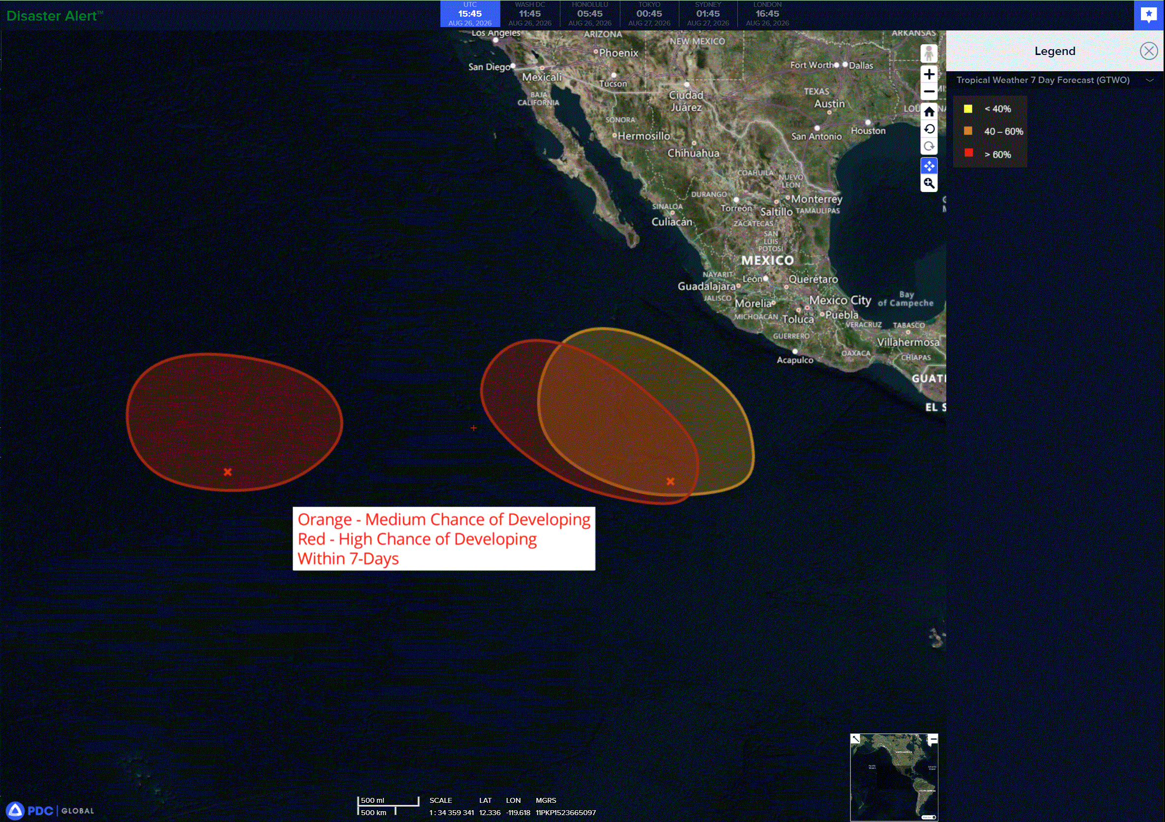
7e
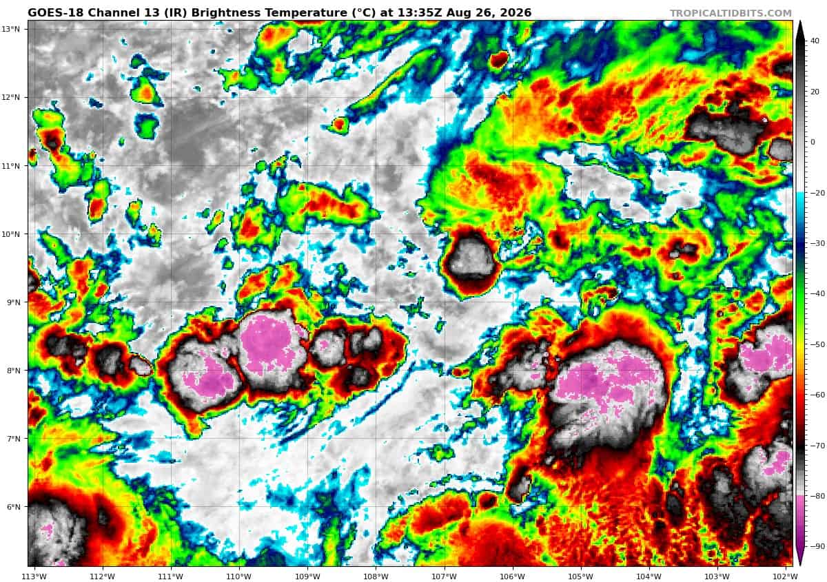
goes18_ir_93E_202608261335_lat9.1-lon-107.2

93E_tracks_latest
iselle
goes18_ir_09E_202608261335_lat21.9-lon-123.6iselle

09E_tracks_latest
lala
goes18_ir_01C_202608261335_lat35.6-lon-177.9lala
01C_tracks_latest
saudel
17W_261200
himawari9_ir_17W_202608261330_lat28.6-lon125.9
17W_tracks_latest
himawari9_ir_20W_202608261330_lat17.2-lon161.0
narra
18W_251800sair
himawari9_ir_18W_202608261330_lat22.5-lon111.8
18W_tracks_latest
20w
20W_261200
20W_tracks_latest
91w
himawari9_ir_91W_202608261330_lat19.5-lon167.3

91W_tracks_latest
By PDC’s Senior Weather
Specialist Glenn James

The Pacific Disaster Center’s (PDC Global) Wednesday, August 26, 2026, Tropical Cyclone Activity Report…for the Pacific Ocean, the Indian Ocean, and adjacent Seas.
Tropical Cyclones
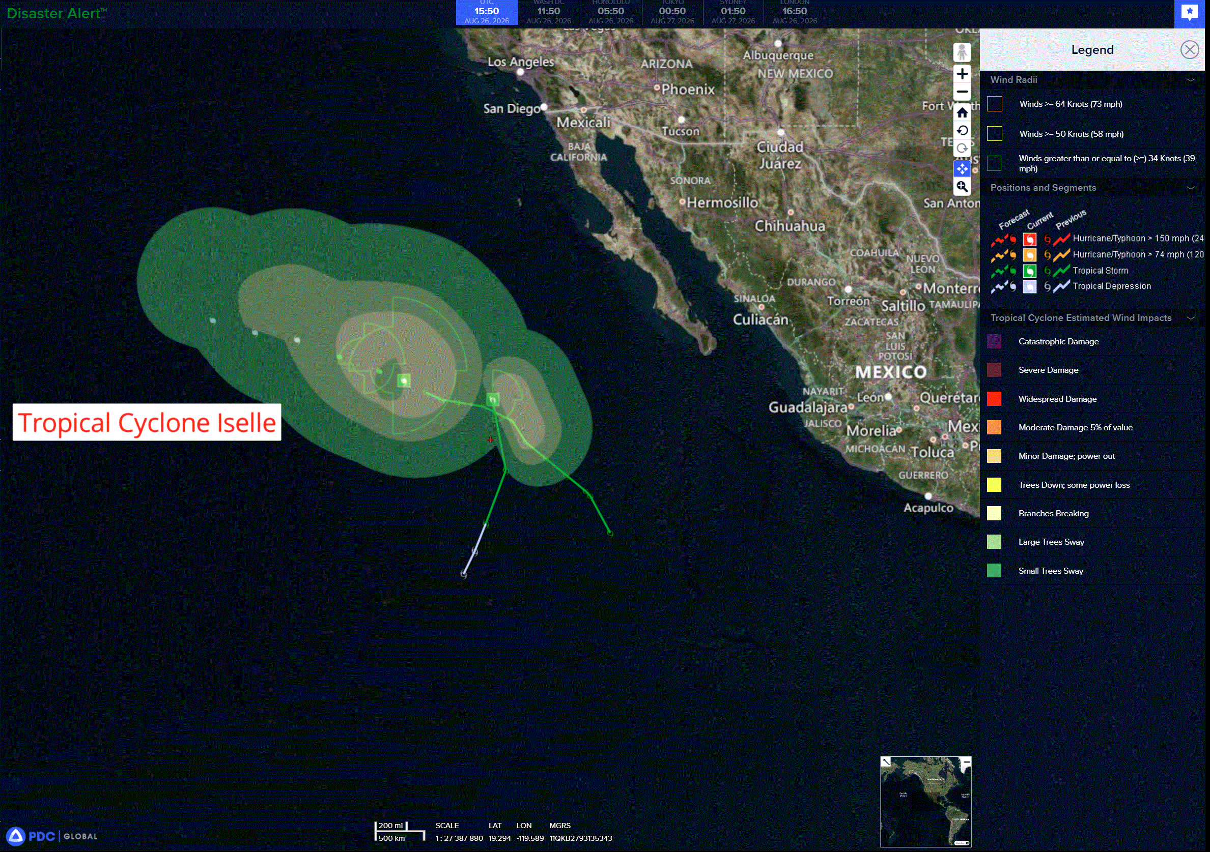
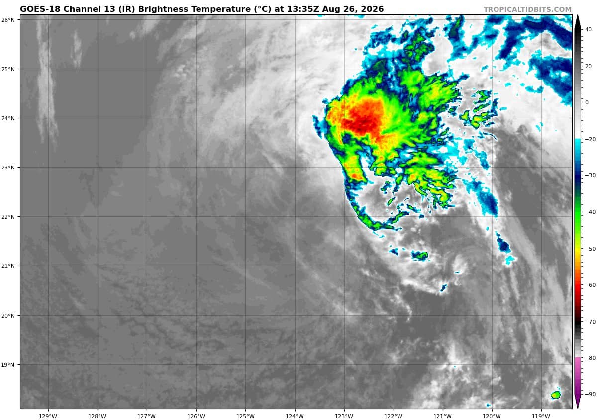
Tropical Cyclone 09E (Iselle) is located about 900 miles west of the southern tip of Baja California
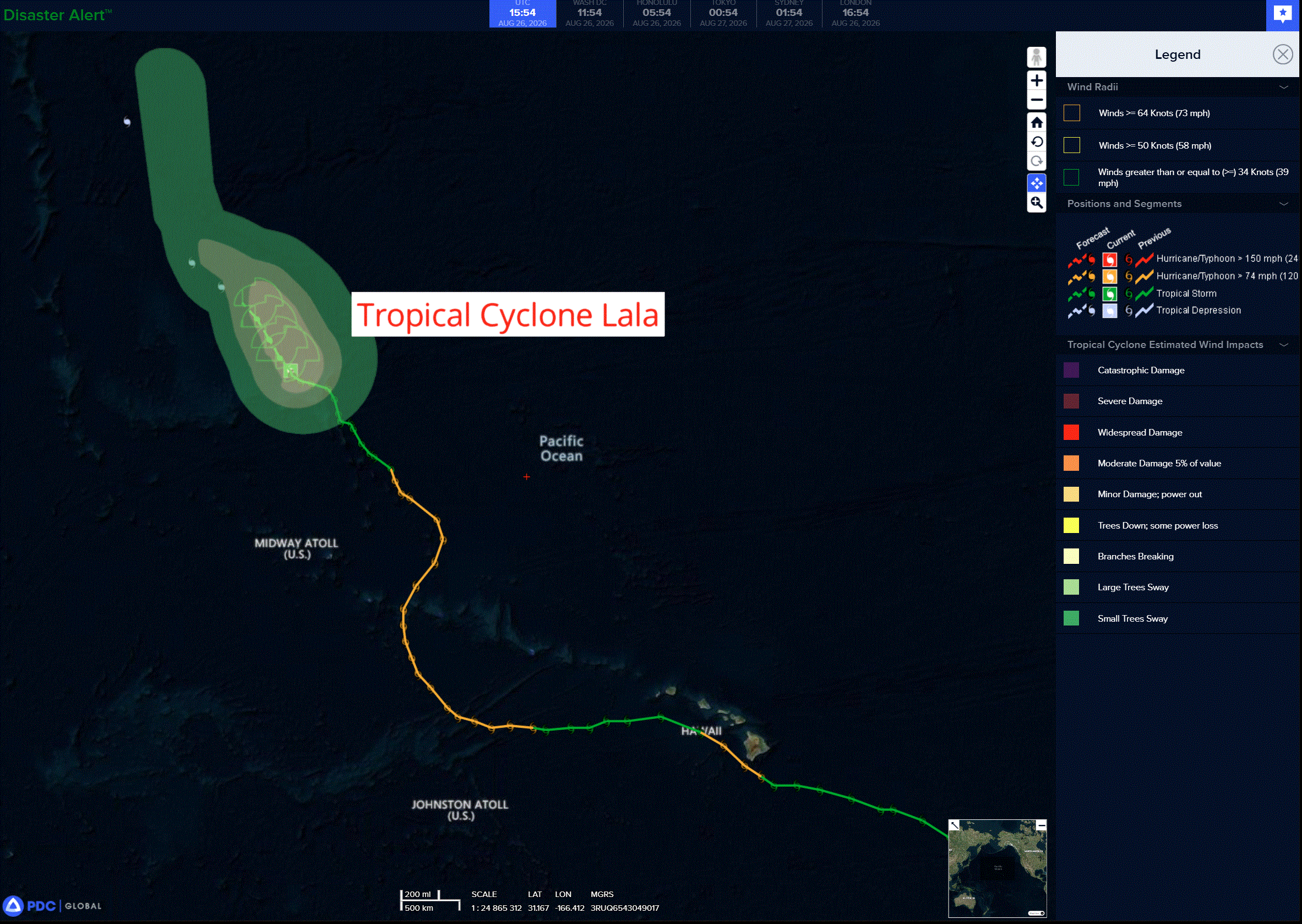
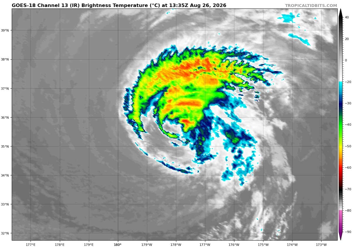
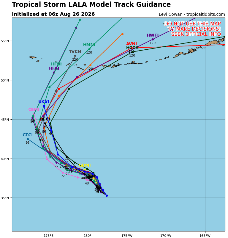
Tropical Cyclone 01C (Lala) is located about 510 miles north of Kure Atoll
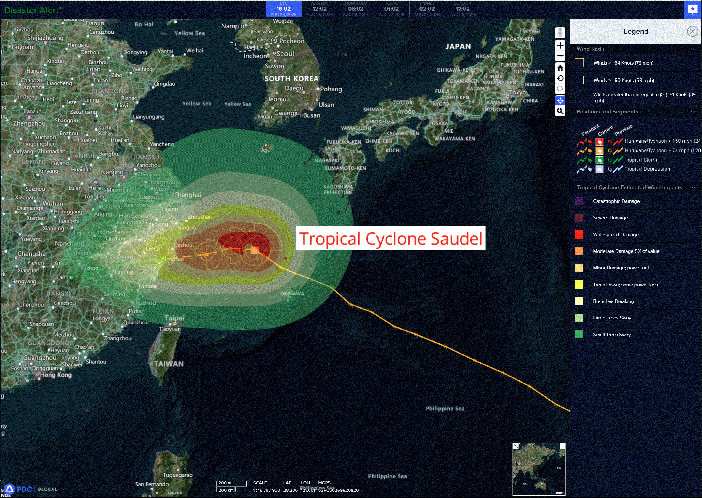
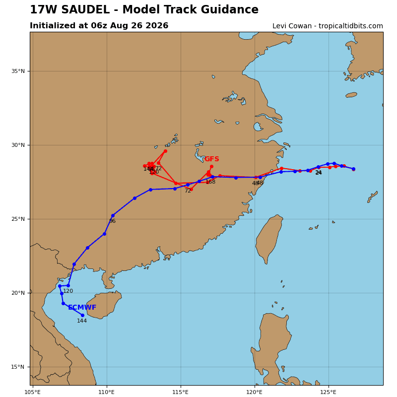
Tropical Cyclone 17W (Saudel)…is located approximately 77 NM east-southeast of Kadena AB
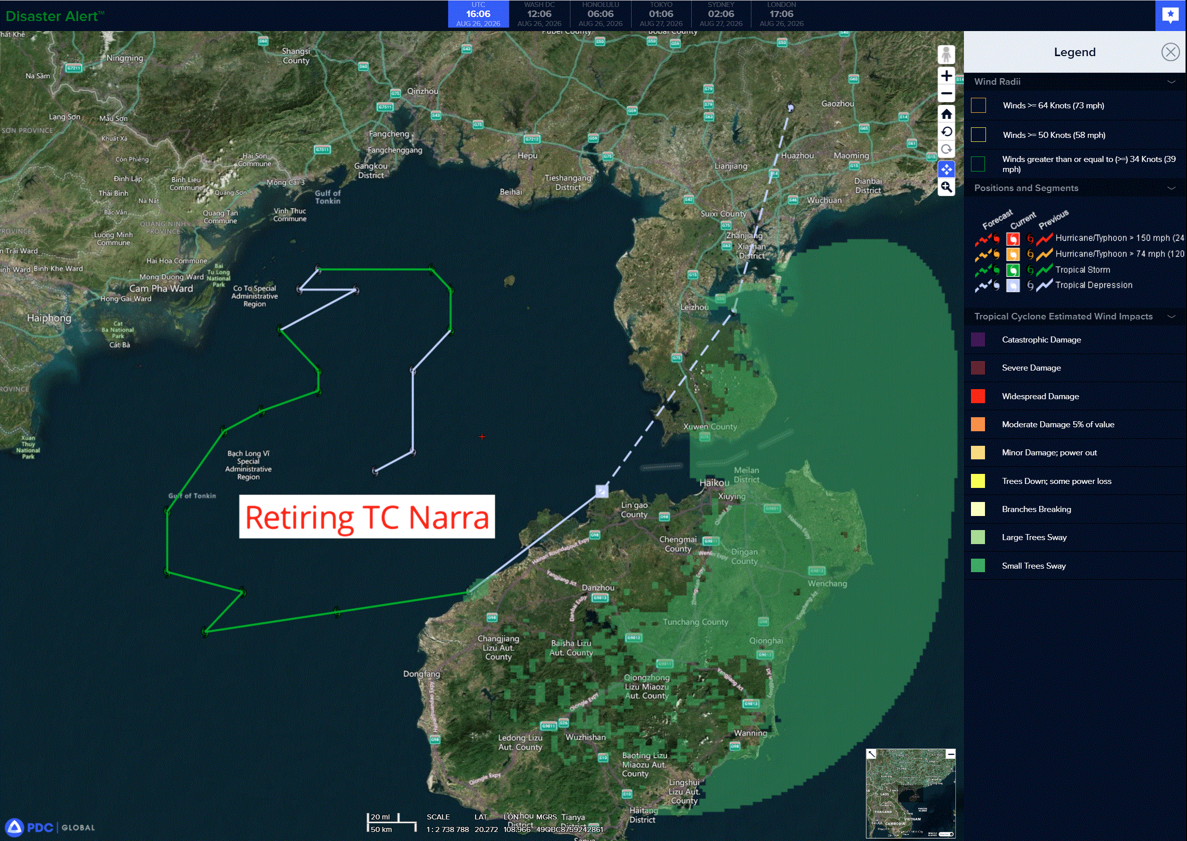
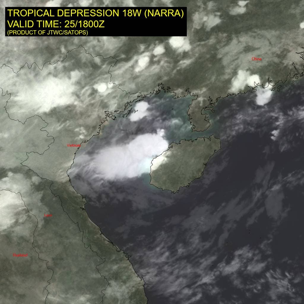
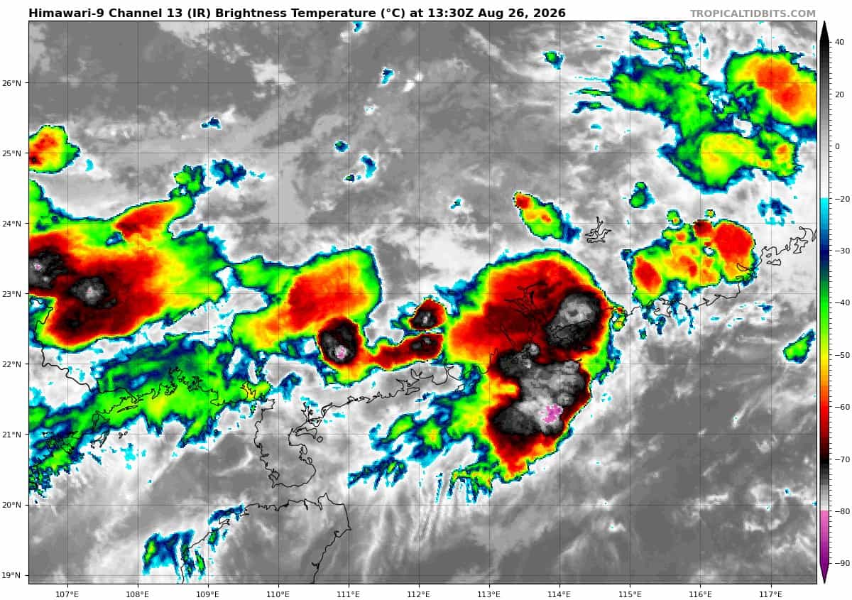
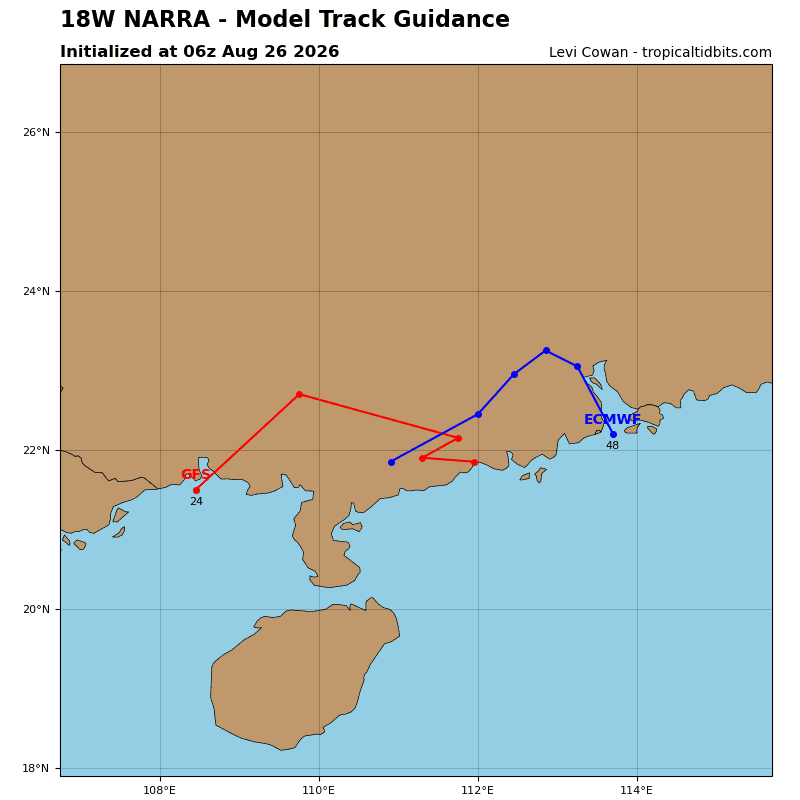
Tropical Cyclone 18W (Narra)…is located approximately 216 NM east-southeast of Hanoi, Vietnam – Final Warning
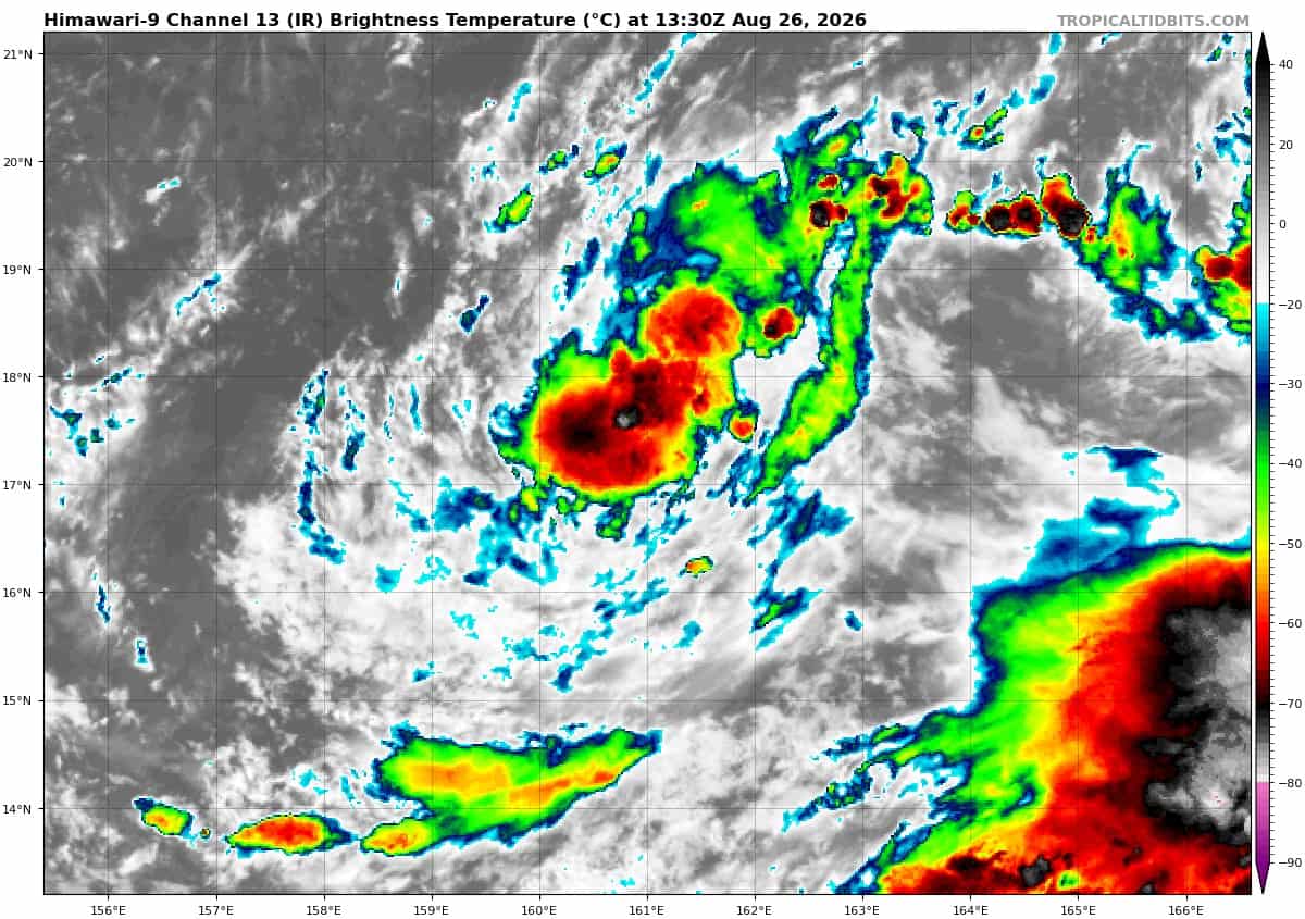
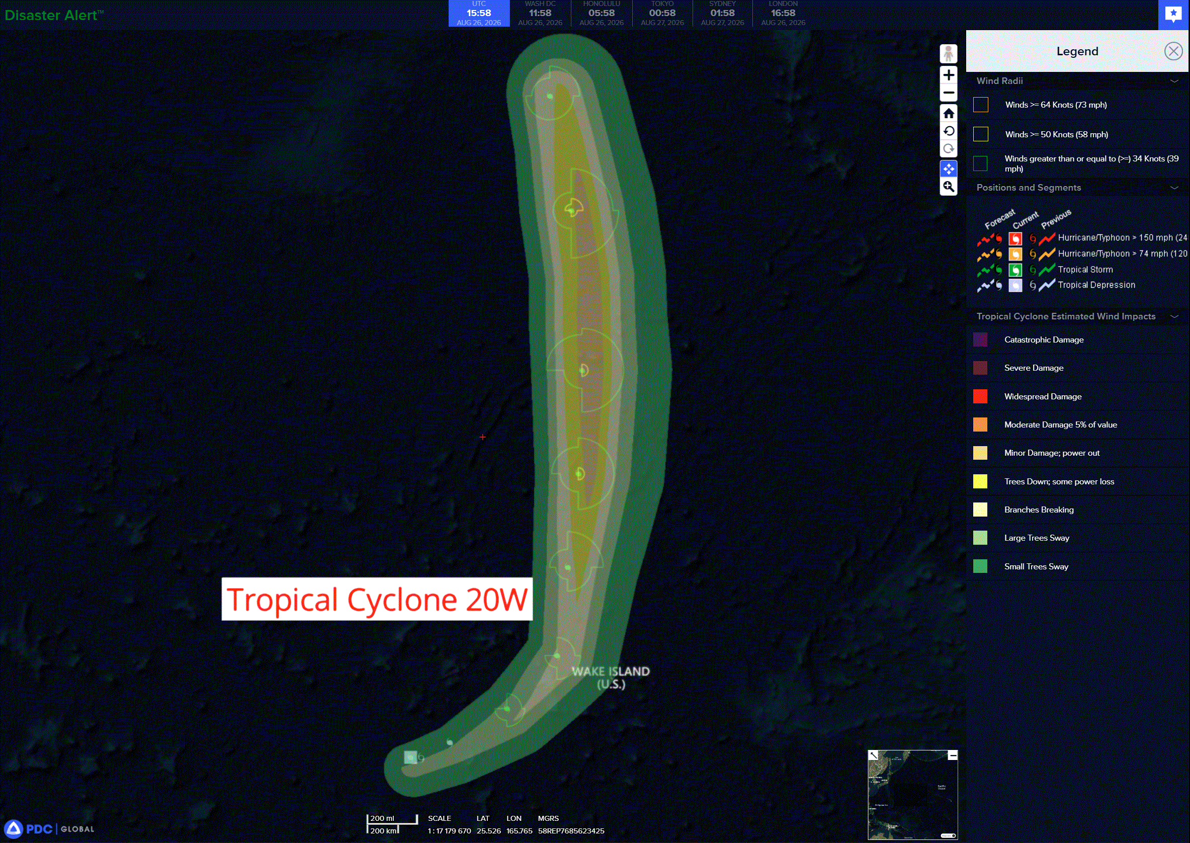
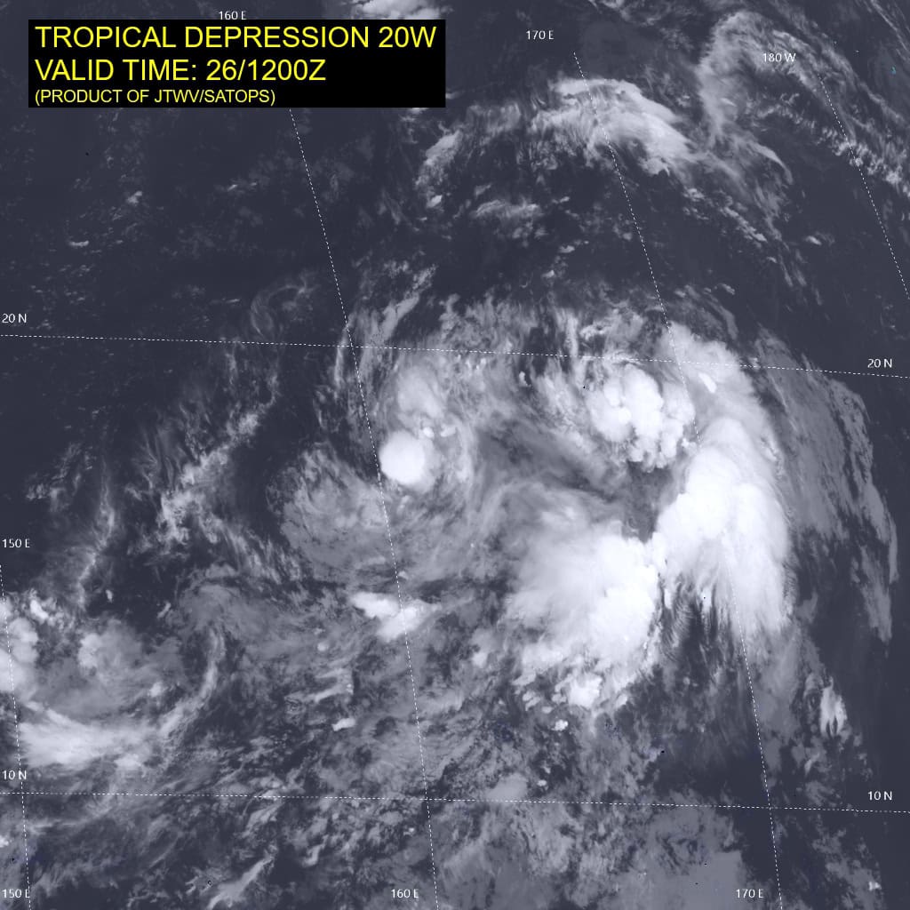
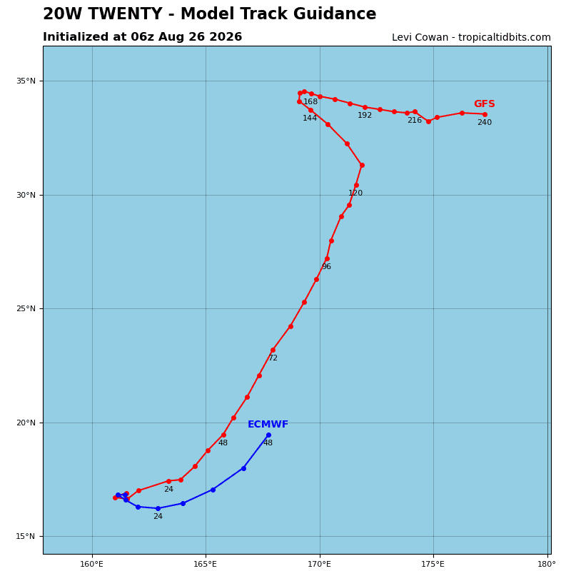
Tropical Cyclone 20W…is located approximately 343 NM west-southwest of Wake Island
Northeast Pacific:
Tropical Cyclone 09E (Iselle)
ISELLE WEAKENS…FORECAST TO BECOME A POST-TROPICAL CYCLONE TONIGHT
According to the NHC advisory number 13…
Iselle is moving toward the west-northwest near 9 mph (15 km/h) and this general motion is expected to continue over the next few days. Maximum sustained winds are near 45 mph (75 km/h) with higher gusts. Steady weakening is expected, and Iselle is forecast to become a post-tropical remnant low by tonight. Tropical-storm-force winds extend outward up to 230 miles (370 km) from the center. The estimated minimum central pressure is 999 mb (29.50 inches).
HAZARDS AFFECTING LAND
SURF: Swells generated by Iselle will continue to affect the west coast of the Baja California Peninsula for a couple more days. These swells are likely to cause life-threatening surf and rip current conditions.
>>> Central East Pacific:
Invest 93E
A broad area of low pressure located well south of southwestern Mexico is producing a large area of showers and thunderstorms and is gradually becoming better organized. Environmental conditions are expected to support gradual development of this system, and a tropical depression is likely to form during the next day or so while it moves west-northwestward at 10 to 15 mph, well offshore of Mexico.
* Formation chance through 48 hours…high…80 percent
* Formation chance through 7 days…high…90 percent
>>> Western East Pacific:
An elongated, broad area of low pressure located well to the east-southeast of the Hawaiian Islands is producing disorganized showers and thunderstorms. Environmental conditions appear conducive for gradual development of this system, and a tropical depression is likely to form late this week or early this weekend while the system drifts to the northeast, then turns westward.
* Formation chance through 48 hours…medium…40 percent
* Formation chance through 7 days…high…70 percent
>>> Well offshore of Southern Mexico:
An area of low pressure could form this weekend well to the south of southwestern Mexico. Environmental conditions appear favorable for some gradual development of this system, and a tropical depression could form by early next week while it moves westward to west-northwestward at 10 to 15 mph.
* Formation chance through 48 hours…low…near 0 percent
* Formation chance through 7 days…medium…60 percent
Central north Pacific:
Tropical Cyclone 01C (Lala)
LALA EXPECTED TO BECOME A REMNANT LOW IN A COUPLE OF DAYS
According to the NHC advisory number 57…
Lala is moving toward the north-northwest near 5 mph (7 km/h) and a slow north-northwestward to northwestward motion is expected over the next couple of days. Maximum sustained winds are near 45 mph (75 km/h) with higher gusts. Gradual weakening is expected during the next couple of days, and Lala is forecast to become a post-tropical remnant low by late Thursday. Tropical-storm-force winds extend outward up to 115 miles (185 km) from the center. The estimated minimum central pressure is 997 mb (29.44 inches).
>>> Central Pacific:
An area of low pressure could form well south of the Hawaiian Islands late this week or over the weekend. Some gradual development is possible by early next week while the system moves slowly west-northwestward, well south-southwest of the Hawaiian Islands.
* Formation chance through 48 hours…low…near 0 percent
* Formation chance through 7 days…low…20 percent
Western Pacific, Indian Ocean, and adjacent Seas:
Western Pacific
Tropical Cyclone 17W (Saudel)
According to the JTWC warning number 33…Sustained winds were 80 knots with gusts to 100 knots
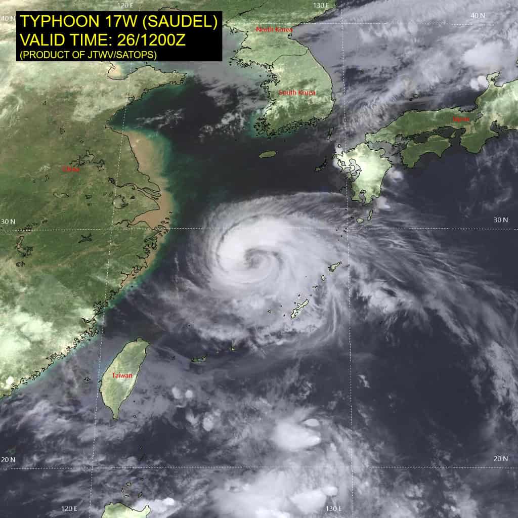
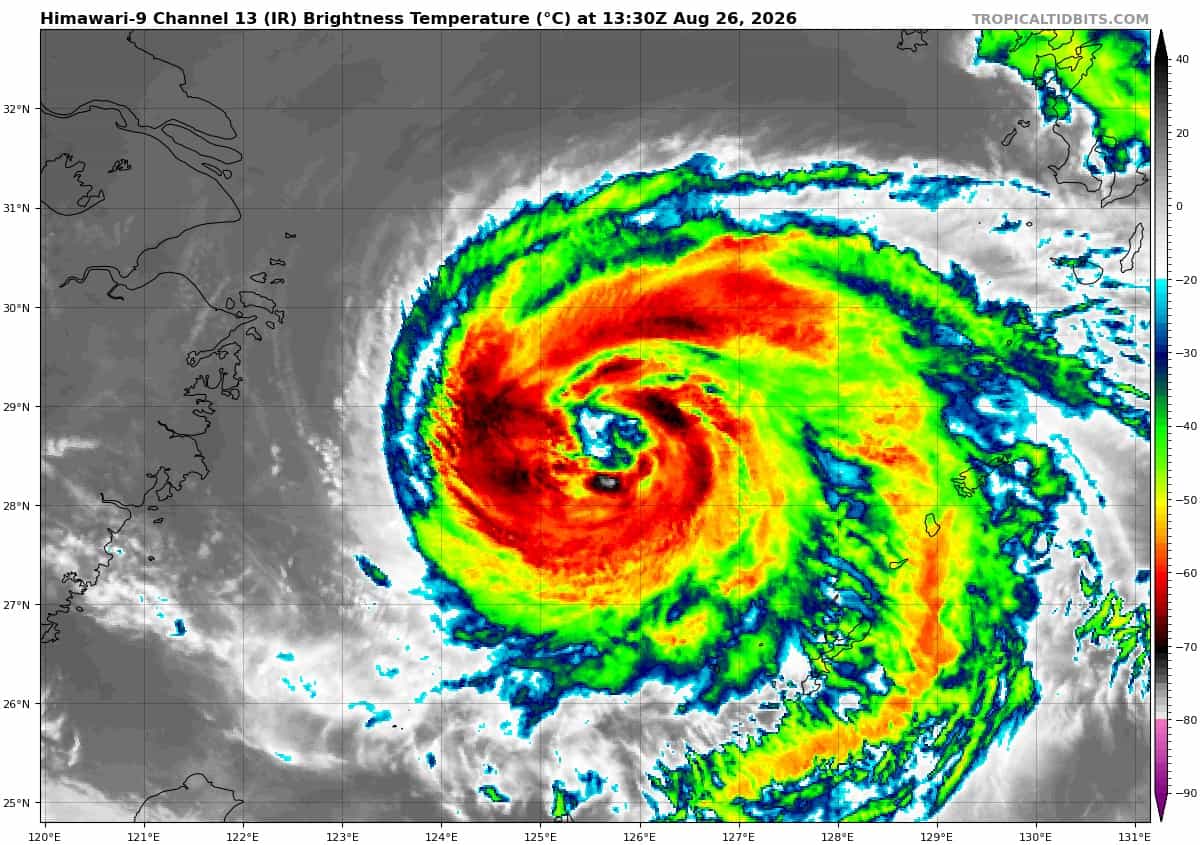
Animated enhanced infrared (eir) satellite imagery depicts typhoon (ty) 17w exhibiting a banding eye, defined by a distinct spiral band that wraps tightly into the center, often with a cloud-free slot separating the inner core from the outer spiral. The poleward outflow aloft has become restricted due to 20-25 kts of northerly vertical wind shear (vws). The comparison of the 260921z ssmis 91 ghz and 37 ghz images indicates that the vortex is tilted eastward
with height.
The circulation has continued to travel west-northwestward, defying expectations of a turn toward the west, though its translation speed has slowed to 06 kts. A 260931z rcm-1 sar pass revealed a shrinking wind field with estimated winds of 80-90 kts within the northern side of the eyewall. The environment is marginal, characterized by warm sea surface temperatures offset by moderate vws.
TY 17W has been reluctant to turn westward, indicating that the str to the north is weaker than modeled. The
system will soon be captured by a deep-layer anticyclone positioned over the interior of China, finally inducing a westward to west-southwestward motion. The landfall point continues to be near the cities of Wenzhou and Taizhou, China.
Despite the warm ocean waters ahead, strengthening vws will cause ty 17w to accelerate its weakening trend while it remains over water. 30 kts of shear combined with increasing land interaction will lead to rapid weakening by 36 hours, a trend that will continue until the storm’s demise by 60 hours.
Tropical Cyclone 18W (Narra) – Final Warning
According to the JTWC warning number 21…Sustained winds were 25 knots with gusts to 35 knots
Animated enhanced infrared (eir) imagery reveals that tropical depression (td) 19w (narra) has become unidentifiable as a circulation within a hostile environment devoid of convection and dominated by very high
(35-40 kts) vertical wind shear. 19w is also unidentifiable in the composite radar covering the area.
Narra is forecast to continue tracking generally northeastward along the coast of Hainan while further unraveling, eventually moving over mainland China and fully dissipating. Global deterministic models, gfs and ecmwf, indicate the remnant circulation is no longer closed and will be completely gone within 12 hours.
Tropical Cyclone 20W
According to the JTWC warning number 2…Sustained winds were 30 knots with gusts to 40 knots
Animated enhanced infrared (eir) satellite imagery depicts a disorganized cluster of persistent convection obscuring a very compact low-level circulation center. The convective activity has good poleward ventilation amidst a low shear environment. A crucial ascat-c pass at 261101z revealed winds of 30 kts associated with a
miniature llcc.
The environment is favorable, characterized by 10-15 kts of southerly vertical wind shear (vws) and very warm sea surface temperatures (sst) of 30-31 degrees celsius.
Tropical depression (td) 20w is meandering in a weakened steering environment caused by the circulation of 91w
location roughly 450 nm to the east-northeast. Both of these circulations will be picked up by an extensive low- to mid-level ner, inducing a northeastward trajectory over the next 24 hours. After that point, a subtropical ridge centered over the dateline will drive the system northward.
There remains substantial forecast uncertainty. Two distinct scenarios are possible. The first is that td 20w will become absorbed by the larger circulation of 91w, which would result in a significantly shorter forecast. The second is that enough separation between the two circulations will exist that allows both to survive as distinct systems.
The JTWC forecast currently follows the latter scenario. Assuming that td 20w will survive the interaction with 91w, a slow to gradual development trend is likely in large part due to low vws and warm sst through 48 hours. The system will intensify more quickly between 48 and 72 hours once its inner core becomes better established.
Increasing vws and significantly lower ocean heat content will lead to gradual weakening beyond 72 hours. Through the forecast period, td 20w will maintain a very compact wind field. The size of the circulation presents an additional challenge that is difficult to predict in advance. Mesoscale phenomena like outflow boundaries, subsidence, and marginal increases in vws as a result of the nearby 91w can substantially influence the development trend of td 20w.
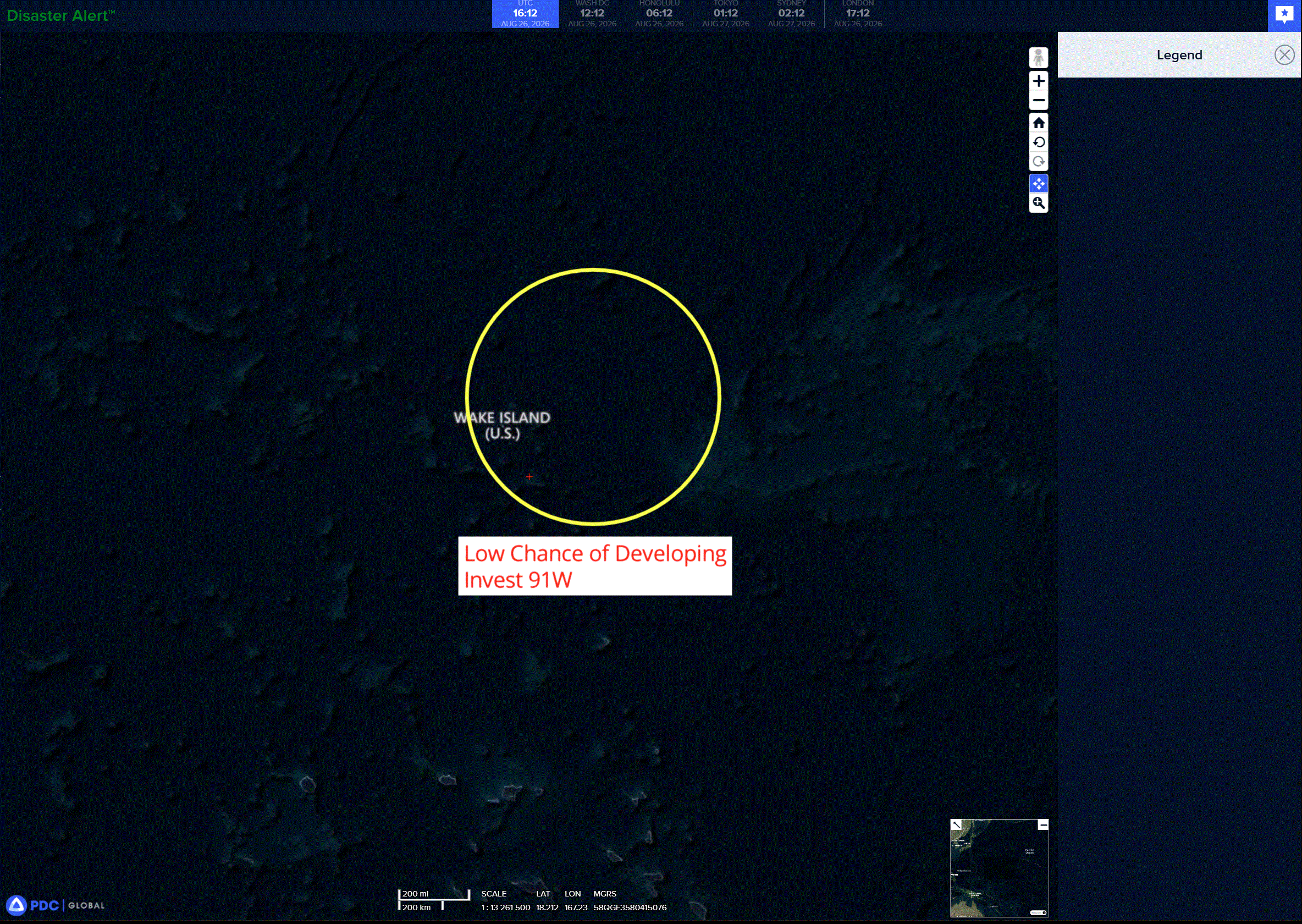
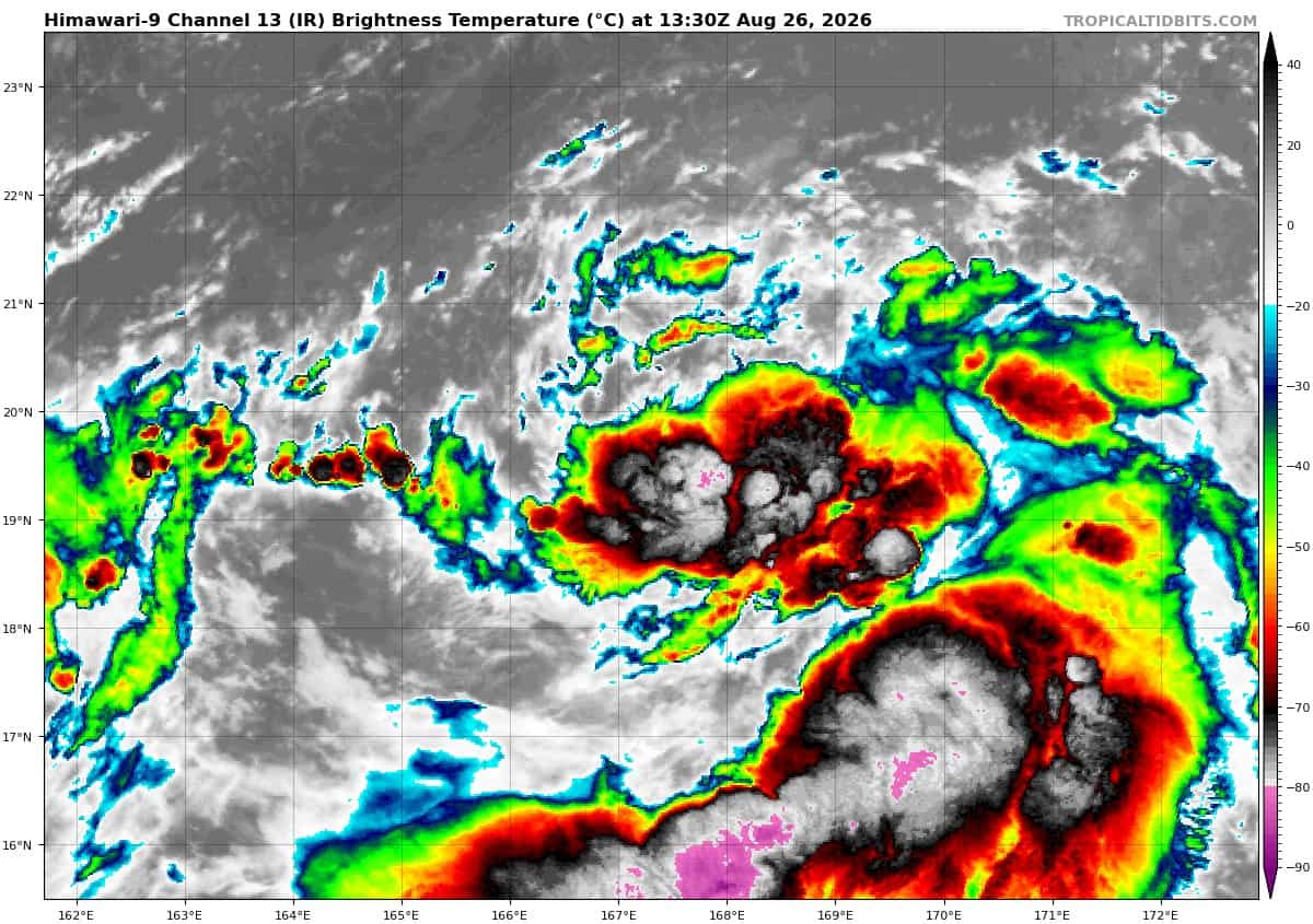
>>> There’s an area of disturbed weather being referred to as Invest 91W, which is located approximately 42 east-northeast of Wake Island
Animated enhanced infrared satellite imagery (eir) reveals a broad and slowly consolidating low-level circulation. A 260858z metop-b partial ascat pass provides clarity of the wind field along the eastern periphery of invest 91w, estimating 20-25 kts.
The environmental factors are conducive for further development with low (5-10 kts) vertical wind shear, very warm (28-29 c) sea surface temperatures, and moderate equatorward outflow aloft.
Global deterministic and ensemble models agree on gradual development of the disorganized system over the next 24-36 hours as the system transits northward.
Maximum sustained surface winds are estimated at 20 to 25 knots.
minimum sea level pressure is estimated to be near 1008 mb.
The potential for the development of a significant tropical cyclone within the next 24 hours is low.