Tropical Cyclone 02C
TROPICAL DEPRESSION MAY BRING RAINFALL AND GUSTY WINDS TO THE HAWAIIAN ISLANDS WITHIN THE NEXT SEVERAL DAYS
According to the NHC advisory number 5…





By PDC’s Senior Weather
Specialist Glenn James

The Pacific Disaster Center’s (PDC Global) Friday, August 21, 2026, Tropical Cyclone Activity Report…for the Pacific Ocean, the Indian Ocean, and adjacent Seas.
Tropical Cyclones
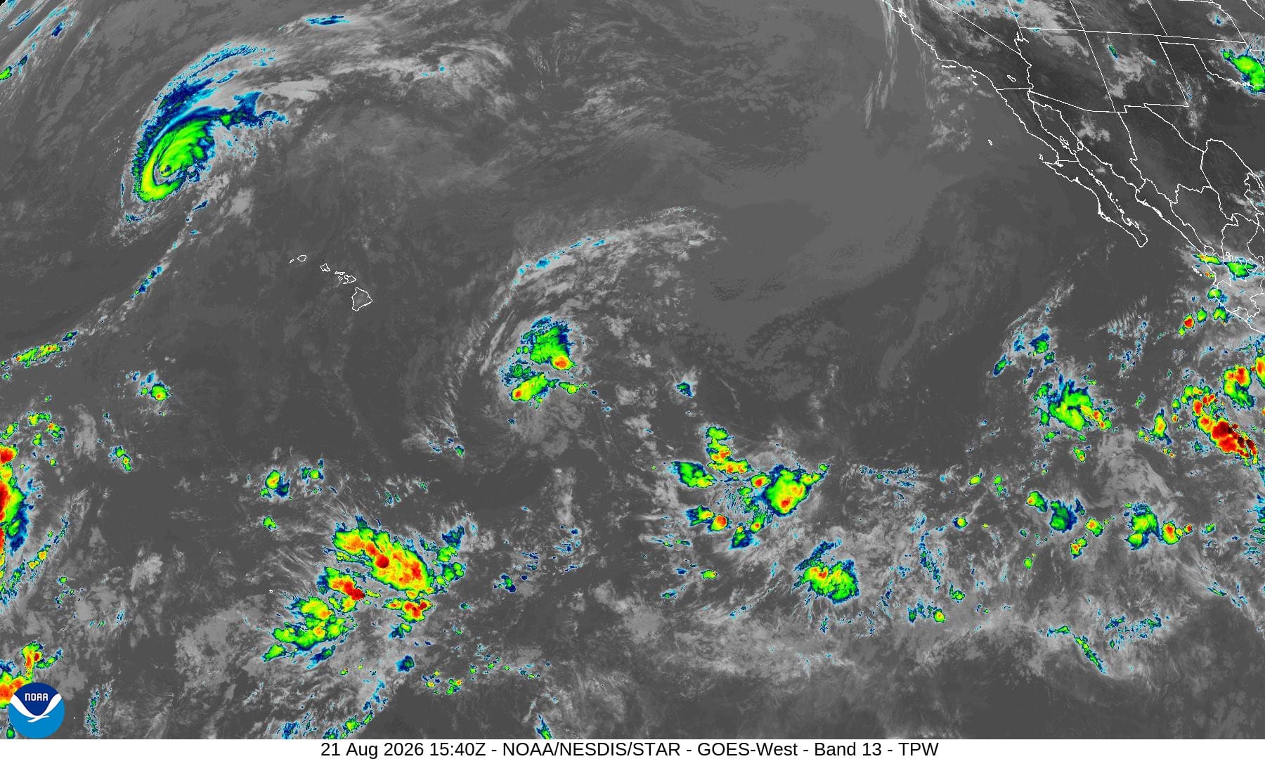
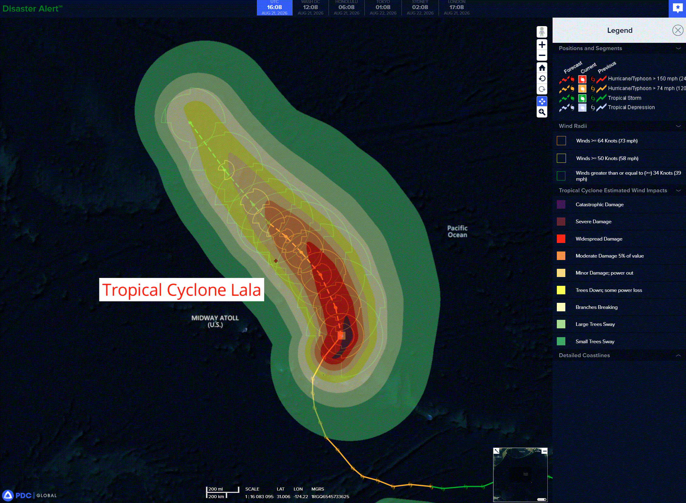
Tropical Cyclone 01C (Lala) is located about 160 miles north of Maro Reef
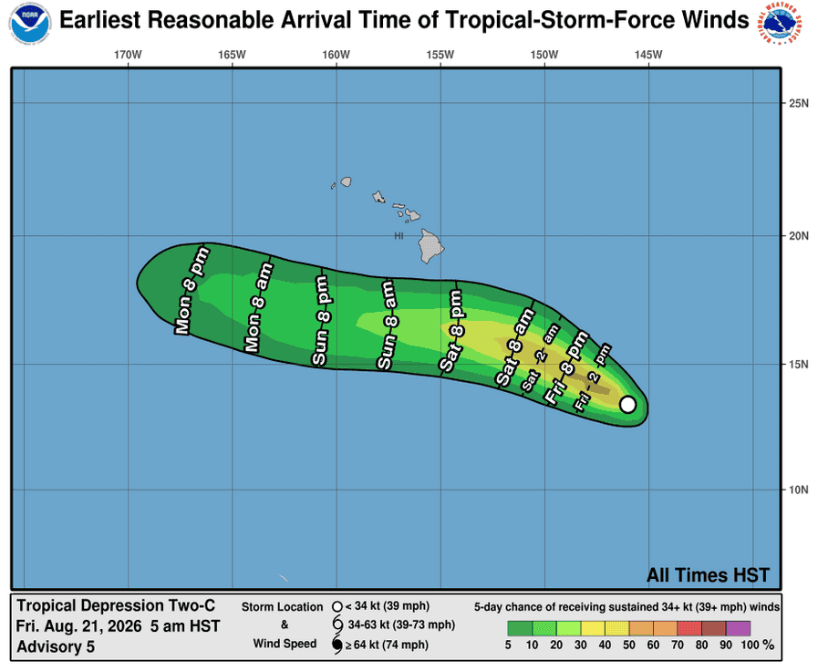
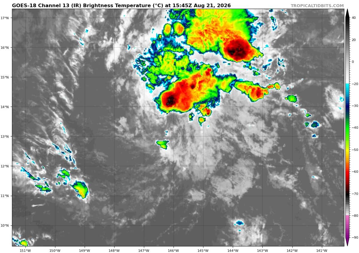
Tropical Cyclone 02C is located about 745 miles southeast of Hilo, Hawaii
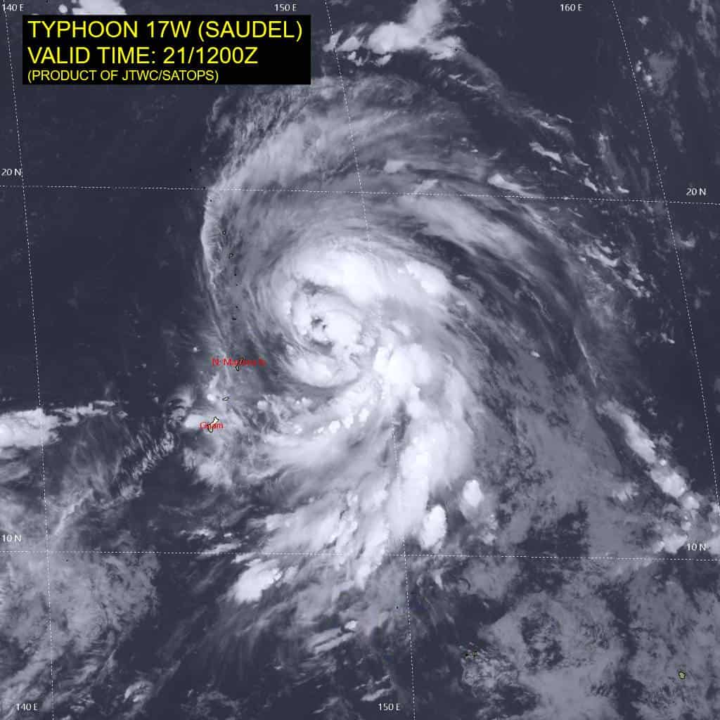
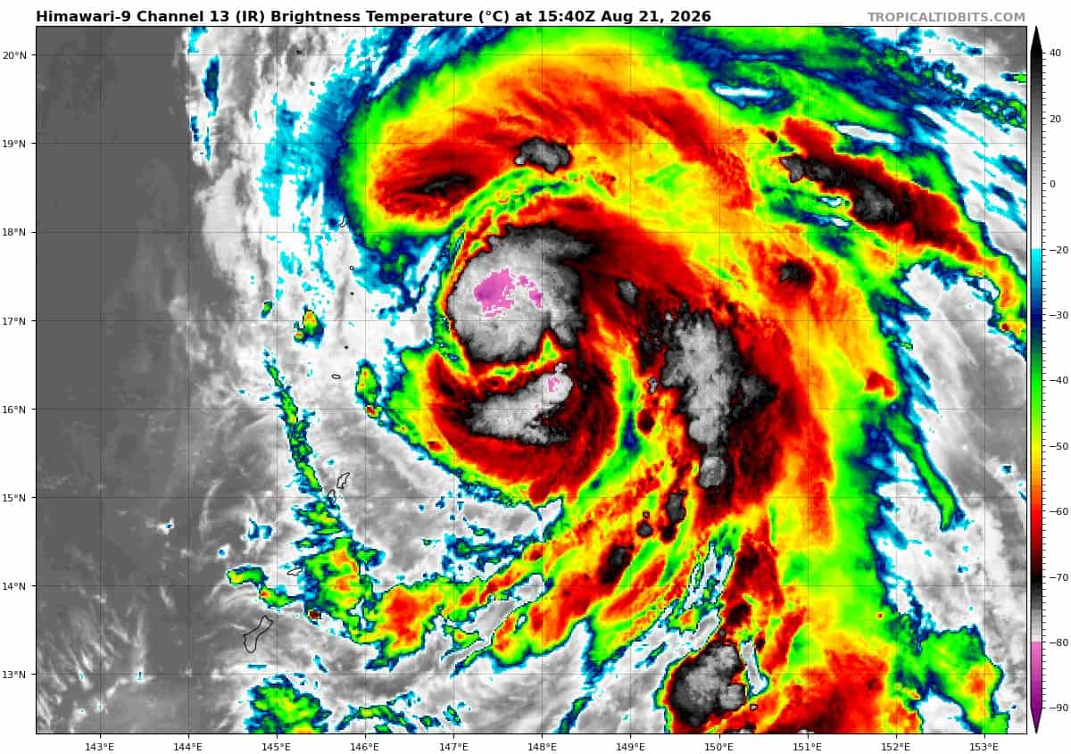
Tropical Cyclone 17W (Saudel)…is located approximately 1141 NM east-northeast of Saipan
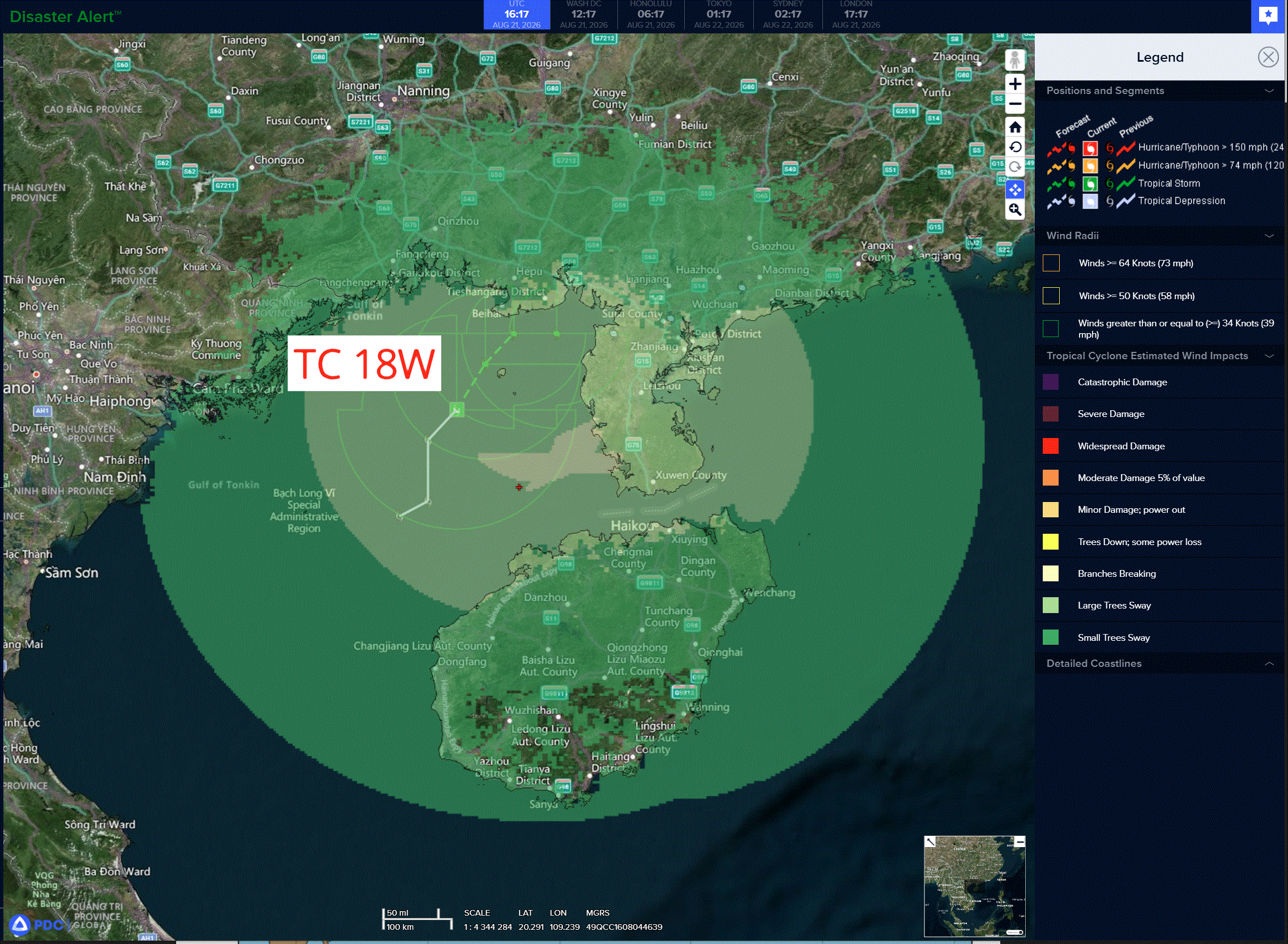
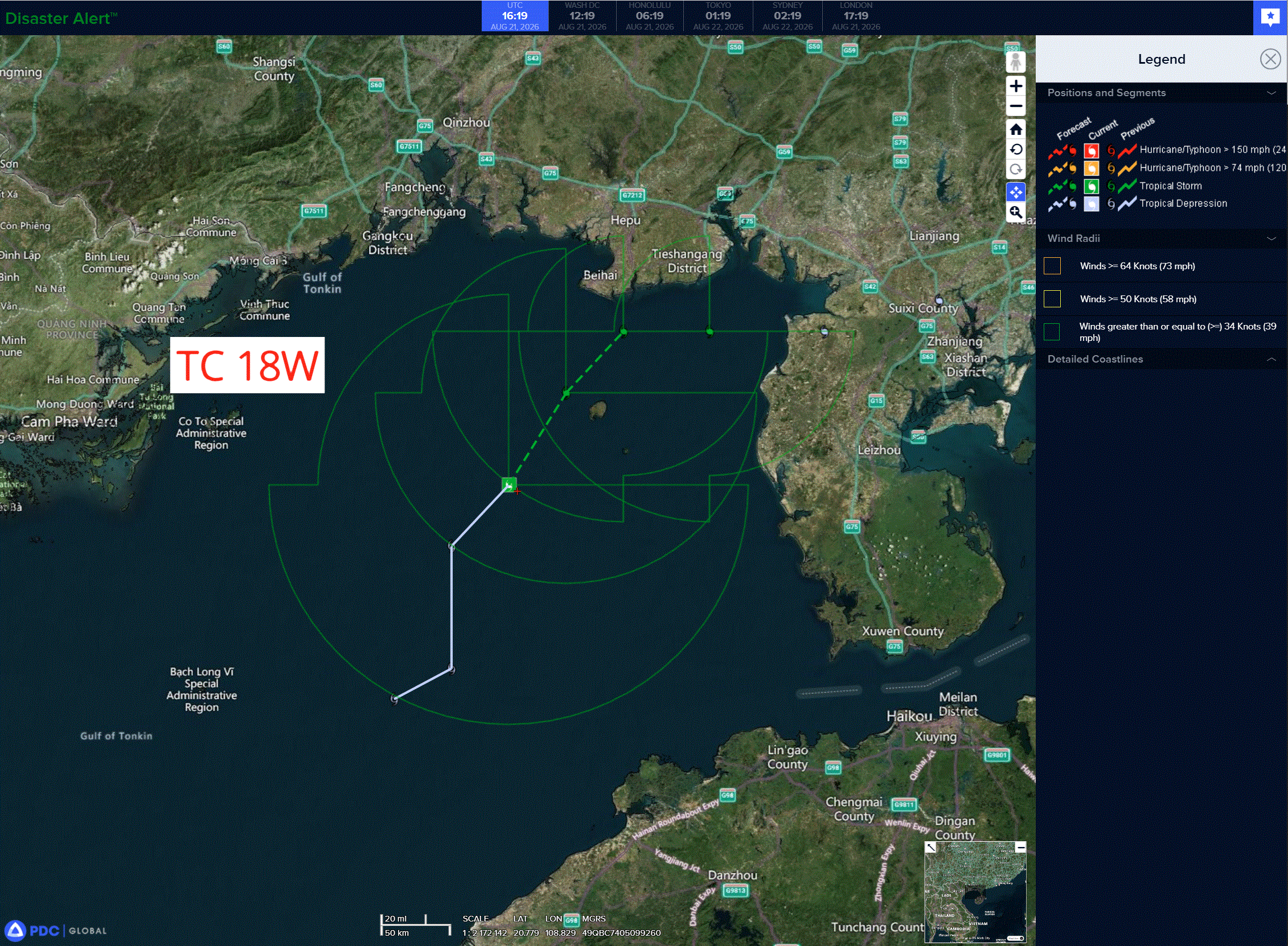
Tropical Cyclone 18W…is located approximately 163 NM east of Hanoi, Vietnam
Northeast Pacific: There are no Tropical Cyclones
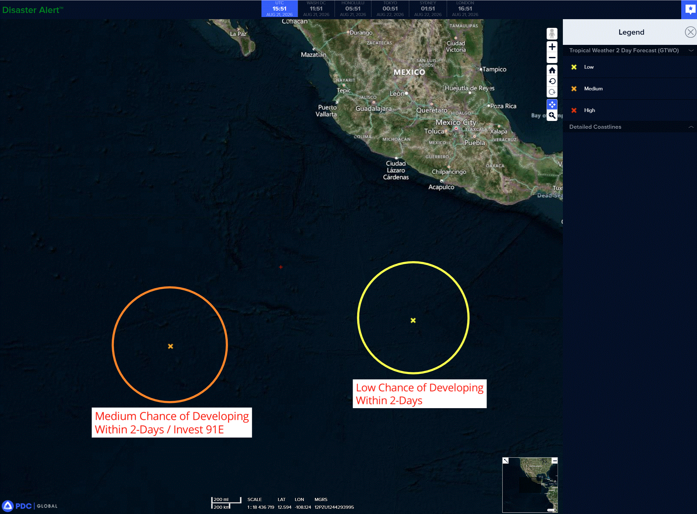
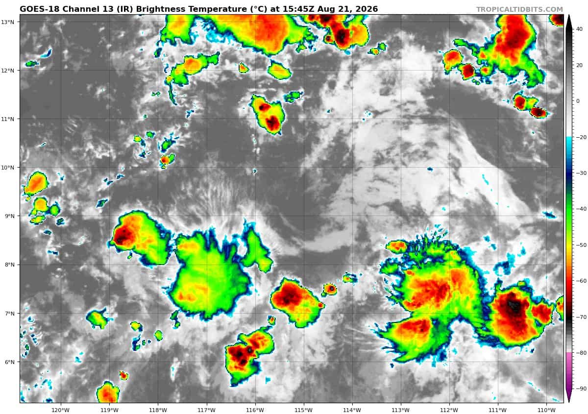
>>> South-southwest of Mexico:
A broad area of low pressure located a few hundred miles south of the coast of southwestern Mexico is producing disorganized showers and thunderstorms. This system is moving west-northwestward and could become a tropical depression over the weekend or early next week before it interacts, or possibly merges with, a disturbance to its west.
* Formation chance through 48 hours…low…20 percent
* Formation chance through 7 days…medium…50 percent
>>> Central East Pacific:
Invest 91E
An area of low pressure located several hundred miles south of the southern tip of the Baja California Peninsula is producing disorganized showers and thunderstorms. Environmental conditions appear favorable for gradual development, and a tropical depression is likely to form this weekend or early next week while the system moves west-northwestward or northwestward at 5 to 10 mph.
* Formation chance through 48 hours…medium…60 percent
* Formation chance through 7 days…high…80 percent
Central north Pacific:
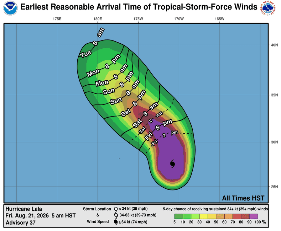
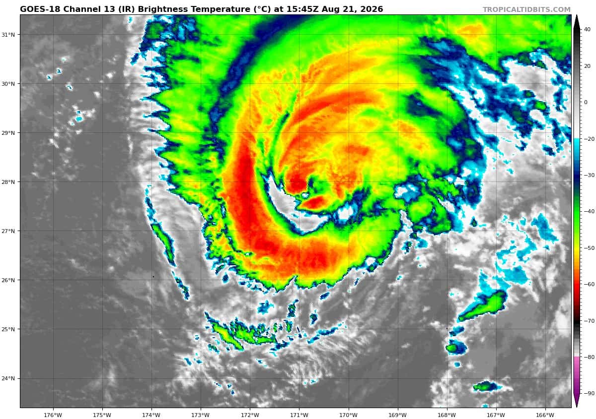
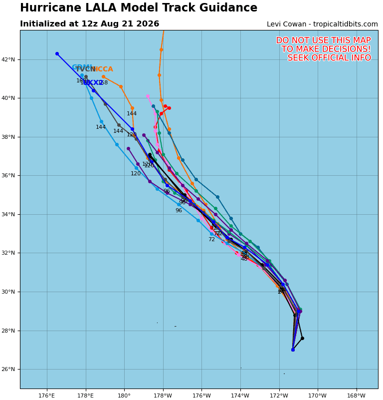
Tropical Cyclone 01C (Lala)
LALA MOVING SLIGHTLY FASTER TOWARDS THE NORTH-NORTHEAST …TROPICAL STORM WARNING DISCONTINUED FOR THE ISLANDS OF THE PAPAHANAUMOKUAKEA MARINE NATIONAL MONUMENT
According to the NHC advisory number 37…
Lala is moving toward the north-northeast near 13 mph (20 km/h) and this motion is expected to continue through this morning. A turn toward the north with a slightly faster forward speed is expected later today, followed by a northwestward motion beginning tonight and continuing through early next week. Maximum sustained winds are near 100 mph (155 km/h) with higher gusts. Some fluctuations in intensity are possible over the next day or so, followed by gradual weakening through next week. Lala is forecast to remain a hurricane through Sunday morning. Hurricane-force winds extend outward up to 45 miles (75 km) from the center and tropical-storm-force winds extend outward up to 150 miles (240 km). The estimated minimum central pressure is 970 mb (28.65 inches).
HAZARDS AFFECTING LAND
SURF: Large surf associated with Lala will affect the Papahanaumokuakea Marine National Monument for the next couple of days. These large waves will likely inundate some of the low-lying atolls, especially from French Frigate Shoals to Maro Reef.
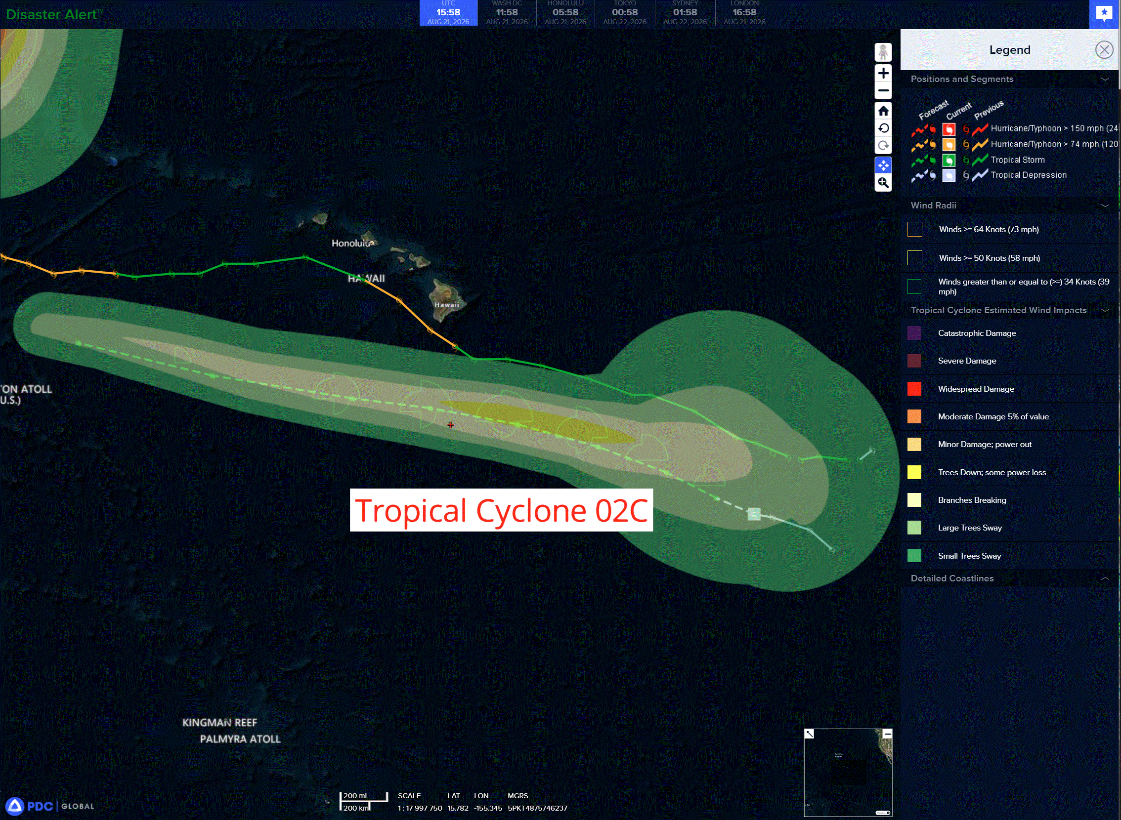
Tropical Cyclone 02C
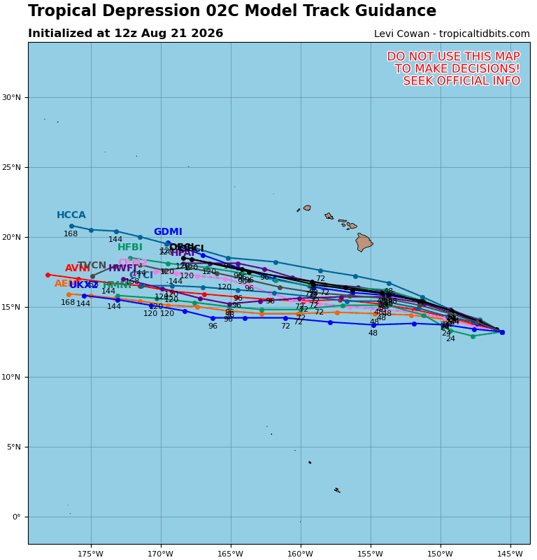
TROPICAL DEPRESSION MAY BRING RAINFALL AND GUSTY WINDS TO THE HAWAIIAN ISLANDS WITHIN THE NEXT SEVERAL DAYS
According to the NHC advisory number 5…
The depression is moving toward the west-northwest near 10 mph (17 km/h). This general motion is expected to persist over the next several days, with the center of the system passing south of the Big Island of Hawaii this weekend, then the smaller main Hawaiian Islands by early next week. Maximum sustained winds are near 35 mph (55 km/h) with higher gusts. Gradual strengthening is forecast over the couple of days, and the depression is forecast to become a tropical storm later today. The estimated minimum central pressure is 1005 mb (29.68 inches).
HAZARDS AFFECTING LAND
RAINFALL: The Tropical Depression is expected to produce rainfall totals of 5 to 10 inches with maximum amounts of 15 inches across the Big Island. Rainfall totals of 1 to 2 inches with maximum amounts of 4 inches are expected on eastern Maui. For the remainder of the islands, 1 to 2 inches of rain are possible. This rainfall may produce life-threatening flooding and mudslides for the windward and southeast Big Island, especially in steep terrain and over areas that were affected recently by Lala.
SURF: Swells generated by the depression are expected to affect portions of the Hawaiian Islands this weekend and into early next week. These swells may cause life-threatening surf and rip current conditions.
Western Pacific, Indian Ocean, and adjacent Seas:
Western Pacific
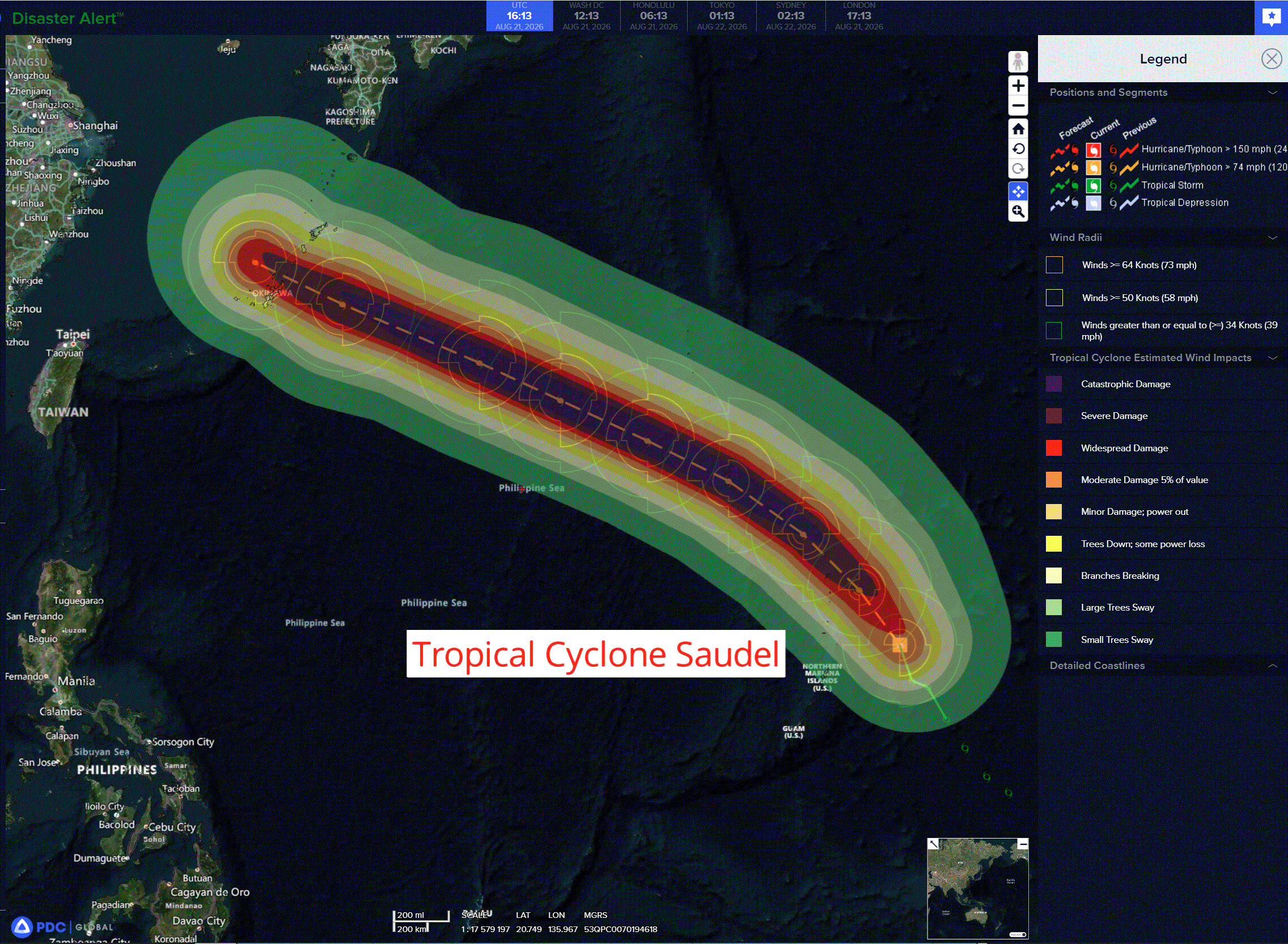
Tropical Cyclone 17W (Saudel)
According to the JTWC warning number 13…
Sustained winds were 70 knots with gusts to 85 knots
Now a typhoon, 17W has undergone rapid intensification (ri), with its intensity increasing by 30 kts in the past 24 hours.
Animated enhanced infrared (eir) satellite imagery depicts an expanding convective envelope as feeder bands explode over the northern and eastern periphery. TY 17W now has a ragged eye as the central dense overcast associated with the inner core has become better defined. The increasing upper-level divergence can be largely attributed to excellent poleward outflow aloft. the system is in a highly favorable environment of high ocean heat content (ohc), low vertical wind shear (vws), and rich, deep-layer moisture.
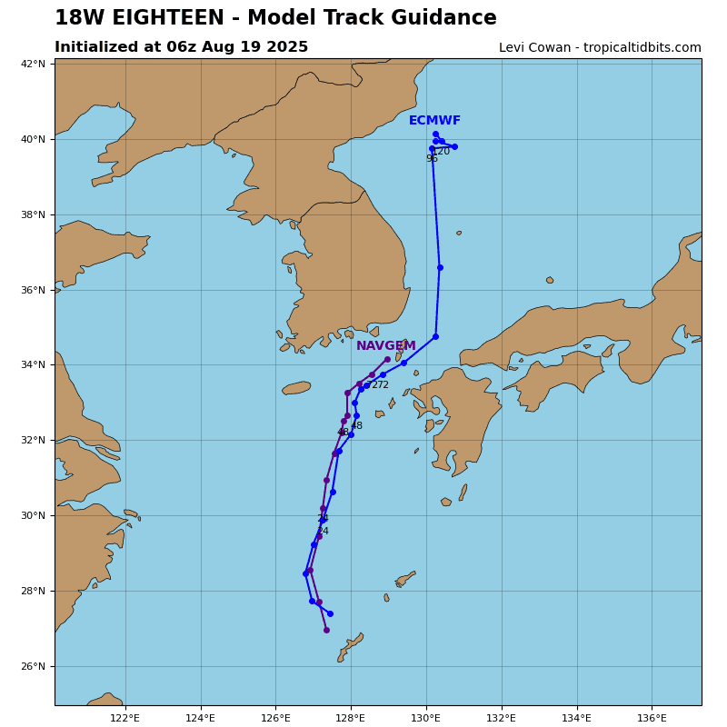
TY 17W continues to move north-northwestward at an average speed of 10-13 kts along the southwestern flank of an elongated str to its northeast. This motion will hold through 36 hours. After this point, the str will migrate westward, which will
force the system onto a more westward track. In the extended period, low confidence remains due to the uncertain impact of the monsoon depression, designated as 94W, on a separate str over Honshu. A stronger 94W would erode the str, creating a weakness that would allow TY 17W to slow and turn poleward, bringing the system closer to the northern Ryukyu Islands and Kyushu.
On the other hand, a weaker 94W would leave the str intact, causing TY 17W to continue on a more westward trajectory toward the southern or central Ryukyu Islands. The JTWC forecast currently favors the latter scenario and depicts a more zonal track at 96 hours and 120 hours.
Rapid intensification (ri) began approximately 24 hours ago and will continue. Over the next 36 hours, TY 17W will traverse
very high ohc within a low-shear environment. Consequently, the system will continue to rapidly deepen to a peak intensity of 125 kts at 48 hours. Afterward, the intensification phase will end as the system moves over progressively lower ohc. A steady weakening trend will commence at 96 hours, driven by lower sea surface temperatures, upwelling of cooler waters caused by a slowing forward motion, and increasing vws.
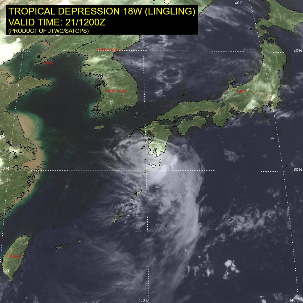
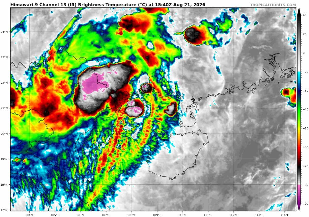
Tropical Cyclone 18W
According to the JTWC warning number 4…
Sustained winds were 35 knots with gusts to 45 knots
Over the past six hours, a mass of very deep convection hooked onto the western flank of TS 18W. This has visibly caused the low-level circulation center (llcc) to spin up. This convection has since weakened and progressed inland over Qinzhou. The llcc remains over the very warm waters of the Gulf of Tonkin, but the moderate to high vertical wind shear (vws) has taken a toll on the convective activity that was once over the center.
A 211032z wsfm mwi 37 ghz image revealed a rather disorganized lower-level structure with heavy precipitation occurring within the western side of the center. Dry air is being pulled northward and is enveloping the circulation, which is suppressing convective activity.
Tropical storm (ts) 18W is located within a weak steering environment. A weak subtropical ridge (str) over southeast China tries to drive the system westward, but the deep-layer southwesterlies to the south attempt to move it in the opposite direction. The end result is a very slow rate of forward movement toward the northeast. The str will weaken over the next 12 hours. Therefore, the JTWC forecast track presumes that the steering influence of the southwesterly flow will dominate and calls for a general northeastward to eastward motion through the period.
With most of the convection now inland and very little over the circulation, the system has likely reached peak intensity. The
environment will be persistently unfavorable for development, characterized by warm sst strongly offset by moderate to high vws and dry air. The JTWC intensity forecast assumes that convection will attempt to rebuild over the circulation while it remains over warm waters, which will help maintain intensity in the face of undesirable shear over the next 36 hours. Once the vortex makes landfall, it will dissipate by 72 hours.
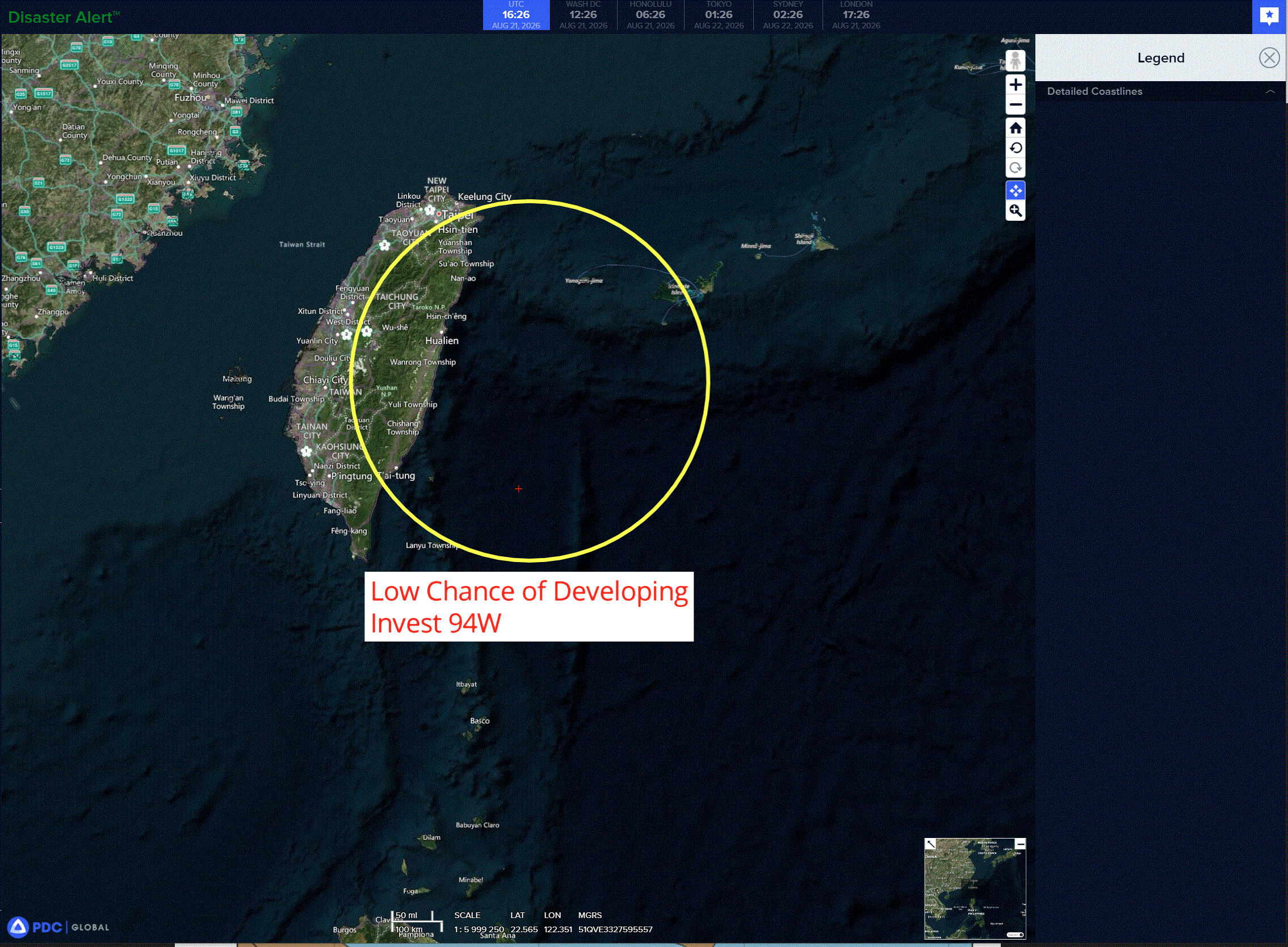
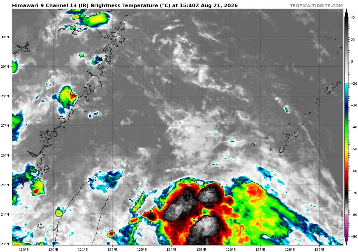
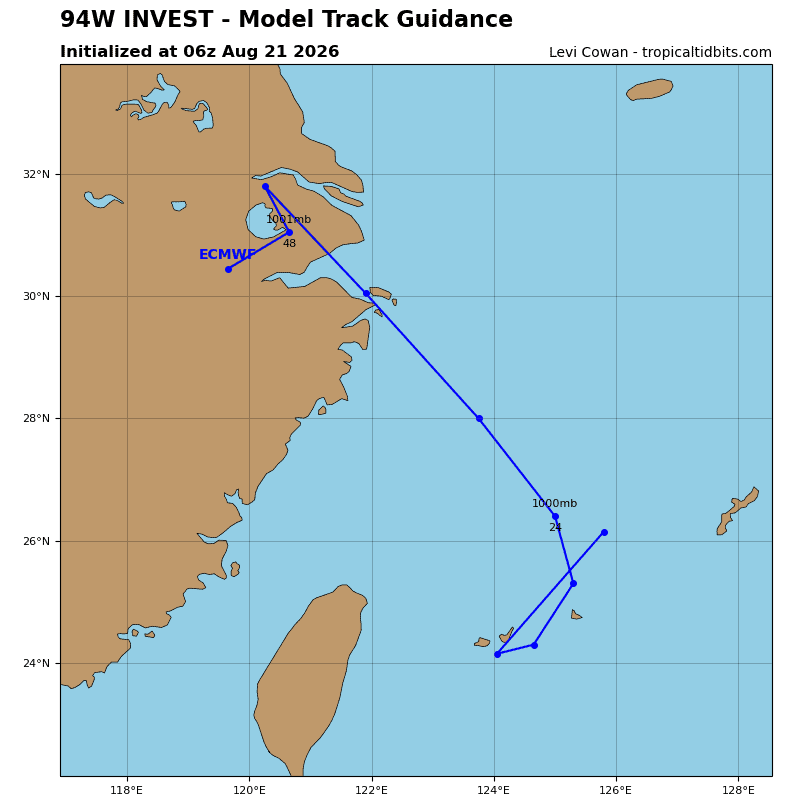
>>> There’s an area of disturbed weather being referred to as Invest 94W, which is located approximately 144 NM east of Kadena AFB
The system is currently classified as a monsoon depression, generally characterized as a large cyclonic circulation, greater than 600 nm diameter, with enhanced winds over the southeastern periphery and a weak core of light winds.
Animated enhanced multi-spectral satellite imagery (msi) depicts a broad circulation partially obscured by dense convection building in the south-southeastern periphery. A 210135z metop-c ascat pass revealed 20-25 kts winds displaced approximately 125 nautical miles east of the analyzed position of the center.
Environmental analysis reveals mostly conducive conditions for development with low to moderate (15 to 20 kts) vertical wind shear, moderate upper-level equatorward outflow, and warm (28-29c) sea surface temperatures.
Global models indicate that the broad circulation will struggle to consolidate into a tropical cyclone in the next 24-36 hours.
Maximum sustained surface winds are estimated at 23 to 28 knots.
Minimum sea level pressure is estimated to be near 1001 mb.
The potential for the development of a significant tropical cyclone within the next 24 hours remains low.
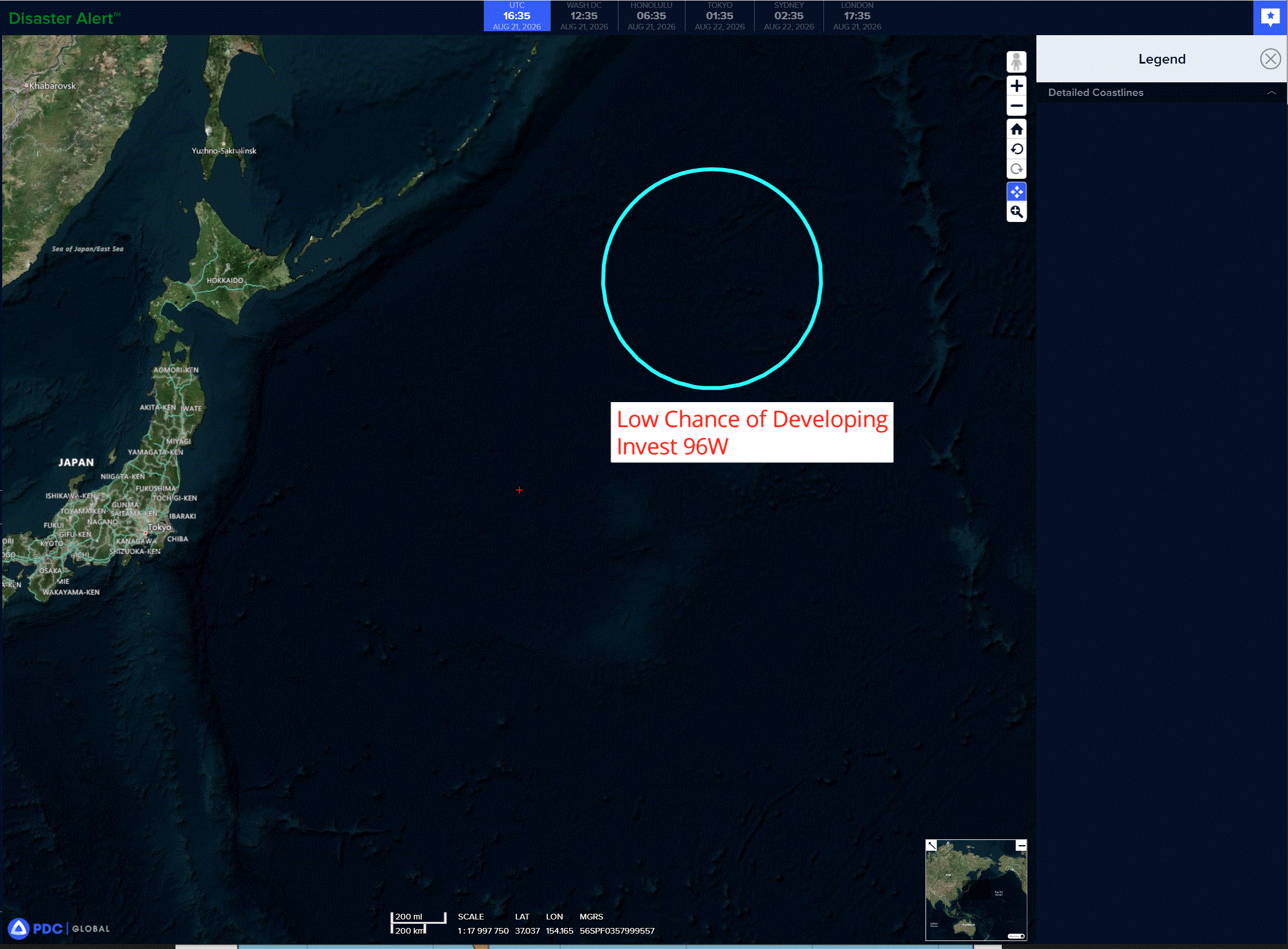
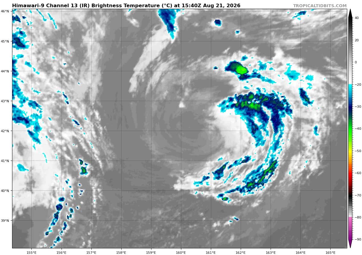
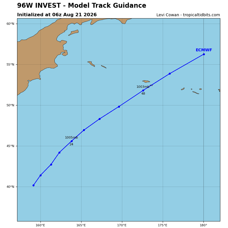
>>> There’s an area of disturbed weather being referred to as Invest 96W, which is located approximately 809 NM east of Misawa, Japan
The system is currently classified as a subtropical cyclone, generally characterized as having both tropical and mid-latitude cyclone features.
Animated enhanced multi-spectral satellite imagery (msi) depicts invest 96W with a fully exposed low-level circulation center (llcc) and deep associated convection over the west-northwestern periphery.
A potent upper-level low presently inhibits convective activity over the center, and plenty of dry air is
wrapping into the circulation.
Deterministic models show 96W transiting northwestward and diminishing as the upper-level low
weakens and the environmental conditions become more hostile, with transition into a tropical cyclone being unlikely.
Maximum sustained surface winds are estimated at 33 to 38 knots.
Minimum sea level pressure is estimated to be near 1003 mb.
The potential for the development of a significant tropical cyclone within the next 24 hours remains low.
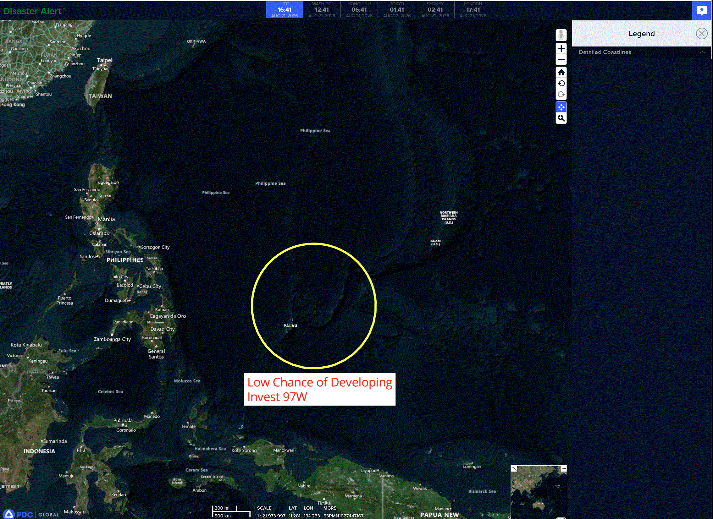
>>> There’s an area of disturbed weather being referred to as Invest 97W, which is located approximately 35 NM north of Yap
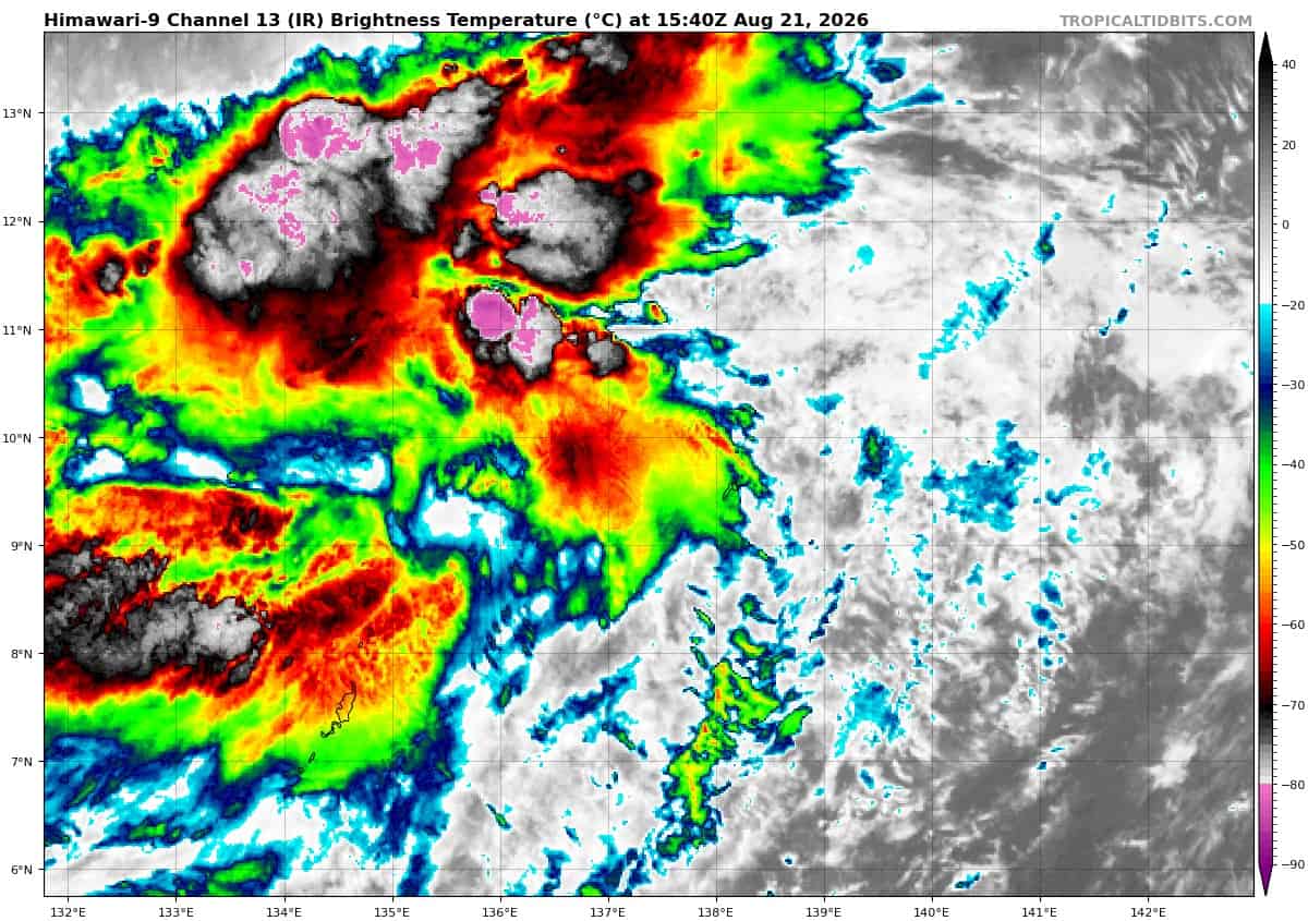
Animated enhanced infrared imagery depicts persistent convection obscuring a loosely defined low-level circulation center (llcc). The convection is associated with a mid-level circulation displaced west of the llcc. A 202335z metop-c ascat pass captured 20-25 kt winds along the western periphery and calmer winds over the northeastern portion.
Environmental examination reveals highly favorable conditions for further development with warm (28-29 c) sea surface temperatures, excellent equatorward outflow channel in the upper levels, and low (10-15 kts) vertical wind shear.
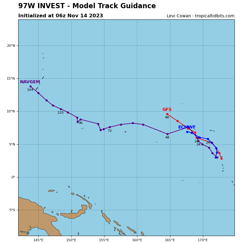
Global deterministic and ensemble models outline gradual development over the next 48 hours. ECMWF in particular develops the system sooner and stronger than GFS.
Maximum sustained surface winds are estimated at 23 to 28 knots.
Minimum sea level pressure is estimated to be near 1005 mb.
The potential for the development of a significant tropical cyclone within the next 24 hours is low.