

Current Snapshot
For all the latest updates visit: DisasterAWARE
1800x1080ce
222222
7
lala
181437_earliest_reasonable_toa_34
goes18_ir_01C_202608181515_lat20.4-lon-166.6lala
01C_gefs_latest
17w
17W_181200sair

17W_tracks_latest
2w
himawari9_ir_94W_202608181510_lat19.9-lon129.9
94W_tracks_latest
himawari9_ir_95W_202608181510_lat19.3-lon116.1
95W_tracks_latest
By PDC’s Senior Weather
Specialist Glenn James

The Pacific Disaster Center’s (PDC Global) Tuesday, August 18, 2026, Tropical Cyclone Activity Report…for the Pacific Ocean, the Indian Ocean, and adjacent Seas.
Tropical Cyclones
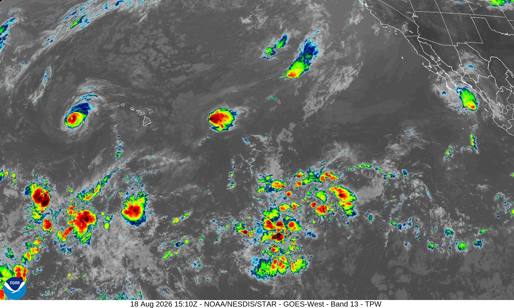
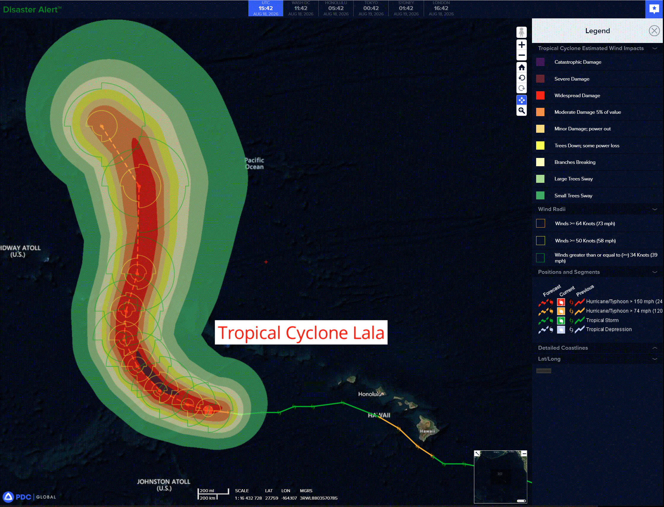
Tropical Cyclone Lala is located about 390 miles south-southwest of Maro Reef
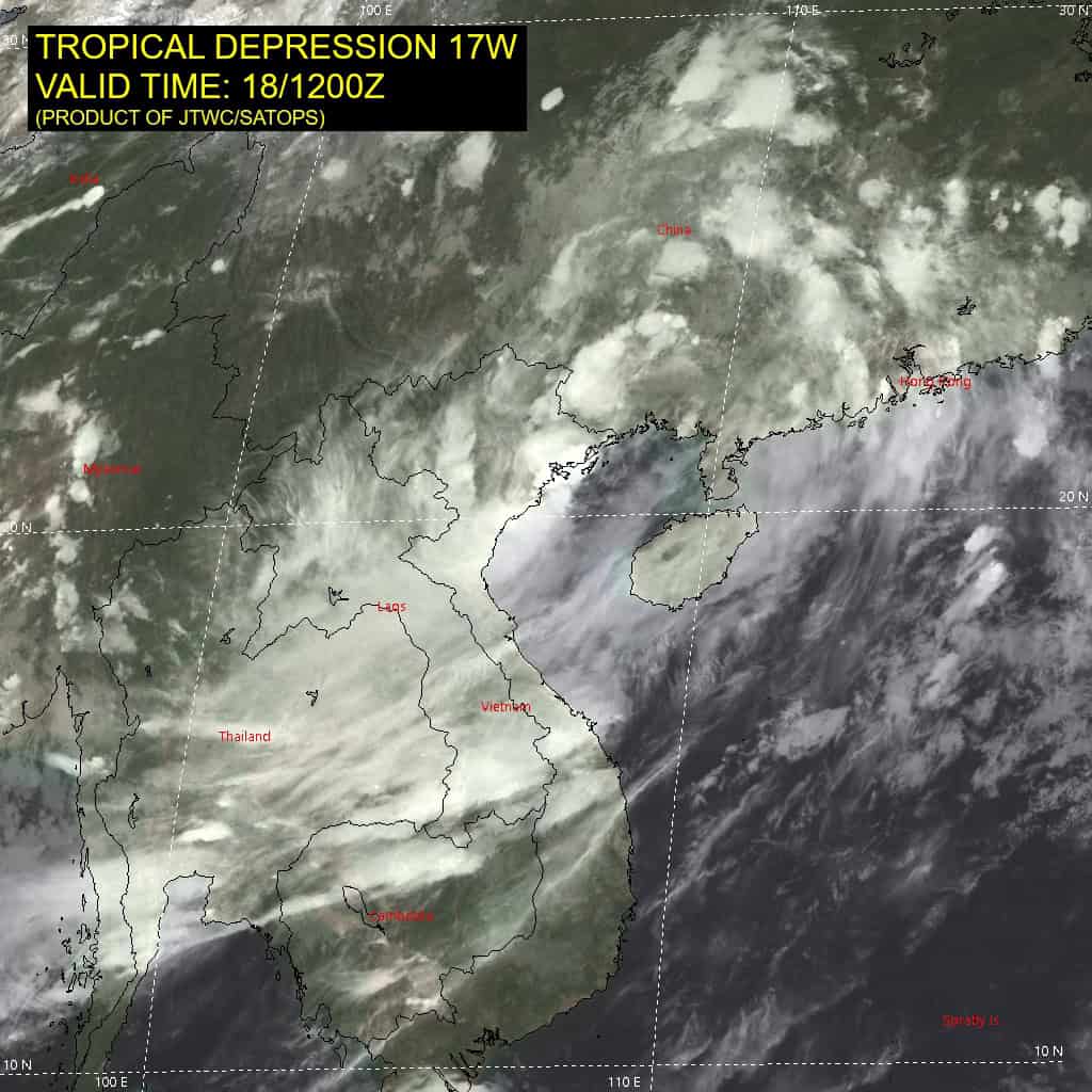
Tropical Cyclone 17W…is located approximately 180 NM east of Chuuk
Northeast Pacific: There are no Tropical Cyclones
>>> South of Mexico:
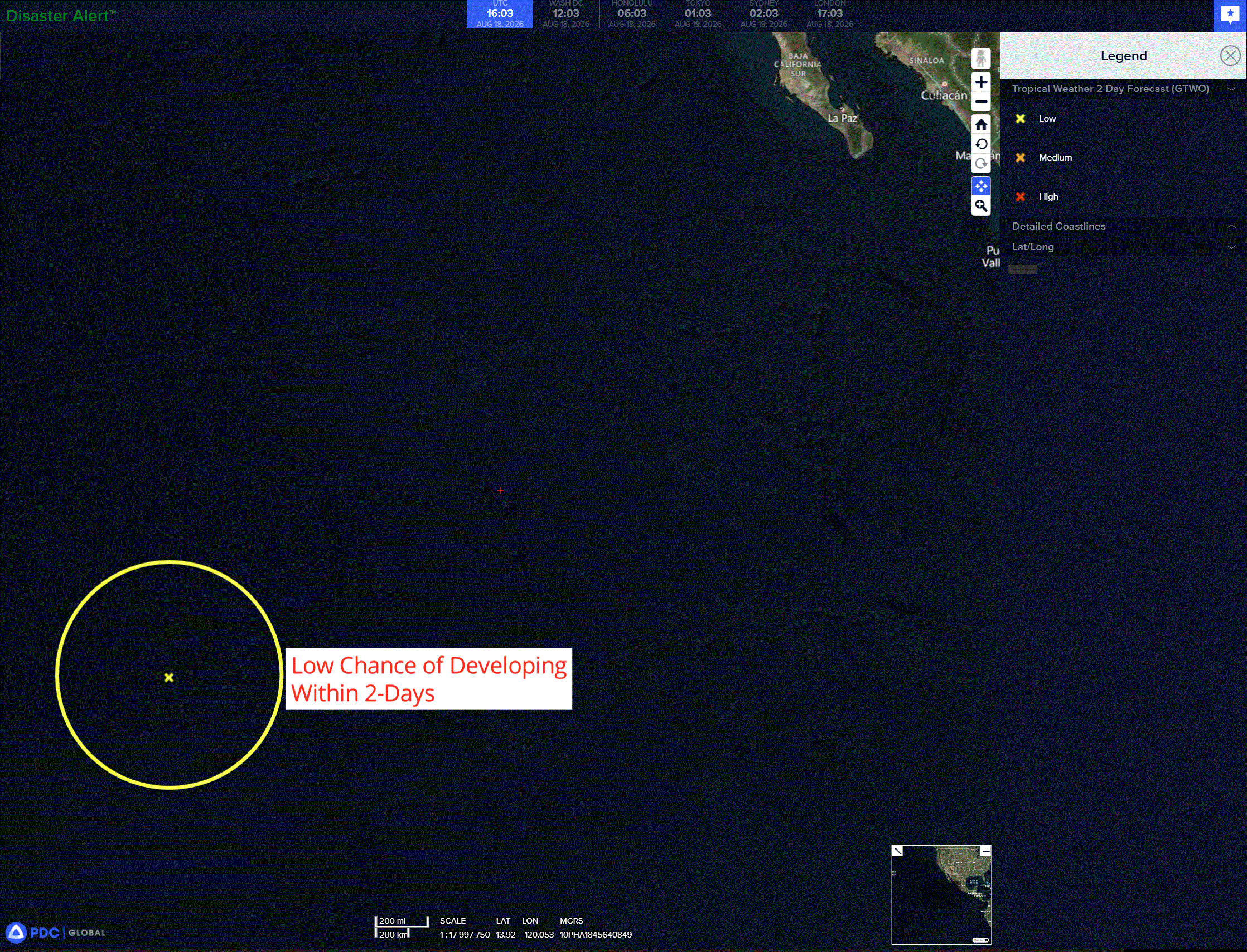
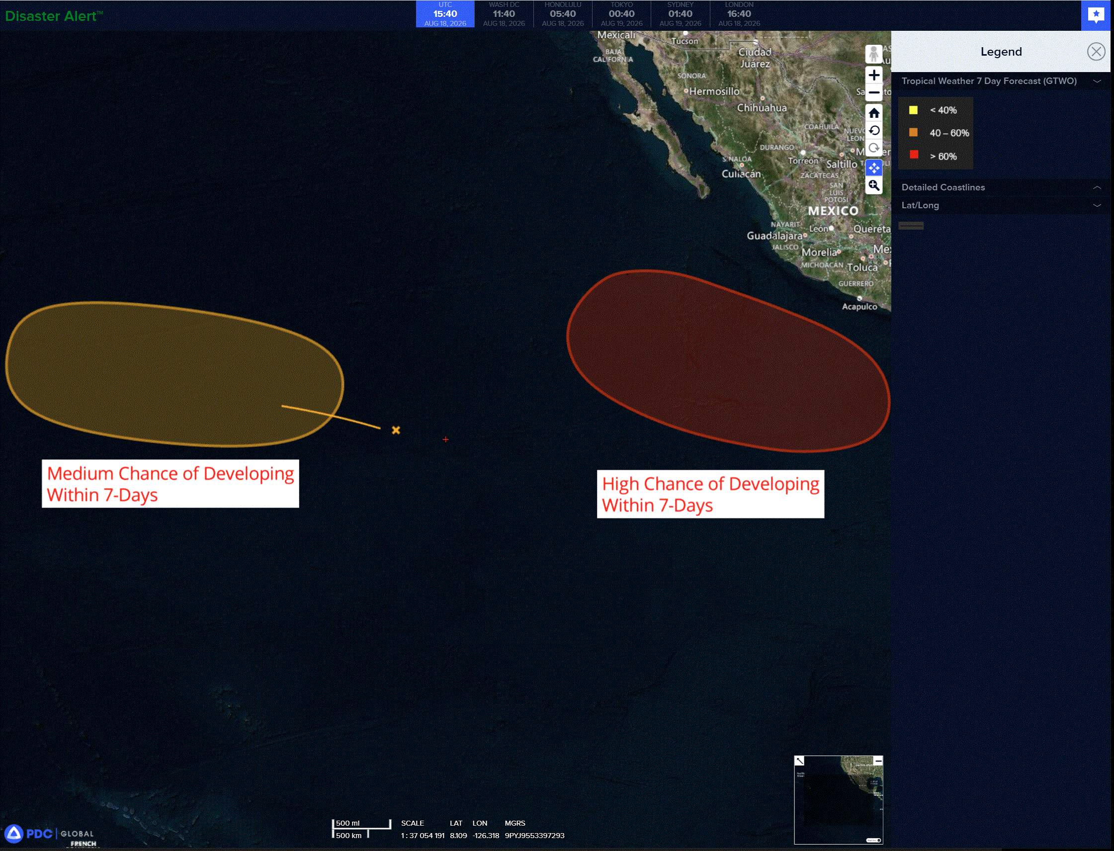
An area of low pressure is forecast to form several hundred miles south of the coast of southern Mexico around the end of the week. Gradual development of this system is likely thereafter, and a tropical depression is expected to form this weekend while the system moves west-northwestward, remaining well offshore of Mexico.
* Formation chance through 48 hours…low…near 0 percent
* Formation chance through 7 days…high…80 percent
>>> Western portion of the eastern Pacific:
A tropical wave located well to the west-southwest of the southern tip of the Baja California Peninsula is producing disorganized showers and thunderstorms. Environmental conditions appear conducive for gradual development of this system, and a tropical depression could form towards the end of the week or over the weekend while the system moves generally westward across the western portion of the east Pacific and into the central Pacific.
* Formation chance through 48 hours…low…20 percent
* Formation chance through 7 days…medium…60 percent
Central north Pacific:
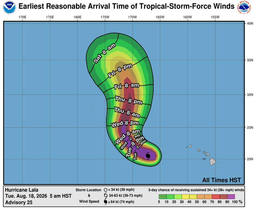
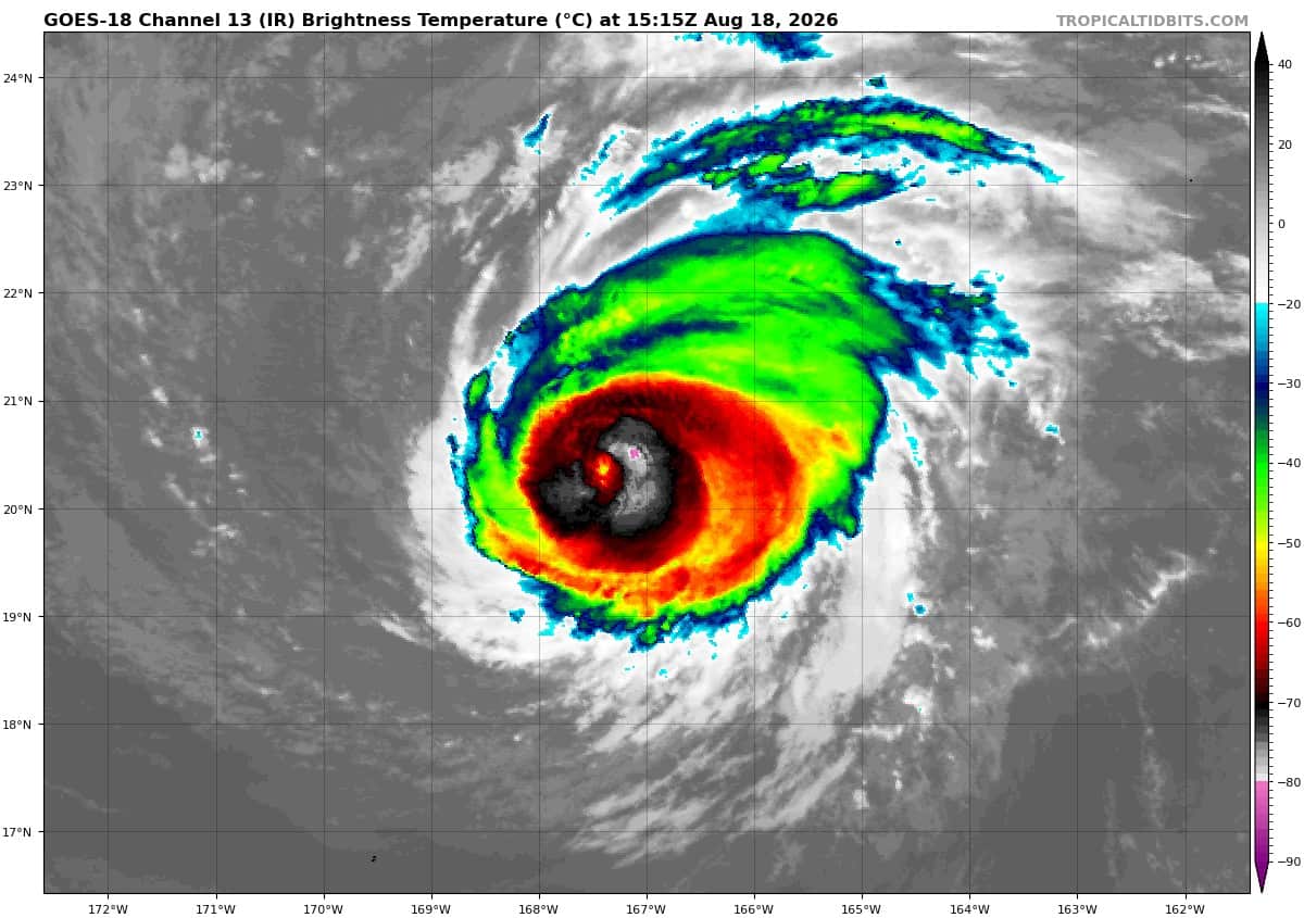
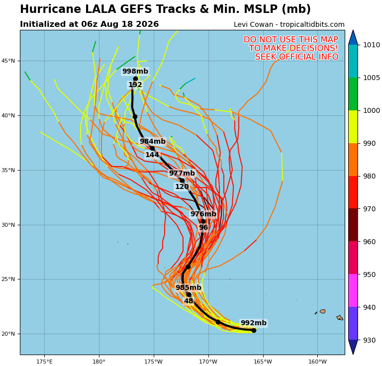
Tropical Cyclone 01C (Lala)
WATCHES ISSUED FOR PORTIONS OF THE PAPAHANAUMOKUAKEA MARINE NATIONAL MONUMENT AS LALA IS EXPECTED TO TURN NORTHWARD
According to the NHC advisory number 25…
Lala is moving toward the west near 9 mph, and this motion is expected to continue today. A turn toward the west-northwest then northwest is forecast tonight and Wednesday, followed by a turn toward the north on Thursday. Maximum sustained winds are now near 85 mph with higher gusts. Strengthening is forecast during the next day or so, and Lala is expected to remain a hurricane for the next several days. Hurricane-force winds extend outward up to 15 miles from the center and tropical-storm-force winds extend outward up to 105 miles. The estimated minimum central pressure is 981 mb (28.97 inches).
Western Pacific, Indian Ocean, and adjacent Seas:
Western Pacific
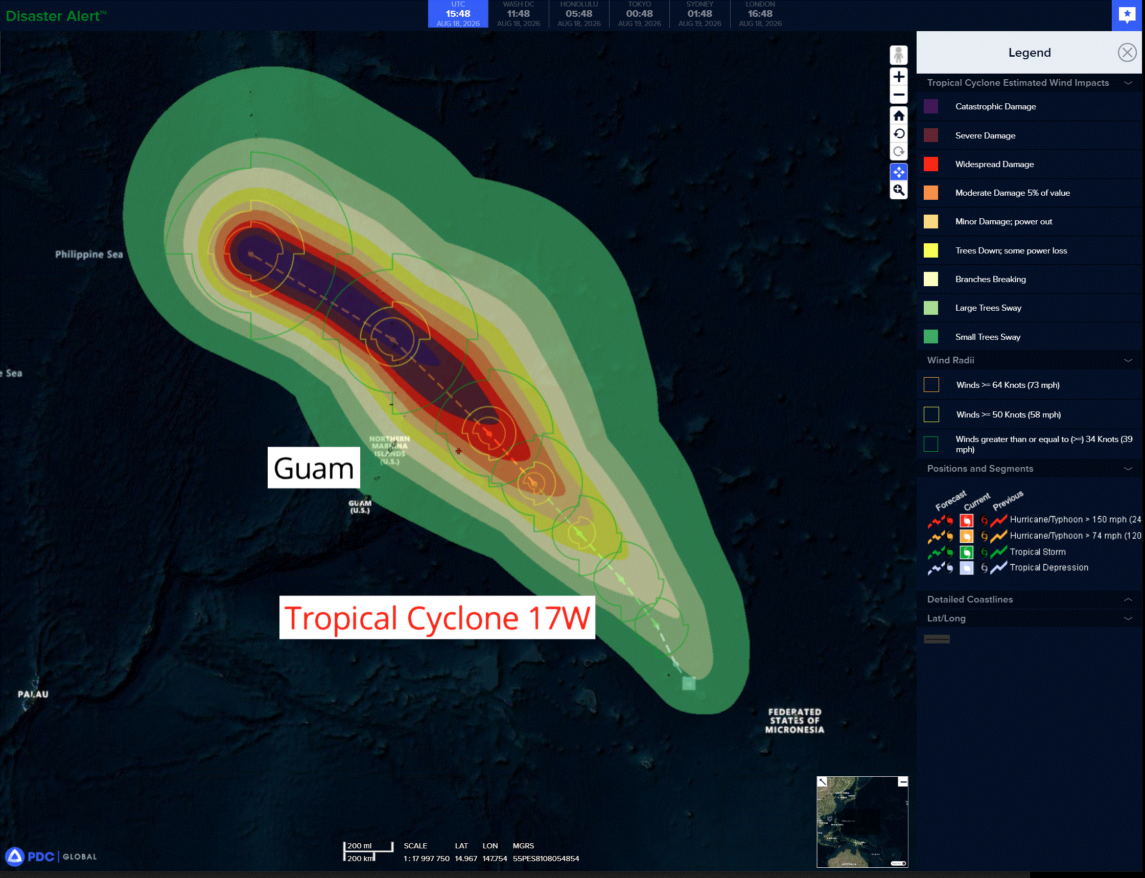
Tropical Cyclone 17W
Animated enhanced infrared (eir) satellite imagery depicts tropical depression 17W with flaring convection obscuring the asymmetric and elongated low-level circulation center (llcc). An 181001z metop-b ascat pass confirmed the asymmetric nature of the wind field. The data showed a large swath of 25 kt winds within the southern semicircle and weaker (10-15 kts) winds within the northern semicircle.
Convective activity has remained confined to the southern portion of the circulation due to a tongue of dry air to the north along with moderate northeasterly vertical wind shear. The current environment is analyzed to be marginally favorable, characterized by moderate equatorward outflow aloft and warm (29-30 c) sea surface temperatures offset by the dry air and northeasterly shear.
TD 17W is forecast to track slowly north-northwestward over the next 24 hours as the system remains within a weak steering pattern. Near 24 hours, the upper-level low that is currently centered near 36n 157e will begin to fill and allow for a subtropical ridge (str) to build in behind it. This str will then extend southwestward and become the primary steering mechanism for 17W through the remainder of the forecast period.
Track speeds are expected to increase in the northwestward direction starting around 36 hours as 17W tracks along the southwestern periphery of the aforementioned str. 17W is forecast to pass about 140 NM north of Saipan, close to the island of Pagan, at around 96 hours. After 96 hours, the track is expected to turn more westward as the str propagates to the west and extends to the north of 17W.
In terms of intensity, 17W is forecast to gradually intensify through 24 hours as the vortex struggles with asymmetry and northeasterly shear. After 24 hours, the wind field will become more symmetric and northeasterly shear will abate, allowing for a quicker rate of intensification. Near 48 hours, the system will begin to take advantage of greatly enhanced outflow and very warm (over 30 c) sea surface temperatures.
This will mark the beginning of a period of rapid intensification (ri) that is forecast to continue through 96 hours. The JTWC forecast explicitly calls for ri from 48 to 96 hours, with an intensity of 50 kts increasing to 115 kts.
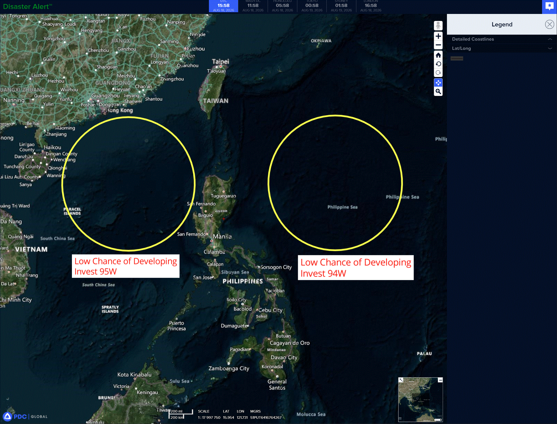
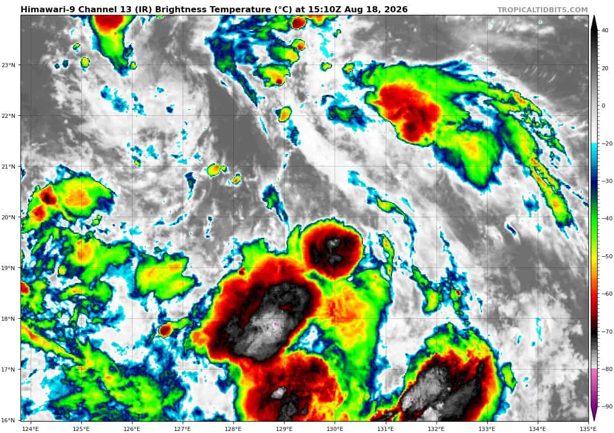
>>> There’s an area of disturbed weather being referred to as Invest 94W, which is located approximately 404 NM south-southeast of Kadena
The system is currently classified as a monsoon depression, generally characterized as a very large cyclonic circulation, greater than 600 nm diameter and extensive elevated winds over the southeastern periphery and a weak core of light winds. Animated multi-spectral satellite imagery (msi) depicts 94W as an area of broad turning, with convection building on the east-southeastern
periphery.
Environmental analysis reveals marginally favorable conditions for development with low (10 to 15kts) vertical wind shear, and warm (29-30 c) sea surface temperatures that are conducive for
further development offset by suppressed outflow due to an upper-level low aloft.
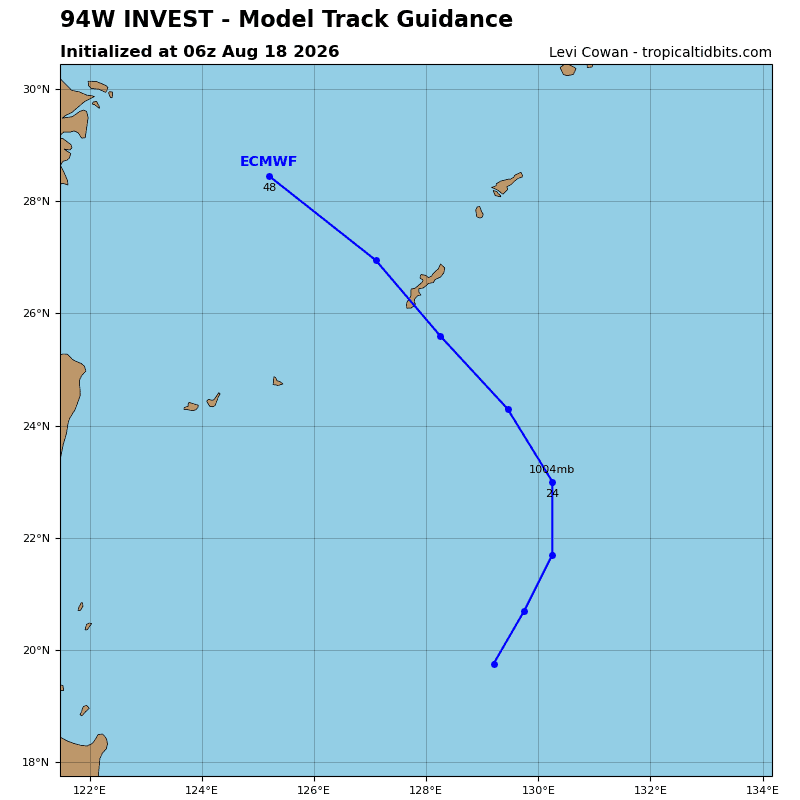
Global models indicate that 94W will transit north-northwestward but does not consolidate into a tropical cyclone. Ensemble models agree on a similar track and intensity as the global models over the next 48 hours.
Maximum sustained surface winds are estimated at 22 to 27 knots.
Minimum sea level pressure is estimated to be near 1004 mb.
The potential for the development of a significant tropical cyclone within the next 24 hours remains low.
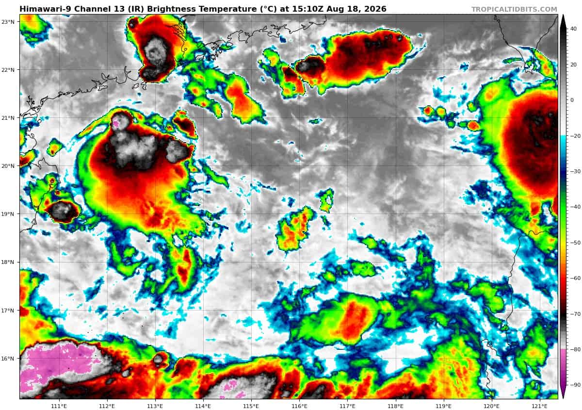
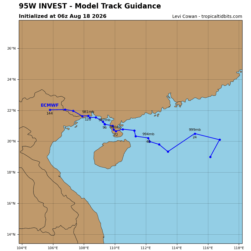
>>> There’s a second area of disturbed weather being referred to as Invest 95W, which is located approximately 207 NM south-southeast of Hong Kong
Animated multi-spectral satellite imagery (msi) depicts 95W as a weak area of turning with disorganized convection.
Environmental analysis reveals marginal conditions for development with low to moderate easterly vertical wind shear (15 to 20 kts), warm (29 to 30 c) sea surface temperatures, and moderate
equatorward outflow.
For global models, gfs is the only model to develop 95W into a consolidated cyclone. Ensemble models do show the steady development of 95W, and for it to take a general slow west-
northwestward track over the next 48 hours.
Maximum sustained surface winds are estimated at 22 to 27 knots.
Minimum sea level pressure is estimated to be near 1002 mb.
The potential for the development of a significant tropical cyclone within the next 24 hours remains low.