

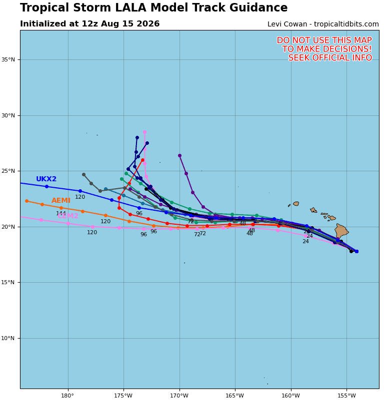

Central Pacific:
Tropical Cyclone 01C (Lala)
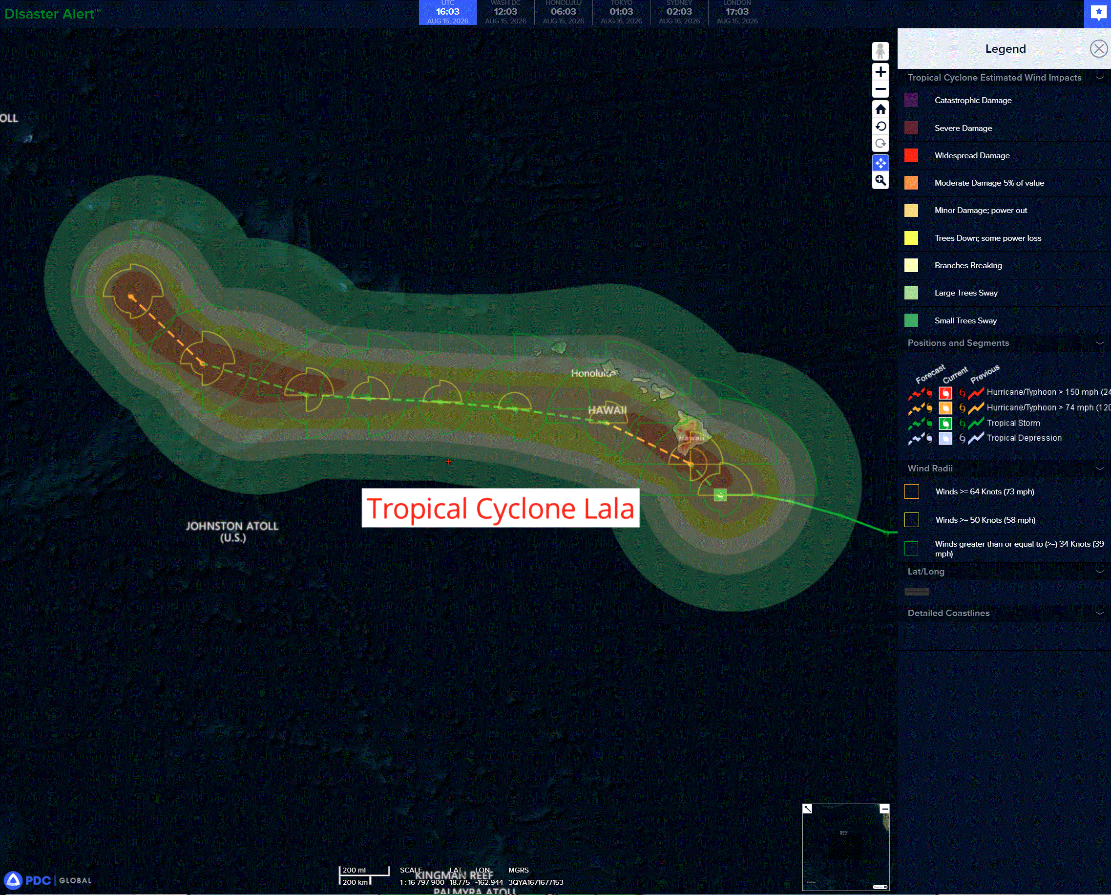
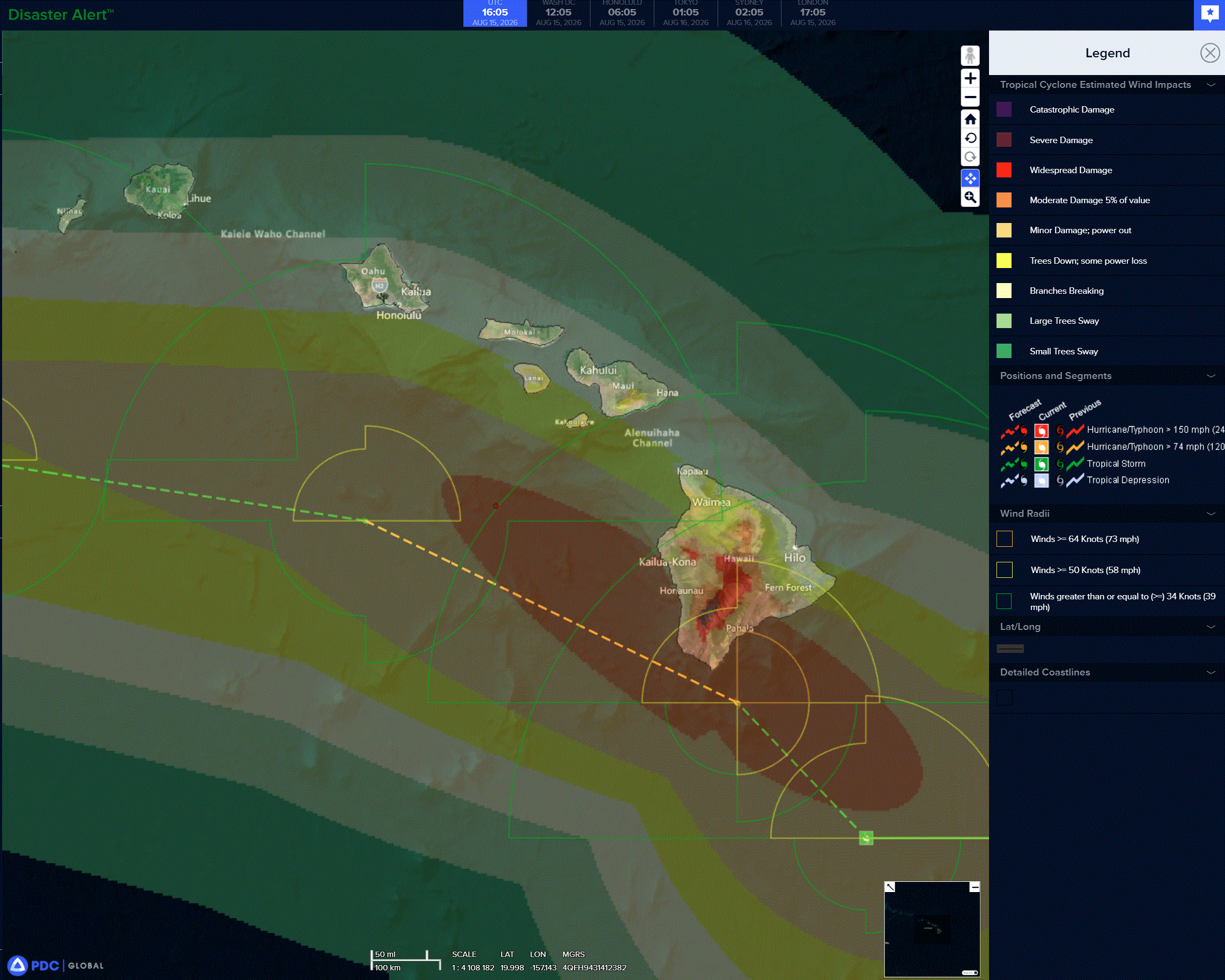
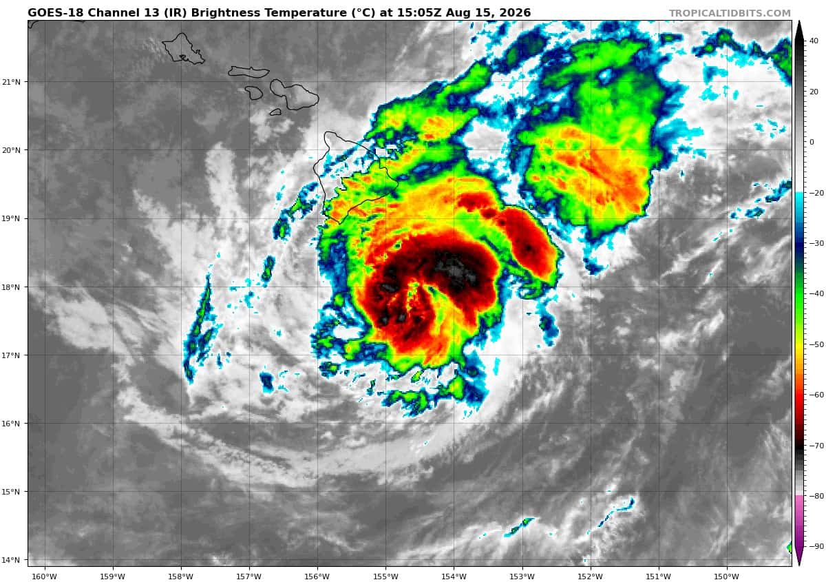
LALA’S EYEWALL BRUSHING THE SOUTHERN PORTION OF THE BIG ISLAND… …DAMAGING WINDS AND HEAVY RAIN WILL PERSIST ACROSS THE BIG ISLAND THROUGH TONIGHT AND SPREAD WESTWARD ACROSS THE SMALLER ISLANDS ON SUNDAY
According to the NHC advisory number 15
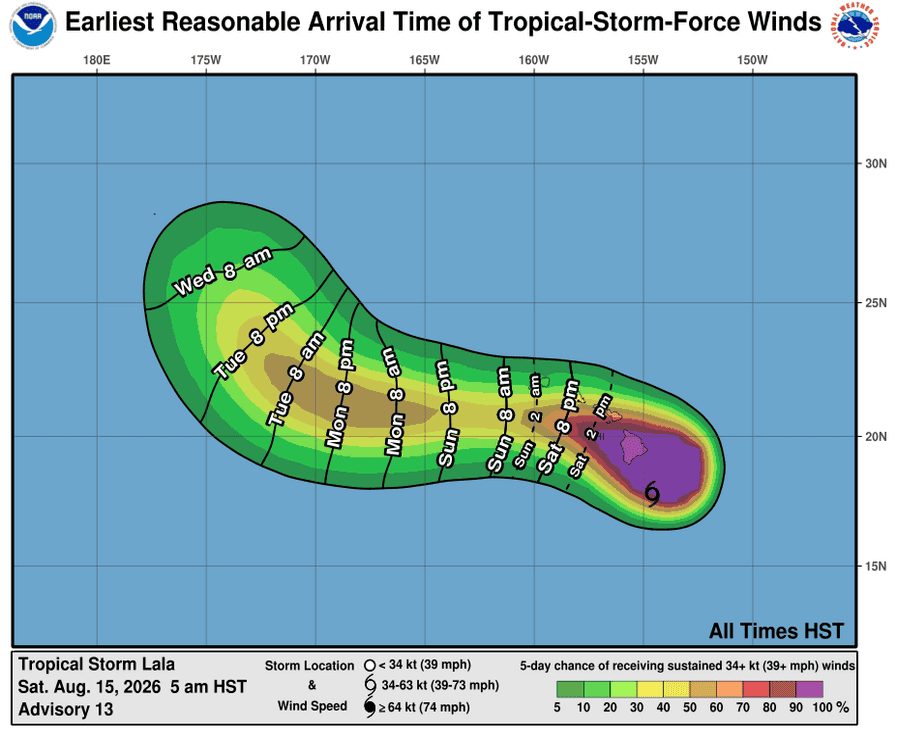
Lala is moving toward the northwest near 9 mph (15 km/h). Some erratic motion remains possible into tonight while Lala interacts with the Big Island of Hawaii. After passing the Big Island, Lala is expected to turn westward on Sunday with an increase in forward speed, as the core of the storm remains south of the smaller main Hawaiian Islands and the easternmost Northwestern Hawaiian Islands through the early part of next week. Maximum sustained winds have increased to near 80 mph (130 km/h) with higher gusts. The intensity of Lala is forecast to remain steady over the next few hours as the hurricane remains near South Point of the Big Island. Thereafter, steady weakening is expected later tonight into Sunday as Lala passes south of the smaller main Hawaiian Islands. Some restrengthening is possible early next week. Hurricane-force winds extend outward up to 45 miles (75 km) from the center and tropical-storm-force winds extend outward up to 175 miles (280 km). The estimated minimum central pressure is 985 mb (29.09 inches).
HAZARDS AFFECTING LAND
WIND: Hurricane conditions will persist on the Big Island of Hawaii into tonight, with the strongest winds expected in areas of higher terrain. Tropical storm conditions will continue to spread westward across portions of the smaller islands from Maui County and Oahu later today through tonight, then to Kauai County on Sunday. Wind speeds atop mountains and on the windward and leeward slopes are often up to 30 percent stronger than the near-surface winds indicated in this advisory, and in some elevated locations could be even greater.
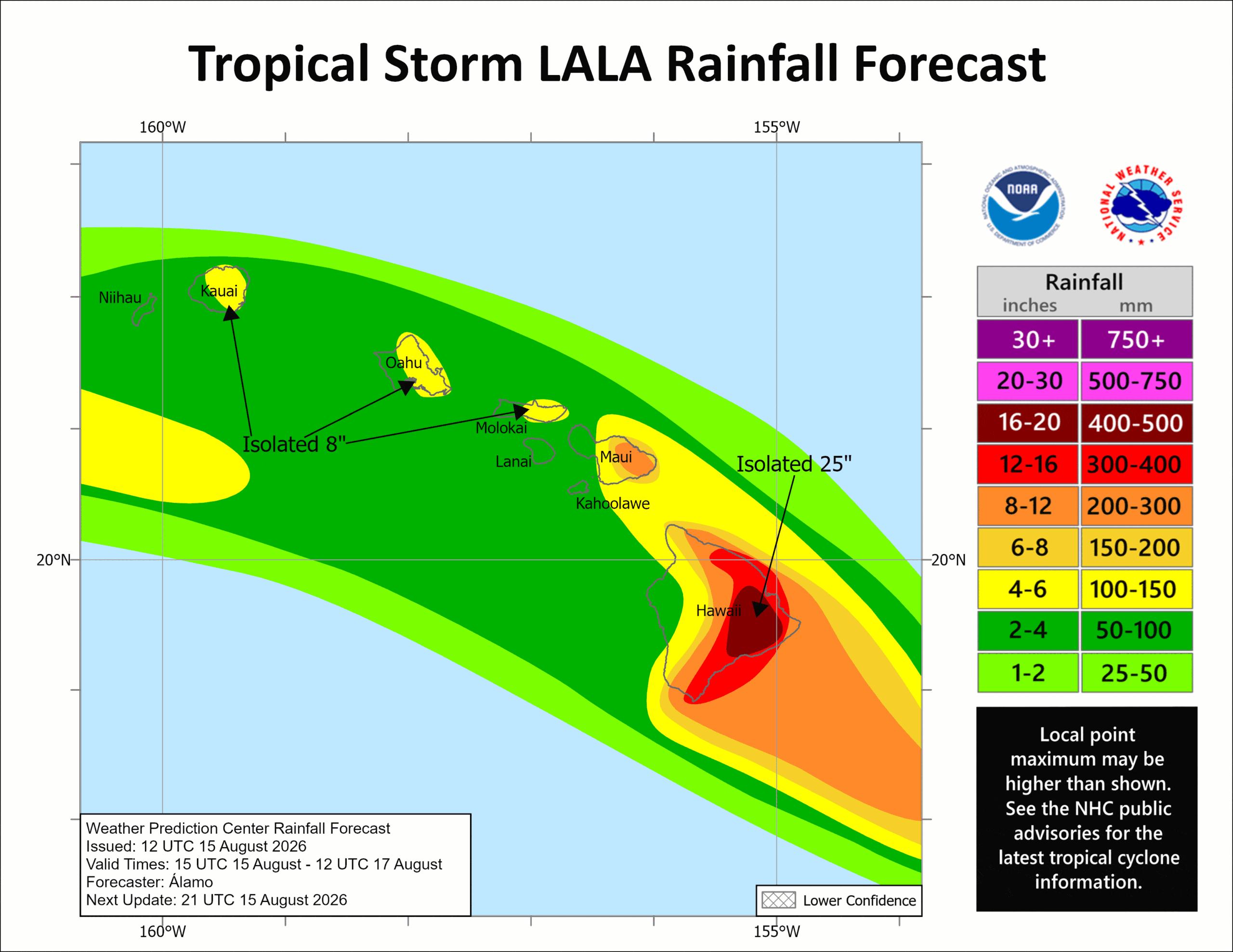
RAINFALL: Lala is expected to produce rainfall totals of 10 to 20 inches across the Big Island, with maximum totals of 25 inches possible. An additional 8 to 12 inches is possible across windward Maui, with totals of 4 to 6 inches, and maximum amounts of 8 inches, across the remainder of the island chain. This rainfall will produce life-threatening flooding and mudslides, especially in areas of steep terrain.
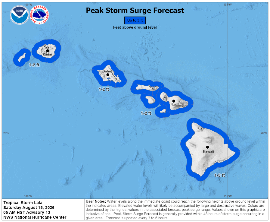
STORM SURGE: The combination of a dangerous storm surge and the tide will cause normally dry areas near the coast to be flooded by rising waters moving inland from the shoreline. The water could reach the following heights above ground somewhere in the indicated areas if the peak surge occurs at the time of high tide…
Hawaii…1 to 3 ft
The deepest water will occur along the immediate coast, where the surge will be accompanied by large and dangerous waves. Surge-related flooding depends on the relative timing of the surge and the tidal cycle, and can vary greatly over short distances.
SURF: Swells generated by Lala will continue to build westward across the exposed windward waters into Sunday. Swells will also build along exposed southern shores as Lala passes south of the islands. These swells are likely to cause life-threatening surf and rip current conditions.