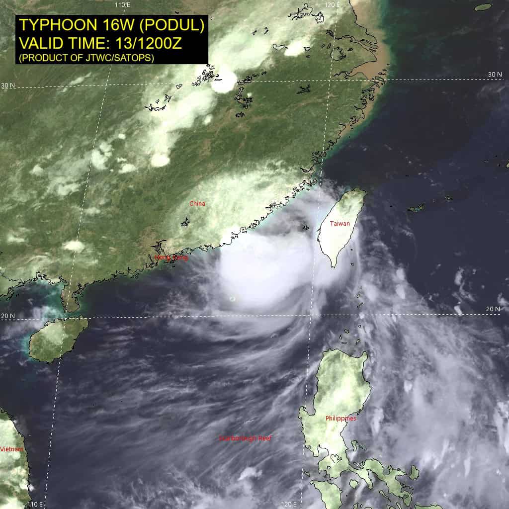
The Pacific Disaster Center’s (PDC Global) Thursday, August 13, 2026, Tropical Cyclone Activity Report…for the Pacific Ocean, the Indian Ocean, and adjacent Seas
Current Tropical Cyclones:
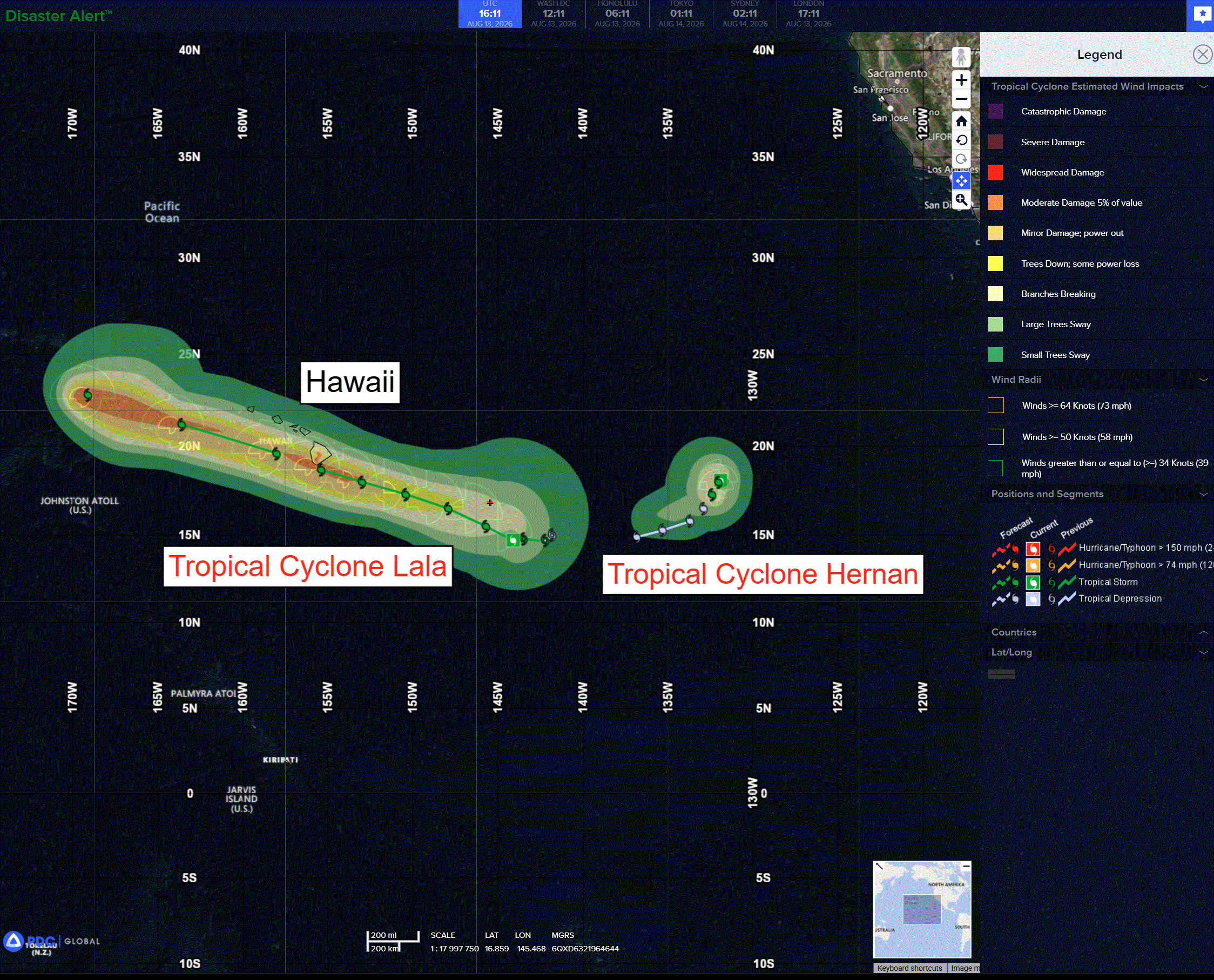
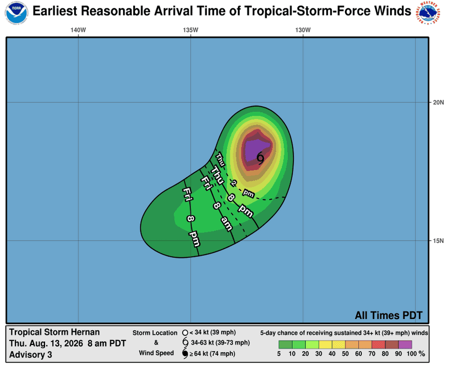
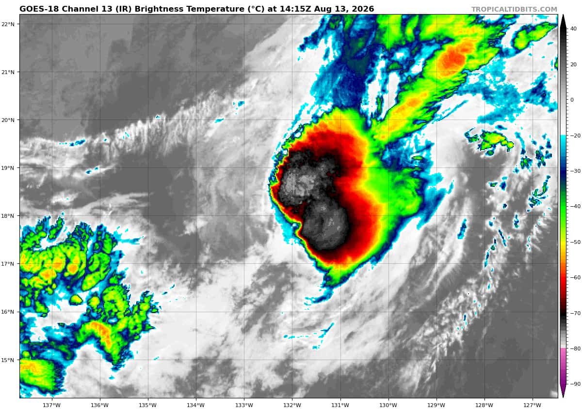
Tropical cyclone 08E (Hernan)…is located approximately 1460 NM west of the southern tip of Baja California
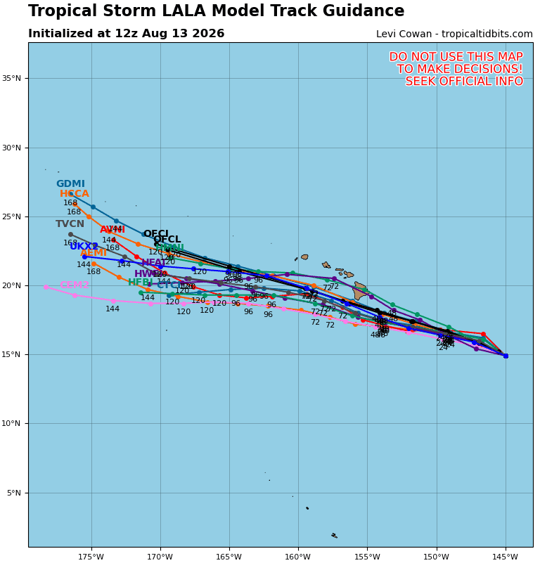
Tropical cyclone 01C (Lala)…is located approximately 705 NM east-southeast of Hilo, Hawaii
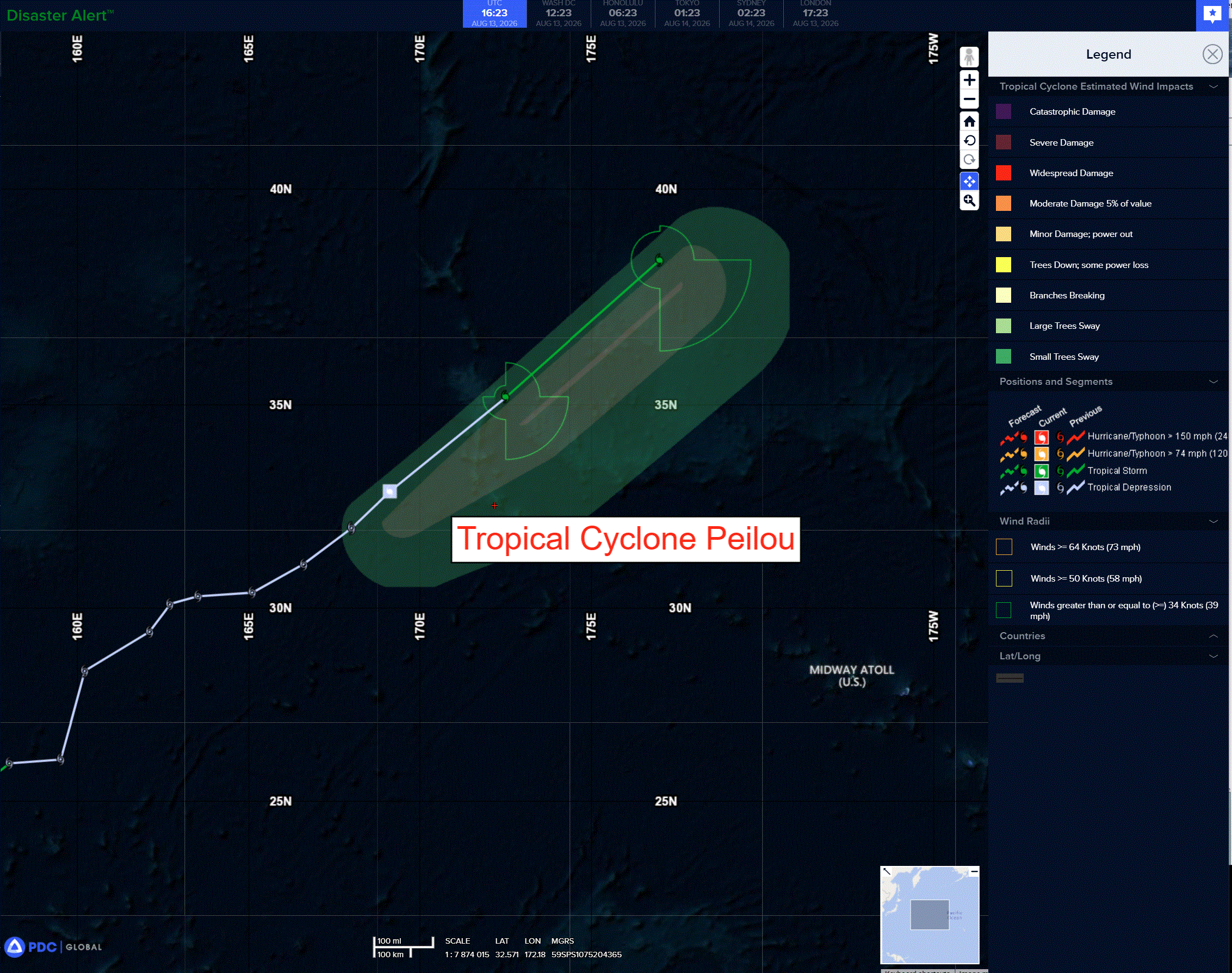
Tropical cyclone 13W (Peilou)…is located approximately 827 NM north of Wake Island
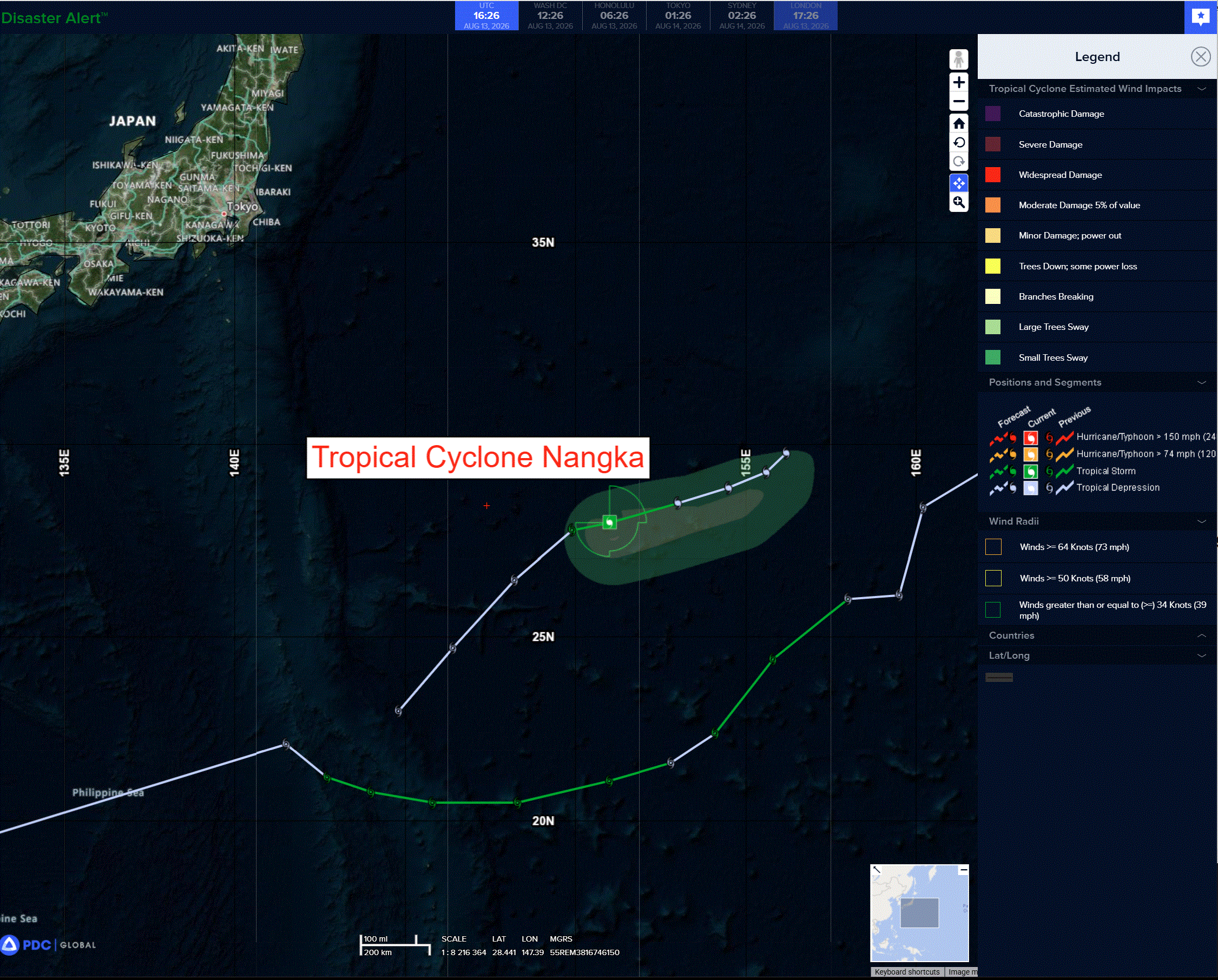
Tropical cyclone 16W (Nangka)…is located approximately 555 NM east-northeast of Iwo To
Northeast Pacific:
Tropical Cyclone 08E (Hernan)
HERNAN STRENGTHENS SLIGHTLY
According to the NHC advisory number 3
Hernan is moving toward the west-southwest near 3 mph (6 km/h). A turn toward the southwest and south is expected over the next couple days. Maximum sustained winds have increased to near 45 mph (75 km/h) with higher gusts. A weakening trend is expected to begin later tonight through Friday, and Hernan is forecast to become a post-tropical remnant low by this weekend. Tropical-storm-force winds extend outward up to 90 miles (150 km) from the center. The estimated minimum central pressure is 1004 mb (29.65 inches).
Central Pacific:
Tropical Cyclone 01C (Lala)
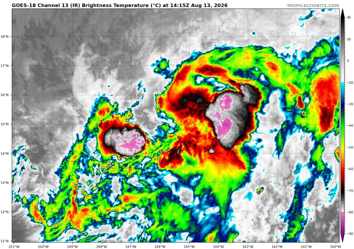
TROPICAL STORM LALA FORMS …HURRICANE WATCH ISSUED FOR THE BIG ISLAND OF HAWAII
According to the NHC advisory number 5
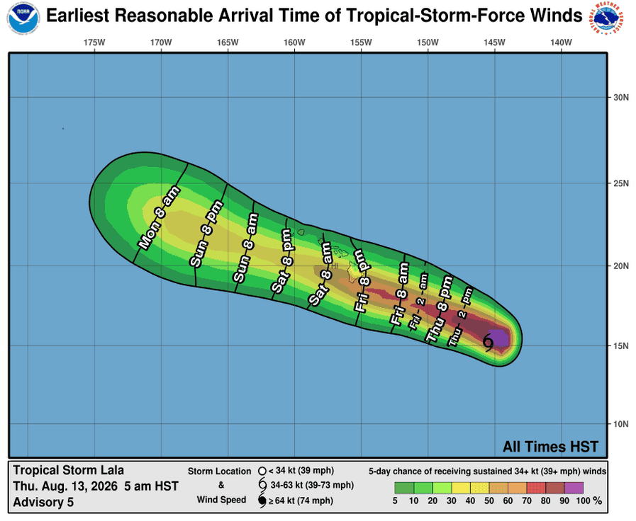
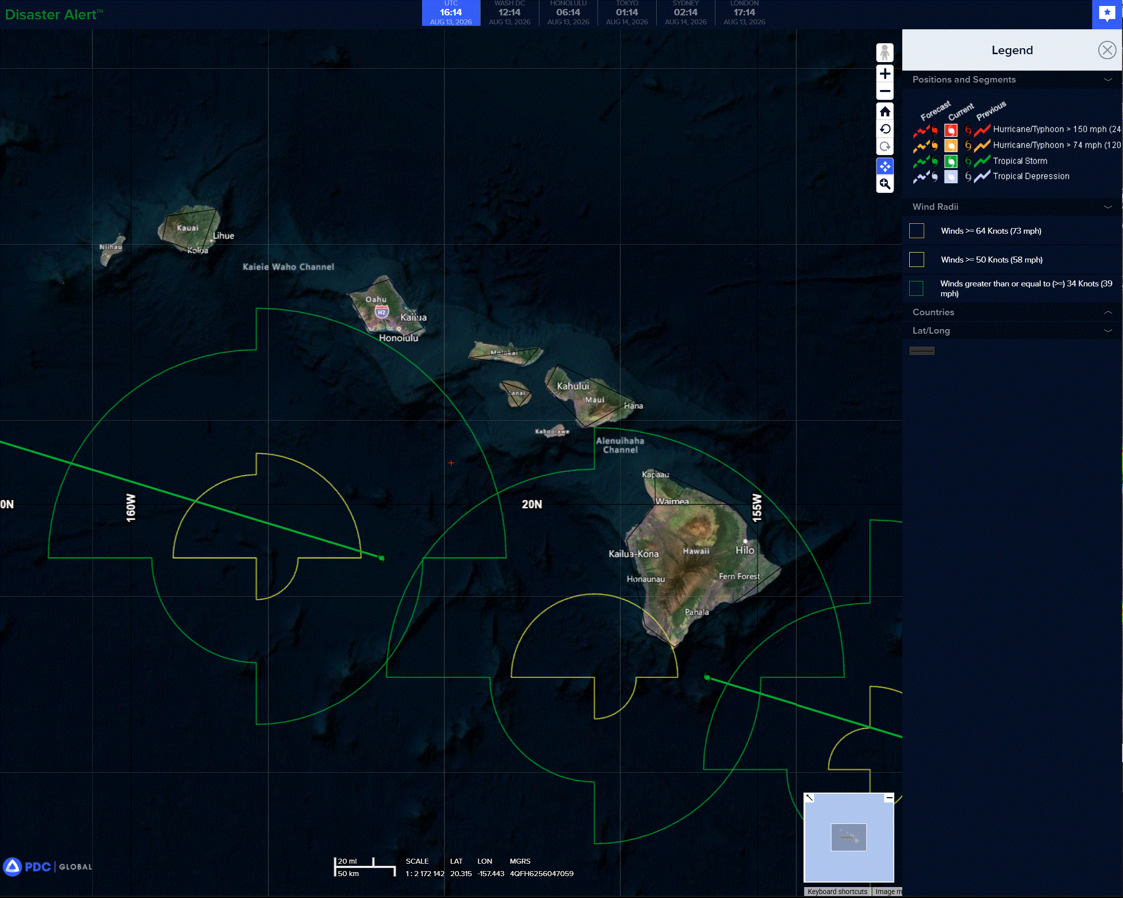
Lala is moving toward the west near 10 mph (17 km/h). A westward to west-northwestward motion is expected during the next several days. On the forecast track, Lala is expected to be near or just south of the Big Island on Saturday, and pass south of the smaller islands during the remainder of the weekend. Maximum sustained winds are near 40 mph (65 km/h) with higher gusts. Steady strengthening is forecast, and Lala could be near hurricane strength as it approaches the Big Island. Tropical-storm-force winds extend outward up to 140 miles (220 km) from the center. The estimated minimum central pressure is 1001 mb (29.56 inches).
HAZARDS AFFECTING LAND
WIND: Hurricane conditions are possible in the Big Island of Hawaii by early Saturday. Wind speeds atop and on the windward sides of hills and mountains are often up to 30 percent stronger than the near-surface winds indicated in this advisory, and in some elevated locations could be even greater.
RAINFALL: Tropical Storm Lala is expected to produce rainfall totals of 5 to 10 inches across much of the Island chain, with maximum totals of 20 inches possible. This rainfall may produce life-threatening flooding and mudslides, especially in areas of steep terrain.
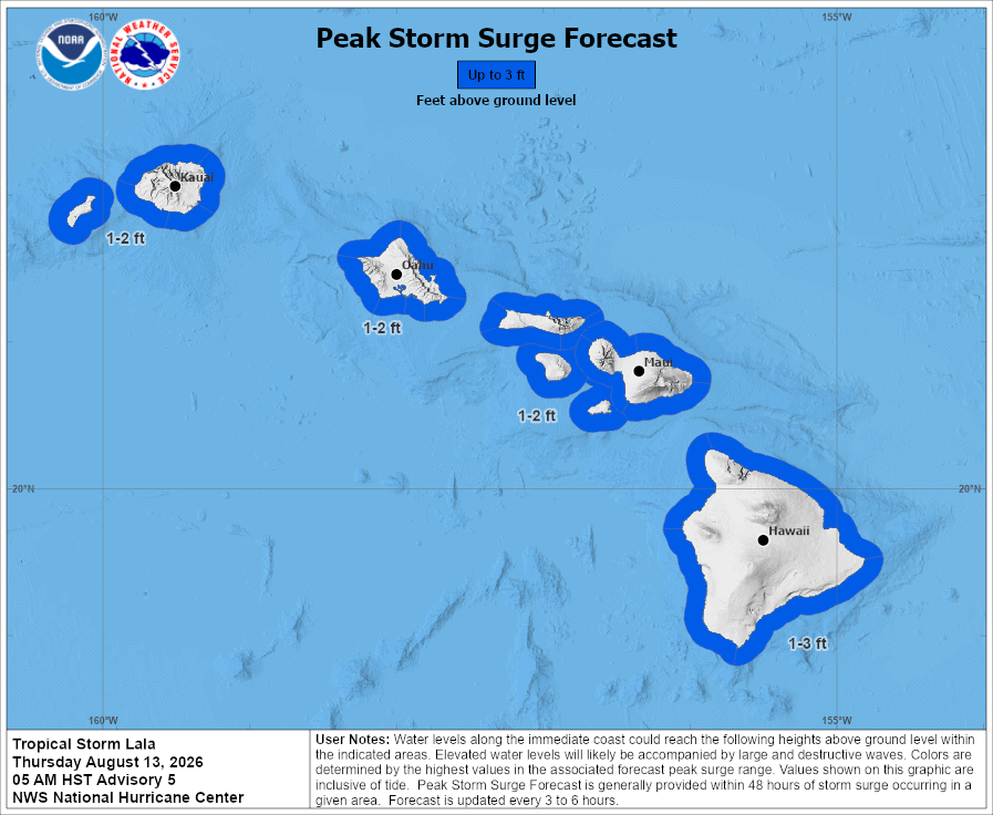
STORM SURGE: The combination of a dangerous storm surge and the tide will cause normally dry areas near the coast to be flooded by rising waters moving inland from the shoreline. The water could reach the following heights above ground somewhere in the indicated areas if the peak surge occurs at the time of high tide… Hawaii…1 to 3 ft The deepest water will occur along the immediate coast, where the surge will be accompanied by large and dangerous waves. Surge-related flooding depends on the relative timing of the surge and the tidal cycle, and can vary greatly over short distances.
SURF: Swells generated by Lala are expected to reach the east-facing shores of the state on Friday, spreading westward and building through the weekend. These swells are likely to cause life-threatening surf and rip current conditions.
Western Pacific, Indian Ocean, and adjacent Seas:
Western Pacific
Tropical Cyclone 13W (Peilou)
According to the JTWC warning number 27, sustained winds were 35 knots…with gusts to 45 knots
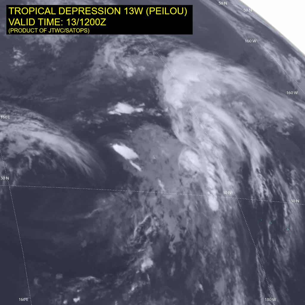
Animated enhanced infrared (eir) satellite imagery depicts a fully exposed low level circulation center (llcc), which is beginning to elongate northeastward along a developing warm frontal boundary. A pocket of deep convection is flaring in the northeastern quadrant,
along a convergent asymptote, and supported by divergent northwesterly upper-level flow. Animated shortwave infrared (swir) imagery depicts other features of note, including a developing cyclonic wave feature to the south, along the developing cold frontal boundary or shearline, and a second area of rotation embedded within a trough extending west
from TD 13W, within the region of moderate cold air advection. both of these features are classic indicators that TD 13W has in fact begun extratropical transition.
Environmental conditions are highly unfavorable, characterized by high vws, cool ssts, dry air entrainment, and strengthening cold air advection.
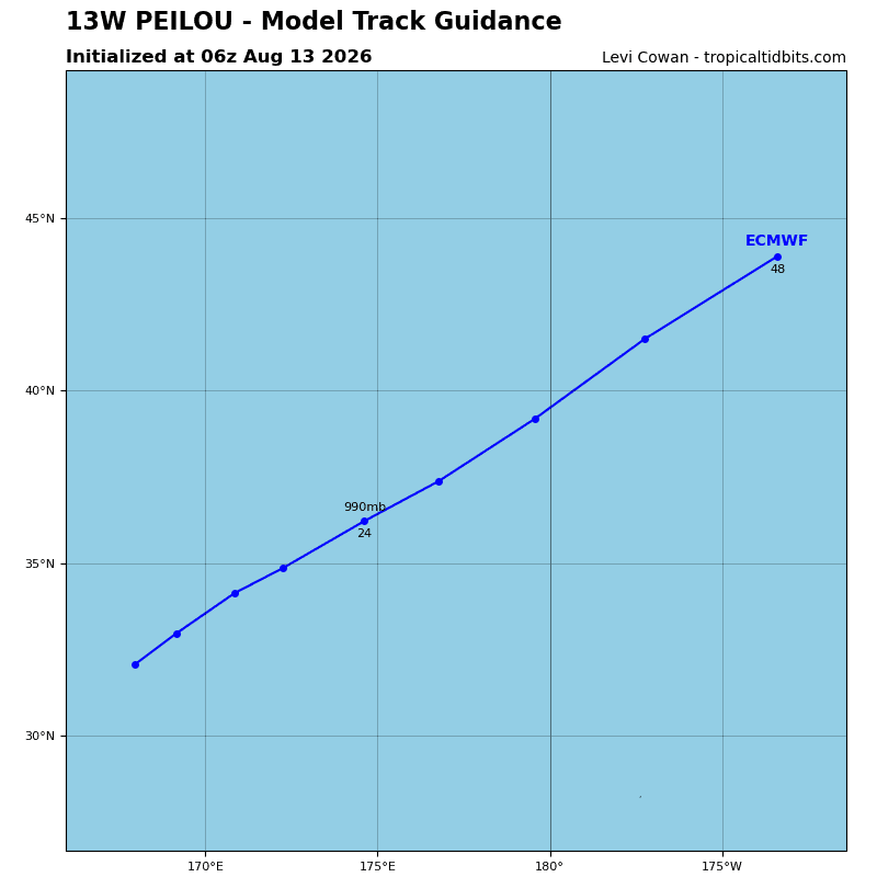
TD 13W will continue to rapidly translate northeastward along the northwestern flank of the str to the southeast through the entire forecast period. The system is already undergoing
ett as the satellite imagery indicates both warm and cold frontogenesis. Additionally, the system is in phase with both a 500mb and 200mb trough to the west, presenting a classic ett synoptic structure.
Over the next 24 hours, the upper trough will deepen while simultaneously TD 13W moves into the right rear entrance region of a jet maximum to the northeast. the strong baroclinic forcing will result in a modest amount of re-intensification as TD 13W completes ett and becomes a fully extratropical low.
Tropical Cyclone 16W (Nangka)
According to the JTWC warning number 5, sustained winds were 35 knots…with gusts to 45 knots
Tropical storm (ts) 16W appears to have undergone a rapid vortex decoupling event over the past six hours. Animated shortwave infrared (swir) satellite imagery depicts a partially exposed low level circulation center (llcc) to the southwest of an area of waning convection. However, the llcc remains mostly obscured and challenging to locate with high confidence using the swir alone. The timely collection of two ascat passes, at 131034z and 131011z,
provided confirmation of the vortex decoupling, depicting a slightly elongated llcc well south of the expected position. The ascat shows 35 knot winds along the western flank as well as in the northeastern quadrant.
The environment is now unfavorable for tropical cyclone development, with high southwesterly vws, and dry air entrainment offsetting the strong poleward outflow and warm ssts.
Tropical storm (ts) 16W is forecast to track northeastward through the forecast period, while steadily decelerating. The track forecast remains subject to a high degree of uncertainty however, as model guidance continues to depict a bifurcation between the physics-based models and the ai-based models. Consistent with the earlier model runs, the majority of the
physics models (all but ecmwf) depict a sharp turn northwestward after 12 hours, while the AI models plus the ecmwf and eceps mean, depict an east-northeastward trajectory continuing through the end of the forecast.
The bifurcation in the model trackers is being driven by differences in how the models handle the steering pattern, complicated now by the fact that the vortex is rapidly decoupling, which will change the level at which the system is steered. Now that the vortex is decoupling, the steering level will lower, where the overall pattern is more stable. The ner to the south will remain the dominant steering influence for the first 18-24 hours of the forecast. Then the system slows sharply as it moves into a weak steering environment as the ner recedes westward and is replaced by an extension of the str centered far to the east. This will eventually turn the system more northward, which is reflected by a shallow turn poleward by the end of the forecast.
Regarding intensity, increasing shear and dry air entrainment will hasten the vortex decoupling, resulting in a slow weakening trend through 48 hours, when the system will dissipate.
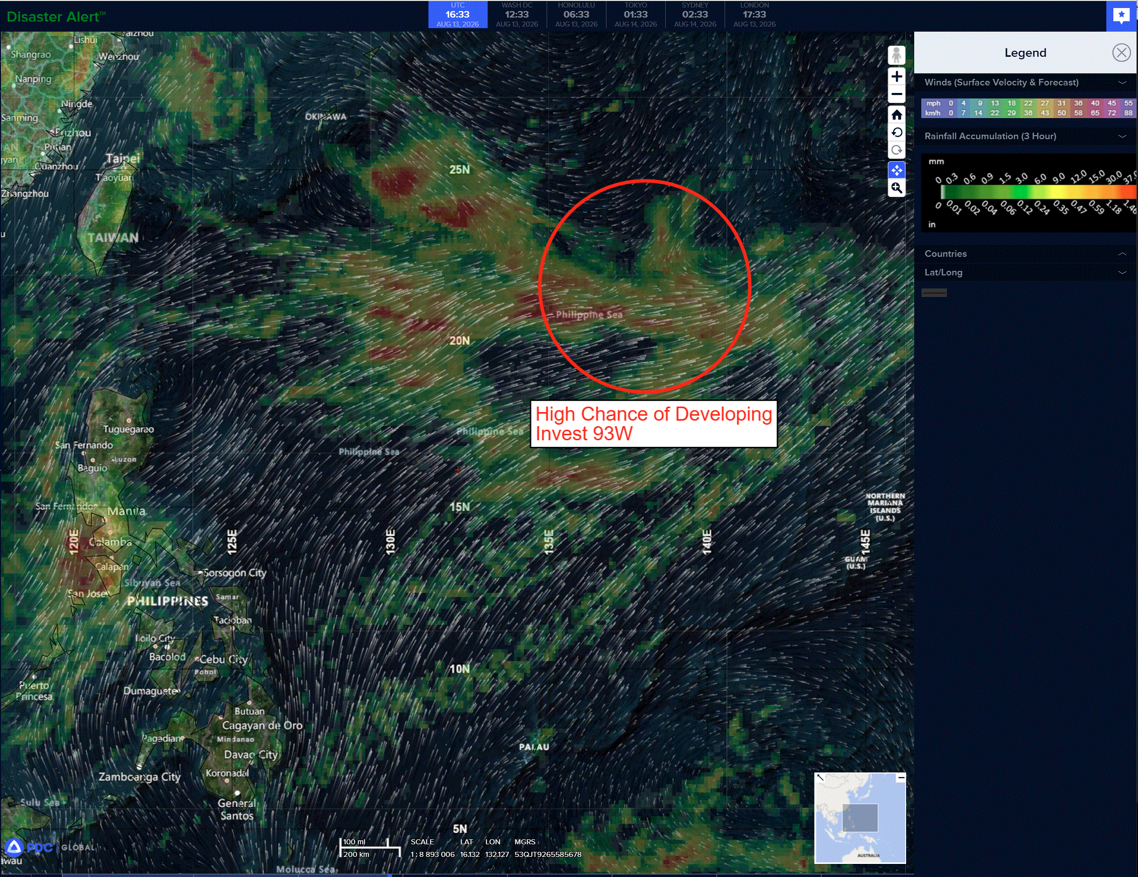
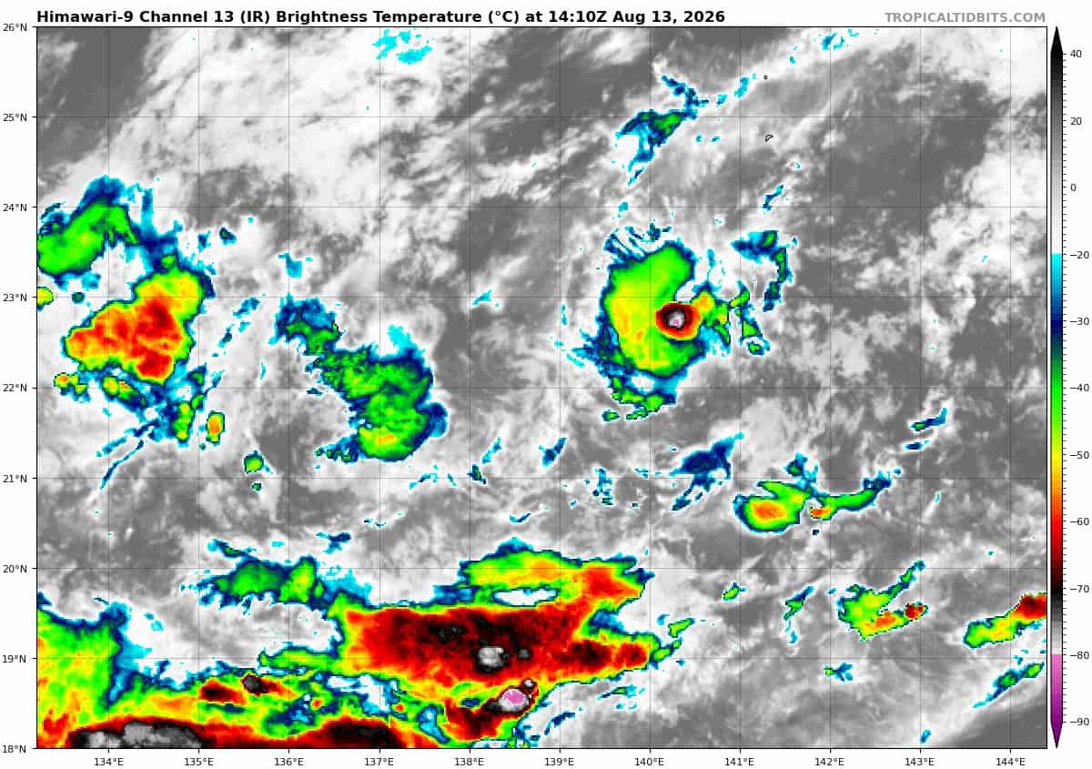
>>> There’s an area of disturbed weather being referred to as Invest 93W, which is located approximately 245 NM southwest of Iwo To
Animated multi-spectral imagery (msi) depicts a very compact low-level circulation center (llcc) with flaring convection over the circulation. A 130102z ascat-c pass reveals 20-25 knots winds around the bulk of the circulation, with some higher winds further to the south in the monsoonal southwesterlies.
Environmental analysis reveals favorable conditions for development with low vertical wind shear (10 to 15kts), warm sea surface temperatures (29 to 30 c), and good poleward upper-level outflow.
Deterministic models depict a circulation that moves generally north-northeast but does not develop into a tropical cyclone. Ensemble models show the rapid attainment, but short-lived
duration, of tropical depression strength and a similar track to the deterministic models over the next 24 hours.
Maximum sustained surface winds are estimated at 22 to 24 knots.
The potential for the development of a significant tropical cyclone within the next 24 hours is upgraded to high.