The Pacific Disaster Center’s (PDC Global) Tuesday, August 11, 2026, Tropical Cyclone Activity Report…for the Pacific Ocean, the Indian Ocean, and adjacent Seas
Current Tropical Cyclones:
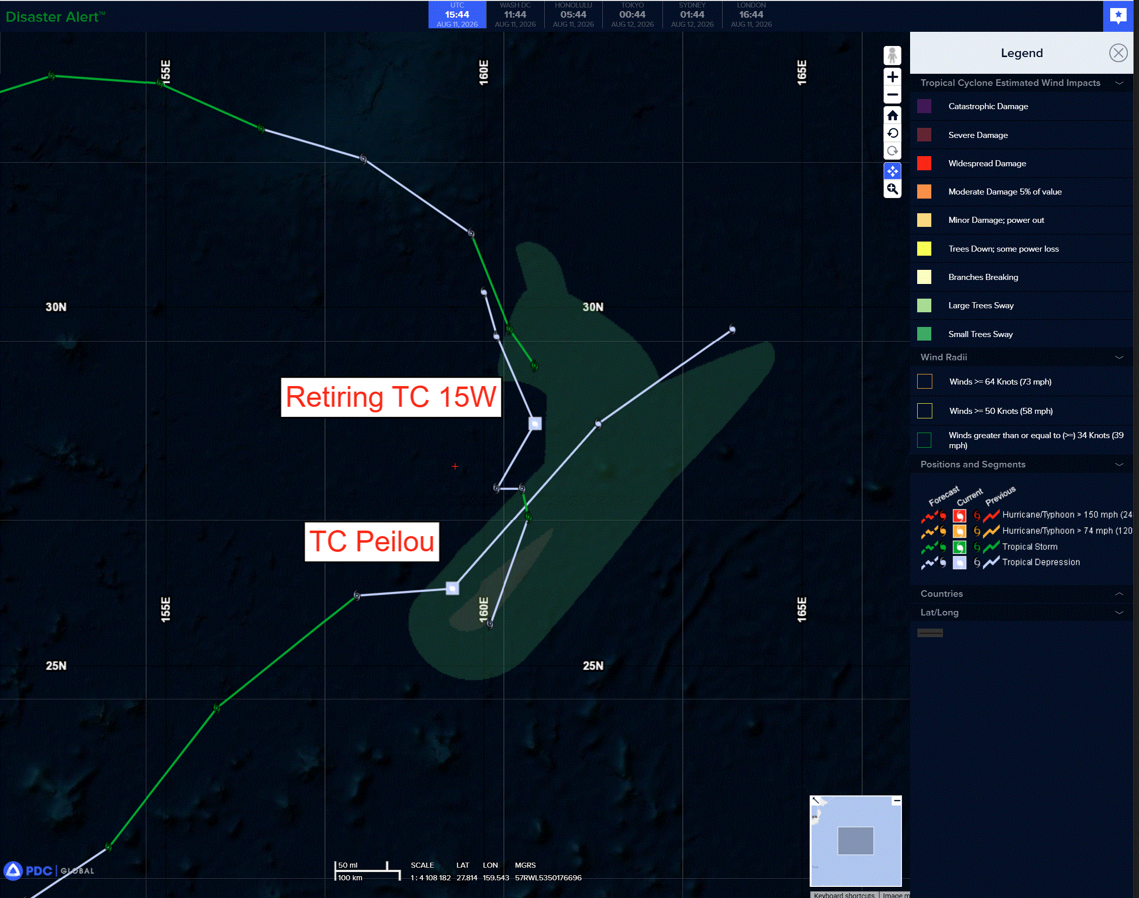
Tropical cyclone 13W (Peilou)…is located approximately 418 NM northeast of Minami Tori Shima
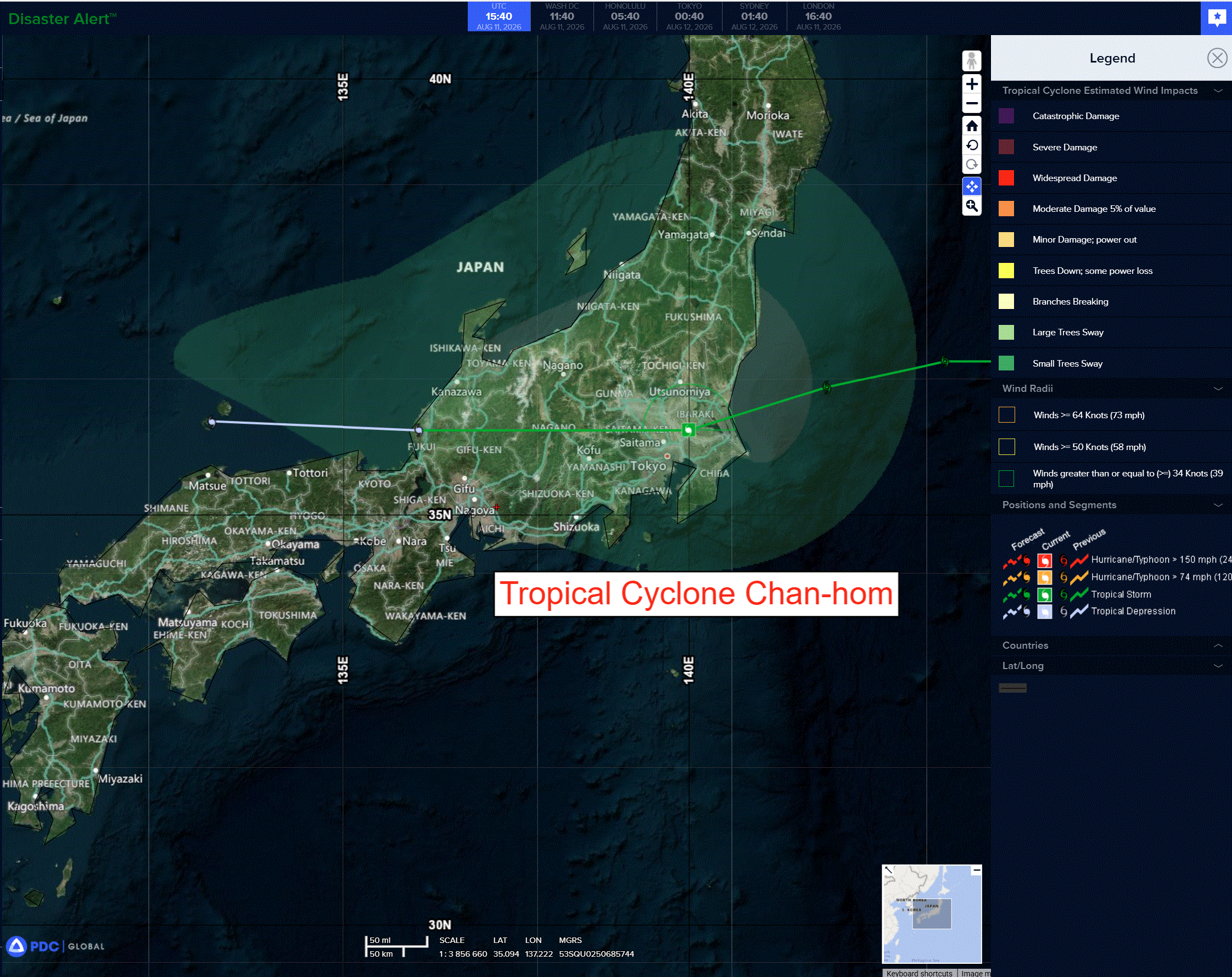
Tropical cyclone 14W (Chan-hom)…is located approximately 79 NM west-northwest of Camp Fuji – Final Warning
Northeast Pacific: There are no Tropical Cyclones
>>> Western East Pacific:
Invest 99E
A well-defined low pressure system located about midway between Hawaii and the west coast of Mexico is producing some shower and thunderstorm activity. Any significant increase in the organization of the showers and thunderstorms would result in the formation of a tropical depression later today or on Wednesday. The system is forecast to move northwestward at 5 to 10 mph over the next couple of days and encounter less favorable environmental conditions late this week.
*Formation chance through 48 hours…high…70 percent
*Formation chance through 7 days…high…70 percent
Central Pacific: There are no Tropical Cyclones
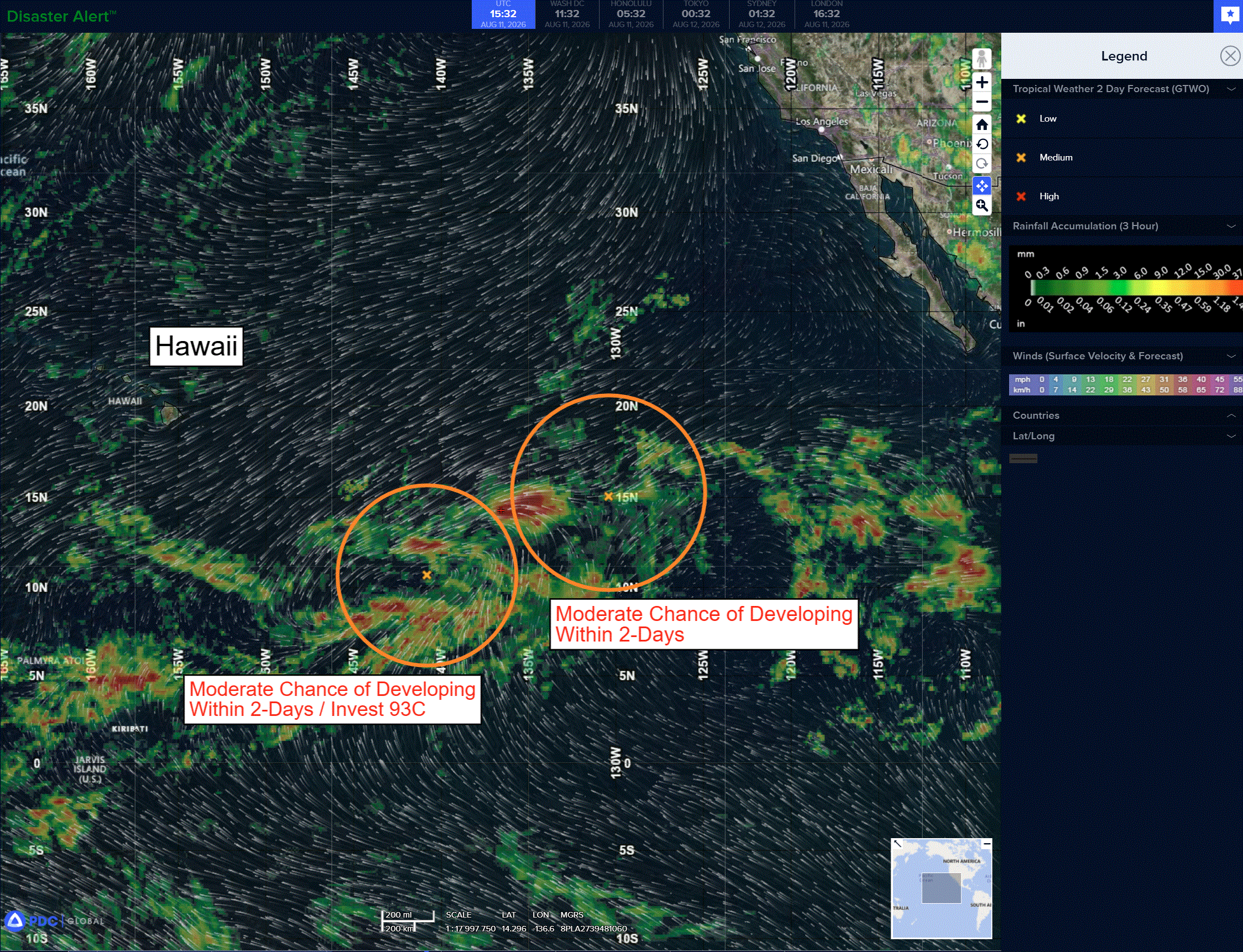
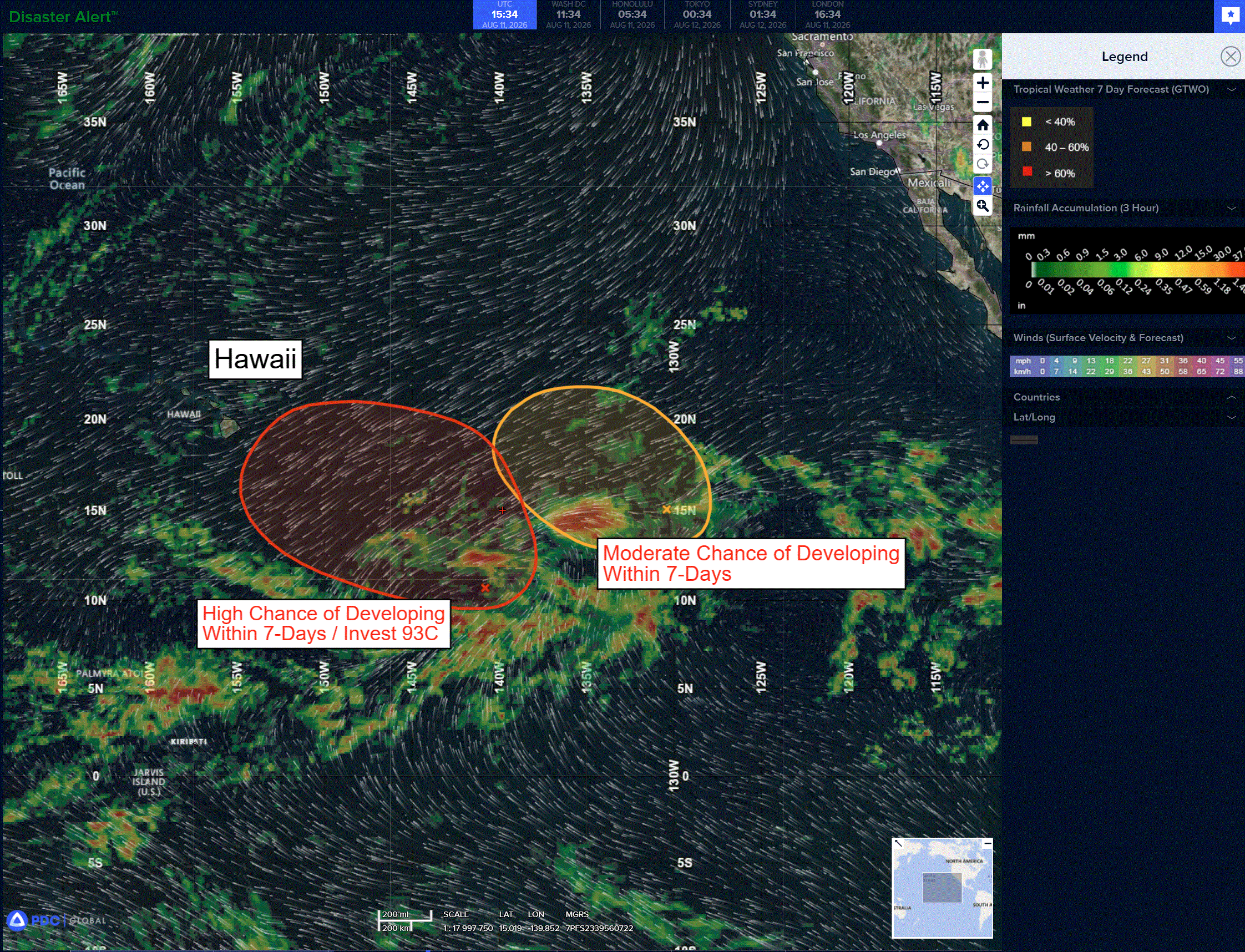
Invest 93C
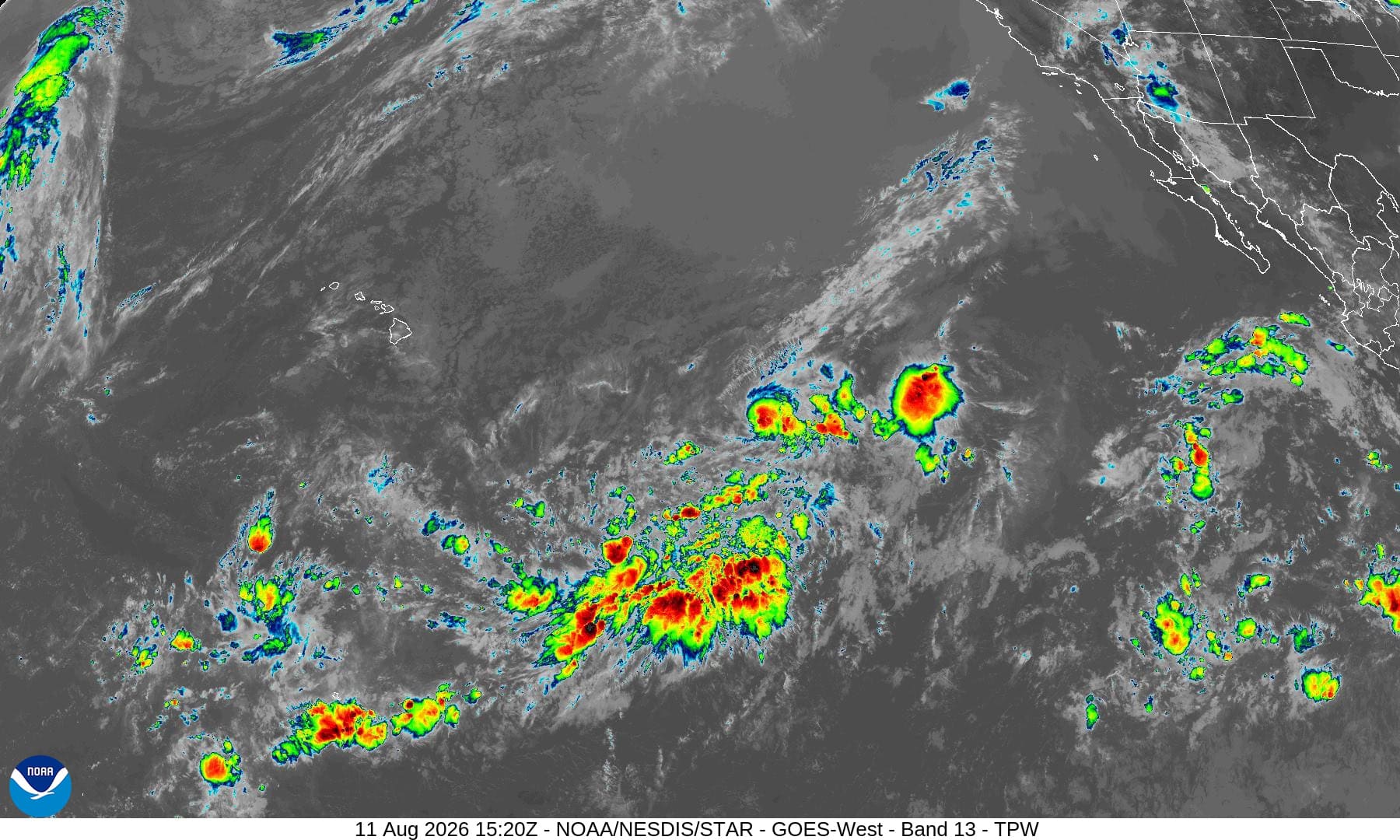
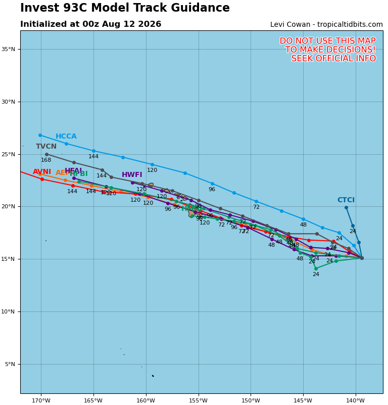
Showers and thunderstorms remain disorganized in association with a broad area of low pressure located about 1100 miles east-southeast of the Hawaiian Islands that is nearly stationary. Environmental conditions are forecast to be conducive for further development, and a tropical depression or storm is expected to form during the next couple of days while the system begins moving generally northwestward across the Central Pacific. Interests in the Hawaiian Islands should closely monitor the progress of this system.
* Formation chance through 48 hours…high…90 percent
* Formation chance through 7 days…high…90 percent
Western Pacific, Indian Ocean, and adjacent Seas:
Western Pacific
Tropical Cyclone 13W (Peilou)
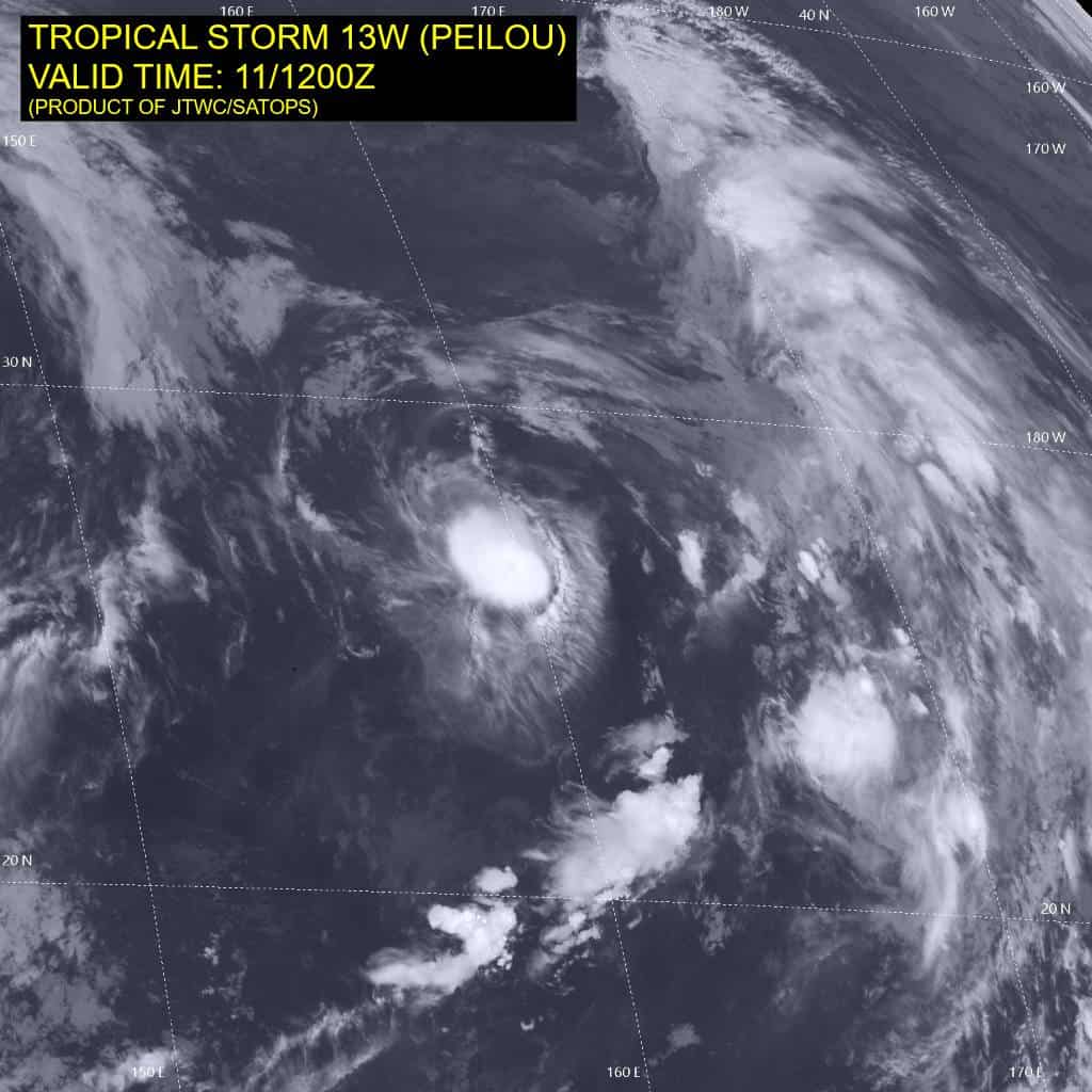
According to the JTWC warning number 20, sustained winds were 30 knots…with gusts to 40 knots
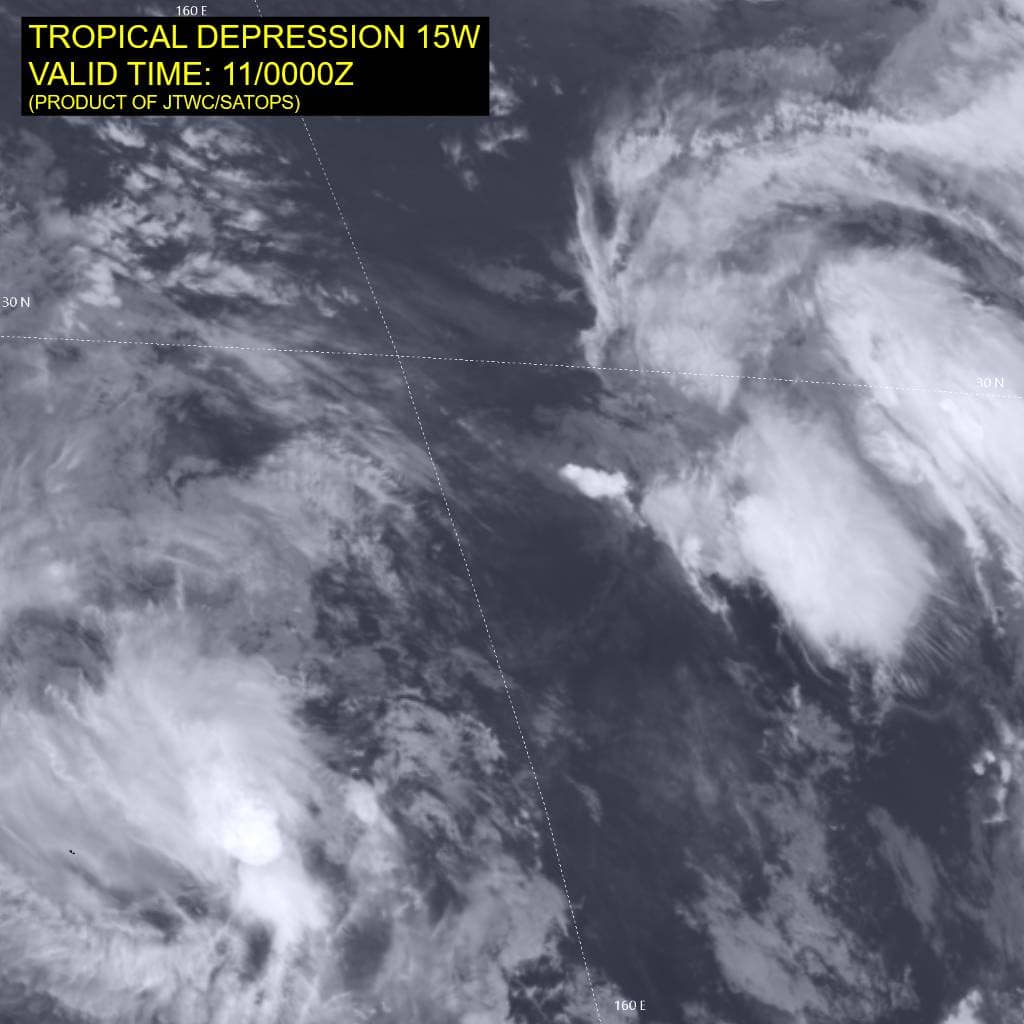
Animated enhanced infrared (eir) satellite imagery depicts tropical depression 13W (Peilou) with collapsing deep central convection obscuring the low-level circulation center (llcc) and weak lower level cloud banding. Additionally, the remnants of tropical depression 15W are drifting westward within Peilou’s northern periphery, disrupting the low level inflow into 13w.
Environmental analysis reveals a highly unfavorable environment, characterized by
deep-layer dry air entrainment and poor divergence aloft, insignificantly offset by the low to moderate (15-20 kts) vertical wind shear (vws) and warm (28-29 c) sea surface temperatures.
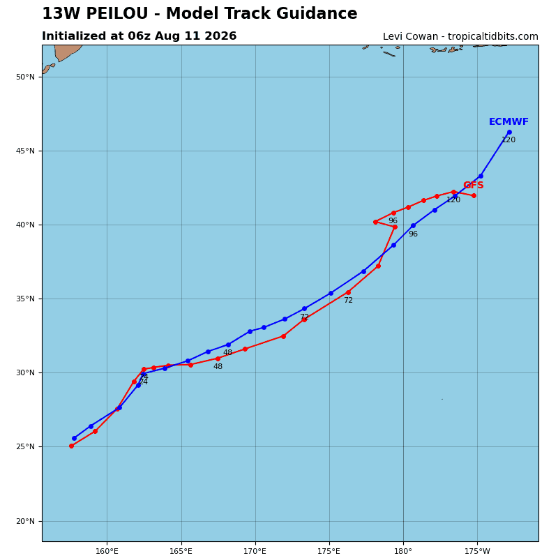
TD 13W is forecast to continue tracking generally northeastward for the duration of the forecast period while it remains steered by the northwestern periphery of the str
to the southeast, with the steering gradient enhanced by the monsoonal flow surrounding the large low-level gyre centered to the west, propelling peilou northeastward.
Regarding intensity, 13W is forecast to gradually weaken due to the increasing vws, the decreasing ssts, and the copious amounts of dry air entraining into the core. TD 13W is expected to open into a trough and dissipate as a tropical cyclone no later than 24 hours.
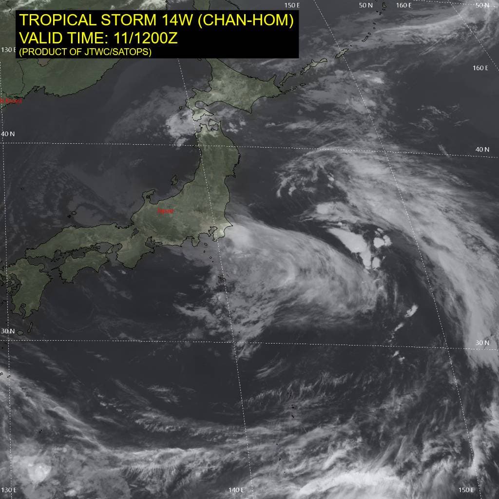
Tropical Cyclone 14W (Chan-hom) – Final Warning
According to the JTWC warning number 20, sustained winds were 30 knots…with gusts to 40 knots
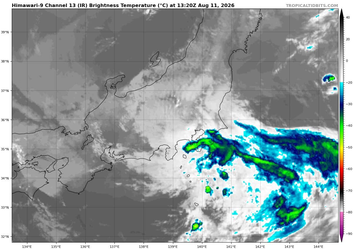
Animated enhanced infrared (eir) satellite imagery depicts tropical storm 14W (Chan-hom) fully exposed and scraping across central Honshu. The plume of central deep convection dissipated immediately following landfall, leaving 14W completely barren. Surface observations from the region support an intensity between 30-35 kts, with the strongest winds confined to the northern semicircle.
The environment remains highly unfavorable, dominated by mountainous terrain, 30-35 kt vertical wind shear, substantial amounts of mid-level dry air entrainment, and poor divergence aloft.
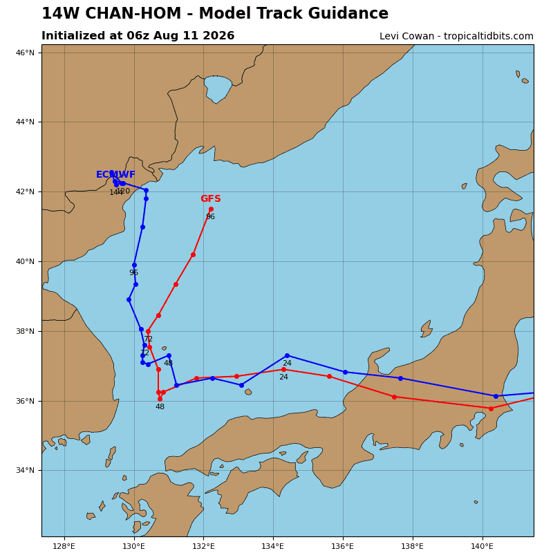
TS 14W is forecast to continue shredding itself over Honshu while it remains steered by the str to the north and deep-layer low to the south, which are inducing a tight steering gradient and driving 14W due west. 14W is forecast to reemerge over water in the Sea of Japan just after 12 hours. However, the environment over water will be no more favorable than the current one, with upwards of 40 kts of vertical wind shear and additional dry air entrainment. given those factors,
14W is not expected to re-intensify after 12 hours, and may not survive the journey to the sea at all. Dissipation is forecast to occur no later than 24 hours.
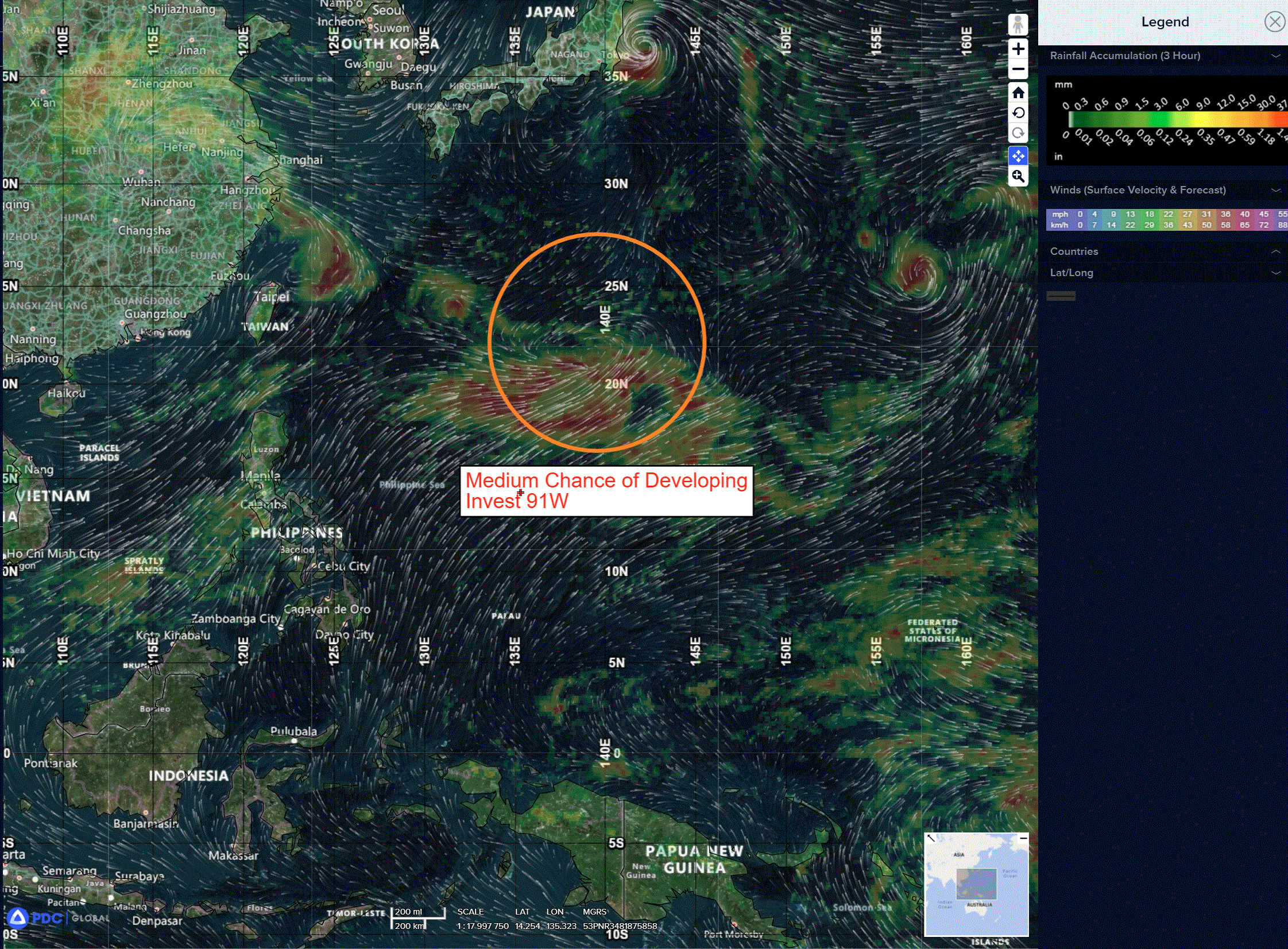
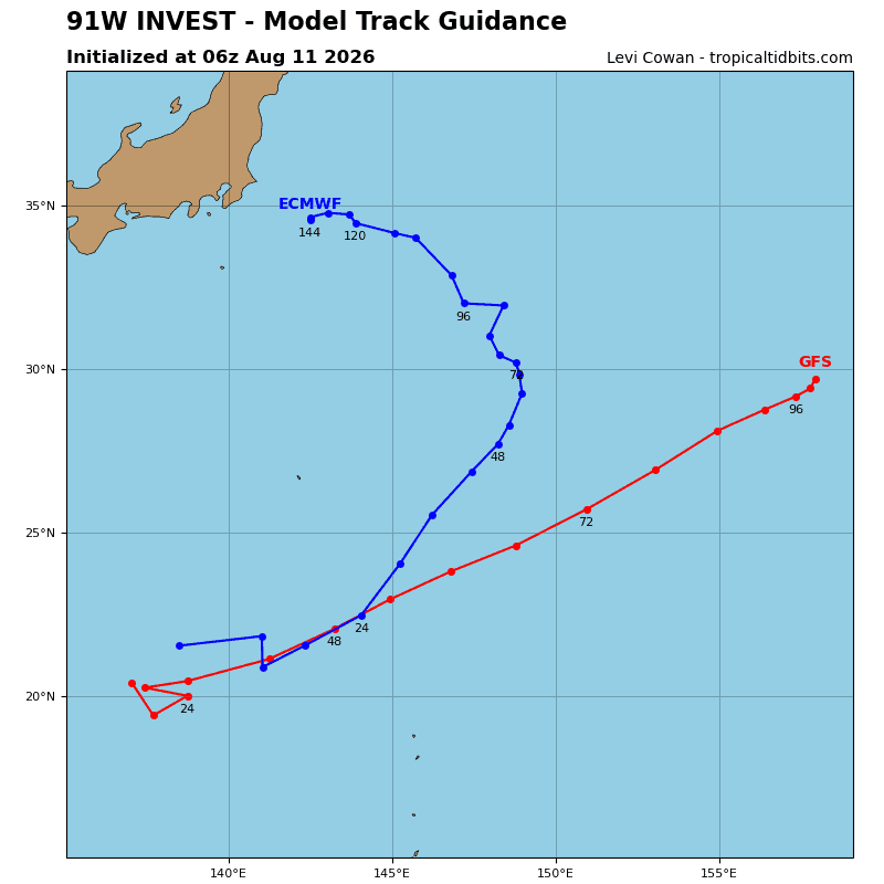
>>> There’s an area of disturbed weather being referred to as Invest 91W, which is located approximately 182 NM south of Iwo To
Animated enhanced infrared satellite imagery (eir) depicts an elongated trough axis with persistent convection to the south. A compact and shallow system possessing tropical characteristics has the possibility of forming along the boundary of the strong monsoonal westerly flow to the south and propagating along the monsoonal gyre as a separate entity.
Environmental analysis indicates a favorable area for development with low vertical wind shear, good equatorward outflow, and a warm sea surface temperature (29-30 c).
Global and deterministic models agree on development of a closed circulation within 36 hours.
Maximum sustained surface winds are estimated at 27 to 133 knots.
The potential for the development of a significant tropical cyclone within the next 24 hours is upgraded high.