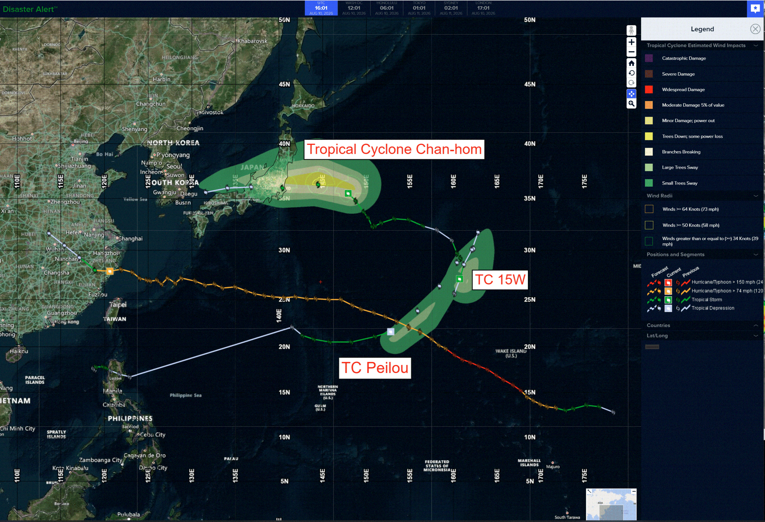
The Pacific Disaster Center’s (PDC Global) Monday, August 10, 2026, Tropical Cyclone Activity Report…for the Pacific Ocean, the Indian Ocean, and adjacent Seas
Current Tropical Cyclones:
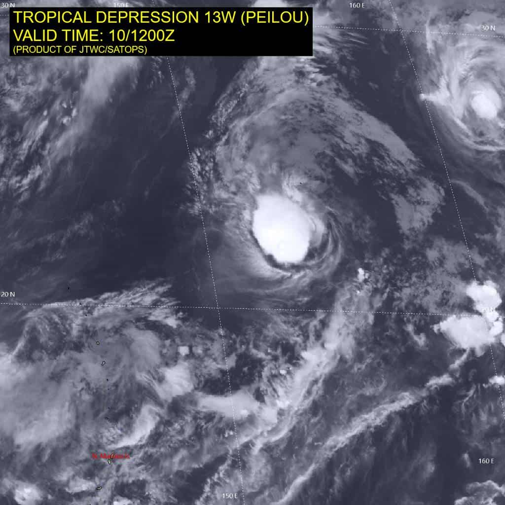
Tropical cyclone 13W (Peilou)…is located approximately 674 NM west-northwest of Wake Island
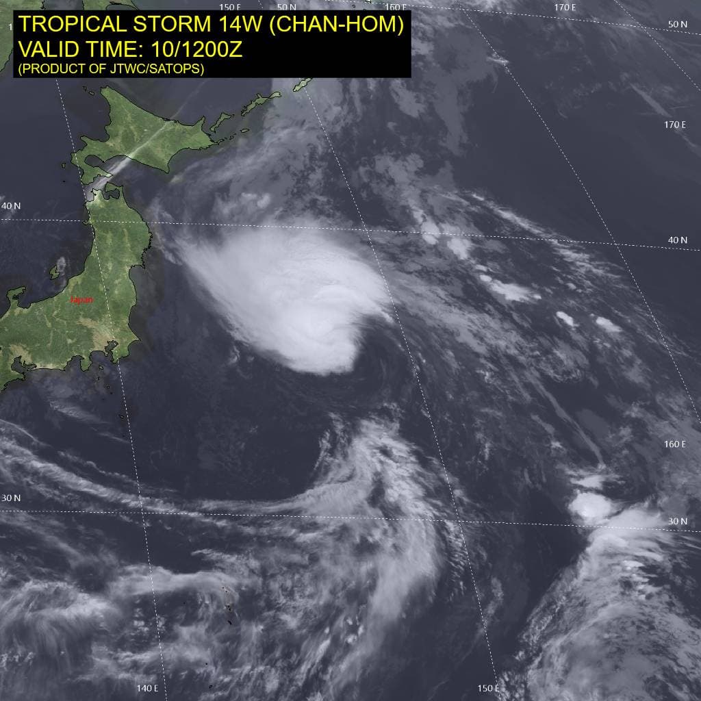
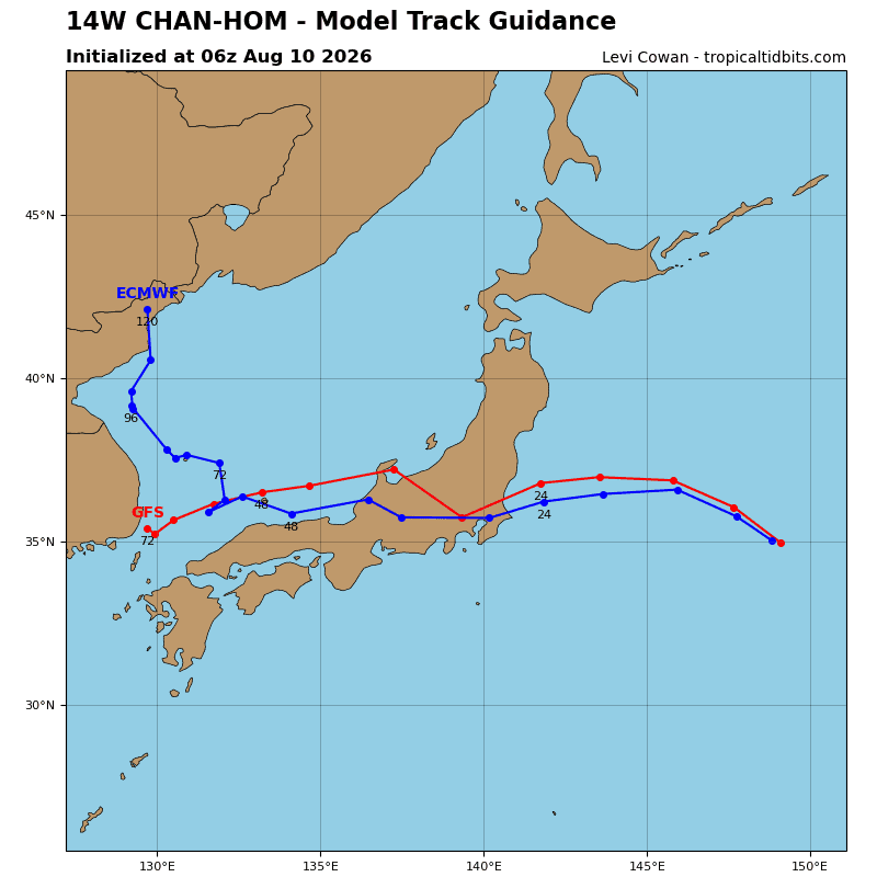
Tropical cyclone 14W (Chan-hom)…is located approximately 173 NM east-northeast of Narita AP, Japan
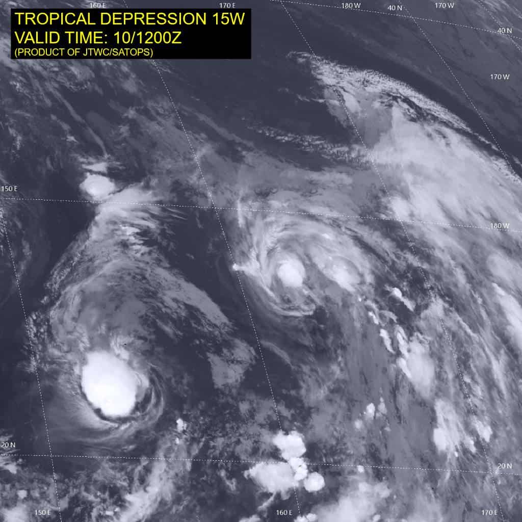
Tropical cyclone 15W…is located approximately 632 NM north-northwest of Wake Island – Final Warning
Northeast Pacific: There are no Tropical Cyclones
>>> Western East Pacific:
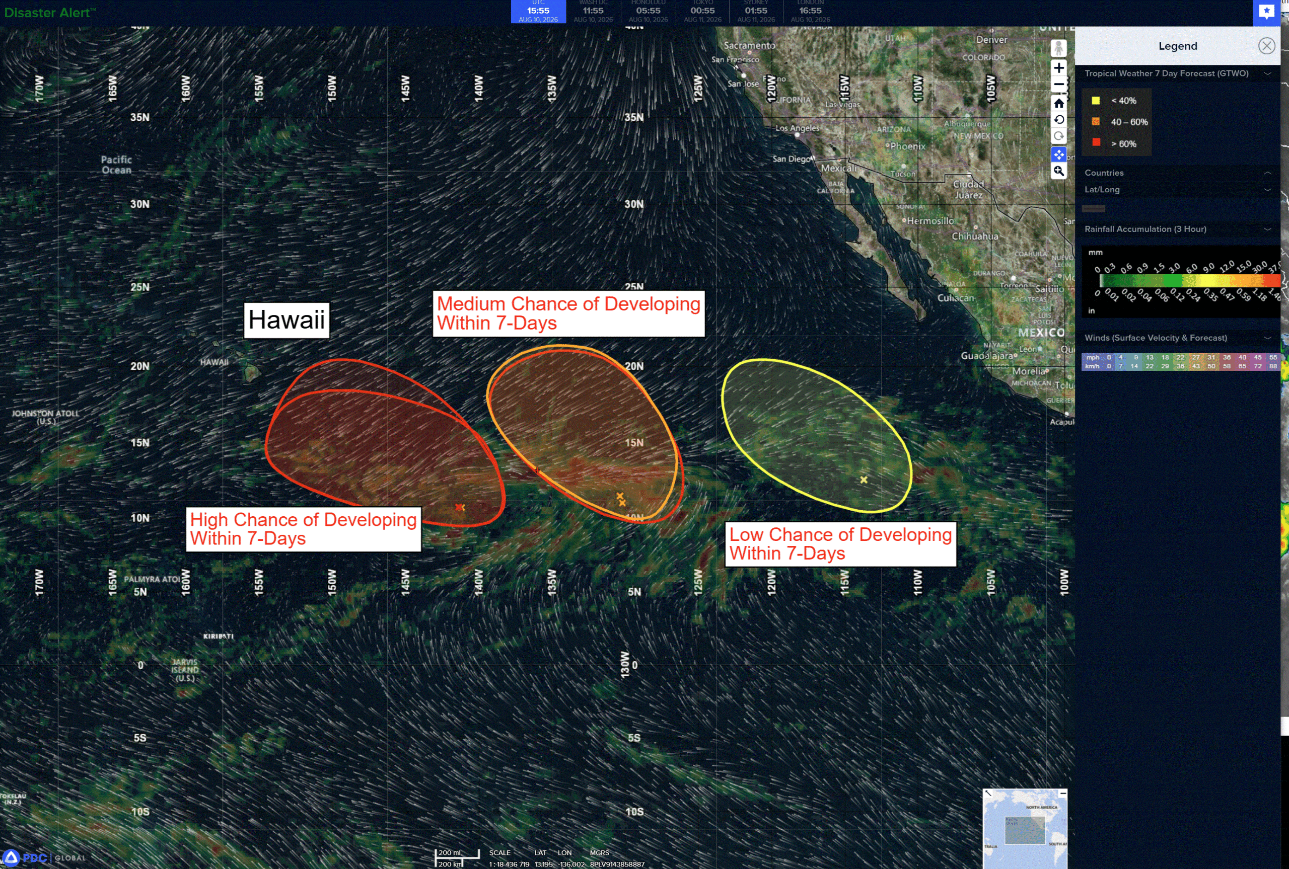
A large area of disorganized showers and thunderstorms is located well to the west-southwest of the southern tip of the Baja California Peninsula. Environmental conditions appear conducive for some gradual development, and a tropical depression could form during the next few days while the system moves slowly west-northwestward to northwestward across the western portion of the East Pacific.
*Formation chance through 48 hours…low…30 percent
*Formation chance through 7 days…medium…60 percent
>>> Southwest of Mexico:
Disorganized showers and thunderstorms located several hundred miles south-southwest of the southern tip of the Baja California Peninsula are associated with a tropical wave. Environmental conditions have become unfavorable, and no further development of this system is expected.
*Formation chance through 48 hours…low…near 0 percent
*Formation chance through 7 days…low…near 0 percent
Central Pacific: There are no Tropical Cyclones
Invest 93C
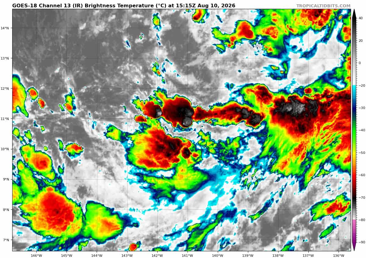
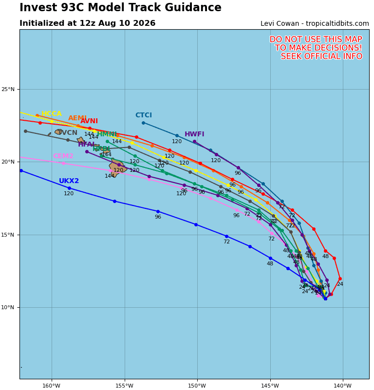
Showers and thunderstorms remain disorganized in association with a broad area of low pressure located about 1100 miles east-southeast of the Hawaiian Islands that is nearly stationary. Environmental conditions are forecast to be conducive for further development, and a tropical depression or storm is expected to form during the middle portion of this week as the system begins moving generally northwestward across the Central Pacific. Interests in the Hawaiian Islands should closely monitor the progress of the system.
* Formation chance through 48 hours…medium…60 percent
* Formation chance through 7 days…high…90 percent
Western Pacific, Indian Ocean, and adjacent Seas:
Western Pacific
Tropical Cyclone 13W (Peilou)
According to the JTWC warning number 17, sustained winds were 35 knots…with gusts to 45 knots
Animated multi-spectral satellite imagery (msi) depicts tropical storm (ts) 13W (Peilou) as a partially exposed low-level circulation center (llcc) with dry air wrapping around the western periphery into the core. The 100546z ssmis microwave image reveals a shallow system with the lower-level cloud lines wrapping in under the central deep convection. The central convection has little to no structure, and has remained relatively unchanged over the past 6 hours.
Environmental analysis reveals a marginal environment, characterized by low (10-15 kts) vertical wind shear (vws), warm (28-29 c) sea surface temperatures (sst), and good poleward outflow supported by an upper-level trough situated to the northwest, offset by moderate amounts of mid-level dry air entrainment from the west.
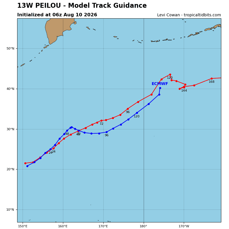
TS 13W is forecast to continue tracking east-northeastward for the duration of the forecast period, while the shallow vortex remains under the steering influence of the strong monsoonal westerlies and the ner centered in the Philippine
Sea.
Regarding intensity, 13W is forecast to gradually weaken through 60 hours as its environment becomes increasingly unfavorable. The upper-level trough currently supporting strong poleward outflow is expected to pass over the system between 24-36 hours, inducing stronger northwesterly vws and significant dry air entrainment. The combination of these factors, plus the loss of the upper-level support provided by the trough, is anticipated to induce Peilou’s terminal weakening and ultimate dissipation no later than 60 hours.
Tropical Cyclone 14W (Chan-hom)
According to the JTWC warning number 17, sustained winds were 50 knots…with gusts to 65 knots
Animated shortwave infrared (swir) satellite imagery depicts a partially exposed low level circulation center (llcc), on the southeastern edge of an area of intense convection in the northwestern quadrant of the circulation. Animated water vapor imagery as well as high-resolution cira derived motion vector (dmv) analysis depicts a robust upper-level low (ull) continuing to dive southward along the coast of Japan, now centered roughly due east of Yokosuka, with troughing extending eastward along the southern flank of TS 14W. This orientation is producing robust poleward, divergent outflow over and northwest of TS 14W, which is supporting the recent burst of convective activity and intensification. A 101114z ascat-b bullseye revealed a well-defined llcc and a compact wind field with maximum non-flagged winds of 45 knots, with some rain-flagged winds exceeding 50 knots in the western sector of the circulation.
Environmental conditions are marginally favorable, with the robust poleward outflow offsetting moderate southeasterly vertical wind shear (vws) and marginal sea surface temperatures (ssts).
TS 14W is beginning to gradually turn more west-northwestward as it begins to feel the effects of building mid-level ridging to the north. By 12 hours, it will be traveling westward and begin a slight west-southwestward jog as the ridge center moves into a position due north of TS 14W. Landfall along the east coast of Honshu northeast of Tokyo is expected near 24 hours. The system then tracks rapidly across the Japanese Alps and emerges into the far southern Sea of Japan (soj) shortly after 36 hours, continuing westward through the remainder of the forecast period. There remains significant uncertainty in regard to the exact track the system will take after landfall, which will in large part be determined by localized terrain interactions as the low-level vortex separates from the mid-level vortex.
Regarding intensity, the system is intensifying as expected due to the burst of convection supported by the dramatically improved upper-level outflow environment. The ull is forecast to remain in a generally favorable position relative to TS 14W for about another 6-12 hours, which will allow for a bit more intensification to occur through 12 hours. The ull continues to drift southeastward and repositions to the south of TS 14W by 12 hours,
Introducing convergent east-northeasterly flow aloft which will weaken the system slightly in the lead-up to landfall. After making landfall, 14W will rapidly decouple and weaken, emerging as a weak hybrid low pressure system undergoing subtropical transition (stt). By the end of the forecast period, the system will have completed stt and dissipated simultaneously.
Tropical Cyclone 15W – Final Warning
According to the JTWC warning number 5, sustained winds were 25 knots…with gusts to 35 knots
Animated shortwave infrared (eir) satellite imagery depicts a decoupled vortex, with the low level circulation center (llcc) displaced west of sheared convection. A 100931z ascat-b bullseye revealed that the decoupling event was already well underway by that time, resulting in a shift southward of the 0600z initial position. The scatterometer data show a well-defined llcc, however the associated windspeed is significantly lower than the majority of the subjective and objective intensity estimates, with 25-30 knot winds limited to an arc across the northern periphery of the circulation.
Environmental conditions have deteriorated faster than expected, with westerly shear increasing sharply over the past six hours, leading to the
decoupling event.
Tropical depression (td) 15W, with a now fully decoupled vortex, will track northward along the eastern periphery of the low-level cyclonic gyre centered to the east through the forecast period. Upper-level westerly flow is expected to continue increasing over the next 12 to 24 hours, which will serve to both increase the westerly shear and usher in dry mid-level air, hastening the dissipation of td 15W. The remnant vortex will continue to spin down and dissipate within the next 24 hours under these highly unfavorable conditions.
>>> There’s an area of disturbed weather being referred to as Invest 91W, which is located approximately 303 NM west-southwest of Iwo To
Animated enhanced multi-spectral satellite imagery (msi) depicts an elongated trough axis with cycling convection along the southern periphery. A 102337z ascat-b pass shows a swath of 20 to 25 kt gradient westerlies to the south of the trough axis.
Environmental analysis for the area indicates a favorable environment for development with low vertical wind shear, good equatorward outflow aloft, and warm sea surface temperatures (29-30 c).
Global deterministic models generally agree on short-term development of a closed circulation within about 24 hours, and global ensemble models favor intensification over the next 36-48 hours.
Maximum sustained surface winds are estimated at 12 to 18 knots.
The potential for the development of a significant tropical cyclone within the next 24 hours is low.