The Pacific Disaster Center’s (PDC Global) Sunday, August 9, 2026, Tropical Cyclone Activity Report…for the Pacific Ocean, the Indian Ocean, and adjacent Seas
Current Tropical Cyclones:
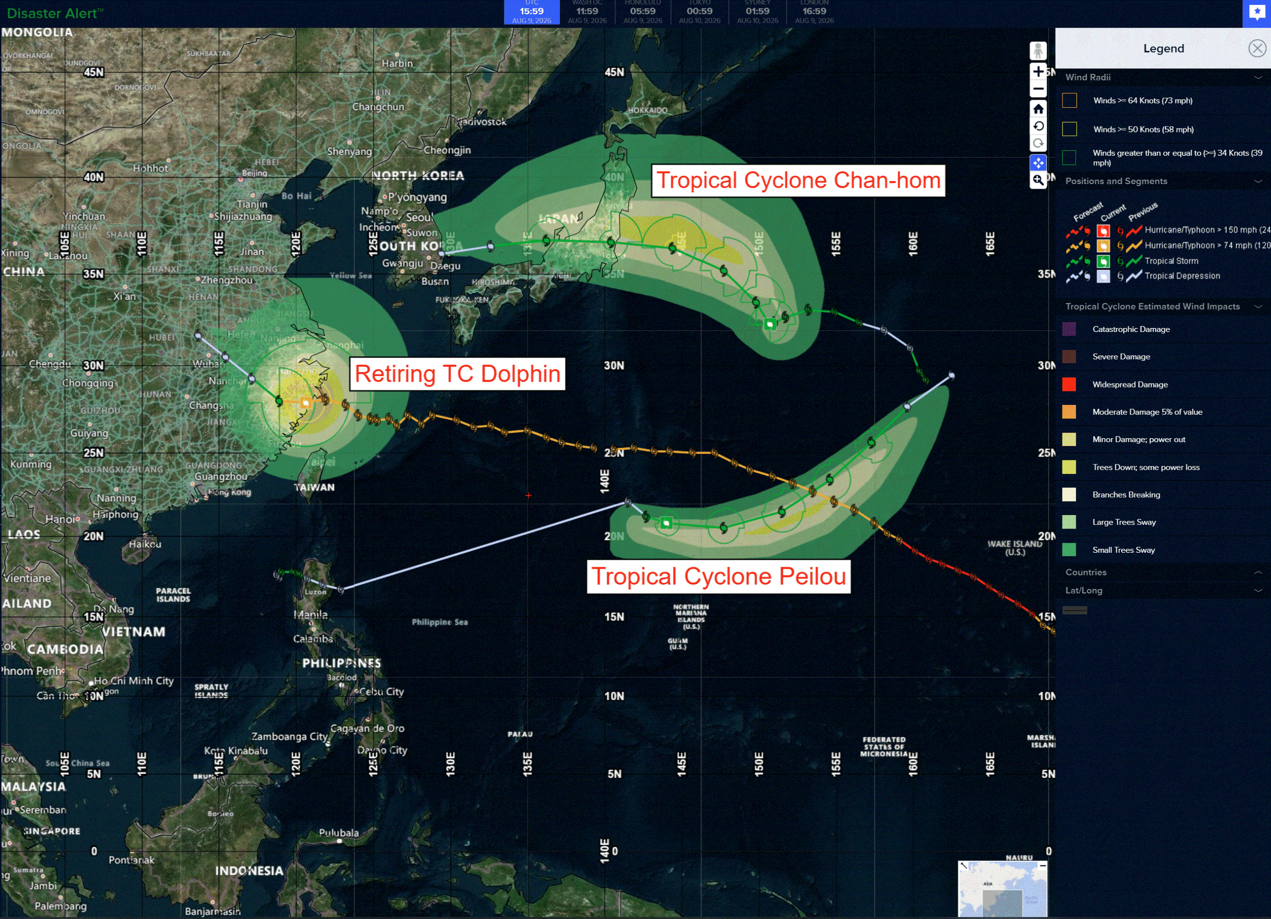
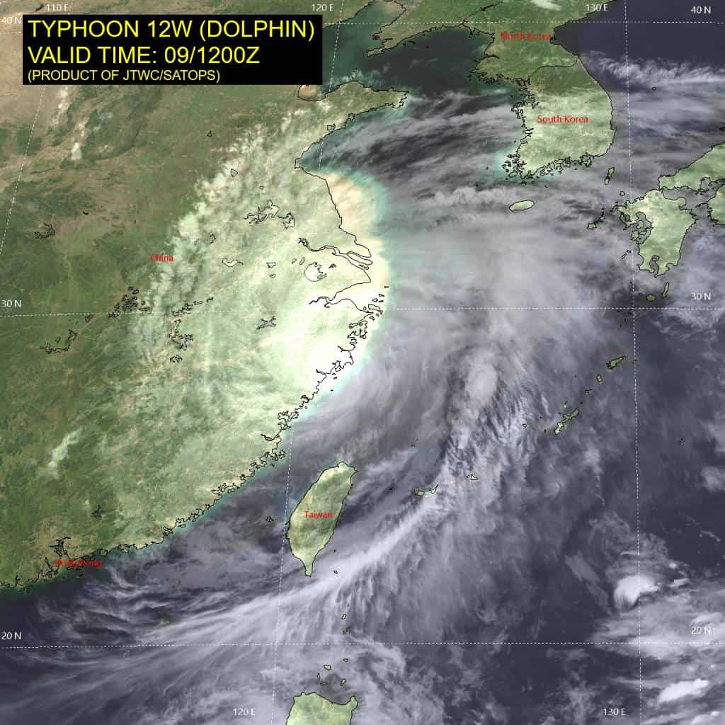
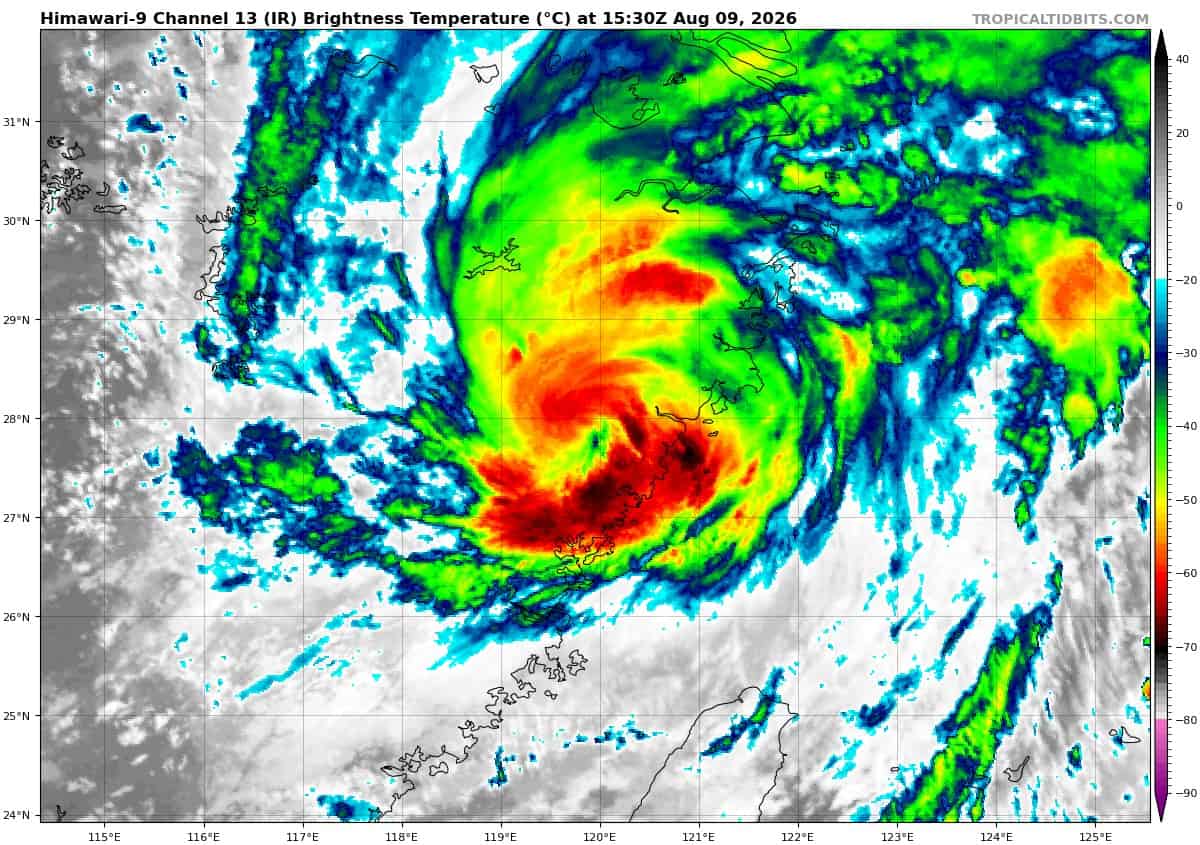
Tropical cyclone 12W (Dolphin)…is located approximately 175 NM north-northwest of Taipei, Taiwan – Final Warning
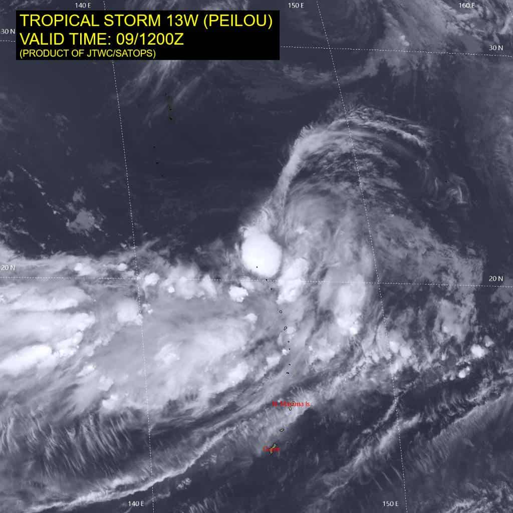
Tropical cyclone 13W (Peilou)…is located approximately 452 NM north-northeast of Andersen AFB
Tropical cyclone 14W (Chan-hom)…is located approximately 535 NM east of Yokosuka, Japan
Tropical cyclone 15W…is located approximately 522 NM northwest of Wake Island
Northeast Pacific: There are no Tropical Cyclones
>>> Western East Pacific:
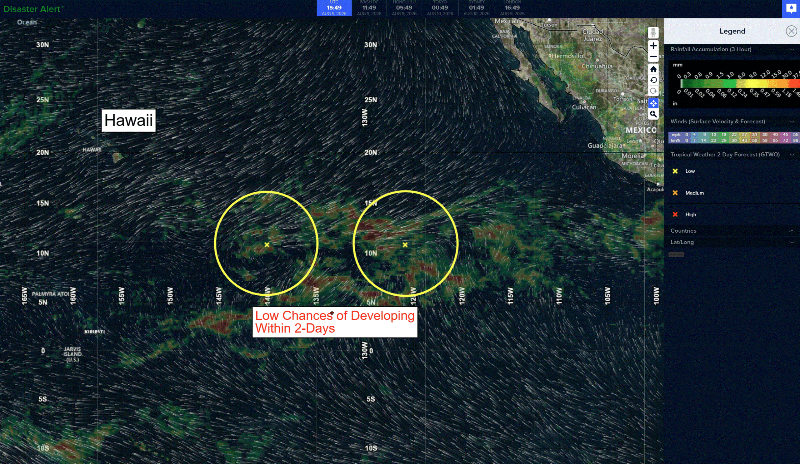
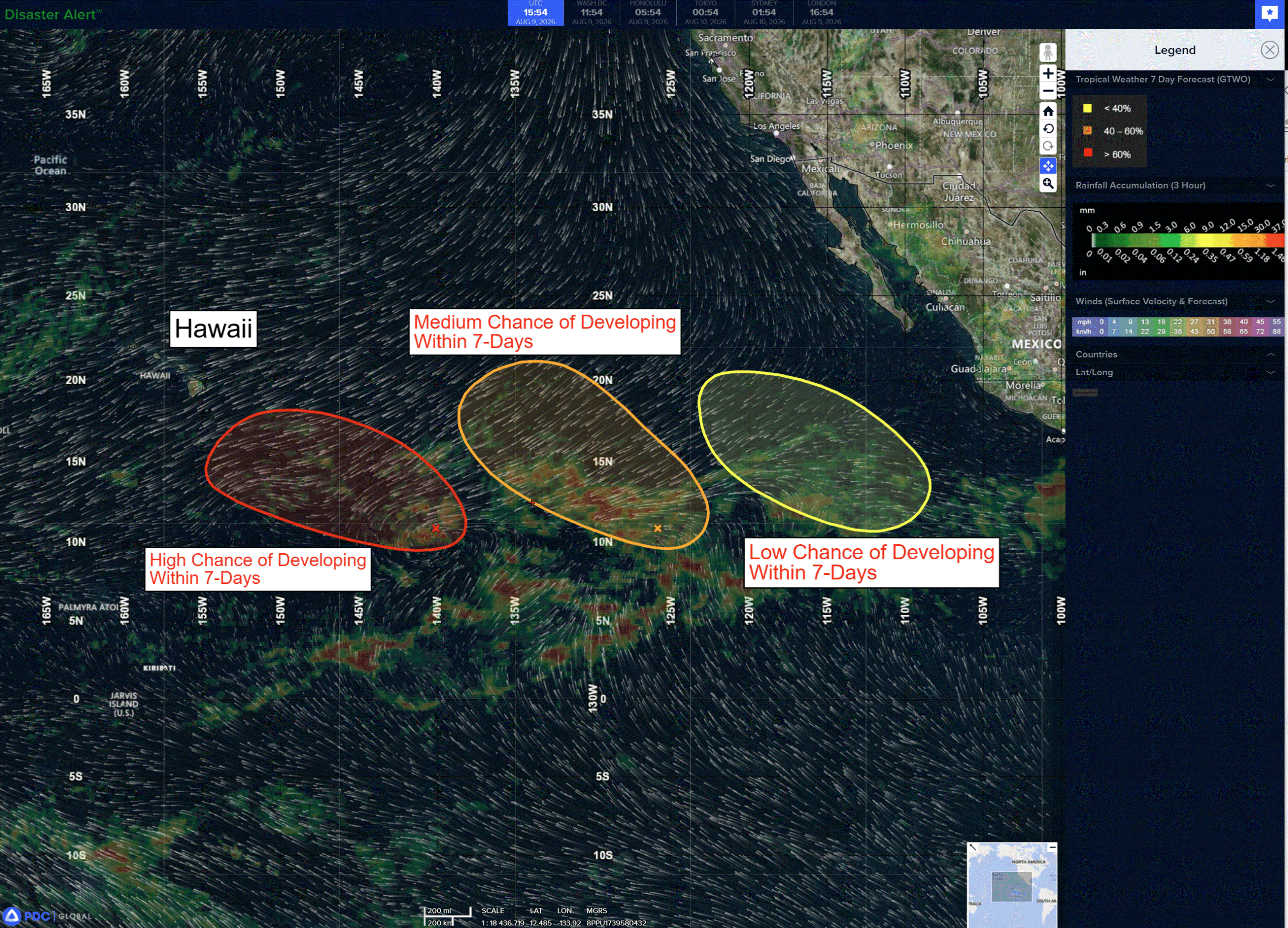
A large area of disorganized showers and thunderstorms is located well to the west-southwest of the southern tip of the Baja California Peninsula. Environmental conditions appear favorable enough for some gradual development, and a tropical depression could form during the next few days while the system moves slowly west-northwestward to northwestward across the western portion of the East Pacific.
*Formation chance through 48 hours…low…30 percent
*Formation chance through 7 days…medium…60 percent
>>> Southwest of Mexico:
Disorganized showers and thunderstorms located several hundred miles south of the southern tip of the Baja California Peninsula are associated with a tropical wave. Environmental conditions appear marginally conducive for slow development during the next day or two as it moves west-northwestward at around 15 mph. By late Tuesday, the system is expected to reach an area of strong upper-level winds, ending its chances for development.
*Formation chance through 48 hours…low…10 percent
*Formation chance through 7 days…low…10 percent
Central Pacific: There are no Tropical Cyclones
Invest 93C
A broad area of low pressure located about 1100 miles east-southeast of the Hawaiian Islands is producing disorganized showers and thunderstorms and is nearly stationary. Environmental conditions are forecast to be conducive for further development, and a tropical depression is expected to form by mid-week as the system begins moving west-northwestward or northwestward across the Central Pacific.
* Formation chance through 48 hours…medium…50 percent
* Formation chance through 7 days…high…90 percent
Western Pacific, Indian Ocean, and adjacent Seas:
Western Pacific
Tropical Cyclone 12W (Dolphin) – Final Warning
According to the JTWC warning number 55, sustained winds were 65 knots…with gusts to 80 knots
Animated enhanced infrared (eir) satellite imagery as well as animated radar data indicate that typhoon 12W made landfall along the eastern coast of China northeast of Wenzhou around 0915z. The system thereupon tracked southwestward, most likely passing in close proximity to Wenzhou itself and continuing to a position west of Ruian by 1200z.
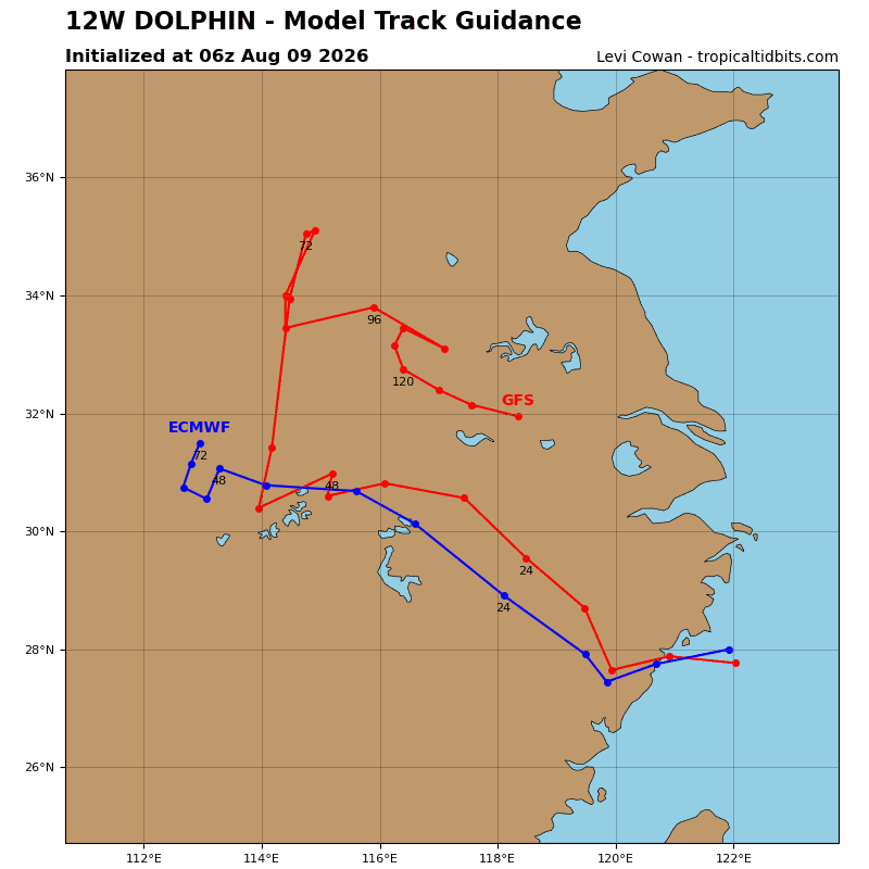
Surface observations from Ruian show winds from the south-southwest, supporting the initial position to the west of the station at 1200z, with high confidence. Now over land, ty 12W will drift southwest for a bit longer before quickly turning northwestward along the southwestern flank of a large subtropical ridge (str) centered to the northeast.
The system will rapidly weaken over the rugged terrain, dissipating over east-central China within the next 48 hours.
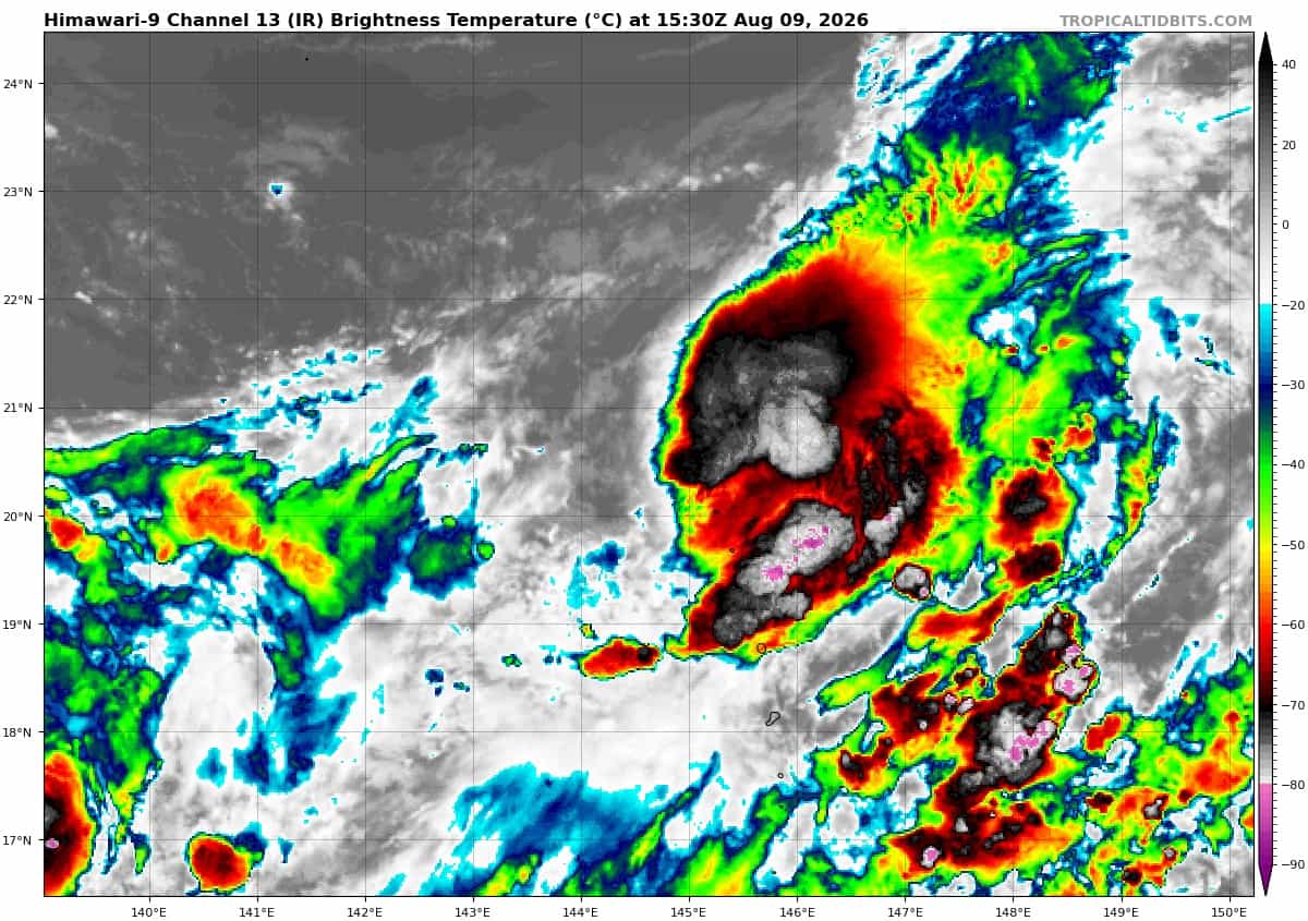
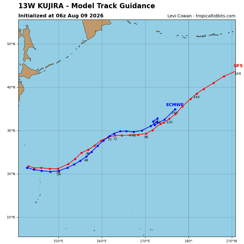
Tropical Cyclone 13W (Peilou)
According to the JTWC warning number 13, sustained winds were 40 knots…with gusts to 50 knots
Animated proxy visible (proxyvis) satellite imagery depicts a small, partially exposed low-level circulation center (llcc) with flaring deep convection developing in the northeastern and southeastern quadrants. A 091131z ascat-b bullseye pass, revealed a very compact wind field associated with ts 13W with maximum winds of 35 knots in the southeastern quadrant. Animated water vapor
imagery depicts a deep upper-level trough to the northwest, which is introducing some dry mid-level air along the far northwestern
flank of the circulation but also providing strong, divergent poleward outflow to the northeast, ahead of the trough axis.
Environmental conditions are marginally favorable, with strong outflow aloft, low vws, and warm ssts offset by dry air entrainment
to the northwest and the extremely small nature of the system.
TS 13W will continue to track southeastward for another few hours before gradually turning eastward by 12 hours. The system then turns northeastward through the remainder of the forecast period, traveling along the northern periphery of a low-to mid-level ner to the south.
Regarding intensity, ts 13W will steadily intensify over the next 24 hours as it moves eastward ahead of the upper-level trough to the west and remains under the divergent upper-level outflow region of the trough, which will support sustained convective development. after 24 hours, significant dry air is forecast to move in from the west, engulf ts 13W, and mark the onset of rapid weakening.
Increased shear after 48 hours, and the passage of the upper-level trough to the east of the system will finish the job started by the dry air entrainment, and ts 13W will dissipate as a tropical cyclone by 72 hours.
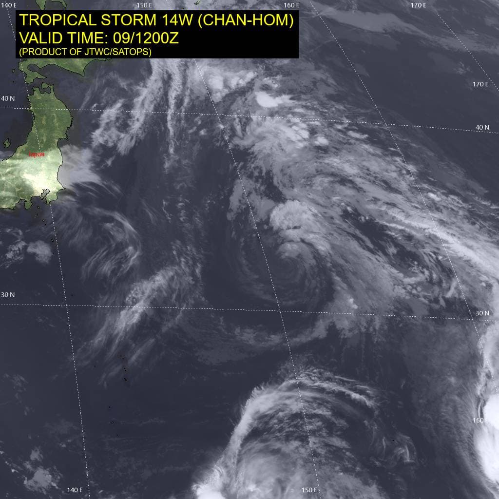
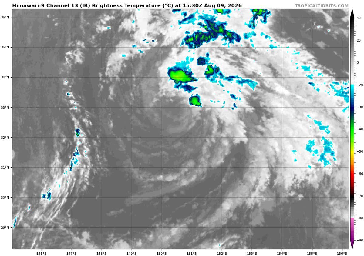
Tropical Cyclone 14W (Chan-hom)
According to the JTWC warning number 13, sustained winds were 40 knots…with gusts to 50 knots
Animated proxy visible (proxyvis) satellite imagery depicts a fully exposed low level circulation center (llcc), with newly developing,
moderate convection in the northeastern quadrant, along a line of convergence. since 0600z the llcc has tracked south-southeastward before turning sharply north and returning to its 0600z position by the 1200z hour, making the best track appear to be stationary. In the subsequent two hours, the system has begun to move out to the northwest. A 090954z ascat-b pass showed the system is barely holding onto tropical storm status, with the vast majority of the visible wind field being 30-35 knots. Animated water vapor imagery, atmospheric motion vector (amv) analysis and model field data show an ull positioned just north of the llcc, with a trough extending to the east.
Also evident in the water vapor imagery is a large deformation zone east of Honshu and a strong upper-level trough currently moving across honshu. The proximity of the ull is introducing upper-level convergent flow aloft over ts 14W, as well as bringing in dry mid-level air and moderate northwesterly shear, inhibiting development. ssts and upper-level outflow conditions remain generally favorable but are more than offset by the unfavorable conditions discussed above.
TS 12W has now started to move out of the weak steering environment, and accelerate northwestward along the strengthening gradient along the southwestern flank of a low- to mid-level subtropical ridge (str) centered southwest of the Aleutians. The northwestward trajectory is forecast to continue through 36 hours, before the track turns sharply westward in response to the ridging building in from the west, merging with the ridge southwest of the Aleutians, forming a single ridge extending from
North Korea, over Sakhalin Island to southeast of Kamchatka.
The system is forecast to make landfall along the eastern coast of Honshu just around 48 hours. after making landfall, the exact
orientation of the ridge to the west, extending roughly from North Korea to far eastern Russia, will determine the track that ts 14W
takes. The ecmwf depicts a more northeastward axis of the ridge which results in a west-southwest trajectory, taking it over Tokyo.
The bulk of the other global and ensemble models show a flatter ridge pattern, which results in a more westward trajectory across
Japan and into the Sea of Japan. The forecast more closely follows the second scenario, with the system emerging into the SOJ west of Kanazawa, Japan by 60 hours, before gradually turning southwestward, making a second landfall near Pohang, South Korea by the end of the forecast period.
Regarding intensity, the proximity of the ull will continue to inhibit development in the short-term. After 18 hours, the trough currently moving over Japan will cut off into an ull which drives south along the east coast of Honshu, ultimately moving into a position southwest of ts 14W, opening up a robust poleward outflow channel. At the same time, the system will be moving over the warm tongue associated with the Kuroshio Current, supporting intensification up to a peak of 50-55 knots by 36 hours. The ull moves southeast of ts 14W rapidly, while the system moves over the Oyashio Current along the coast of Japan, resulting in weakening prior to landfall.
Terrain interaction will further weaken ts 14W before it moves into the SOJ. The system begins subtropical transition (stt) by 60 hours, and will complete stt by 72 hours as it also weakens and dissipates prior to landfall in Korea.
Tropical Cyclone 15W
According to the JTWC warning number 1, sustained winds were 30 knots…with gusts to 40 knots