The Pacific Disaster Center’s (PDC Global) Saturday, August 8, 2026, Tropical Cyclone Activity Report…for the Pacific Ocean, the Indian Ocean, and adjacent Seas
Current Tropical Cyclones:
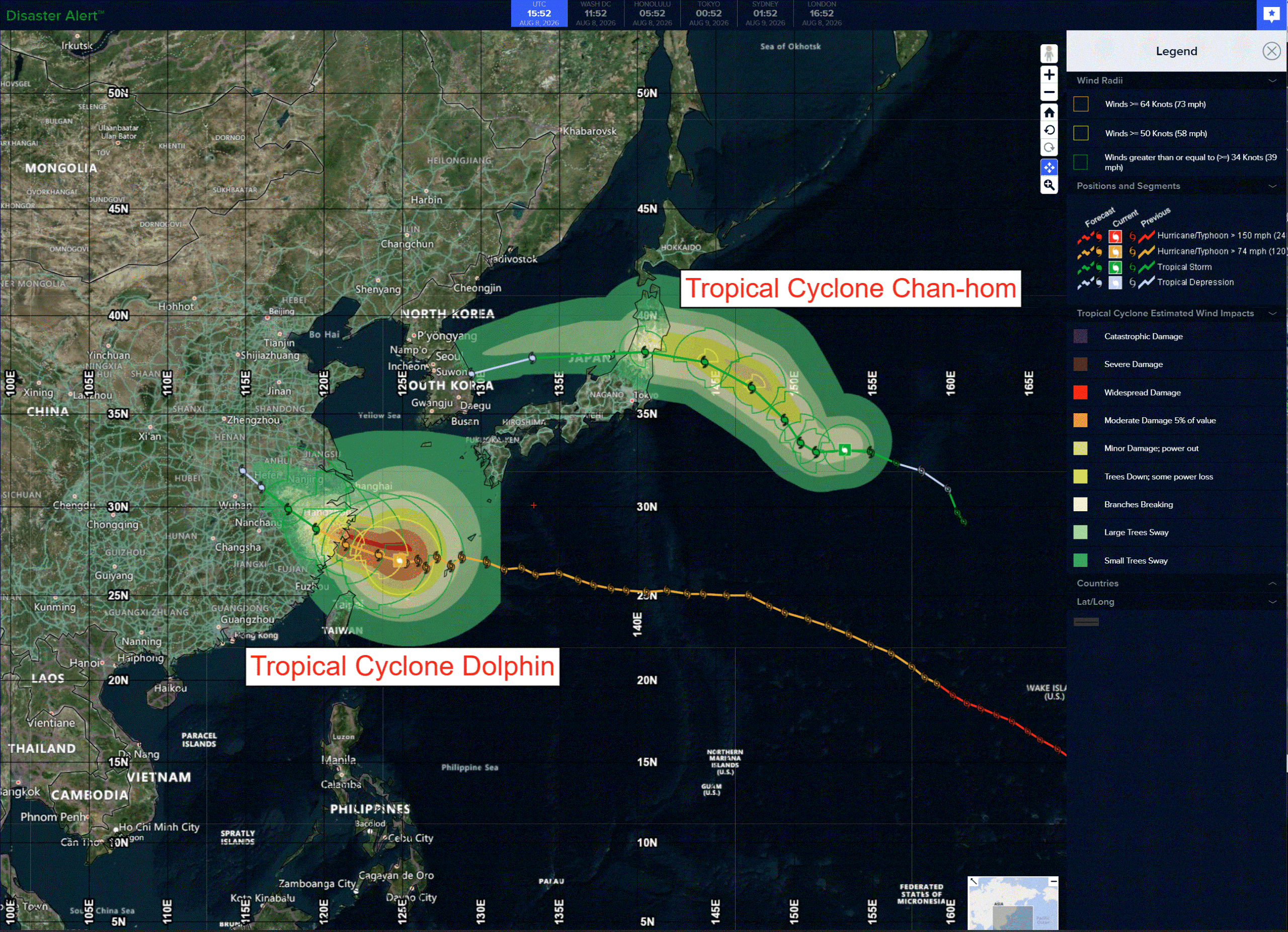
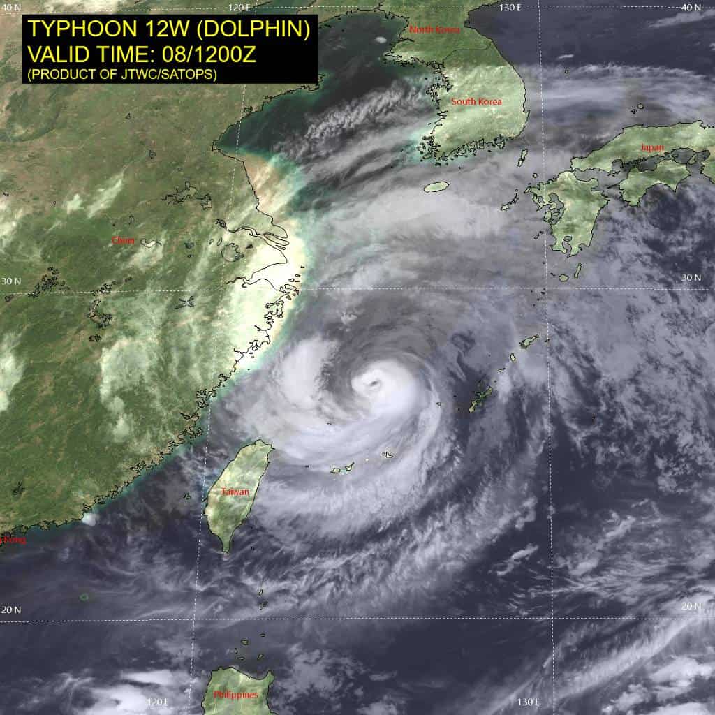
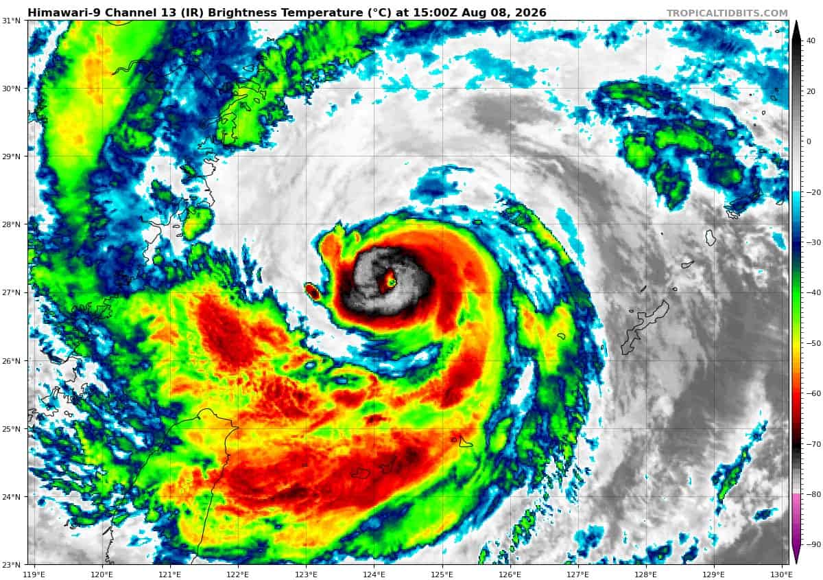
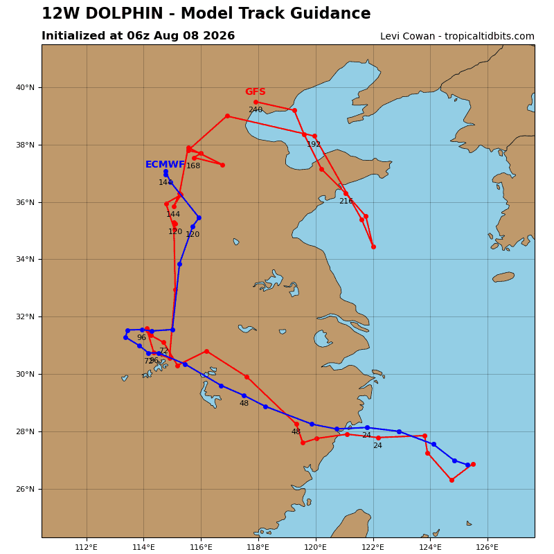
Tropical cyclone 12W (Dolphin)…is located approximately 186 NM north-northeast of Taipei, Taiwan
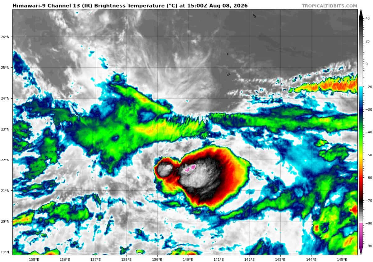
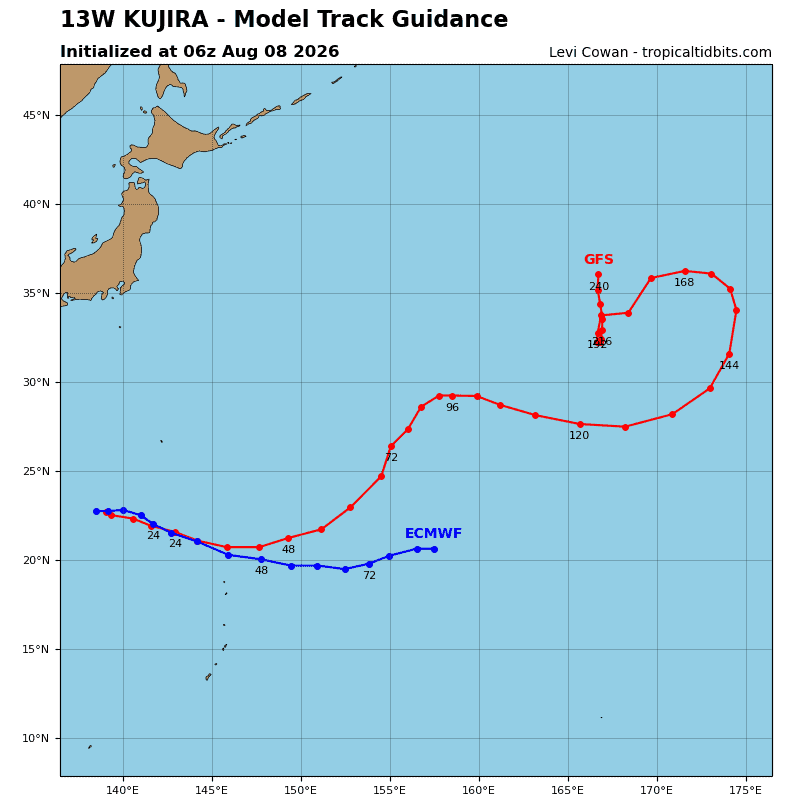
Tropical cyclone 13W (Kujira)…is located approximately 162 NM south of Iwo-To
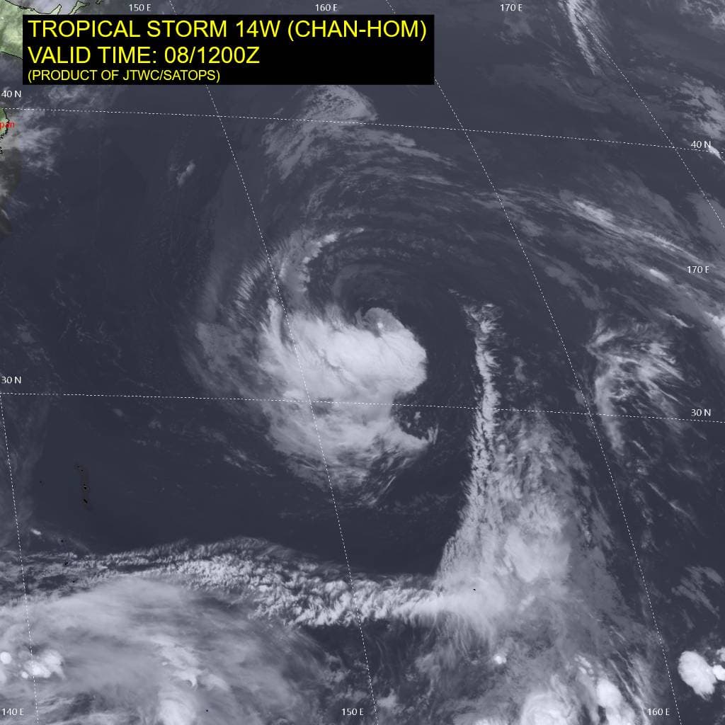
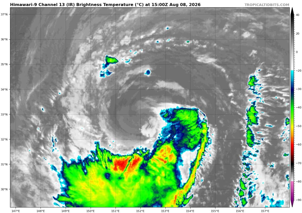
Tropical cyclone 14W (Chan-hom)…is located approximately 617 NM east of Yokosuka, Japan
Northeast Pacific: There are no Tropical Cyclones
>>> Western East Pacific:
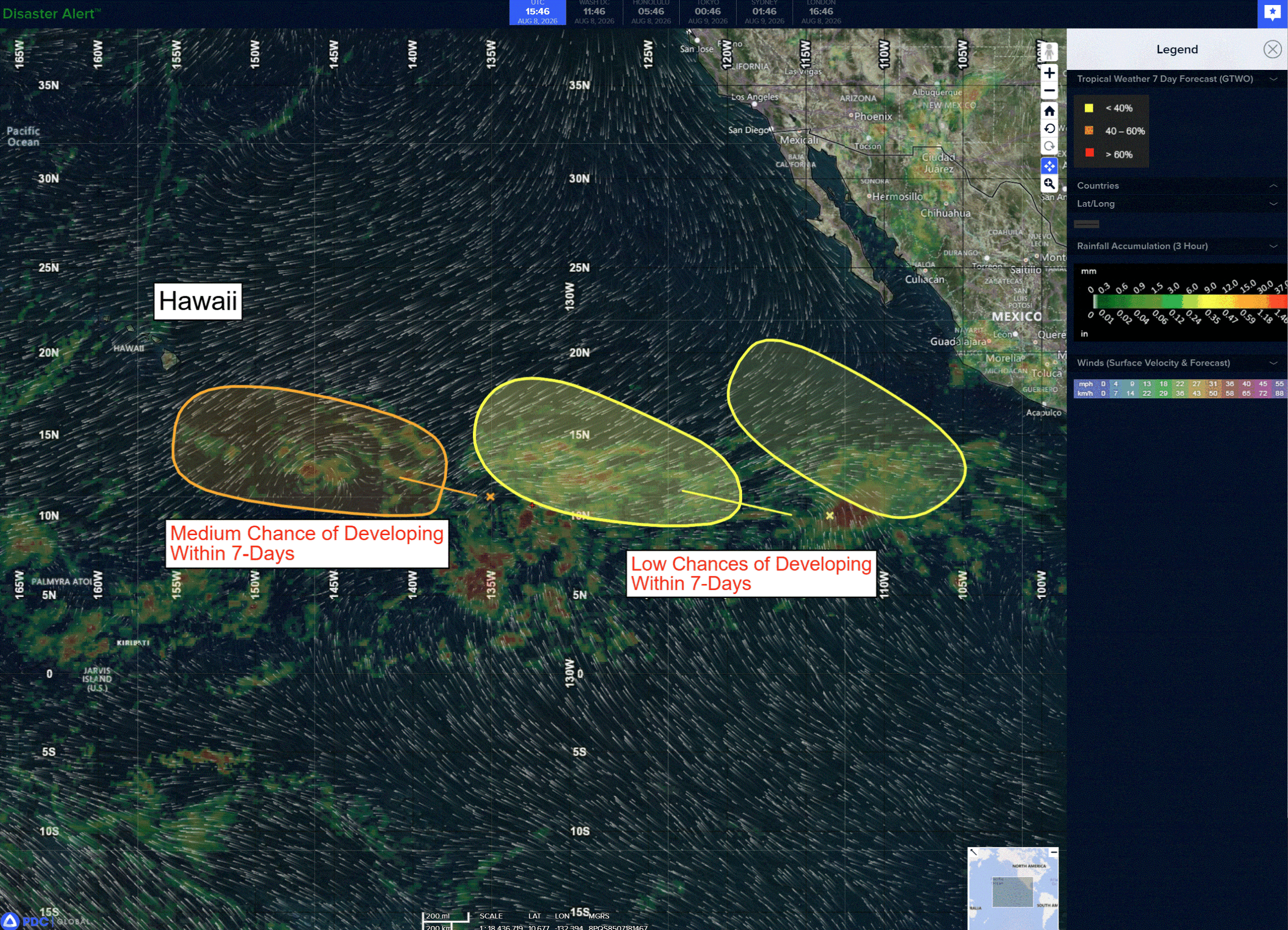
A tropical wave located several hundred miles southwest of the southern tip of the Baja California Peninsula is producing disorganized showers and thunderstorms. Upper-level winds are forecast to be conducive for gradual development, and a tropical depression could form by midweek while the system moves slowly west-northwestward.
*Formation chance through 48 hours…low…10 percent
*Formation chance through 7 days…medium…50 percent
>>> Southwest of Mexico:
An area of low pressure could form well offshore of the southwestern coast of Mexico by the middle of next week. Some gradual development of this system is possible thereafter as it moves generally west-northwestward.
*Formation chance through 48 hours…low…near 0 percent
*Formation chance through 7 days…low…10 percent
Central north Pacific: There are no Tropical Cyclones
A tropical wave located about 1000 miles east-southeast of the Hawaiian Islands is producing a large area of disorganized showers and thunderstorms. Environmental conditions appear conducive for further development of this system, and a tropical depression is likely to form in a few days while the wave moves west-northwestward across the central Pacific.
* Formation chance through 48 hours…low…30 percent
* Formation chance through 7 days…high…90 percent
Western Pacific, Indian Ocean, and adjacent Seas:
Western Pacific
Tropical Cyclone 12W (Dolphin)
According to the JTWC warning number 53, sustained winds were 70 knots…with gusts to 85 knots
Animated enhanced infrared satellite imagery (eir) depicts typhoon (ty) 12W with a very compact inner core undergoing reorganization, cocooned within an extensive outer circulation defined by multiple rainbands wrapping into a broad outer ring. Animated radar imagery shows that the eyewall width has decreased, while simultaneously the eye has expanded and cleared in eir imagery, continuing a cycle (erc) observed repeatedly with this system. A 081020z ssmis 91ghz image revealed a fragmented eyewall on the western flank, which has since reconsolidated.
The system is situated over a tongue of very warm (30-31c) ssts with relatively high ohc, supporting the re-intensification of the inner core. Environmental conditions remain favorable, with optimal ocean conditions, strong radial outflow aloft, and low vertical wind shear. the primary limiting factor is the expansive nature of the outer circulation and the complex/hybrid structure of the system as a whole.
The larger circulation associated with ty 12W sits in a weak steering pattern, south of a weakness in the str over Korea, but is generally moving slowly westward. Trapped within this expansive outer circulation, the inner core of ty 12W continues to exhibit a trochoidal trajectory while meandering slowly westward. Over the next 12 hours, the weakness to the north is forecast to be replaced by a building ridge over southern Japan, which will drive ty 12W onto a west-northwestward trajectory towards the eastern coast of
China. Landfall in southeastern Zhejiang Province is expected near 24 hours. After landfall, the system will continue to track inland and by the end of the forecast period will begin to recurve northward around the str axis.
In terms of intensity, the system is moving over a tongue of high ohc waters, supporting maintenance of its current intensity at minimum, with slight intensification potential by 12 hours. The primary limiting factors are the expansive nature of the outer core and complex interplay with cyclonic outflow aloft, which extends beyond the inner core radius and has persisted for several days. The
forecast calls for the system to maintain its current intensity through landfall, before undergoing rapid terrain-induced weakening
until complete dissipation by 72 hours.
Tropical Cyclone 14W (Chan-hom)
According to the JTWC warning number 9, sustained winds were 45 knots…with gusts to 55 knots
Animated multi-spectral satellite imagery (msi) depicts a partially exposed low-level circulation center (llcc), with the western
periphery of the system obscured by a pocket of deep convection and associated cirrus blowoff, and the eastern semicircle fully exposed. Animated total precipitable water (tpw) imagery, as well as a 080656z ssmis 91ghz microwave image, reveal a large wedge of extremely dry mid-level air entrained along the eastern flank. Animated water vapor imagery and atmospheric motion vector (amv) data verify the presence of an upper-level low positioned just southwest of the surface llcc, ushering in the dry mid-level air while inducing convergence aloft over the southeastern portion of ts 14W.
The environment is marginal for intensification. ssts are generally sufficient to support development, while deep-layer shear is low. However, the presence of the upper-level low in close proximity and the associated dry air entrainment and upper convergence are offsetting the otherwise favorable factors.
Tropical storm (ts) 14W will continue to track westward along the southern flank of a low- to mid-level str for the next 12 to 24 hours. The system will begin to decelerate after 12hours, as the ridge begins to erode from the west due to an approaching upper-level trough moving east from Japan. After 24 hours, the system slows down to 5-6 knots while turning northwestward as a weakness develops in the ridge over Hokkaido, with the ridge reorienting along a northwest-to-southeast axis. By 72 hours, the trough and associated weakness in the ridge move east and are replaced by a new ridge developing over far eastern Russia, which will drive ts 14W onto a westward track across the northern portion of Honshu. Landfall along the coast of Honshu, in the general vicinity of Sendai, Japan, is expected near 72 hours. Thereafter, the system rapidly moves into the Sea of Japan (soj) along the strong gradient on the southern side of the building ridge over eastern Russia. As the system weakens and shallows out in the extended forecast, the steering gradient weakens, allowing the system to decelerate through 120 hours.
Regarding intensity, ts 14W will face marginal to marginally unfavorable conditions for the next 12 to 24 hours, as it moves northwestward generally in alignment with the upper-level low. Around 24 hours, the upper low opens up into a trough and begins to decouple from ts 14W, allowing for modest improvement in the overall environment. By 48 hours, another upper-level low develops near Sendai, with a trough extending southeastward to the south of ts 14W, opening up a robust, near-jet-level poleward outflow
channel. TS 14W will tap into this outflow channel and intensify to a peak of 50 knots by 60 hours.
Further evolution of the upper-level pattern places ts 14W on the northwestern (convergent) side of the upper low by 72 hours, and the system will weaken slightly as it approaches landfall. The system will begin a rapid subtropical transition (stt) as it crosses Honshu and moves into the soj, completing stt no later than 120 hours. The system will steadily weaken as it undergoes stt.
Tropical Cyclone 13W (Kujira)
According to the JTWC warning number 9, sustained winds were 25 knots…with gusts to 35 knots
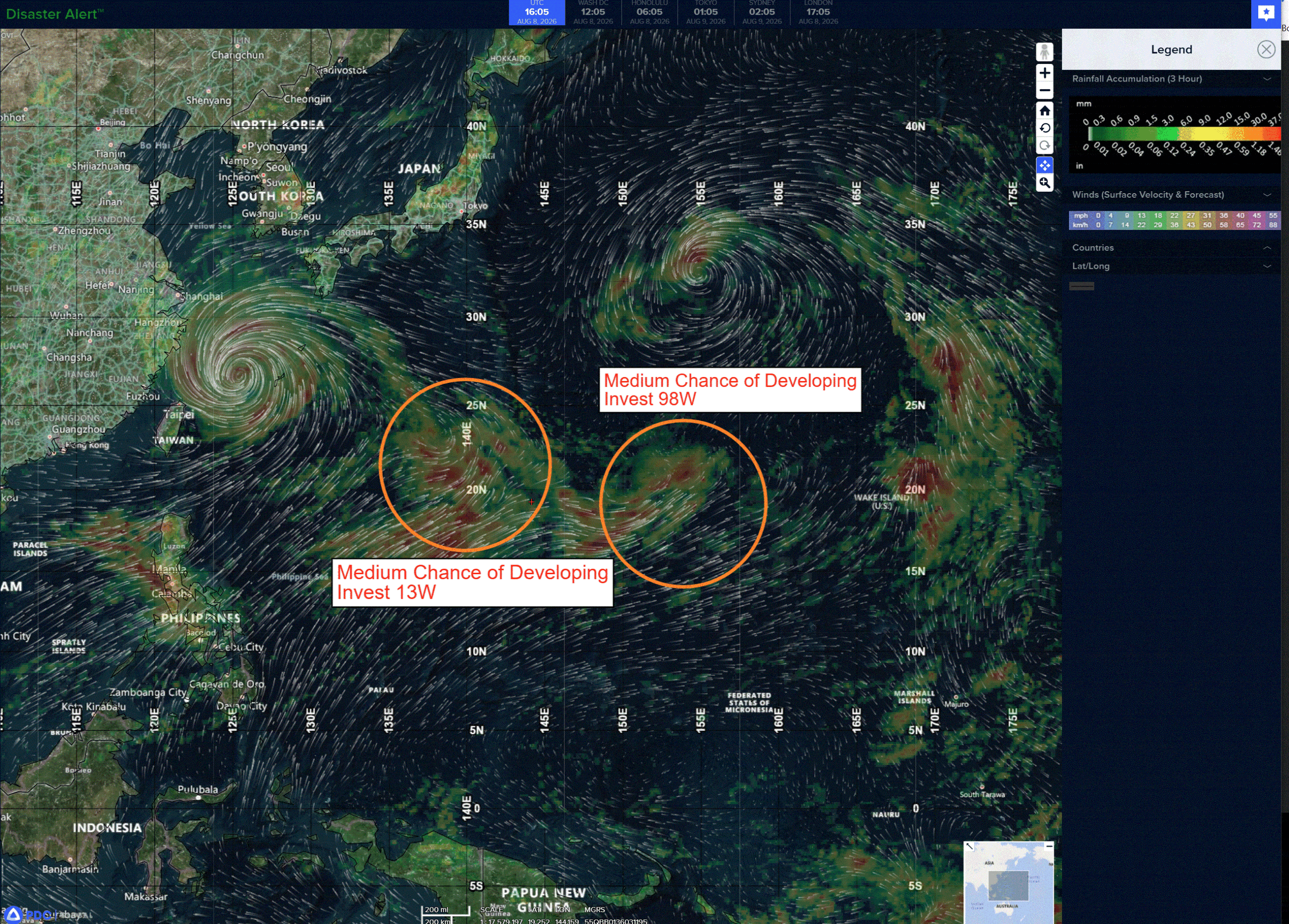
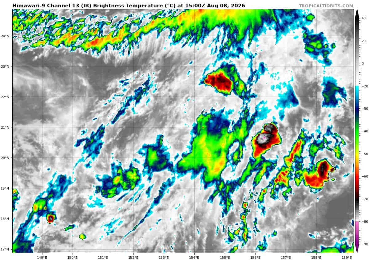
>>> There’s an area of disturbed weather that’s being referred to as Invest 98W which is located approximately 608 NM west-northwest of Wake Island.
Enhanced infrared imagery (eir) depicts a still loosely defined but now fully developed closed circulation embedded within a broad trough. A 081011z ascat-b pass reveals a still loose but now consolidated circulation, showing 25 to 30kts along the southwestern periphery of the circulation.
Environmental analysis reveals favorable conditions for development with low vertical wind shear (5 to 10kts), warm sea surface temperatures (29 to 30 c), and good poleward outflow.
Deterministic models briefly develop 98W into a weak tropical depression that generally tracks north-northeastward along the eastern periphery of the cyclonic gyre pattern. Ensemble models depict more significant development and a general northeast track of 98W over the next 24 to 36 hours.
Maximum sustained surface winds are estimated at 17 to 27 knots.
The potential for the development of a significant tropical cyclone within the next 24 hours is upgraded to high.