The Pacific Disaster Center’s (PDC Global) Wednesday, August 5, 2026, Tropical Cyclone Activity Report…for the Pacific Ocean, the Indian Ocean, and adjacent Seas
Current Tropical Cyclones:
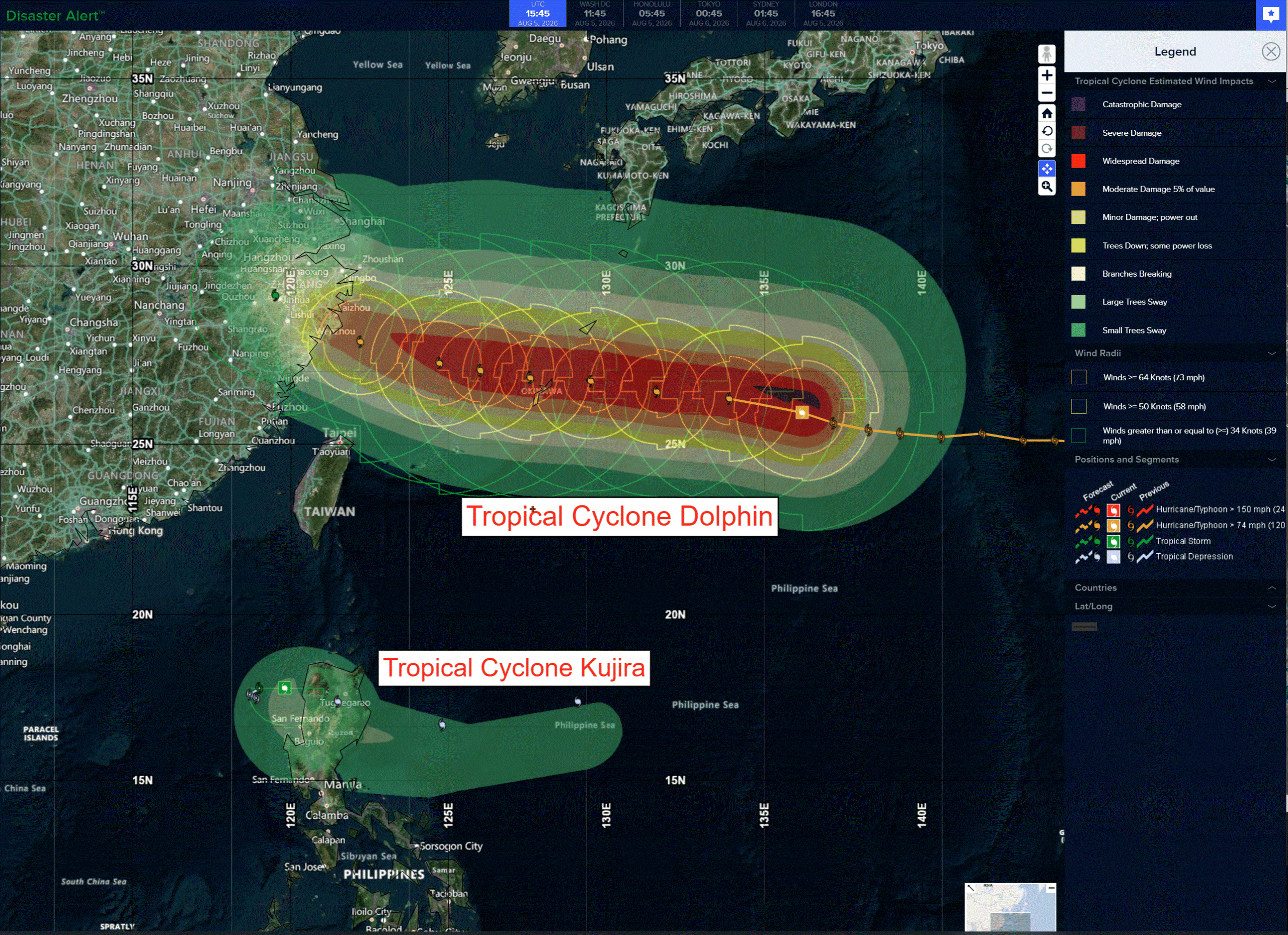
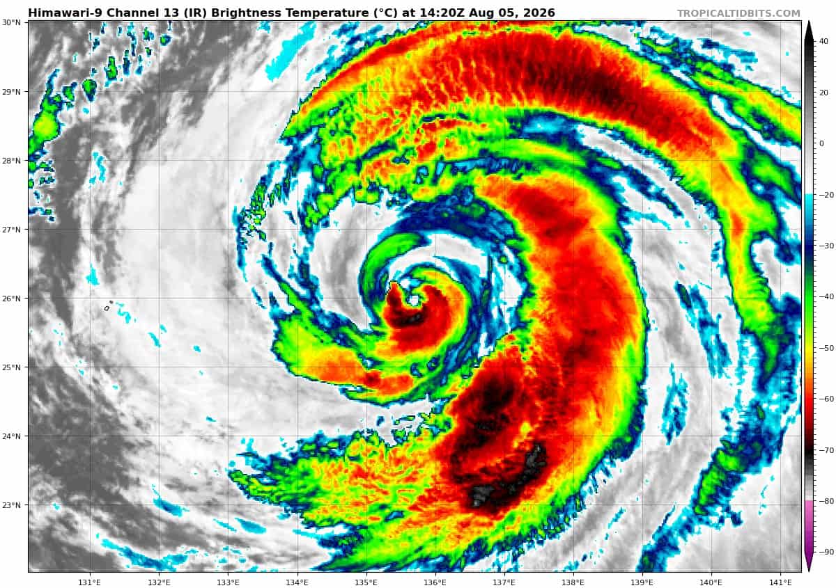
Tropical cyclone 12W (Dolphin)…is located approximately 307 NM east of Kadena AB
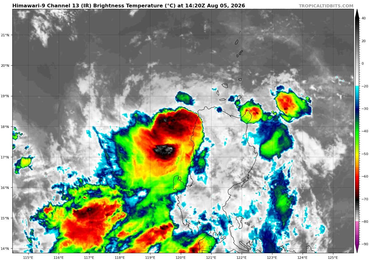
Tropical cyclone 13W (Kujira)…is located approximately 169 NM north of Manila, Philippines
Northeast Pacific: There are no Tropical Cyclones
>>> Western East Pacific:
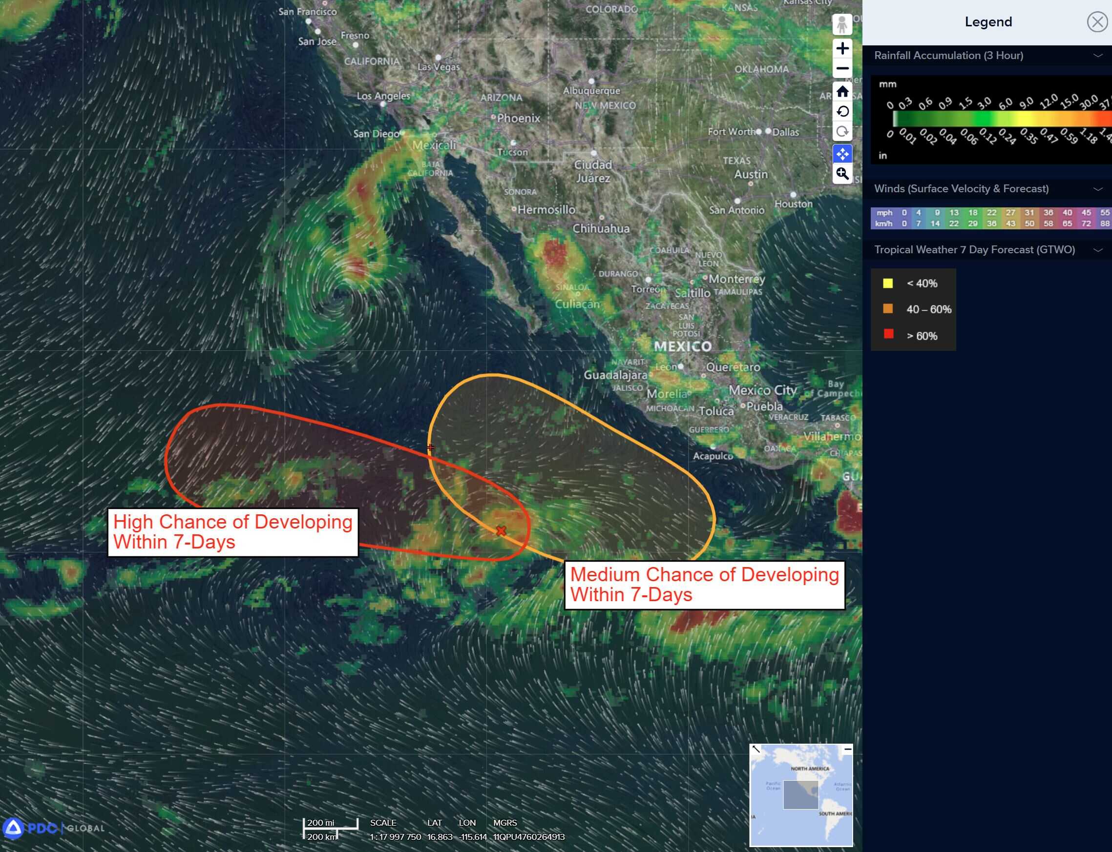
A tropical wave located over the central portion of the east Pacific is producing limited shower and thunderstorm activity. Environmental conditions could become more conducive for slow development of this system over the weekend into early next week as it moves generally westward at 10 to 15 mph.
*Formation chance through 48 hours…low…near 0 percent
*Formation chance through 7 days…low…20 percent
>>> Central East Pacific:
A broad area of low pressure is forecast to form well offshore of the southwestern coast of Mexico late this weekend or early next week. Some gradual development of this system is possible thereafter while it moves generally west-northwestward.
*Formation chance through 48 hours…low…near 0 percent
*Formation chance through 7 days…low…20 percent
Central north Pacific: There are no Tropical Cyclones
>>> Central Pacific:
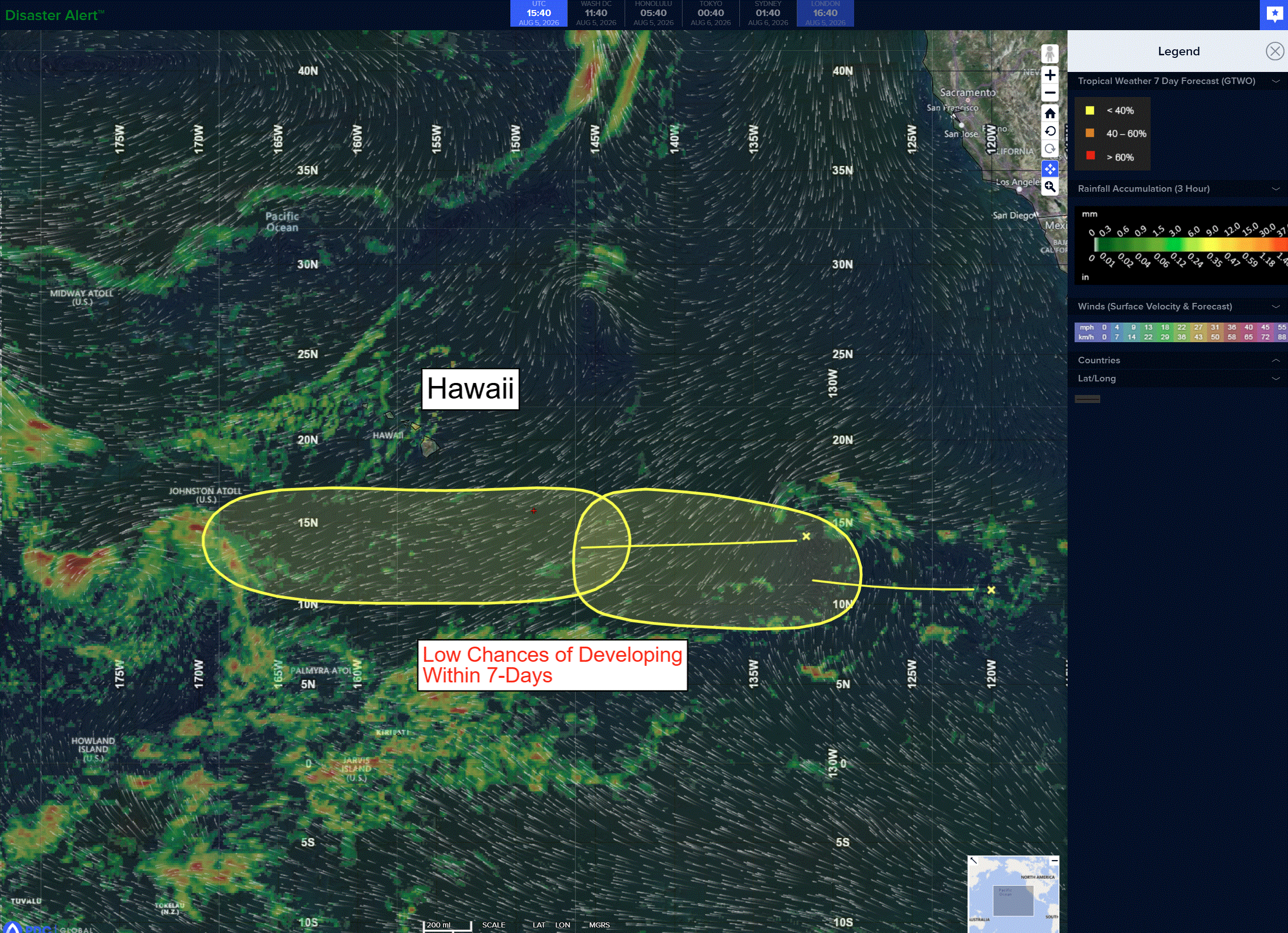
A tropical wave located over the western portion of the east Pacific is producing disorganized showers and thunderstorms. Environmental conditions appear marginally conducive for slow development over the next several days while it moves westward at 10 to 15 mph.
*Formation chance through 48 hours…low…near 0 percent
*Formation chance through 7 days…low…10 percent
Western Pacific, Indian Ocean, and adjacent Seas:
Western Pacific
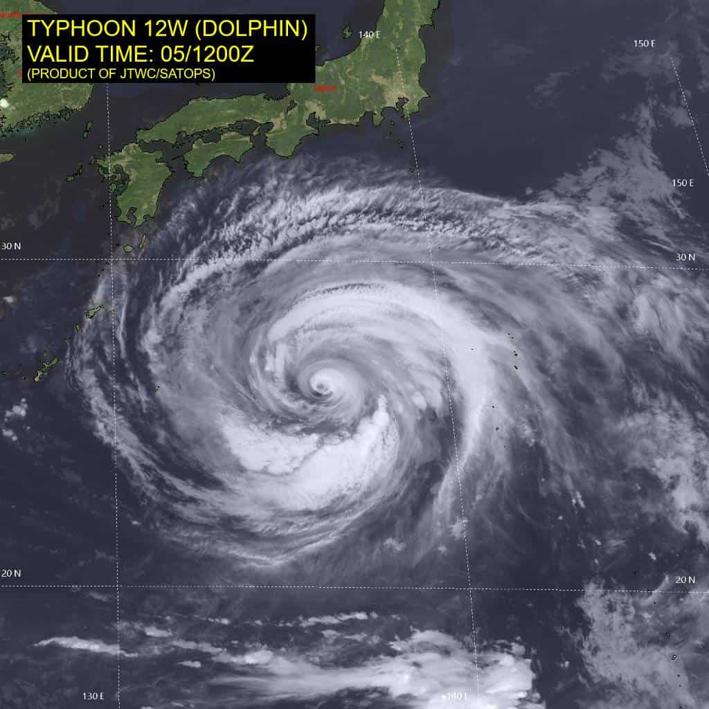
Tropical Cyclone 12W (Dolphin)
According to the JTWC warning number 41, sustained winds were 80 knots…with gusts to 100 knots
Animated multi-spectral satellite imagery (msi) and enhanced infrared (eir) satellite imagery depict typhoon (ty) 12W with a cloud-filled, but well-defined 17nm wide eye embedded within a symmetric central dense overcast (cdo). Eye temperatures continue to cool, now estimated at -04c as the eye fills with clouds, while cloud-top temperatures have steadily risen to the -45c range, consistent with
cloud-top temps from 12 hours ago. A 050436z amsr2 and 050659z ssmis 89ghz image depict a compact inner core of convection, surrounded by an expansive outer ring of moderate convection. The ssmis image depicts a stationary banding complex (sbc), which the cimss m-perc fails to pick up, draped across the southern region of the circulation and wraps up along the eastern side, ultimately merging with the inner eyewall in the northeastern quadrant. Both microwave images also depict a relatively clear moat separating the sbc from the main core of convection and inner eyewall. The fact that m-perc is not picking up on this sbc is notable for future eyewall replacement cycle prediction.
Environmental conditions remain favorable, with warm ssts (although ohc remains low), strong radial outflow (divergent cyclonic in the immediate vicinity of the core, turning anticyclonic at a distance) and low deep-layer shear.
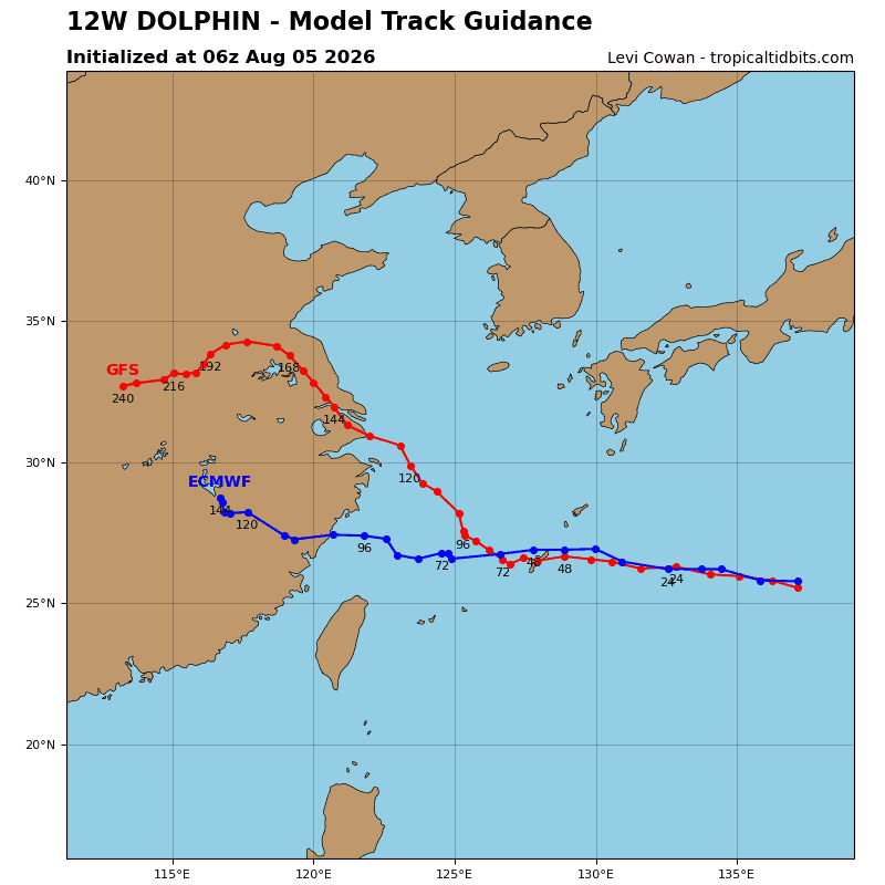
TY 12W is forecast to continue its westward track towards the Ryukyu Islands under the steering influence of the strong str centered over the Sea of Japan. track speeds are forecast to remain consistent for the next 36-48 hours as the ridge remains firmly entrenched to the north. Some trochoidal wobbles are anticipated, especially if and when the system begins another erc, though there are no significant changes in track expected before the system reaches the Ryukyus.
By 48 hours, an upper-level trough will move across far northeastern China, eroding the western extent of the str, inducing a break or weakness in the steering ridge over the Korean Peninsula. The trough is not forecast to be strong enough to pull TY 12W northward, though its presence introduces some marginal uncertainty into the forecast track. All of the major global models depict the same scenario, with a weakness developing in the ridge over the Korean Peninsula, but differences emerge in how the models predict TY 12W to respond.
The navgem, with its known poleward track biases show an aggressive response and a dramatic turn northward, though now delayed significantly later than in previous runs. The gfs still insists on turning the system poleward but a shallower angle and not until after passing Okinawa. Ensembles in general support a westward trajectory through 120 hours, with a low probability scenario of a turn northward after 96 hours.
The system is expected to slow down after 48 hours, but maintain a generally westward track through 120 hours. The first landfall is forecast to occur at Okinawa around 48 hours, with a second
landfall south of Shanghai between 96 and 120 hours.
Regarding intensity, while the sole erc prediction aid is currently not picking up on a strong sbc signature, the presence of cyclonic outflow aloft and the presence of the sbc strongly suggest secondary eyewall formation is likely. If the system attempts another erc, due to the extremely broad nature of the outer convective ring, and oceanic upwelling, it is unlikely to be able to complete it. The forecast calls for a steady intensity, with the possibility of swings of plus or minus 5-10 knots, over the next 48 hours as the system hurtles towards Okinawa.
After moving into the ecs, the system will rapidly weaken as it continues to expand, upwells significantly cooler waters and encounters some convergence aloft. After landfall in China, the
system will rapidly weaken due to land effects.
Tropical Cyclone 13W (Kujira)
According to the JTWC warning number 6, sustained winds were 30 knots…with gusts to 40 knots
Animated multi-spectral satellite imagery (msi) depicts an elongated, disorganized, and fully exposed low-level circulation center (llcc) west-southwest of Vigan, Philippines, with deep convection displaced to the southwest quadrant due to persistent moderate northeasterly vertical wind shear (vws). A 050209z metop-c ascat pass revealed a highly elongated llcc, with predominantly 25-30 knot winds in the northern half of the circulation and 35-40 knot winds confined to the southern quadrant, co-located with the deepest convection.
Environmental conditions are marginally unfavorable as moderate vws, dry air entrainment along the northern periphery, and land interaction impede convective consolidation.
Tropical storm (ts) 13W has meandered slowly northward in a weak steering environment over the last 24 hours, and remains quasi-stationary. Over the next 12 to 18 hours, strengthening southwest monsoon surge flow will steer TS 13W eastward, with landfall along northern Luzon expected near 12 to 15 hours. The system will quickly cross Luzon while steadily weakening. The remnant vortex is
expected to emerge off the east coast of Luzon by 24 hours before being accelerated eastward into the Philippine Sea along the northern periphery of the surging monsoon southwesterlies.
The system has attained its peak intensity and is expected to maintain 35 knots until landfall near 12 hours. The system will weaken to 25-30 knots as it crosses Luzon and continue to slowly weaken through the remainder of the forecast. Upon offshore emergence, the llcc is forecast to degenerate into an open trough with an increasingly asymmetric wind field featuring 25-30 knot monsoon surge winds confined to the southern periphery.
By 36 hours, the system will lose tropical characteristics while retaining winds above warning thresholds within the asymmetric monsoon envelope. Beyond 36 hours, the remnant vorticity
will be absorbed into the expansive circulation of TY 12W.
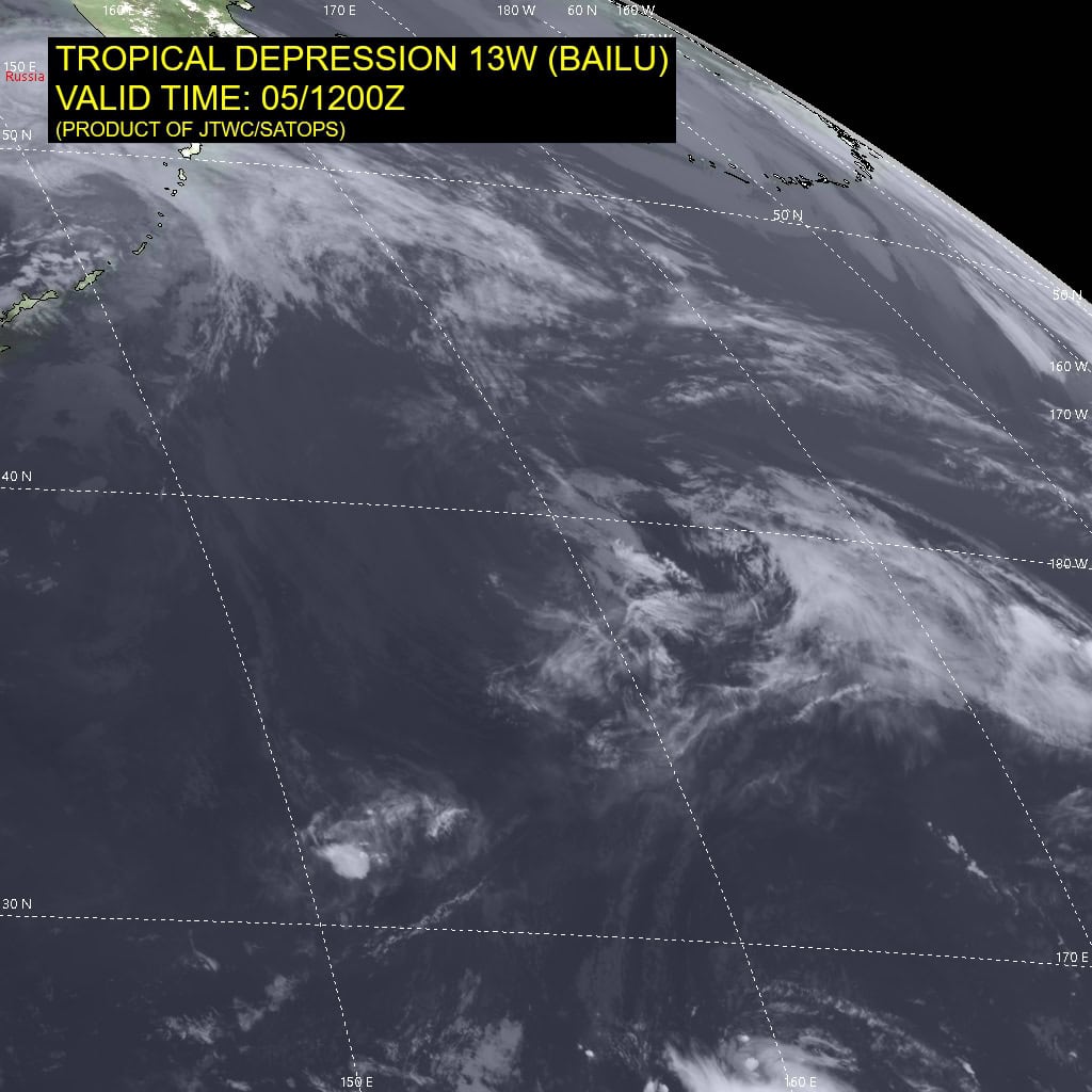
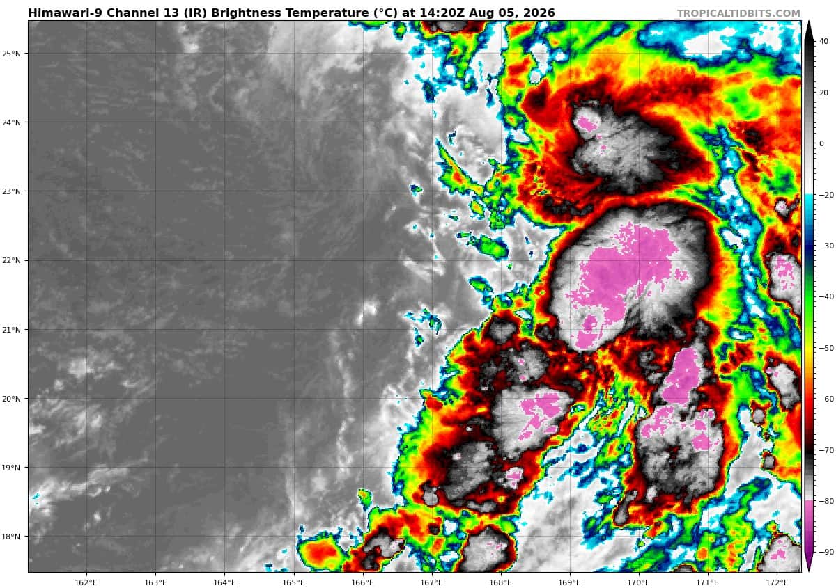
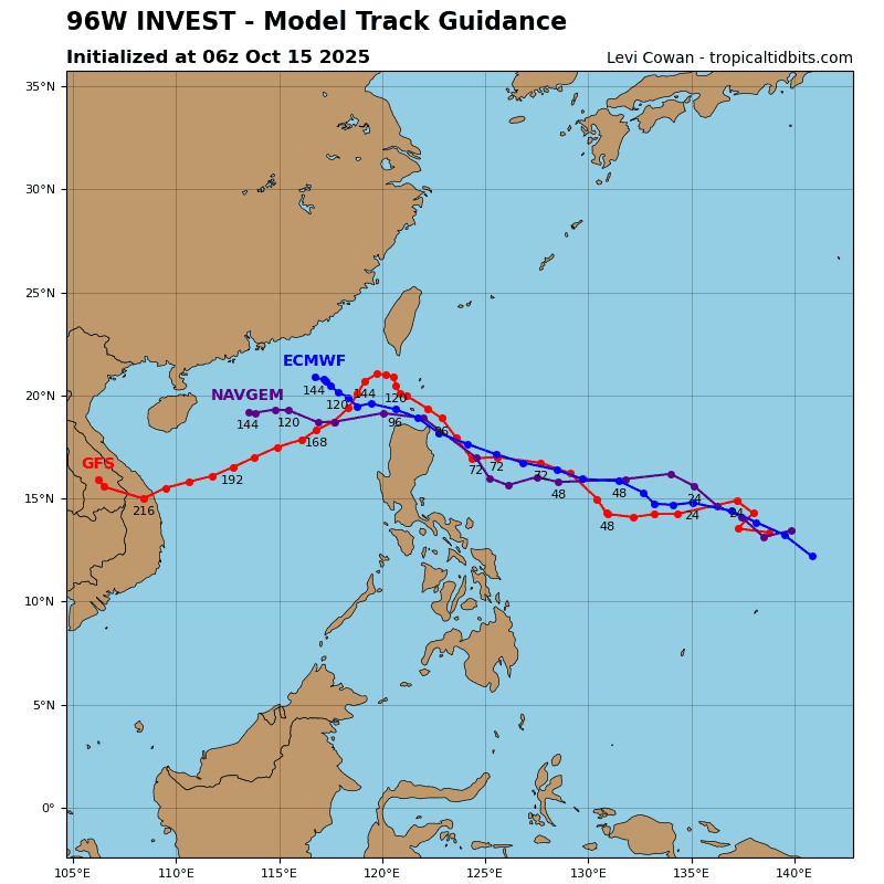
>>> There’s an area of disturbed weather that’s being referred to as Invest 96W, which is located approximately 324 NM north-northwest of Wake Island
Animated multi-spectral satellite imagery (msi) depicts a broad, still developing low-level circulation,
embedded within an expansive region of troughing.
Environmental analysis reveals favorable conditions for development with low vertical wind shear (10-15kts), warm sea surface temperatures (29 to 30 c), and strong poleward upper-level outflow.
Global models depict the circulation moving under an upper-level trough and into a drier environment, which will hinder its potential development into a tropical cyclone and cause it to become subtropical after 36 hours. Global models indicate the steady development of 96W into a broad, possible short term tropical cyclone within the next 36 to 48 hours hours.
Maximum sustained surface winds are estimated at 37 to 43 knots.
The potential for the development of a significant tropical cyclone within the next 24 hours is upgraded to medium.