Central north Pacific: There are no Tropical Cyclones
Tropical cyclone formation is not expected during the next 7 days.



By PDC’s Senior Weather
Specialist Glenn James

The Pacific Disaster Center’s (PDC Global) Tuesday, August 4, 2026, Tropical Cyclone Activity Report…for the Pacific Ocean, the Indian Ocean, and adjacent Seas
Current Tropical Cyclones:
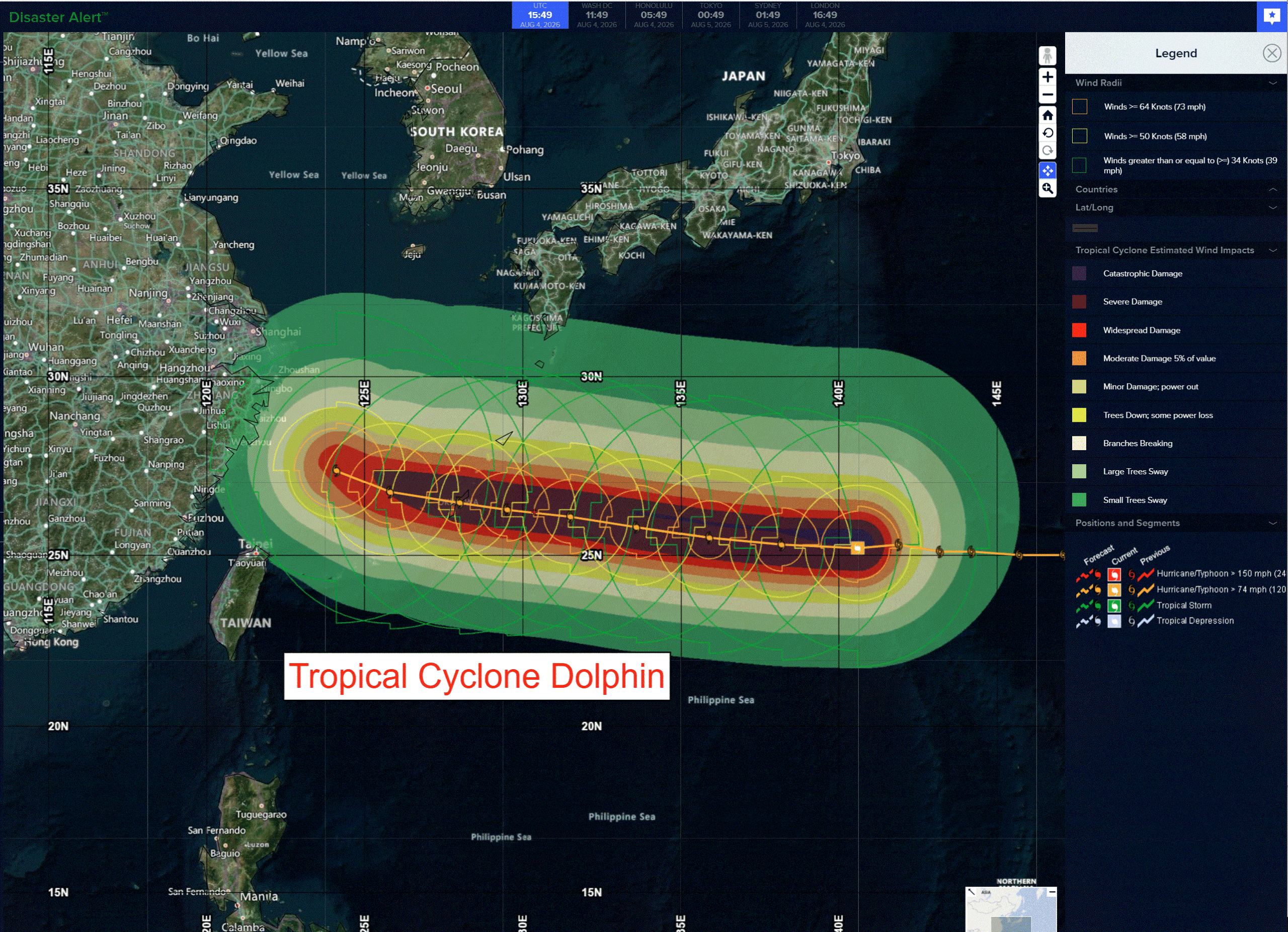
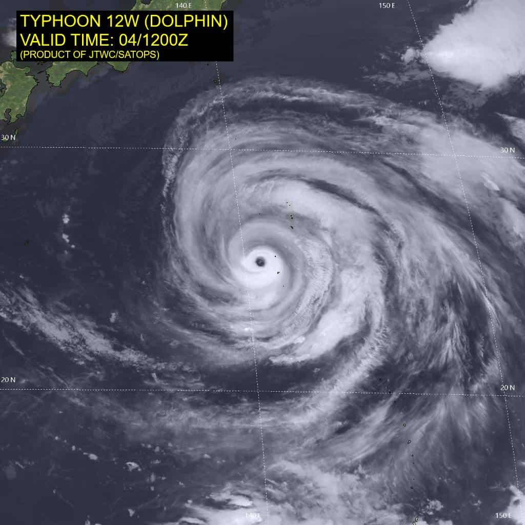
Tropical cyclone 12W (Dolphin)…is located approximately 695 NM east of Kadena AB
Tropical cyclone 13W (Kujira)…is located approximately 212 NM north of Manila, Philippines
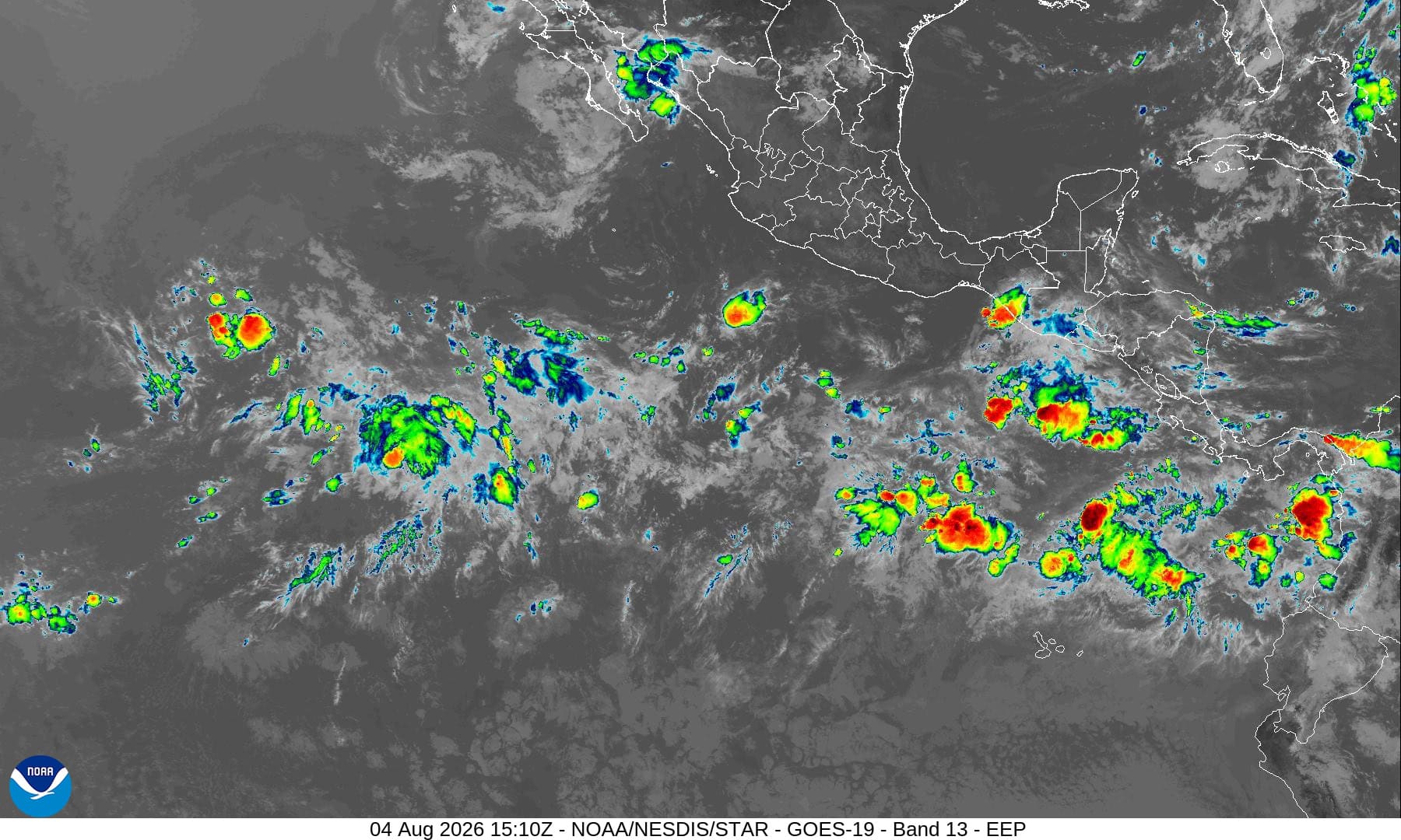
Northeast Pacific: There are no Tropical Cyclones
Tropical cyclone formation is not expected during the next 7 days.
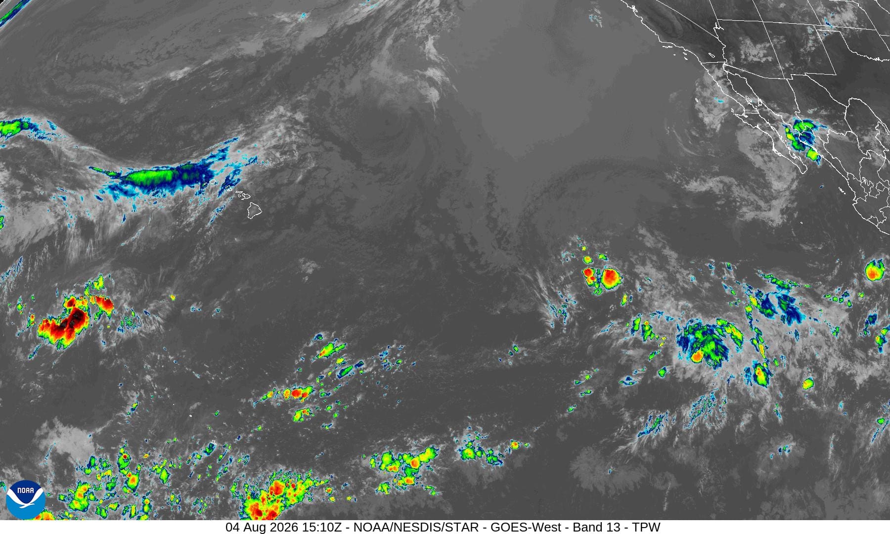
Central north Pacific: There are no Tropical Cyclones
Tropical cyclone formation is not expected during the next 7 days.
Western Pacific, Indian Ocean, and adjacent Seas:
Western Pacific
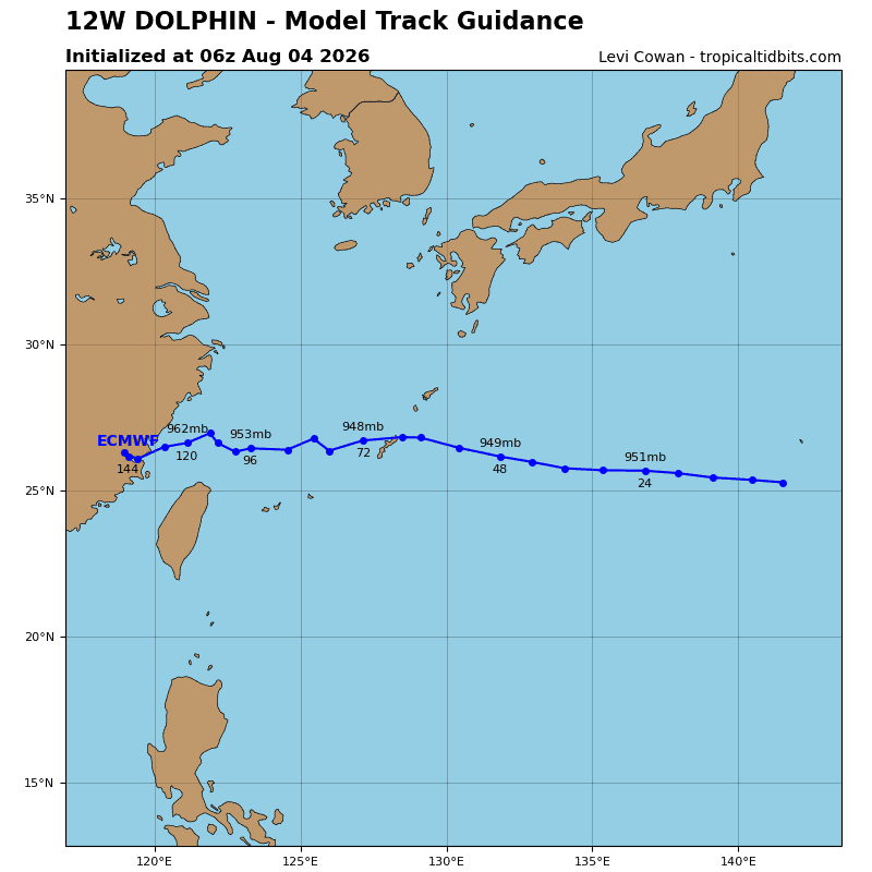
Tropical Cyclone 12W (Dolphin)
According to the JTWC warning number 35, sustained winds were 110 knots…with gusts to 135 knots
Typhoon (ty) 12W (Dolphin) continues to outperform expectations, maintaining a compact inner core of deep convection and a symmetric but thin eyewall and a 17nm wide eye feature. The eye is sufficiently
cloud-free to maintain a 17c eye temperature while multiple mesovortices are visible, even in the shortwave infrared (swir) loop. Relatively dry mid-level air is clearly entrained along the eastern side of the circulation, now wrapping around to the western flank, producing a clear moat feature. These features were becoming evident in a 040748z wsf-m 89ghz microwave image, along with a thinning and erosion of the northwestern eyewall, likely due to elevated northwesterly upper-level shear and some dry mid-level air in that quadrant.
A 040842z rcm-3 sar pass revealed a vmax (peak) of 115 knots, and a vmax (mean) of 106 knots, supporting the 0600z intensity estimate of 115 knots with high confidence. The sar also depicted a patch of lighter (40-50 knots) winds in the southeastern quadrant, which is backed up by the same feature in the 041152z ascat-b pass. Both sensors also indicated the continued expansion of the already very large wind field.
Environmental conditions remain overall favorable, characterized by strong radial outflow aloft and
low deep-layer shear. while ssts in the region are the highest of anywhere in the western north pacific, the warm layer is thin, with low ohc and the expansive wind field is inducing oceanic upwelling across a vast expanse. This is leading to an overall reduction in ssts near the core of the system and certainly in the eastern and northern portions, marginally offsetting the otherwise favorable conditions. Additionally, model-based soundings suggest a layer of enhanced (10-15 kts) northwesterly shear in the mid- to upper-levels.
TY 12w continues to exhibit occasional trochoidal motion, particularly after it passed over north Iwo To Island, briefly tracking west-southwestward before recently resuming a more west-northwestward track. the track made good over the past six hours has been just south of due west, at 12 knots, moving along the southern periphery of a deep-layer str which is centered anomalously north in the Sea of Japan. Even though trochoidal oscillations are expected to continue, the overall track will remain west-northwestward at a fairly steady 10-12 knots through 48 hours, with the system passing very close to Minami Daito Jima by this point in the forecast.
By 48 hours, a deep upper-level trough will move into northeastern Manchuria. The trough will continue moving eastward through the remainder of the forecast period. While it does not extend south beyond the Korean Peninsula, the trough will erode the str from the west and allow for development of a weakness in the ridge to develop over Korea. This will weaken the steering gradient, allowing ty 12W to slow as it approaches the Ryukyu Islands. Track speeds slow to just 4-5 knots after the system moves into the East China Sea. By the end of the forecast period, the system will begin a gradual turn towards the northwest as it begins to be steered by a building ridge over southern Japan. TY 12W is forecast to make landfall on Okinawa near 72 hours before moving into the East China Sea.
Regarding intensity, the system appears to have reached a steady state, achieving balance between competing environmental factors. The forecast calls for the system to weaken slightly over the next 12 hours and then maintain intensity through 36 hours before embarking on a stepwise weakening trend through landfall at Okinawa due primarily to marginally lower ssts from oceanic upwelling as well as a reduction in outflow aloft.
After 72 hours, the system will weaken more rapidly as it slows down and upwelling becomes more
significant. While the intensity is forecast to steadily decrease, the wind field conversely is expected to continue its expansion, with gale-force winds expected to cover an almost 600nm diameter swath of the East China Sea by 120 hours.
Tropical Cyclone 13W (Kujira)
According to the JTWC warning number 1, sustained winds were 30 knots…with gusts to 40 knots
Animated enhanced infrared (eir) satellite imagery depicts a poorly organized tropical depression with deep convection limited to the southwestern quadrant. Moderate northeasterly vertical wind shear is also apparent in the eir, pressuring the convection to the southwest and partially exposing low-level clouds associated with the low-level circulation center. An earlier 141339z ascat-b pass
revealed an elongated but closed llcc with the highest winds in the southeastern quadrant.
The environment is characterized as marginally favorable with warm sea surface temperatures being offset by weak outflow aloft and moderate vws.
Tropical depression (td) 13W (Kujira) has remained in a quasi-stationary position over the past 6 hours as it slowly consolidates. The track is forecast to remain mostly quasi-stationary over the next 12 hours as west-southwesterly monsoon flow forces td 13W eastward into Luzon. Landfall near Vigan is expected around 051600z.
The system is expected to briefly reach tropical storm status, aided by the southwest monsoon flow funneled by the west coast of Luzon. The system will rapidly decay once it makes landfall and is expected to dissipate over Luzon.
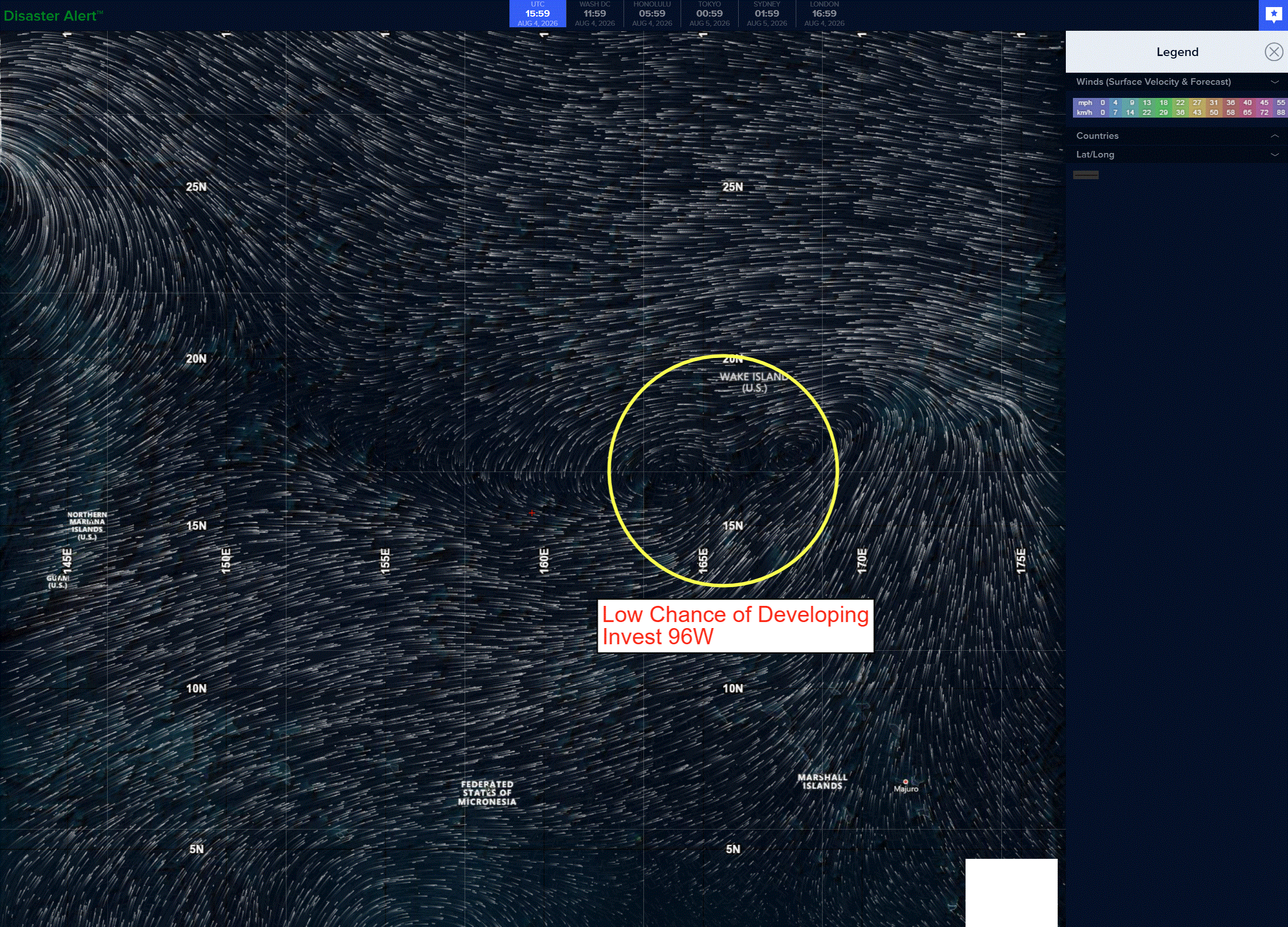
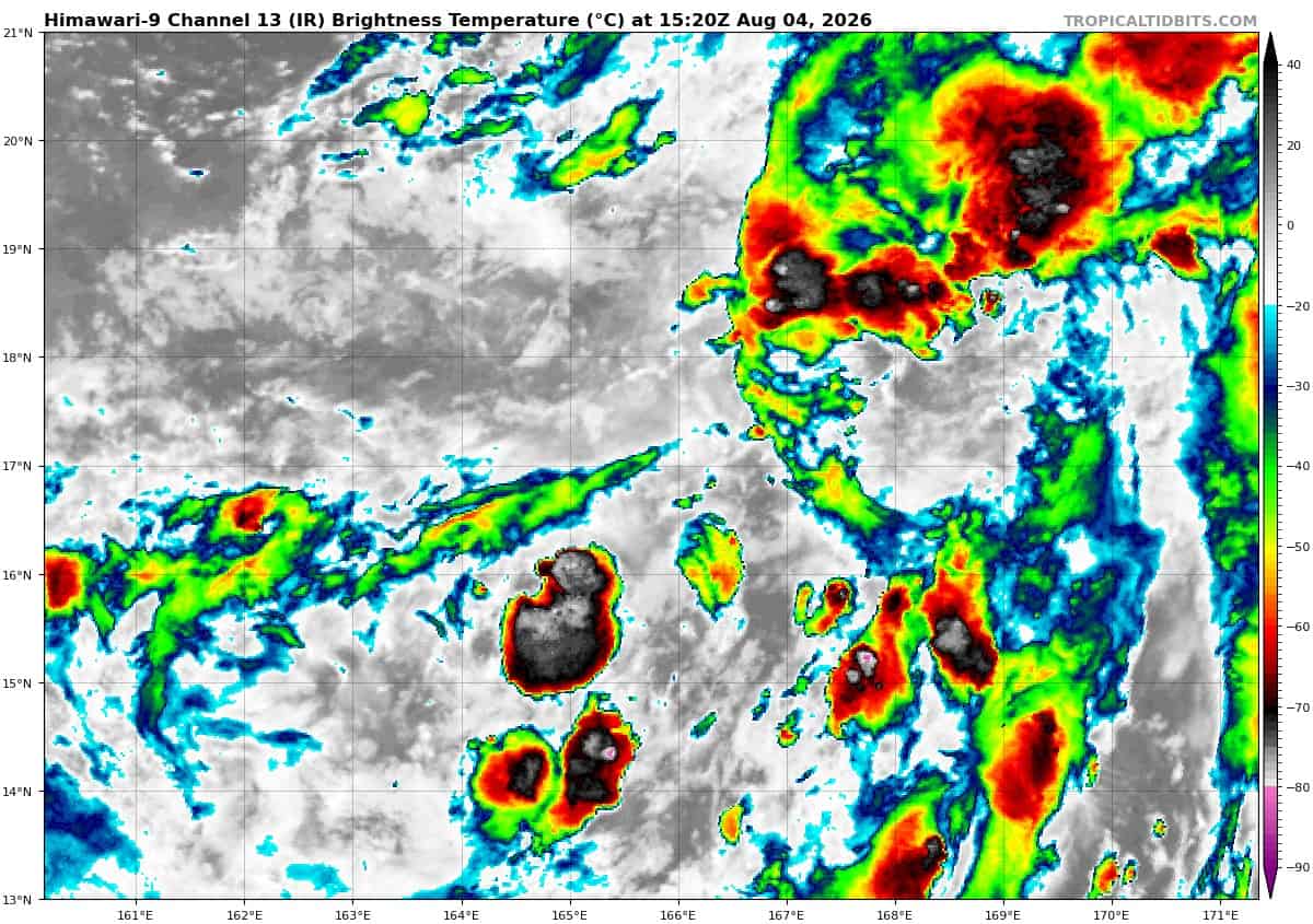
>>> There’s an area of disturbed weather that’s being referred to as Invest 96W, which is located approximately 134 NM south-southwest of Wake Island
Enhanced infrared imagery (eir) depicts a broad and very elongated region of troughing with developing low-level circulations (llc) positioned in the western end of the trough and in the northeastern portion, in the vicinity of Wake Island. A partial 040952z ascat-b pass showed sharp
cyclonic turning to the south of Wake Island but did capture the entire extent of the broad rotation.
Environmental analysis reveals favorable conditions are supportive of development with low vertical
wind shear (10-15kts), warm sea surface temperatures (29 to 30 c), and good poleward outflow. However, the window of opportunity for TC development is small, as global models depict the circulation moving under an upper-level trough and into a drier environment, which will support the transition of the system into a subtropical cyclone after about 36 hours.
Global models indicate the steady development of 96W into a broad, briefly tropical cyclone within the next 24 to 36 hours. Ensemble models also agree in the continued development of 96W and for it to take a general northward track over the next 48 hours.
Maximum sustained surface winds are estimated at 17 to 22 knots.
The potential for the development of a significant tropical cyclone within the next 24 hours is low.