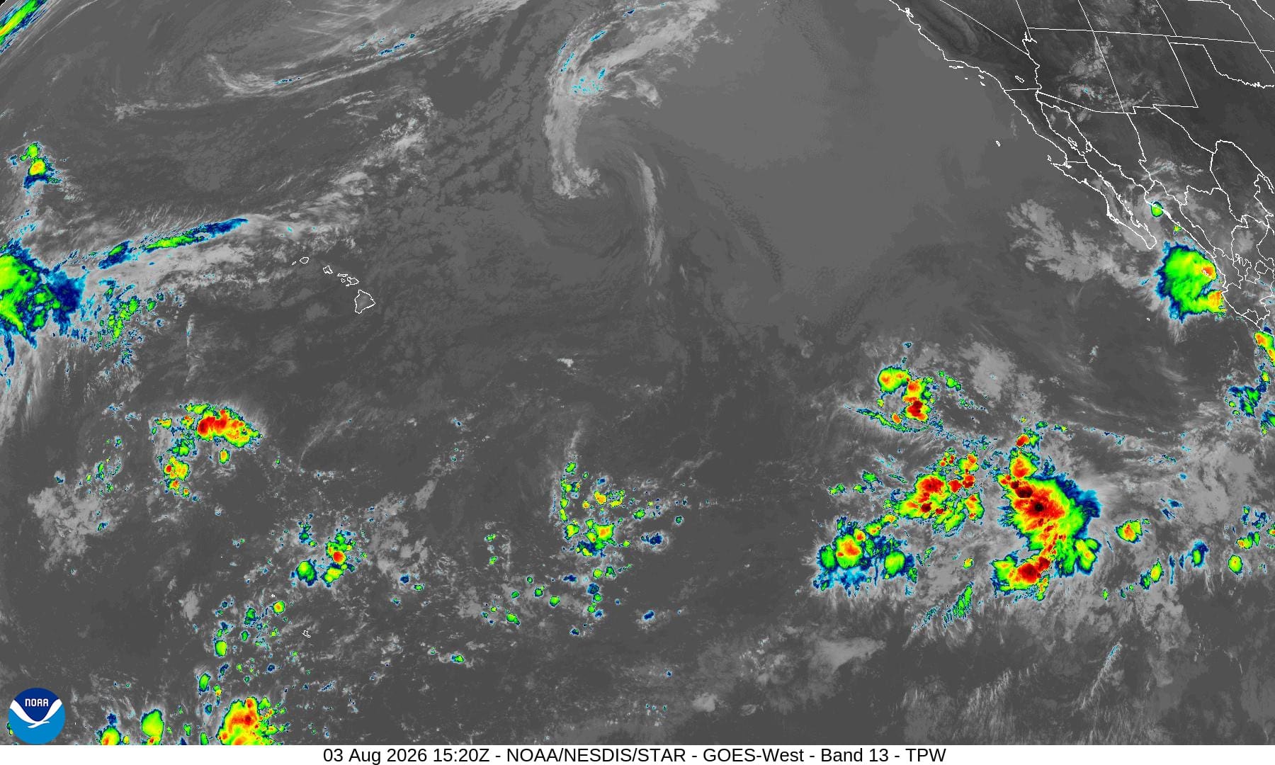
Central north Pacific: There are no Tropical Cyclones
Tropical cyclone formation is not expected during the next 7 days.


By PDC’s Senior Weather
Specialist Glenn James

The Pacific Disaster Center’s (PDC Global) Monday, August 3, 2026, Tropical Cyclone Activity Report…for the Pacific Ocean, the Indian Ocean, and adjacent Seas
Current Tropical Cyclones:
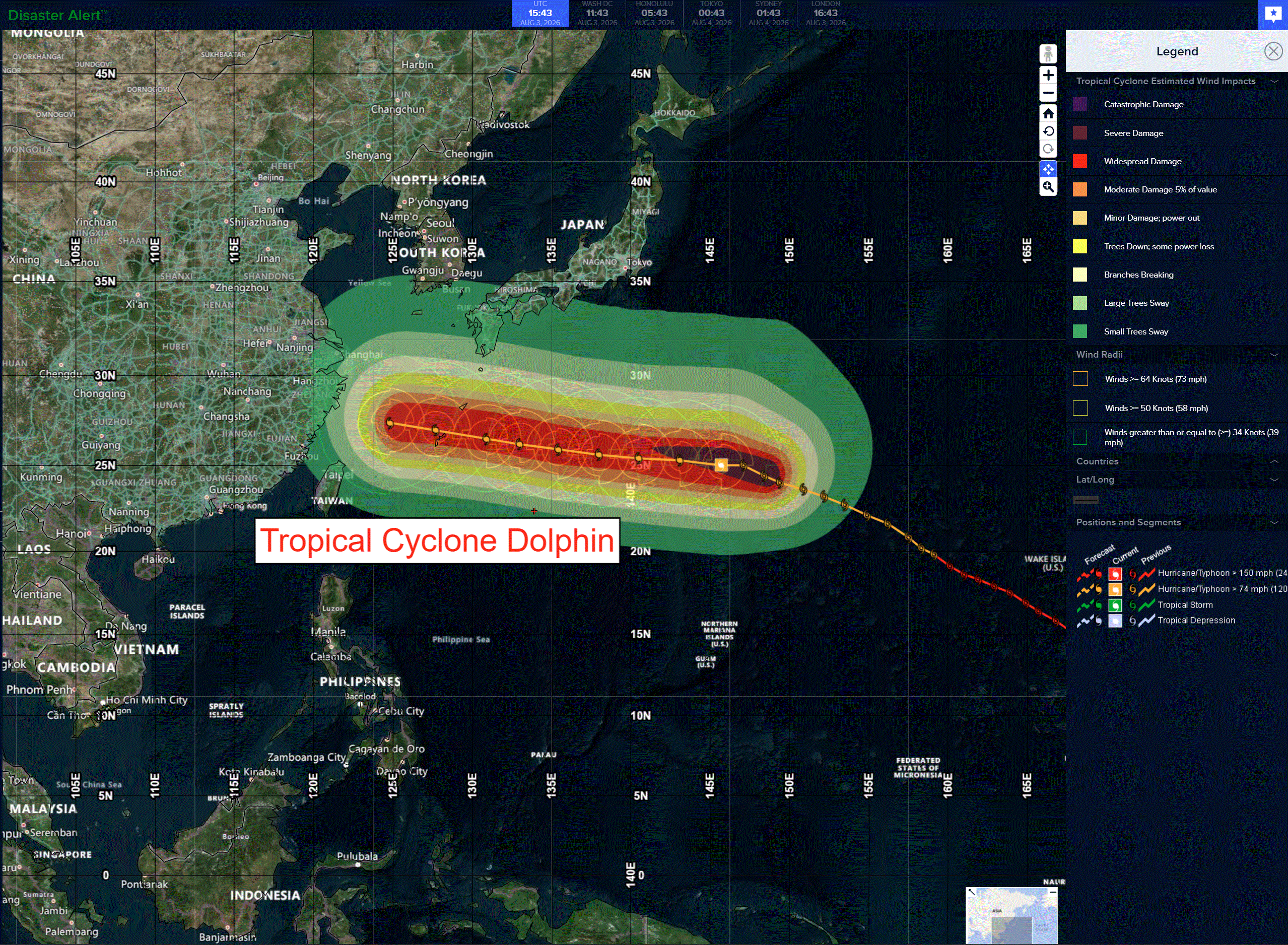
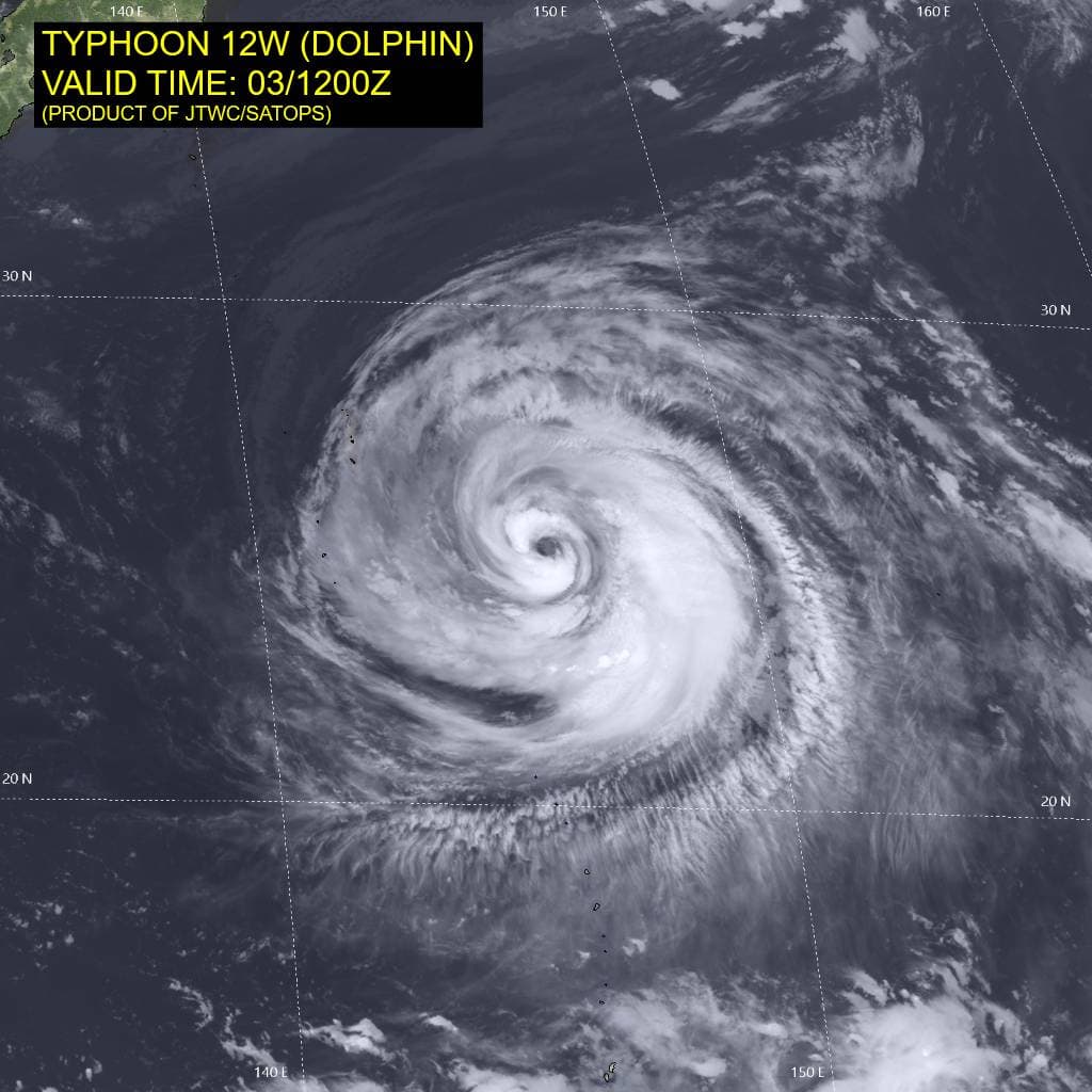
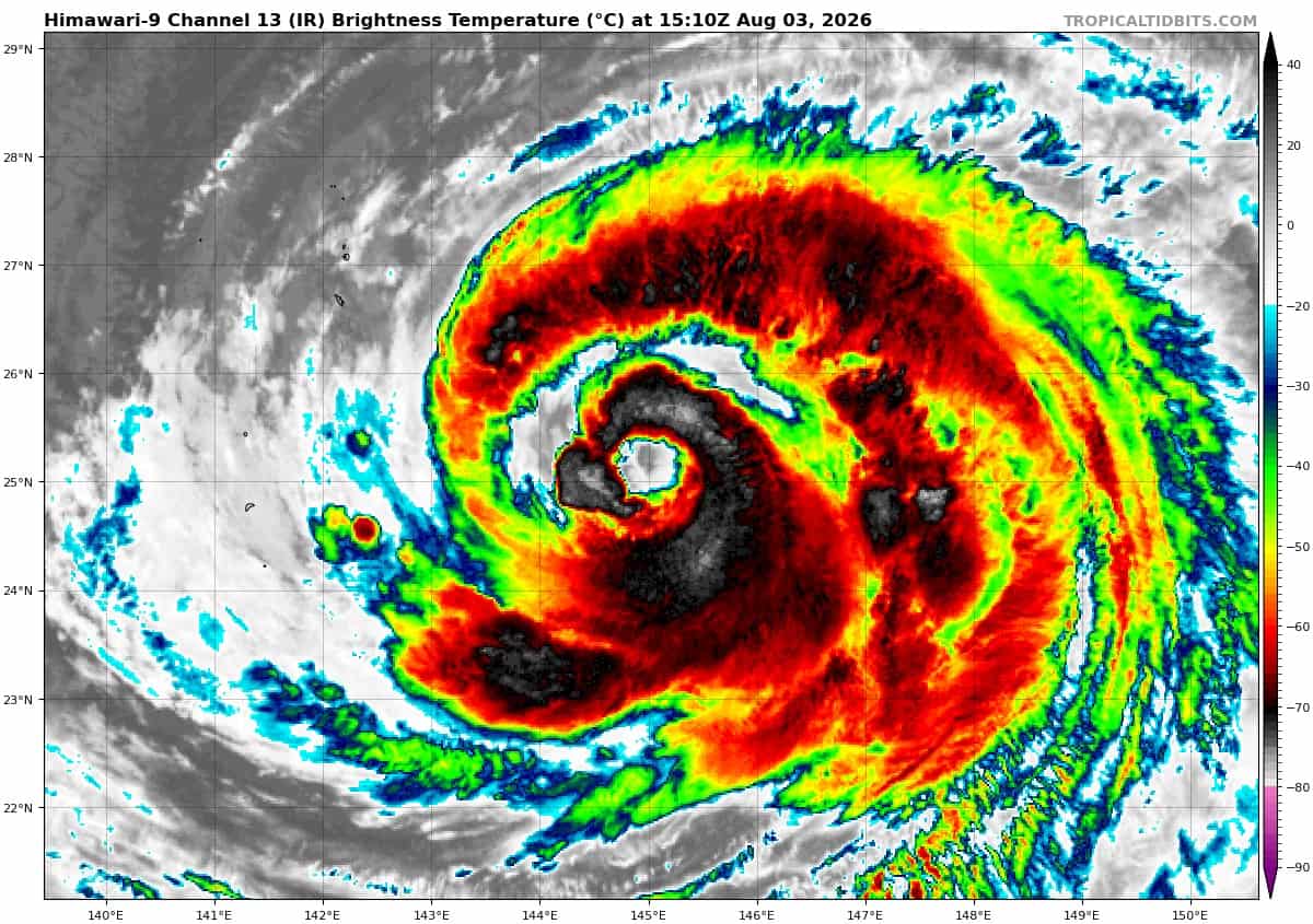
Tropical cyclone 12W (Dolphin)…is located approximately 836 NM east of Kadena AB
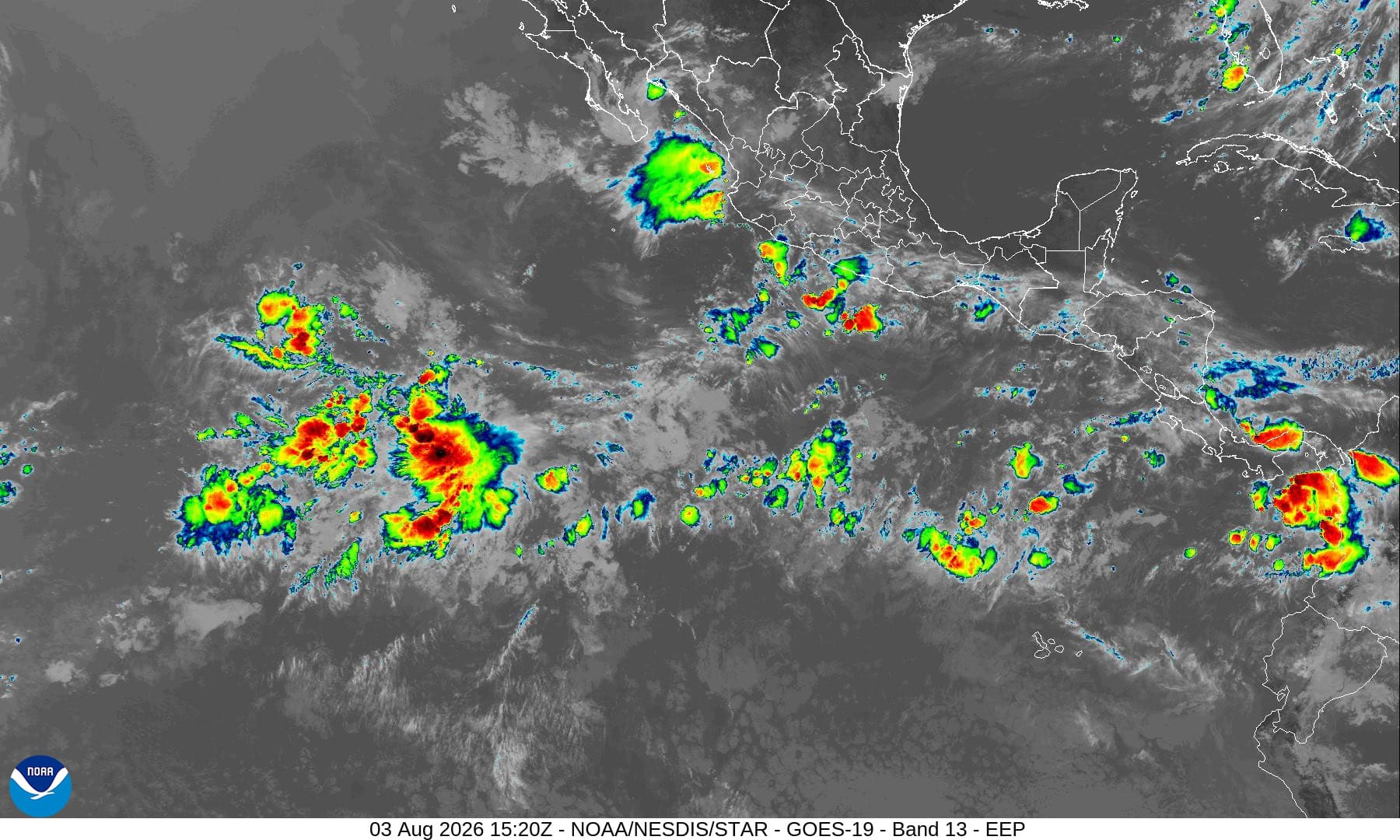
Northeast Pacific: There are no Tropical Cyclones
Tropical cyclone formation is not expected during the next 7 days.
Central north Pacific: There are no Tropical Cyclones
Tropical cyclone formation is not expected during the next 7 days.
Western Pacific, Indian Ocean, and adjacent Seas:
Western Pacific
Tropical Cyclone 12W (Dolphin)
According to the JTWC warning number 33, sustained winds were 100 knots…with gusts to 125 knots
Animated enhanced infrared (eir) satellite imagery depicts typhoon (ty) 12W struggling to complete its fourth eyewall replacement cycle (erc). The cloud shield is becoming increasingly sparce, and the inner eyewall is still identifiable but opening on the northern side. The outer eyewall looks no better defined than it did 6 hours ago, though the dry slot is getting larger and now envelops nearly the entire inner eye wall.
Animated eir also reveals the coldest deep convection is now restricted to the eastern semicircle. The
environment remains favorable, characterized by low (10-15 kts) vertical wind shear (vws), warm (29-30 c) sea surface temperatures (sst), and good divergence aloft.
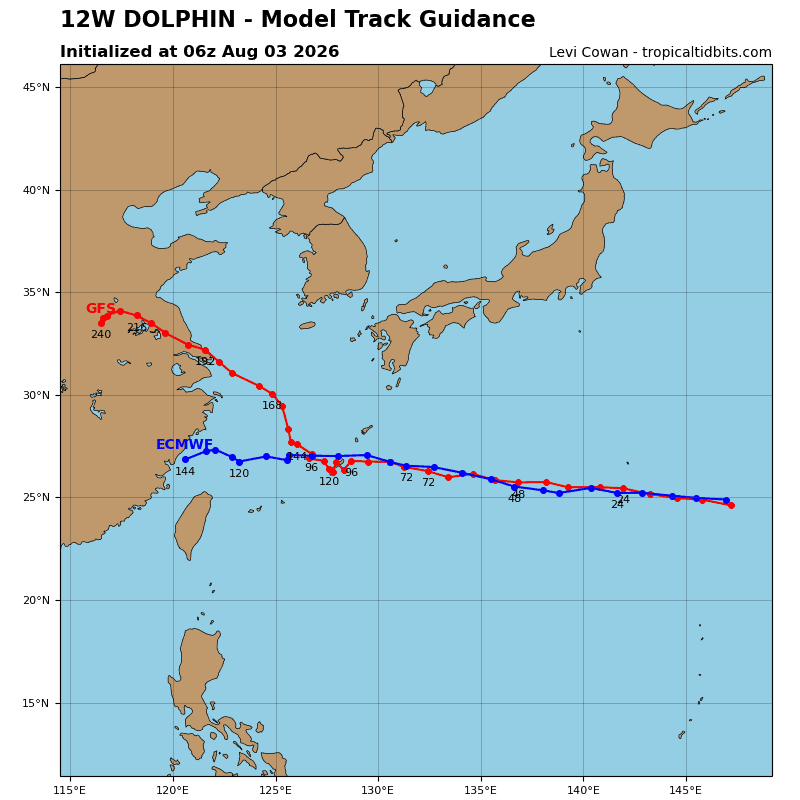
TY 12W (Dolphin) is forecast to continue tracking along the southwestern extension of the str centered far to the northeast. within the next 12-24 hours, the steering influence will shift to a second str currently centered over the Korean Peninsula. 12W will then track west-northwestward along the
southern periphery of that ridge through the end of the forecast period.
Between 72-120 hours, 12W may encounter a weaker steering environment as a deep-layer trough passes north of the steering ridge and weakens it, thereby reducing the steering gradient and potentially slowing Dolphin’s speed of advance.
Regarding intensity, 12W is forecast to maintain a relatively steady intensity throughout the forecast period. Dolphin is expected to weaken slightly over the next 12 hours as the erc continues, then sustain an intensity of approximately 85 kts through 96 hours and weaken slightly after that, with the 10-15 kts of vws expected to reduce to 5-10 kts after about 24 hours and the ohc values dropping slightly around 60-72 hours. as a result, the primary driver of weakening in the near term forecast is the erc.
In the likely scenario that dolphin fails to complete the ongoing erc, it would accelerate the rate of weakening and compound the negative effects of lower ohc. tThe eye and wind field will remain quite large through 120 hours, bringing impacts to the entirety of the Japanese Ryukyu Islands regardless of center position.
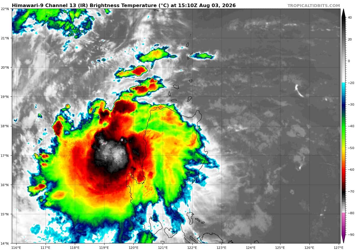
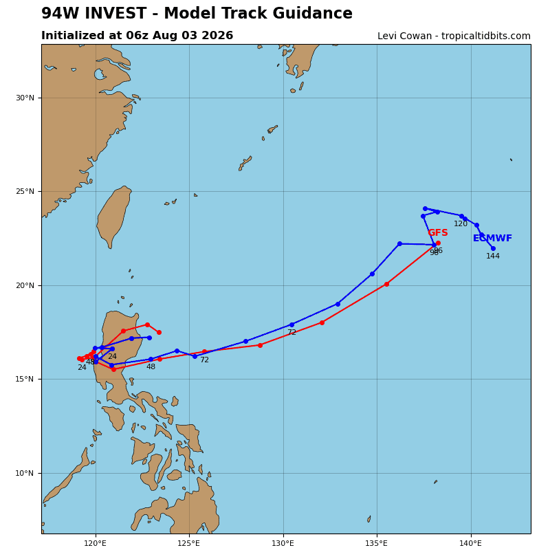
>>> There’s an area of disturbed weather that’s being referred to as Invest 94W, which is located approximately 63 NM southwest of Vigan
animated multi-spectral satellite imagery (msi) reveals an obscured low level circulation center (llcc) that tracked under deep convection after it made landfall in Luzon.
Environmental analysis reveals highly unfavorable conditions for tropical cyclone development characterized by land interaction, high vertical wind shear (greater than 30 knots), and significant dry air along the eastern periphery, as well as elevated gradient flow to the south caused by inflow into typhoon 12W (Dolphin) and elevated gradient flow to the west from funneling effects in the Luzon Strait.
Maximum sustained surface winds are estimated at 17 to 22 knots.
The potential for the development of a significant tropical cyclone within the next 24 hours remains medium.