

Current Snapshot
For all the latest updates visit: DisasterAWARE
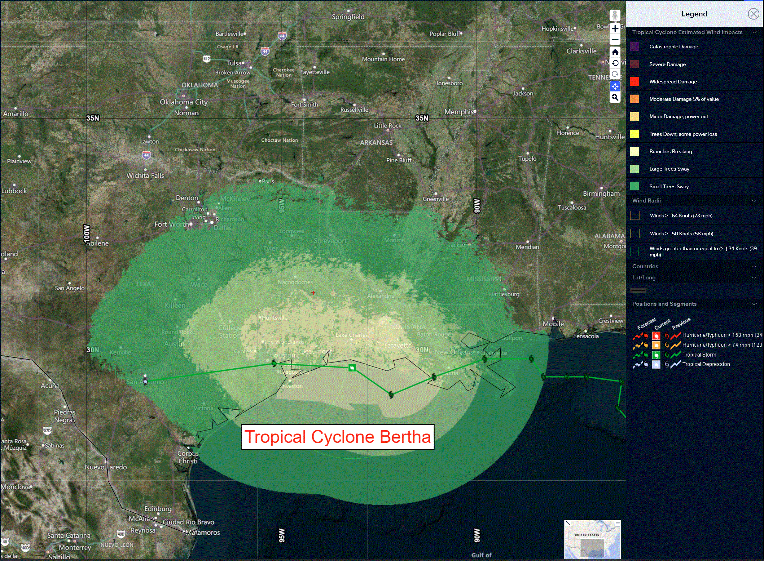
bertha
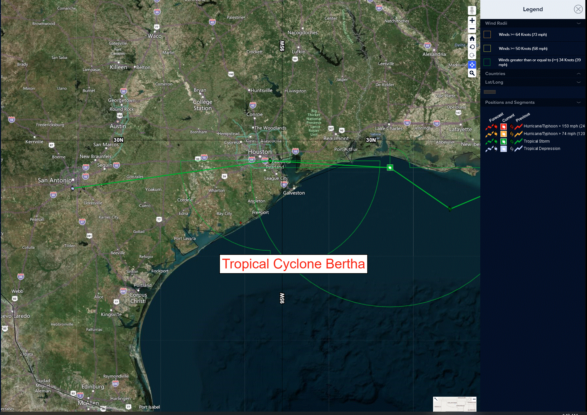
close
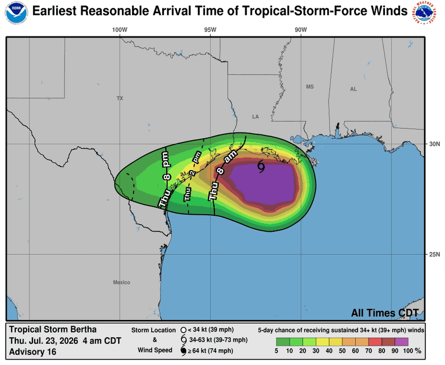
231437_earliest_reasonable_toa_34bertha
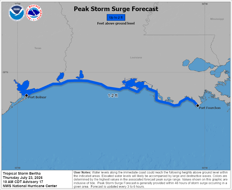
231437_peak_surge
rain

flash
1000×1000
02L_tracks_latest
By PDC’s Senior Weather
Specialist Glenn James

The Pacific Disaster Center’s (PDC Global) Thursday, July 23, 2026, Tropical Cyclone Activity Report…for the Atlantic Ocean, the Caribbean Sea, and the Gulf of America
Current Tropical Cyclones:
Tropical Cyclone 02L (Bertha)…is located 100 miles southwest of Lake Charles, Louisiana
Atlantic Ocean: There are no active tropical cyclones
Tropical cyclone formation is not expected during the next 7 days.
Caribbean Sea: There are no active tropical cyclones
Tropical cyclone formation is not expected during the next 7 days.
Gulf of America:
Tropical Cyclone 02L (Bertha)
BERTHA MOVING WESTWARD VERY NEAR THE SOUTHWESTERN LOUISIANA COAST …EXPECTED TO REACH THE TEXAS COAST LATER TODAY
According to the NHC Advisory number 17
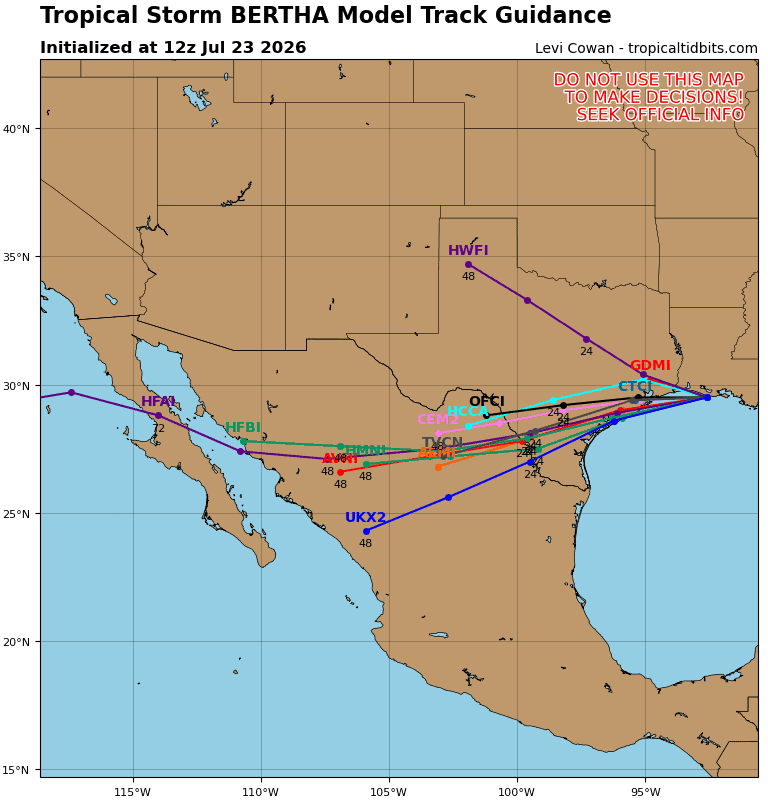
Bertha is moving toward the west near 10 mph (17 km/h) and this motion with some increase in forward speed is expected during the next day or so. On the forecast track, the center of Bertha will move near or along the Louisiana and upper Texas coasts during the next several hours, and then move inland over Texas this evening.
Maximum sustained winds remain near 45 mph (75 km/h) with higher gusts. Little change in strength is expected today, and Bertha is forecast to maintain tropical storm intensity until it reaches the upper Texas coast later today.
The system is expected to dissipate inland over Texas late tonight or Friday. Tropical-storm-force winds extend outward up to 160 miles (260 km) from the center. The minimum central pressure based on data from the Air Force Reserve reconnaissance aircraft is 1004 mb (29.65 inches).
HAZARDS AFFECTING LAND
WIND: Tropical storm conditions will continue spreading across portions of the northern and northwestern Gulf Coast within the warning area through today.
STORM SURGE: The combination of storm surge and the tide will cause normally dry areas near the immediate coast to be flooded by rising waters moving inland from the shoreline. The water could reach the following heights above ground somewhere in the indicated areas if the peak surge occurs at the time of high tide…
Port Bolivar, TX to Port Fourchon, LA…1-2 ft
The deepest water will occur along the immediate coast. Surge-related flooding depends on the relative timing of the surge and the tidal cycle, and can vary greatly over short distances.
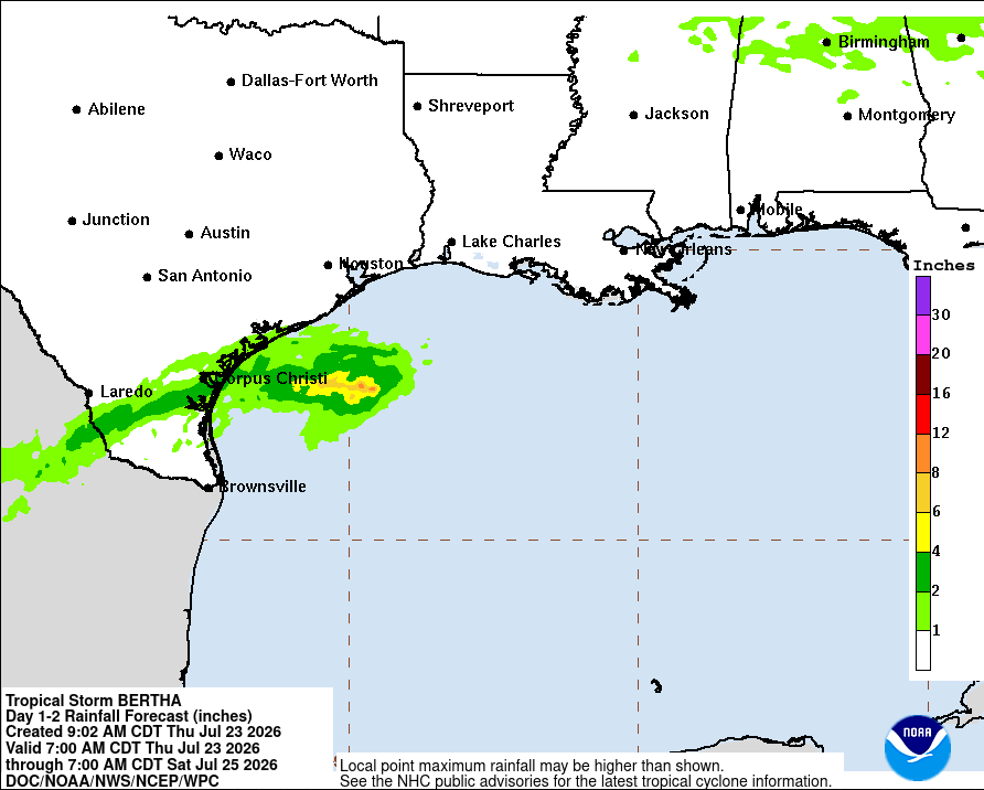
RAINFALL: Bertha is expected to produce total rainfall amounts of 2 to 4 inches with isolated totals to 6 inches through Thursday night along Texas Gulf Coast and South Texas. This rainfall may produce isolated flash flooding, especially in urban areas.
SURF: Swells generated by Bertha will continue spreading westward along the northern and northwestern Gulf Coast. These swells are likely to cause life-threatening surf and rip current conditions.