

Current Snapshot
For all the latest updates visit: DisasterAWARE
02a
02a2
201448_earliest_reasonable_toa_34
201448WPCQPF_sm
tt
GOES19-GA-13-1000×1000
02L_tracks_latest
By PDC’s Senior Weather
Specialist Glenn James

The Pacific Disaster Center’s (PDC Global) Monday, July 20, 2026, Tropical Cyclone Activity Report…for the Atlantic Ocean, the Caribbean Sea, and the Gulf of America
Current Tropical Cyclones:
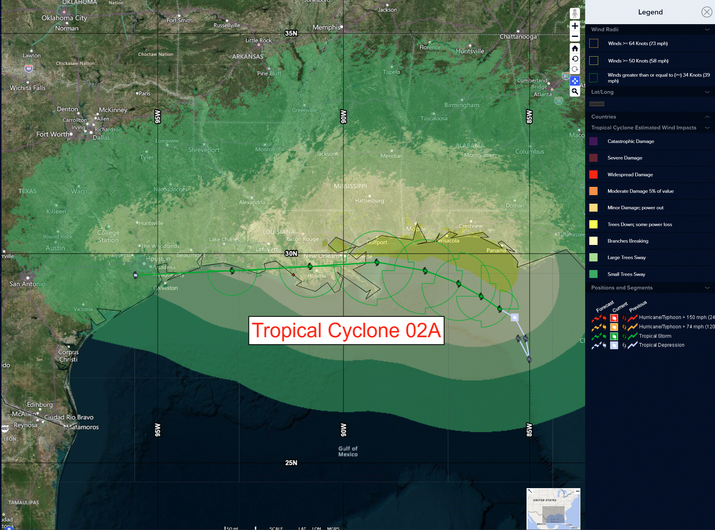
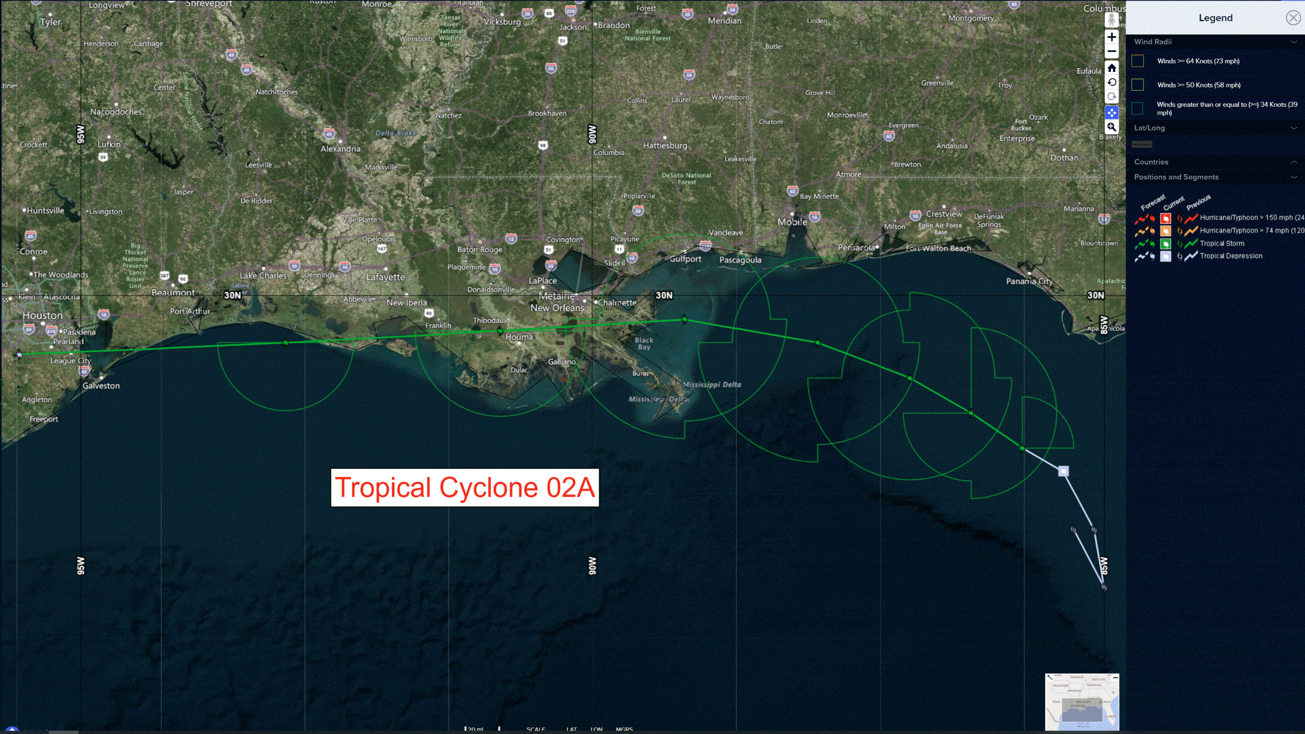
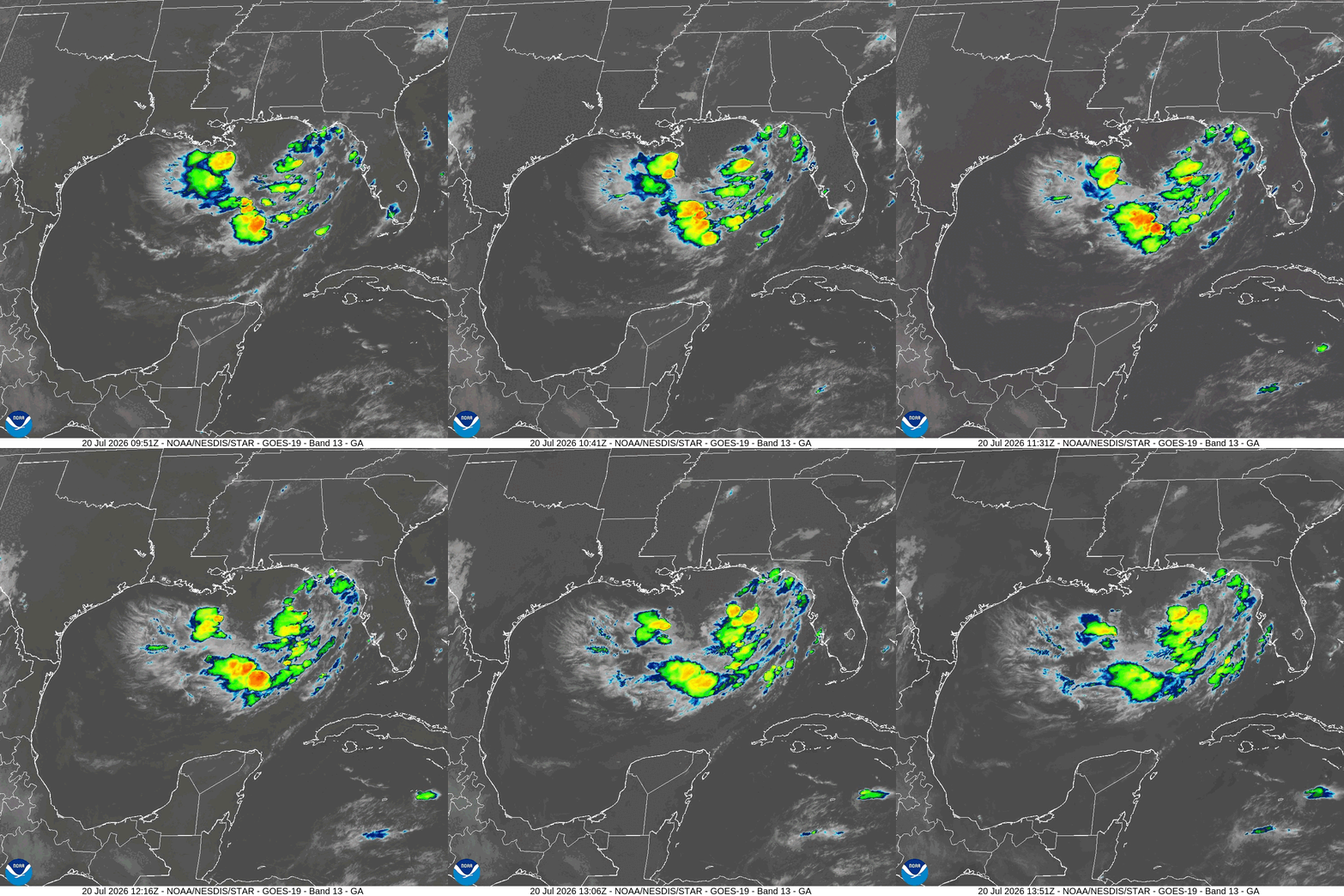
Tropical Cyclone 02A (Bertha)…is located 110 miles south of Panama City, Florida
Atlantic Ocean: There are no active tropical cyclones
Tropical cyclone formation is not expected during the next 7 days.
Caribbean Sea: There are no active tropical cyclones
Tropical cyclone formation is not expected during the next 7 days.
Gulf of America:
Tropical Cyclone 02A (Bertha)
NOAA HURRICANE HUNTERS FIND THAT THE DEPRESSION HAS STRENGTHENED INTO TROPICAL STORM BERTHA
According to the NHC Advisory number 6A
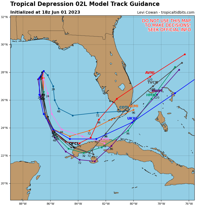
Bertha has been drifting erratically near 3 mph (6 km/h), but a northwestward motion is expected tonight and Tuesday morning, followed by a west-northwestward or westward motion. On the forecast track, Bertha will move near or along the northern Gulf coast during the next several days. Maximum sustained winds have increased to near 40 mph (65 km/h) with higher gusts. Some additional strengthening is possible during the next day or so. Tropical-storm-force winds extend outward up to 70 miles (110 km) from the center.
HAZARDS AFFECTING LAND
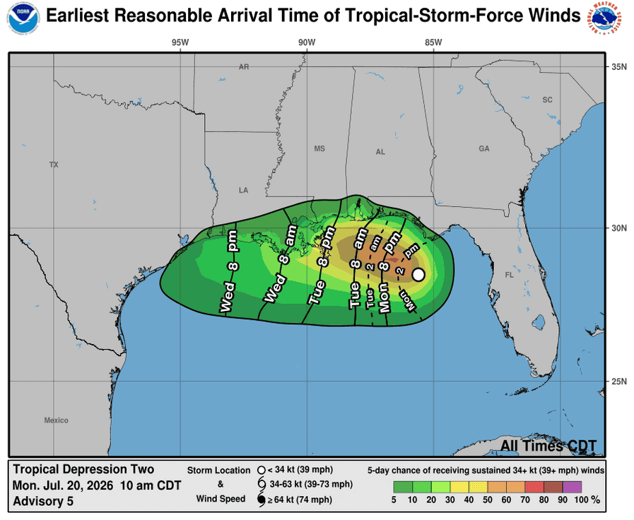
WIND: Tropical storm conditions are possible within the watch area in the Florida Panhandle by late tonight into Tuesday. Tropical storm conditions are possible within the remainder of the watch area by late Tuesday night into Wednesday.
STORM SURGE: The combination of storm surge and the tide will cause normally dry areas near the immediate coast to be flooded by rising waters moving inland from the shoreline. The water could reach the following heights above ground somewhere in the indicated areas if the peak surge occurs at the time of high tide…
Mouth of the Mississippi River, LA to AL/FL Border…2-4 ft Indian Pass, FL to Chassahowitzka, FL…1-3 ft Morgan City, LA to Mouth of the Mississippi River, LA…1-3 ft Lake Pontchartrain…1-3 ft
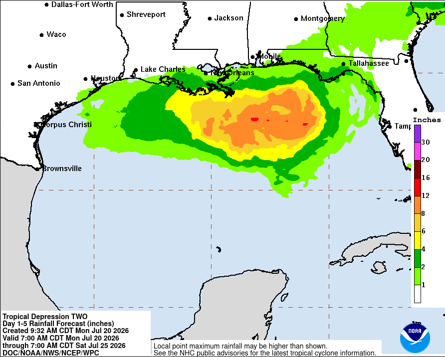
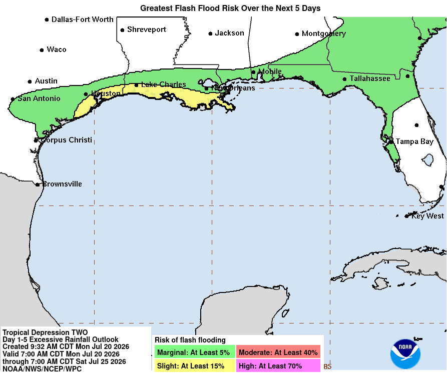
RAINFALL: The tropical depression is expected to produce rainfall amounts of 2 to 4 inches with locally higher totals around 6 inches through Friday along the Gulf Coast and adjacent inland locations from western Florida to the Middle Texas Coast, including southern portions of Alabama, Mississippi, and Louisiana. This rainfall may produce areas of flash flooding, especially in urban areas.
TORNADOES: An isolated tornado or two are possible over the Florida Big Bend region today.
SURF: Swells generated by the depression are affecting portions of the Gulf coast of Florida and are likely to spread westward during the week. These swells are likely to cause life-threatening surf and rip current conditions.