The Pacific Disaster Center’s (PDC Global) Monday, July 13, 2026, Tropical Cyclone Activity Report…for the Pacific Ocean, the Indian Ocean, and adjacent Seas
Current Tropical Cyclones:
There are no Tropical Cyclones
Northeast Pacific: There are no active tropical cyclones
>>> Offshore of Southwestern Mexico:
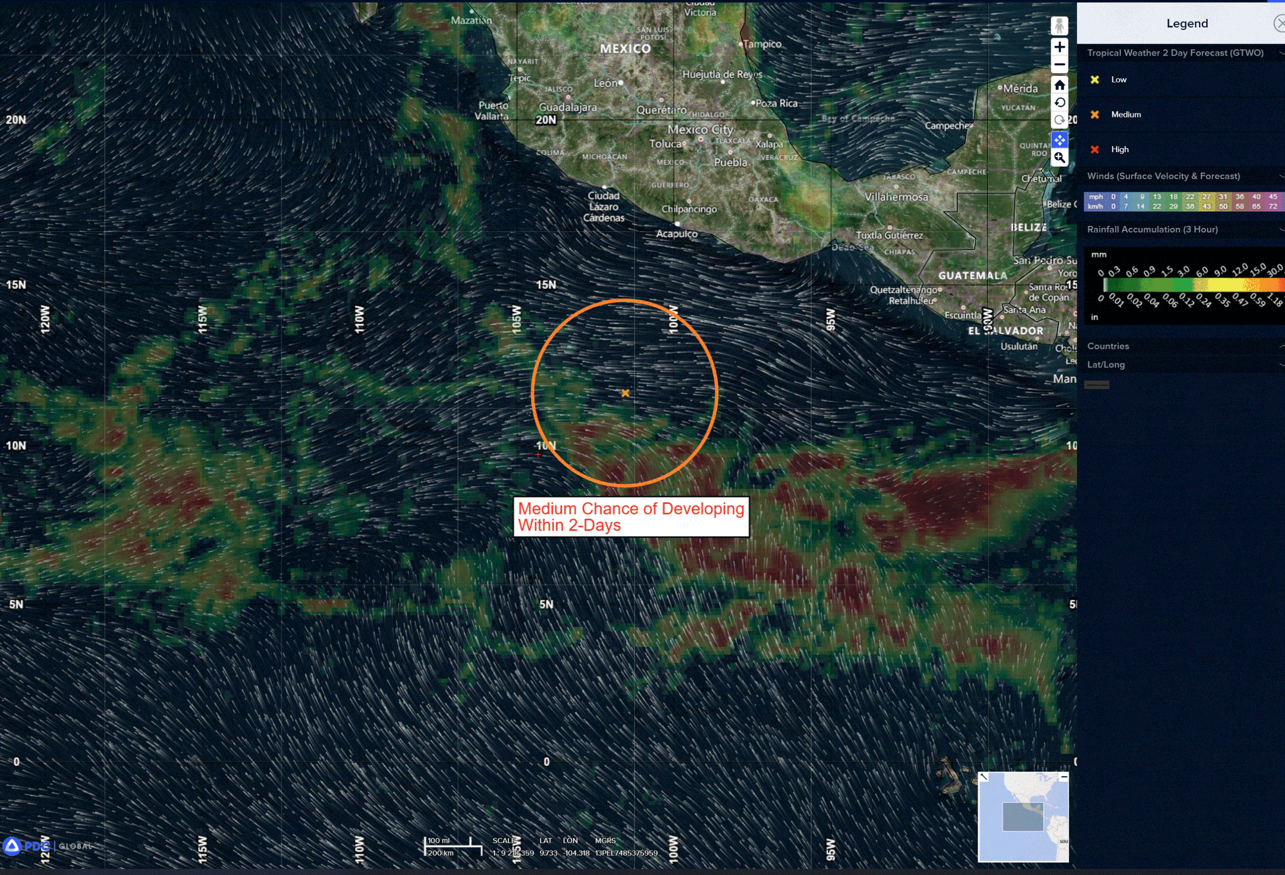
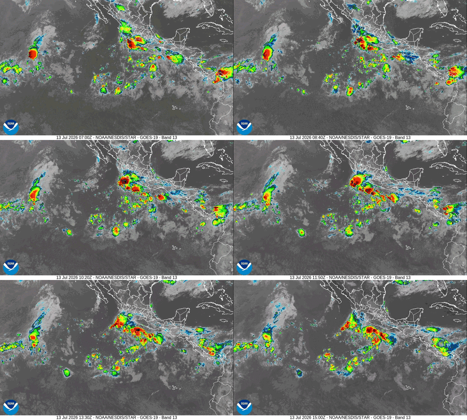
A tropical wave is producing a large area of disorganized thunderstorms and gusty winds a couple of hundred miles south of the coast of southwestern Mexico. Environmental conditions appear favorable for continued development, and a tropical depression is expected to form over the next couple of days while the system moves generally west-northwestward, staying offshore the coast of Mexico.
* Formation chance through 48 hours…high…80 percent
* Formation chance through 7 days…high…90 percent
>>> Offshore of Southern and Southwestern Mexico:
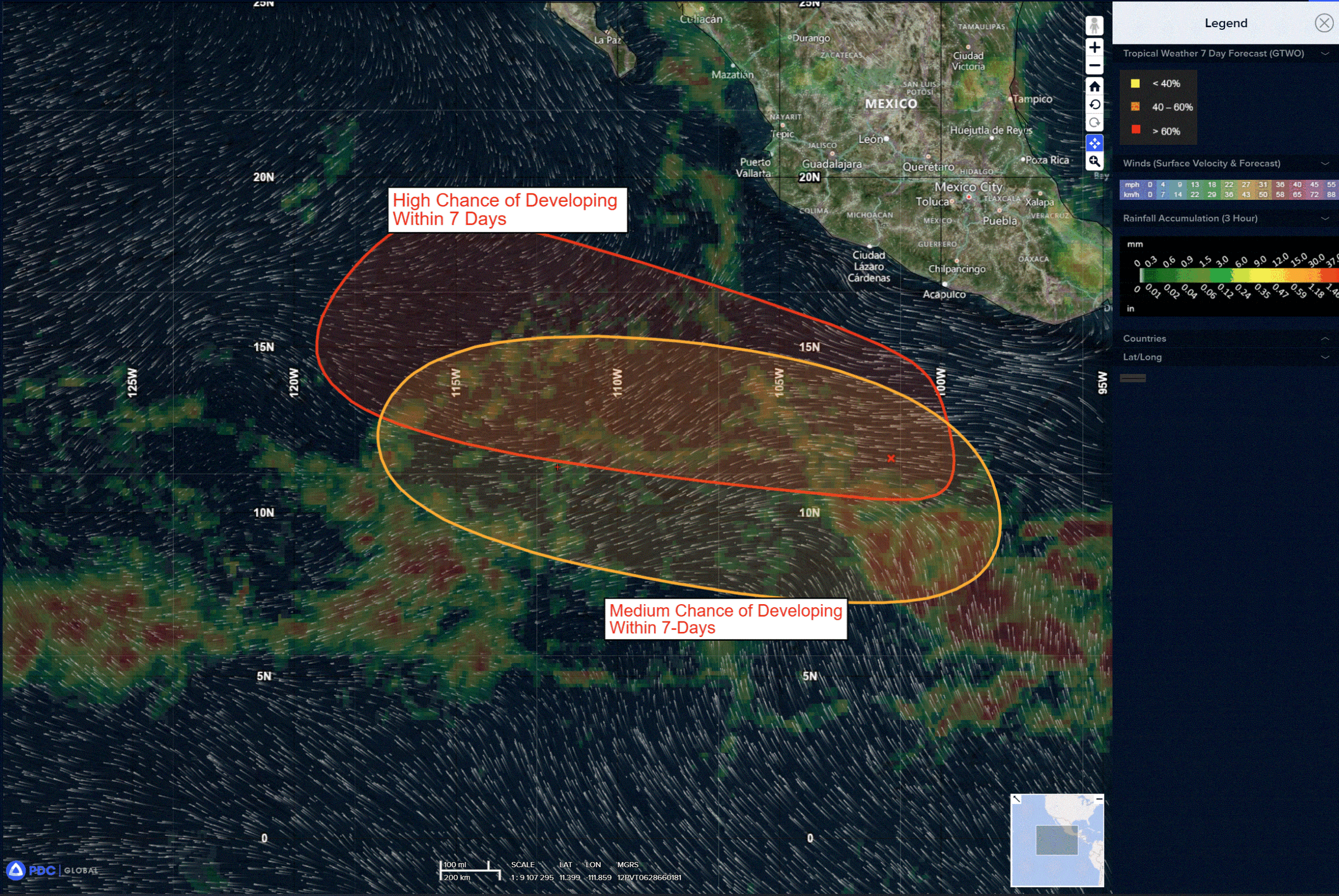
An area of low pressure is expected to form by the middle of the week several hundred miles south of the coast of southern Mexico. Environmental conditions appear conducive for gradual development of this system thereafter, and a tropical depression could form by the end of the weekend while it moves generally west-northwestward well offshore of Mexico.
* Formation chance through 48 hours…low…near 0 percent
* Formation chance through 7 days…medium…60 percent
Here’s the link to the National Hurricane Center (NHC)
Central Pacific: There are no active tropical cyclone
>>> Well South of the Hawaiian Islands:
Invest 91C
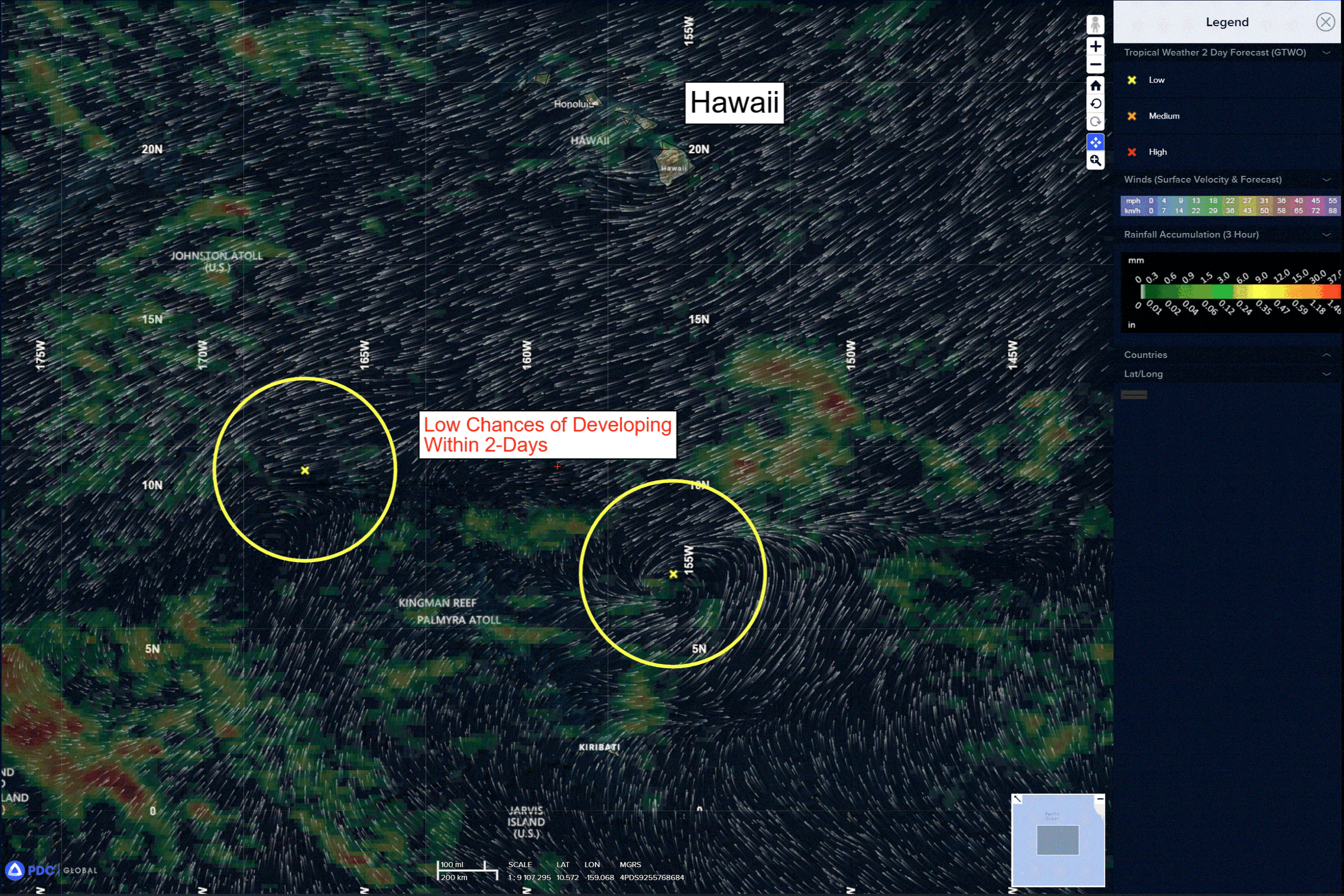
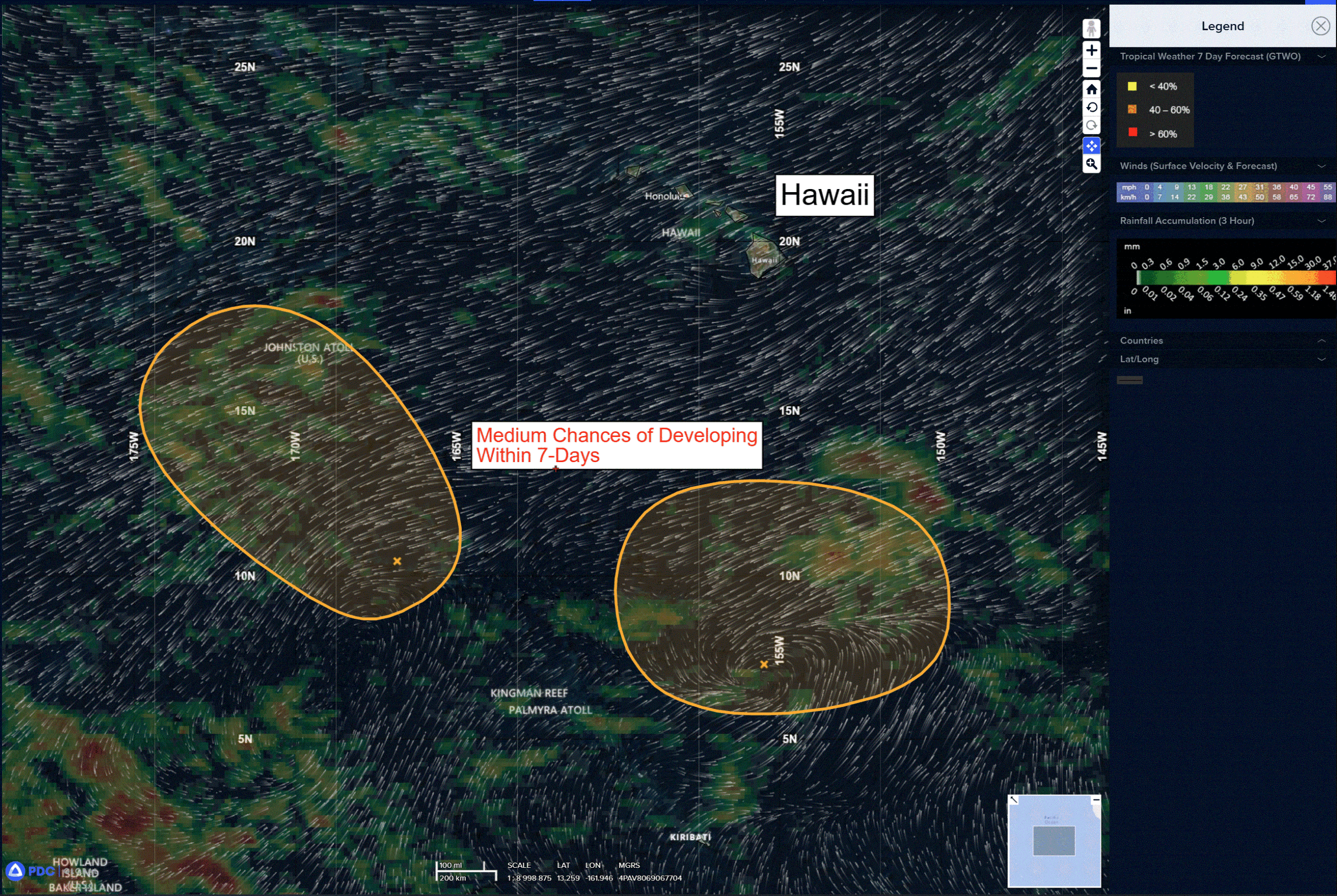
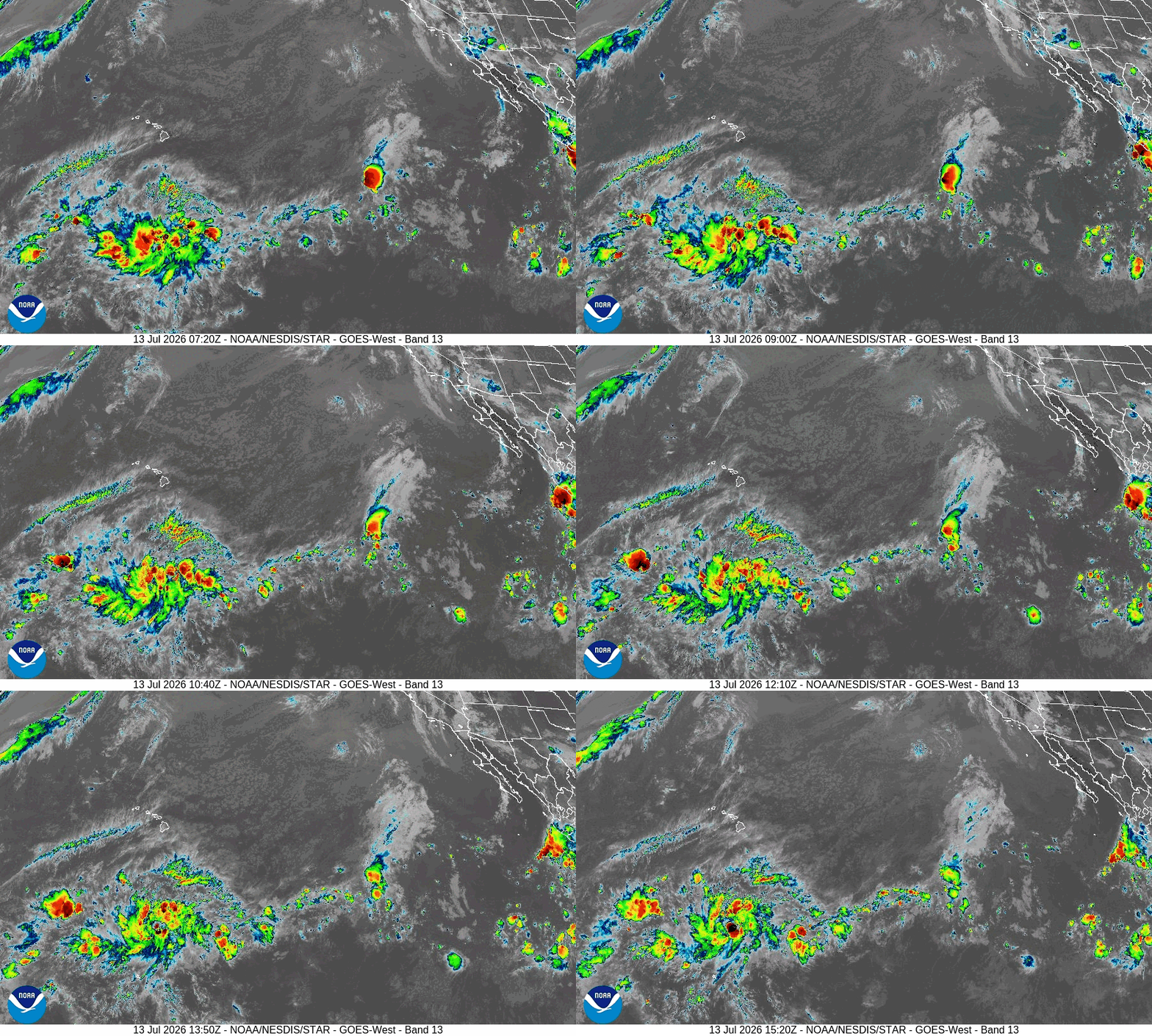
Showers and thunderstorms have been persisting near the center of a broad area of low pressure located several hundred miles south of the Hawaiian Islands. Recent satellite-derived wind data indicate that the system is producing a small area of near gale-force winds, mainly in gusts, over its southeastern side. However, the system lacks a well-defined surface circulation. If the circulation becomes better defined, a tropical depression or tropical storm could form over the next day or two while the system moves little. The disturbance is expected to move into less favorable environmental conditions later this week, likely ending the chances of development.
* Formation chance through 48 hours…high…70 percent
* Formation chance through 7 days…high…70 percent
>>> Well Southwest of the Hawaiian Islands:
Invest 90C
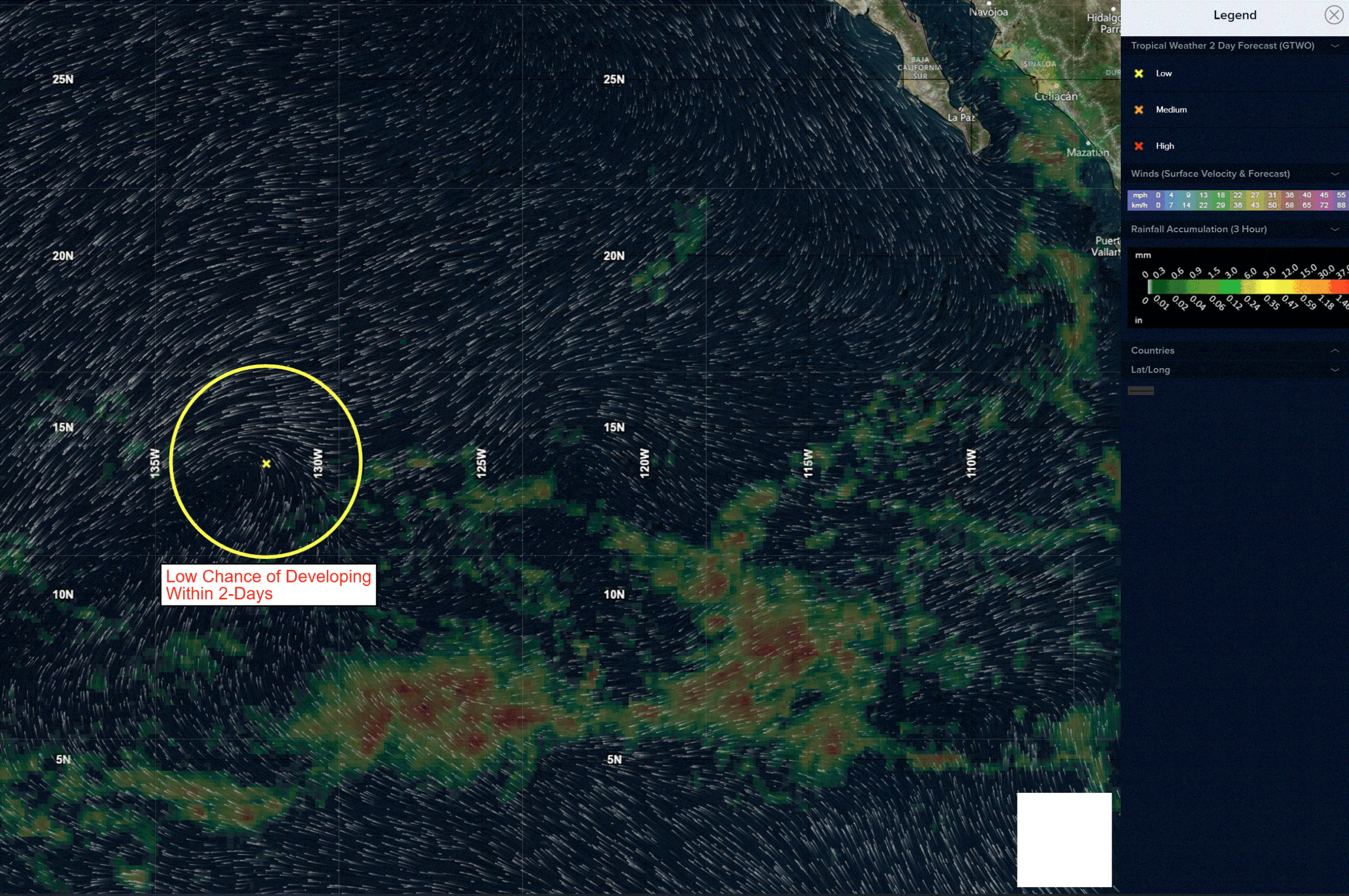
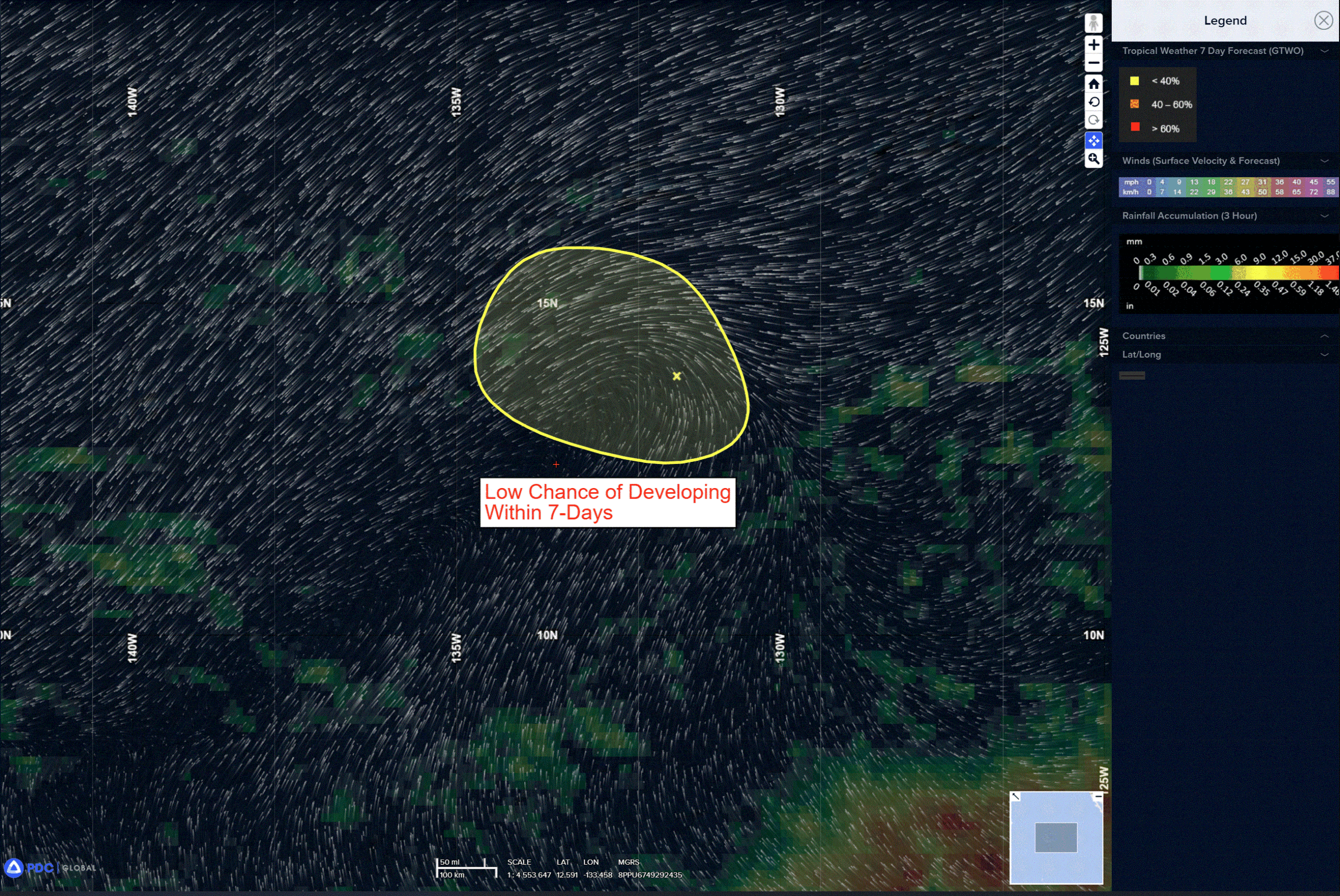
A trough of low pressure located several hundred miles to the southwest of the Hawaiian Islands continues to produce an area of disorganized showers and thunderstorms. Environmental conditions appear favorable for gradual development, and it could become a tropical depression later in the week as it moves slowly northwestward, remaining well southwest of the Hawaiian Islands.
* Formation chance through 48 hours…low…30 percent
* Formation chance through 7 days…medium…50 percent
Western Pacific, Indian Ocean, and adjacent Seas:
Western Pacific
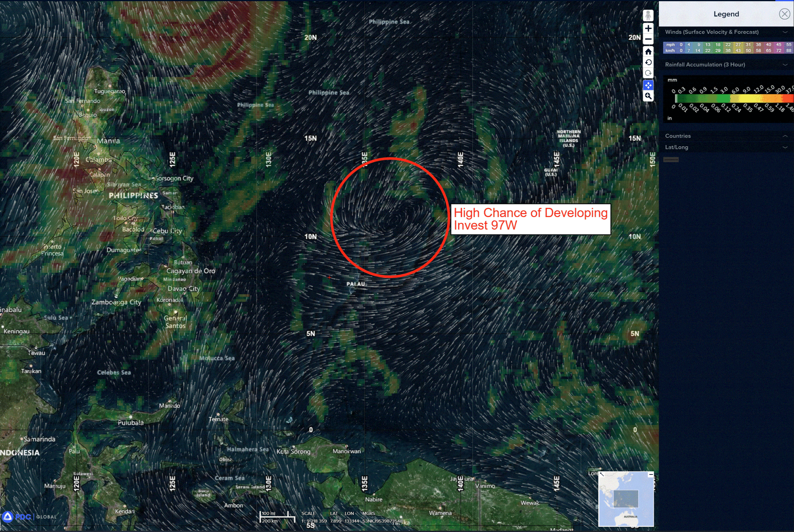
>>> There’s an area of disturbed weather being referred to as Invest 97W, which is located approximately 110 NM northwest of Yap
Animated multi-spectral satellite imagery (msi) depicts a mostly obscured, elongated and relatively disorganized low-level circulation (llc) with flaring convection primarily focused on the western flank. A 130006z ascat pass depicts the elongated circulation with a swath of 25 kt winds to the south of the center and pockets of 20kt winds to the northeast and southwest.
Environmental analysis reveals a favorable environment for development with moderate
poleward and equatorward upper-level outflow, low to moderate vertical wind shear (15-20 kts), and warm sea surface temperatures (29-30 c).
Global models show 97W tracking generally northwestward as it rapidly consolidates over the next 24 hours but the gfs, ecmwf and navgem all show the system quickly dissipating within 48 hours. Ensemble models show a weak system tracking northwestward then turning northeastward after 48 hours while quickly weakening.
Maximum sustained surface winds are estimated at 23 to 28 knots.
The potential for the development of a significant tropical cyclone within the next 24 hours is upgraded to high.
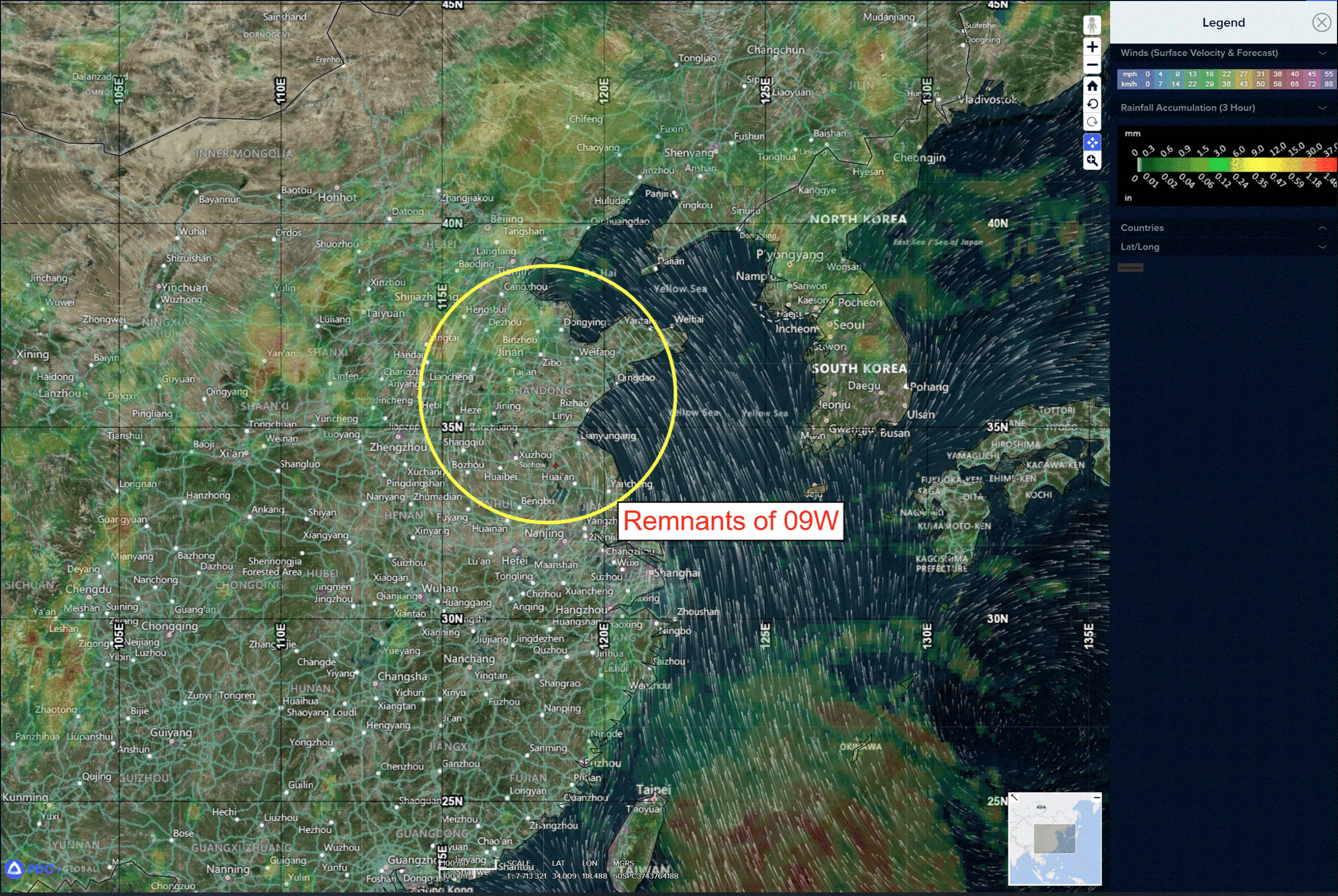
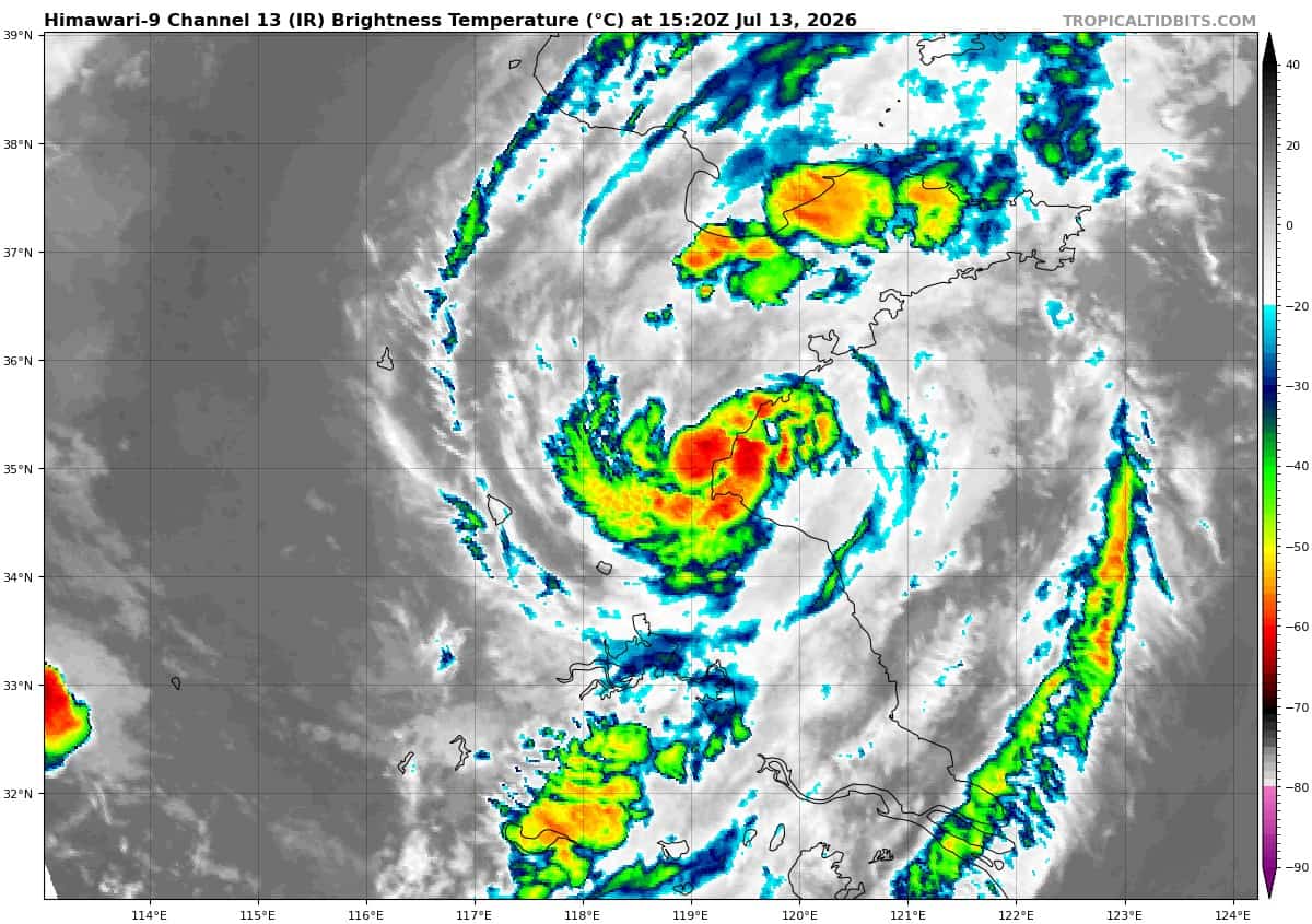
>>> There’s an area of disturbed weather being referred to as Remnants of 09W, which is located approximately 133 NM northwest of Shanghai
Animated multi-spectral satellite imagery (msi) depicts remnants of 09W as a broad circulation and associated deep convection currently transiting north-northeastward and over
land.
Upper-level analysis indicates the 09W is in a marginally favorable environment for redevelopment with low (5-10 kts) vertical wind shear (vws), robust poleward outflow channel associated with an upper-level jet to the north, offset by borderline (24-25 degrees celsius) sea surface temperatures ahead of the expected track.
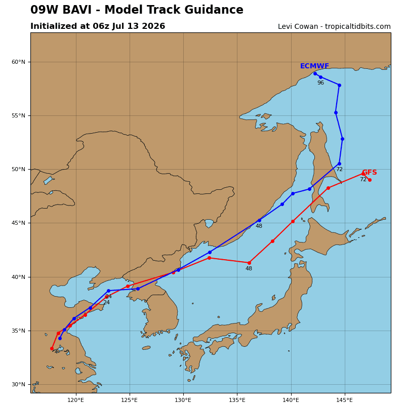
Global deterministic models indicate low probability of regeneration as the system continues to track east-northeastward.
Maximum sustained surface winds are estimated at 18 to 23 knots.
The potential for the development of a significant tropical cyclone within the next 24 hours is low.