

Current Snapshot
For all the latest updates visit: DisasterAWARE
ee7
e
2
7
c
bavi
09W_081500sair
himawari9_ir_09W_202607081520_lat17.3-lon131.8
09W_tracks_latest
By PDC’s Senior Weather
Specialist Glenn James

The Pacific Disaster Center’s (PDC Global) Wednesday, July 8, 2026, Tropical Cyclone Activity Report…for the Pacific Ocean, the Indian Ocean, and adjacent Seas
Current Tropical Cyclones:
Tropical Cyclone 09W (Bavi) is located approximately 506 NM south-southeast of Kadena AB
Northeast Pacific Ocean: There are no Tropical Cyclones
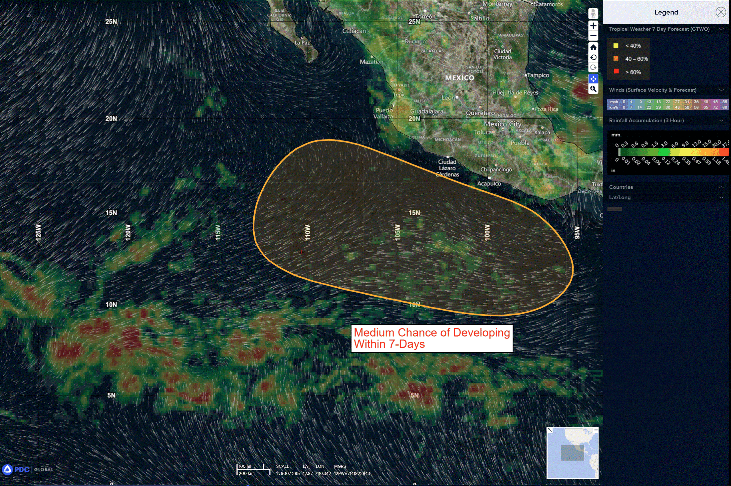
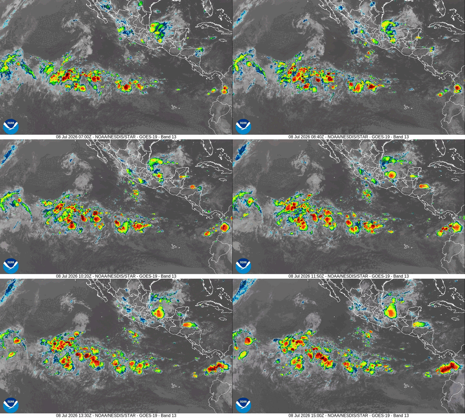
>>> Offshore of Southwestern Mexico:
An area of low pressure is expected to form late this weekend or early next week several hundred miles south-southwest of the coast of southwestern Mexico. Environmental conditions appear favorable for gradual development thereafter, and a tropical depression could form next week while the system moves generally west-northwestward.
* Formation chance through 48 hours…low…near 0 percent
* Formation chance through 7 days…medium…50 percent
Central Pacific Ocean: There are no Tropical Cyclones
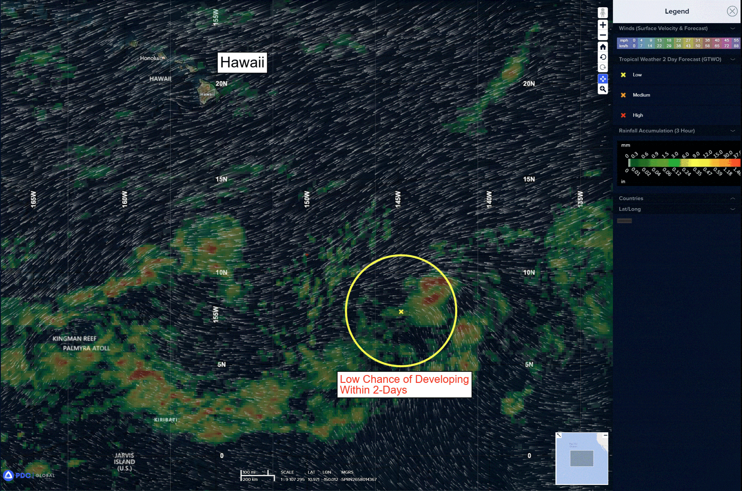
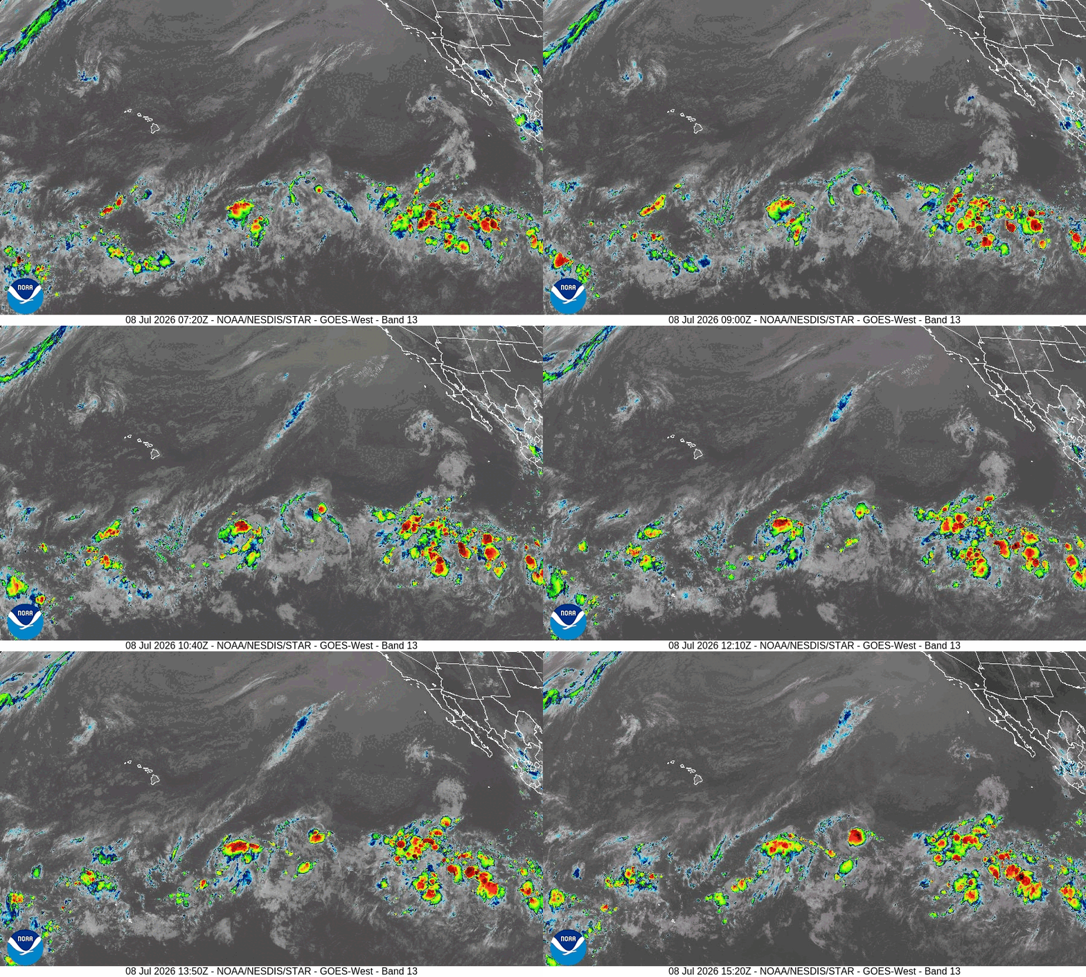
A trough of low pressure located several hundred miles southeast of the Hawaiian Islands continues to produce disorganized showers and thunderstorms. Environmental conditions appear favorable for gradual development of this system later this week into early next week, and a tropical depression could form as the system moves westward to west-northwestward across the central Pacific, remaining well south of the Hawaiian Islands.
* Formation chance through 48 hours…low…10 percent
* Formation chance through 7 days…medium…60 percent
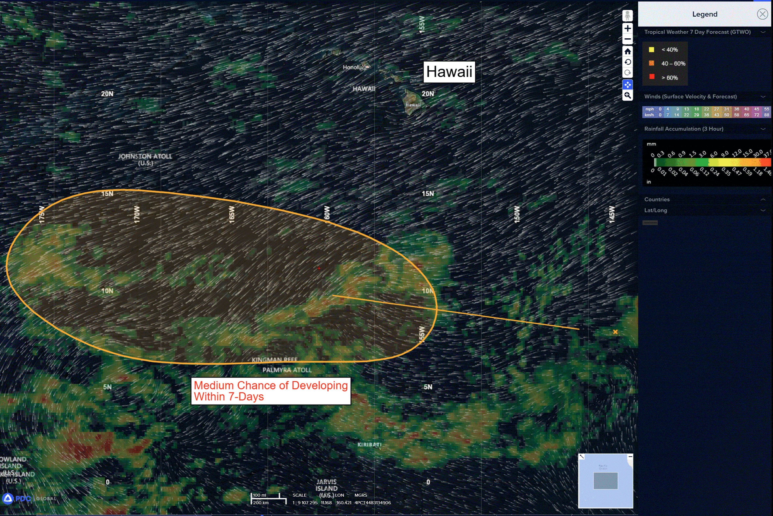
>>> Well Southeast of the Hawaiian Islands:
Another area of showers and thunderstorms is associated with a trough of low pressure located more than 1000 miles east-southeast of the Hawaiian Islands. Environmental conditions appear favorable for slow development of this system this weekend into early next week as it moves westward or west-southwestward into the central Pacific, remaining well south of the Hawaiian Islands.
* Formation chance through 48 hours…low…near 0 percent
* Formation chance through 7 days…low…20 percent
Western Pacific, Indian Ocean, and adjacent Seas:
Western Pacific
Typhoon 09W (Bavi)
According to the JTWC Warning Number 33, sustained winds are 110 knots with gusts to 135 knots
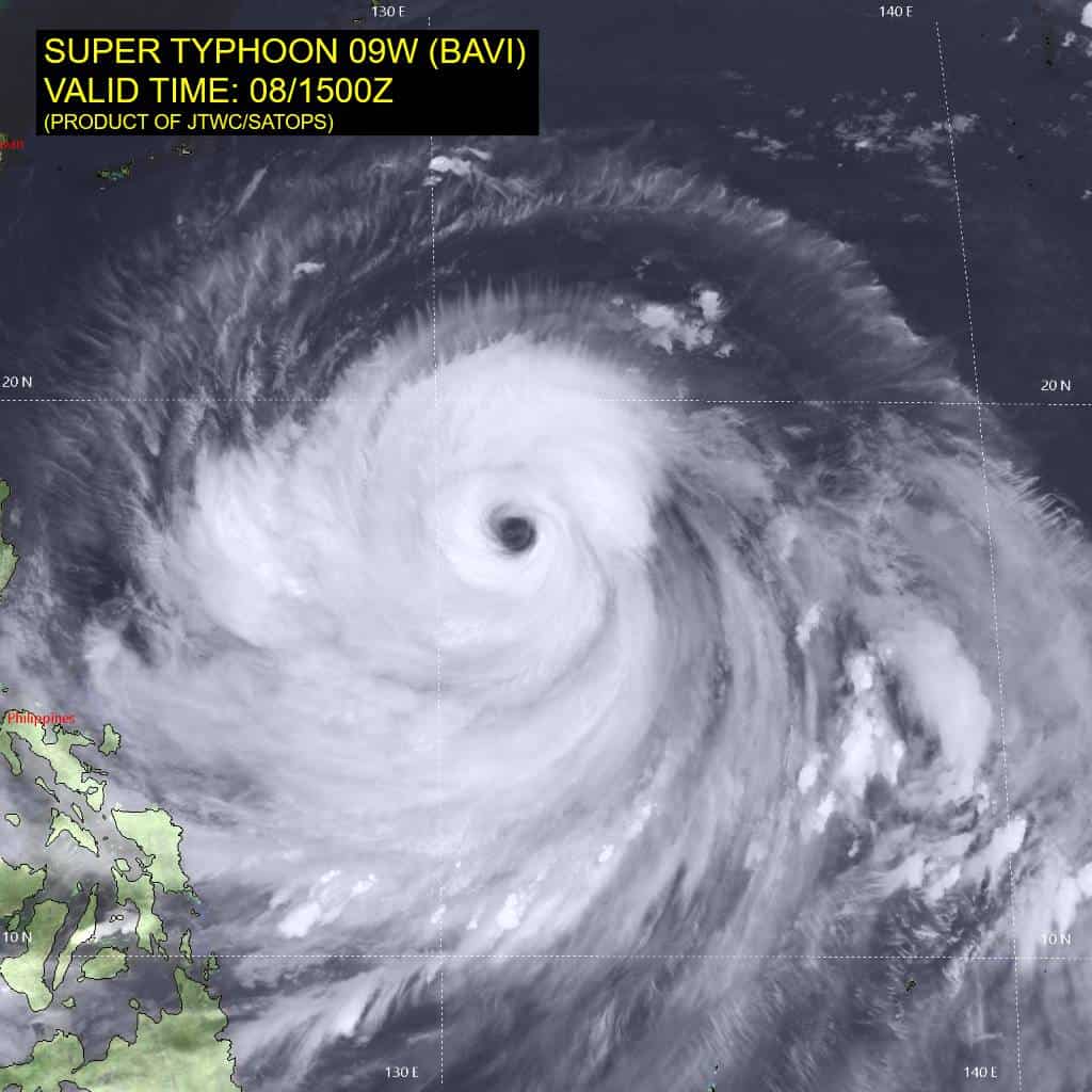
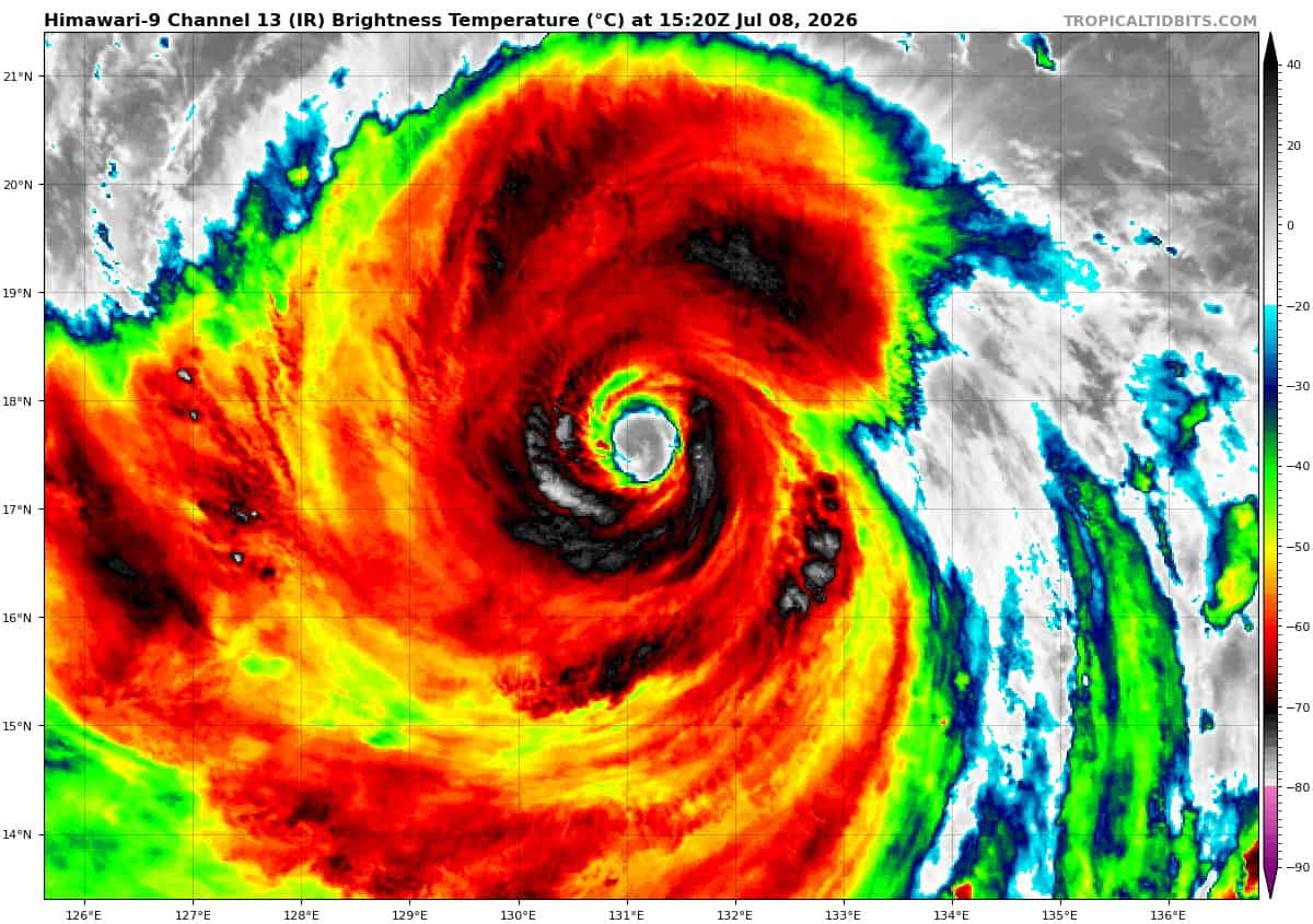
Animated enhanced infrared (eir) satellite imagery depicts typhoon 09W (Bavi) attempting to undergo another eyewall replacement cycle (erc) with clear separation between the inner-core and a very large secondary eyewall, particularly within the northern semicircle. In response to the erc, the overall convective structure has clearly degraded over the past 6 hours and has caused a lowering in intensity. The erc was captured well by the 080913z ssmis 37 ghz microwave image which revealed a wide moat feature separating the two eyewalls. The inner eyewall does appear to be restructuring at around 081400z, suggesting that the erc may not be able to entirely complete. A 080910z radarsat-2 sar image showed a vmax peak of 126 kts within the northern portion of the eyewall and an r64 of over 100 nm from the center in all quadrants.
Environmental analysis indicates that 09W remains in a marginally favorable environment characterized by strong radial outflow aloft and warm (29-30 c) sea surface temperatures offset by moderate to high (20-25 kts) northeasterly vertical wind shear and slight dry air intrusion.
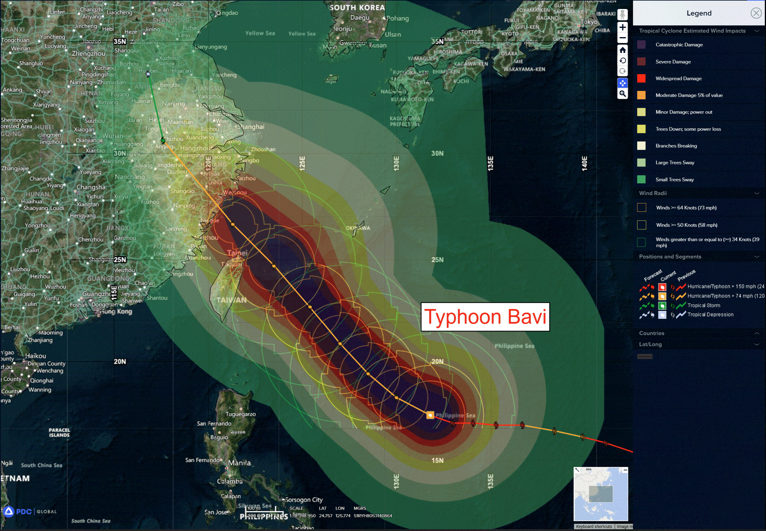
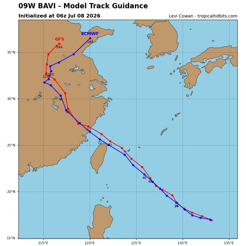
09W is forecast to begin tracking northwestward as the str that is currently positioned over southern Japan merges with the str that is situated to the northeast of 09W over the next 6-12 hours. A northwestward track is then expected to persist through 96 hours as 09W tracks along the southwestern periphery of the resulting str. A passage over the Yaeyama Islands is forecast to occur just before 60 hours as the system continues to head toward the eastern coast of China. A final landfall is forecast to take place soon after 72 hours near Wenzhou, China.
Throughout the track leading up to the final landfall, the wind field of 09W is expected to remain very large with gale-force winds extending up to 300 nm from the center. 09W will then track further inland into mainland China through 96 hours before making a northward turn as the system attempts to round the western extent of the str.
In terms of intensity, 09W is forecast to continue slightly weakening through 12 hours under the influence of the moderate northeasterly vertical wind shear and potential eyewall replacement cycle. From 24 hours through 48 hours, the intensity is expected to more or less be maintained as shear drops to below 15 kts. Near 60 hours, 09W is expected to enter an area of much lower ocean heat content (below 25 kj), triggering another bout of weakening as the system approaches the coast of China. After landfall, terrain interaction will cause the vortex to rapidly deteriorate with
dissipation forecast to occur around 120 hours, west of Shanghai.