
")
Current Snapshot
For all the latest updates visit: DisasterAWARE
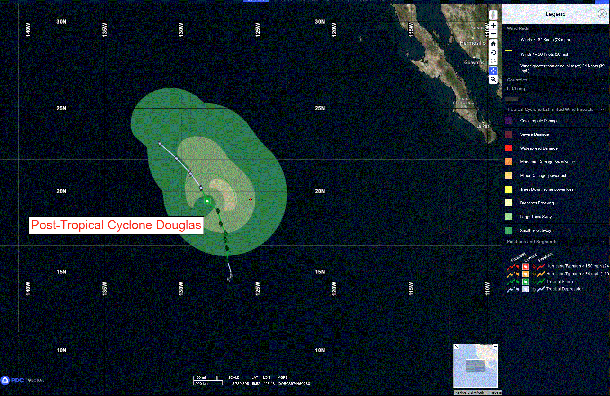
doug
e
goes18_ir_04E_202607031515_lat19.1-lon-128.1
04E_tracks_latest
7
c
bavi
09W_031200sair
09W_tracks_latest
may
10W_031200sair
10W_tracks_latest
By PDC’s Senior Weather
Specialist Glenn James

The Pacific Disaster Center’s (PDC Global) Friday, July 3, 2026, Tropical Cyclone Activity Report…for the Pacific Ocean, the Indian Ocean, and adjacent Seas
Current Tropical Cyclones:
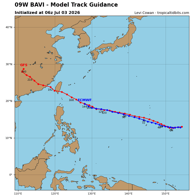
Tropical Cyclone 09W (Bavi) is located approximately 395 NM east of Hagatna, Guam
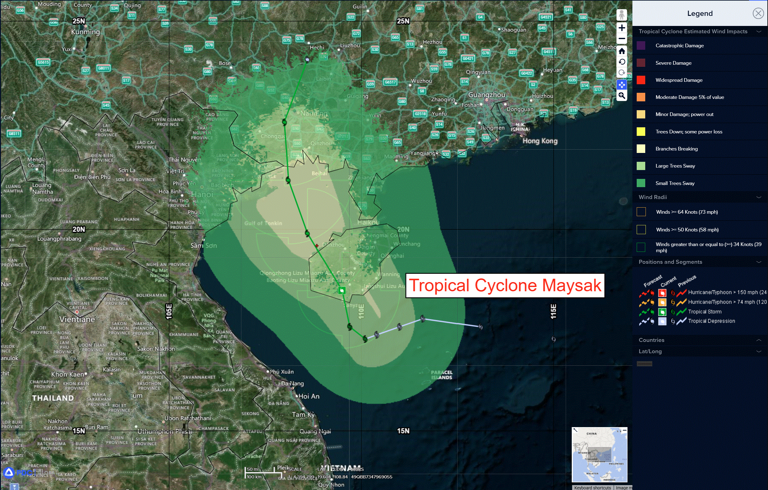
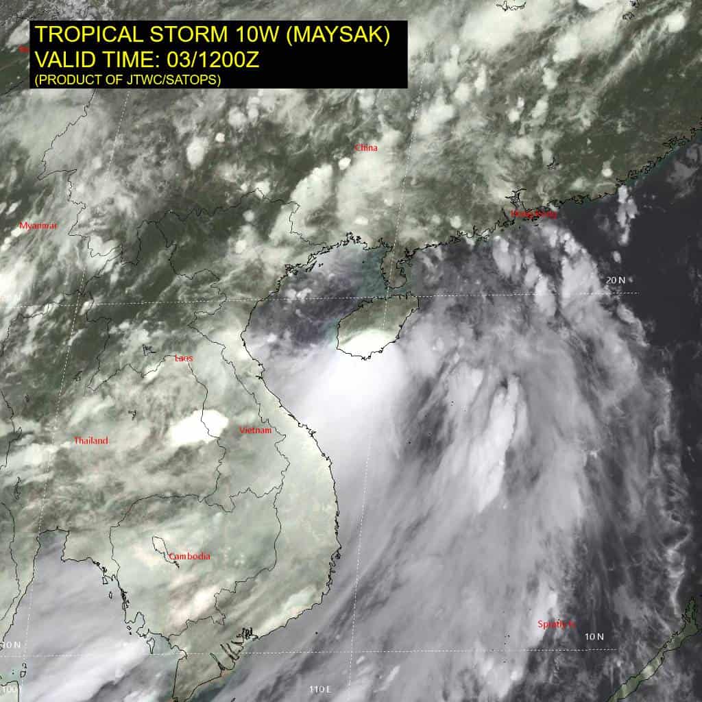
Tropical Cyclone 10W (Maysak) is located approximately 148 NM east-southeast of Hanoi, Vietnam
Northeast Pacific Ocean:
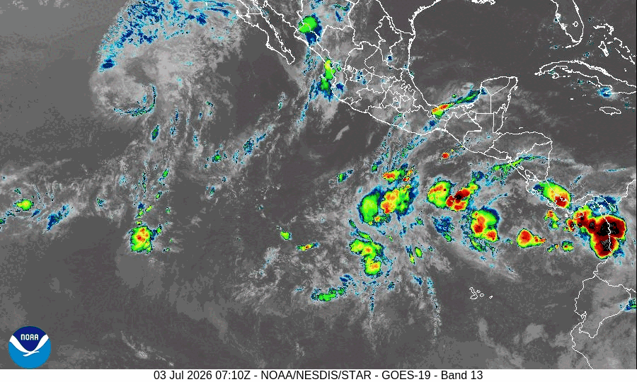
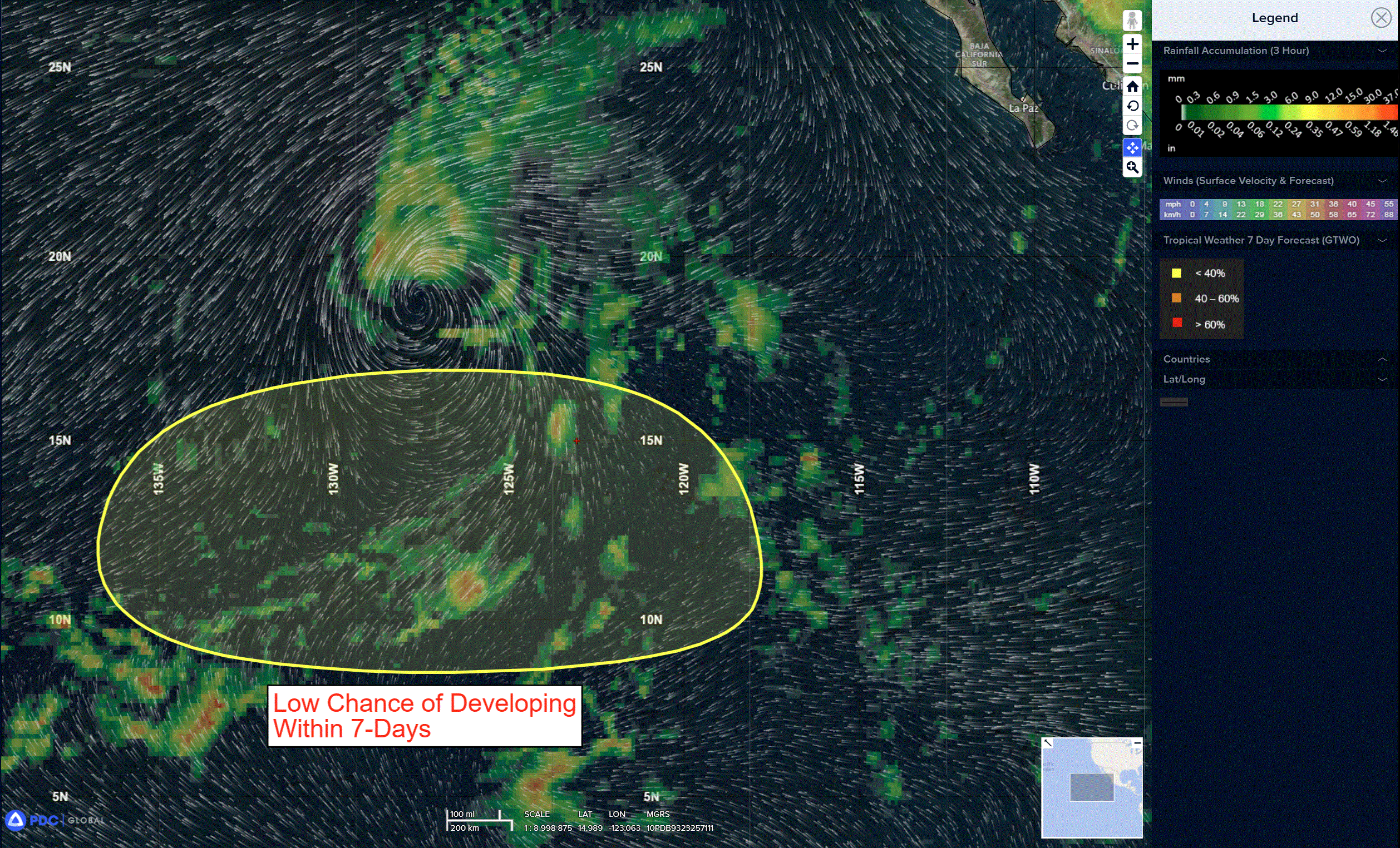
Western East Pacific: There are no Tropical Cyclones
>>> A tropical wave is forecast to move westward across the central portion of the East Pacific through the weekend. By the early or middle part of next week, environmental conditions could support some gradual development of this system while it moves generally westward at 10 to 15 mph across the western portion of the East Pacific.
* Formation chance through 48 hours…low…near 0 percent
* Formation chance through 7 days…low…20 percent
Central Pacific Ocean: There are no Tropical Cyclones
Western Pacific, Indian Ocean, and adjacent Seas:
Western Pacific
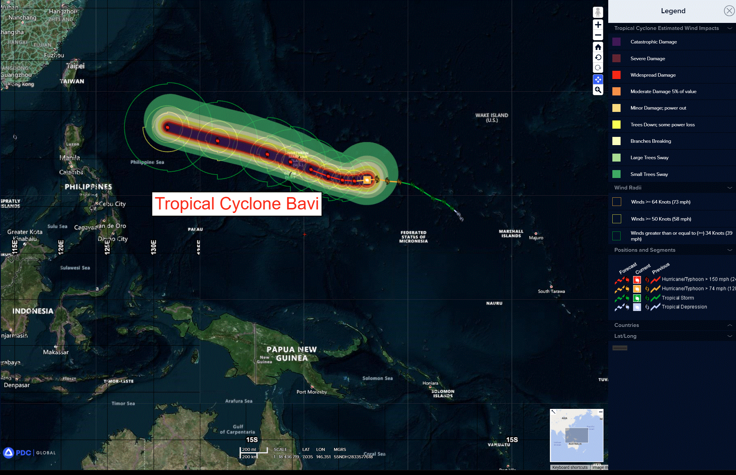
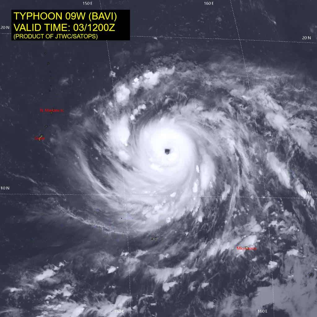
Super Typhoon 09W (Bavi)
According to the JTWC Warning Number 13, sustained winds are 140 knots with gusts to 170 knots
Animated enhanced infrared (eir) imagery depicts a large, symmetric cyclone with a well-defined eye. The dvorak-enhanced infrared channel shows a symmetric central dense overcast completely surrounding the eye with very warm temperatures within the subsident region of the central eye. Animated water vapor imagery illustrates continued robust radial outflow, uninhibited in the current low shear environment.
The environment is characterized as highly favorable for continued rapid intensification, with low (5-10 kts) deep-layer vertical wind shear (vws), very warm (29-30c) sea surface temperatures, high ocean heat content (ohc) exceeding 110 kj per cm3, and strong radial outflow aloft.
Typhoon 09W (Bavi) has undergone extreme rapid intensification from 60 kts to 125 kts over the past 24 hours. The system has continued on a nearly westward track under the steering influence of an extension of the str centered to the northwest over the past 6 hours. A weakening in the steering ridge as a longwave trough transits eastward well to the north of TY 09W has slowed the track speed, which is expected to remain below 10 kts through 36 hours.
The cpa to Saipan and Rota remains similar to the previous forecast, expected around 052100z. The orientation of the str currently anchored south of Kyushu and its slow northwestward migration over the next 120 hours will result in a primarily westward component to the track through 24 hours. After 24 hours, the track turns west-northwestward in this steering environment for the remainder of the forecast period.
Rapid intensification is forecast to continue for the next 12 hours before leveling off at a peak of 150 kts at 24 hours. after 36 hours, vws is expected to steadily increase to 20 kts at 60 and 30-35 knots by 120 hours, initiating a gradual weakening trend. The possibility of an eyewall replacement cycle (erc) remains likely, as suggested by hafs-a, which introduces some uncertainty in the timing and magnitude of the peak intensity. In the event of an erc, the wind field is expected to expand and further limit intensification.
Tropical Cyclone 10W (Maysak)
According to the JTWC Warning Number 10, sustained winds are 45 knots with gusts to 55 knots
Animated enhanced infrared (eir) satellite imagery depicts a compact vortex with deep convection over the low-level circulation center and in the southwest quadrant. Moderate northeasterly vertical wind shear (vws) has continued to prevent consolidation of the deep convection around the core over the past 6 hours. Animated radar imagery showed the center of rotation as TS 10W made landfall over southern Hainan Island.
The environment is characterized as marginal with moderate equatorward outflow offset by the system’s track over Hainan Island and moderate (15-20 kts) vws.
Tropical storm 10W (Maysak) has slowly made its way onshore of Hainan Island over the past 3 hours on a north-northwestward track. The weakening of the southwestern extension of the primary steering ridge centered to the northeast is expected to facilitate the north-northwestward trajectory for
the next 24 hours, turning north then northeastward through the remainder of the forecast period.
The system is expected to reemerge over the Gulf of Tonkin within the next 10 hours along this track, then make a second landfall along the Sino-vietnamese border region just after 24 hours. A brief period of intensification up to a peak of 45 kts is expected as 10W transits over the Gulf of Tonkin, followed by rapid dissipation upon landfall over southeast China.