

Current Snapshot
For all the latest updates visit: DisasterAWARE
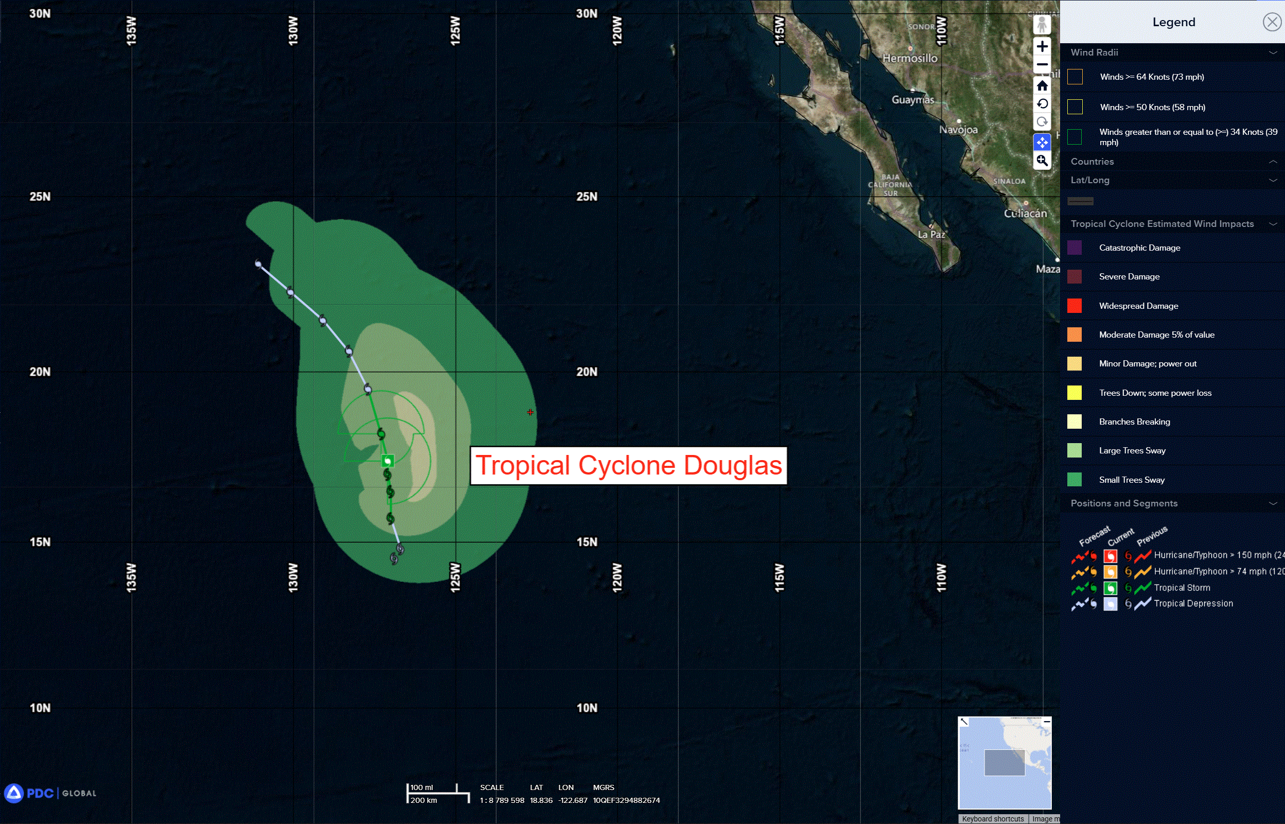
doug
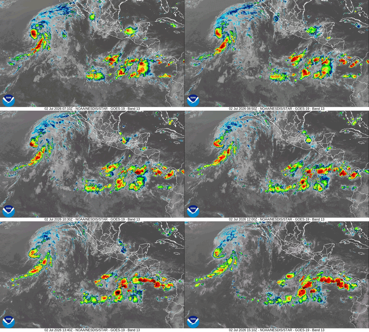
e
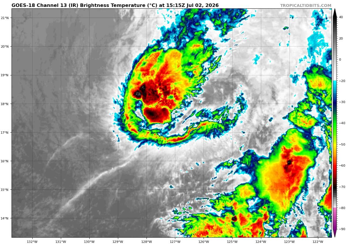
goes18_ir_04E_202607021515_lat17.1-lon-127.1
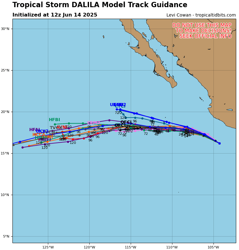
04E_tracks_latest
GOES18-TPW-13-900×540
bavi
09W_021200sair

09W_tracks_latest
10w
10W_021200sair

10W_tracks_latest
By PDC’s Senior Weather
Specialist Glenn James

The Pacific Disaster Center’s (PDC Global) Thursday, July 2, 2026, Tropical Cyclone Activity Report…for the Pacific Ocean, the Indian Ocean, and adjacent Seas
Current Tropical Cyclones:
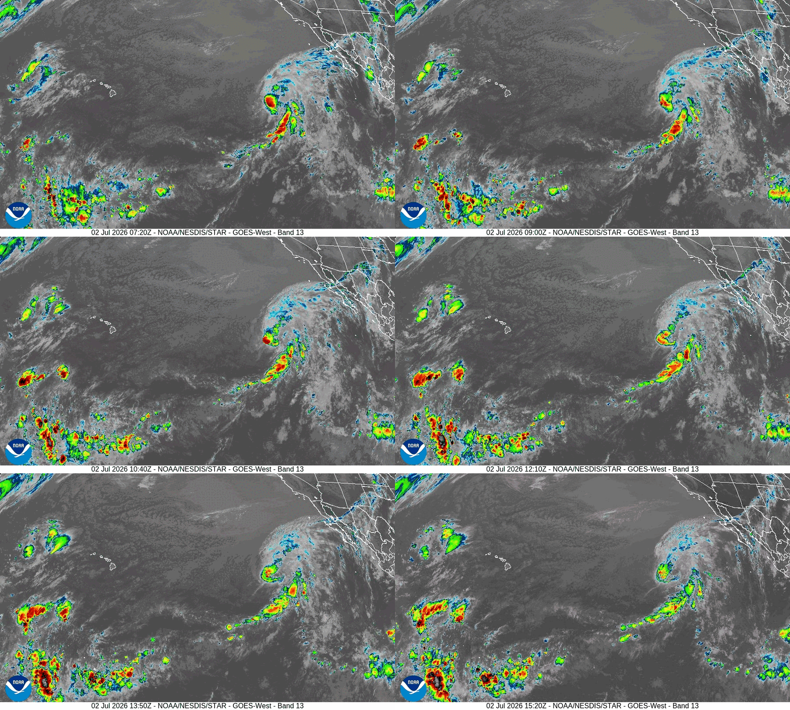
Tropical Cyclone 04E (Douglas) is located about 1180miles west-southwest of the southern tip of Baja California
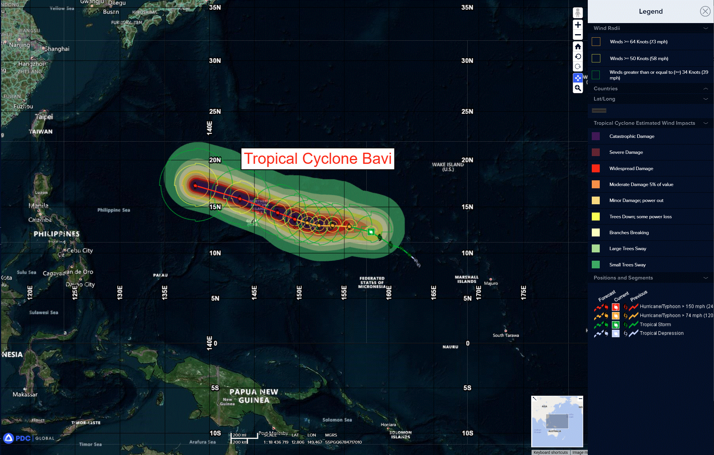
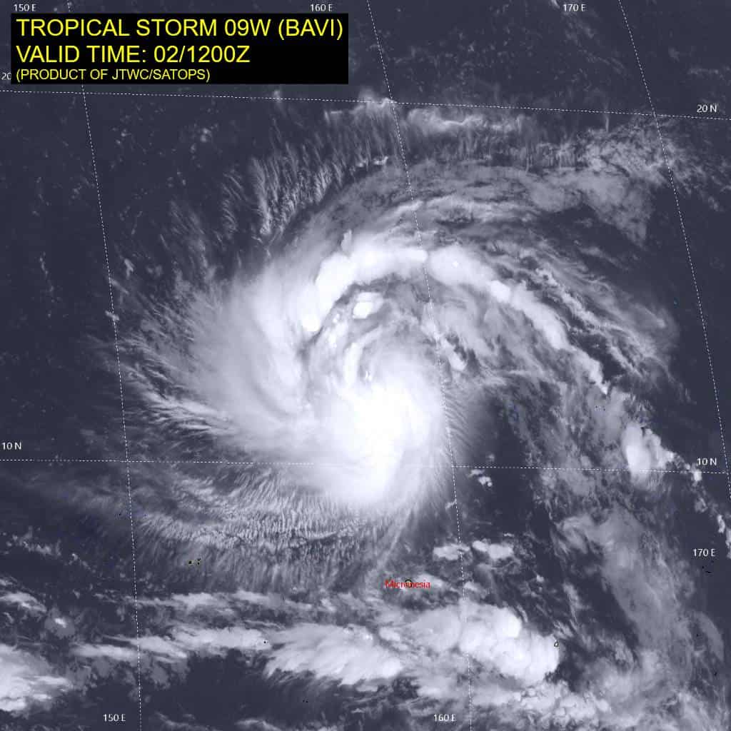
Tropical Cyclone 09W (Bavi) is located approximately 687 NM east of Andersen AFB
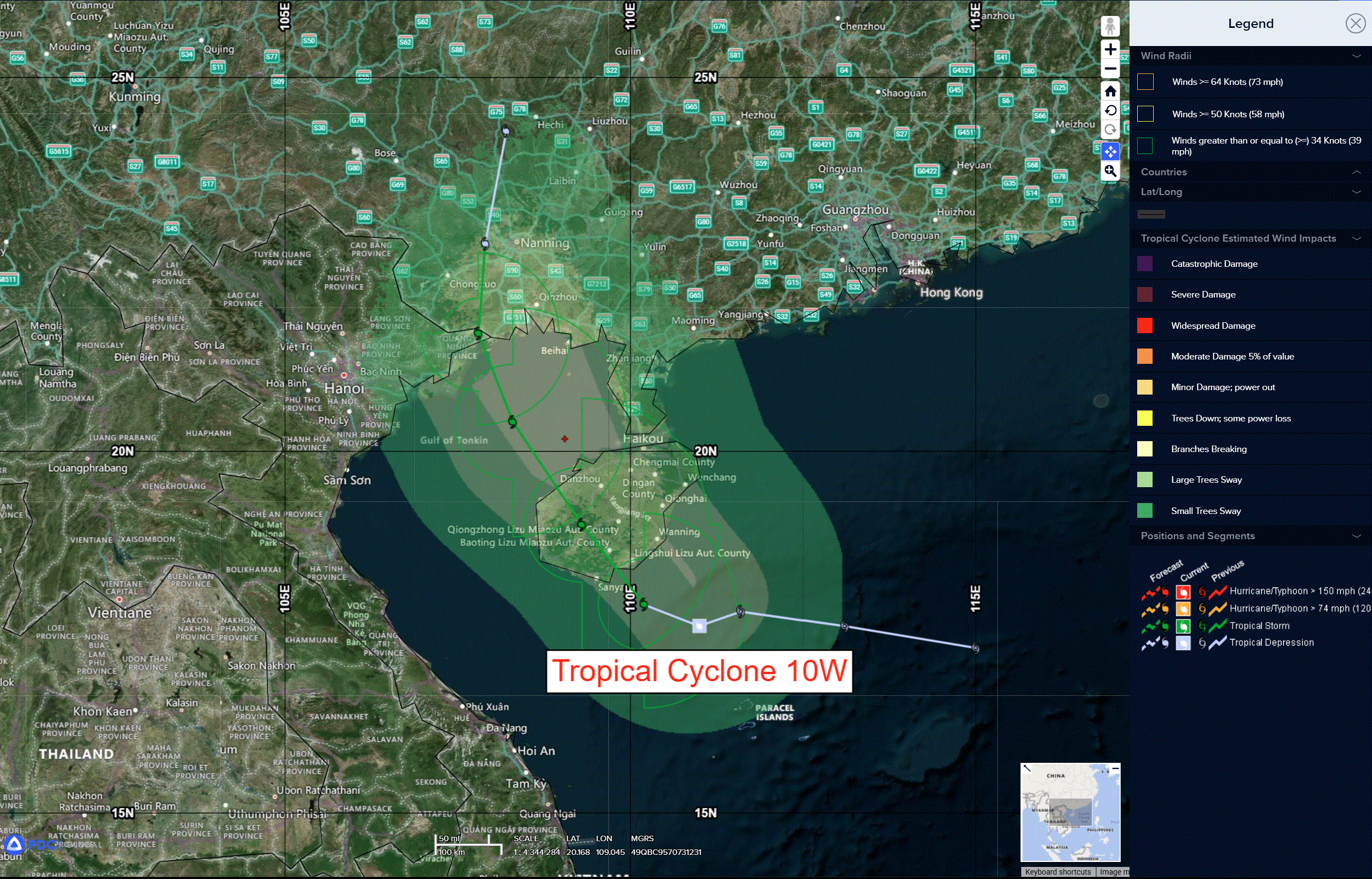
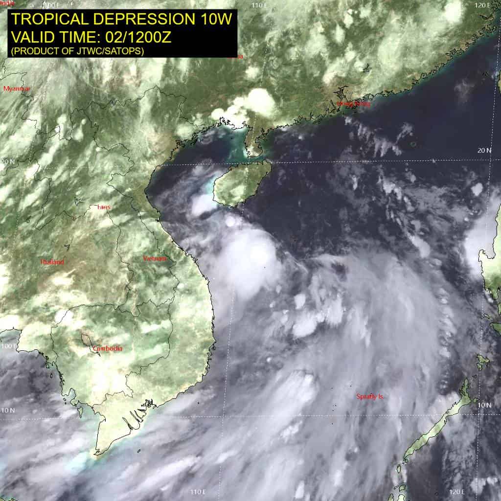
Tropical Cyclone 10W (Maysak) is located approximately 147 NM northeast of Da Nang, Vietnam
Northeast Pacific Ocean:
Tropical Cyclone 04E (Douglas)
DOUGLAS NOW MOVING NORTH-NORTHWESTWARD OVER THE OPEN PACIFIC…EXPECTED TO BECOME A REMNANT LOW ON FRIDAY
According to the NHC advisory number 7…
Douglas is now moving toward the north-northwest near 7 mph (11 km/h), and this motion is expected to continue tonight. A motion toward the northwest is expected on Friday and Saturday. Maximum sustained winds are near 40 mph (65 km/h) with higher gusts. Little change in strength is expected for the next several hours. A weakening trend is forecast beginning late tonight, and Douglas is expected to become a post-tropical cyclone on Friday. Tropical-storm-force winds extend outward up to 90 miles (150 km) from the center.
Western East Pacific:
>>> An area of low pressure is forecast to form well to the southwest of the Baja California Peninsula during the early or middle part of next week. Environmental conditions could support some gradual development of this system, while it moves generally westward at 10 to 15 mph across the western portion of the East Pacific.
* Formation chance through 48 hours…low…near 0 percent
* Formation chance through 7 days…low…20 percent
Central Pacific Ocean: There are no Tropical Cyclones
Western Pacific, Indian Ocean, and adjacent Seas: There are no Tropical Cyclones
Western Pacific
Tropical Cyclone 09W (Bavi)
According to the JTWC Warning Number 8, sustained winds are 70 knots with gusts to 85 knots
Animated enhanced infrared (eir) satellite imagery depicts persistent convective banding wrapping into the consolidating central core of TS 09W. Although the low-level circulation center is fully obscured, the slackening vertical wind shear (vws) over the past 6 hours suggests that the vortex has become better aligned vertically. Robust poleward and equatorward outflow is evident in animated water vapor imagery, along with improving radial outflow over the past few hours. A 020704z wsfm 37 ghz microwave image revealed a nascent microwave eye with improved symmetry of the convective banding surrounding the central core.
The environment is characterized as highly favorable with very warm (29-30 c) sea surface temperatures, high ocean heat content, and strong outflow aloft. The only limiting environmental factor in the short term is the 10-15 kts of easterly vws.
Tropical storm 09W (Bavi) has continued on a northwestward track over the past 6 hours under the steering influence of an extension of the str positioned to the northeast. The system is expected to assume a westward trajectory through 48 hours as a str centered near Kyushu builds in from the west and takes over as the primary steering mechanism. The track speed is expected to slow between 24 and 72 hours under this steering influence as a longwave trough propagates eastward to the north, temporarily weakening the steering gradient. After 60 hours, TS 09W returns to a west-northwestward track as it approaches the northern Mariana islands, with a cpa to Saipan around 052300z.
Intensification over the next 12 hours is expected to remain steady as the system consolidates and moves into a lower shear environment. After 12 hours, environmental conditions favor an extended period of rapid intensification (ri) through 60 hours. Hafs-a continues to depict an
eyewall replacement cycle (ewrc) starting between 48 and 60 hours, continuing through passage trough the northern Marianas. As a result,
the intensity is forecast to level off at a peak of 135 kts from 72 hours through the remainder of the forecast period.
Tropical Cyclone 10W
According to the JTWC Warning Number 5, sustained winds are 30 knots with gusts to 40 knots
Animated enhanced infrared (eir) satellite imagery depicts the previously exposed low-level circulation center incorporating with flaring convection in the southwest quadrant as the system appears to be reorganizing around the broader surrounding cyclonic circulation.
The environment is characterized as marginal with warm (29-30 c) sea surface temperatures and moderate equatorward outflow being offset by 15-20 kts of northeasterly vertical wind shear (vws).
Tropical depression 10W has slowed its track speed over the past 6 hours as the low-level circulation reorganizes. The track is expected to resume a northwestward trajectory toward Hainan Island within the next 12 hours under the steering influence of the str to the northeast. Initial landfall along the southeastern coast of Hainan is forecast shortly before 18 hours, then 10W is expected to reemerge over water in the Gulf of
Tonkin just before 30 hours, with a second landfall near the sino-vietnamese border region shortly before 48 hours.
The decaying remnants will then track inland over mainland China on a north-northeasterly track for the remainder of the forecast period.
There is expected to be a brief window of opportunity for the system to intensify before tracking over Hainan, then another brief period of intensification over the Gulf of Tonkin, reaching a peak of 40 kts just before the second landfall.