
")
Current Snapshot
For all the latest updates visit: DisasterAWARE
e
c
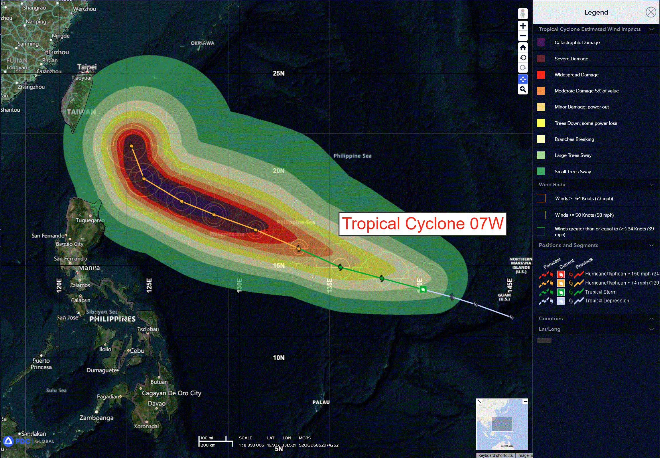
07w
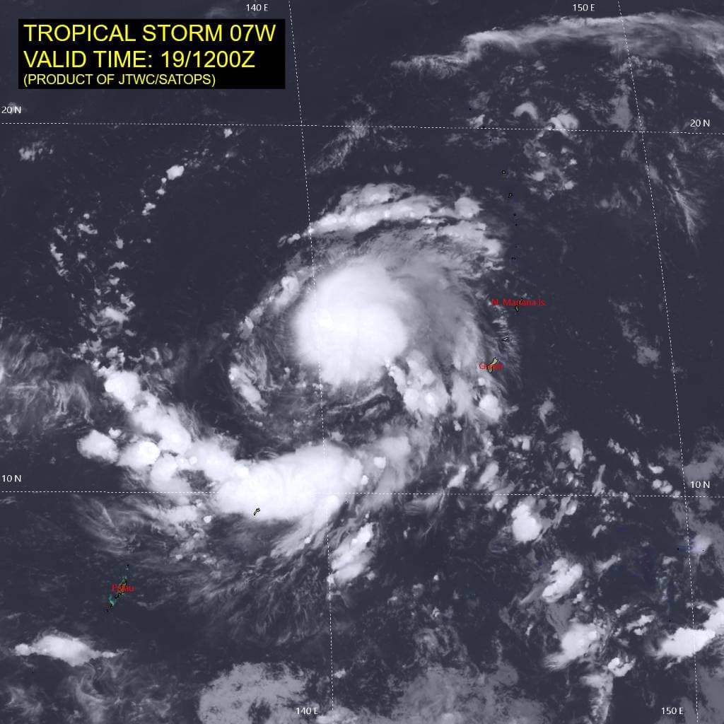
07W_191200sair

07W_tracks_latest
By PDC’s Senior Weather
Specialist Glenn James

The Pacific Disaster Center’s (PDC Global) Friday, June 19, 2026, Tropical Cyclone Activity Report…for the Pacific Ocean, the Indian Ocean, and adjacent Seas
Current Tropical Cyclones:
Tropical Cyclone 07W (Mekkhala)…is located 283 NM north of Yap
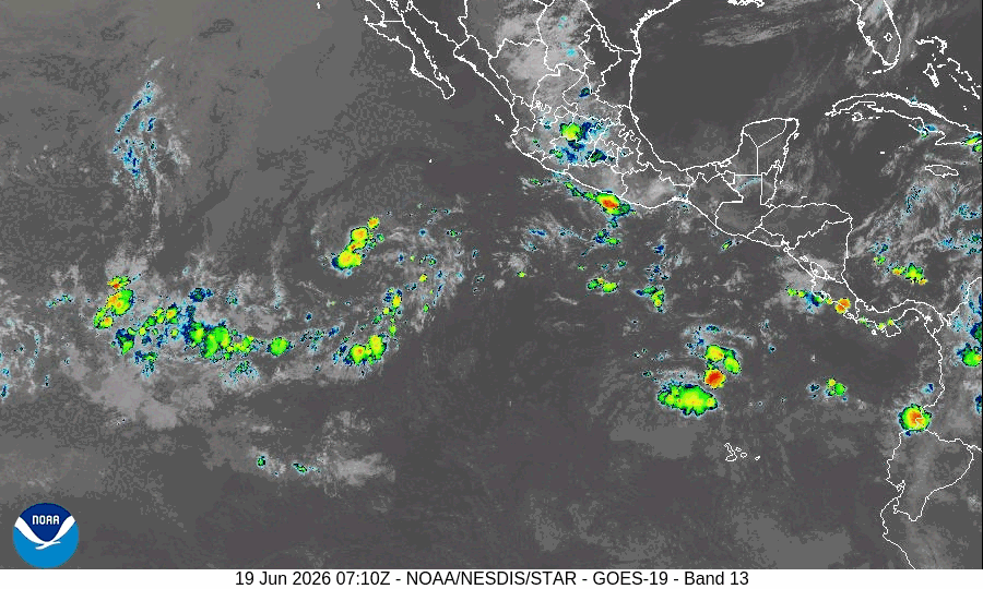
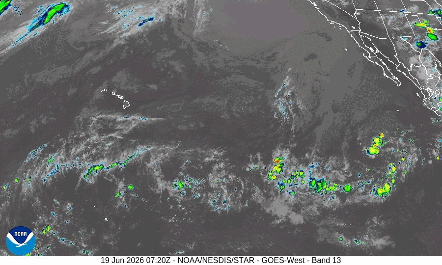
Northeast Pacific Ocean: There are no Tropical Cyclones
Tropical cyclone formation is not expected during the next 7 days.
Central Pacific Ocean: There are no Tropical Cyclones
Tropical cyclone formation is not expected during the next 7 days.
Western Pacific, Indian Ocean, and adjacent Seas: There are no Tropical Cyclones
Tropical Cyclone 07W (Mekkhala)
According to the JTWC Warning number 6…sustained winds are 45 knots with gusts to 55
Animated enhanced infrared (eir) satellite imagery depicts tropical storm 07W with a developing central dense overcast (cdo) feature and associated overshooting cloud tops measuring colder than -90 c. The overall structure of the convective mass has markedly improved over the past 6 hours and is likely indicative of the beginning of an expected intensification phase.
Environmental analysis indicates that 07W is in a favorable environment characterized by moderate equatorward outflow aloft, low (5-10 kts) vertical wind shear, and very warm (30-31 c) sea surface temperatures.
TS 07W is forecast to track west-northwestward, along the southwestern periphery of the str, through 72 hours. After 72 hours, 07W is expected to begin a poleward turn as it rounds the western extent of the str. However, simultaneously to the poleward turn, a separate str is expected to build over the northern South China Sea. This will create a competing steering environment and will cause 07W to slow down
considerably as it tracks southeast of Taiwan through 120 hours.
Regarding intensity, 07W is forecast to steadily intensify over the next 24 hours as the vortex becomes more symmetric and vertically aligned. After 24 hours, a more rapid rate of intensification is expected as shear remains low and sea surface temperatures remain very warm. Rapid intensification (ri) is explicitly forecast to occur from 24 to 72 hours (55 kts to 120 kts). The peak intensity is forecast to occur near 72 hours as northeasterly shear greatly increases afterward.
Additionally, the slow movement speed near the end of the forecast period may allow for the upwelling of cooler waters. As a result, a weakening trend is expected to occur after 72 hours as the system commences its poleward turn.