
")
Current Snapshot
For all the latest updates visit: DisasterAWARE
cristina
GOES19-EEP-13-900×540
goes19_ir_03E_202606091515_lat12.5-lon-87.5
bbb

03E_tracks_latest
5555
10
By PDC’s Senior Weather
Specialist Glenn James

The Pacific Disaster Center’s (PDC Global) Tuesday, June 9, 2026, Tropical Cyclone Activity Report…for the Pacific Ocean, the Indian Ocean, and adjacent Seas
Current Tropical Cyclones:
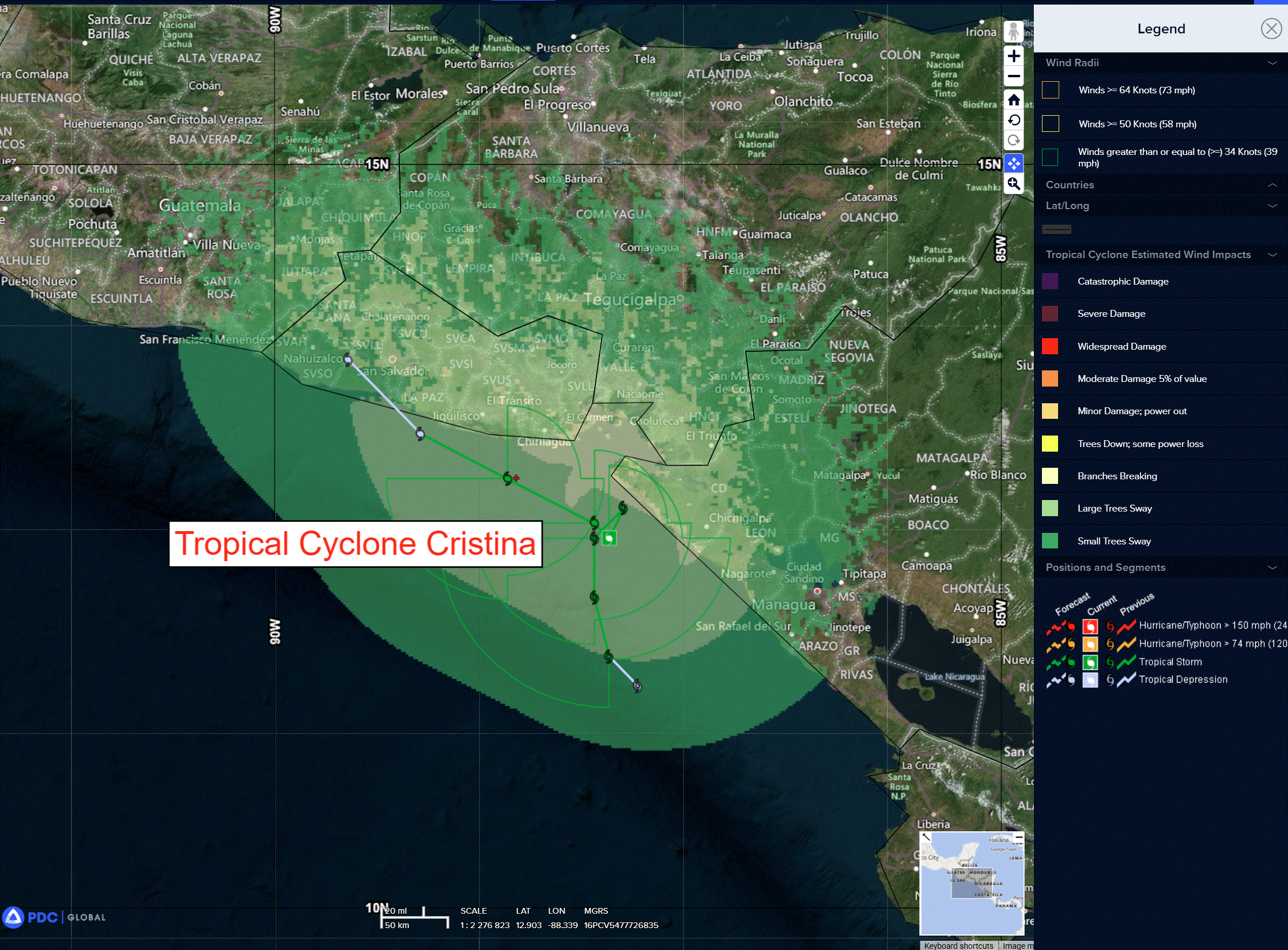
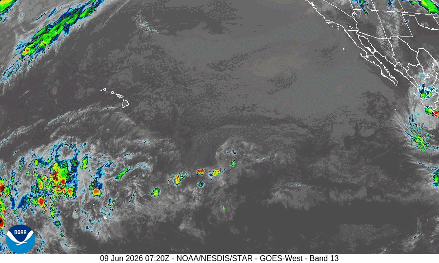
Tropical Cyclone 03E (Cristina)…is located about 100 miles west-northwest of Managua, Nicaragua
Northeast Pacific Ocean:
Tropical Cyclone 03E (Cristina)
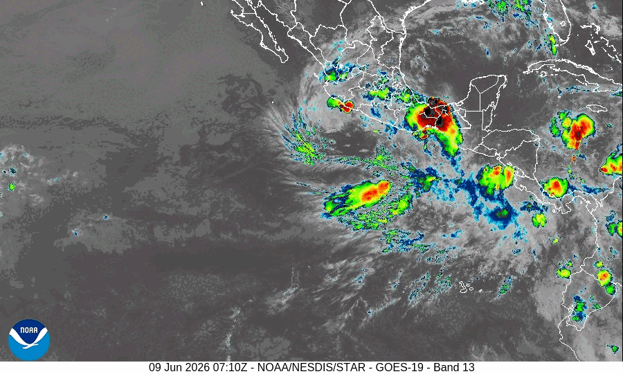
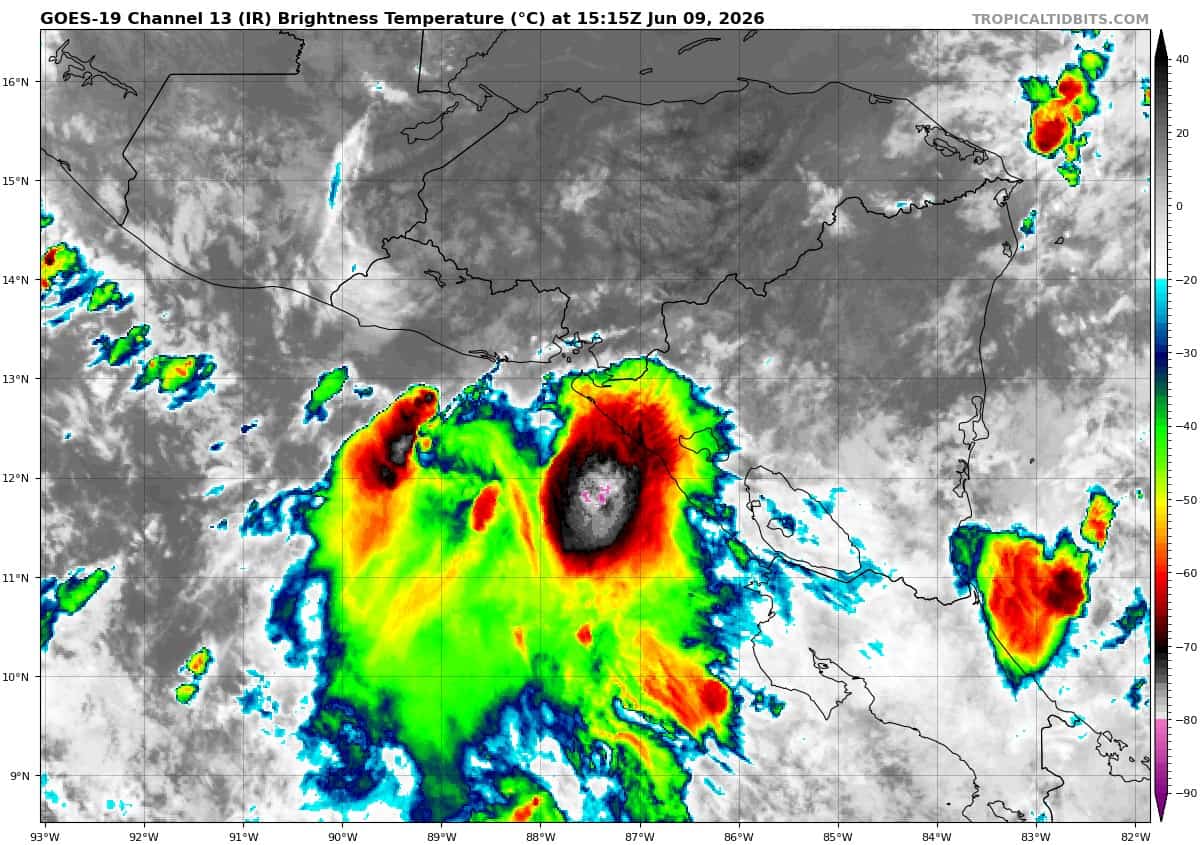
CRISTINA CONTINUES TO MEANDER OFFSHORE…HEAVY RAINS EXPECTED TO CONTINUE OVER PORTIONS OF CENTRAL AMERICA DURING THE NEXT COUPLE OF DAYS
According to the NHC advisory number 8…Cristina is located about 130 west of Managua, Nicaragua
Cristina is moving slowly toward the west near 2 mph. A turn to the west-northwest and northwest is forecast over the next couple of days. On the forecast track, Cristina should move near or along the coasts of Nicaragua, Honduras, and El Salvador through midweek. Maximum sustained winds remain near 40 mph with higher gusts. Slight strengthening is possible through Wednesday, with weakening expected Wednesday night or Thursday after Cristina moves inland. Tropical-storm-force winds extend outward up to 80 miles from the center.
HAZARDS AFFECTING LAND
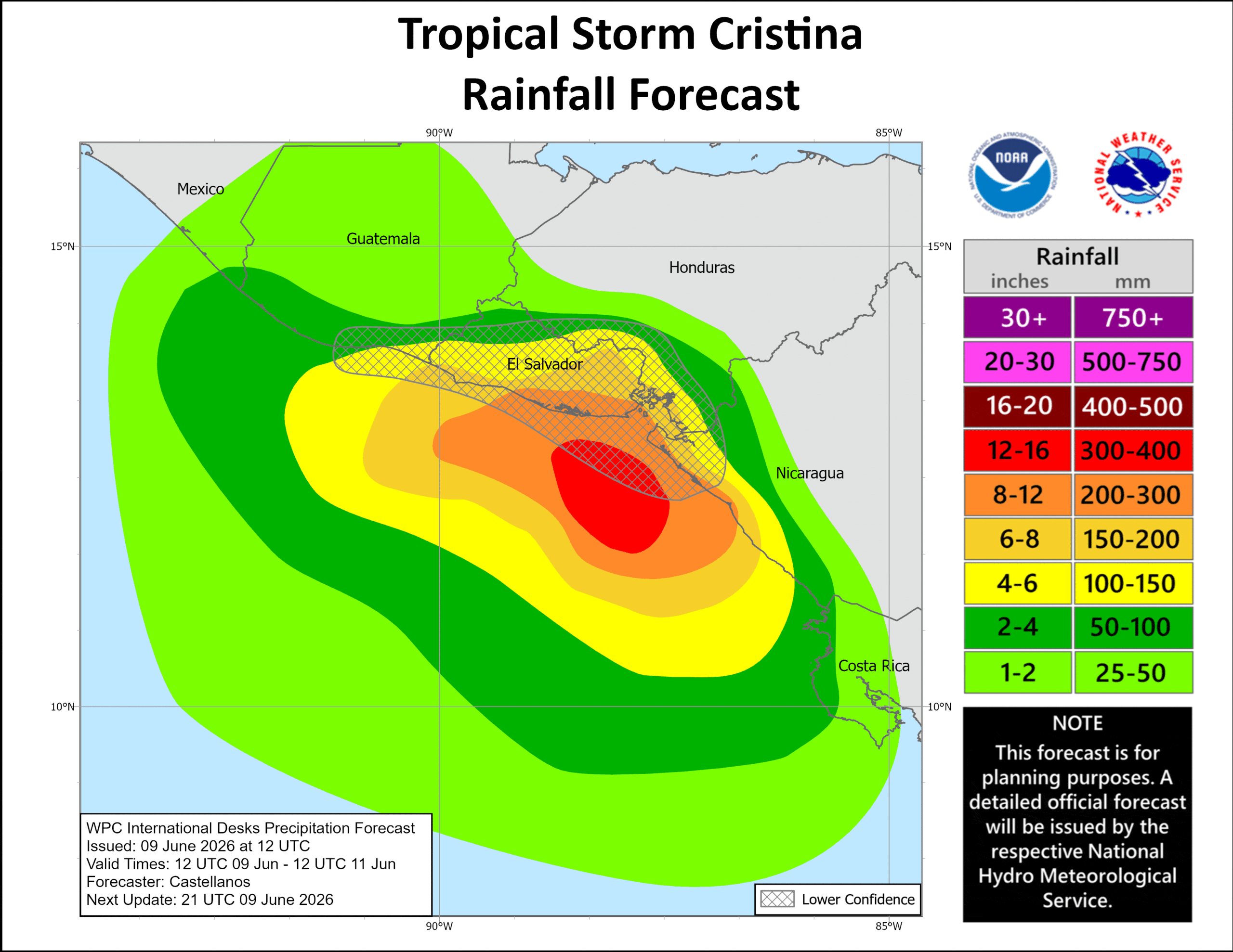
RAINFALL: Tropical Storm Cristina is expected to produce rainfall totals of 4 to 8 inches, with maximum totals of 12 inches possible across coastal portions of Nicaragua, Honduras, El Salvador, and Guatemala through Thursday morning. This rainfall may produce life-threatening flooding and mudslides, especially in areas of steep terrain.
STORM SURGE: Coastal flooding from storm surge is possible in areas of onshore winds. Near the coast, the surge will be accompanied by large and damaging waves.
WIND: Tropical storm conditions are expected to spread along portions of the coast within the warning area today.
Central Pacific Ocean: There are no Tropical Cyclones
Tropical cyclone formation is not expected during the next 7 days.
Western Pacific, Indian Ocean, and adjacent Seas: There are no Tropical Cyclones