
")
Current Snapshot
For all the latest updates visit: DisasterAWARE
amanda
GOES18-TPW-13-900×540
goes18_ir_01E_202606061515_lat12.7-lon-134.5
061459_earliest_reasonable_toa_34
01E_tracks_latest
g
goes19_ir_91E_202606061515_lat13.8-lon-103.2
91E_tracks_latest
91w
himawari9_ir_91W_202606061510_lat28.2-lon126.0

91W_tracks_latest
By PDC’s Senior Weather
Specialist Glenn James

The Pacific Disaster Center’s (PDC Global) Saturday, June 6, 2026, Tropical Cyclone Activity Report…for the Pacific Ocean, the Indian Ocean, and adjacent Seas
Current Tropical Cyclones:
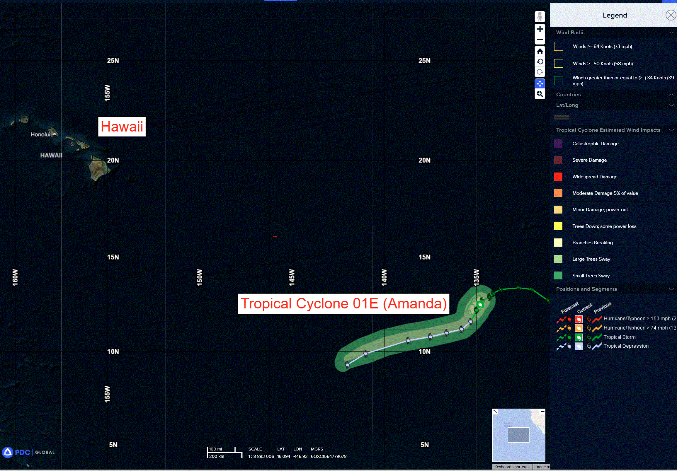
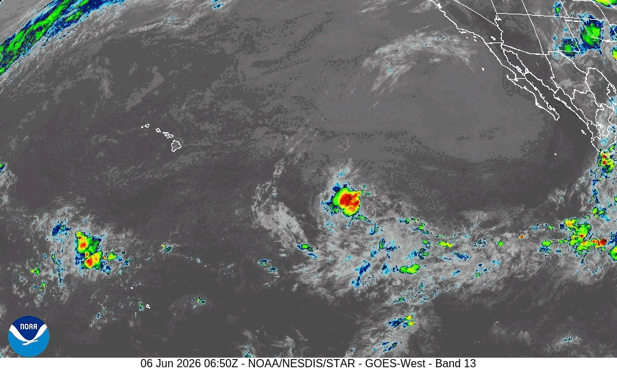
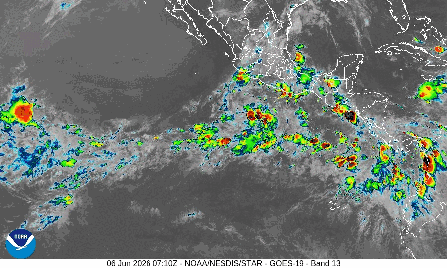
Tropical Cyclone 01E Amanda…is located approximately 1435 miles east-southeast of Hilo, Hawaii
Northeast Pacific Ocean:
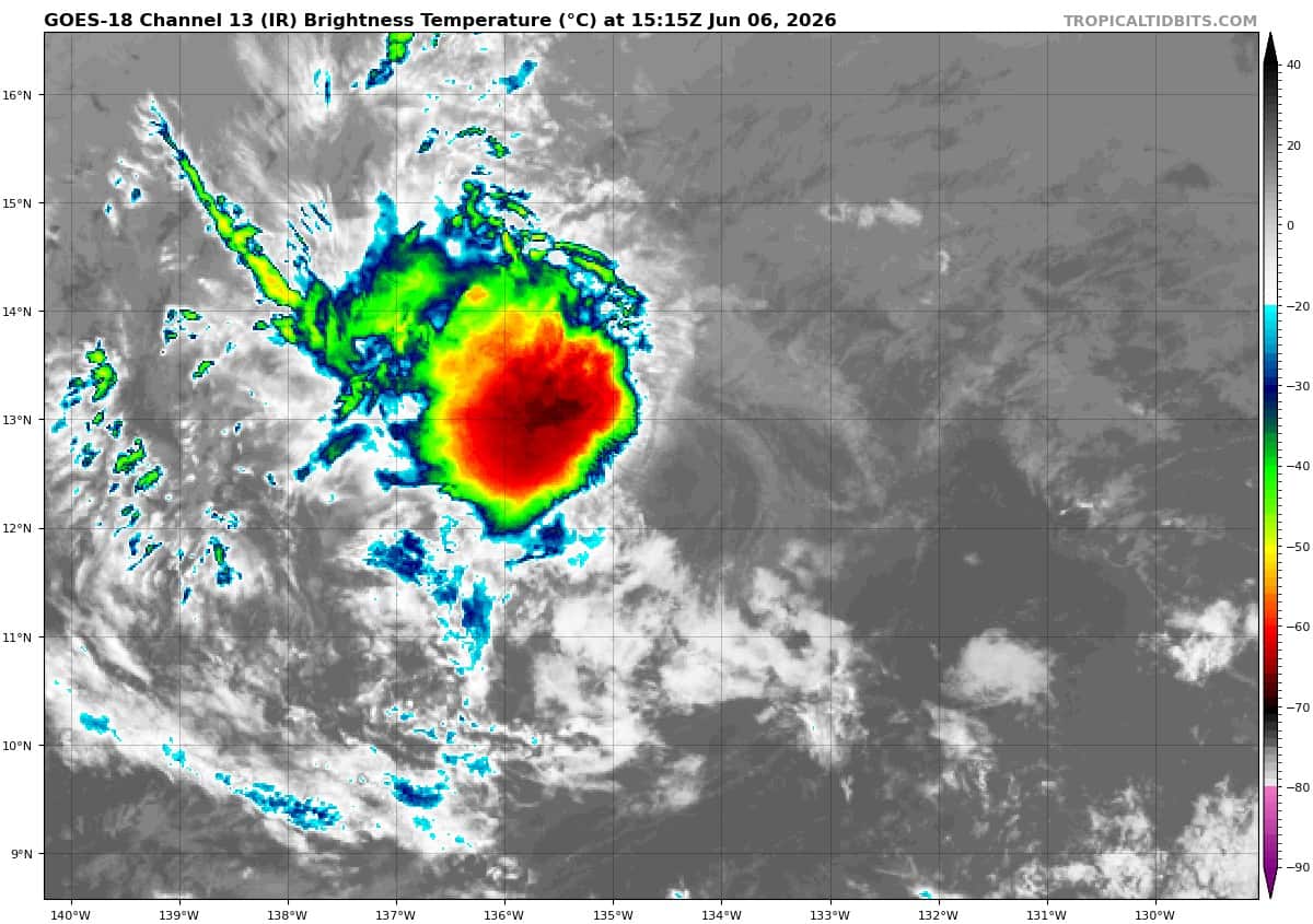
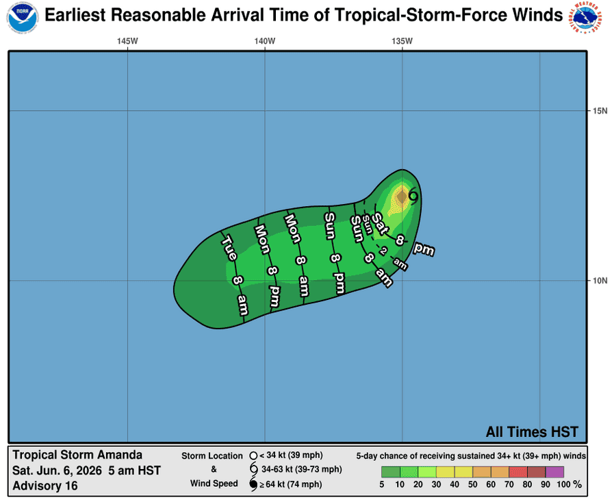
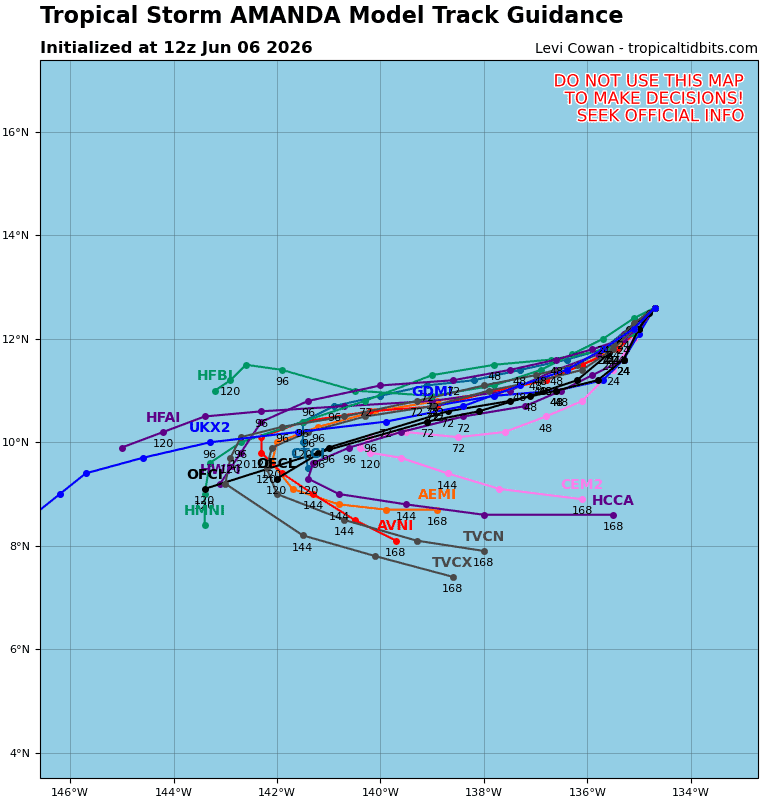
Tropical Cyclone 01E (Amanda)
AMANDA REMAINS A TROPICAL STORM
According to the NHC advisory number 16
Amanda is moving toward the southwest near 5 mph (7 km/h), and this general motion is expected to continue through the weekend followed by a gradual turn toward the west-southwest by early next week.
Maximum sustained winds are near 40 mph (65 km/h) with higher gusts. Gradual weakening is forecast through the weekend, and Amanda is expected to degenerate into a remnant low by late Sunday.
Tropical-storm-force winds extend outward up to 35 miles (55 km) from the center.
>>> Offshore Southern and Southwestern Mexico:
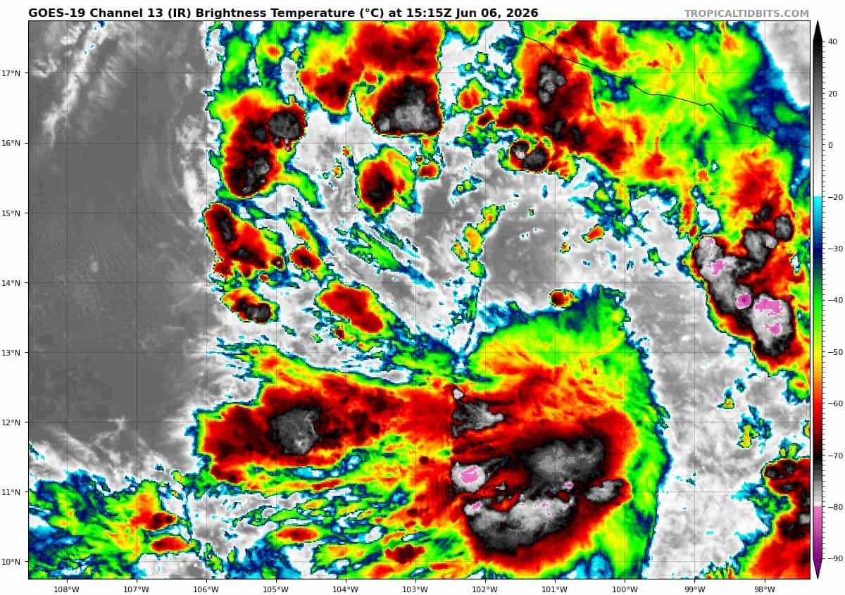
Invest 91E
Showers and thunderstorms associated with a broad area of low pressure located a few hundred miles south-southwest of Zihuatanejo, Mexico, are beginning to show signs of organization. Environmental conditions appear conducive for additional development, and a tropical depression is likely to form within the next day or so. The disturbance is forecast to move northeastward and then northward, and approach the coast of southern Mexico Sunday night and Monday. Interests in southern Mexico should monitor the progress of this system. Regardless of development, heavy rainfall and life-threatening flash flooding are possible across portions of southern Mexico through early next week.
* Formation chance through 48 hours…high…70 percent
* Formation chance through 7 days…high…70 percent
>>> Offshore of Central America:
Invest 92E
Showers and thunderstorms associated with a broad area of low pressure offshore of Central America have increase in coverage since yesterday. Environmental conditions appear conducive for development and a tropical depression is likely to form while the system moves slowly northward toward the coast of Central America. Interests along the Pacific coasts of northwestern Costa Rica, Nicaragua, Honduras, and El Salvador should monitor the progress of this system. Regardless of development, heavy rainfall and life-threatening flash flooding are possible across portions of Costa Rica, Nicaragua, El Salvador, and Guatemala through early next week.
* Formation chance through 48 hours…high…70 percent
* Formation chance through 7 days…high…70 percent
Central Pacific Ocean: There are no Tropical Cyclones
Tropical cyclone formation is not expected during the next 7 days.
Western Pacific, Indian Ocean, and adjacent Seas: There are no Tropical Cyclones
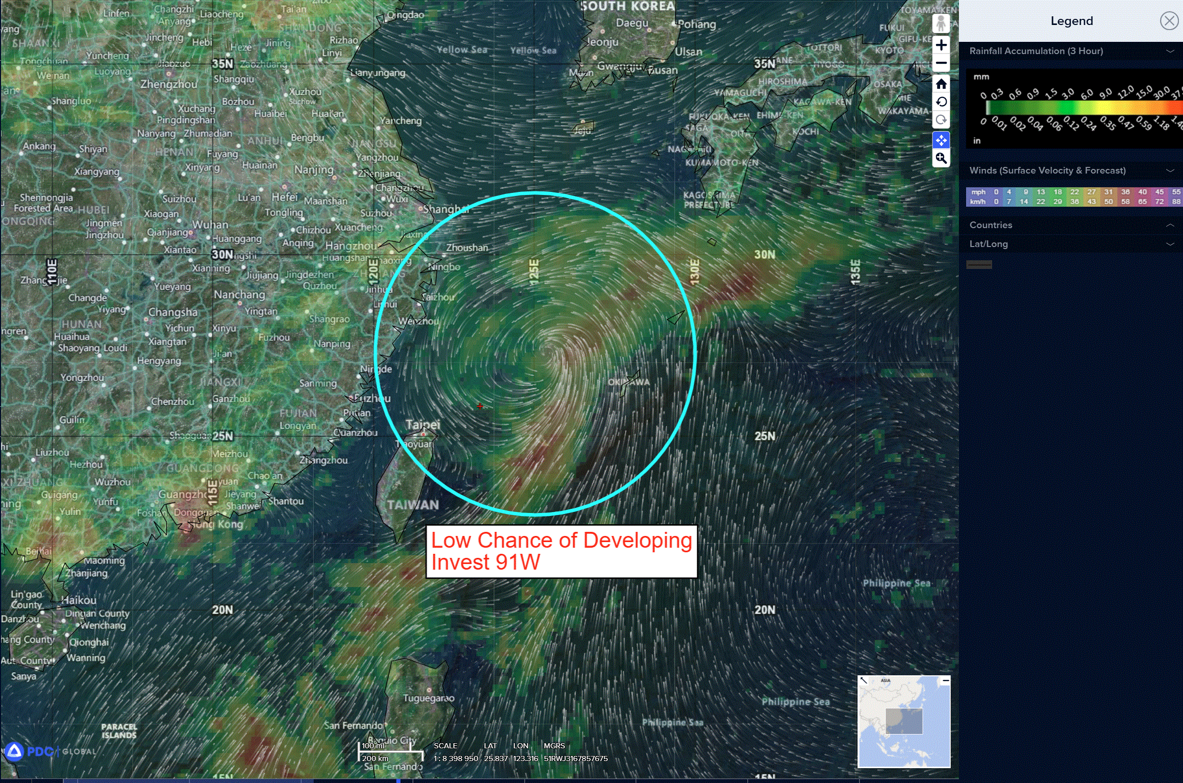
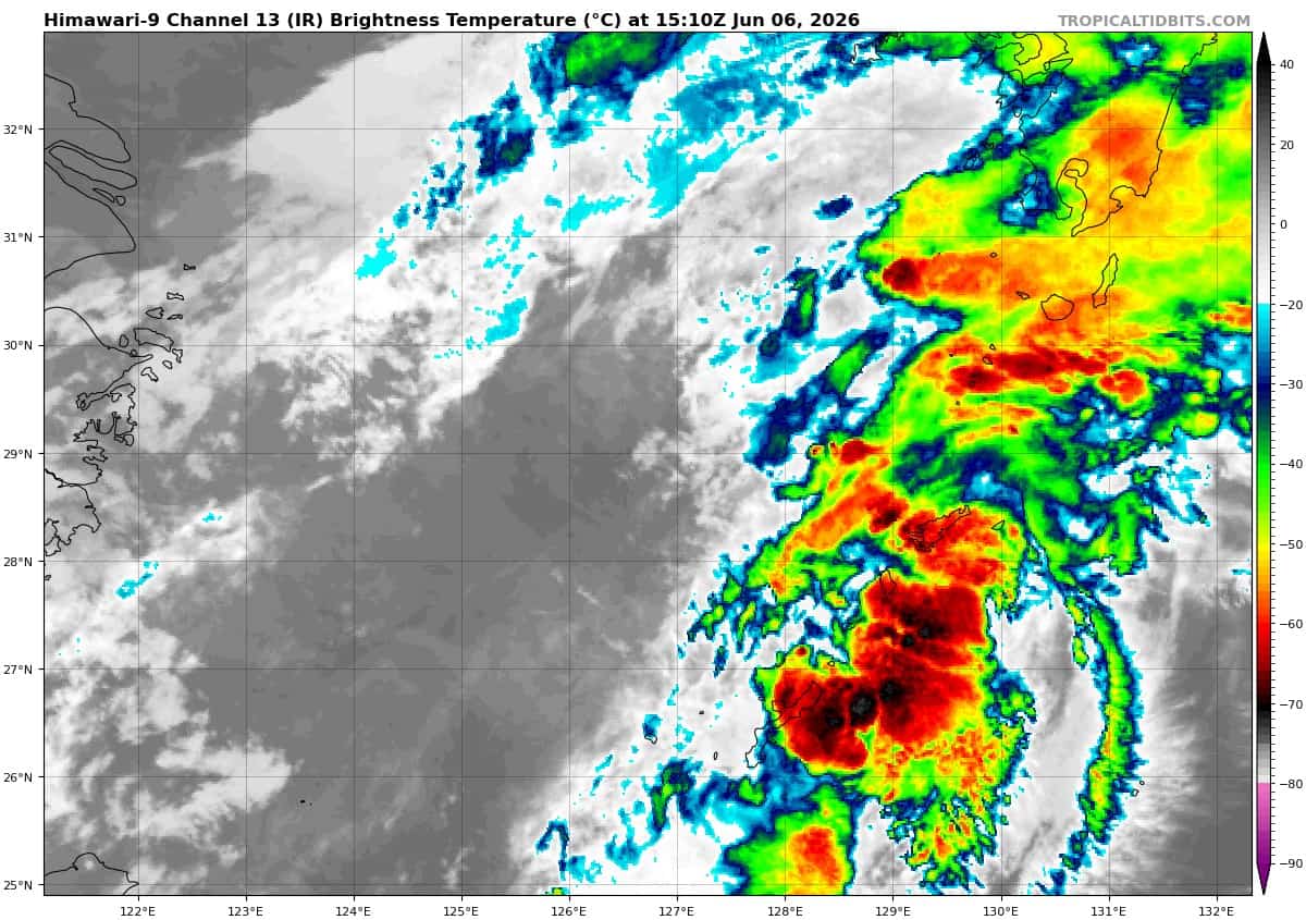
There’s an area of disturbed weather being referred to as Invest 91W, which is located approximately 260 NM west-southwest of Kadena, Japan
The system is currently classified as a subtropical disturbance, generally characterized as having both tropical and mid-latitude cyclone features.
Animated multi-spectral satellite imagery (msi), along with animated Taiwan radar data, and surface and ship observations depict a weak, disorganized rotation moving inland over south central Taiwan, to the east of Kaohsiung. The system lies well south of the Mai-yu/baiu boundary (mbc) currently
draped across the East China Sea (ecs).
Animated multi-spectral satellite imagery (msi) depicts a weak, disorganized rotation moving just south of the Mai-yu/baiu boundary currently draped across the East China Sea. 91W is forecast to continue moving rapidly north north-eastward into the East China Sea.
Environmental analysis for the area indicates marginally favorable conditions for intensification with low vertical wind shear (10-15 knots), warm (26-27 c) sea surface temperatures (sst), and good
poleward outflow aloft.
Tthe system transits northeastward it will encounter significantly cooler ssts surrounding the Kuroshio Current, as well as increased temperature advection. Deterministic guidance shows 91W reaching peak intensity over the next 18 hours as it passes west of Okinawa.
The wind field is forecast to expand as it moves through the East China Sea, with the highest winds being located in the eastern hemisphere of the circulation.
Maximum sustained surface winds are estimated at 23 to 28 knots.
The potential for the development of a significant tropical cyclone within the next 24 hours remains low.