
")
Current Snapshot
For all the latest updates visit: DisasterAWARE
amanda
h
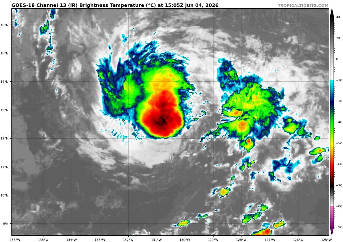
goes18_ir_01E_202606041505_lat12.3-lon-130.2

01E_tracks_latest
2
7
7777
ggg
10
By PDC’s Senior Weather
Specialist Glenn James

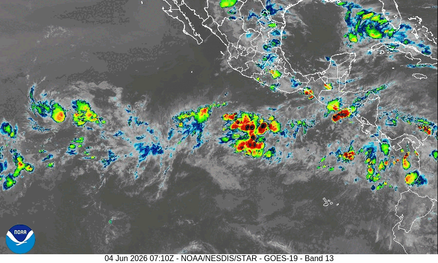
The Pacific Disaster Center’s (PDC Global) Thursday, June 4, 2026, Tropical Cyclone Activity Report…for the Pacific Ocean, the Indian Ocean, and adjacent Seas
Current Tropical Cyclones:
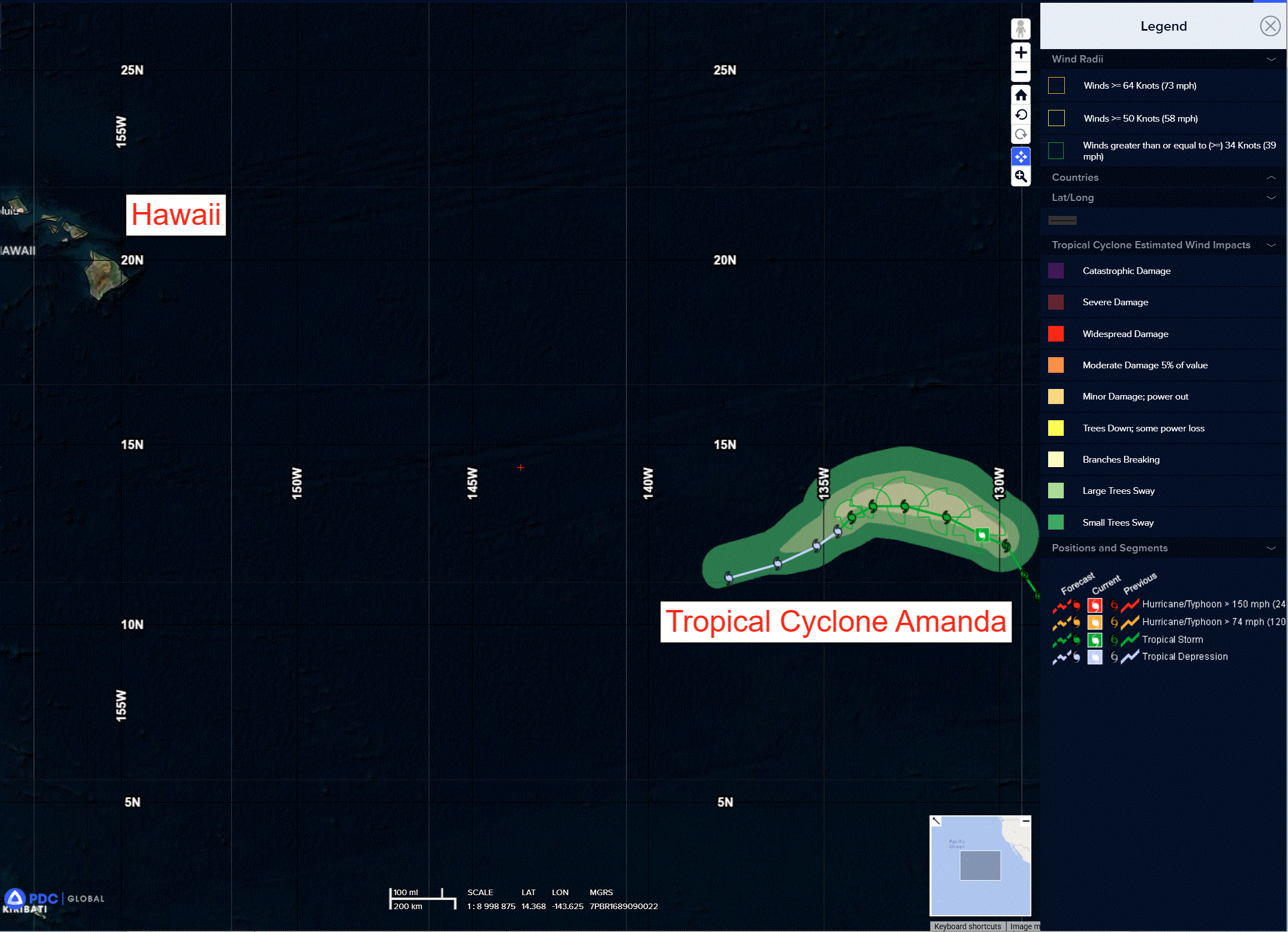
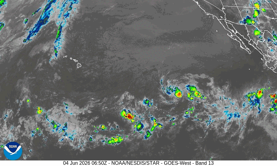
Tropical Cyclone 01E Amanda…is located approximately 1590 miles west-southwest of the southern tip of Baja California
Northeast Pacific Ocean:
Tropical Cyclone 01E (Amanda)
SMALL AMANDA CONTINUES MOVING WEST-NORTHWESTWARD OVER THE OPEN EAST PACIFIC
According to the NHC advisory number 10
Amanda is moving toward the west-northwest near 10 mph (17 km/h) and this motion is expected to continue into Friday. A turn towards the west and then southwest at a slower forecast speed is anticipated by this weekend. Maximum sustained winds remain near 45 mph (75 km/h) with higher gusts. Little change in strength is forecast during the next day or so followed by gradual weakening trend this weekend. Amanda is forecast to become a post-tropical remnant low by early next week.
Tropical-storm-force winds extend outward up to 45 miles (75 km) from the center.
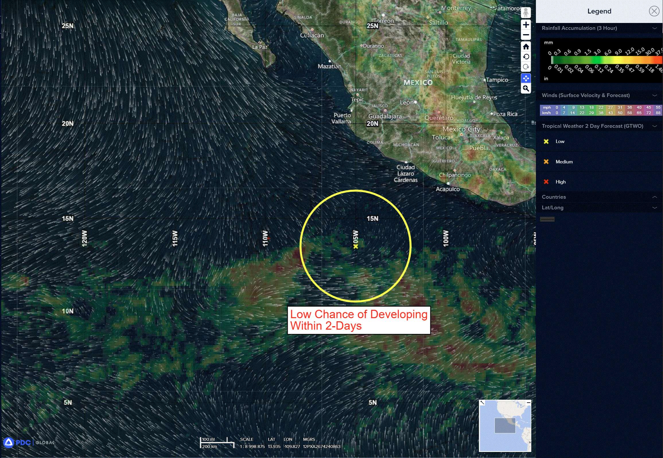
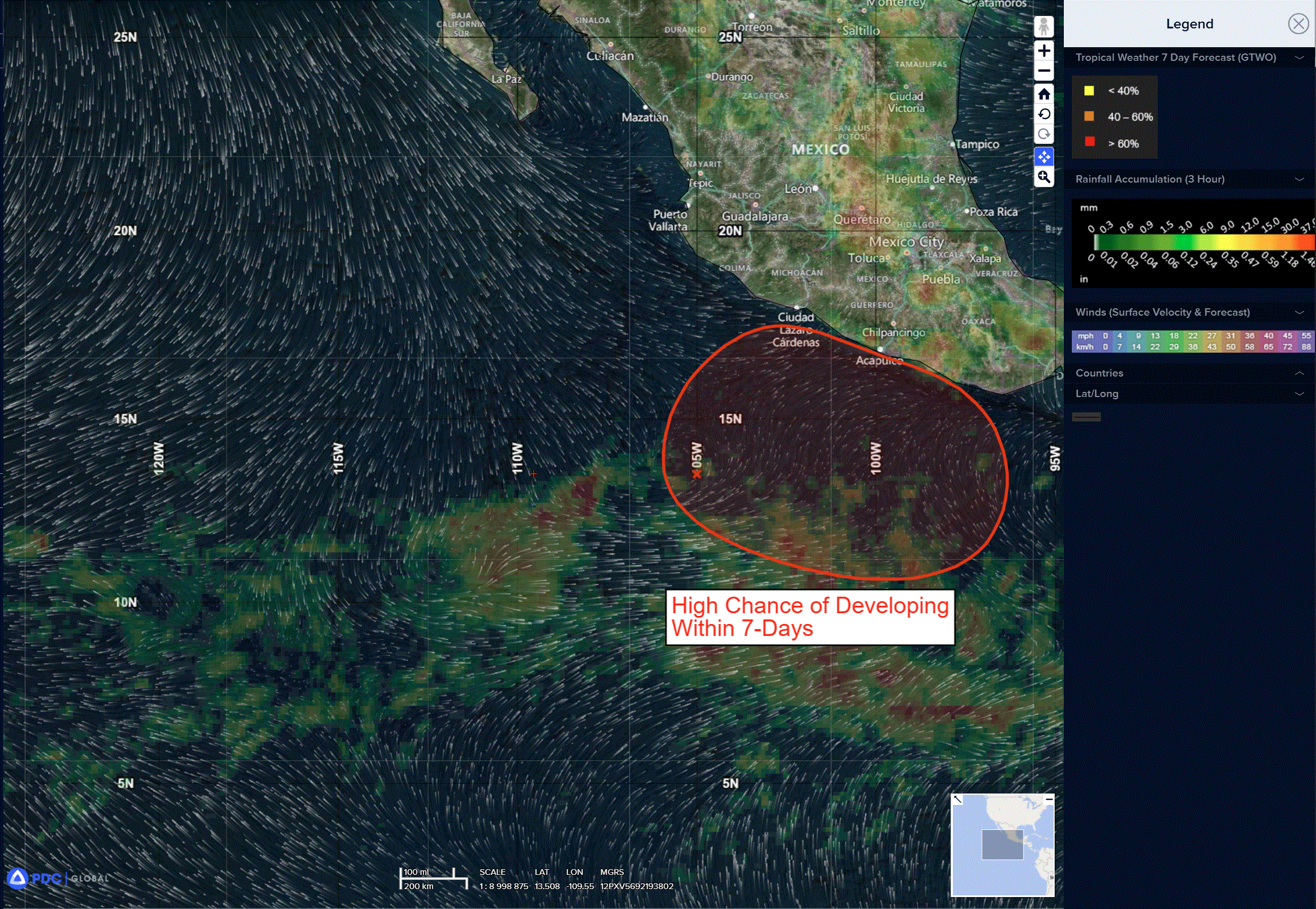
>>> Offshore Southern and Southwestern Mexico:
A trough of low pressure located well offshore of southwestern Mexico is producing a large area of disorganized showers and thunderstorms.
Environmental conditions appear conducive for development of this system, and a tropical depression is likely to form during the next several days while it moves slowly northward or north-northeastward near the coast of southern Mexico.
* Formation chance through 48 hours…low…30 percent
* Formation chance through 7 days…high…80 percent
>>> Offshore of Central America:
A trough of low pressure offshore of Central America is producing some disorganized shower and thunderstorm activity.
Environmental conditions appear conducive for development of this system, and a tropical depression is likely to form during the next several days while it moves slowly northward
* Formation chance through 48 hours…low…20 percent
* Formation chance through 7 days…high…70 percent
Central Pacific Ocean: There are no Tropical Cyclones
Tropical cyclone formation is not expected during the next 7 days.
Western Pacific, Indian Ocean, and adjacent Seas: There are no Tropical Cyclones
There’s an area of disturbed weather being referred to as Invest 91W, which is located approximately 55 NM southwest of Ishigakijima, Japan
The system is currently classified as a subtropical disturbance, generally characterized as having both tropical and midlatitude cyclone features.
Animated multi-spectral satellite imagery (msi) depicts a weak, disorganized disturbance forming in the vicinity ofTaiwan, south of the Mei-yu/baiu boundary which is currently positioned over the East China Sea. animated radar imagery shows broad cyclonic turning centered over southern Taiwan, with rain bands primarily displaced to the south of the assessed center.
Earlier scatterometer wind speed data revealed a swath of 25 kt winds to the south of the center. The environment is assessed to be marginally favorable for further development, with moderate (15-20 kts) vertical wind shear (vws), warm (28-29 c) sea surface temperatures, weak poleward and
equatorward outflow aloft, and land interaction with Taiwan.
91W is expected to track quickly northeastward into the East China Sea where it will become embedded within and track along the Mei-yu/baiu boundary toward southwestern Japan, likely retaining subtropical characteristics.
The wind field is likely to be highly asymmetric, with the strongest winds expected on the southeastern side of the system. As the system passes west of Okinawa, a brief period of intensification is possible as it approaches Kyushu.
Maximum sustained surface winds are estimated at 23 to 28 knots.
The potential for the development of a significant tropical cyclone within the next 24 hours is low.