
")
Current Snapshot
For all the latest updates visit: DisasterAWARE
1
22
2
jang

06W_011200sair
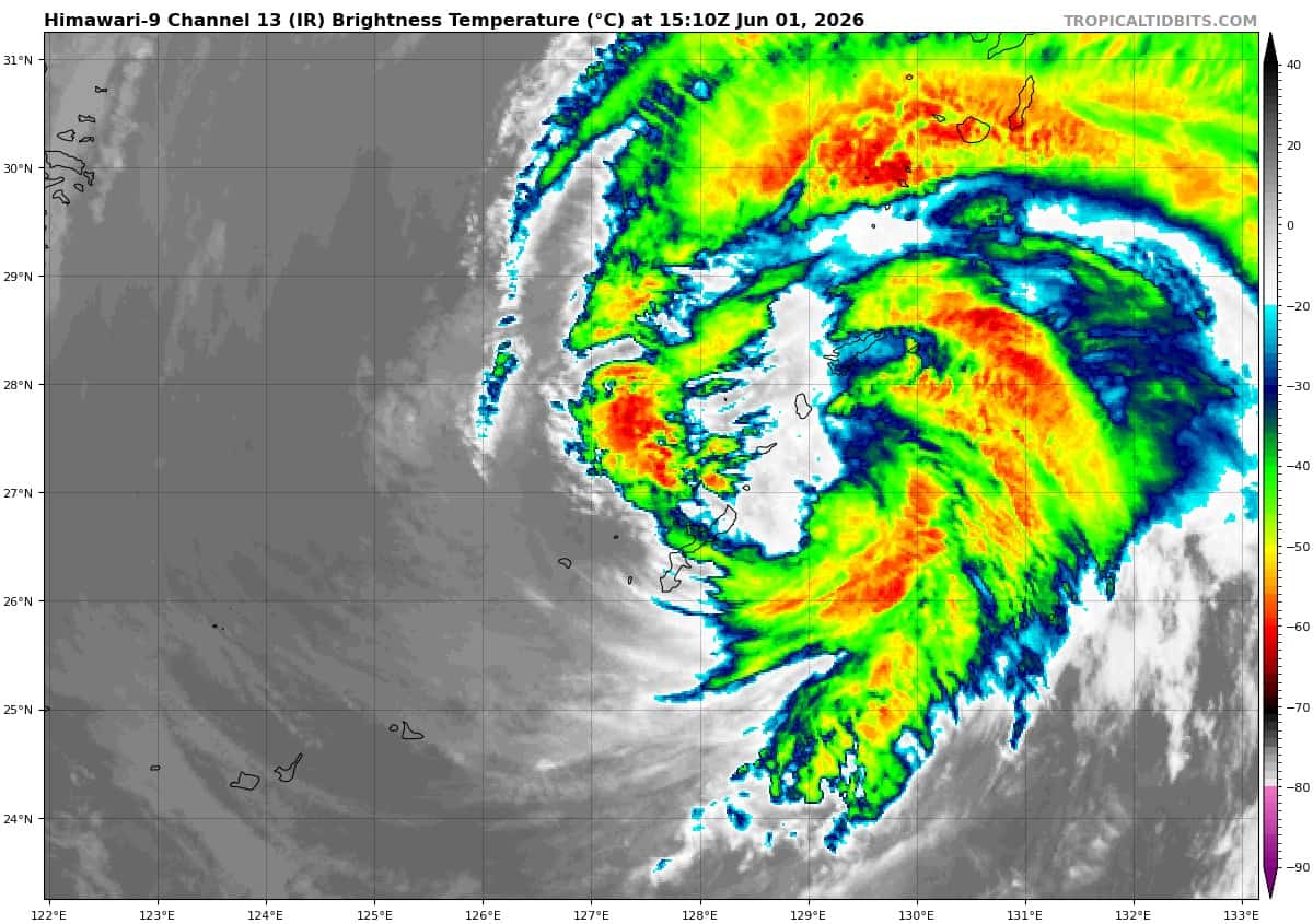
himawari9_ir_06W_202606011510_lat26.7-lon127.5

06W_tracks_latest
By PDC’s Senior Weather
Specialist Glenn James

The Pacific Disaster Center’s (PDC Global) Monday, June 1, 2026, Tropical Cyclone Activity Report…for the Pacific Ocean, the Indian Ocean, and adjacent Seas
Current Tropical Cyclones:
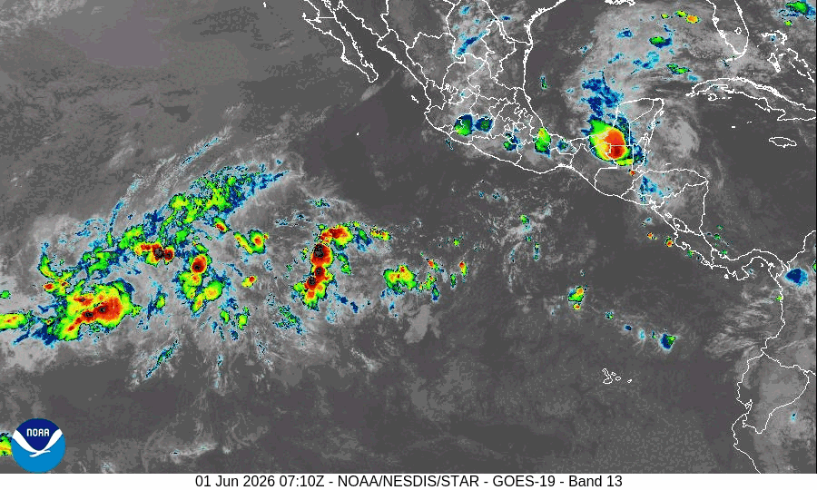
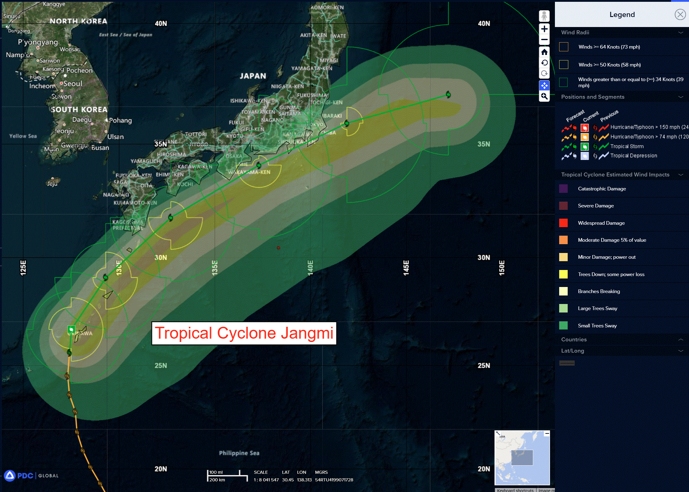
Tropical Cyclone 06W (Jangmi)…is located approximately 679 NM west-southwest of Yokosuka, Japan
Northeast Pacific Ocean: There are no Tropical Cyclones
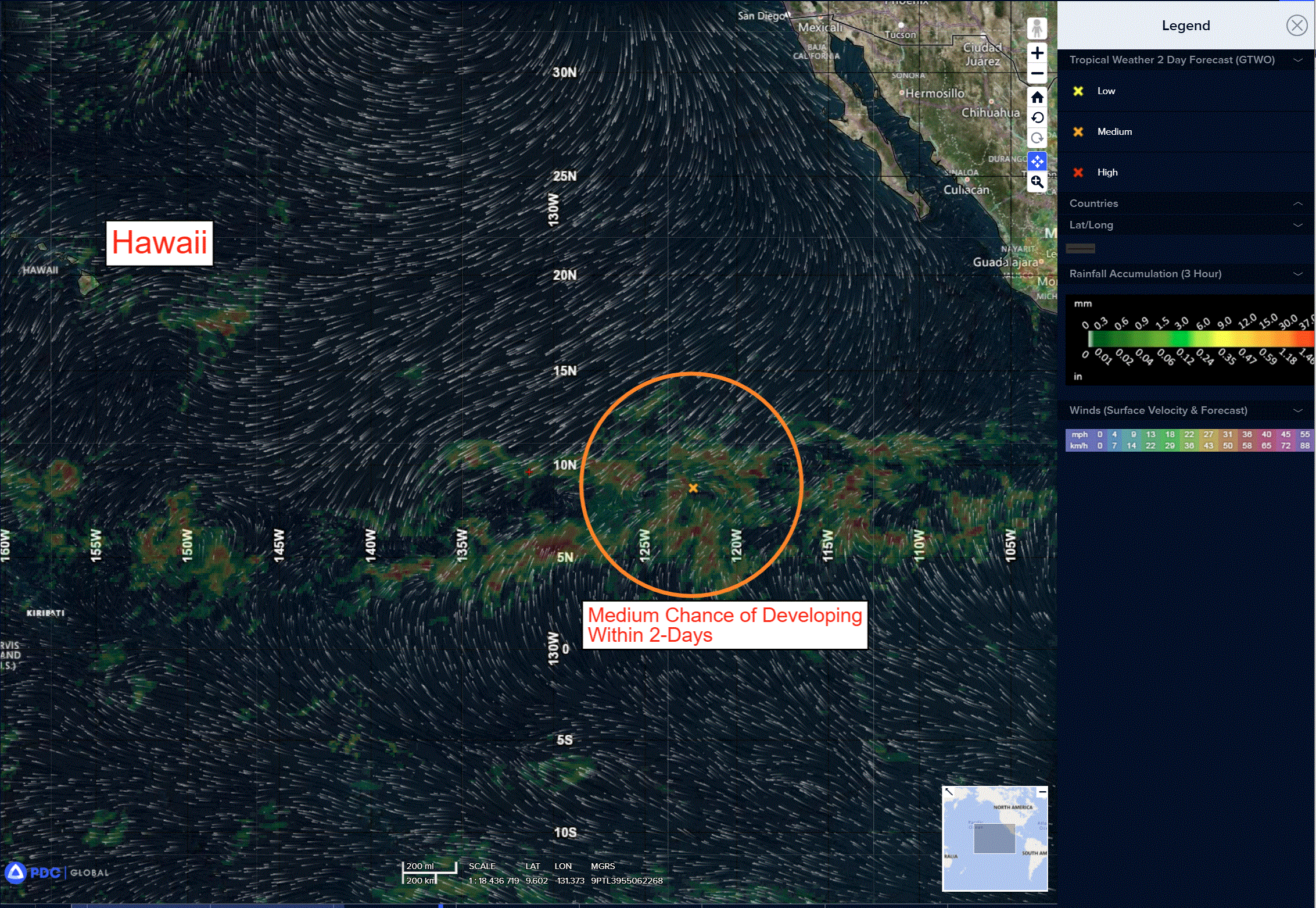
>>> Well Southwest of the Baja California Peninsula:
Invest 90E
Satellite images indicate that an area of low pressure located well southwest of the southern tip of the Baja California Peninsula is starting to show signs of organization.
Environmental conditions appear conducive for additional development, and a tropical depression is expected to form during the next day or two while the system moves westward or west-northwestward around 10 mph across the western portion of the East Pacific.
* Formation chance through 48 hours…high…70 percent
* Formation chance through 7 days…high…90 percent
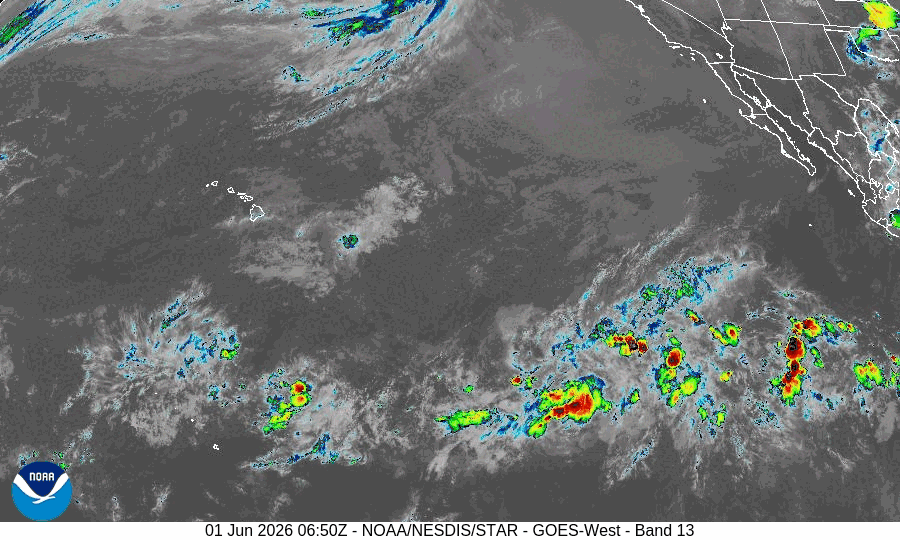
>>> Eastern East Pacific:
An area of low pressure could form offshore of Central America and southern Mexico late this week or over the weekend.
Environmental conditions appear favorable for some development of this system thereafter, while it moves westward to west-northwestward at around 10 mph.
* Formation chance through 48 hours…low…near 0 percent
* Formation chance through 7 days…medium…40 percent
Central Pacific Ocean: There are no Tropical Cyclones
Tropical cyclone formation is not expected during the next 7 days.
Western Pacific, Indian Ocean, and adjacent Seas:
Western Pacific
Tropical Cyclone 06W (Jangmi)
According to the JTWC warning number 24 sustained winds were 50 knots with gusts to near 65 knots
Animated enhanced infrared (eir) satellite imagery depicts a broad, irregular low level circulation (llc), with a rapidly deteriorating convective structure. The upper-level rotation is beginning to decouple under pressure from increasing westerly shear (now estimated at 15 knots), and entrainment of dry, subsident air impinging upon the southwestern quadrant of the llc. Animated JMA radar data indicates minimal convective activity across the western semicircle of the system, while a well-defined rain shield and embedded convection is focused in the northeast and eastern quadrants. A 011227z metop-c ascat pass delineated a symmetrical eye feature centered just west of Iejima Island, and the eastern edge of the llcc extending over the central region of Okinawa proper.
Surface observations indicate light and variable winds at sites within the circulation center (eye), and winds quickly increasing at Naha as the southern edge of the eye moves northward. Surface pressures at Iejima auxiliary landing field reached a minimum of 982mb near 1200z, supporting the initial mslp assessment with high confidence.
Environmental conditions are beginning to deteriorate, with a recent increase in vertical wind shear (vws) evident in the latest cimss estimates, rapidly decreasing sea surface temperatures (ssts), and dry, subsident air entraining into the core of the system. However, poleward outflow remains robust, flowing into the right rear entrance region of a strong jet maximum over central Honshu.
Owing to a late-stage trochoidal oscillation, the center of TS 06W bypassed a direct landfall on Okinawa; however, due to the expansive scale of the llcc, the majority of Okinawa experienced conditions consistent with eye passage in the surface wind field. Having rounded the axis of the str to the east, tropical storm 06W will now accelerate northeastward along the northwestern flank of the ridge, tracking west of but parallel to the northern Ryukyu Islands for the next 12-18 hours, before passing adjacent to the southern tip of Kyushu. The system will track in close proximity to or potentially make a brief landfall along the southern tip of Honshu south of Kyoto around 30 hours. A landfall on the southern portion of the Izu Peninsula is explicitly forecast to occur around 40 hours, after which ts 06W will rapidly transit the southern Sagami Bay and the southern approaches to Tokyo Bay. By 48 hours, the system will begin to decelerate as it moves back over open waters east of Chosi. Forward propagation speed will decelerate significantly by the end of the forecast as the cyclone veers
eastward in response to the str retreating southward to a position near Guam.
Regarding intensity, the system is already exhibiting signs of significant vortex tilt, and the increasing shear and dry air entrainment will lead to a complete decoupling of the vertical vortex within the next 24 hours. However, while the remaining vortex will be shallow, the surface wind field will remain relatively robust, and will gradually decay due to conservation of momentum as well as the influence of baroclinic forcing. TS 06W will gradually weaken in a step-wise manner but remain a storm-force system until the end of the forecast period.