
")
Current Snapshot
For all the latest updates visit: DisasterAWARE
1
2
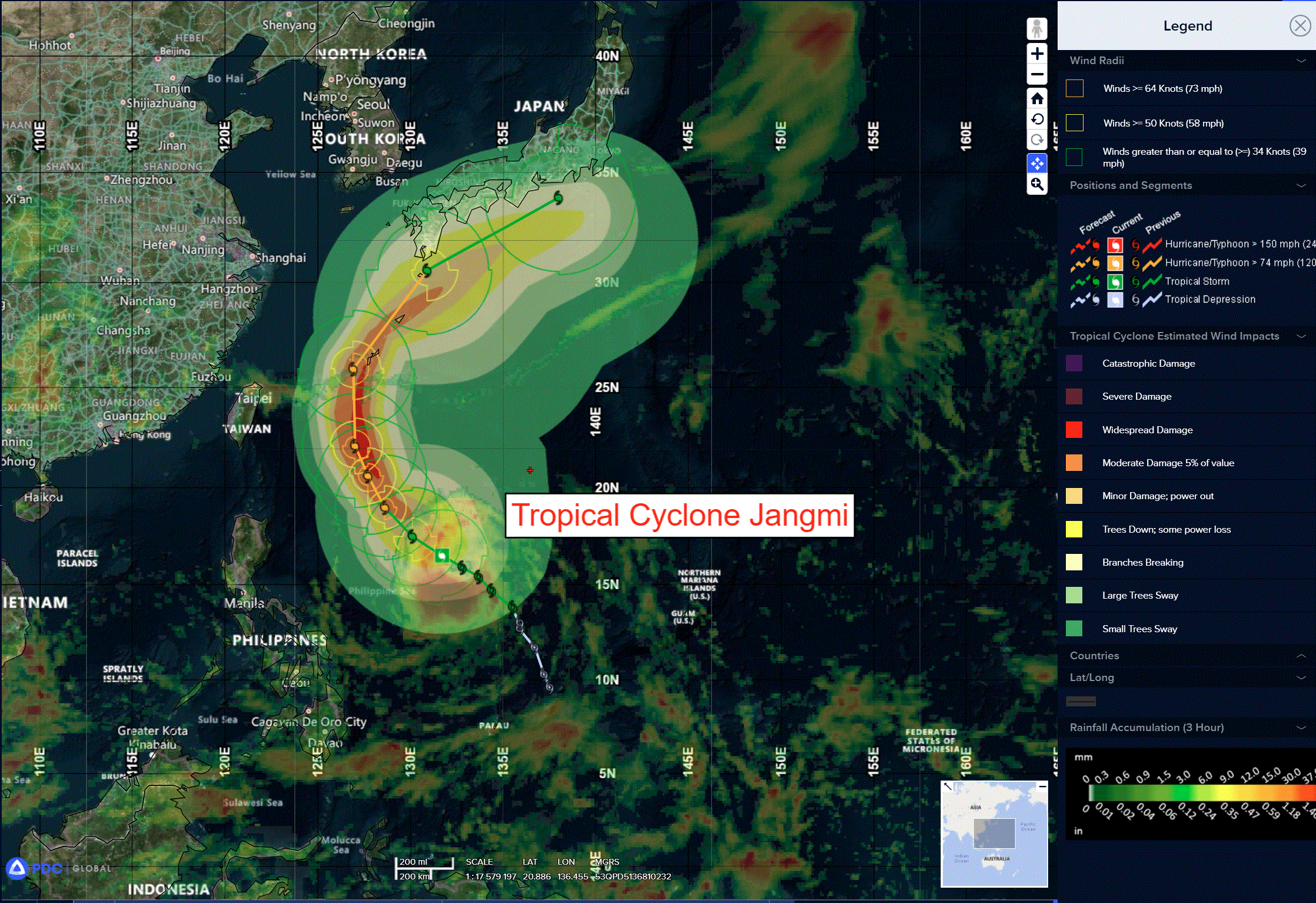
jangmi

06W_291200sair

06W_tracks_latest
By PDC’s Senior Weather
Specialist Glenn James

The Pacific Disaster Center’s (PDC Global) Friday, May 29, 2026, Tropical Cyclone Activity Report…for the Pacific Ocean, the Indian Ocean, and adjacent Seas
Current Tropical Cyclones:
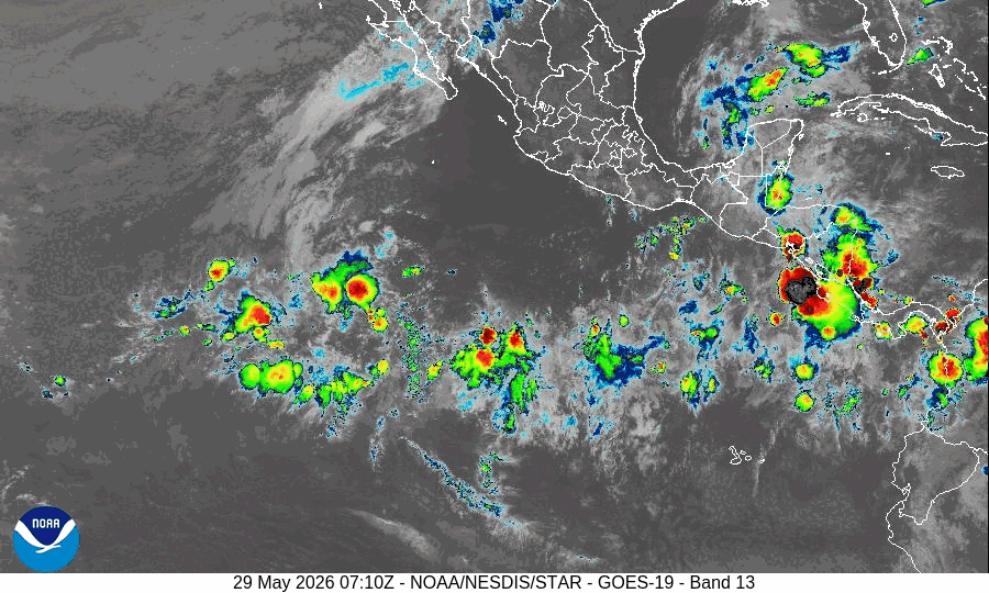
Tropical Cyclone 06W (Jangmi)…is located approximately 555 NM south-southeast of Kadena AB
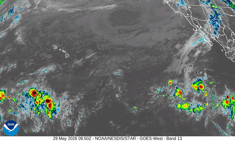
Northeast Pacific Ocean: There are no Tropical Cyclones
Well Southwest of the Baja California Peninsula:
A broad area of low pressure is forecast to form early next week well to the southwest of the southern tip of the Baja California peninsula.
Environmental conditions appear conducive for additional development thereafter, and a tropical depression is likely to form during the middle part of next week while moving westward or west-northwestward at 10 to 15 mph across the western portion of the East Pacific.
* Formation chance through 48 hours…low…near 0 percent
* Formation chance through 7 days…high…80 percent
Central Pacific Ocean: There are no Tropical Cyclones
Western Pacific, Indian Ocean, and adjacent Seas:
Western Pacific
Tropical Cyclone 06W (Jangmi)
According to the JTWC warning number 12 sustained winds were 55 knots with gusts to near 70 knots
Animated enhanced infrared (eir) satellite imagery depicts significantly improved convective signature associated with tropical storm 06W (Jangmi). Initial position is assessed with high confidence based on a 291112 gpm gmi 37 ghz microwave imagery depicting a continuously broad low-level circulation center (llcc) with nearly all of the deep convection concentrated in the southern semicircle.
The ambient thermodynamic and kinematic environment is largely conducive for continued cyclogenesis, highlighted by elevated sea surface temperatures of 29-30 c and moderate equatorward outflow aloft. Hhowever, analysis of water vapor and shortwave infrared imagery reveals competing mitigating factors, specifically the presence of mid-level dry air entrainment and persistent northeasterly vertical wind shear (10-15 kts) impinging on the northeastern quadrant.
TS 06W is forecast to continue transiting along the southwestern periphery of a building subtropical ridge (str) centered to the northeast over the next 48 hours. During that time, the mid-level northeasterly vertical wind shear (vws) is expected to relax, which will allow the system to further consolidate and intensify. Peak intensity of 80 kts is expected around 48 hours.
After that, the system is expected to reach the axis of the ridge and begin poleward and eventually eastward turn. As the guidance have been shifting slightly westward, the track is now expected to overlay the warm water signature of the Kuroshio current underneath. As such, the weakening impacted by otherwise cooling sea surface temperatures will be slightly reduced, allowing the system to maintain maximum wind speeds of 55-60 kts around the time TS Jangmi approaches the island of Kyushu.
Beyond 96 hours, as the system accelerates northeastward, reduced oceanic heat content will likely induce localized cold wake upwelling, thereby accelerating vortex decay. At the same time, the system will begin interacting with the mid-latitude westerlies.
While the introduction of baroclinic forcing impacts is expected to enhance poleward ventilation via the jet stream, these dynamic benefits will be rapidly overwhelmed by a hostile thermodynamic boundary layer characterized by plummeting sea surface temperatures and increasing vws. Cconsequently, a precipitous weakening trend will commence, accompanied by a significant kinematic expansion of the wind field, posing potential hazards to mainland Japan.