
")
Current Snapshot
For all the latest updates visit: DisasterAWARE
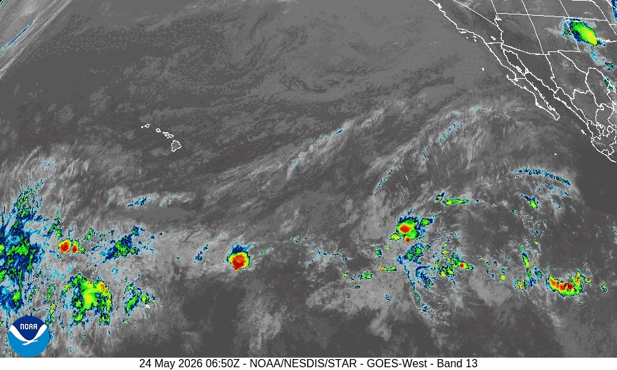
GOES18-TPW-13-900×540
10
By PDC’s Senior Weather
Specialist Glenn James

The Pacific Disaster Center’s (PDC Global) Sunday, May 24, 2026, Tropical Cyclone Activity Report…for the Pacific Ocean, the Indian Ocean, and adjacent Seas
Current Tropical Cyclones:
There are no Tropical Cyclones
Northeast Pacific Ocean: There are no Tropical Cyclones
Tropical cyclone formation is not expected during the next 7 days.
Central Pacific Ocean: There are no Tropical Cyclones
Western Pacific, Indian Ocean, and adjacent Seas: There are no Tropical Cyclones
Western Pacific
>>> There’s an area of disturbed weather being referred to as Invest 99W, which is located approximately 239 NM east-southeast of Yap
Animated multi-spectral satellite imagery, a 242153z f16 ssmis 91ghz imagery, and a 242352z metop-b ascat pass, depict a broad and poorly organized low level circulation center (llcc) partially obscured by flaring
convection, with associated deep convection displaced along the southern and northern peripheries.
Upper level analysis indicates 99W is in a moderately favorable environment for development with moderate
(15-20kts) vertical wind shear (vws), good divergence aloft, particularly in the poleward direction, and warm (29-30c) sea surface temperatures (ssts).
Global deterministic and ensemble models are in good agreement that 99W will continue to consolidate as it tracks generally north-northwestward over the next few days. Although overall conditions are favorable, the lack of a distinct, consolidated llcc will limit potential development in the near term.
Maximum sustained surface winds are estimated at 13 to 18 knots.
The potential for the development of a significant tropical cyclone within the next 24 hours is low.