
")
Current Snapshot
For all the latest updates visit: DisasterAWARE
GOES18-TPW-13-900×540
hagupit
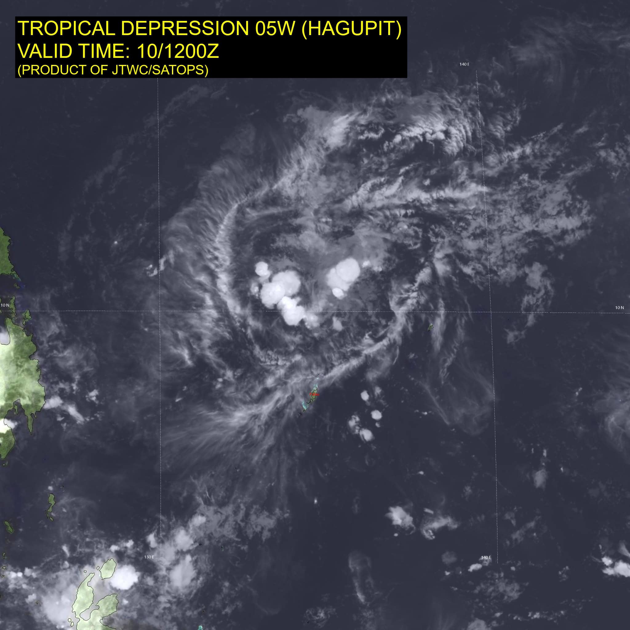
05W_101200sair
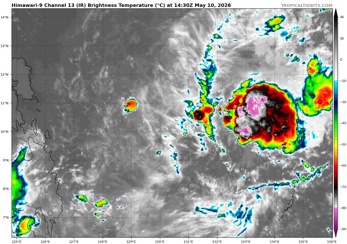
himawari9_ir_05W_202605101430_lat10.3-lon131.0

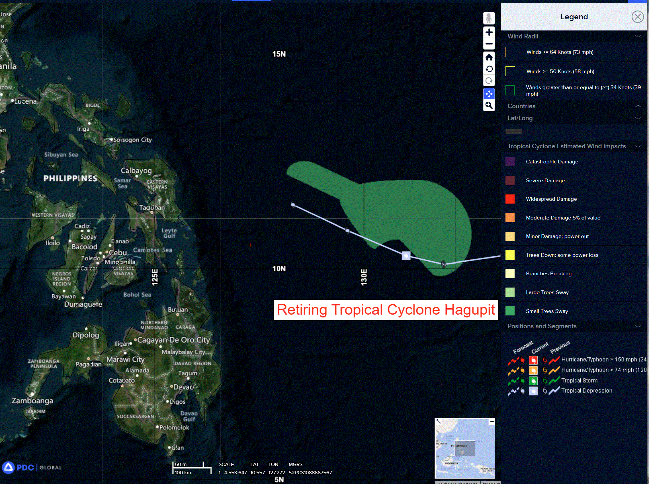
05W_tracks_latest
By PDC’s Senior Weather
Specialist Glenn James

The Pacific Disaster Center’s (PDC Global) Sunday, May 10, 2026, Tropical Cyclone Activity Report…for the Pacific Ocean, the Indian Ocean, and adjacent Seas
Current Tropical Cyclones:
Tropical Cyclone 05W (Hagupit) is located approximately 256 NM west-northwest of Kyangel – Final Warning
Northeast Pacific Ocean: There are no Tropical Cyclones
The last regularly scheduled Tropical Cyclone Activity Report of the 2025 eastern North Pacific Hurricane Season has been issued. Routine issuance of this section of the PDC product will resume on May 15, 2026. During the off-season, Special Tropical Weather Outlooks will be issued as conditions warrant by the NHC.
Central Pacific Ocean: There are no Tropical Cyclones
The 2025 central North Pacific hurricane season has ended. As such, the final routine Tropical Cyclone Activity Report for the 2025 season has been issued. Routine issuance of this section of the PDC product will resume on June 1, 2026. During the off-season, Special Tropical Weather Outlooks will be issued as conditions warrant by the CPHC.
Western Pacific, Indian Ocean, and adjacent Seas:
Tropical Cyclone 05W (Hagupit) – Final Warning
According to the JTWC Warning number 20, sustained winds are 25 knots with gusts to 35 knots
Animated enhance infrared imagery depicts 05W as a weak, fully exposed, and shallow vortex completely void of any deep convection.
Environemntal analysis reveals a highly unfavorable environment characterized by high (20-25 kts) mid-level vertical wind shear, significant dry air entrainment, and poor upper-level divergence, offset by warm (29-30 c) sea surface temperatures.
Hagupit will continue drifting west-northwestward for the duration of the forecast period, and succumbing to the high mid-level shear and dry air entrainment no later than 12 hours.
Both track and intensity model guidance are in strong agreement, supporting the JTWC track and intensity forecasts
with high confidence.