
")
Current Snapshot
For all the latest updates visit: DisasterAWARE
GOES18-TPW-13-900×540
hag
05W_081200sair
himawari9_ir_05W_202605081420_lat8.7-lon138.2

05W_tracks_latest
By PDC’s Senior Weather
Specialist Glenn James

The Pacific Disaster Center’s (PDC Global) Friday, May 8, 2026, Tropical Cyclone Activity Report…for the Pacific Ocean, the Indian Ocean, and adjacent Seas
Current Tropical Cyclones:
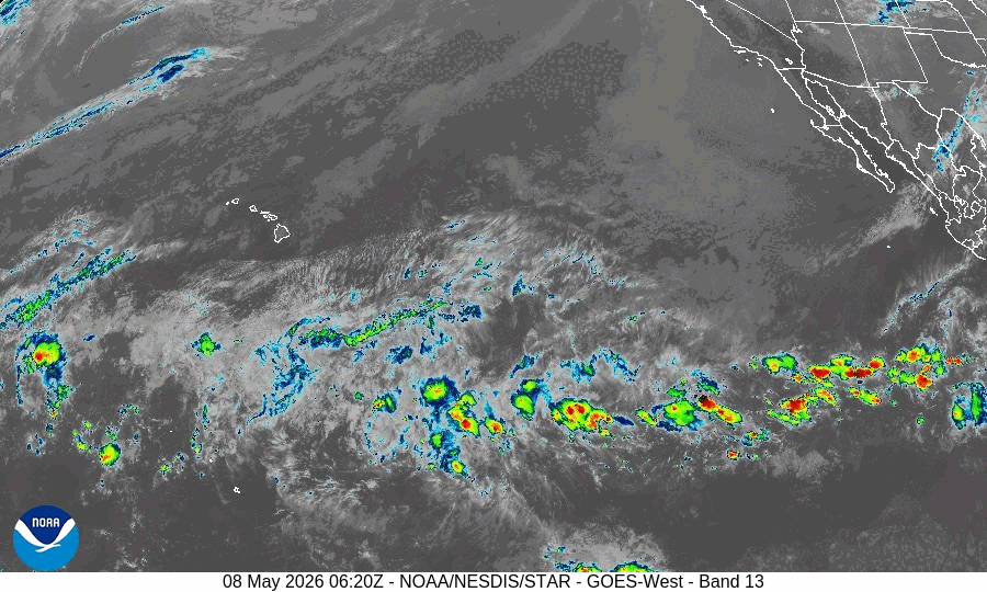
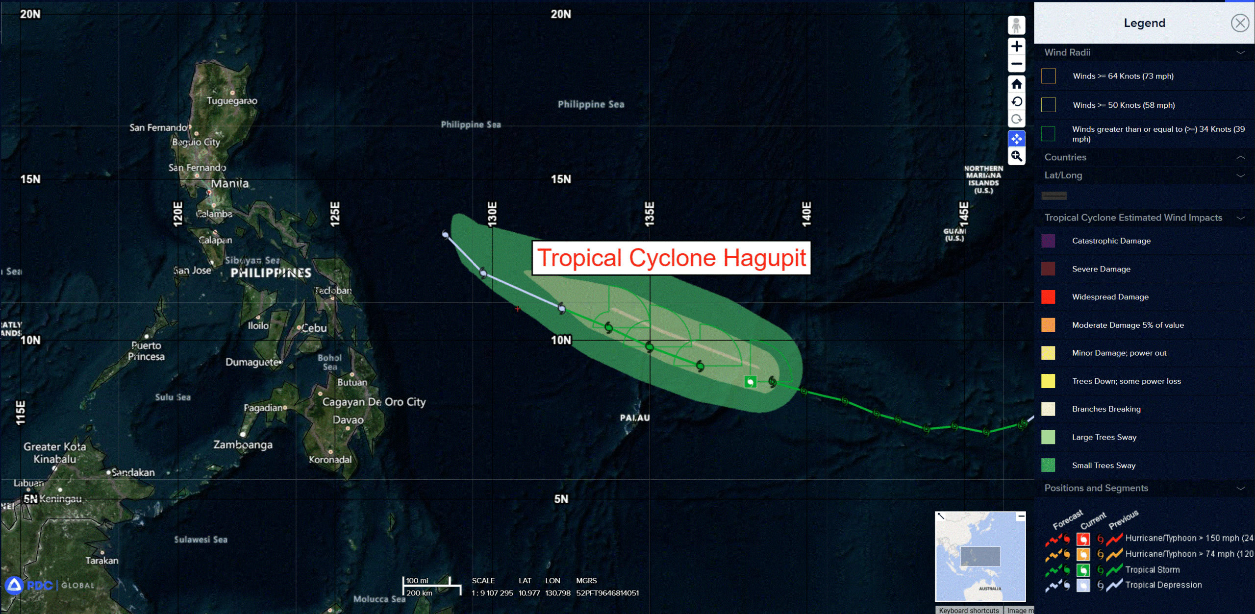
Tropical Cyclone 05W (Hagupit) is located approximately 156 NM northeast of Angaur
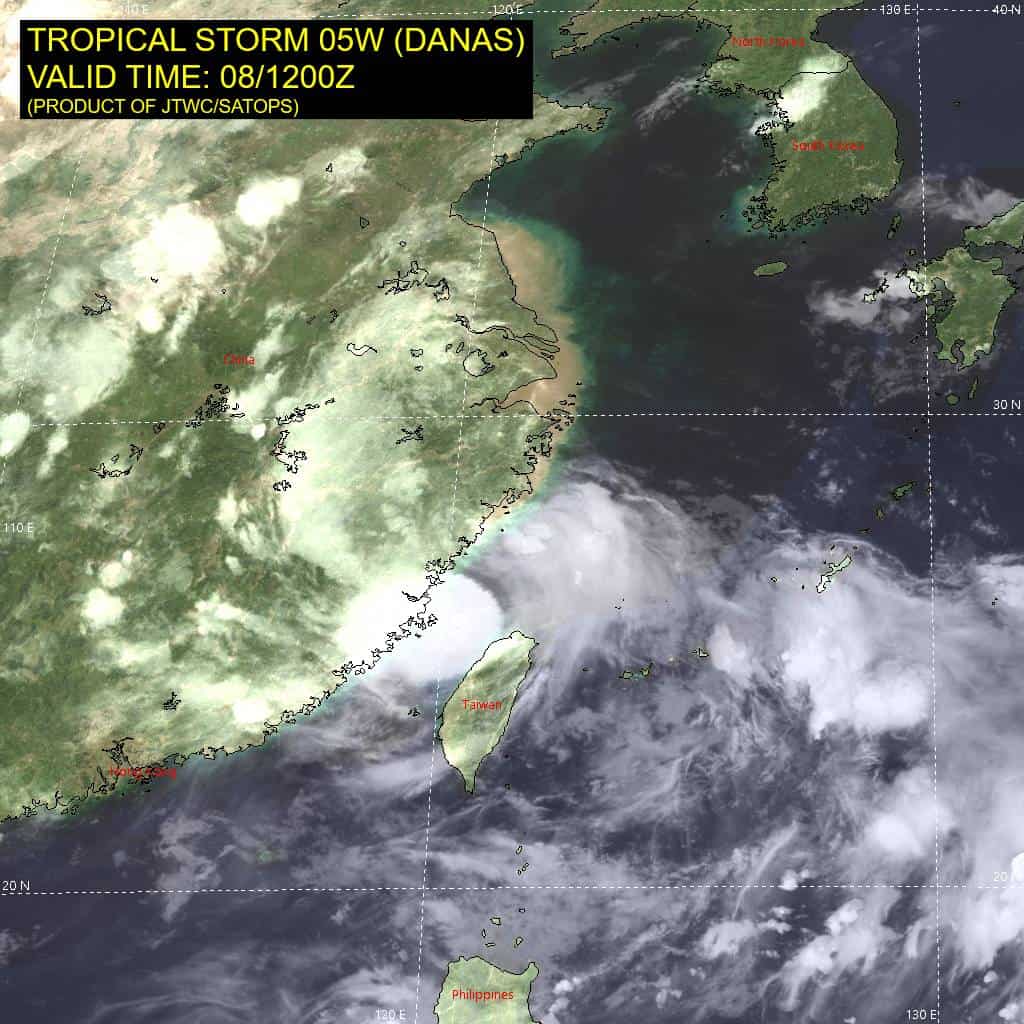
Northeast Pacific Ocean: There are no Tropical Cyclones
The last regularly scheduled Tropical Cyclone Activity Report of the 2025 eastern North Pacific Hurricane Season has been issued. Routine issuance of this section of the PDC product will resume on May 15, 2026. During the off-season, Special Tropical Weather Outlooks will be issued as conditions warrant by the NHC.
Central Pacific Ocean: There are no Tropical Cyclones
The 2025 central North Pacific hurricane season has ended. As such, the final routine Tropical Cyclone Activity Report for the 2025 season has been issued. Routine issuance of this section of the PDC product will resume on June 1, 2026. During the off-season, Special Tropical Weather Outlooks will be issued as conditions warrant by the CPHC.
Western Pacific, Indian Ocean, and adjacent Seas:
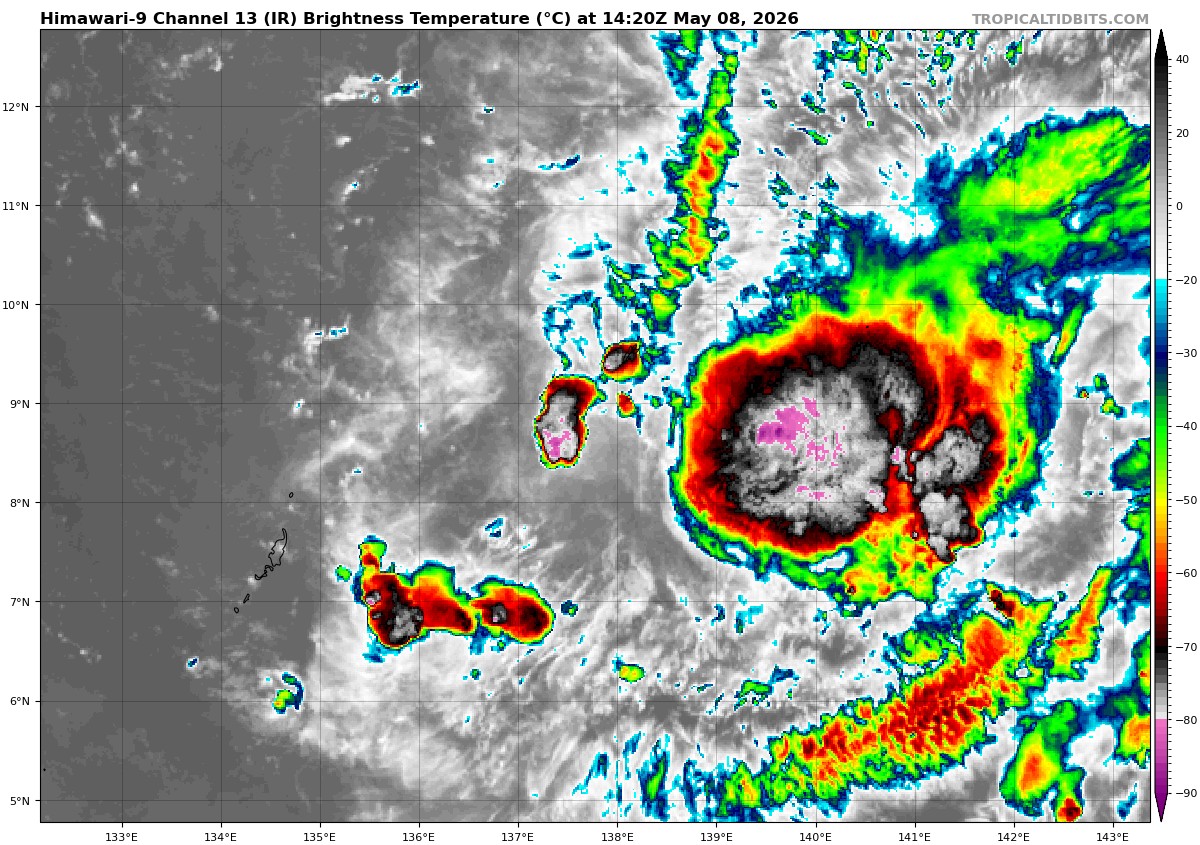
Tropical Cyclone 05W (Hagupit)
According to the JTWC Warning number 14, sustained winds are 35 knots with gusts to 45 knots
Animated multi-spectral satellite imagery (msi) depicts poorly organized deep convection displaced east of the low-level circulation center (llcc) and a few brief pulses of convection to the west. Moderate upper-level outflow producing ample cirrus leaves the llcc completely obscured in the msi. A 080437z amsr-2 89 ghz microwave image exposed some evidence of low-level bands wrapping into the llcc beneath the cirrus canopy.
The environment is characterized as marginally favorable with moderate poleward outflow, warm (29-30 c) sea surface temperatures, and moderate vertical wind shear (vws). A layer of significantly drier air between 600-300 mb and moderate mid-level westerly shear serve to offset the favorable
environmental factors.
Tropical storm 05W (Hagupit) is forecast to continue on a steady west-northwestward track under the steering influence of the str to the northeast through 48 hours. The eastward migration of the str will result in a weaker steering environment for 05W, causing its track speed to slow and turn gradually poleward through the end of the forecast period.
The offsetting environmental factors previously discussed are expected to allow the system to maintain its intensity through 36 hours. After 36 hours, further enhanced dry air entrainment over the Philippine Sea will be the primary mechanism to initiate a weakening trend that is forecast to result in
dissipation by 96 hours. Dissipation will be aided by steadily increasing westerly mid-layer shear, dry air entrainment, and loss of upper-level outflow support in the later taus.