
")
Current Snapshot
For all the latest updates visit: DisasterAWARE
kkkkkkkkkk
hagupit
05W_071200sair
himawari9_ir_05W_202605071420_lat7.7-lon142.2

05W_tracks_latest
93s
meteosat9_ir_93S_202605071421_lat-8.9-lon82.5
93S_tracks_latest
By PDC’s Senior Weather
Specialist Glenn James

The Pacific Disaster Center’s (PDC Global) Thursday, May 7, 2026, Tropical Cyclone Activity Report…for the Pacific Ocean, the Indian Ocean, and adjacent Seas
Current Tropical Cyclones:
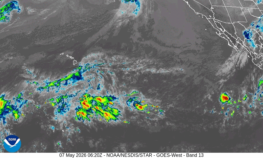
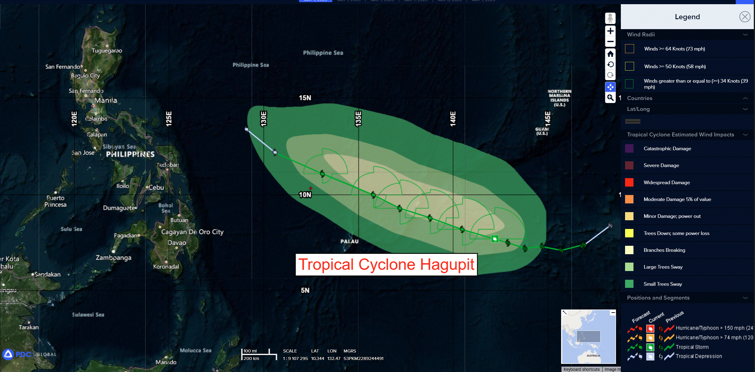
Tropical Cyclone 05W (Hagupit) is located approximately 125 NM east-southeast of Yap
Northeast Pacific Ocean: There are no Tropical Cyclones
The last regularly scheduled Tropical Cyclone Activity Report of the 2025 eastern North Pacific Hurricane Season has been issued. Routine issuance of this section of the PDC product will resume on May 15, 2026. During the off-season, Special Tropical Weather Outlooks will be issued as conditions warrant by the NHC.
Central Pacific Ocean: There are no Tropical Cyclones
The 2025 central North Pacific hurricane season has ended. As such, the final routine Tropical Cyclone Activity Report for the 2025 season has been issued. Routine issuance of this section of the PDC product will resume on June 1, 2026. During the off-season, Special Tropical Weather Outlooks will be issued as conditions warrant by the CPHC.
Western Pacific, Indian Ocean, and adjacent Seas:
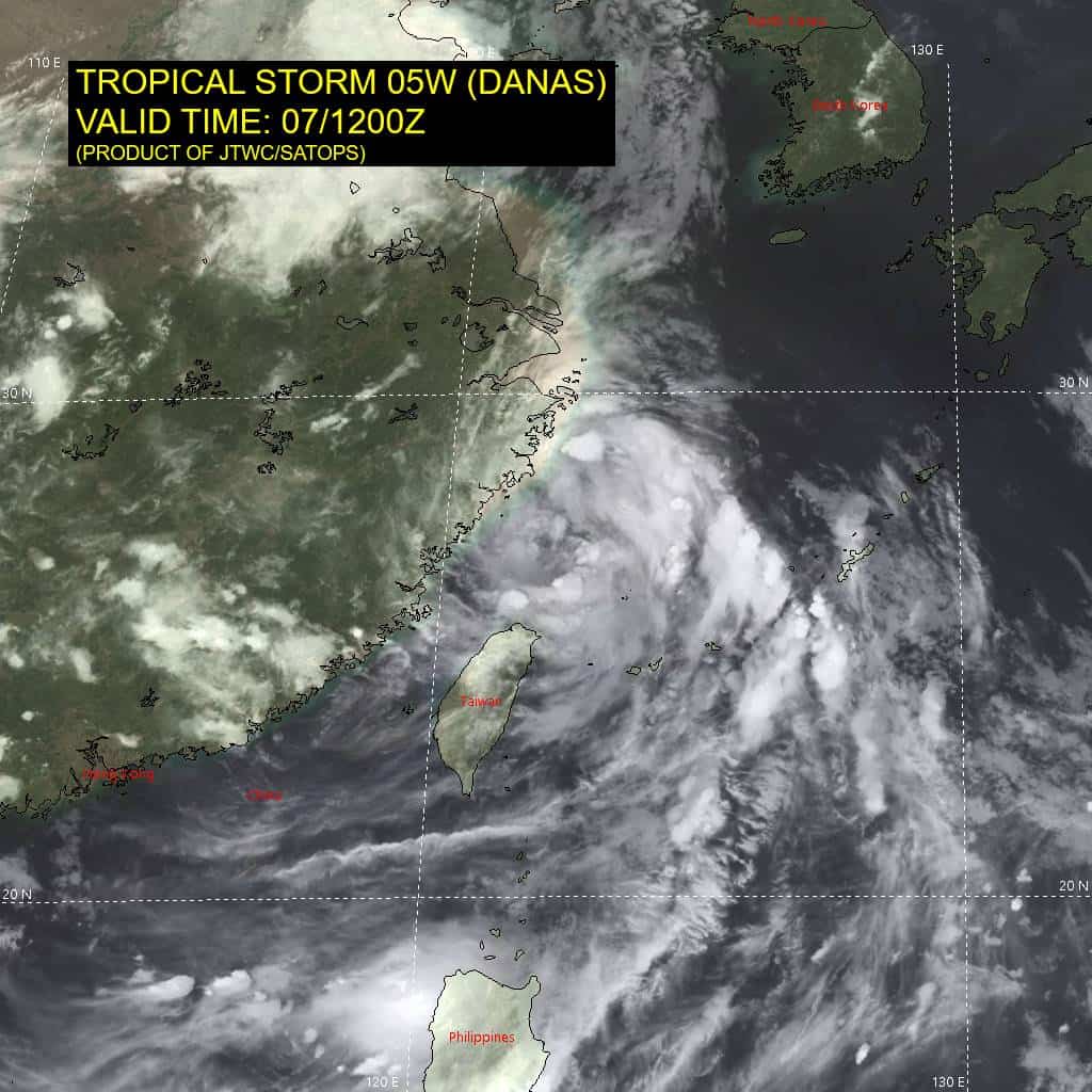
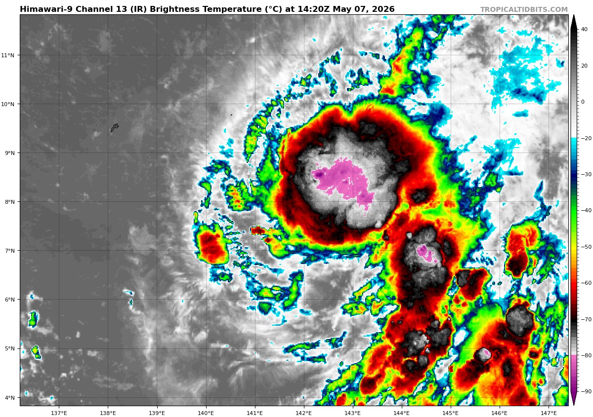
Tropical Cyclone 05W (Hagupit)
According to the JTWC Warning number 10, sustained winds are 40 knots with gusts to 50 knots
Animated multi-spectral satellite imagery (msi) depicts a partially exposed low-level circulation (llc) with deep convection mostly confined to the eastern and northern semicircles. Flaring convective bands in the southwestern quadrant remain disorganized and the resulting msi presentation is asymmetric.
The environment is characterized as marginally favorable with weak radial outflow, warm (29-30 c) sea surface temperatures, and low deep-layer vertical wind shear (vws). Dry air entrainment from the west and moderate (15-20 kts) west-northwesterly mid-tropospheric shear are acting to offset the other more favorable environmental factors.
Tropical storm 05W (Hagupit) is forecast to continue on a generally west-northwestward track through the entire forecast period, passing just south of yap around 081700z. The track speed is expected to slow after 72 hours as 05W turns to a northwestward trajectory as the primary steering ridge migrates slowly eastward, setting up a weak steering environment.
TS Hagupit is forecast to increase in intensity to 40 kts at 12 hours, then maintain 40 kts through 72 hours as environmental conditions stymie any further intensification. The system is expected to begin dissipating over the Philippine Sea after 72 hourss in an area of abundant dry mid-level air and increasing vws, becoming fully dissipated by 120 hours.
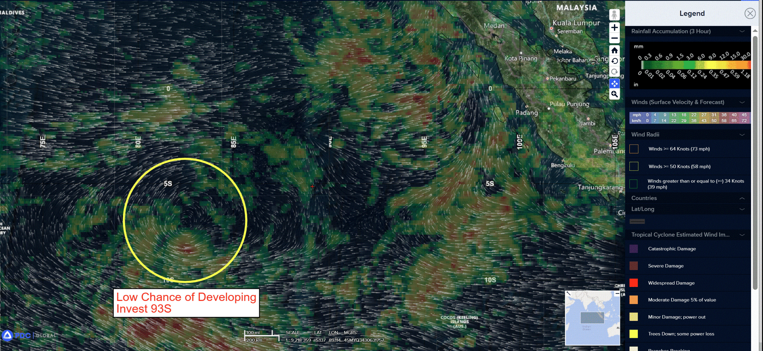
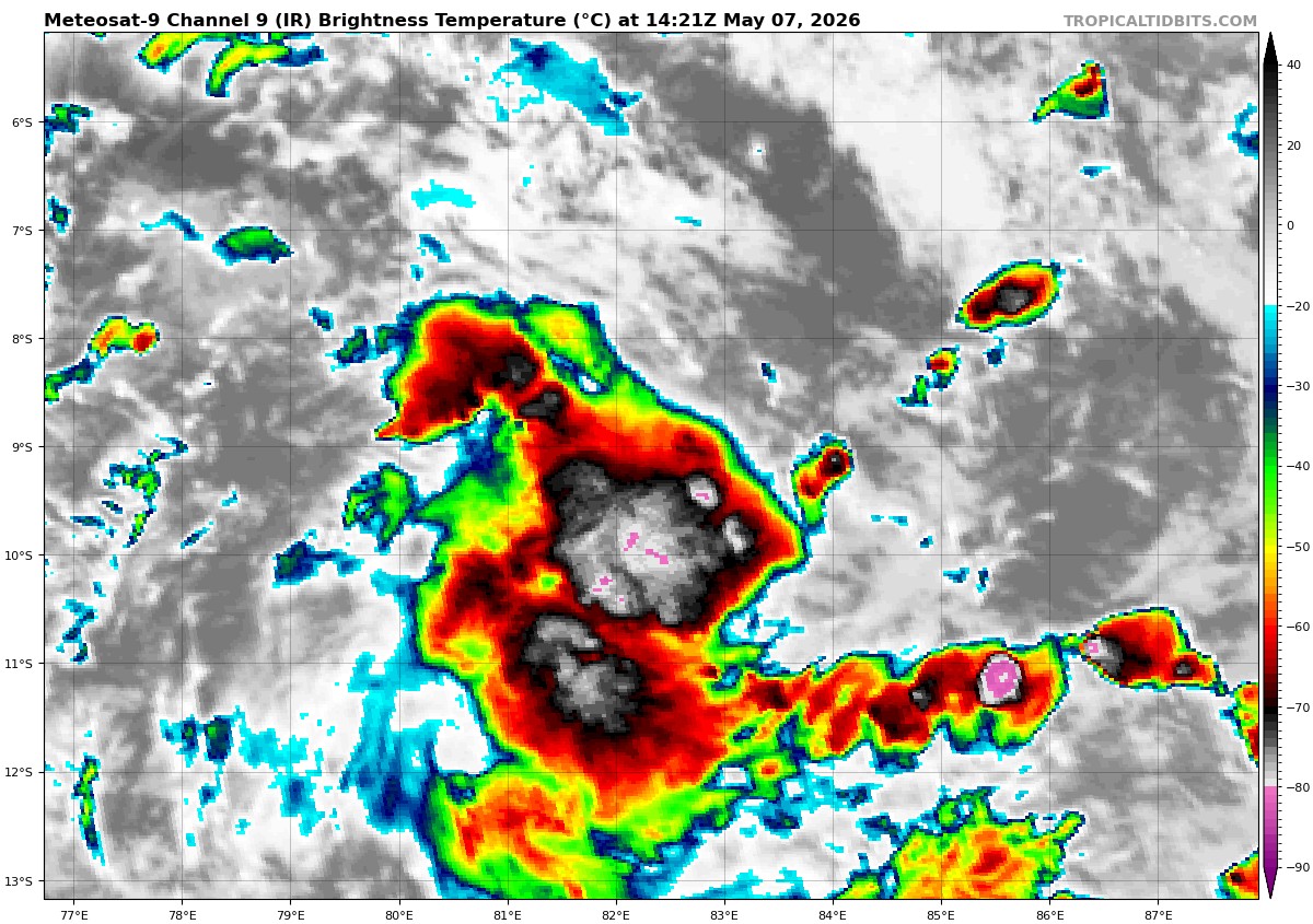
>>> There’s an area of disturbed weather being referred to as Invest 93S, which is located approximately 605 NM west of Diego Garcia
Animated enhanced infrared satellite imagery (eir) depicts a broad rotation with persistent but disorganized convection associated with the low level
circulation (llcc) embedded within a trough.
Environmental analysis depicts favorable conditions for development with low to moderate vertical wind shear (15-20 kts), warm sea surface temperatures (29-30c), and moderate poleward outflow within the upper levels.
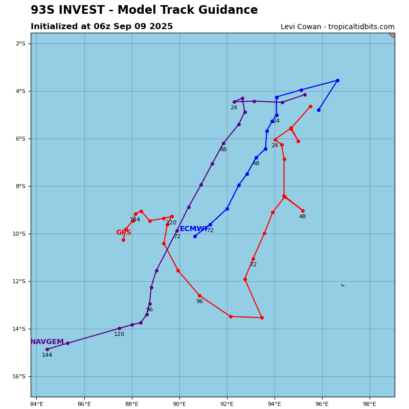
Model guidance is mixed, with the gefs and ecens esembles depicting slow but steady devleopment as the system tracks poleward. Global deterministic
models are in a disagreement, with the gfs being the most aggressive guidance, depicting a rapid development and intensification within the next 72 hours, while the ecmwf and navgem show very weak development, keeping the system below warning threshold.
Maximum sustained surface winds are estimated at 18 to 23 knots.
The potential for the development of a significant tropical cyclone within the next 24 hours remains low.