
")
Current Snapshot
For all the latest updates visit: DisasterAWARE
GOES18-TPW-13-900×540
sinlaku
close
04W_150600sair
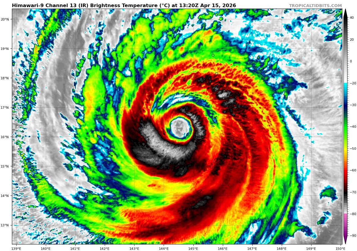
himawari9_ir_04W_202604151320_lat16.2-lon144.6
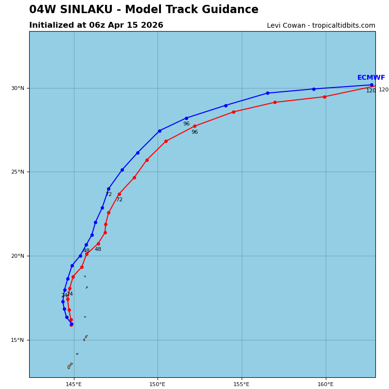
04W_tracks_latest
By PDC’s Senior Weather
Specialist Glenn James

The Pacific Disaster Center’s (PDC Global) Wednesday, April 15, 2026, Tropical Cyclone Activity Report…for the Pacific Ocean, the Indian Ocean, and adjacent Seas
Current Tropical Cyclones:
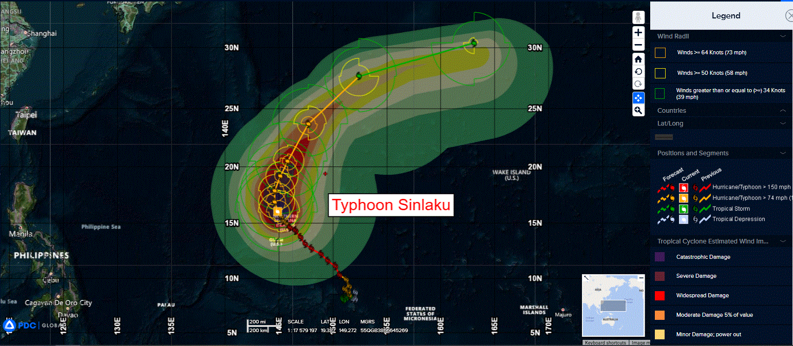
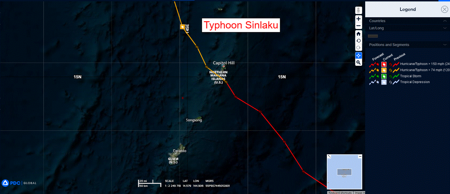
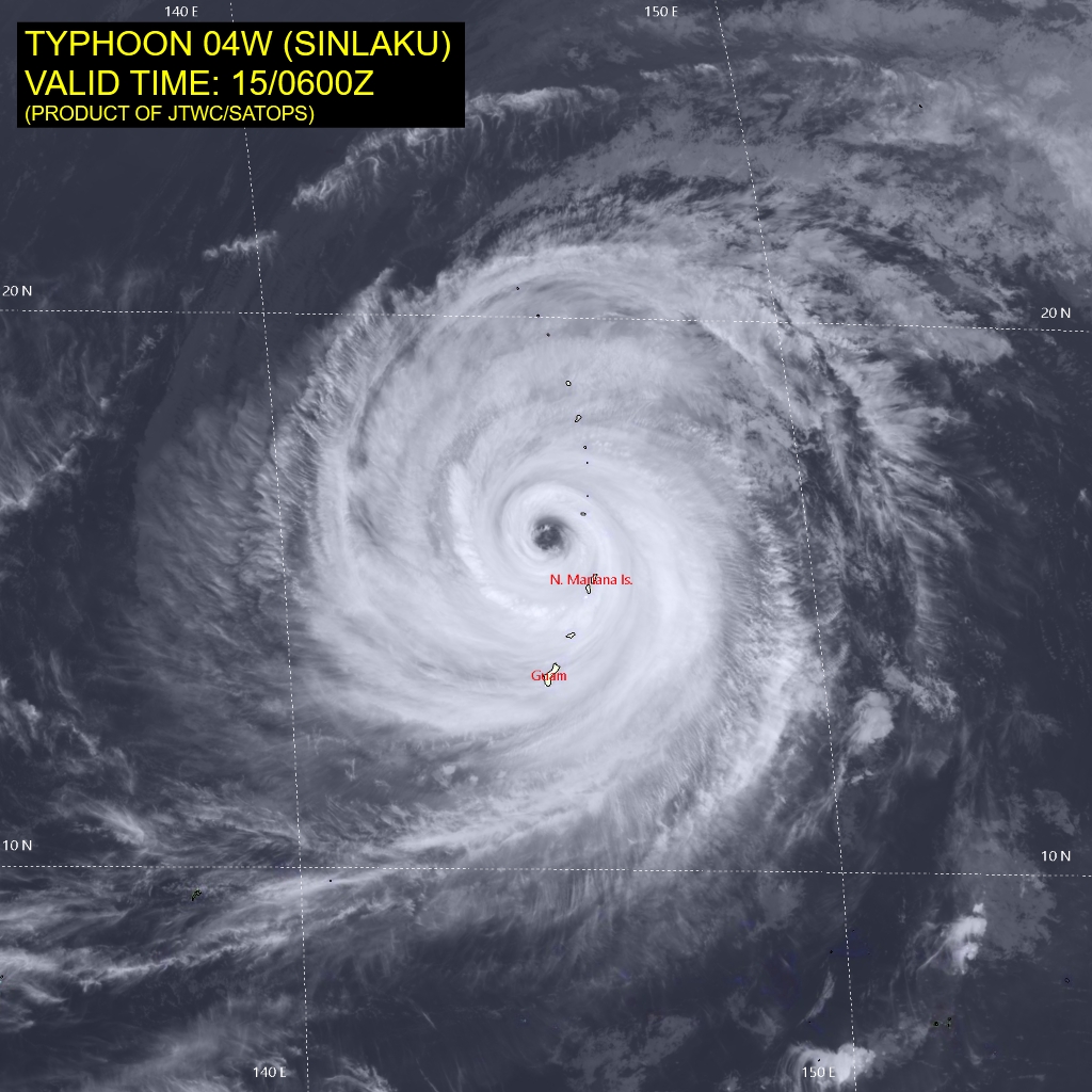
Tropical Cyclone 04W (Sinlaku)…is located approximately 92 NM northwest of Saipan
Northeast Pacific Ocean: There are no Tropical Cyclones
The last regularly scheduled Tropical Cyclone Activity Report of the 2025 eastern North Pacific Hurricane Season has been issued. Routine issuance of this section of the PDC product will resume on May 15, 2026. During the off-season, Special Tropical Weather Outlooks will be issued as conditions warrant by the NHC.
Central Pacific Ocean: There are no Tropical Cyclones
The 2025 central North Pacific hurricane season has ended. As such, the final routine Tropical Cyclone Activity Report for the 2025 season has been issued. Routine issuance of this section of the PDC product will resume on June 1, 2026. During the off-season, Special Tropical Weather Outlooks will be issued as conditions warrant by the CPHC.
Western Pacific, Indian Ocean, and adjacent Seas:
Northwest Pacific Ocean
Tropical Cyclone 04W (Sinlaku)
According to the JTWC warning number 27, sustained winds are 110 knots with gusts to 135 knots
Animated multi-spectral satellite imagery (msi) depicts a large, powerful typhoon slowly tracking away from Saipan and Tinian. The 4-5 kt forward speed has led to a prolonged period of destructive winds over the Mariana Islands. Deep convection associated with the central dense overcast (cdo) continues to rotate around a large
eye. Having completed an eyewall replacement cycle (erc), the eye has enlarged to 30 nm in diameter, and the wind field has expanded. A 142053z wsf-m mwi 37 ghz image showed an eyewall slightly open on the northern side with an even larger outer ring measuring 100-110 nm in diameter, which signifies potential for another erc.
A coincident 142003z rcm-3 sar pass revealed a similar structure with a 110 kt average peak wind. In fact, the cimss mperc product captures this structure and predicts a 77 percent probability of another erc. In the past 06 hours, TY 04w has been attempting to consolidate its inner core as the surrounding cloud tops cool, and the upper-level outflow expands radially.
Environmental analysis indicates favorable conditions of warm sea surface temperatures, plentiful mid-level moisture, and low vertical wind shear (vws).
The primary driving mechanism for TY 04W is the northern extension of a ner. The ridge will pinch off from the ner and build, which will steer the system northward through 24 hours. For the remainder of the forecast period, the mid-latitude westerlies will increasingly impart a force towards the east, causing the storm to curve and accelerate north-northeast from 24 to 72 hours and northeast to east-northeast towards the end of the period.
The intensity forecast for the first 24 hours has been adjusted upward. Now that Sinlaku has completed erc, the favorable environmental conditions will help maintain the intensity. If a second erc commences, it would support capping the intensity and potentially induce a slow weakening trend. The intensity forecast
captures this by holding the intensity steady through 12 hours and then shows slow weakening at 24 hours.
TY 04W will weaken more quickly between 24 and 48 hours as it encounters cooler waters, becomes surrounded by drier air, and entertains stronger potential for dry air entrainment due to a second erc. Rapid weakening will take place after 48 hours once the system travels over sub-26 degree celsius sst, and the vws associated with the westerlies increases to 20-30 kts. Extratropical transition (ett) will begin at 72 hours. Nevertheless, the forecast calls for a potent, storm-force extratropical low at 120 hours.