
")
Current Snapshot
For all the latest updates visit: DisasterAWARE
GOES18-TPW-13-900×540
sinlaku
sinclose
04W_101200sair

04W_tracks_latest
maila
30P_101200sair
himawari9_ir_30P_202604101320_lat-8.4-lon154.3
30P_tracks_latest
31p
himawari9_ir_31P_202604101340_lat-30.1-lon178.5
By PDC’s Senior Weather
Specialist Glenn James

The Pacific Disaster Center’s (PDC Global) Friday, April 10, 2026, Tropical Cyclone Activity Report…for the Pacific Ocean, the Indian Ocean, and adjacent Seas
Current Tropical Cyclones:
Tropical Cyclone 04W (Sinlaku)…is located approximately 61 NM west-northwest of Chuuk
Tropical Cyclone 30P (Maila)…is located approximately 712 NM northeast of Cairns, Australia
Northeast Pacific Ocean: There are no Tropical Cyclones
The last regularly scheduled Tropical Cyclone Activity Report of the 2025 eastern North Pacific Hurricane Season has been issued. Routine issuance of this section of the PDC product will resume on May 15, 2026. During the off-season, Special Tropical Weather Outlooks will be issued as conditions warrant by the NHC.
Central Pacific Ocean: There are no Tropical Cyclones
The 2025 central North Pacific hurricane season has ended. As such, the final routine Tropical Cyclone Activity Report for the 2025 season has been issued. Routine issuance of this section of the PDC product will resume on June 1, 2026. During the off-season, Special Tropical Weather Outlooks will be issued as conditions warrant by the CPHC.
Western Pacific, Indian Ocean, and adjacent Seas:
Northwest Pacific Ocean
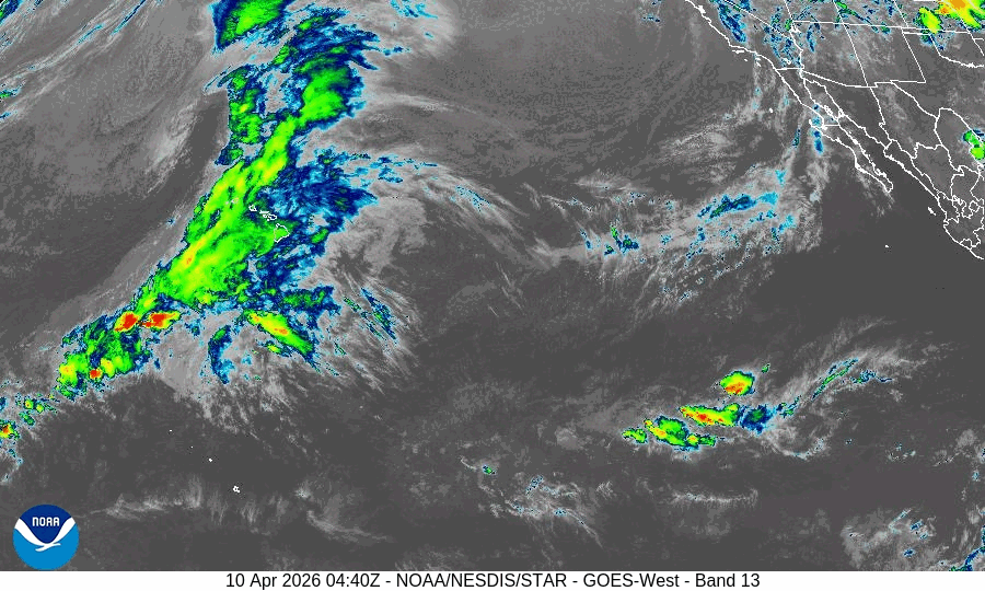
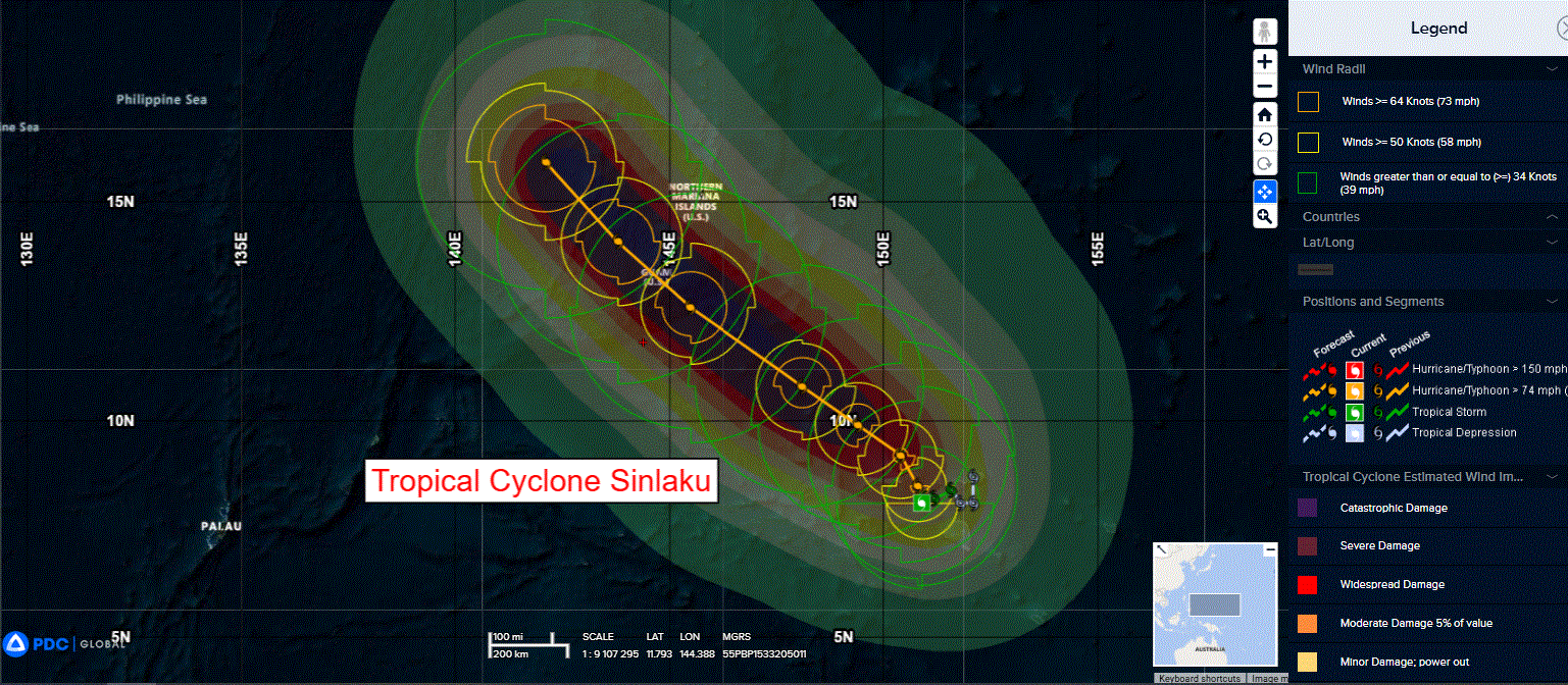
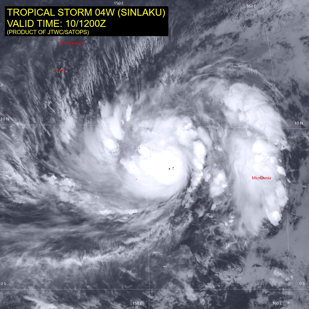
Tropical Cyclone 04W (Sinlaku)
According to the JTWC warning number 8, sustained winds are 60 knots with gusts to 75 knots
Animated multi-spectral satellite imagery (msi) depicts a consolidating low-level circulation center (llcc) embedded within a ragged central dense overcast (cdo), with extensive spiral bands wrapping into the center. The quasi-stationary llcc remains partially exposed in the southeast quadrant. The atmospheric sounding at Chuuk, courtesy of the National Weather Service office at Tiyan, depicts 10-15 kts of southeasterly flow at 200-300 mb, which confirms the presence of some vertical wind shear (vws) and is consistent with restricted upper-level outflow in the southeast quadrant observed in the satellite imagery. A 092213z ascat-c pass displayed a somewhat asymmetric surface circulation, which helps to explain some of the recent satellite-detected lightning strikes in the more robust bursts of convection within the cdo.
However, the environment is favorable for development, characterized by warm sea surface temperatures (sst), abundant deep-layer moisture, except for a dry slot immediately southeast of the llcc, and moderate poleward and westward exhaust.
The forecast track has changed little from that in the previous warning, shifting slightly to the south at 96 and 120 hours. the steering environment is dictated by a ner to the east that will compete with a strong str to the northwest, with a weakness in the ridge to the north of the system. The influence of these competing features will yield a slow track towards the northwest through 36 hours. TS 04W will gain forward speed by 48 hours as the ner builds to the east, and the faster movement will continue to the end of the forecast period.
The uncertainty in the evolution of the ridges lends to low confidence in the forecast track. Given the largely favorable environmental conditions, the system will continue to intensify at near the climatological rate through 24 hours. Rapid intensification in the short term is less likely because the large system in the face of some vws aloft will necessitate a period of time to work out the asymmetries in the nascent inner core. However, once the inner core becomes symmetric, TS 04W will undergo a higher rate of intensification.
While the current forecast shows a 25 kt increase in 24 hours, which is just shy of rapid intensification (ri), and a peak of 110 kts, it is not out of the question that the system could intensify faster and reach a higher peak prior to reaching Guam. Towards the end of forecast period, a moderation of intensity is indicated as the system could undergo an eyewall replacement cycle and approach its maximum potential intensity.
Southwest Pacific Ocean
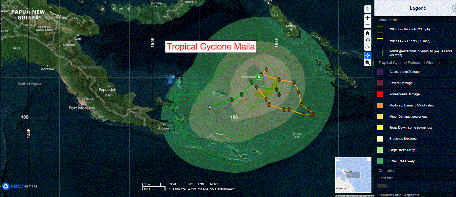
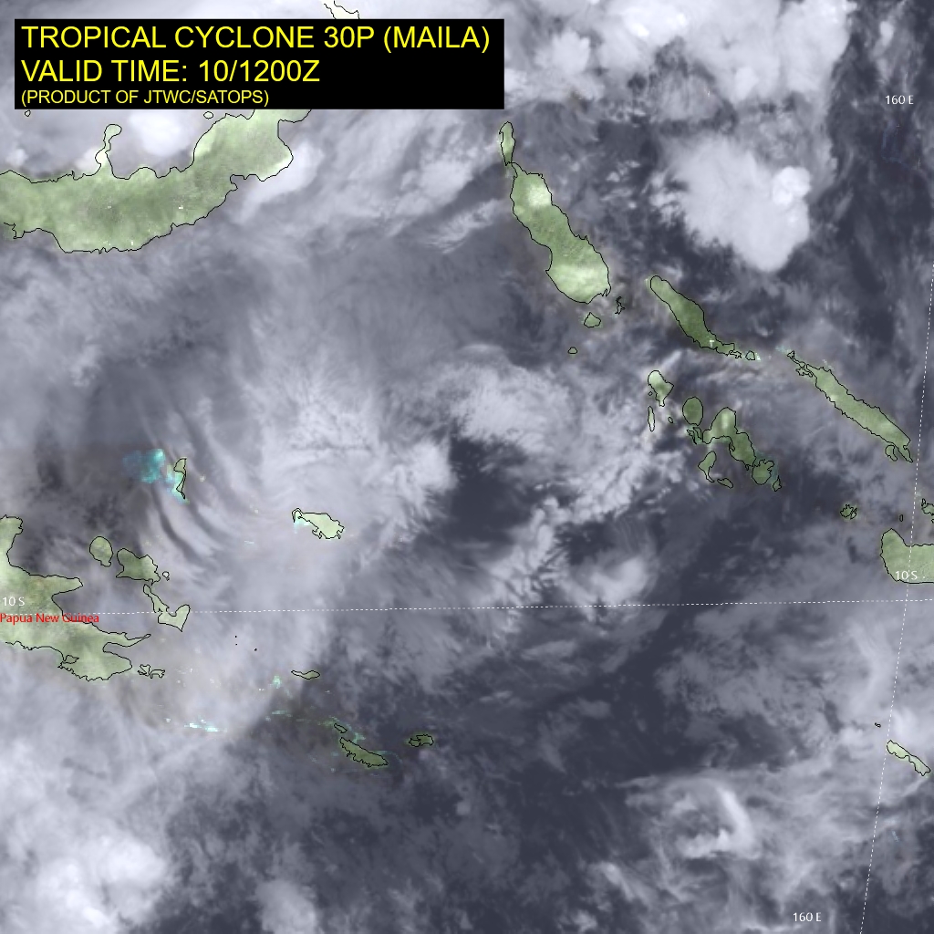
Tropical Cyclone 30P (Maila)
According to the JTWC warning number 18, sustained winds are 45 knots with gusts to 55 knots
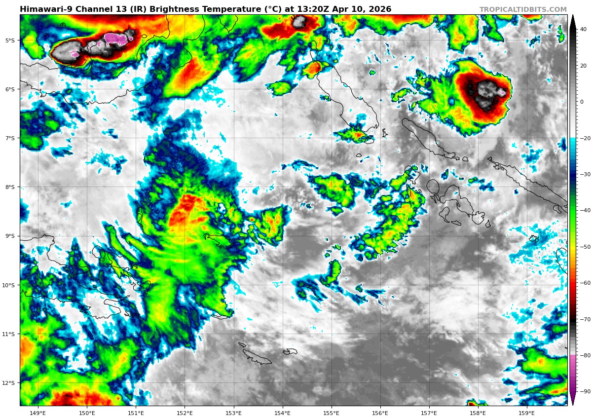
Animated multi-spectral satellite imagery (msi) depicts tropical cyclone 30P (Maila) with disorganized convection offset to the west of the low-level circulation center. A 092033z f16 ssmis 91 ghz microwave image revealed exposed low-level cloud lines within the eastern and southern peripheries wrapping into the center. The ssmis image also showed convective banding has largely dissipated and is now located within a small area to the north of the assessed center.
Environmental analysis indicates that 30P is in an unfavorable environment characterized by moderate westward outflow aloft, moderate to high (20-25 kts) easterly vertical wind shear, and cold sea surface temperatures.
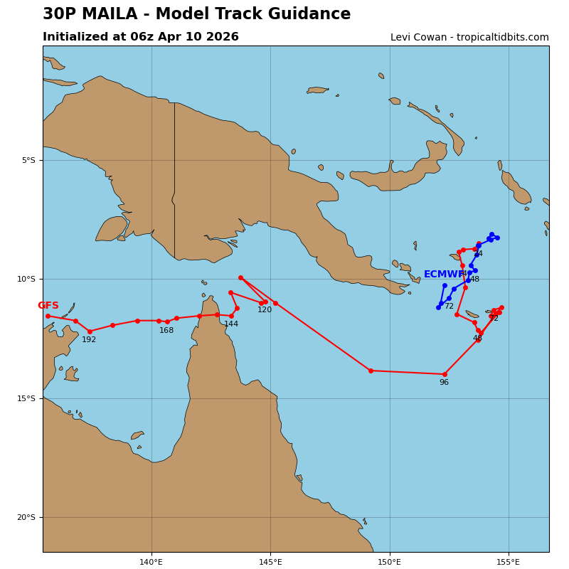
TC 30P is forecast to drift southwestward along the northern periphery of a building ridge to the southeast throughout the entire forecast period. The ridge is not expected to be fully built in until around 72 hours, so track speeds are forecast to be slow moving. There remains a significant amount of uncertainty in the actual direction that 30P takes as models show the system tracking in wide range of possible trajectories. There is a chance that 30P falls apart more quickly in a location closer to its current position.
Regarding intensity, 30P is forecast to continue weakening under the effects of persistent easterly shear and cool sea surface temperatures caused by upwelling. There is also significant uncertainty in the timing of dissipation. If the system stays in place longer than anticipated, a much earlier dissipation could occur. As it stands, the JTWC intensity forecast calls for dissipation near the tip of the Papuan Peninsula no later than 96 hours.
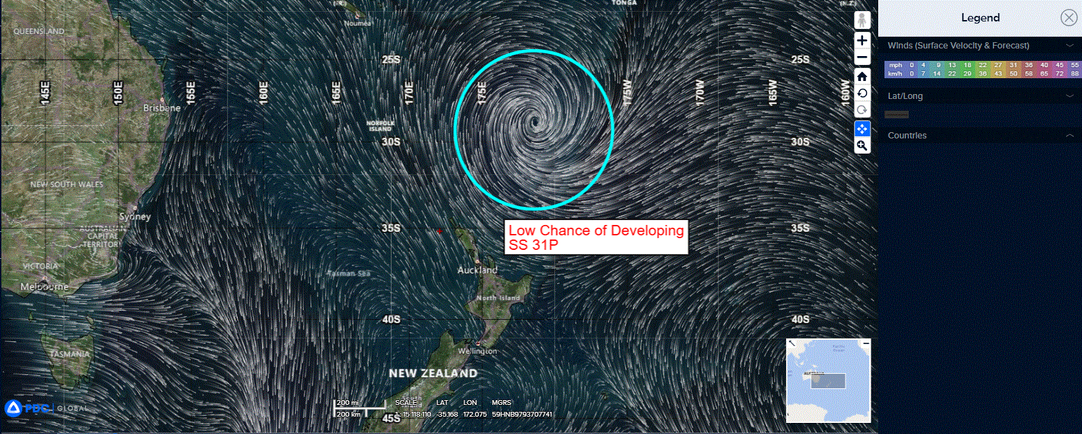
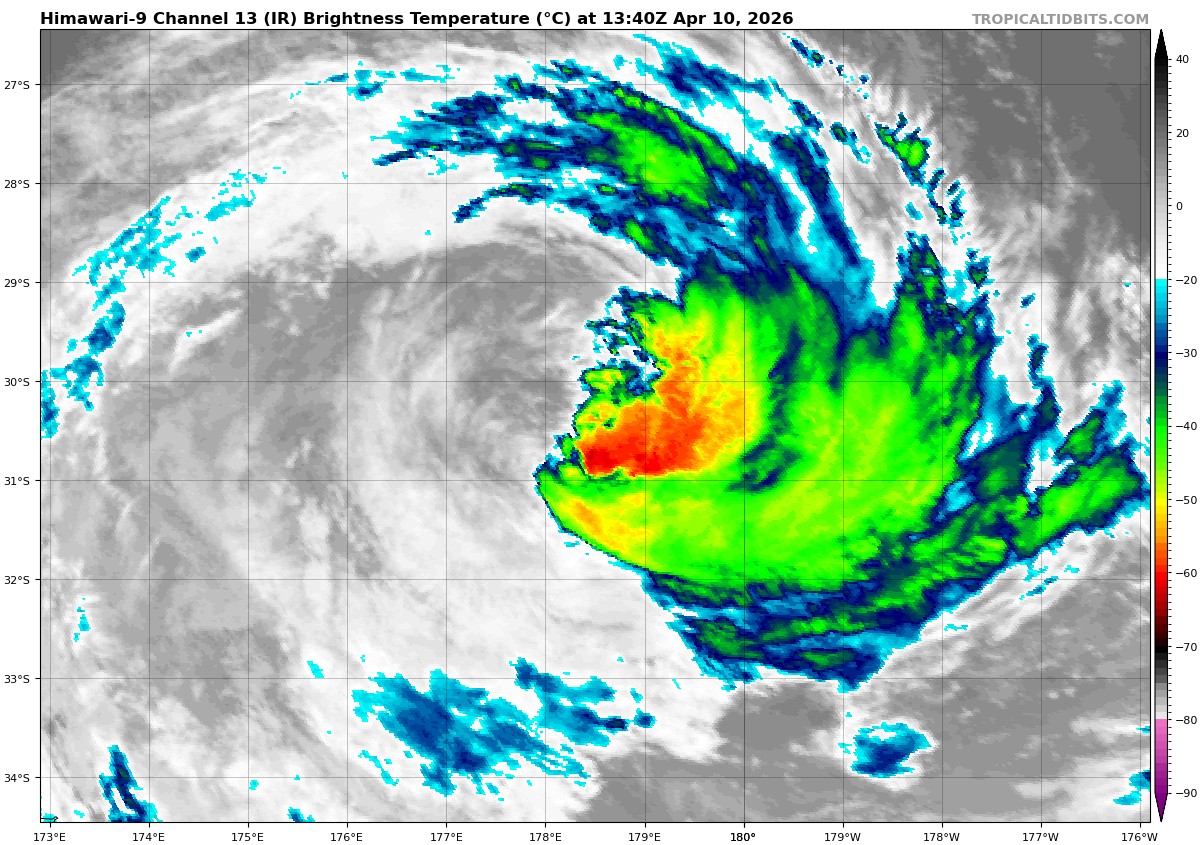
>>> There’s an area of disturbed weather being referred to as SS 31P, which is located approximately 564 NM southwest of Tonga
The system is currently classified as a subtropical cyclone, generally characterized as having both tropical and mid-latitude cyclone features.
Multi-spectral satellite imagery (msi) depicts a very well-defined low level circulation center (llcc) embedded within a tight swirl of mid-level cloud bands, absent of any deep convection.
Environmental analysis reveals unfavorable conditions for development characterized by high vertical wind shear (20-30 knots), moderate upper level poleward outflow, and cold sea surface temperatures (23-24 c).
Global models agree on a southwestward track over the next 24-48 hours,
Maximum sustained surface winds are estimated at 53 to 58 knots.
The potential for the development of a significant tropical cyclone within the next 24 hours is low.