
")
Current Snapshot
For all the latest updates visit: DisasterAWARE
GOES18-TPW-13-900×540
04w
04W_090600sair
himawari9_ir_04W_202604091240_lat8.1-lon152.1

04W_tracks_latest
maila
maila
himawari9_ir_30P_202604091240_lat-8.5-lon154.7
30P_tracks_latest
v
31P_090600sair
himawari9_ir_31P_202604091240_lat-26.8-lon179.0
31P_tracks_latest
By PDC’s Senior Weather
Specialist Glenn James

The Pacific Disaster Center’s (PDC Global) Wednesday, April 8, 2026, Tropical Cyclone Activity Report…for the Pacific Ocean, the Indian Ocean, and adjacent Seas
Current Tropical Cyclones:
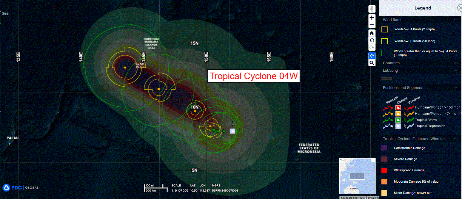
Tropical Cyclone 04W…is located approximately 541 NM southeast of Andersen AFB
Tropical Cyclone 30P (Maila)…is located approximately 741 NM northeast of Cairns, Australia
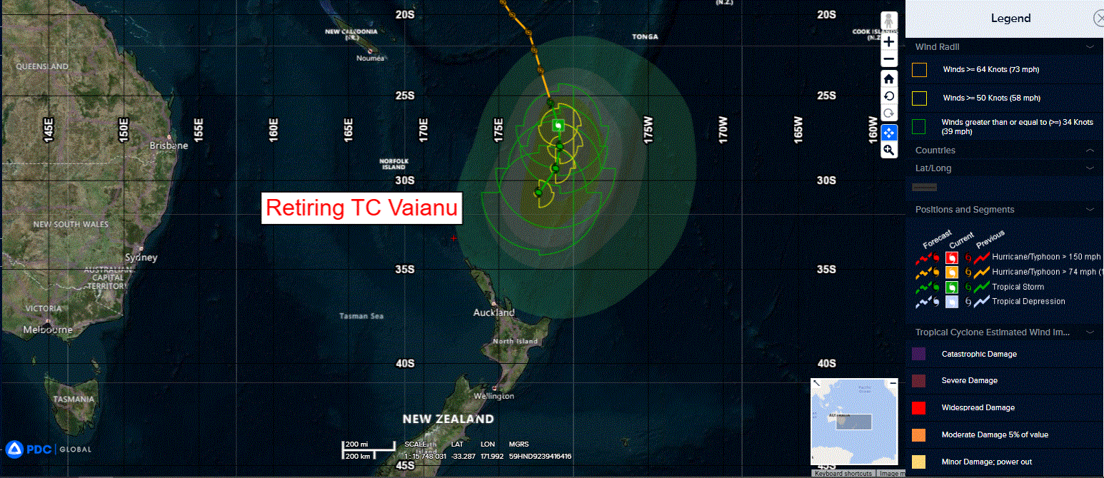
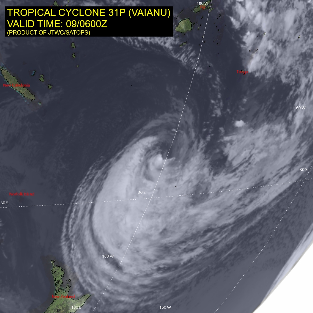
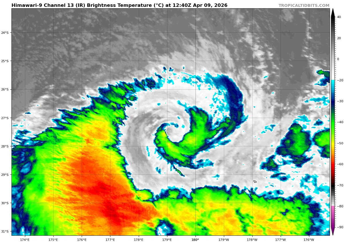
Tropical Cyclone 31P (Vaianu)…is located approximately 523 NM south of Suva, Fiji – Final Warning
Northeast Pacific Ocean: There are no Tropical Cyclones
The last regularly scheduled Tropical Cyclone Activity Report of the 2025 eastern North Pacific Hurricane Season has been issued. Routine issuance of this section of the PDC product will resume on May 15, 2026. During the off-season, Special Tropical Weather Outlooks will be issued as conditions warrant by the NHC.
Central Pacific Ocean: There are no Tropical Cyclones
The 2025 central North Pacific hurricane season has ended. As such, the final routine Tropical Cyclone Activity Report for the 2025 season has been issued. Routine issuance of this section of the PDC product will resume on June 1, 2026. During the off-season, Special Tropical Weather Outlooks will be issued as conditions warrant by the CPHC.
Western Pacific, Indian Ocean, and adjacent Seas:
Northwest Pacific Ocean
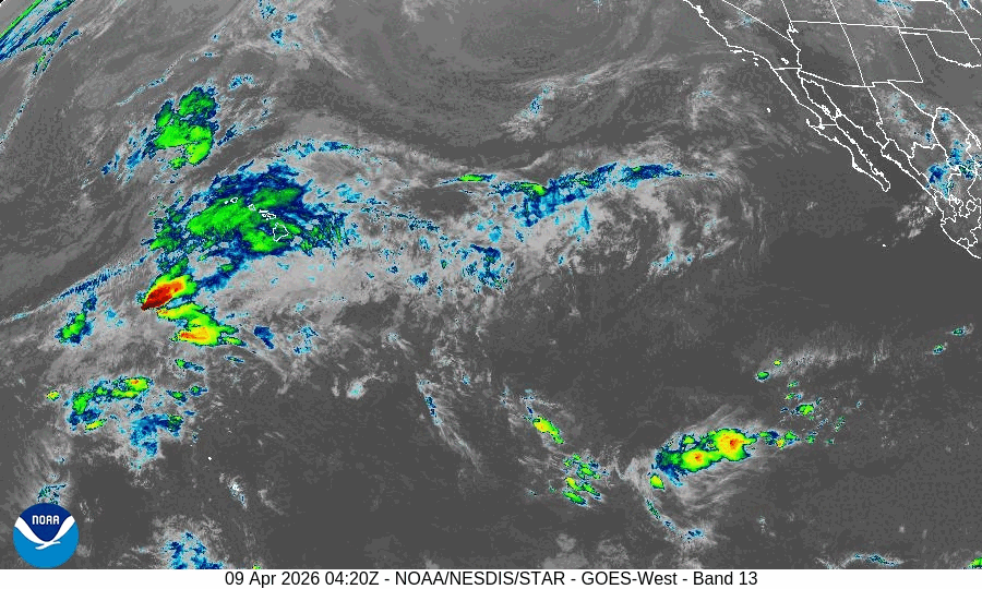
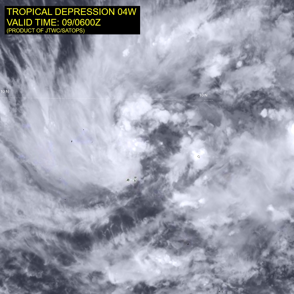
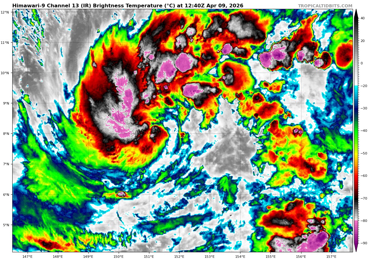
Tropical Cyclone 04W
According to the JTWC warning number 2, sustained winds are 30 knots with gusts to 40 knots
Animated multi-spectral satellite imagery (msi) depicts a large, slowly consolidating low-level circulation center (llcc) with formative banding northwest of the center and good poleward upper-level outflow. Located south of a weakness in the subtropical ridge, TD 04W is slowly traversing westward over warm sea surface temperatures (sst) of 28-29 degrees celsius and high mid-level moisture.
TD 04W is located in a weak steering environment with a northwest extension of a near-equatorial ridge (ner) to the east and a strong subtropical ridge (str) centered near Luzon. After 36 hours, the ner will build and induce a more northwestward motion. The ridge will continue to strengthen and guide the system towards the Mariana Islands through 120 hours.
There remains significant challenges in the extended forecast track. TD 04W will encounter competing steering influences: from the extension of the ner to the east and the str to the west. A stronger ner will push the system more poleward, while a weaker ridge will lead to a more zonal track. the forecast currently favors the more zonal
forecast vice the strongly poleward trajectory as depicted in some of
the model guidance.
The intensity forecast is more straightforward. The environmental conditions will be highly favorable for continued development. Low vws, plentiful mid-level moisture, and warm sst will fuel intensification. The forecast rate of deepening initially follows the climatological rate, given the size of the circulation. More significant intensification towards a 115 kt peak is then forecast as the inner core becomes established by 48 hours. It is important to note that the wind field will extend far out from the center, making for far-reaching impacts. The forecast holds the intensity at 120 hours with low confidence due to the effects of a slightly worse environment.
Southwest Pacific Ocean
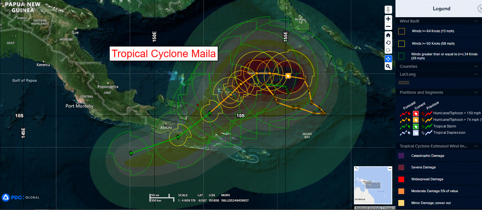
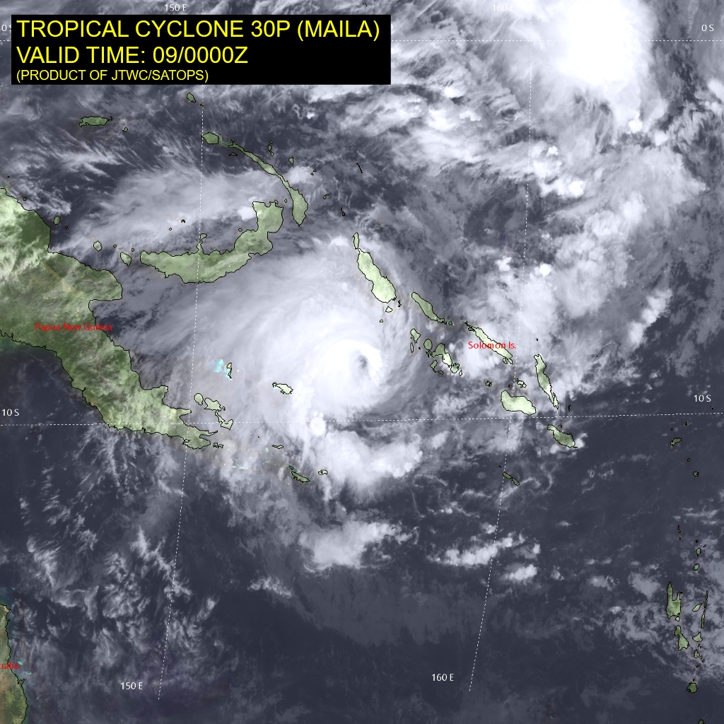
Tropical Cyclone 30P (Maila)
According to the JTWC warning number 15, sustained winds are 100 knots with gusts to 125 knots
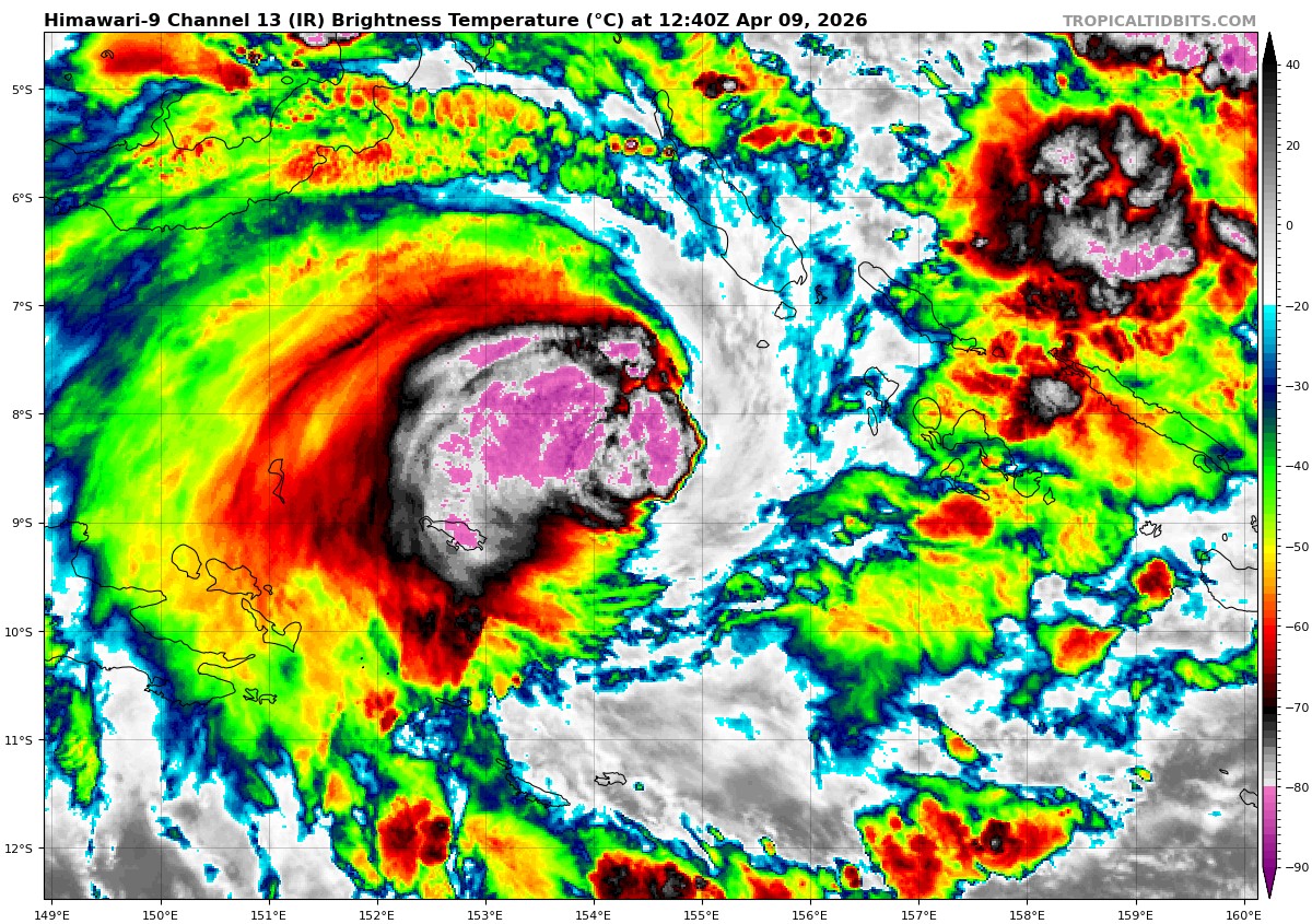
Animated multi-spectral satellite imagery (msi) depicts tropical cyclone 30P (Maila) with a slightly ragged 15nm eye and pressure along the southeastern quadrant. the culprit for the deformation within the southeastern quadrant is attributed to the moderate easterly shear acting on the system. A partial 082305z metop-b ascat pass caught the center of the circulation, lending high confidence to the initial position and western wind radii.
Environmental analysis indicates that 30P is currently in a marginally favorable environment characterized by moderate equatorward outflow aloft, moderate easterly vertical wind shear, and warm sea surface temperatures.
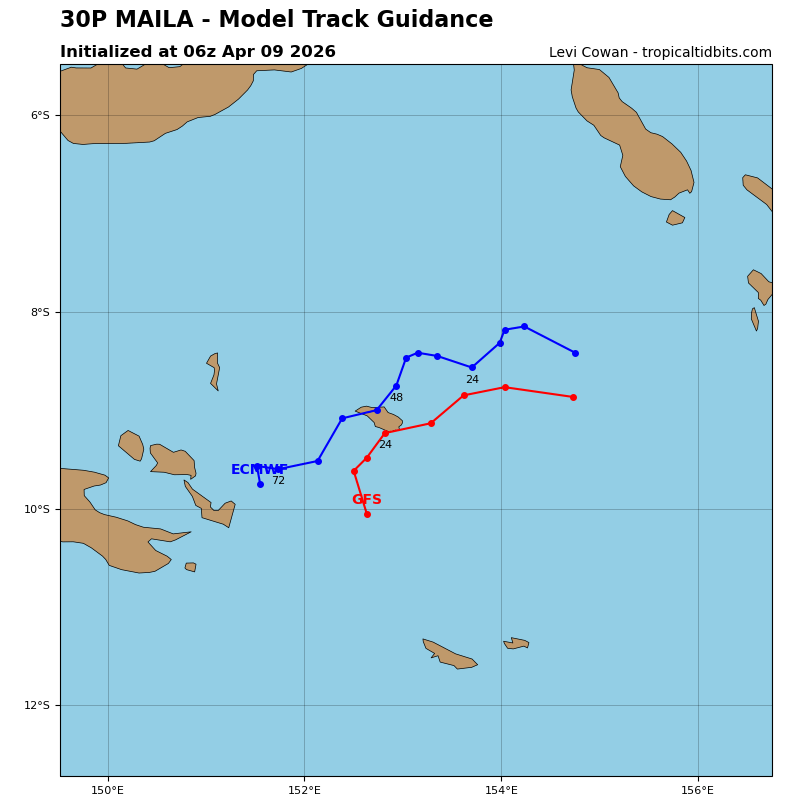
TC 30P is forecast to track generally westward, along the northwestern periphery of the str over central
Australia through 24 hours. Near 24 hours, ridging is expected to build
to the southeast of the system, driving it southwestward through 120 hours.
A track near the tip of the Papuan Peninsula is forecast to occur near 96 hours. however, there has started to be significant uncertainty revolving around the potential for further slow movement and dissipation within the Solomon Sea. The system is currently forecast to steadily weaken through 48 hours due to a track through the pool of cold waters that was left in the wake of 30P.
The track back through the cold pool, along with the persistent easterly vertical wind shear, will cause 30P to weaken. As it stands, the JTWC forecast calls for weakening throughout the entire forecast period and a slower movement after 24 hours as it attempts to track off to the west-southwest.
There is a possibility that the system dissipates east of Papua New Guinea if a slower track movement occurs over the next 72 hours.
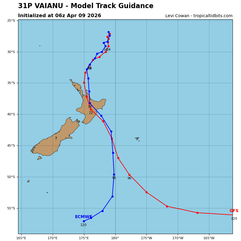
Tropical Cyclone 31P (Vaianu) – Final Warning
According to the JTWC warning number 14, sustained winds are 55 knots with gusts to 70 knots
Animated infrared imagery depicts a partially exposed llcc with a burst of convection over the southern semicircle. The system exhibits a hybrid structure consisting of swirling mid-level clouds and little central convection, located in an unfavorable environment characterized by 30 kts of vws and 25 degree celsius sst.
Environmental analysis reveals weak temperature advection and an upper level trough directly aloft. the position and intensity are assessed with high confidence based on the exposed center and a
082330z oscat-3 image depicting 50 kt winds, respectively. the system
will be steered towards the south by a deep layer ridge to the east.
TC 31P will turn towards the southwest as a ridge approaches New
Zealand from the west and induces a more westward motion. Weak
baroclinic forcing will cause the system to complete subtropical transition by 12 hours and help to sustain its intensity through 24 hours, followed by gradual weakening.