
")
Current Snapshot
For all the latest updates visit: DisasterAWARE
GOES18-TPW-13-900×540
M
30P_071200sair
himawari9_ir_30P_202604071430_lat-9.7-lon156.3
30P_tracks_latest
V
31P_071200sair
himawari9_ir_31P_202604071430_lat-20.0-lon175.9
31P_tracks_latest
By PDC’s Senior Weather
Specialist Glenn James

The Pacific Disaster Center’s (PDC Global) Tuesday, April 7, 2026, Tropical Cyclone Activity Report…for the Pacific Ocean, the Indian Ocean, and adjacent Seas
Current Tropical Cyclones:
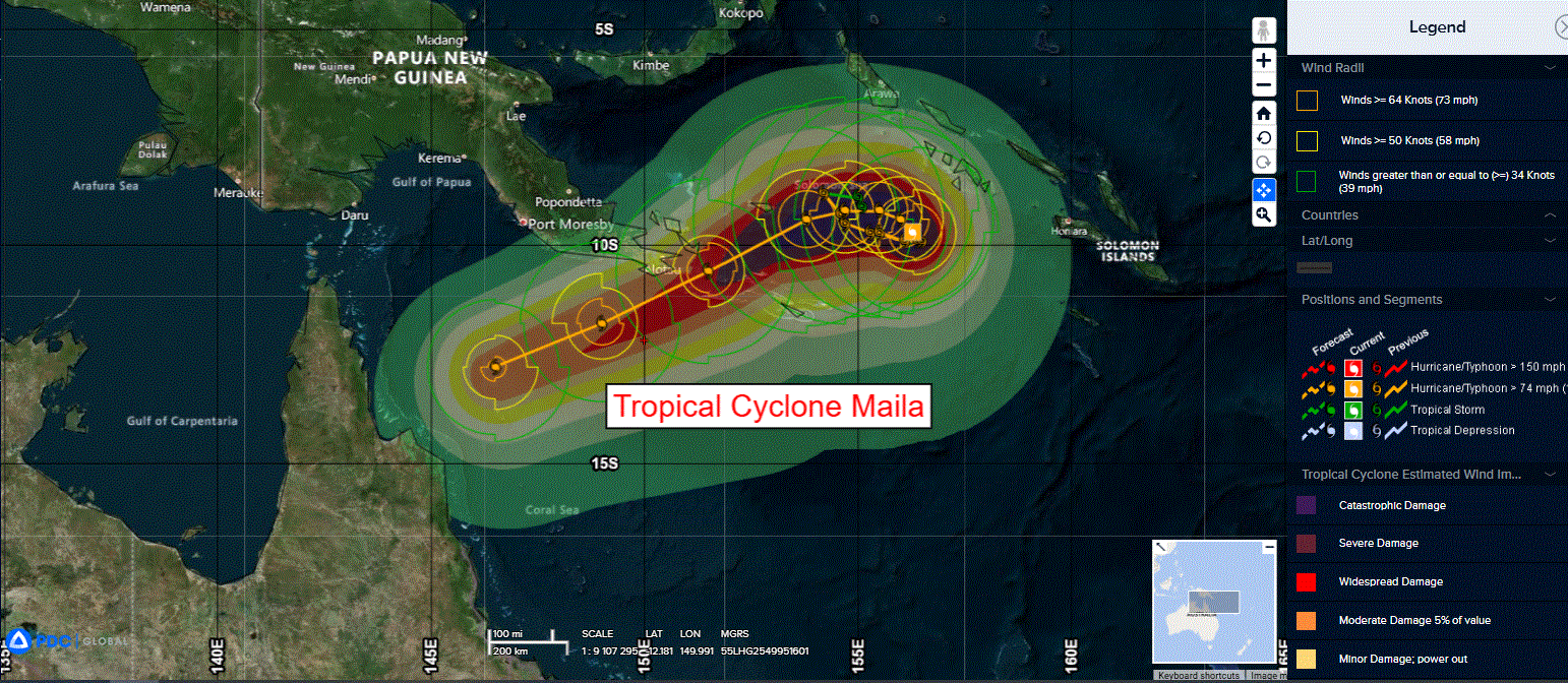
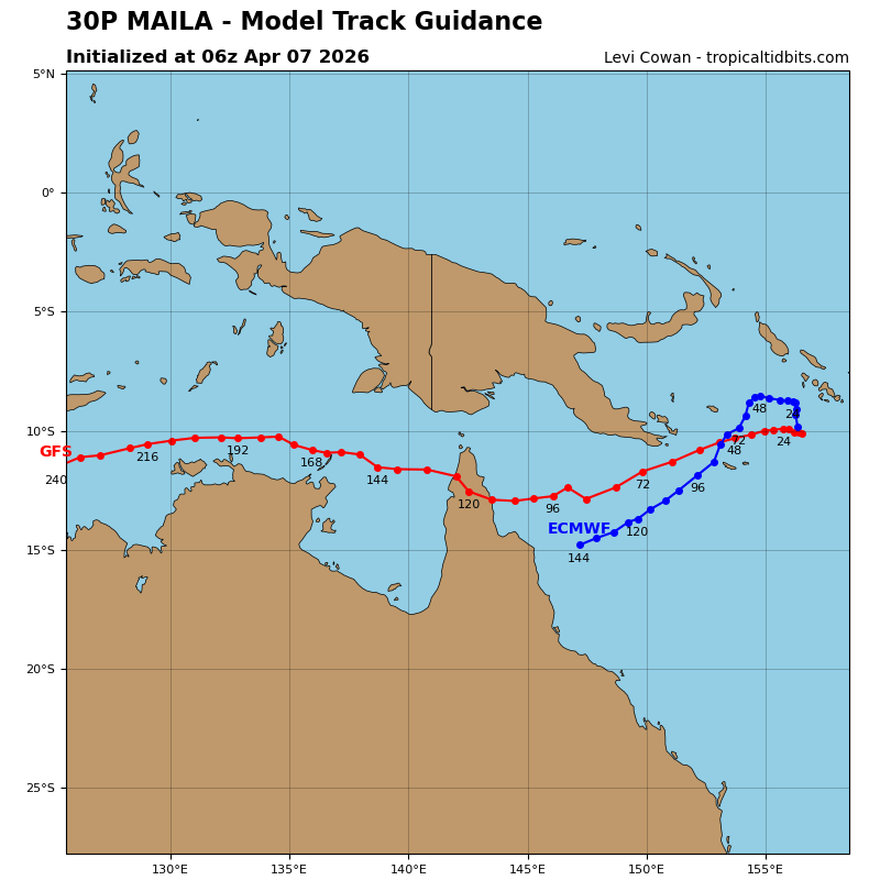
Tropical Cyclone 30P (Maila)…is located approximately 757 NM northeast of Cairns, Australia
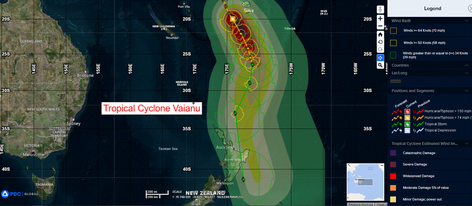
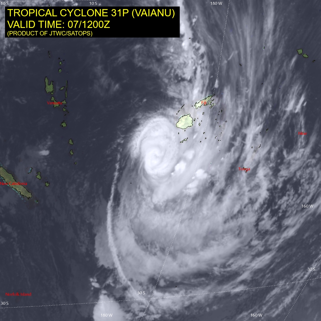
Tropical Cyclone 31P (Vaianu)…is located approximately 252 NM south-southwest of Suva, Fiji
Northeast Pacific Ocean: There are no Tropical Cyclones
The last regularly scheduled Tropical Cyclone Activity Report of the 2025 eastern North Pacific Hurricane Season has been issued. Routine issuance of this section of the PDC product will resume on May 15, 2026. During the off-season, Special Tropical Weather Outlooks will be issued as conditions warrant by the NHC.
Central Pacific Ocean: There are no Tropical Cyclones
The 2025 central North Pacific hurricane season has ended. As such, the final routine Tropical Cyclone Activity Report for the 2025 season has been issued. Routine issuance of this section of the PDC product will resume on June 1, 2026. During the off-season, Special Tropical Weather Outlooks will be issued as conditions warrant by the CPHC.
Western Pacific, Indian Ocean, and adjacent Seas:
Southwest Pacific Ocean
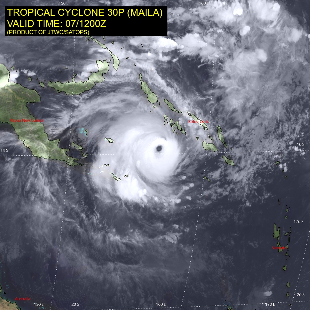
Tropical Cyclone 30P (Maila)
According to the JTWC warning number 13, sustained winds are 115 knots with gusts to 130 knots
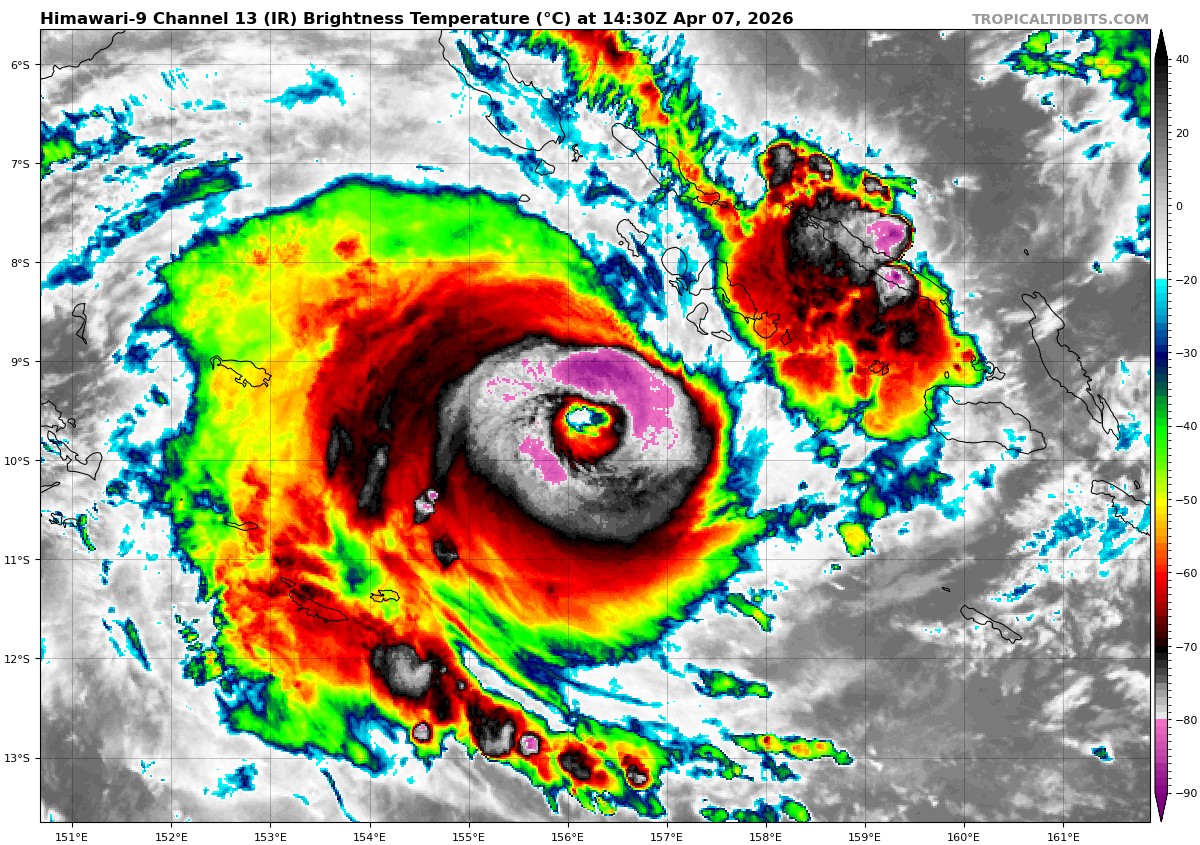
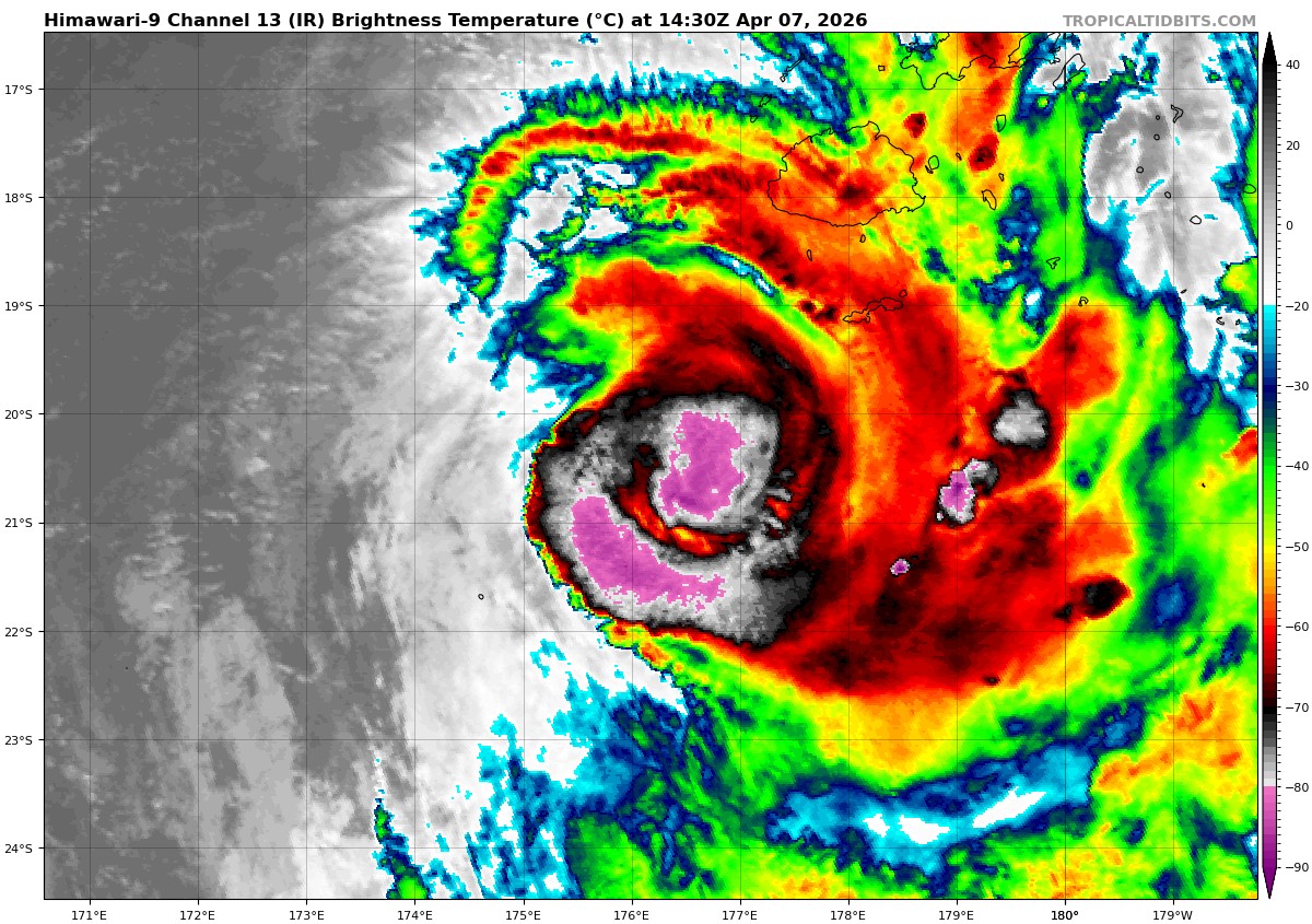
Animated enhanced infrared (eir) satellite imagery depicts a discernible and fully symmetric, central eye feature of tropical cyclone 30P (Maila). The temperature of the eye has warmed slightly since the last warning occurring beneath a persistent canopy of very cold deep convection with cloud top temperatures near -83 c. The system has undergone substantial axisymmetrization, resulting in a more uniform and robust eyewall structure now evident across all quadrants, indicating slow, but steady intensification.
Synoptic environment reveals largely supportive conditions, characterized by low (10-15 kts) vertical wind shear, ample tropospheric moisture content, and a well-established, predominantly westward, upper-level outflow channel. The primary antagonistic factor holding a potential for halting the intensification rate is the oceanic feedback mechanism of cold water upwelling, as simulated by the coupled ocean-atmosphere models hafs and hwrf. The cool water pool depicted by those numerical predictions is depicted right underneath the currently forecast track.
TC 30P is projected to continue tracking west-northwestward over the next 12-24 hours, at very slow (3-4 kts) translational speeds. Slow acceleration toward the west-southwest under the steering influence of a subtropical ridge positioned to its southwest is expected after 24 hours. This trajectory is expected to keep TC 30P on a path just south of the Papuan Peninsula for the duration of the forecast period.
The coupled models depict a region of oceanic cold wake (sub -26c) in close proximity to the current low-level circulation center and extending directly in front of the projected path, potentially increases the chances of halted intensification. Nevertheless, the persistent strengthening trend suggests that either this cold pool is less extensive than modeled, or the ambient sea surface temperatures are warmer than simulated.
Given the otherwise benign environmental parameters, continued intensification is anticipated, with a peak intensity near 120 kts projected between 24 and 36 hours. Thereafter, a gradual weakening trend is expected to commence due to increasing mid-level vertical wind shear (forecast to reach 30-35 kts around 72 hours) and the potential for increased frictional effects from topographic interaction with the Owen Stanley Range.
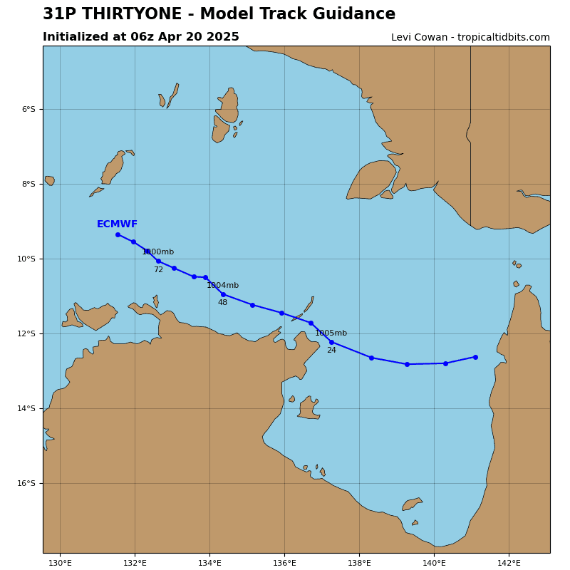
Tropical Cyclone 31P (Vaianu)
According to the JTWC warning number 11, sustained winds are 80 knots with gusts to 100 knots
Animated enhanced infrared (eir) satellite imagery reveals tropical cyclone 31P (Vaianu) propagating southeastward along the southwestern periphery of a near-equatorial ridge (ner) centered to the northeast. The eye feature has become fully obscured and cloud-filled. Westerly vertical wind shear has marginally subsided over the last 6 hours, but the dry air entrainment is still prevalent resulting in an overall marginally unfavorable environment. Offsetting these characteristics are favorable and warm (28-29 c) sea surface temperatures (sst) and a well-defined poleward upper-level outflow.
TC 31P is projected to maintain its southeastward trajectory, steered by the aforementioned
near-equatorial ridge, through 48 hours. Subsequently, the cyclone will migrate to the south of the subtropical jet axis and will enter a region of increasing upper-level troughing. A deep-layer anticyclone to the southeast will then induce a brief southwestward turn, a trajectory expected to persist until the system transits the ridge axis near 96 hours. Concurrently, the onset of subtropical transition is anticipated as the cyclone moves over much cooler waters (below 26 c). This transformation is expected to be complete just prior to 120 hours, as the system makes landfall over the north island of New Zealand, and becomes positioned underneath the jet maximum.
Regarding intensity, a consistent decay is forecast as vertical wind shear is projected to increase substantially, reaching 40-45 kts as early as 24 hours and persisting through at least 48 hours. As the shear intensity is expected to relax after 48 hours, the rate of weakening should decrease, and the systems interaction with the upper-level trough is expected to help it sustain an intensity near 45-55 kts deep into its subtropical phase.
>>> There’s an area of disturbed weather being referred to as Invest 90W, which is located approximately 89 NM southeast of Chuuk
Animated enhanced infrared satellite imagery depict a broad area of cyclonic turning with dense flaring convection obscuring the low level center.
Environmental analysis indicates 90W is currently in a favorable environment for development being centered in a lower pocket (10-15 kt) of vertical wind shear, warm (29-30 c) sea surface temperatures, and a point source just east assisting with moderate poleward outflow.
Global models are in good agreement on a westward track with intensification over the next 24-48 hours.
Maximum sustained surface winds are estimated at 13 to 18 knots.
The potential for the development of a significant tropical cyclone within the next 24 hours
is medium.