
")
Current Snapshot
For all the latest updates visit: DisasterAWARE
GOES18-TPW-13-900×540
indusa
29S_041800sair
meteosat9_ir_29S_202604051436_lat-29.5-lon71.6
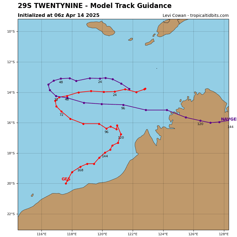
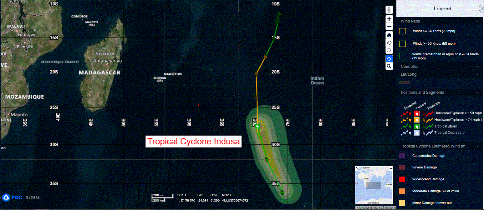
29S_tracks_latest
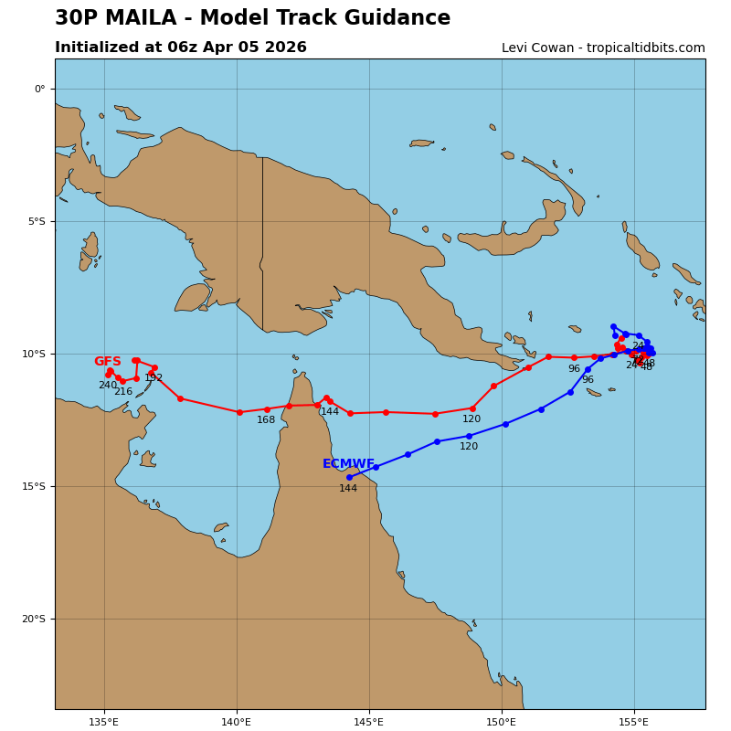
maila
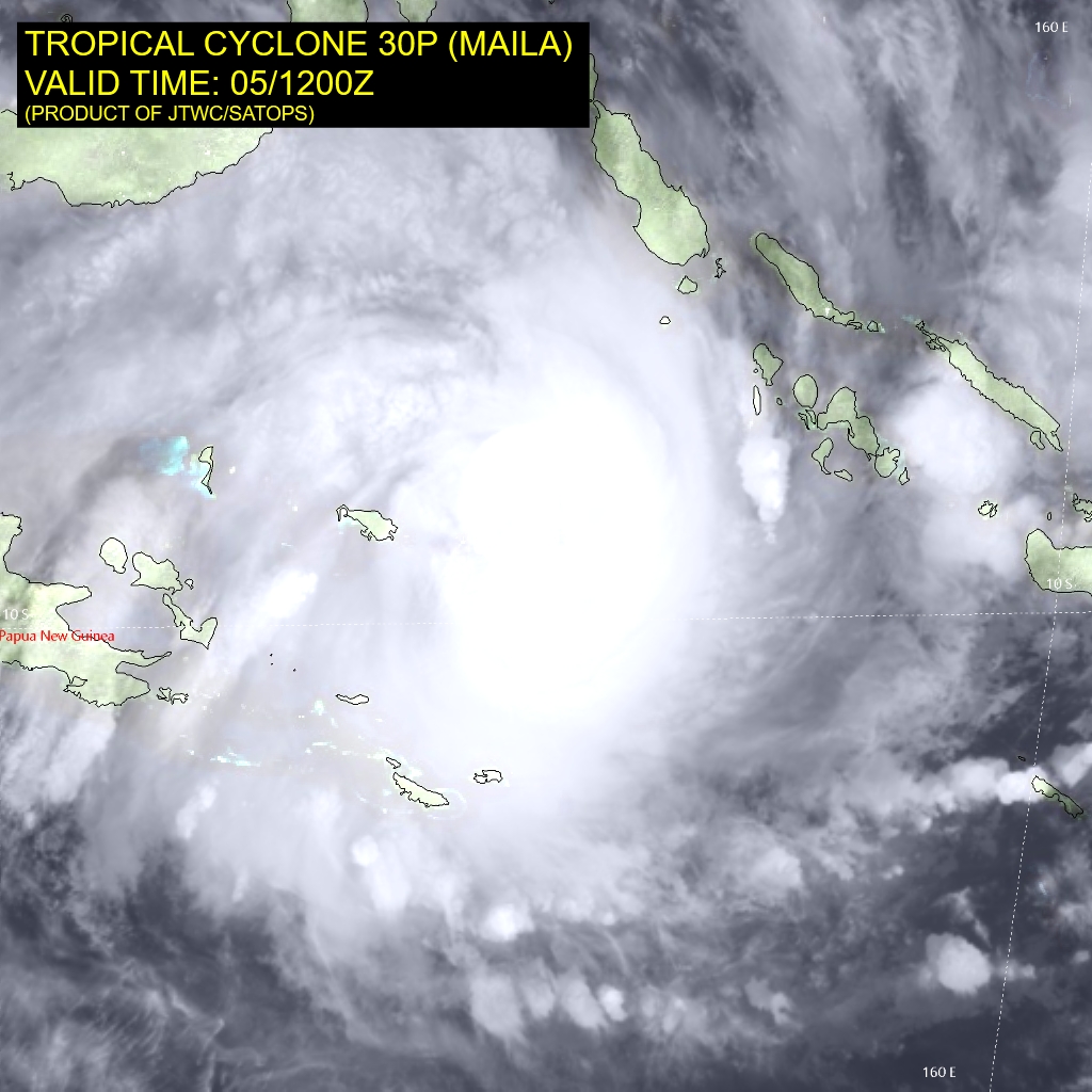
30P_051200sair
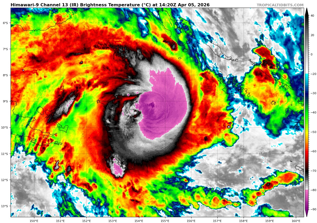
himawari9_ir_30P_202604051420_lat-9.3-lon154.6
30P_tracks_latest
v
31P_051200sair
himawari9_ir_31P_202604051420_lat-14.9-lon172.4
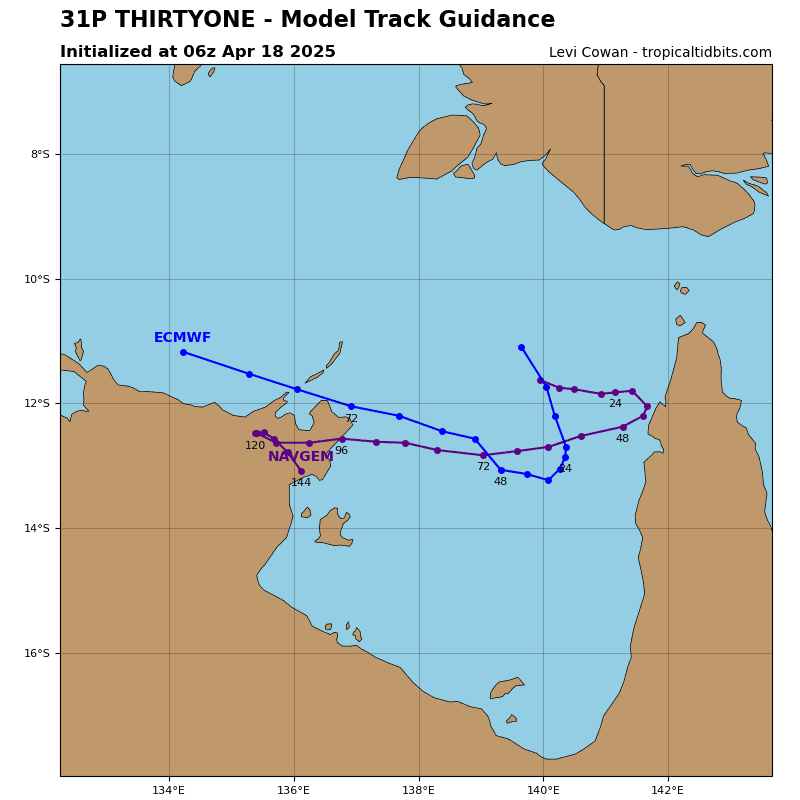
31P_tracks_latest
By PDC’s Senior Weather
Specialist Glenn James

The Pacific Disaster Center’s (PDC Global) Sunday, April 5, 2026, Tropical Cyclone Activity Report…for the Pacific Ocean, the Indian Ocean, and adjacent Seas
Current Tropical Cyclones:
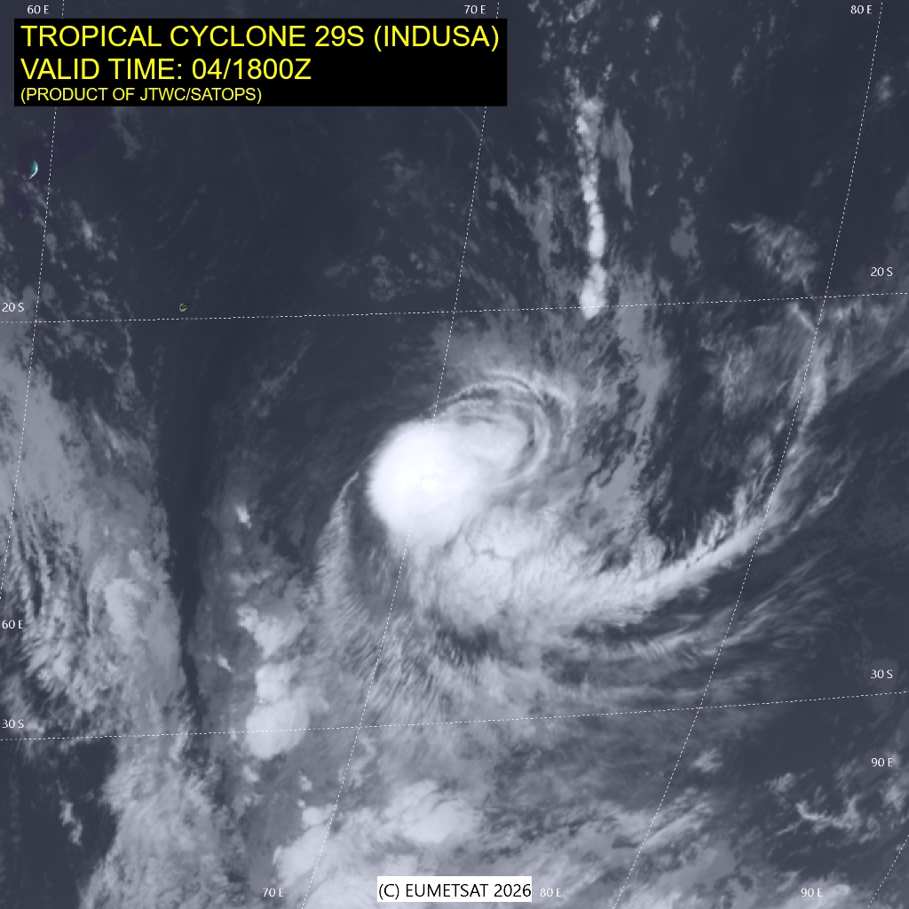
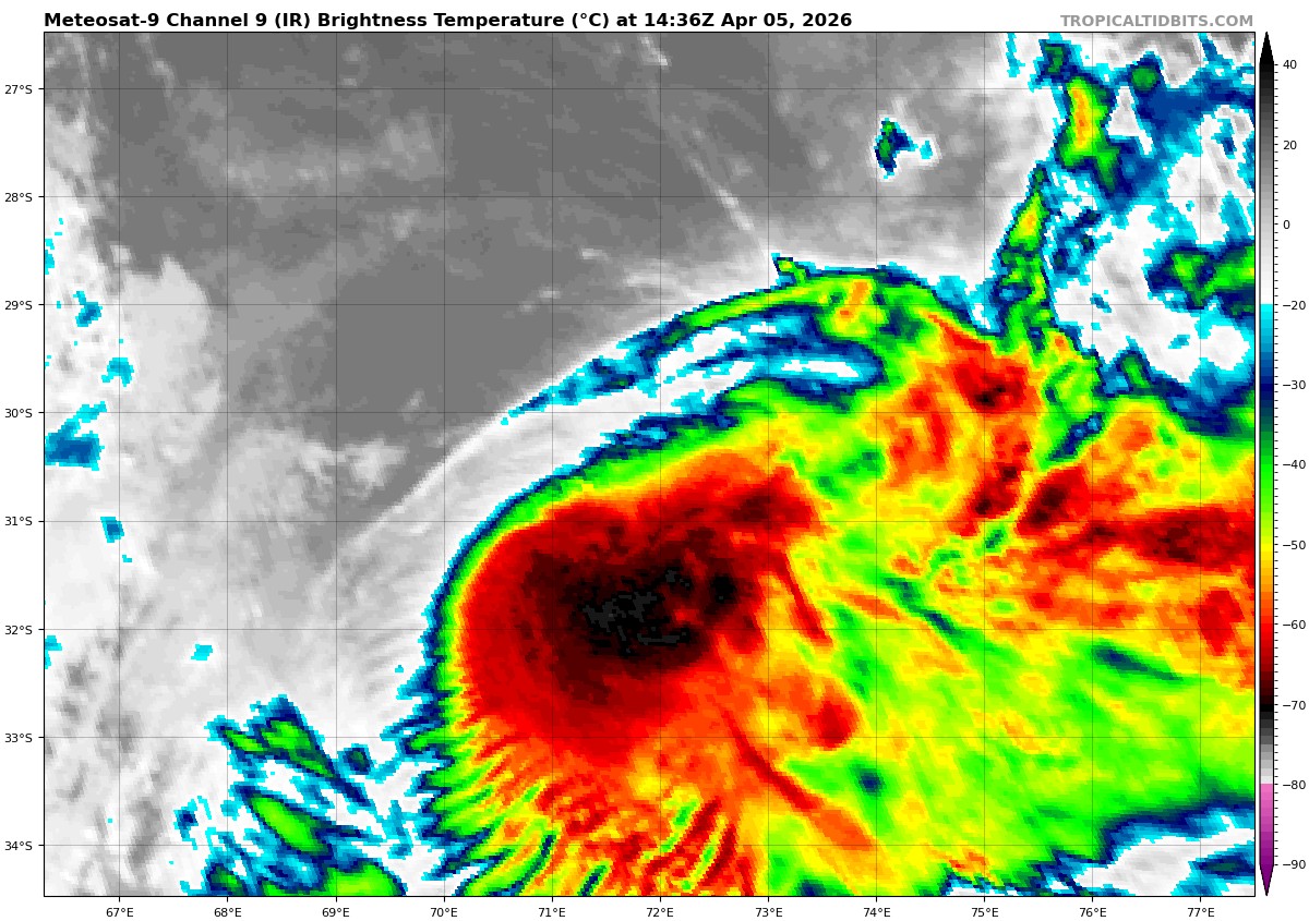
Tropical Cyclone 29S (Indusa)…is located approximately 1109 NM southeast of Port Louis, Mauritius – Final Warning
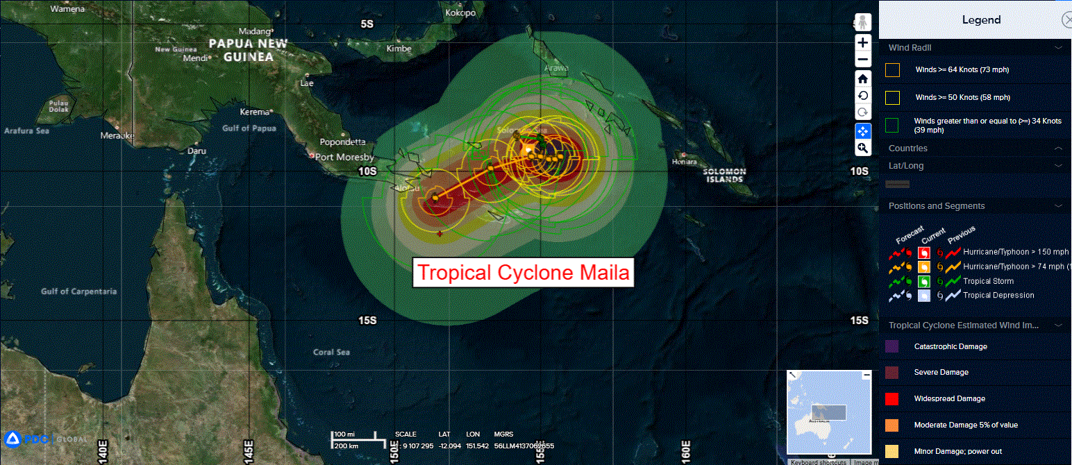
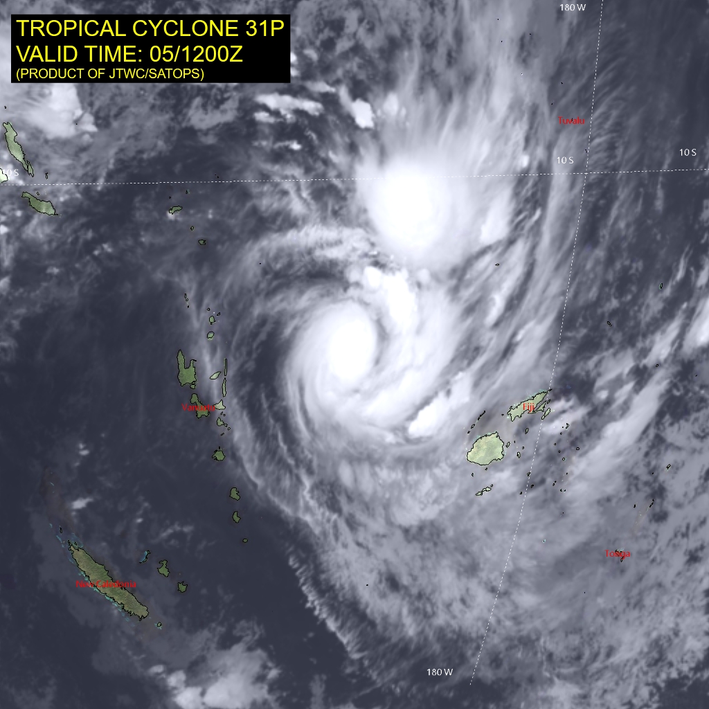
Tropical Cyclone 30P (Maila)…is located approximately 687 NM northeast of Cairns, Australia
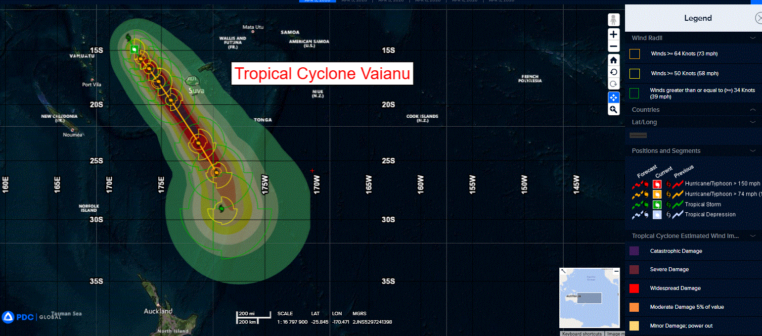
Tropical Cyclone 31P (Vaianu)…is located approximately 290 NM northeast of Port Vila, Vanuatu
Northeast Pacific Ocean: There are no Tropical Cyclones
The last regularly scheduled Tropical Cyclone Activity Report of the 2025 eastern North Pacific Hurricane Season has been issued. Routine issuance of this section of the PDC product will resume on May 15, 2026. During the off-season, Special Tropical Weather Outlooks will be issued as conditions warrant by the NHC.
Central Pacific Ocean: There are no Tropical Cyclones
The 2025 central North Pacific hurricane season has ended. As such, the final routine Tropical Cyclone Activity Report for the 2025 season has been issued. Routine issuance of this section of the PDC product will resume on June 1, 2026. During the off-season, Special Tropical Weather Outlooks will be issued as conditions warrant by the CPHC.
Western Pacific, Indian Ocean, and adjacent Seas:
South Indian Ocean
Tropical Cyclone 29S (Indusa) – Final Warning
According to the JTWC warning number 10, sustained winds are 50 knots with gusts to 65 knots
Animated enhanced infrared satellite imagery (eir) depicts a decoupling vortex with deep convection heavily sheared to the southeast. As a result, the low-level circulation center (llcc) has become partially exposed in the northwestern quadrant.
The environment is increasingly hostile with high vertical wind shear (vws), significant mid-level dry air entrainment, and sea surface temperatures of 23-24 c. tropical cyclone 29S is forecast to
continue on a southeastward track along the southwestern extent of the deep-layer subtropical ridge (str) to the northeast over the next 12 hours.
Further weakening in a highly unfavorable environment is expect through the end of the forecast period. The system is currently undergoing extratropical transition (ett) and will complete ett in the next 12 hours.
Southwest Pacific Ocean
Tropical Cyclone 30P (Maila)
According to the JTWC warning number 4, sustained winds are 75 knots with gusts to 90 knots
Animated enhanced infrared (eir) satellite imagery depicts a system relatively symmetrical central dense overcast (cdo) which has remained for the most part unchanged for the past 12 hours. While an eye has yet to appear in the cdo, a 050753z wsf-m color-enhanced 37ghz image revealed a well-formed microwave eye is present under the cdo.
One possible reason for the lack of a faster pace of intensification is the presence of some evident dry mid-level air, evidenced by a moat between rain bands in the microwave imagery, wedging up the western side of the eye feature. Additionally, mesoscale model-derived soundings indicate the presence of high (20-25 knot) mid-level easterly shear, which if present, would also inhibit a faster rate of intensification. Even with these negative factors, TC 30P has steadily intensified over the past 12 hours.
Environmental conditions are favorable, with warm ssts, moderate westerly outflow aloft, and low deep-layer shear, offset by dry mid-level air and moderate to high mid-level easterly shear.
Tropical cyclone 30P has maintained a quasi-stationary motion over the last 12 hours and remains trapped in a competing steering environment as described above. There are as of yet no signs of any significant change in the steering pattern for the next 48 to 60 hours and TC 30P will meander slowly around the Solomon Sea through that time frame. The forecast calls for a slow eastward progression through 36 hours, then a turn northward by 48 hours. However, the bottom line is that the track will be both highly erratic and highly uncertain, though the system is expected to remain in a fairly small area through 48 hours.
By 72 hours, the ner to the north moves away to the north and the trough associated with TC 31P near Fiji moves away towards the southeast, which will allow the str over Australia to build eastward to the south of TC 30P. Beyond 96 hours, the str over Australia moves quickly eastward, positioning itself to the south of TC 30P. This evolution of the steering pattern will allow TC 30P to be ejected westward after 72 hours, ultimately transiting close to the southeast
tip of Papua New Guinea by the end of the forecast period.
Regarding intensity, deep-layer shear is forecast to continue to weaken in the near-term, and mid-level shear is also expected to slacken, allowing the vortex to fully align. Once this occurs, the system is forecast to rapidly intensify (ri), to a peak of 110 knots by 36 hours. Ocean heat content in the region is high, so the warm water is deep enough to allow for about 36 hours of upwelling before the cool waters reach the surface.
Beginning at 48 hours, the system rapidly weakens as it loses its energy source. By 72 hours, TC 30P will reach its minimum and as it begins to move to the west and away from the cool upwelled pool, it will begin to intensify once more. However, proximity to terrain and a marginal increase in shear will serve to cap the intensity through the end of the forecast period.
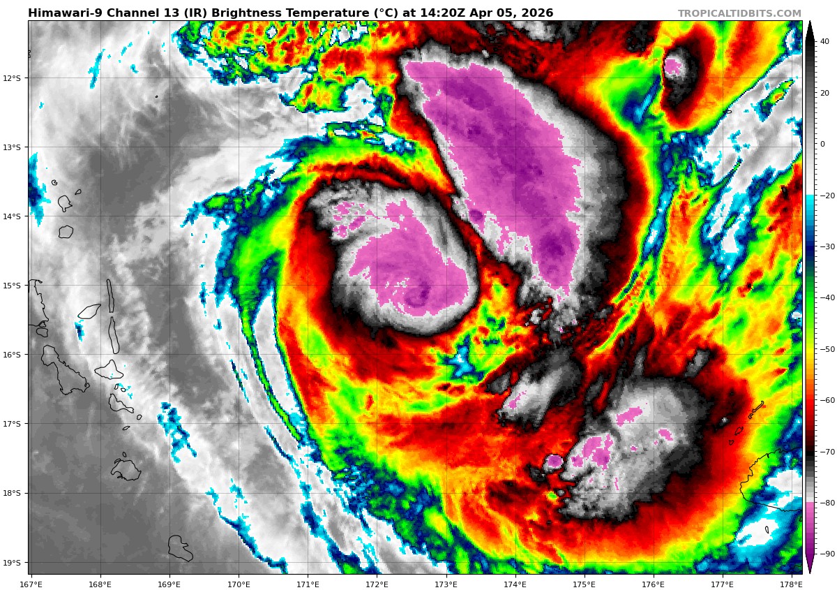
Tropical Cyclone 31P (Vaianu)
According to the JTWC warning number 2, sustained winds are 55 knots with gusts to 70 knots
Animated multi-spectral satellite imagery (msi) depicts an asymmetric vortex with convective banding wrapping into the center primarily on the eastern side. Low-level cloud bands are visible in the northwestern quadrant, however, the low-level circulation center (llcc) is almost completely obscured. Animated water vapor imagery reveals moderate poleward and equatorward outflow, as well as a pocket of relatively dry air situated southwest of the assessed center location.
The current environment is analyzed to be favorable for intensification with moderate westerly
vertical wind shear (vws), very warm sea surface temperatures (29-30 c), and good outflow aloft.
Tropical cyclone 31P has tracked slowly southeastward over the past 12 hours under the relatively weak steering influence of the str to its east. The system will continue to advance southeast at a leisurely pace under the weak steering flow through 36, at which time a longwave trough approaching from the west tightens the gradient and causes it to accelerate southeastward through the remainder of the forecast period.
A steady intensity increase in a favorable environment, further enhanced by increased poleward outflow after 36 hours from a jet streak associated with the aforementioned trough, is forecast
through about 60 hours. TC 31P is expected to peak at 85-90 kts near 60 hours, after which an increasingly hostile shear environment and dry air entrainment are forecast to initiate a steady weakening phase through the end of the forecast period. The system is expected to begin extratropical transition around 120 hours under the influence of the jet streak previously mentioned.