
")
Current Snapshot
For all the latest updates visit: DisasterAWARE
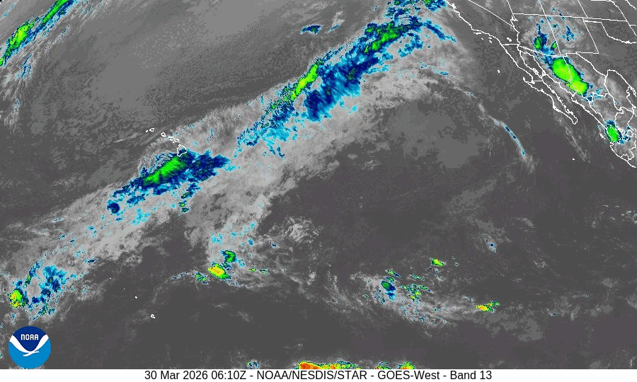
GOES18-TPW-13-900×540
99
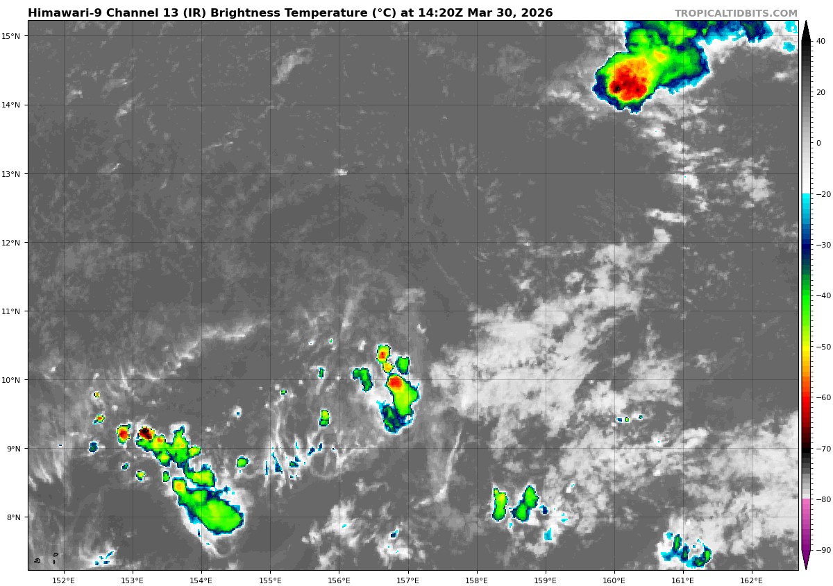
himawari9_ir_99W_202603301420_lat10.7-lon157.5
99W_tracks_latest
By PDC’s Senior Weather
Specialist Glenn James

The Pacific Disaster Center’s (PDC Global) Monday, March 30, 2026, Tropical Cyclone Activity Report…for the Pacific Ocean, the Indian Ocean, and adjacent Seas
Current Tropical Cyclones:
There are no tropical cyclones
Northeast Pacific Ocean: There are no Tropical Cyclones
The last regularly scheduled Tropical Cyclone Activity Report of the 2025 eastern North Pacific Hurricane Season has been issued. Routine issuance of this section of the PDC product will resume on May 15, 2026. During the off-season, Special Tropical Weather Outlooks will be issued as conditions warrant by the NHC.
Central Pacific Ocean: There are no Tropical Cyclones
The 2025 central North Pacific hurricane season has ended. As such, the final routine Tropical Cyclone Activity Report for the 2025 season has been issued. Routine issuance of this section of the PDC product will resume on June 1, 2026. During the off-season, Special Tropical Weather Outlooks will be issued as conditions warrant by the CPHC.
Western Pacific, Indian Ocean, and adjacent Seas: There are no Tropical Cyclones
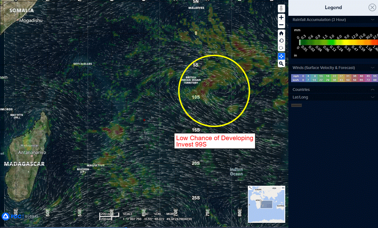
South Indian Ocean
>>> There’s an area of disturbed weather being referred to as Invest 99S, which is located approximately 285 NM east-southeast of Diego Garcia.
Animated multi-spectral imagery depicts a partially obscured low level circulation center with convective banding along the western semicircle. A 301250z ssmis pass shows disorganized curved banding about an elongated llcc along a west-northwest to east-southeast axis.
environmental analysis reveals a marginally favorable environment for development with moderate poleward upper level outflow, moderate vertical wind shear (15-20 kts), and warm sea surface temperatures (29-30 c).
Out of the deterministic models, navgem is most aggressive with 99S, showing immediate development, but other models are more hesitant, showing gradual organization over the next 24-48 hours. Global models agree on 99S turning slowly southward or southwestward over the next 24-48 hours.
Maximum sustained surface winds are estimated at 18 to 23 knots.
The potential for the development of a significant tropical cyclone within the next 24 hours remains low.