
")
Current Snapshot
For all the latest updates visit: DisasterAWARE
yyyyy
nsarelle
27P_261200sair
himawari9_ir_27P_202603261450_lat-20.4-lon114.6
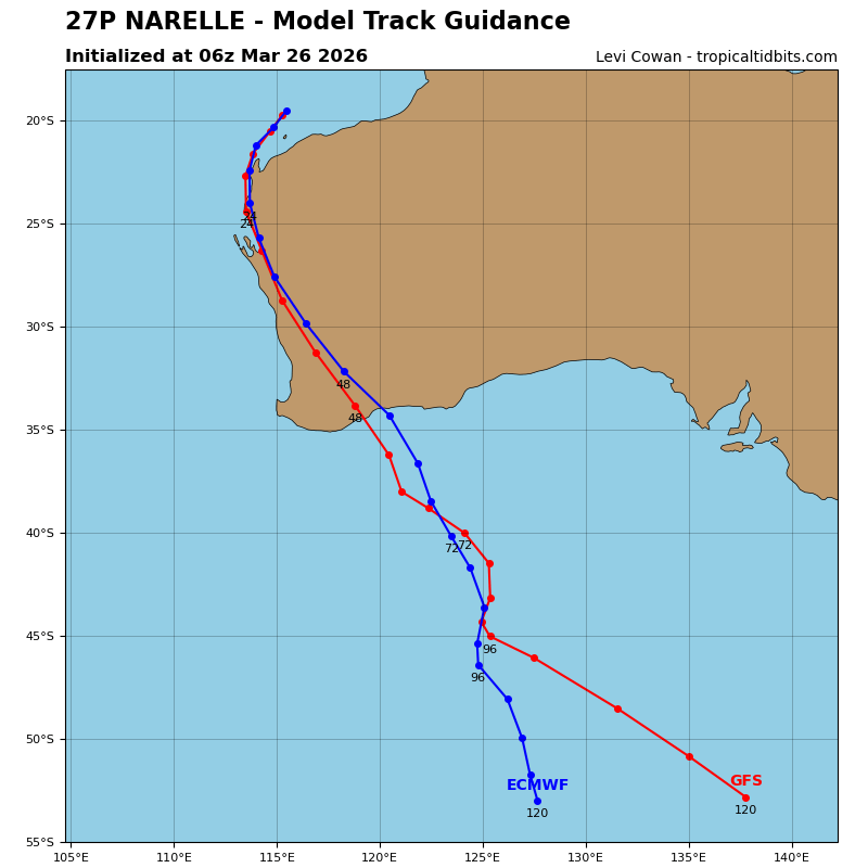
27P_tracks_latest
By PDC’s Senior Weather
Specialist Glenn James

The Pacific Disaster Center’s (PDC Global) Thursday, March 26, 2026, Tropical Cyclone Activity Report…for the Pacific Ocean, the Indian Ocean, and adjacent Seas
Current Tropical Cyclones:
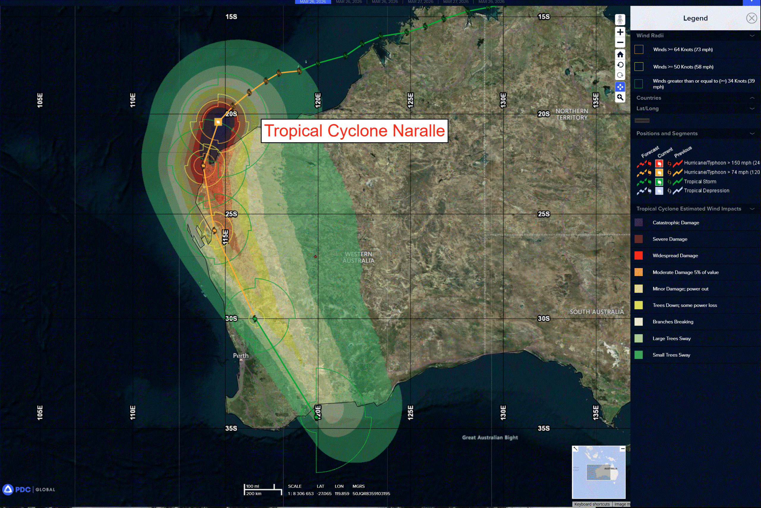
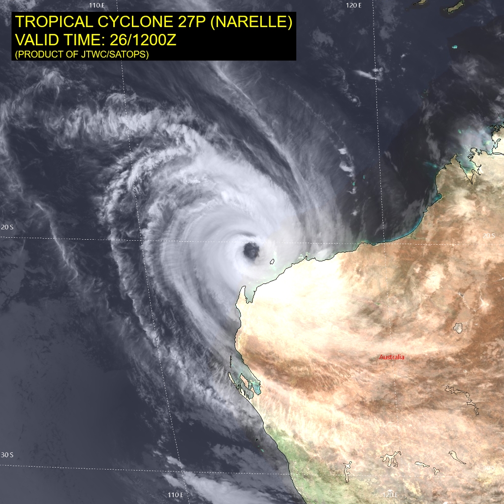
Tropical Cyclone 27P (Narelle)…is located approximately 72 NM north of Learmonth, Australia
Northeast Pacific Ocean: There are no Tropical Cyclones
The last regularly scheduled Tropical Cyclone Activity Report of the 2025 eastern North Pacific Hurricane Season has been issued. Routine issuance of this section of the PDC product will resume on May 15, 2026. During the off-season, Special Tropical Weather Outlooks will be issued as conditions warrant by the NHC.
Central Pacific Ocean: There are no Tropical Cyclones
The 2025 central North Pacific hurricane season has ended. As such, the final routine Tropical Cyclone Activity Report for the 2025 season has been issued. Routine issuance of this section of the PDC product will resume on June 1, 2026. During the off-season, Special Tropical Weather Outlooks will be issued as conditions warrant by the CPHC.
Western Pacific, Indian Ocean, and adjacent Seas:
South Indian Ocean
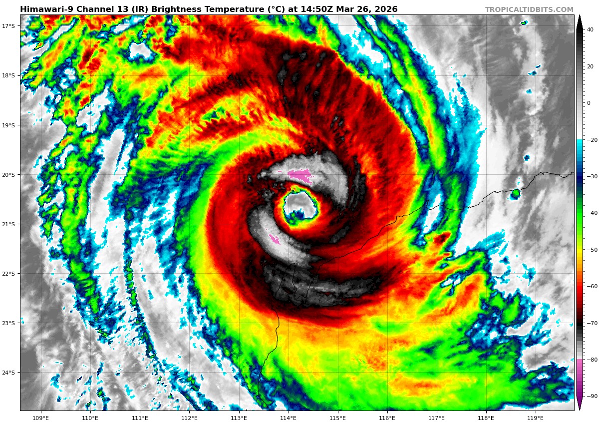
Tropical Cyclone 27P (Narelle)
According to the JTWC warning number 36, the sustained winds were 110 knots with gusts to near 135 knots
Animated enhanced infrared (eir) satellite imagery depicts a very large (40-45 nm) eye feature surrounded by nearly symmetric bands of deep convection. A 261021z f17 ssmis 91 ghz microwave image shows that the vortex has retained its overall structure over the past 6 hours, with a large and symmetric microwave eye feature. The 37 ghz version of the same microwave image revealed that the outer-eyewall that was present in earlier microwave imagery has become the primary structure, suggesting that the eyewall replacement cycle (erc) has completed or is close to completion. The erc is likely the reason for the current broad nature of the eye.
The current environment is characterized as favorable due to low vertical wind shear (vws), warm (28-29 c) sea surface temperatures, and strong poleward outflow.
TC 27P (Narelle) has continued on its southwestward trajectory over the past 6 hours under the steering influence of the str to the southeast. Landfall along the Exmouth Peninsula is expected just after 6 hours, resulting in a near-direct
hit of Learmonth by the most intense left-front quadrant. The system is forecast to round the str axis around 12 hours, then turn to a southward track that becomes south-southeastward by 24 hours. After 24 hours, TC Narelle will accelerate inland, east of Geraldton and Perth, before emerging back over water south of western Australia near 48 hours.
The system is at or near its peak intensity, with only around 6 hours until land interaction and cooling sea surface temperatures will initiate the rapid weakening phase. Further weakening will be promoted by increasing westerly vws from 24 hours onward. Subtropical transition is forecast to begin around 36 hours and complete by 48 hours as the system tracks southeast of Perth.