
")
Current Snapshot
For all the latest updates visit: DisasterAWARE
GOES18-TPW-13-900×540
narelle
27P_231200sair
himawari9_ir_27P_202603231430_lat-15.1-lon126.8
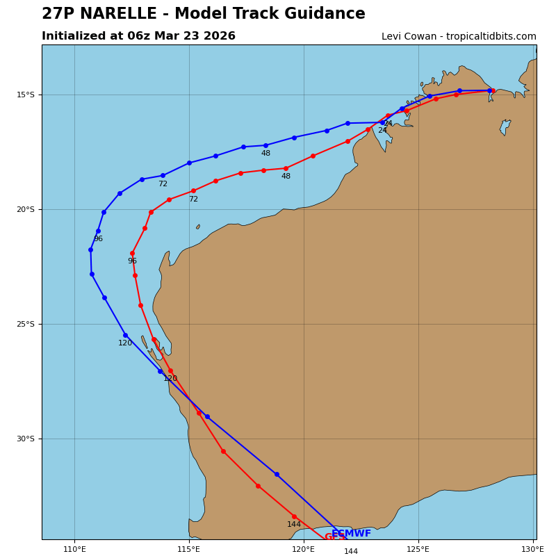
27P_tracks_latest
By PDC’s Senior Weather
Specialist Glenn James

The Pacific Disaster Center’s (PDC Global) Monday, March 23, 2026, Tropical Cyclone Activity Report…for the Pacific Ocean, the Indian Ocean, and adjacent Seas
Current Tropical Cyclones:
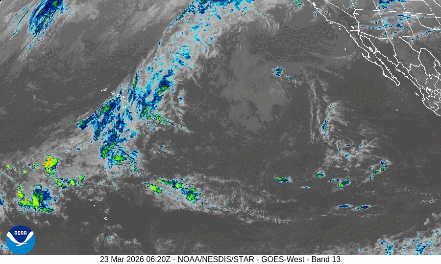
Tropical Cyclone 27P (Narelle)…is located approximately 195 NM northeast of Broome, Australia
Northeast Pacific Ocean: There are no Tropical Cyclones
The last regularly scheduled Tropical Cyclone Activity Report of the 2025 eastern North Pacific Hurricane Season has been issued. Routine issuance of this section of the PDC product will resume on May 15, 2026. During the off-season, Special Tropical Weather Outlooks will be issued as conditions warrant by the NHC.
Central Pacific Ocean: There are no Tropical Cyclones
The 2025 central North Pacific hurricane season has ended. As such, the final routine Tropical Cyclone Activity Report for the 2025 season has been issued. Routine issuance of this section of the PDC product will resume on June 1, 2026. During the off-season, Special Tropical Weather Outlooks will be issued as conditions warrant by the CPHC.
Western Pacific, Indian Ocean, and adjacent Seas:
SW Pacific Ocean
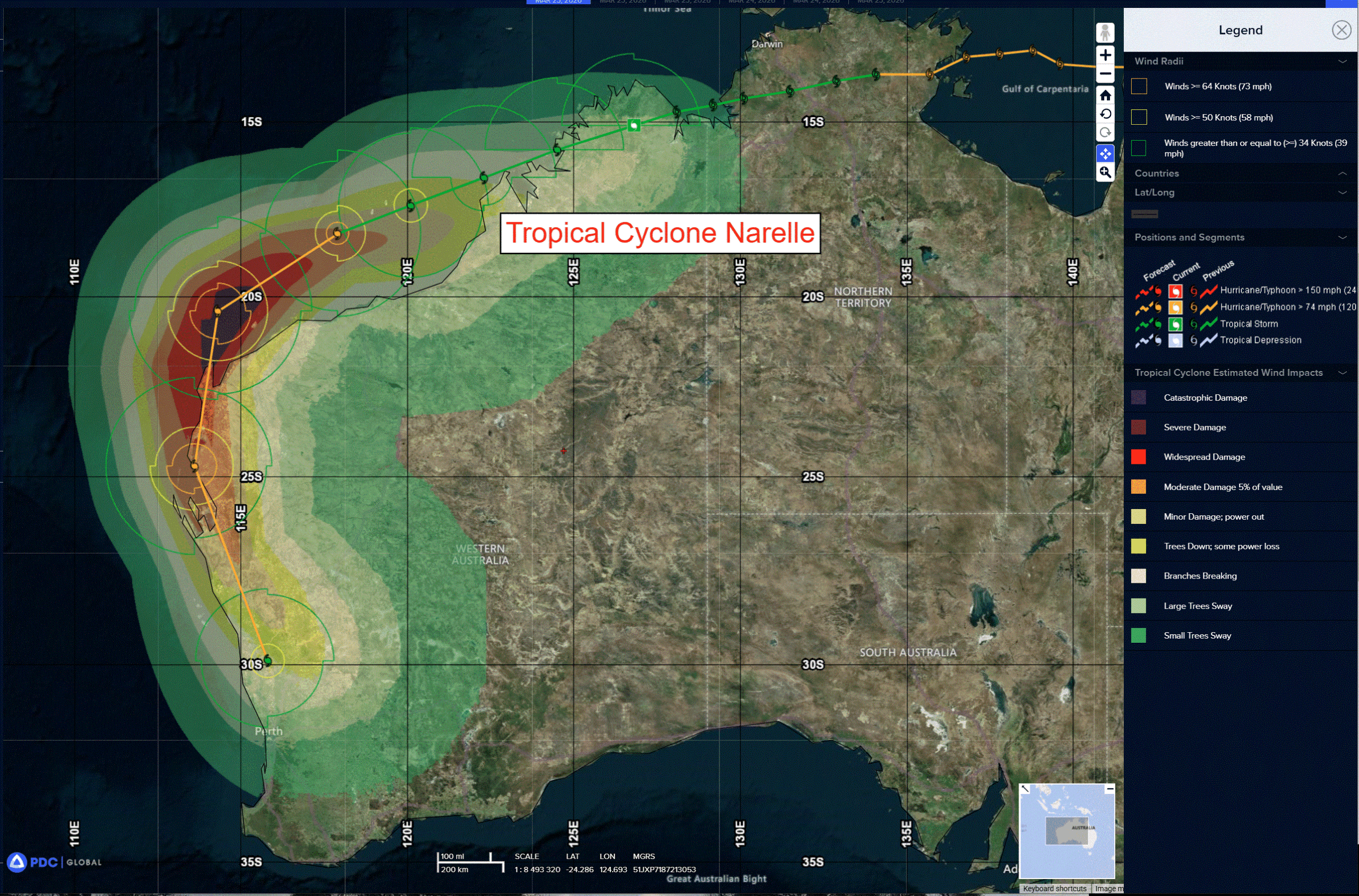
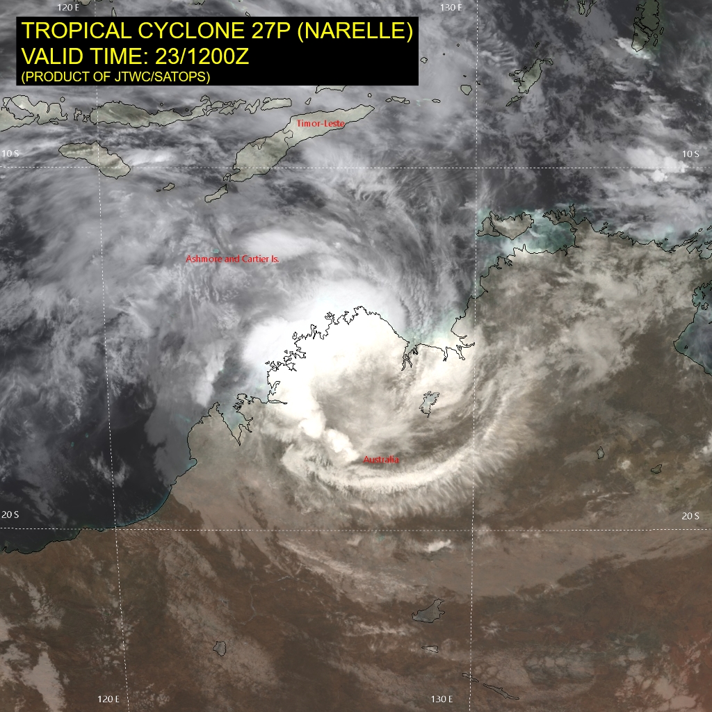
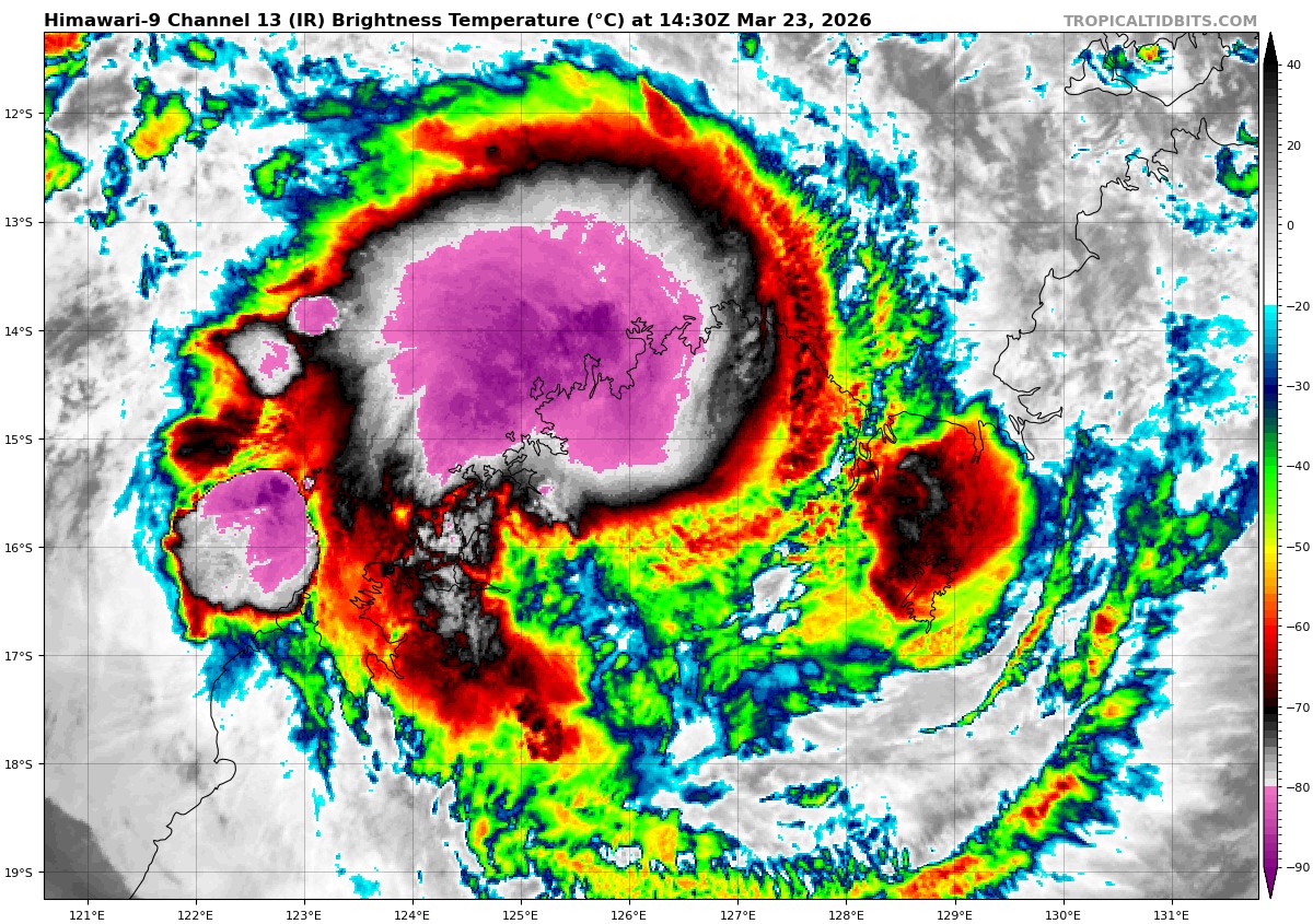
Tropical Cyclone 27P (Narelle)
According to the JTWC warning number 25, the sustained winds were 35 knots with gusts to near 45 knots
Animated multi-spectral satellite imagery (msi) depicts a slightly reorganized vortex that has maintained some convection over warm water following a brief period over the Bonaparte Gulf over the past 6 hours.
TC 27P (Narelle) continues on a west-southwestward track under the steering influence of the str to the south. It is forecast to continue west-southwestward along the Kimberley coast through 18 hours where it will reemerge over the southern Indian Ocean, southeast of Adele Island. The west-southwestward trajectory continues through 72 hours, then the system begins to round the ridge axis initiating a poleward turn. Narelle is forecast to skirt the western Australia coastline, tracking just west of Learmonth shortly before 96 hours. After 96 hours the system will track southward and accelerate toward Geraldton through 120 hours.
In terms of intensity, TC Narelle is forecast to weaken slightly over the next 12 hours as it transits over land in the Kimberley region. Once the system emerges back over water, the environment will quickly improve and support redevelopment. A steady rate of intensification will occur through 48 hours as the system recovers from its time over land. After 48 hours a rapid rate
of intensification is forecast to occur through 72 hours as it approaches the Exmouth Peninsula. A peak intensity of 100-105 kts is likely to occur near 84 hours, which is not directly captured by the current warning.
Cooling sea surface temperatures, increasing westerly vertical wind shear, and dry air entrainment after 84 hours will cause the system to weaken through the remainder of the forecast period. TC Narelle is forecast to begin subtropical transition at 120 hours where it begins to interact with mid-latitude westerly winds and crosses the 26 c sst isotherm.
>>> There’s an area of disturbed weather being referred to as Invest SS 28P, which is located approximately 310 NM south-southwest of Noumea, New Caledonia
The system is currently classified as a subtropical cyclone, generally characterized as having both tropical and mid-latitude cyclone features. Animated enhanced multi-spectral satellite imagery depicts a weak frontal system with flaring convection located just poleward and eastward of the low-level circulation center (llcc).
The system has continued to be sheared to the south-southeast, with the llcc becoming only partially obscured along the primary convective structures, very typical of a subtropical cyclone.
Environmental analysis reveals unfavorable conditions for tropical transition moving forward, defined by a deep layer, mid-level dry air being entrained throughout the systems core, strong north-northwesterlies aloft, high vertical wind shear (vws) of 40-50 kts, and cooling sea surface temperatures of 25-26 c.
Global models are in agreement that subtropical cyclone 28P will track southward as the broad and asymmetric wind field continues to expand as the system transits south.
Maximum sustained surface winds are estimated at 37 to 42 knots.
The potential for the development of a significant tropical cyclone within the next 24 hours remains low.