Western Pacific, Indian Ocean, and adjacent Seas: There are no Tropical Cyclones
Western Pacific

")


By PDC’s Senior Weather
Specialist Glenn James

The Pacific Disaster Center’s (PDC Global) Monday, September 15, 2025, Tropical Cyclone Activity Report…for the Pacific Ocean, the Indian Ocean, and adjacent Seas
Current Tropical Cyclones:
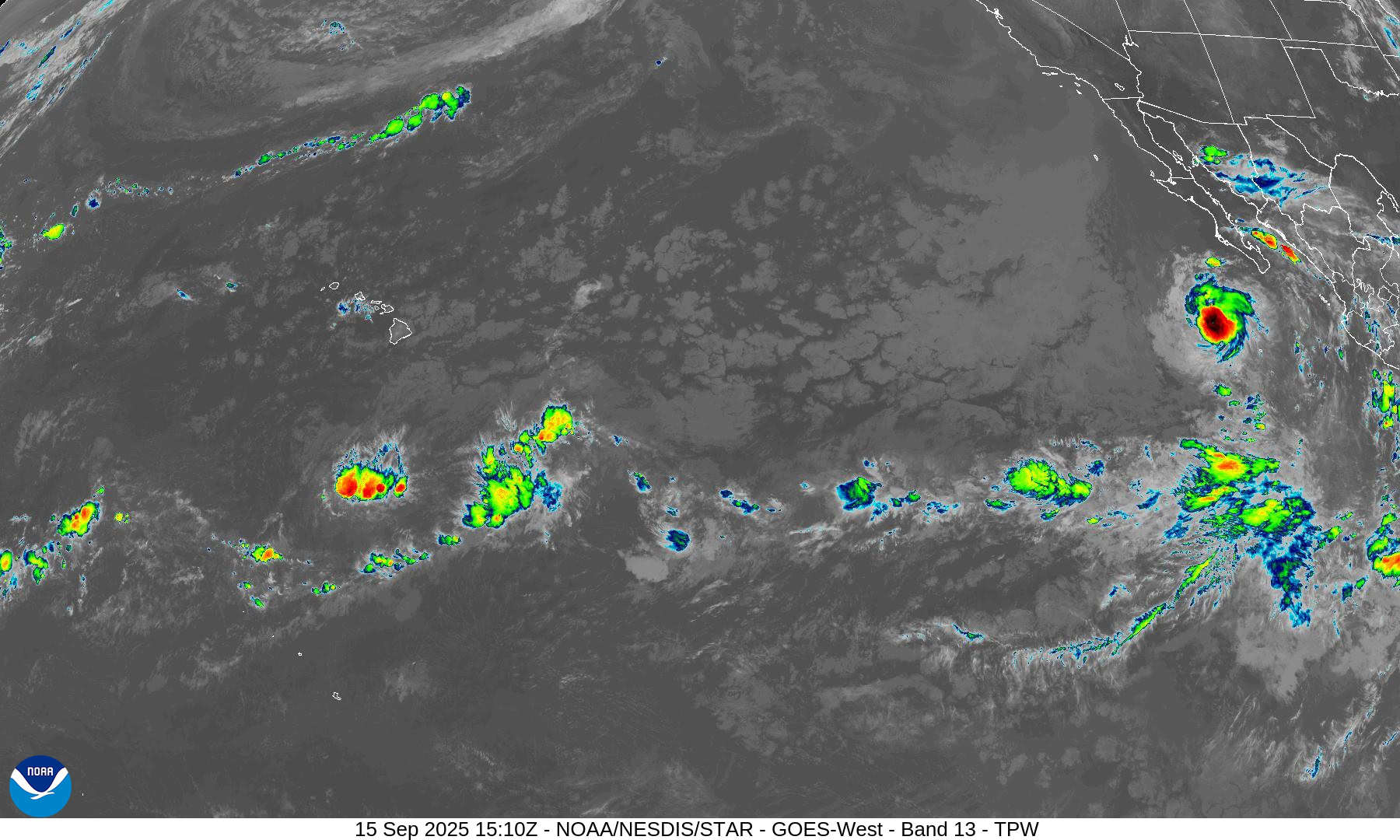
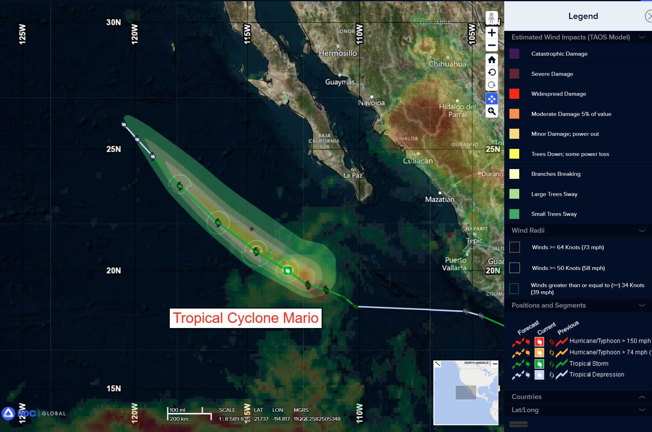
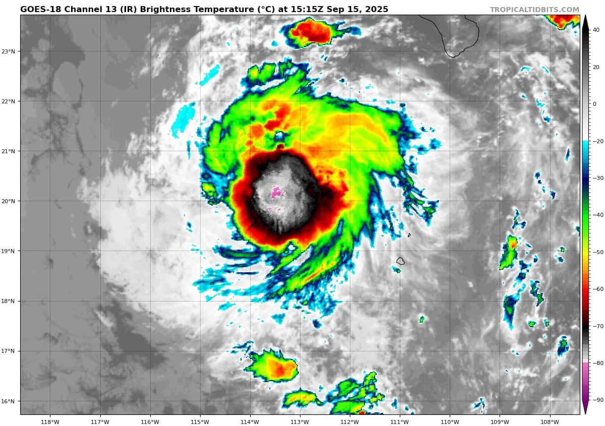
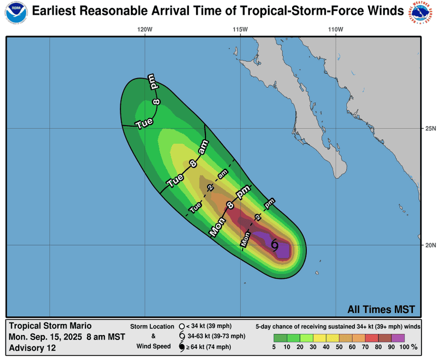
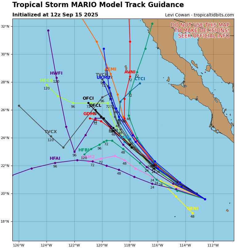
Tropical Cyclone Mario is located about 340 miles west-southwest of the southern tip of Baja California
Northeast Pacific Ocean:
Tropical Cyclone Mario
MARIO BEGINNING TO MOVE OVER COOLER WATERS
According to the NHC advisory number 14
Mario is moving toward the northwest near 13 mph (20 km/h), and this general motion with some decrease in forward speed is forecast during the next couple of days.
Tropical-storm-force winds extend outward up to 45 miles (75 km) from the center.
The estimated minimum central pressure is 995 mb (29.39 inches).
Off the coast of Southwestern Mexico:
>>> An trough of low pressure located several hundred miles off the coast of southern Mexico continues to produce a broad area of disorganized showers and thunderstorms. Environmental conditions appear conducive for additional development of this system, and a tropical depression is likely to form during the middle to latter part of this week as it moves west-northwestward at 10 to 15 mph over the central east Pacific.
*Formation chance through 48 hours…medium…50 percent
*Formation chance through 7 days…high…80 percent
Central Pacific Ocean: There are no Tropical Cyclones
Tropical cyclone formation is not expected during the next 7 days.
Western Pacific, Indian Ocean, and adjacent Seas: There are no Tropical Cyclones
Western Pacific
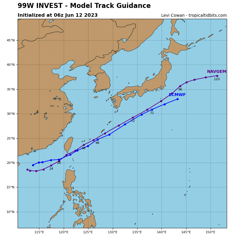
>>> There’s a, area of disturbed weather being referred to as Invest 99W, which is located approximately 108 NM north of Legazpi
Animated multi-spectral satellite imagery depicts a system that is becoming more compact and developing a low-level circulation (llc). Formative banding is evident along the northwest periphery of the llc. A partial 160106z ascat-c image shows 20-25 knot winds north of center.
Global models indicate development with a west-northwestward track over the next 24 hours.
Deterministic and ensemble models depict intensification with a north-northwestward track toward Luzon, Philippines.
Maximum sustained surface winds are estimated at 18 to 23 knots.
The potential for the development of a significant tropical cyclone within the next 24 hours remains high.