
")
Current Snapshot
For all the latest updates visit: DisasterAWARE
1800x1080aaa
jerry
goes19_ir_10L_202510091615_lat15.6-lon-58.5
091439_earliest_reasonable_toa_34
091439INTQPF_sm
10L_tracks_latest
96L
96L7
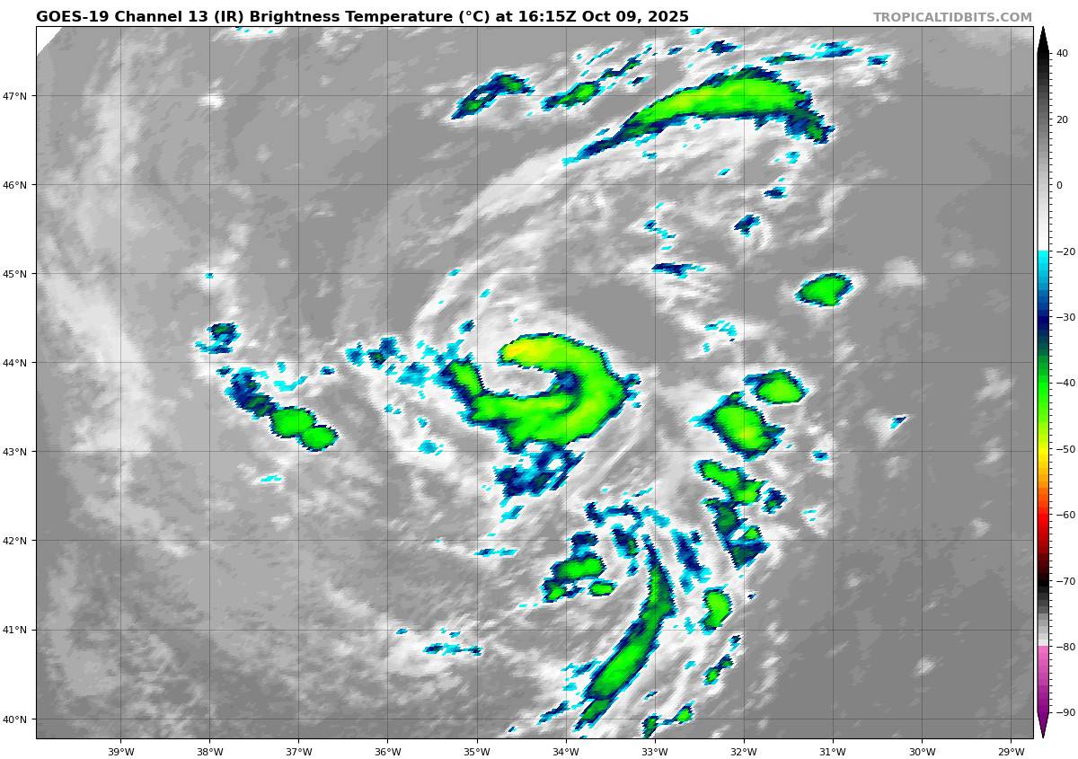
goes19_ir_96L_202510091615_lat43.4-lon-34.6

96L_tracks_latest
By PDC’s Senior Weather
Specialist Glenn James

The Pacific Disaster Center’s (PDC Global) Thursday, October 9, 2025, Tropical Cyclone Activity Report…for the Atlantic Ocean, the Caribbean Sea, and the Gulf of America
Current Tropical Cyclones:
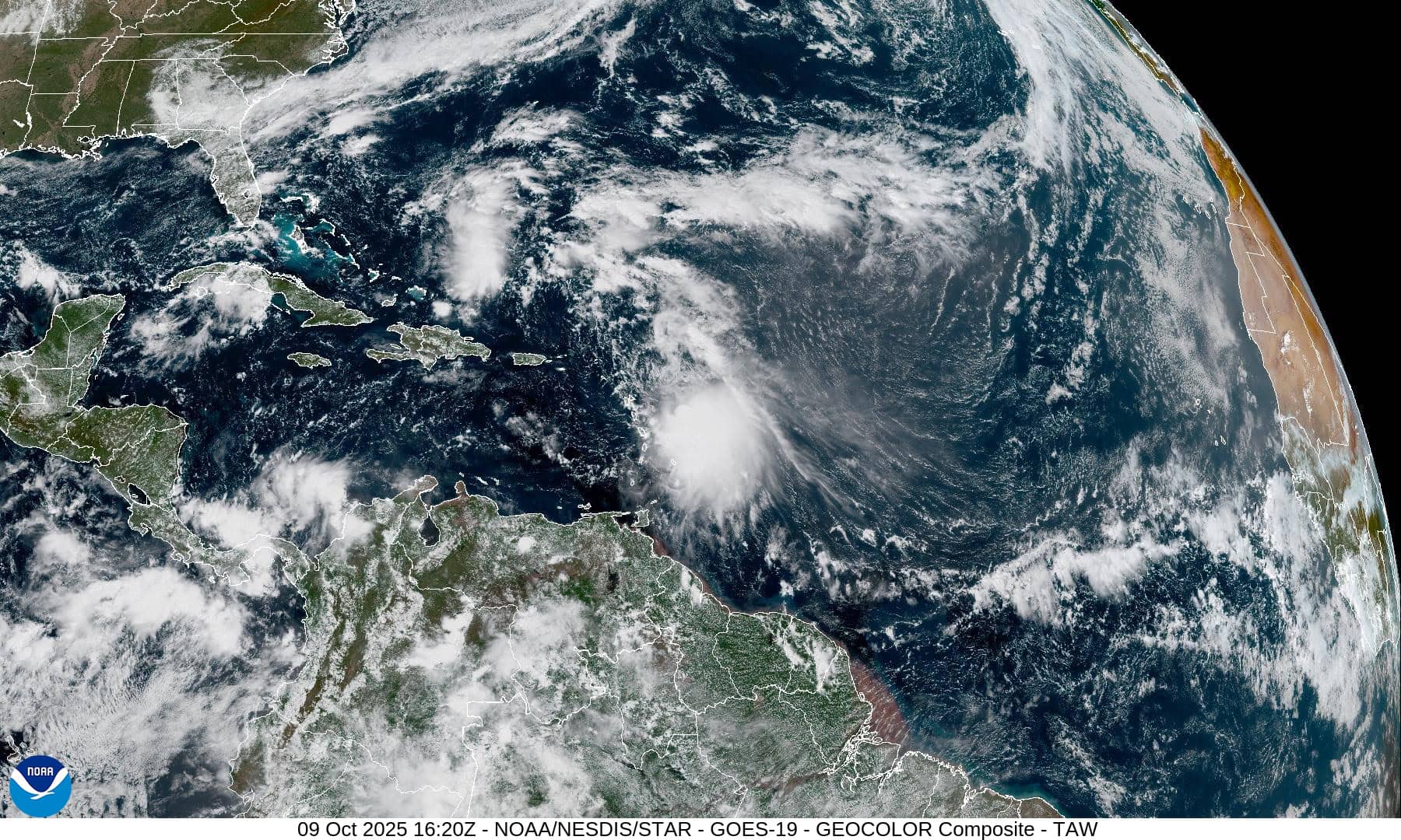
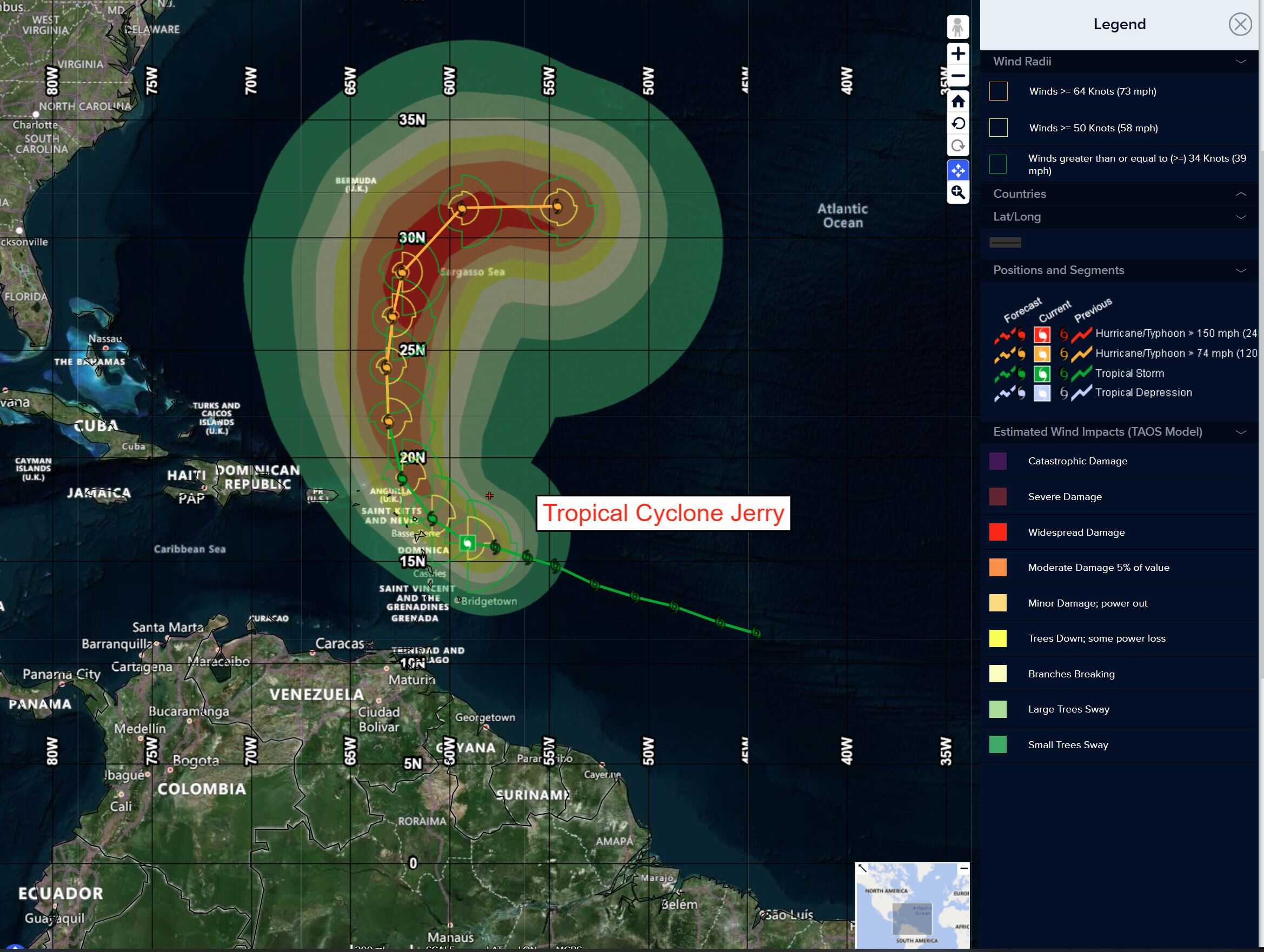
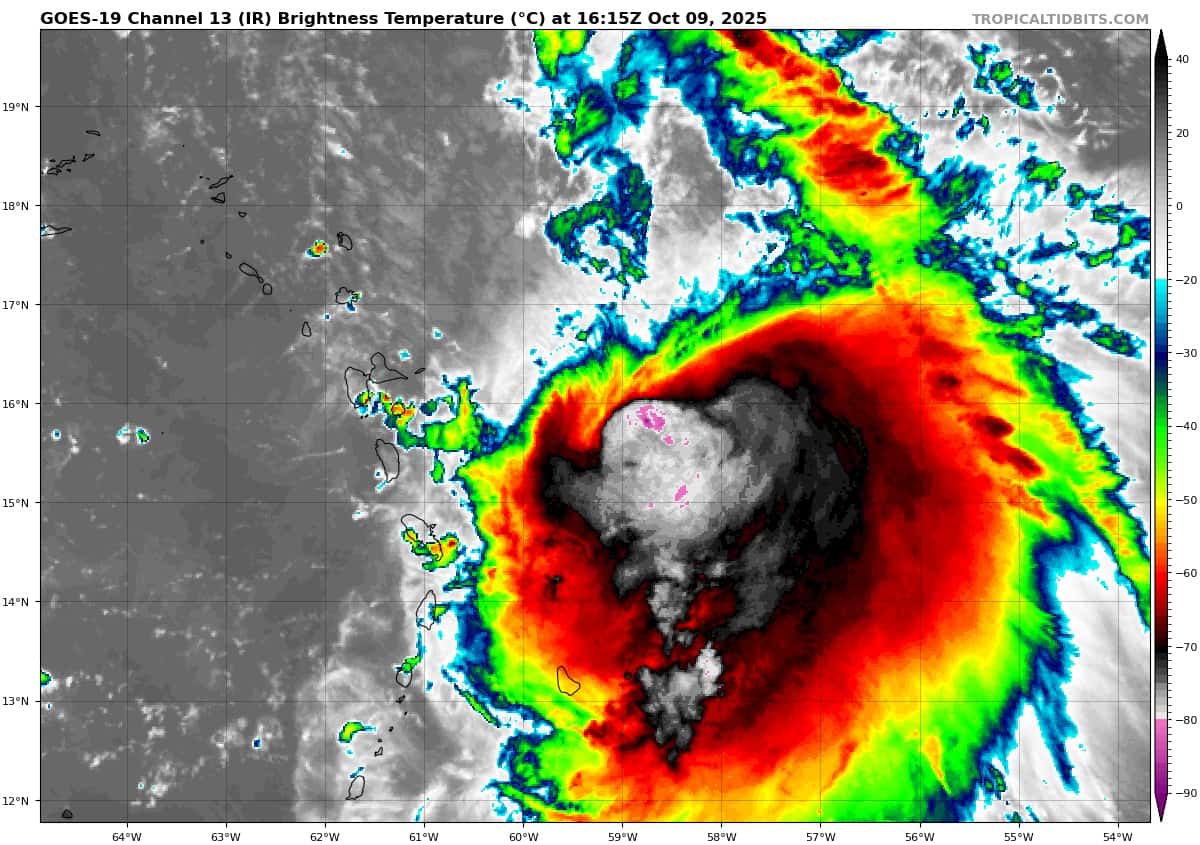
Tropical Cyclone Jerry…is located about 310 miles east-southeast of the northern Leeward Islands
Atlantic Ocean:
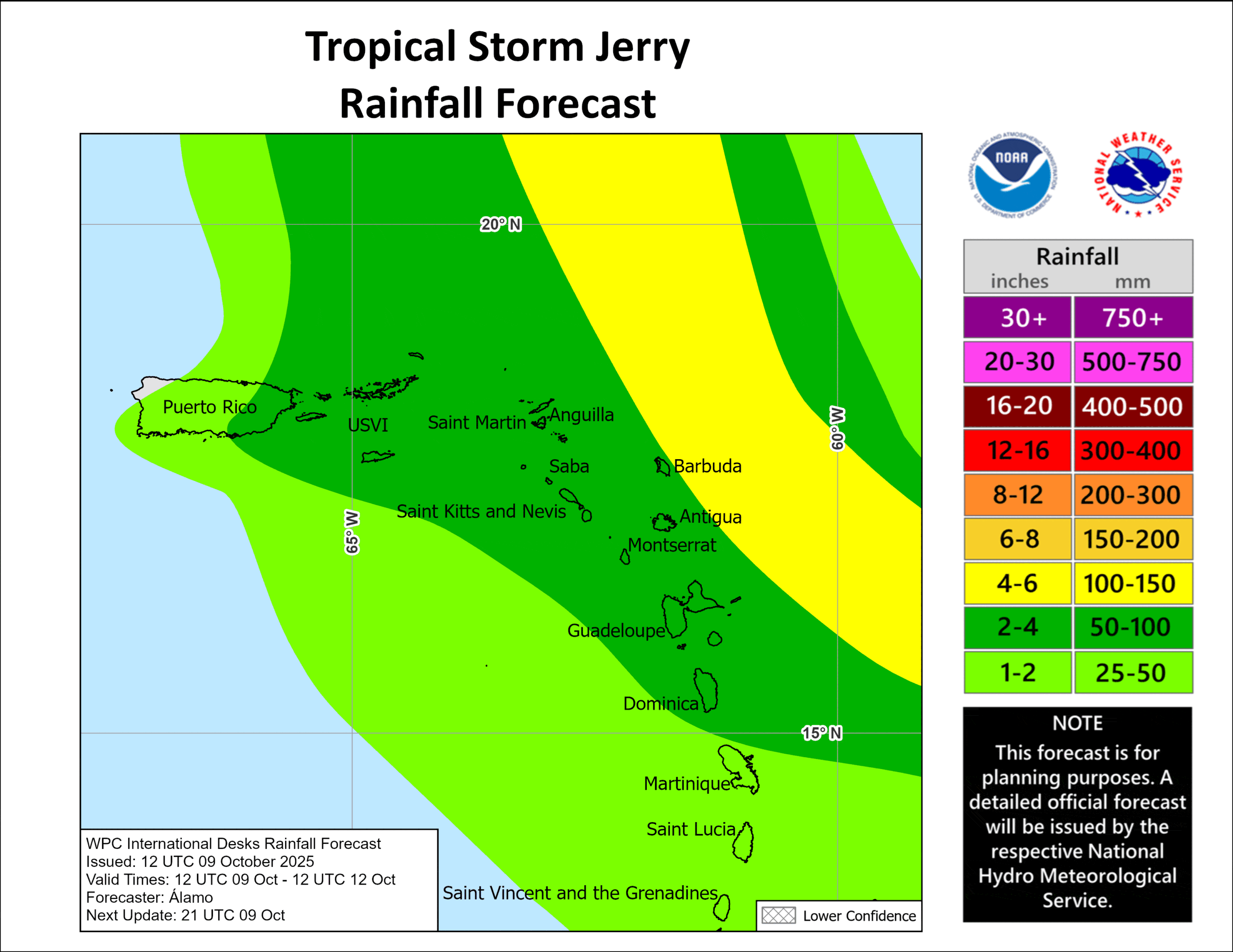
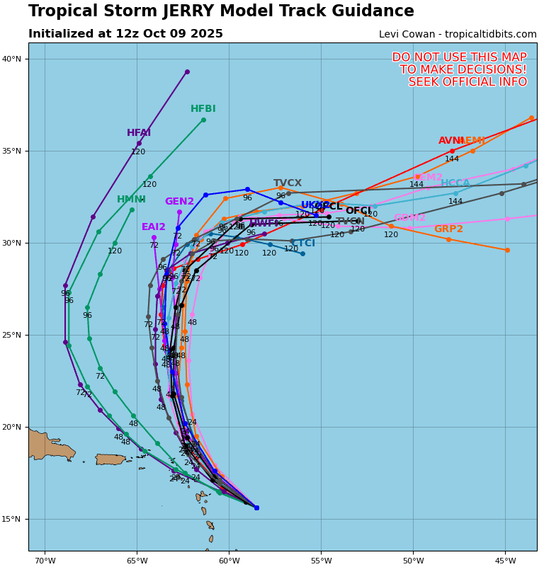
Tropical Cyclone Jerry
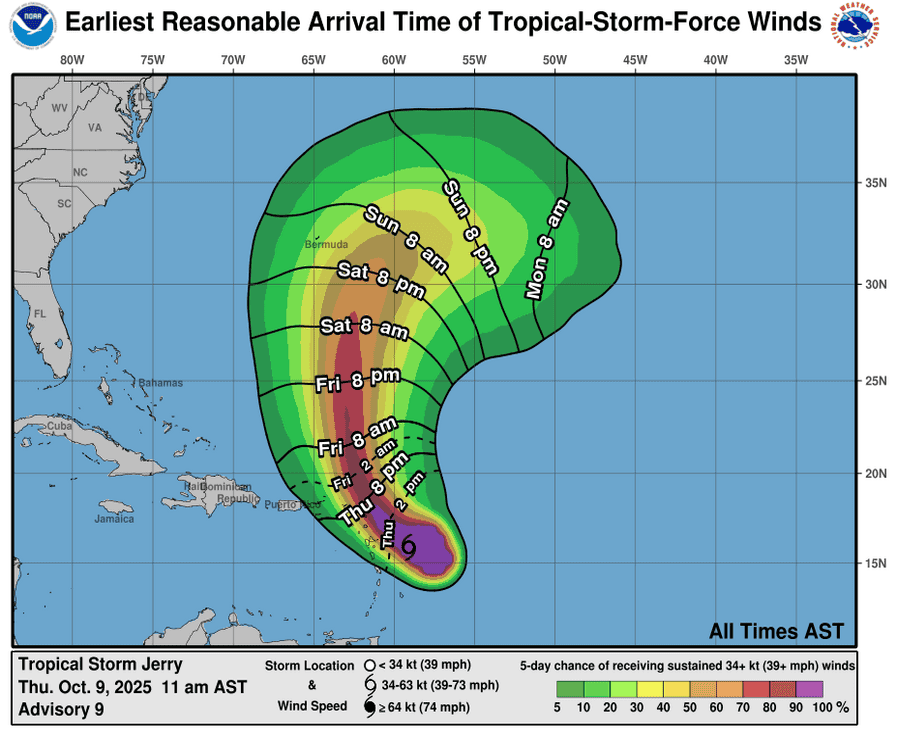
JERRY EXPECTED TO BE NEAR THE NORTHERN LEEWARD ISLANDS LATER TODAY…TROPICAL STORM WARNING ISSUED FOR BARBUDA
According to the NHC advisory number 9
Jerry is moving toward the west-northwest near 18 mph (30 km/h). A turn toward the northwest is expected late today, followed by a slightly slower northward motion on Friday and Saturday. On the forecast track, the center of Jerry is expected to pass near or to the northeast of the northern Leeward Islands later today and tonight. Maximum sustained winds are near 65 mph (100 km/h) with higher gusts. Gradual strengthening is forecast during the next few days, and Jerry could become a hurricane by late Friday or Saturday. Tropical-storm-force winds extend outward up to 175 miles (280 km) from the center. The estimated minimum central pressure is 999 mb (29.50 inches).
HAZARDS AFFECTING LAND
WIND: Tropical storm conditions are expected in Barbuda later today and tonight. Tropical storm conditions are possible in portions of the northern Leeward Islands within the watch area later today into Friday.
RAINFALL: Through Friday, 2 to 4 inches of rain with local storm total maxima to 6 inches are expected across the Leeward and Virgin Islands. This rainfall brings a risk of flash flooding, especially in urban areas and in steep terrain. For portions of Puerto Rico, moisture associated with Jerry combined with local orographic effects may result in up to 2 to 4 inches of rain, with isolated 6 inches possible.
SURF: Swells generated by Jerry are beginning to reach the Leeward and Windward Islands. These swells will spread westward toward the Virgin Islands and Puerto Rico tonight, then toward the rest of the Greater Antilles over the next couple of days. These swells are likely to cause life-threatening surf and rip current conditions.
North Atlantic
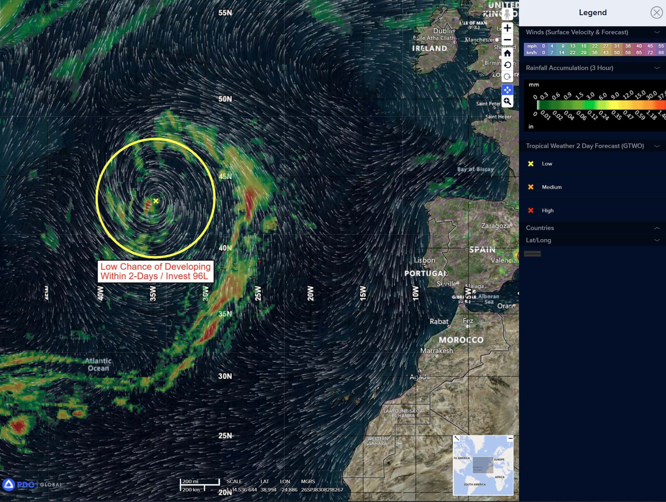
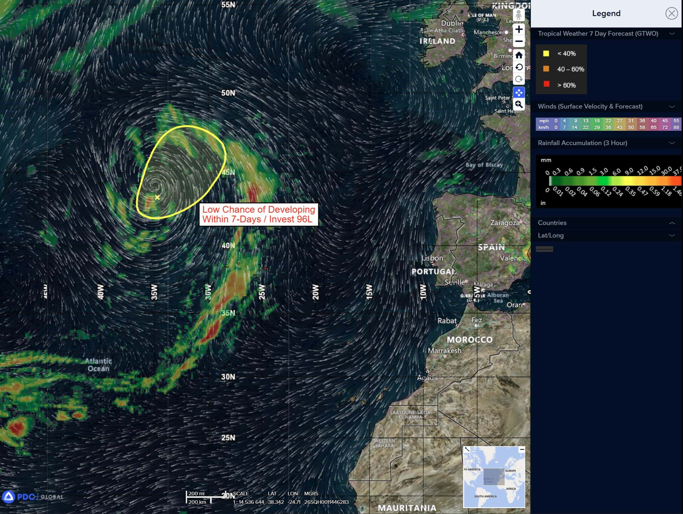
Invest 96L
>>> A gale-force non-tropical area of low pressure located several hundred miles to the west-northwest of the Azores is producing limited shower activity near its center. Some subtropical or tropical development of this system is possible over the next day or two before it moves over even cooler waters and into a stronger shear environment.
* Formation chance through 48 hours…low…10 percent
* Formation chance through 7 days…low…10 percent
Caribbean Sea: There are no active tropical cyclones
Tropical cyclone formation is not expected during the next 7-days.
Gulf of America: There are no active tropical cyclones
Tropical cyclone formation is not expected during the next 7-days.