
")
Current Snapshot
For all the latest updates visit: DisasterAWARE
atlantic
jerry
goes19_ir_10L_202510081445_lat13.3-lon-51.6
081451_earliest_reasonable_toa_34
081451INTQPF_sm
10L_tracks_latest
2
7
1000×1000
By PDC’s Senior Weather
Specialist Glenn James

The Pacific Disaster Center’s (PDC Global) Wednesday, October 8, 2025, Tropical Cyclone Activity Report…for the Atlantic Ocean, the Caribbean Sea, and the Gulf of America
Current Tropical Cyclones:
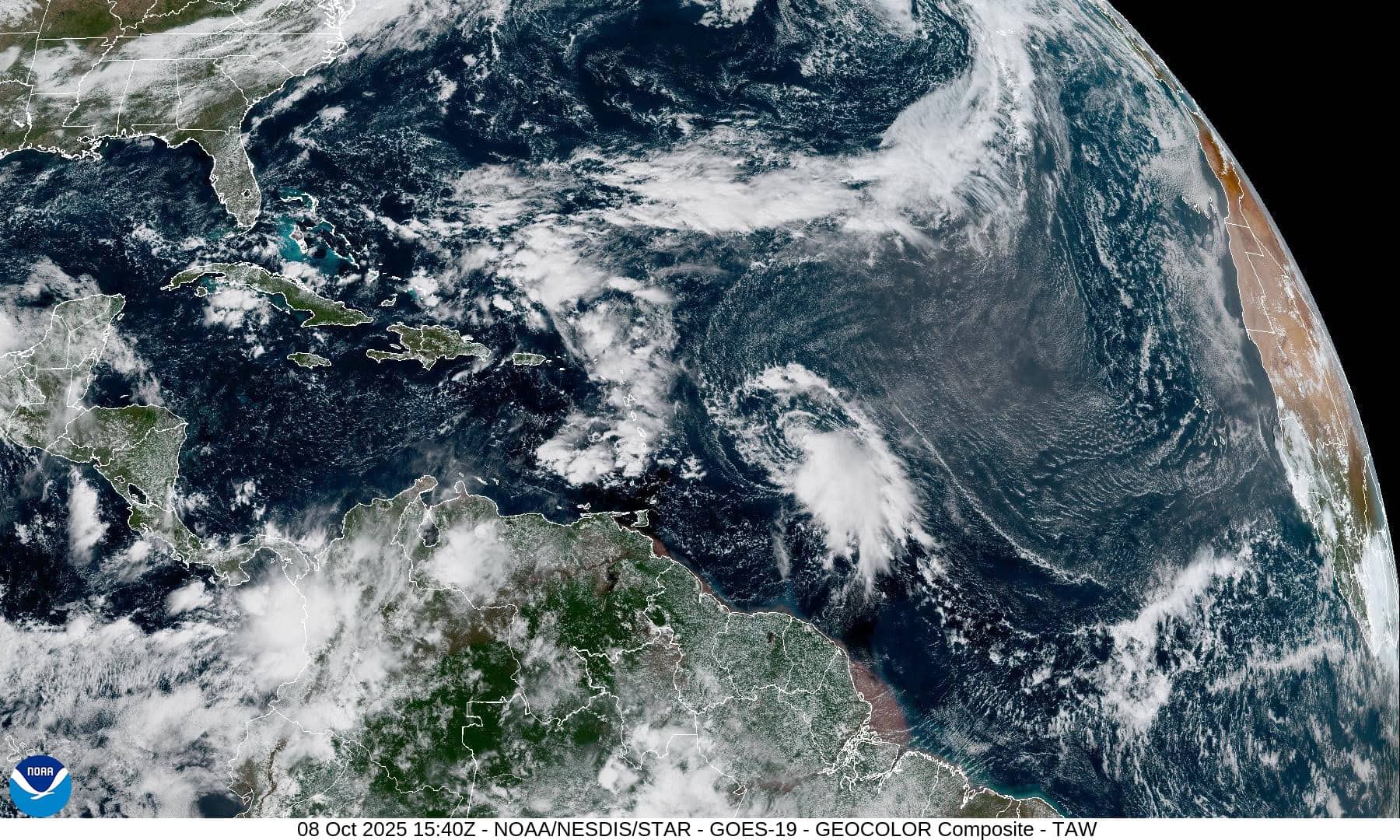
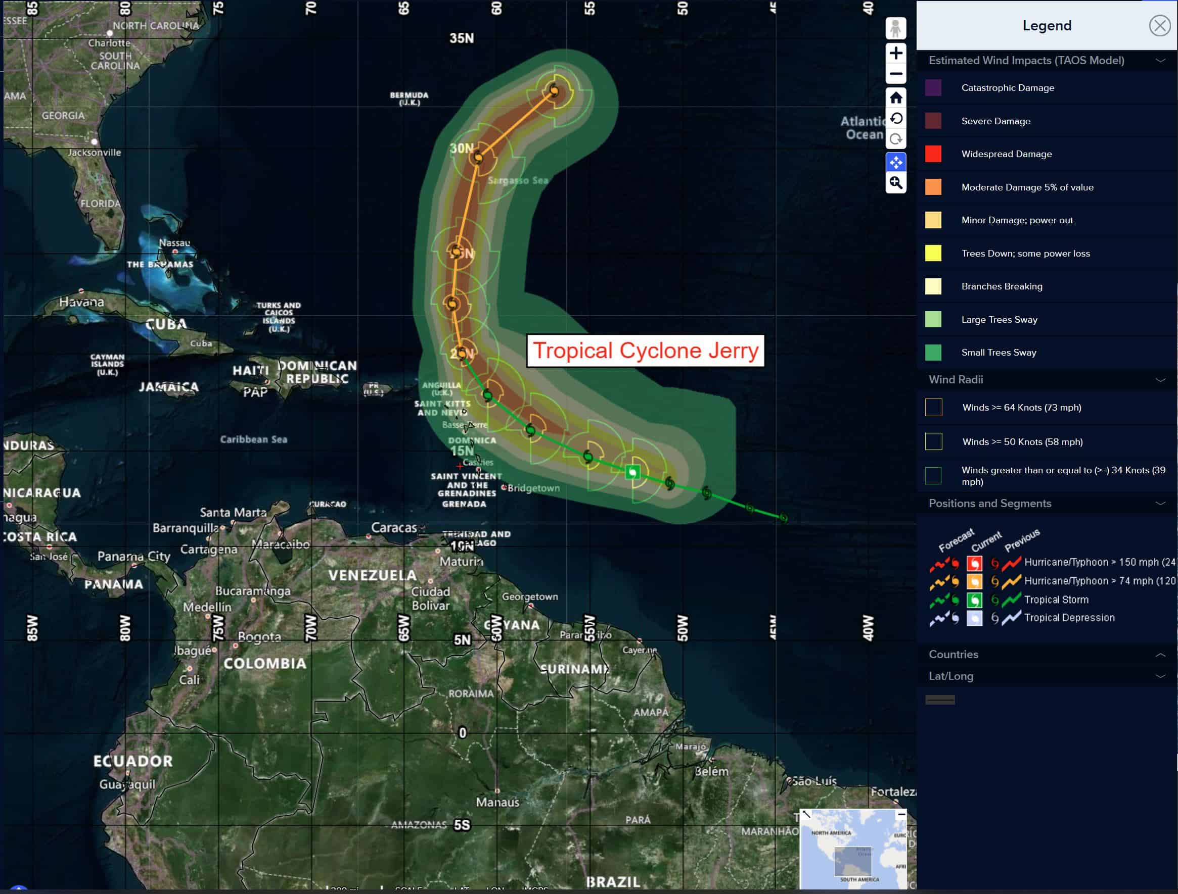
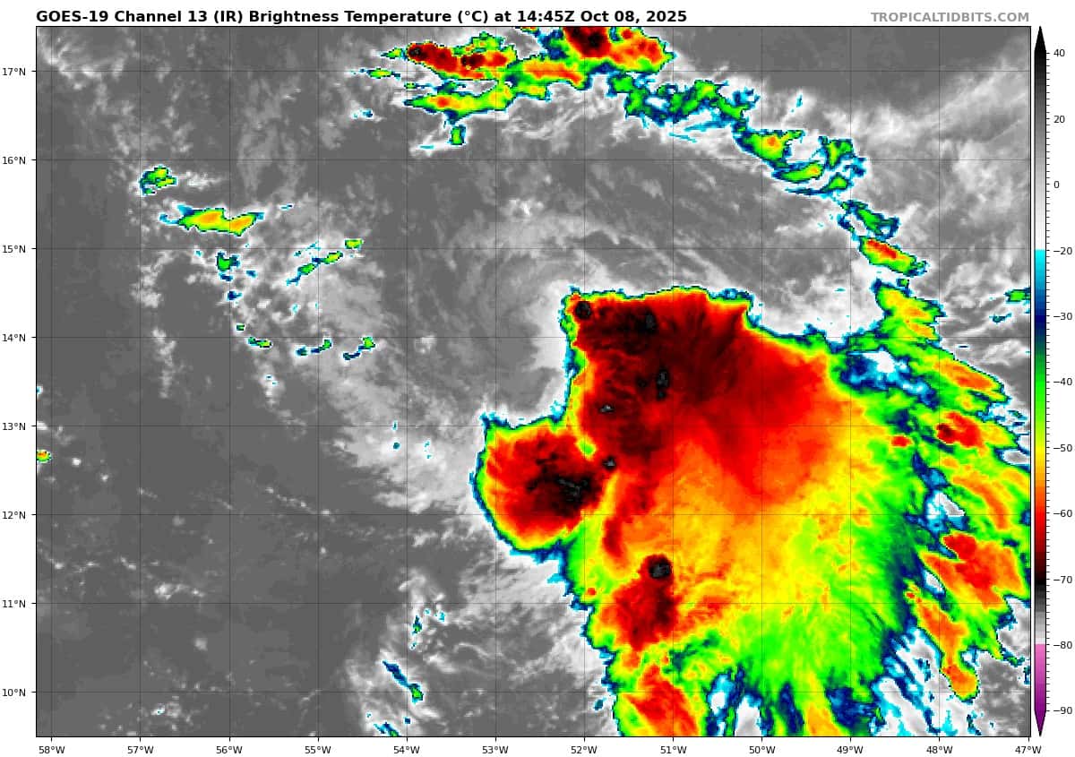
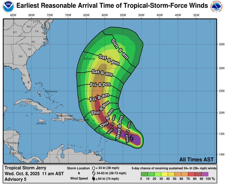
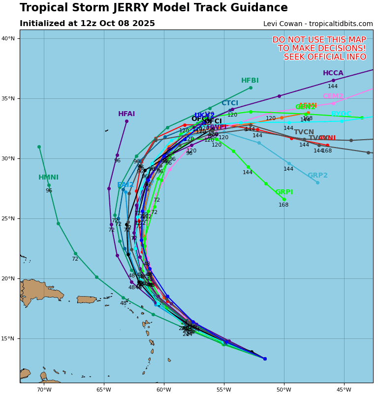
Tropical Cyclone Jerry…is located about 750 miles east-southeast of the northern Leeward Islands
Atlantic Ocean:
Tropical Cyclone Jerry
JERRY REMAINS A SHEARED TROPICAL STORM…TROPICAL STORM CONDITIONS POSSIBLE ON PORTIONS OF THE NORTHERN LEEWARD ISLANDS AS JERRY PASSES NEARBY LATER TODAY INTO FRIDAY
According to the NHC advisory number 7A
Jerry is moving toward the west-northwest near 23 mph (37 km/h), and this general motion is expected to continue through early Thursday. A turn toward the northwest and then north at a slower forward speed is expected late Thursday into Saturday. On the forecast track, the center of Jerry is expected to pass near or to the northeast of the northern Leeward Islands late Thursday and Thursday night.
Data from a NOAA Hurricane Hunter aircraft indicate that maximum sustained winds have increased to near 60 mph (95 km/h) with higher gusts. Gradual strengthening is forecast during the next few days, and Jerry could become a hurricane by the weekend.
Tropical-storm-force winds extend outward up to 125 miles (205 km) from the center. The estimated minimum central pressure is 1003 mb (29.62 inches).
HAZARDS AFFECTING LAND
WIND: Tropical storm conditions are possible in portions of the northern Leeward Islands within the watch area late Thursday into Friday.
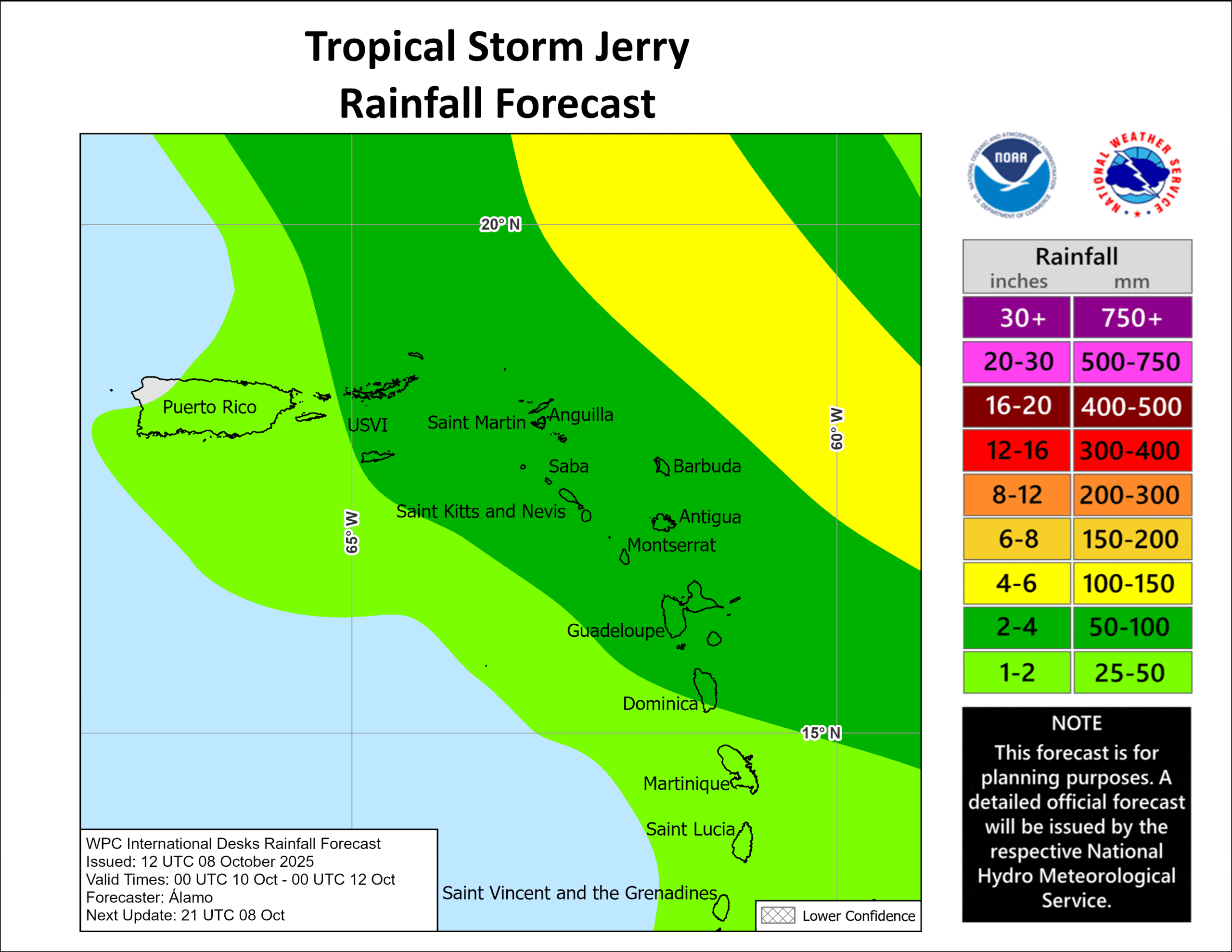
RAINFALL: On Thursday into early Friday, 2 to 4 inches of rain with local storm total maxima to 6 inches are expected across the Leeward Islands, British Virgin Islands, and U.S. Virgin Islands from Thursday into Saturday morning due to Jerry. This rainfall brings a risk of flash flooding, especially in areas of steep terrain.
SURF: Swells generated by Jerry are expected to reach the Leeward Islands on Thursday. These swells are likely to cause life-threatening surf and rip current conditions.
North Atlantic
Invest 96L
>>>A gale-force non-tropical area of low pressure located several hundred miles to the west-northwest of the Azores is producing limited shower activity near its center.
Some subtropical or tropical development of this system is possible over the next day or two before it moves over even cooler waters and into a stronger shear environment.
* Formation chance through 48 hours…low…10 percent
* Formation chance through 7 days…low…10 percent
Caribbean Sea: There are no active tropical cyclones
Tropical cyclone formation is not expected during the next 7-days.
Gulf of America: There are no active tropical cyclones
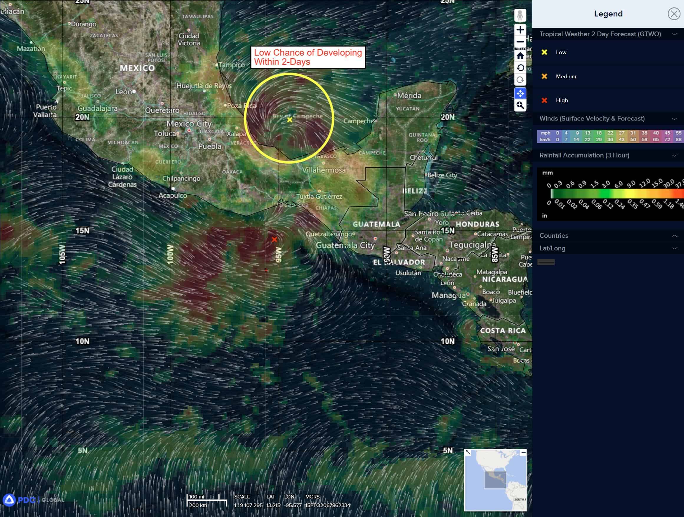
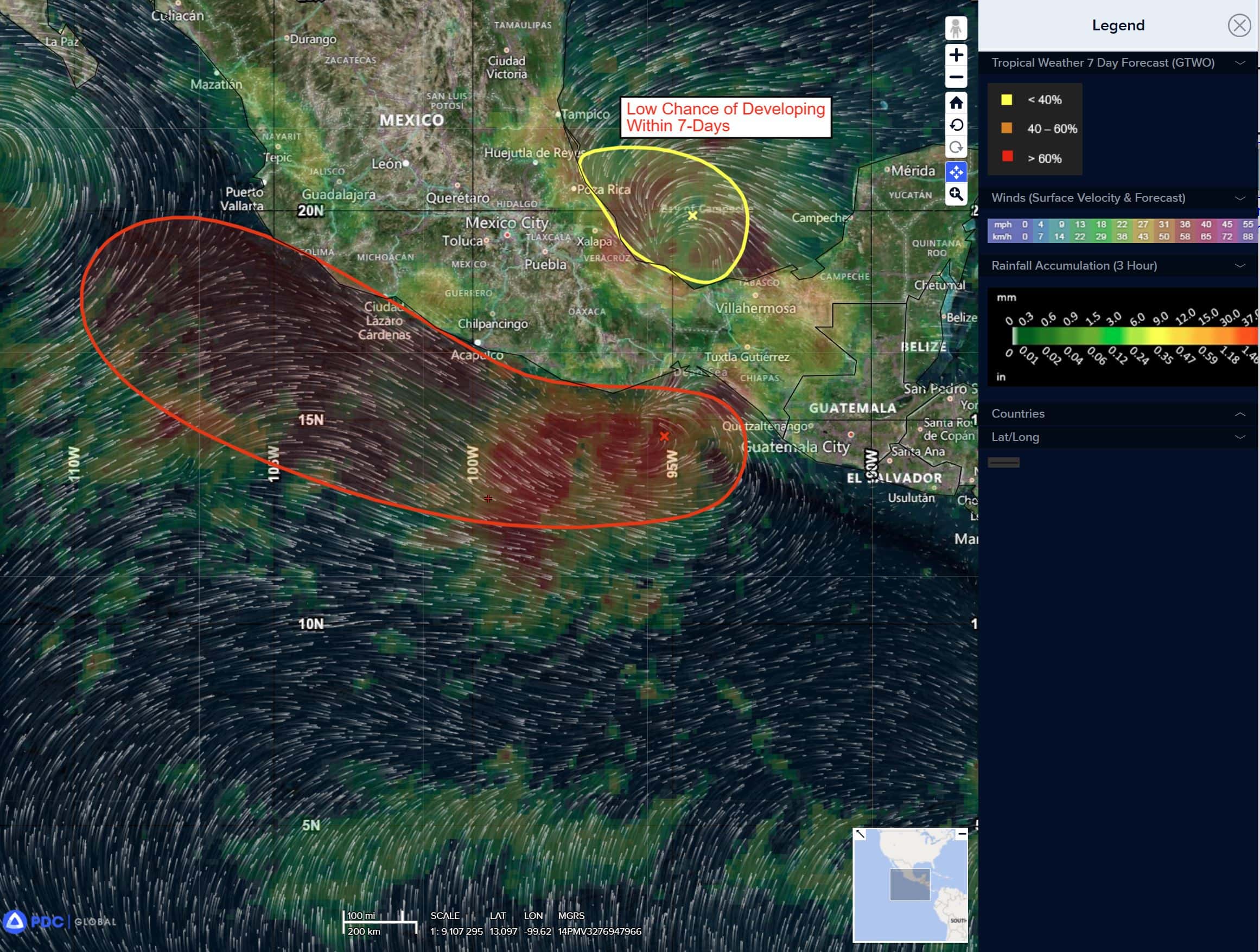
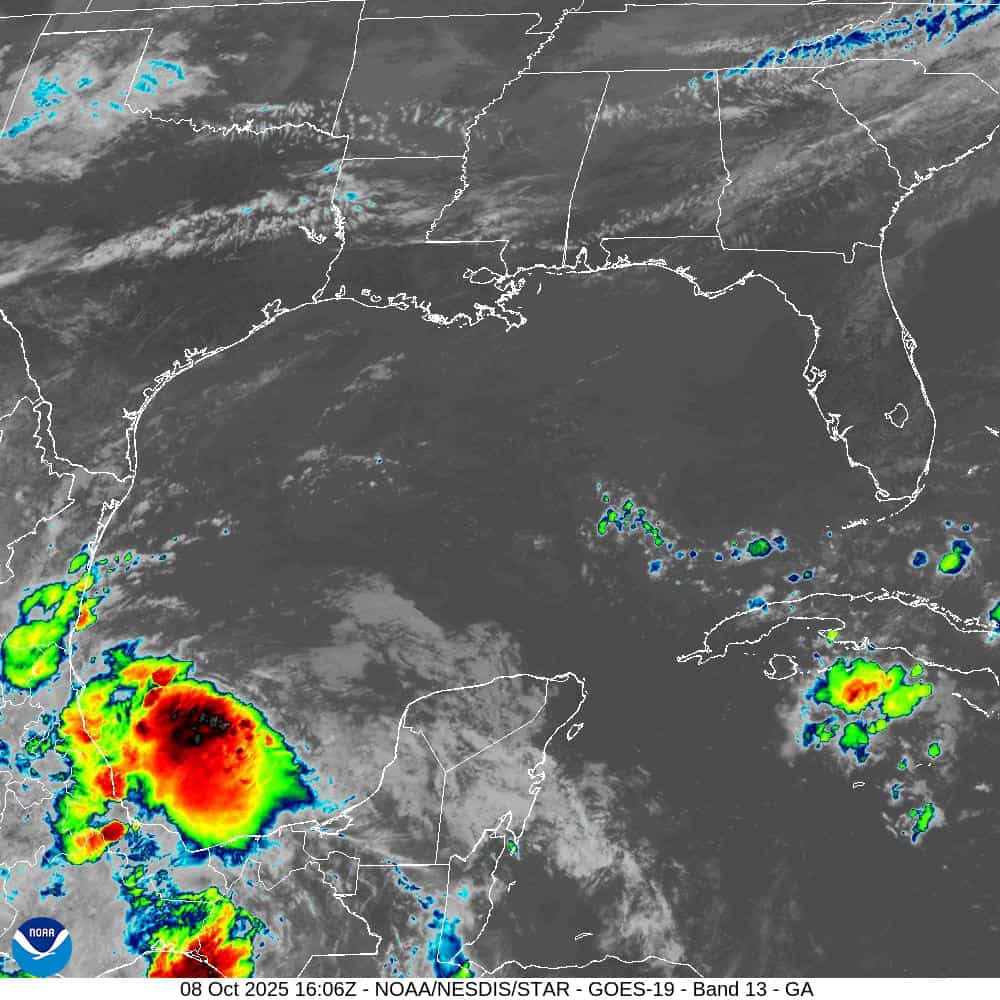
Bay of Campeche
>>> A trough of low pressure associated with some disorganized showers and thunderstorms has moved inland over southern Mexico, and development is not expected. Heavy rain and gusty winds will continue across portions of southern Mexico today.
* Formation chance through 48 hours…low…near 0 percent
* Formation chance through 7 days…low…near 0 percent