
")
Current Snapshot
For all the latest updates visit: DisasterAWARE
1800x1080a
atlantic
goes19_ir_08L_202509271435_lat22.5-lon-59.7
271438_earliest_reasonable_toa_34hum
08L_tracks_latest
goes19_ir_09L_202509271437_lat22.0-lon-76.0
271449_earliest_reasonable_toa_3409L
271449INTQPF_sm
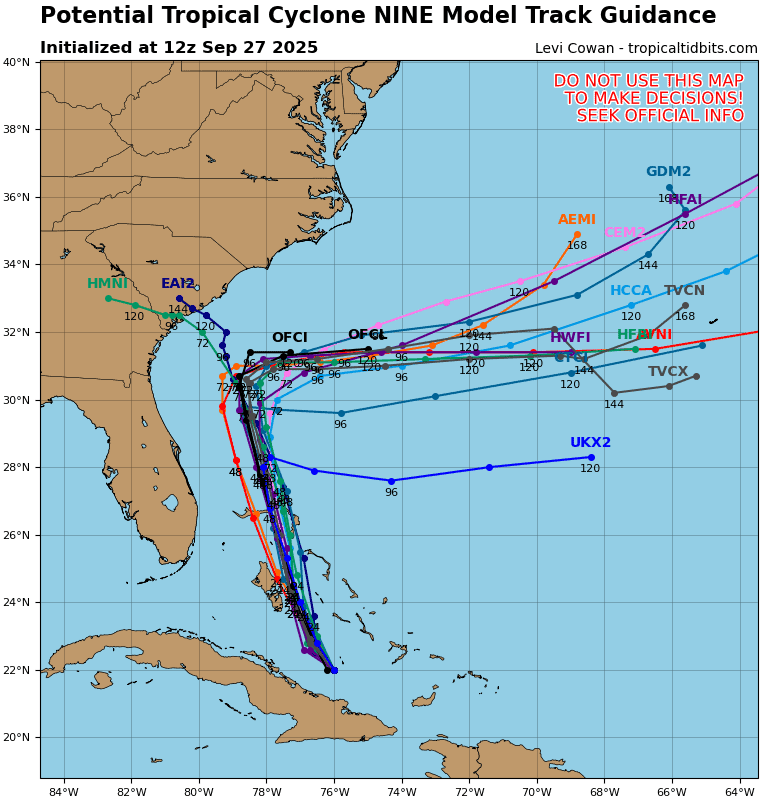
09L_tracks_latest
By PDC’s Senior Weather
Specialist Glenn James

The Pacific Disaster Center’s (PDC Global) Saturday, September 27, 2025, Tropical Cyclone Activity Report…for the Atlantic Ocean, the Caribbean Sea, and the Gulf of America
Current Tropical Cyclones:
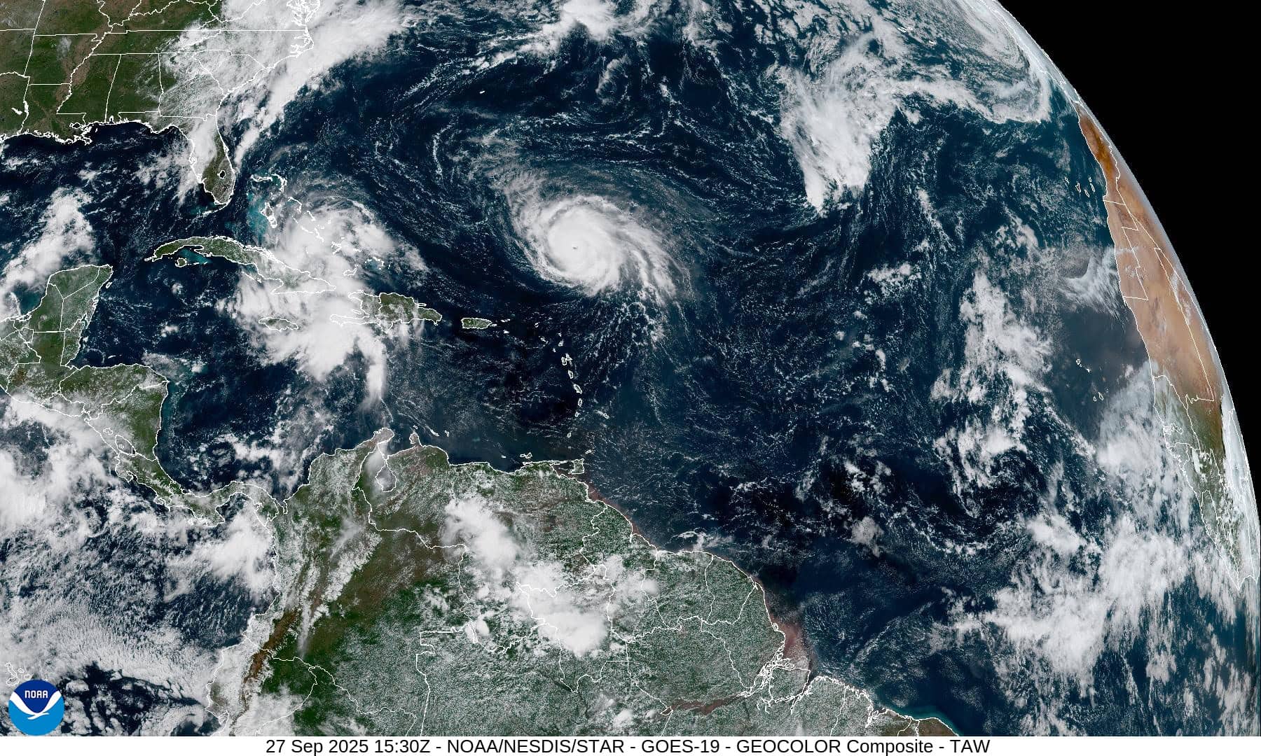
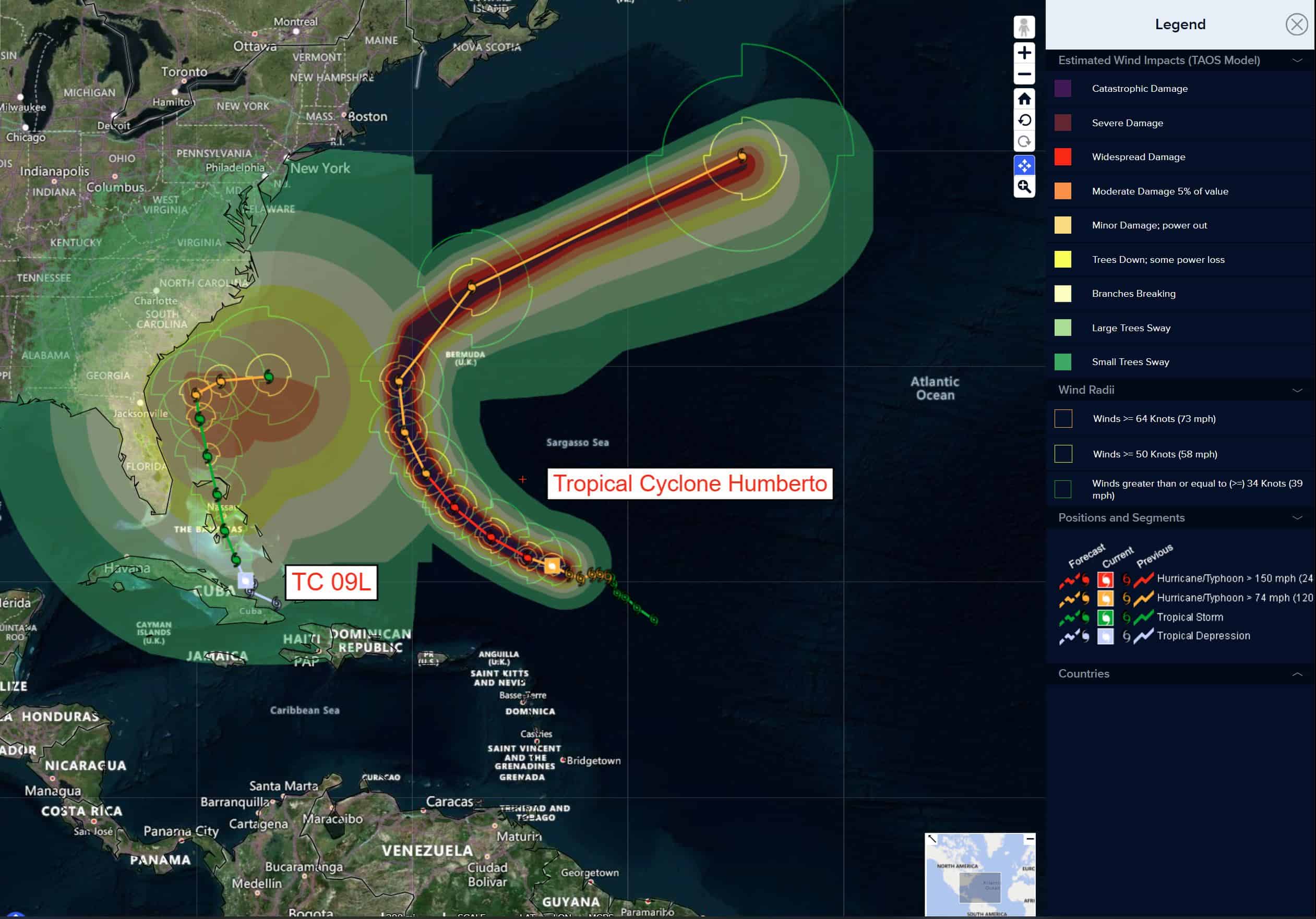
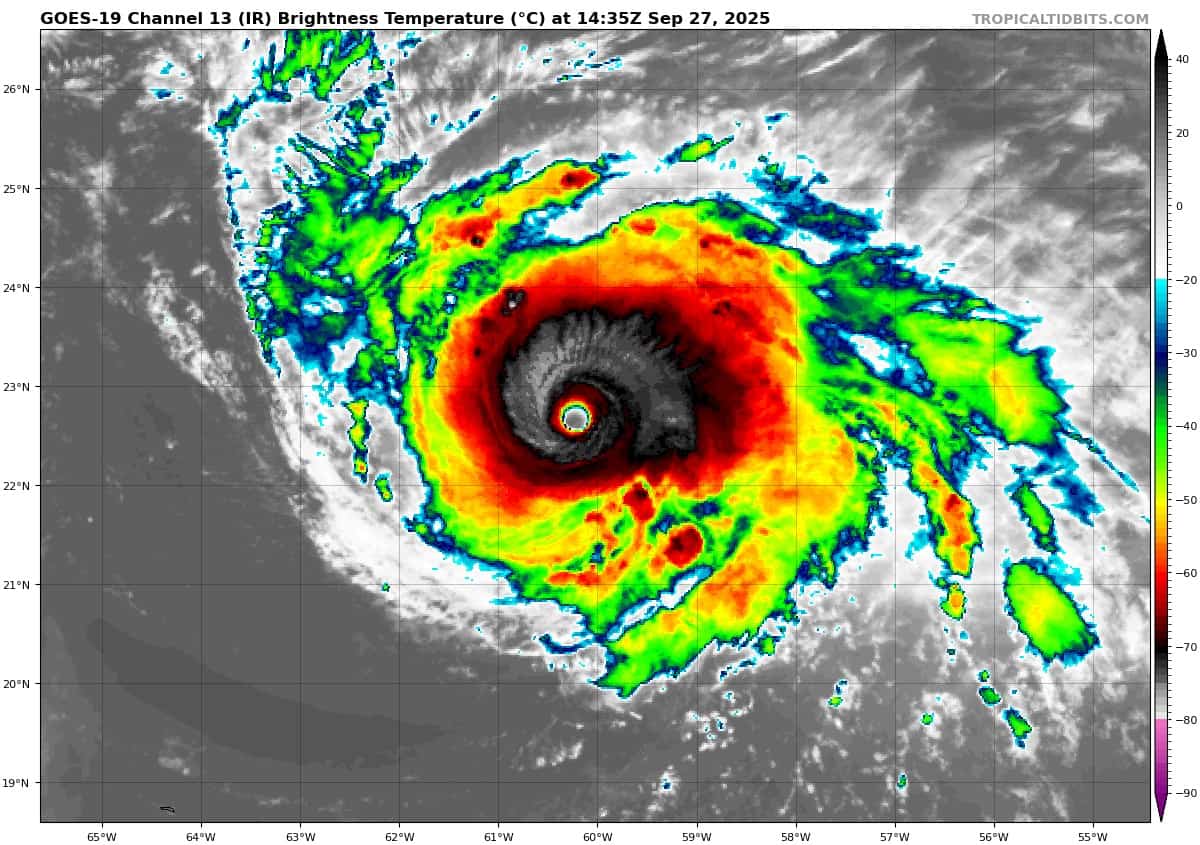
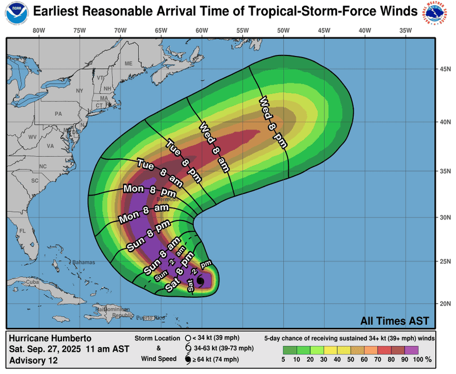
Tropical Cyclone 08L (Humberto)…is located about 720 south-southeast of Bermuda
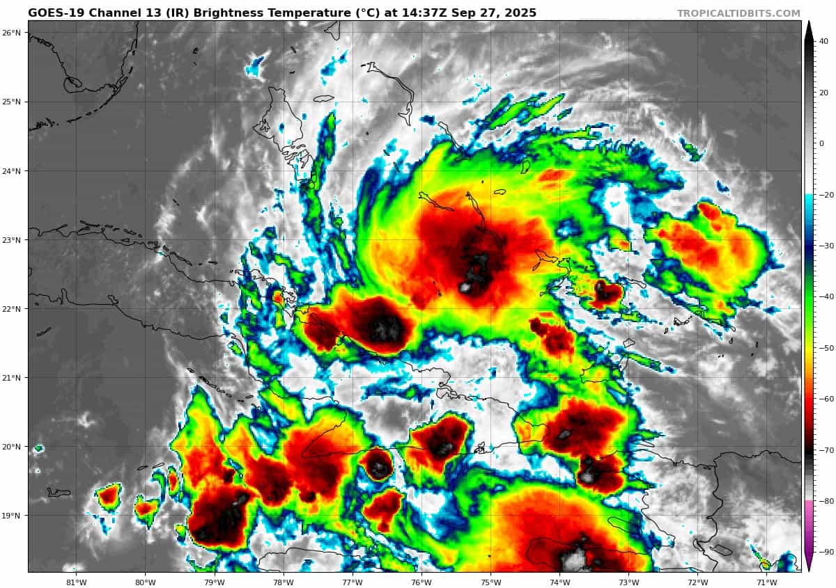
Tropical Cyclone 09L…is located about 115 south-southwest of the central Bahamas
Atlantic Ocean:
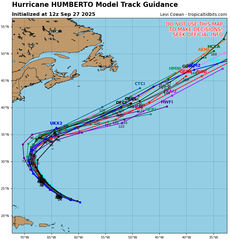
Tropical Cyclone 08L (Humberto)
DANGEROUS SURF FROM MAJOR HURRICANE HUMBERTO EXPECTED TO AFFECT CARIBBEAN AND BERMUDA SHORES LATER THIS WEEKEND
According to the NHC advisory number 12
Humberto is moving toward the west-northwest near 8 mph (13 km/h). A turn toward the northwest is anticipated on Sunday. Humberto is forecast to then turn northward by Tuesday. Maximum sustained winds are near 145 mph (230 km/h) with higher gusts. Humberto is a category 4 hurricane on the Saffir-Simpson Hurricane Wind Scale. Some strengthening is possible today. Humberto will likely remain a powerful major hurricane for the next several days. Hurricane-force winds extend outward up to 25 miles (35 km) from the center and tropical-storm-force winds extend outward up to 105 miles (165 km). The estimated minimum central pressure is 938 mb (27.70 inches).
HAZARDS AFFECTING LAND SURF:
SURF: Swells generated by Humberto will affect portions of the northern Leeward Islands, the Virgin Islands, Puerto Rico, and Bermuda beginning tonight and continuing next week. Swells from Humberto will also affect the U.S. East Coast beginning Monday. These swells are likely to cause life-threatening surf and rip current conditions.
Tropical Cyclone 09L
DISTURBANCE BECOMES A TROPICAL DEPRESSION…EXPECTED TO STRENGTHEN AND PRODUCE SIGNIFICANT RAINFALL OVER PORTIONS OF EASTERN CUBA AND THE BAHAMAS THROUGH THE WEEKEND
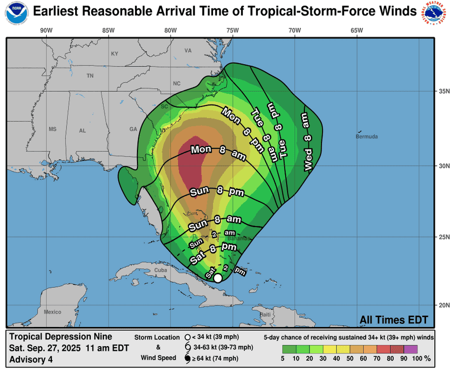
According to the NHC advisory number 4
The depression is moving toward the northwest near 6 mph (9 km/h). A north-northwestward motion is expected to begin later today and continue through Monday. On the forecast track, the center of the system is expected to move across the central and northwestern Bahamas this weekend and approach the southeast U.S. coast early next week. Maximum sustained winds are near 35 mph (55 km/h) with higher gusts. Strengthening is expected during the next few days, and the system is forecast to become a tropical storm by tonight and a hurricane by late Monday or Tuesday. The estimated minimum central pressure based on NOAA Hurricane Hunter dropsonde data is 1005 mb (29.68 inches).
HAZARDS AFFECTING LAND
WIND: Tropical storm conditions are expected in the central Bahamas beginning later today or early Sunday and in the northwestern Bahamas on Sunday. Tropical storm conditions are possible in the watch area on Monday.
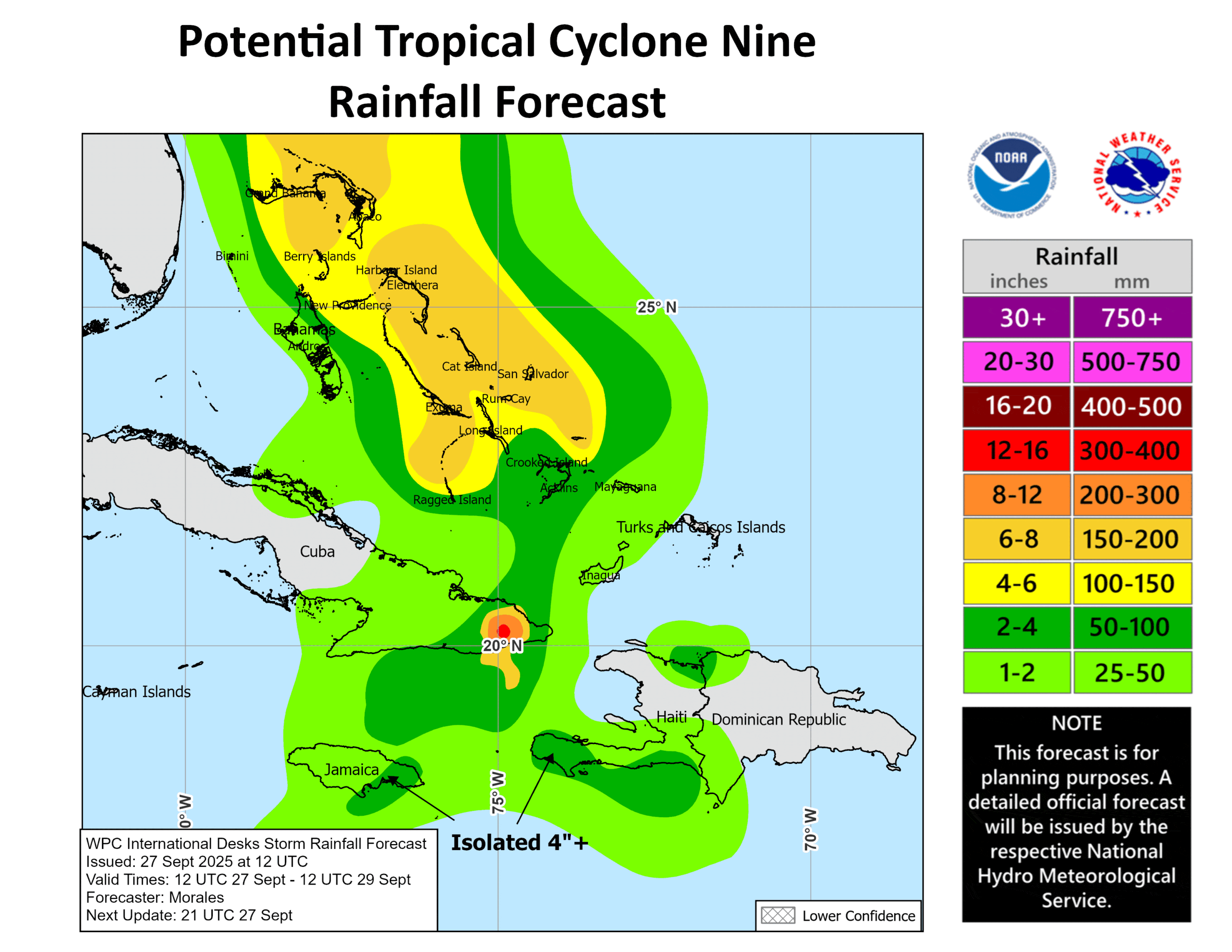
RAINFALL: Tropical Depression Nine is expected to produce rainfall amounts of 8 to 12 inches, with isolated maximum totals of 16 inches possible in eastern Cuba, and 4 to 8 inches of rain in the Bahamas. Across Hispaniola, Jamaica, and portions of central and southern Cuba, an additional 2 to 4 inches of rain is expected. This rainfall will likely produce flash and urban flooding. Mudslides are also possible in areas of higher terrain across eastern Cuba, Hispaniola, and Jamaica.
Moisture from Tropical Depression Nine will lead to a threat of heavy rainfall well to the north from Coastal Georgia through the Carolinas and into the southern Mid-Atlantic states into early next week which could cause flash, urban, and river flooding.
STORM SURGE: A storm surge will raise water levels by as much as 1 to 3 feet above ground level along the immediate coast in areas of onshore winds in the northwestern Bahamas. Near the coast, the surge will be accompanied by large waves.
SURF: Swells generated by both this system and Hurricane Humberto will affect portions of the Bahamas this weekend, and spread to portions of the southeast U.S. coast early next week. These swells are likely to cause life-threatening surf and rip current conditions.
Caribbean Sea: There are no active tropical cyclones
Tropical cyclone formation is not expected during the next 7-days.
Gulf of America: There are no active tropical cyclones
Tropical cyclone formation is not expected during the next 7-days.