Tropical Cyclone 07E (Gil)
GIL NOW A HURRICANE
According to the NHC Advisory number 8

")

By PDC’s Senior Weather
Specialist Glenn James

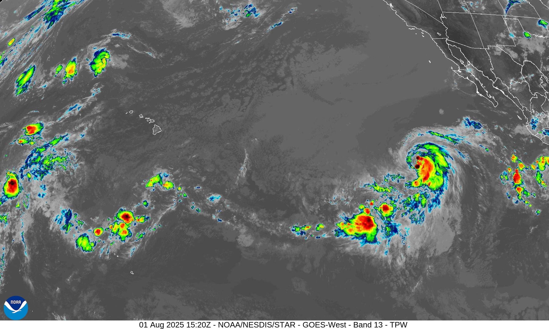
The Pacific Disaster Center’s (PDC Global) Friday, August 1, 2025, Tropical Cyclone Activity Report…for the Pacific Ocean, the Indian Ocean, and adjacent Seas
Current Tropical Cyclones:
Tropical Cyclone (Gil)…is located about 1080 miles west-southwest of the southern tip of Baja California
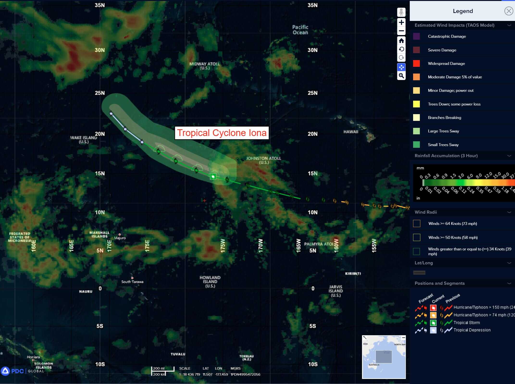
Tropical Cyclone 01C (Iona)…is located about 1465 miles west of Honolulu, Hawaii
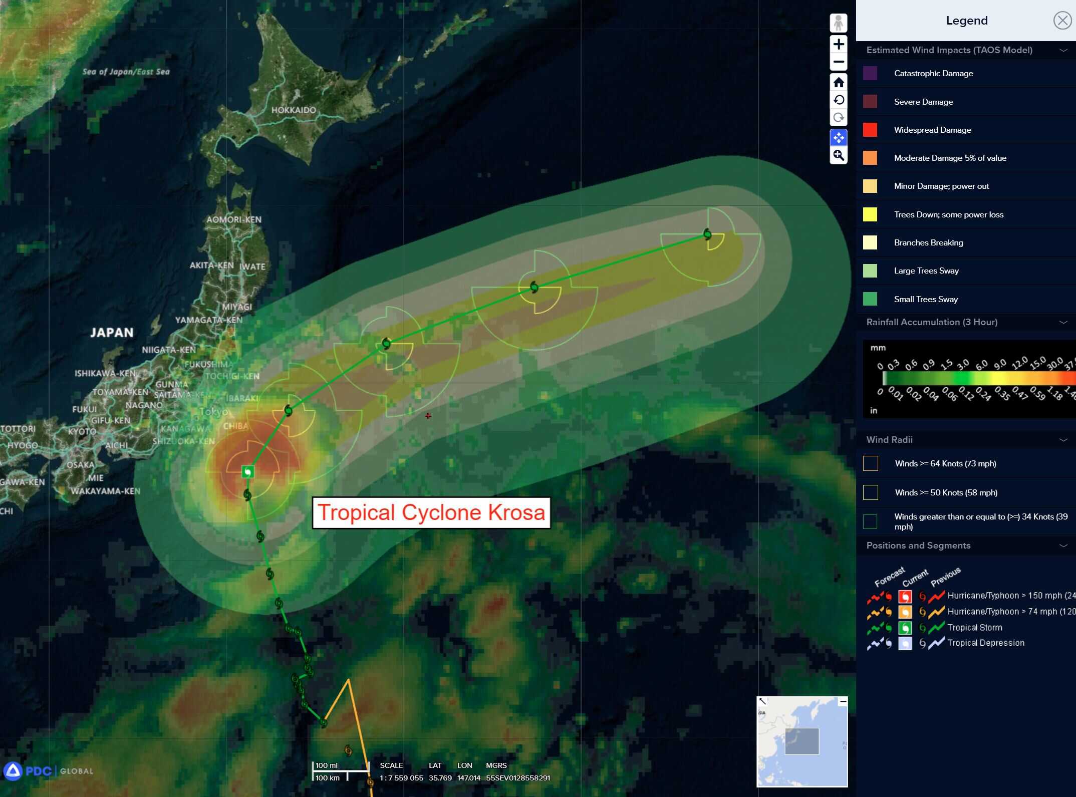
Tropical Cyclone 12W (Krosa)…is located approximately 115 NM east-southeast of Narita AP, Japan
Tropical Cyclone 13W…is located approximately 281 NM west-northwest of Iwo To
Northeast Pacific Ocean:
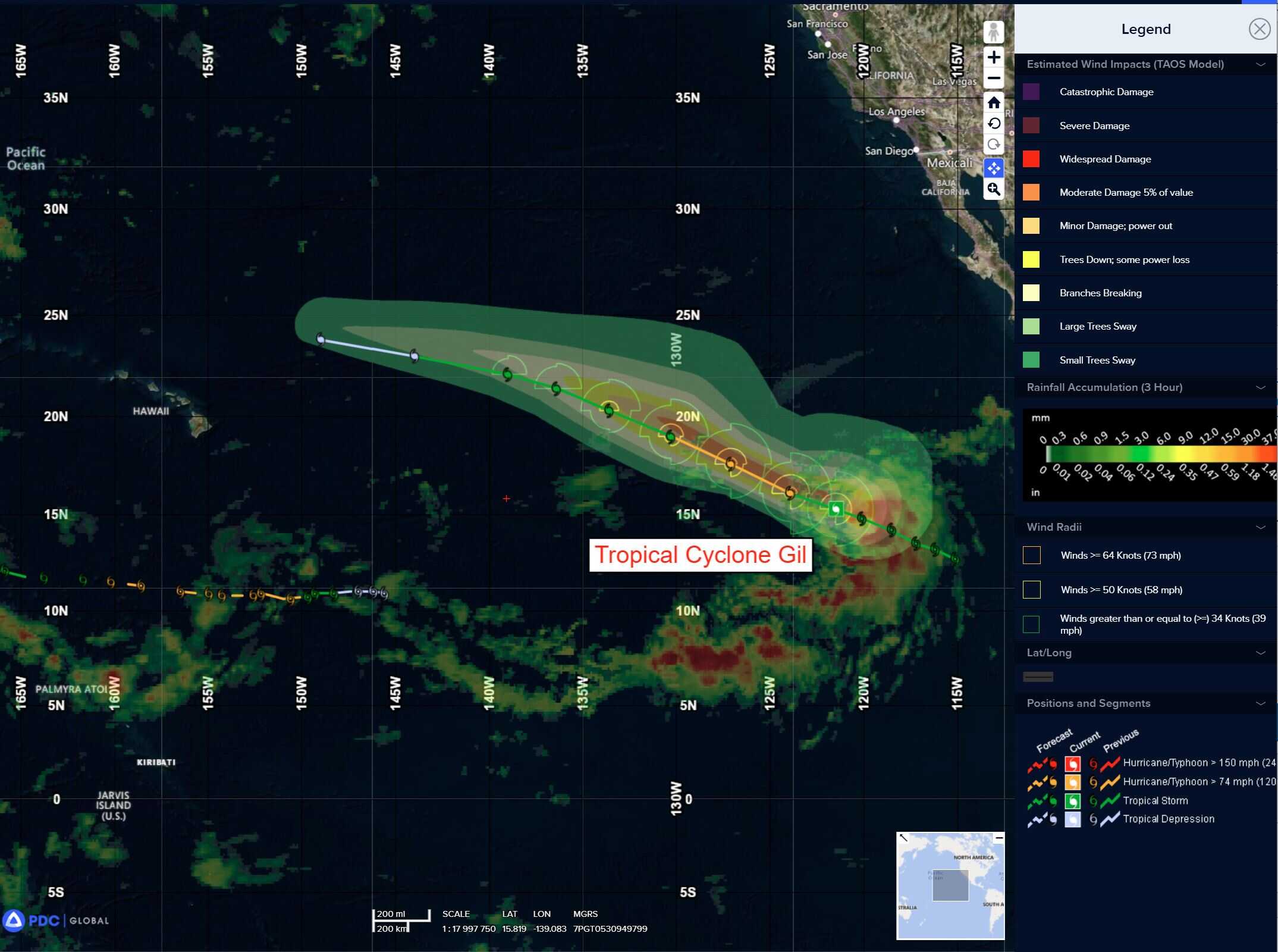
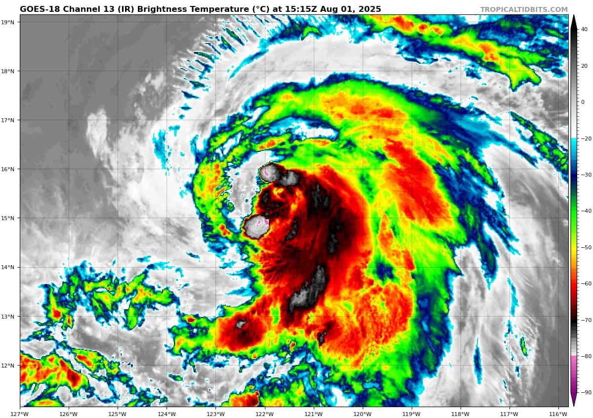
Tropical Cyclone 07E (Gil)
GIL NOW A HURRICANE
According to the NHC Advisory number 8
Gil is moving toward quickly the west-northwest near 20 mph (31 km/h), and this motion is expected to continue through the weekend. A slower motion toward the west is forecast by Monday. Maximum sustained winds have increased to near 75 mph (120 km/h) with higher gusts. Some additional strengthening is possible overnight. Weakening is forecast to begin on Saturday, and Gil is likely to become post-tropical as early as Sunday. Hurricane-force winds extend outward up to 30 miles (45 km) from the center and tropical-storm-force winds extend outward up to 125 miles (205 km).
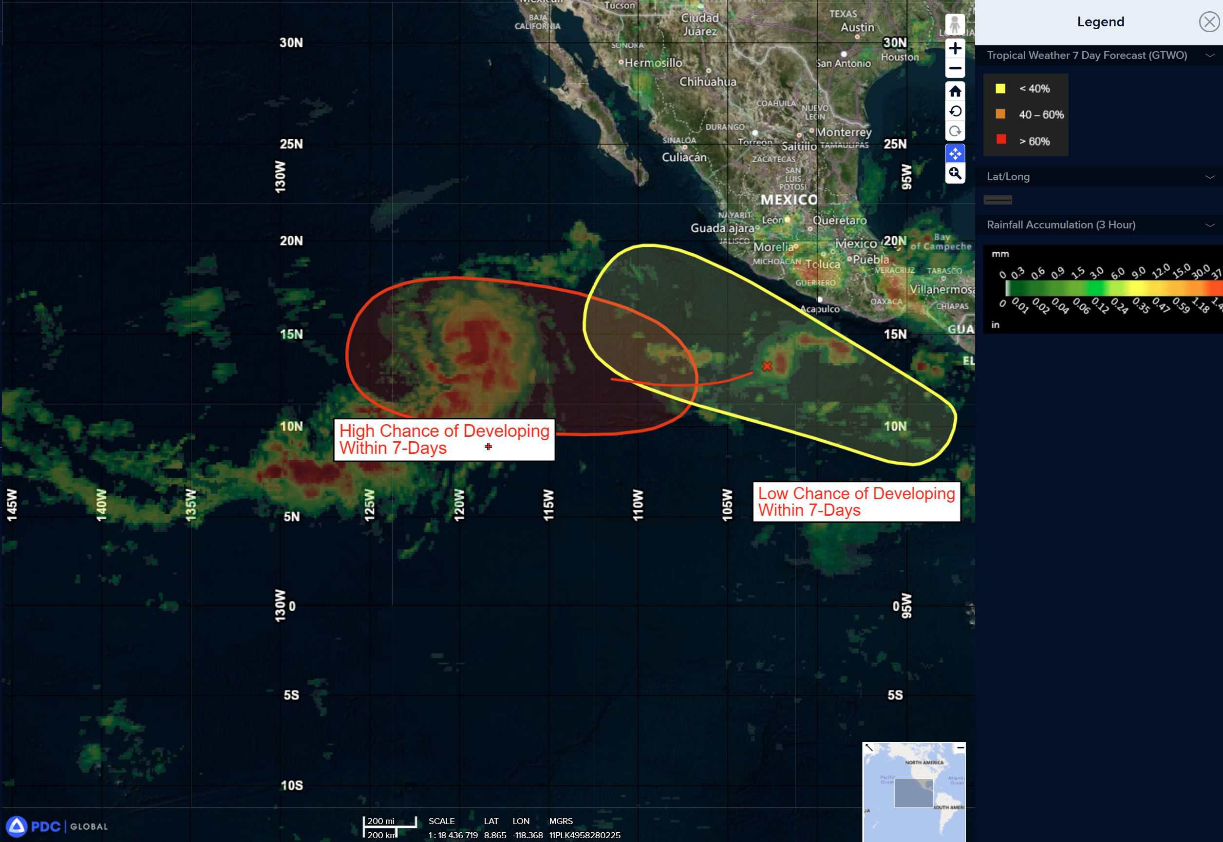
Western East Pacific:
>>> An area of low pressure is expected to form well southwest of southwestern Mexico within the next day or two. Environmental conditions appear conducive for some gradual development of this system, and a tropical depression is likely to form late this weekend or early next week as the system moves west-northwestward at 10 to 15 mph.
* Formation chance through 48 hours…medium…50 percent
* Formation chance through 7 days…high…80 percent
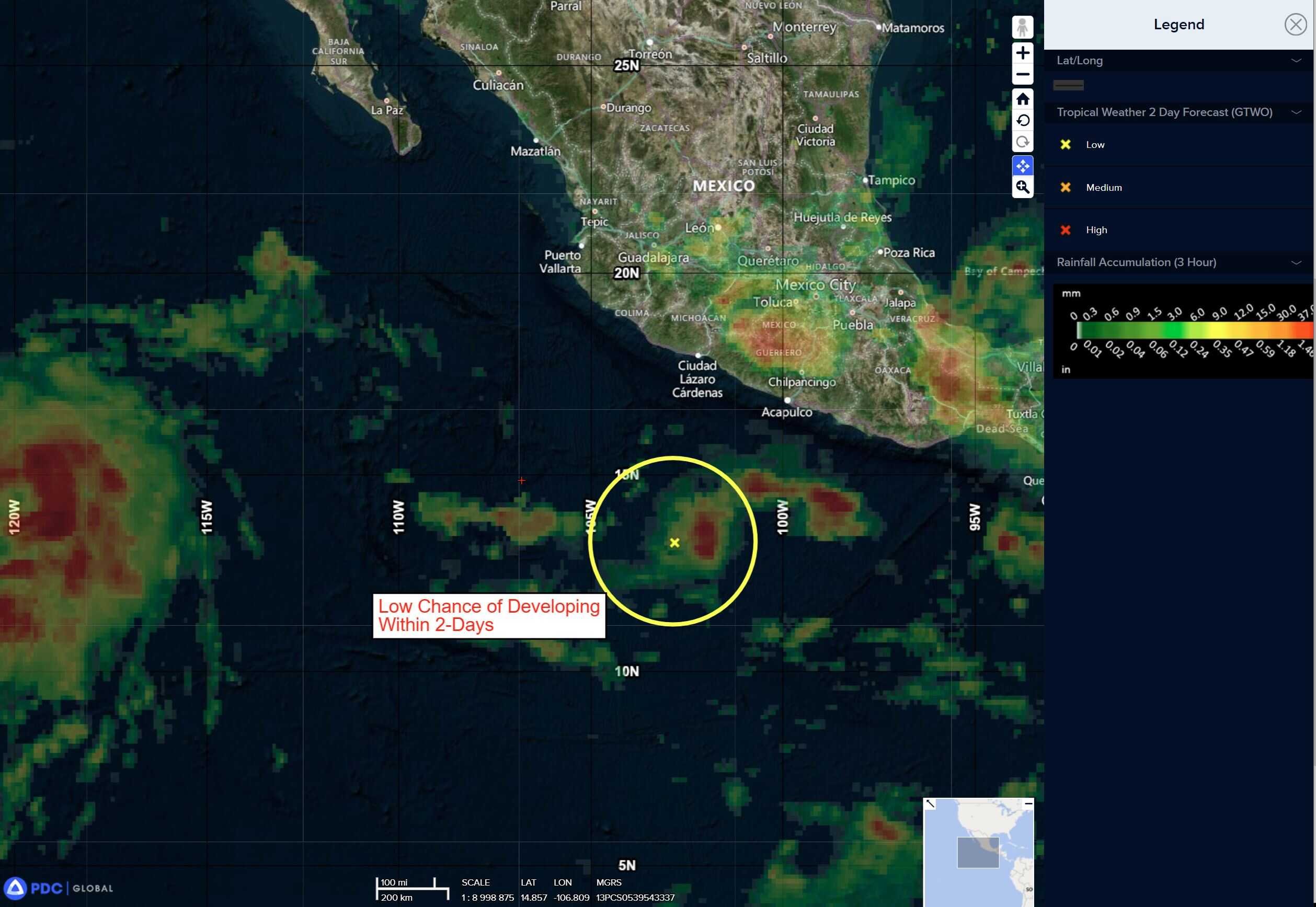
South of Southern Mexico:
>>> An area of low pressure is forecast to form offshore of the coast of Central America and southern Mexico by the middle part of next week. Thereafter, environmental conditions appear conducive for some development as the system moves generally west-northwestward at 10 to 15 mph.
* Formation chance through 48 hours…low…near 0 percent
* Formation chance through 7 days…medium…40 percent
Central Pacific Ocean:
Tropical Cyclone 01C (Iona)
IONA EXPECTED TO CROSS THE INTERNATIONAL DATELINE IN THE NEXT 6 HOURS OR SO
According to the NHC advisory number 24
The depression is moving toward the west-northwest near 17 mph (28 km/h), and this motion is expected to continue over the next couple of days with a gradual decrease in forward speed. Maximum sustained winds are near 35 mph (55 km/h) with higher gusts. Little change in strength is forecast during the next
Western Pacific, Indian Ocean, and adjacent Seas:
Western Pacific
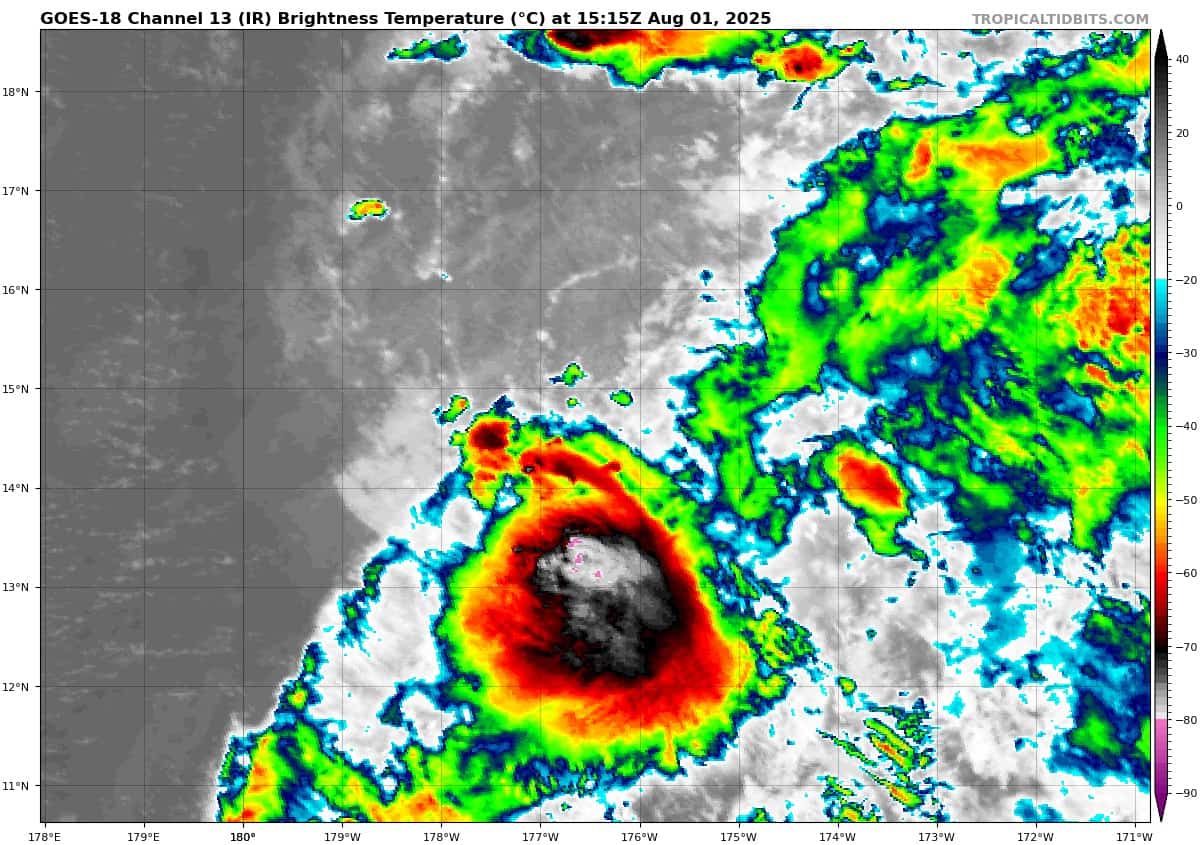
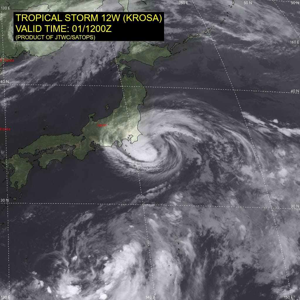
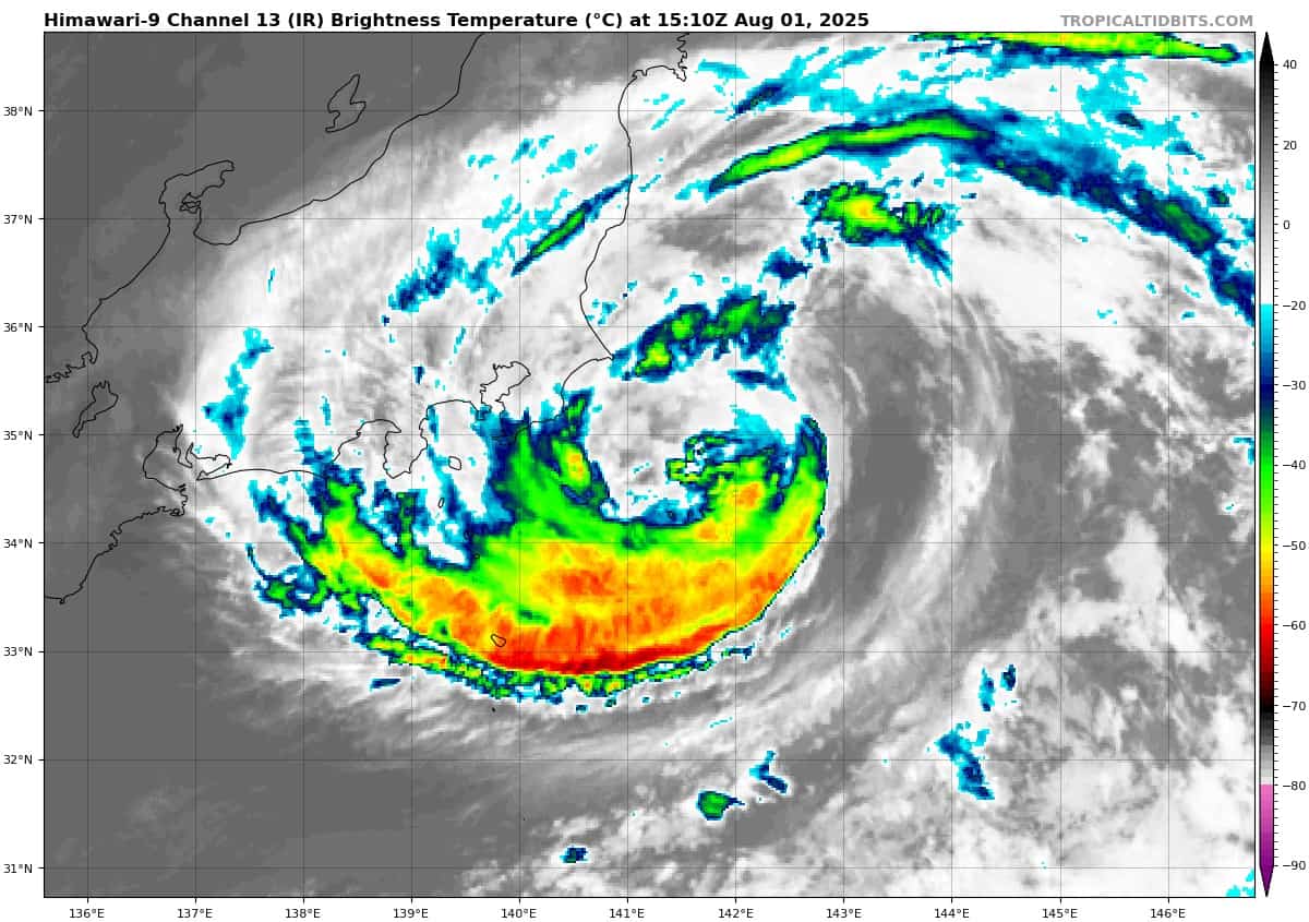
Tropical Cyclone 12W (Krosa)
According to the JTWC warning number 38 sustained winds are 55 knots with gusts to near 70 knots
Animated enhanced infrared satellite imagery depicts building deep convection obscuring the low-level circulation center (llcc) of tropical storm 12W.
TS 12W will curve slowly northeastward under the steering influence of the near equatorial ridge to the southeast. After 12 hours, an approaching deep layer-trough from the northwest will increase the track speed gradually over the course of the forecast period, driving the system northeastward.
Between 36-48 hours, TS 12W will undergo extratropical transition as the system becomes baroclinic and frontal. The warm waters of the Kuroshio current will support a 60 knot intensity for the next 12 hours while countered by an unfavorable upper-level environment and dry air entraining into the circulation.
After 12 hours, high vertical wind shear will initiate weakening and amplify the aforementioned unfavorable features. By the end of the forecast, TS 12W will weaken to 50 knots as an extratropical cyclone.
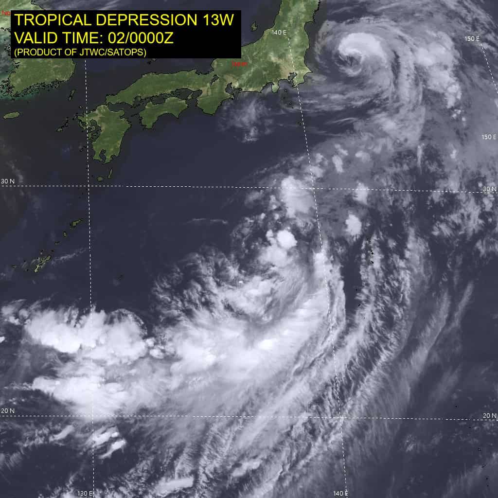
Tropical Cyclone 13W
According to the JTWC warning number 1 sustained winds are 25 knots with gusts to near 35 knots