Tropical cyclone formation is not expected during the next 7 days.
Western Pacific, Indian Ocean, and adjacent Seas:

")

By PDC’s Senior Weather
Specialist Glenn James

The Pacific Disaster Center’s (PDC Global) Sunday, August 3, 2025, Tropical Cyclone Activity Report…for the Pacific Ocean, the Indian Ocean, and adjacent Seas
Current Tropical Cyclones:
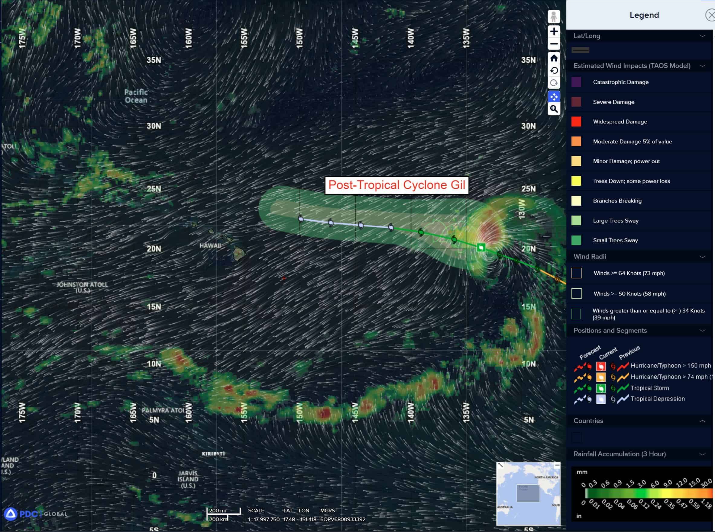
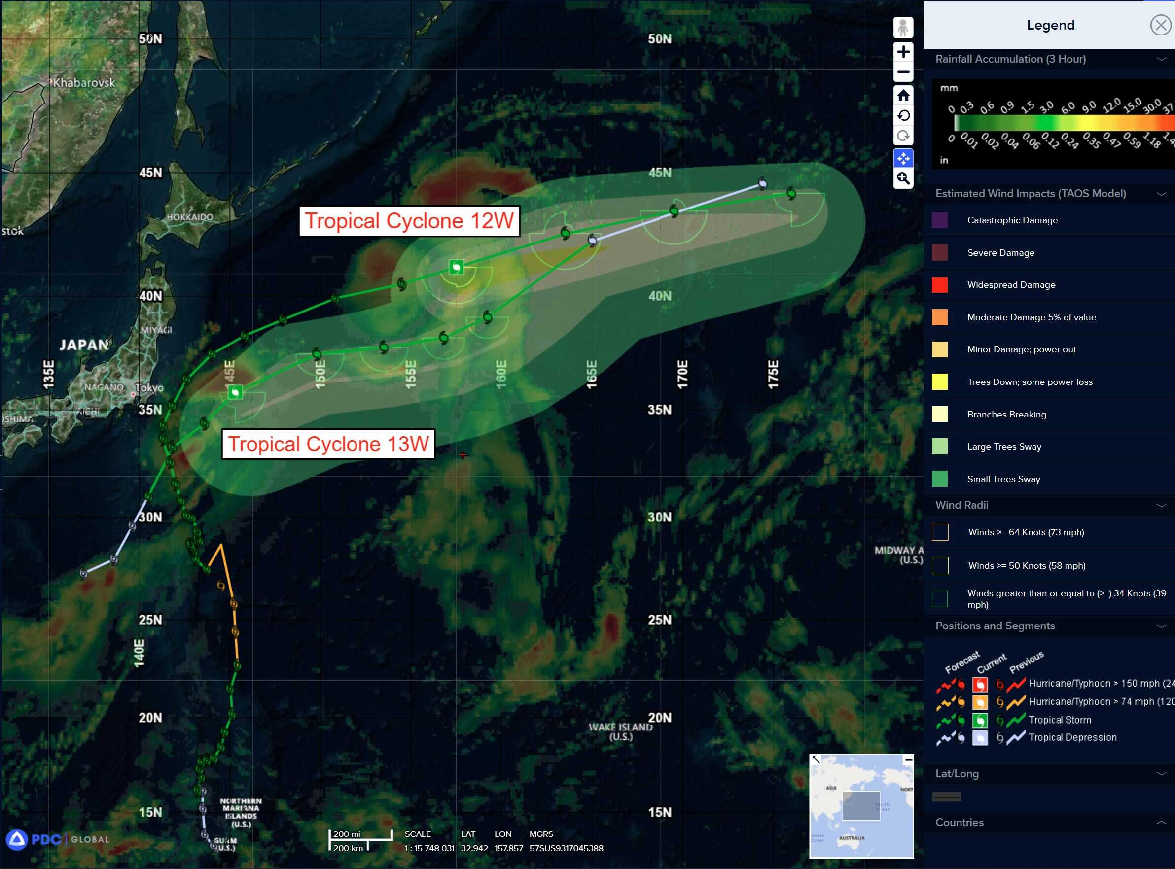
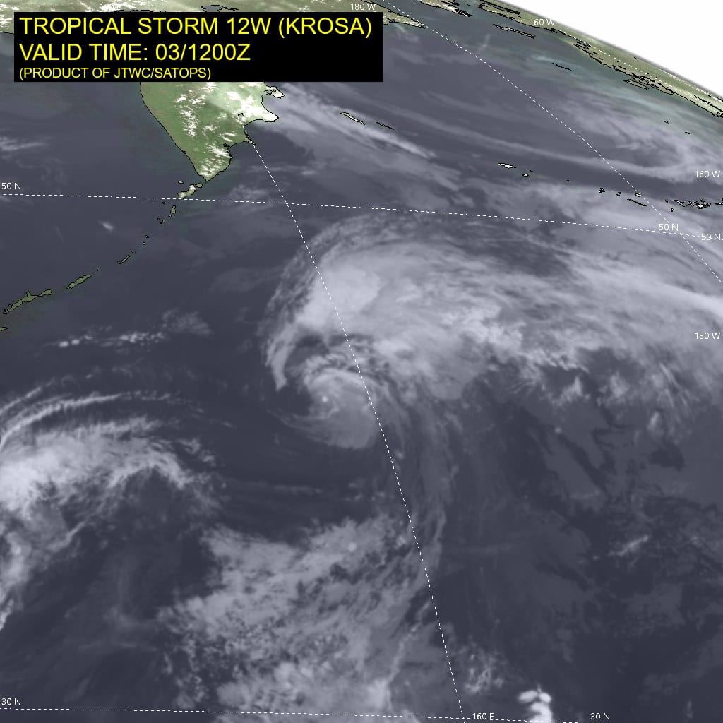
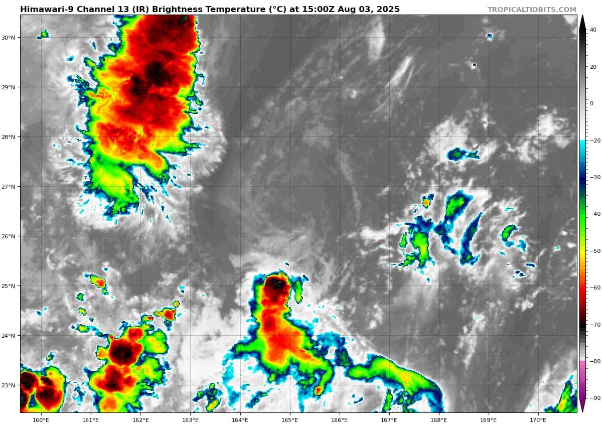
Tropical Cyclone 12W (Krosa)…is located approximately 866 NM east-northeast of Misawa, Japan – Final Warning
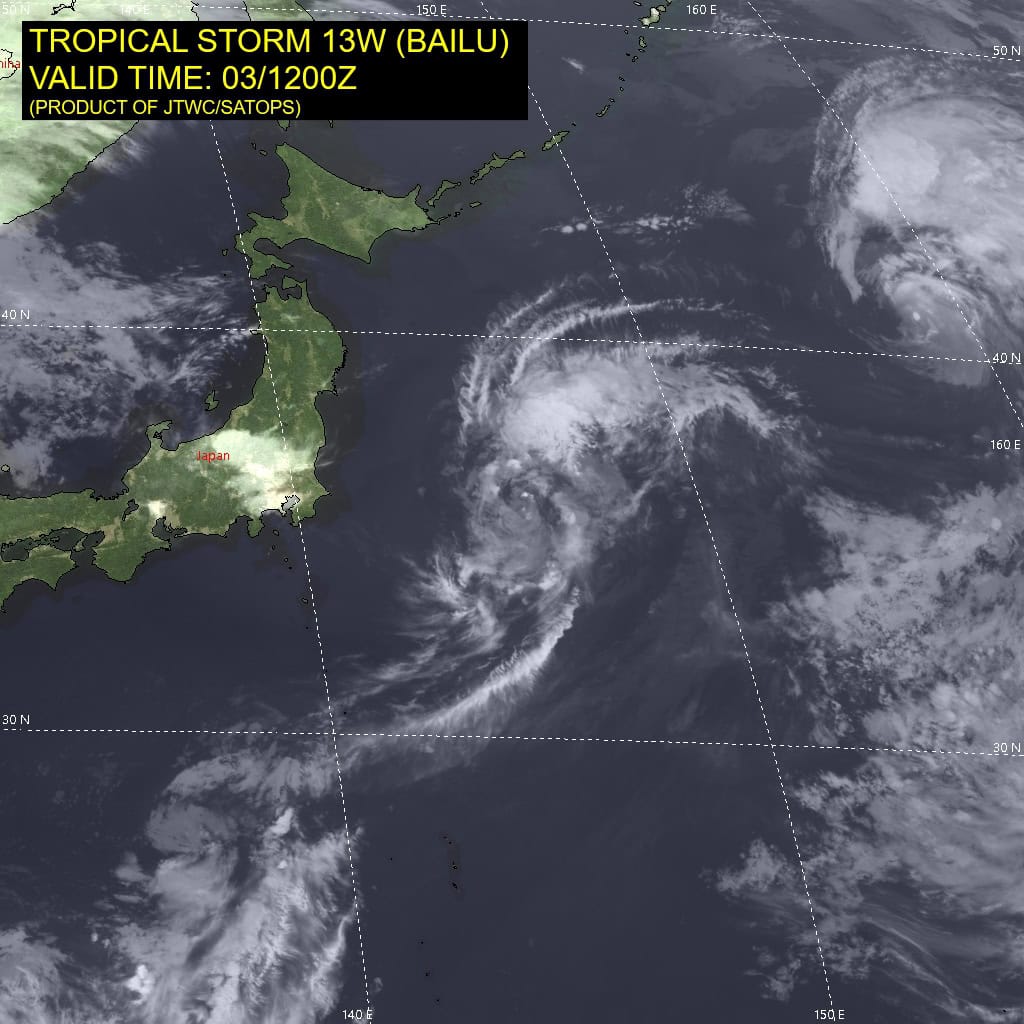
Tropical Cyclone 13W (Bailu)…is located approximately 335 NM east-northeast of Narita AP, Japan
Tropical Cyclone 14W…is located approximately 491 NM north-northwest of Wake Island
Northeast Pacific Ocean:
Central East Pacific:
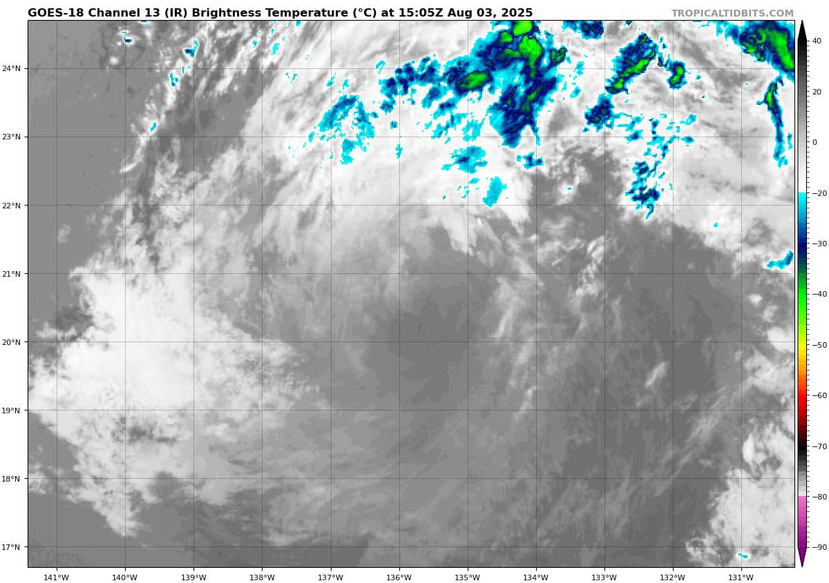
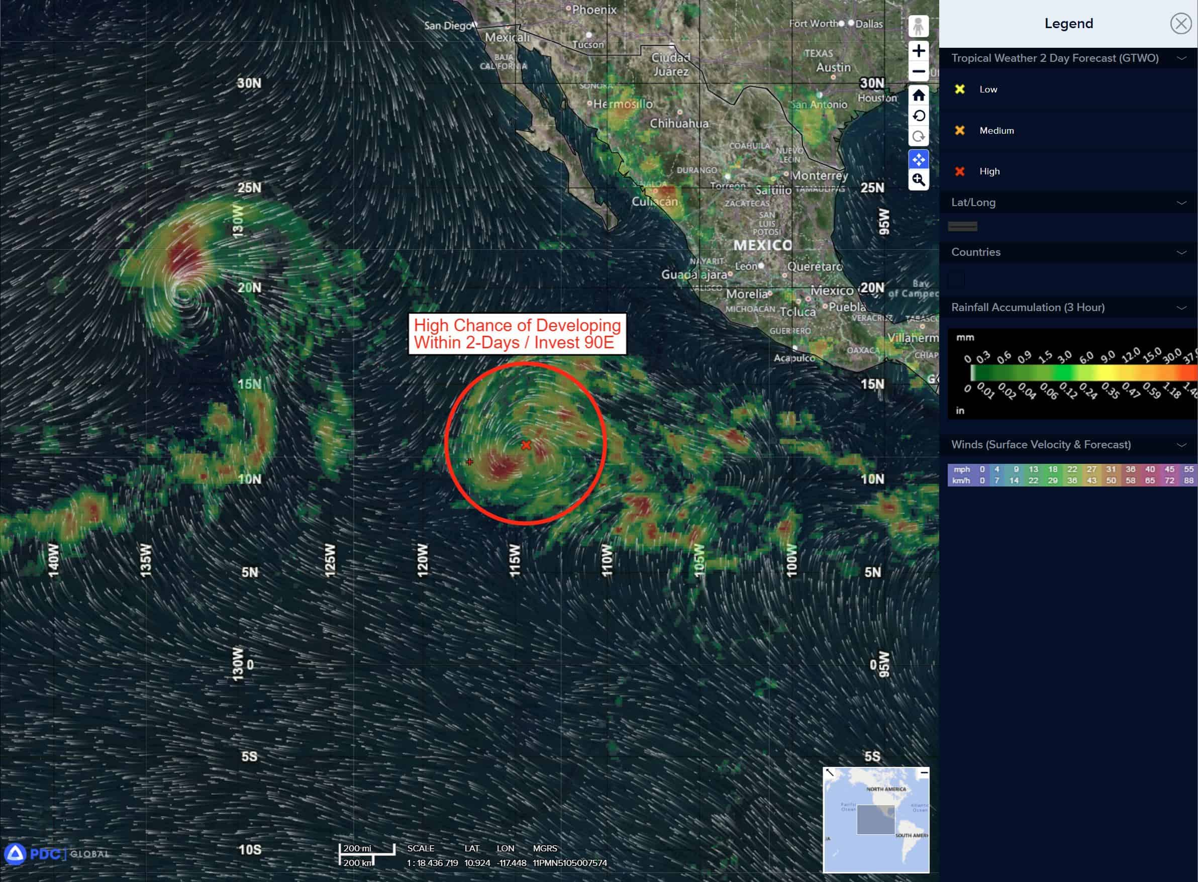
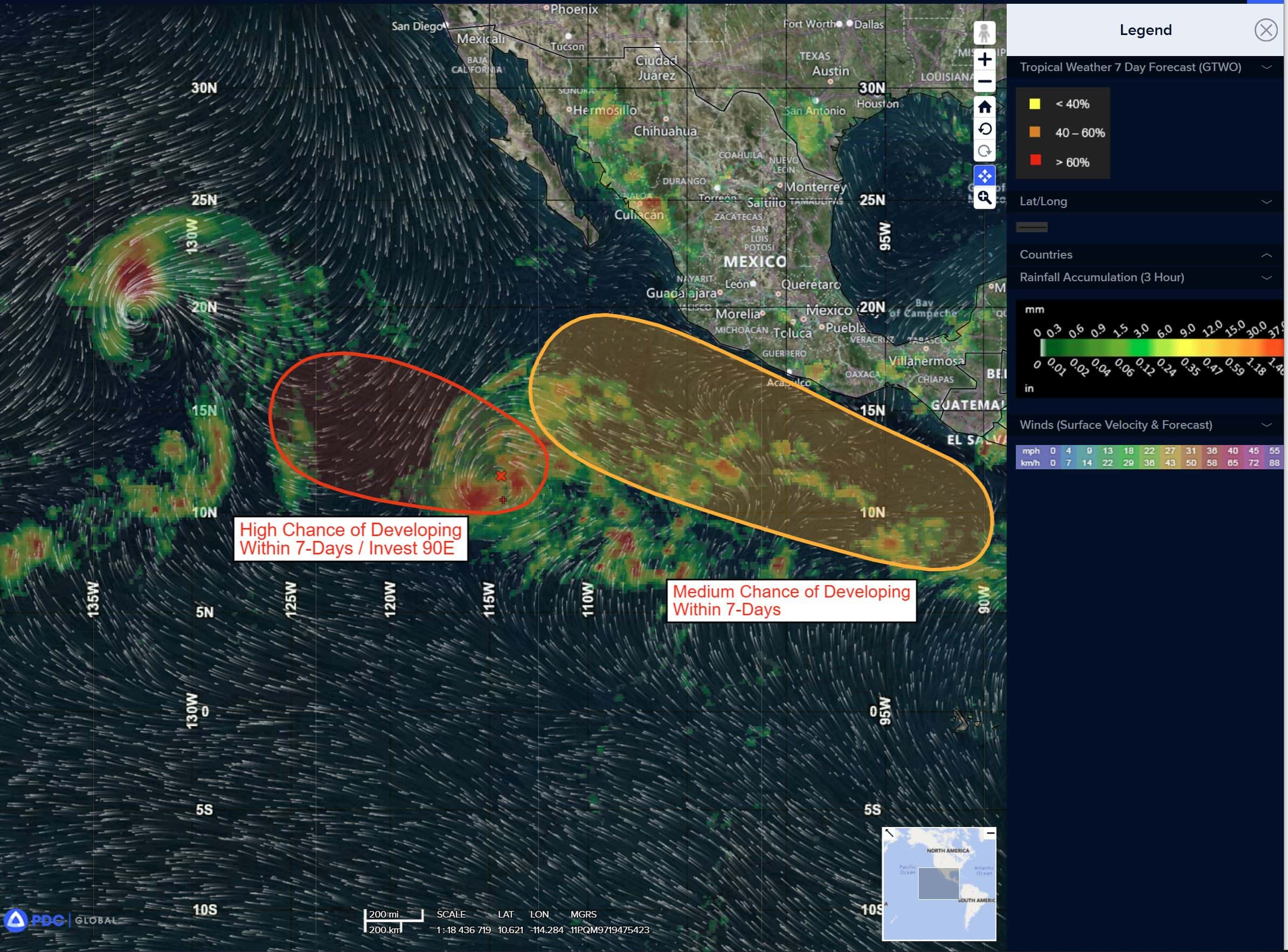
Invest 90E
>>> Disorganized showers and thunderstorms located well west-southwest of the southwestern coast of Mexico are associated with a broad area of low pressure. Environmental conditions are conducive for development of this system, and a tropical depression is likely to form during the next day or two while the system moves west-northwestward at 10 to 15 mph.
* Formation chance through 48 hours…high…90 percent
* Formation chance through 7 days…high…90 percent
South of Southern Mexico:
>>> An area of low pressure is forecast to form offshore of the coast of Central America and southern Mexico by midweek. Environmental conditions appear conducive for some development, and a tropical depression could form later this week as the system moves generally west-northwestward at 10 to 15 mph.
* Formation chance through 48 hours…low…near 0 percent
* Formation chance through 7 days…medium…50 percent
Central Pacific Ocean: There are no Tropical Cyclones
Tropical cyclone formation is not expected during the next 7 days.
Western Pacific, Indian Ocean, and adjacent Seas:
Western Pacific
Tropical Cyclone 12W (Krosa) – Final Warning
According to the JTWC warning number 45 sustained winds are 50 knots with gusts to near 65 knots
Animated enhanced infrared (eir) satellite imagery depicts a system in the throes of rapid vortex decoupling, with a partially exposed low level circulation center (llcc) southwest of the mid-level rotation with remnant convection. A 031049z ascat-b and a 030952z ascat-c pass revealed a small llcc with a broad swath of gale-force winds across the southern hemisphere of the circulation and an embedded region of 45-50 knot winds to the south.
Environmental conditions are rapidly becoming unfavorable, with strong westerly shear, very cool ssts, and significant dry air, particularly along the western flank, offset by robust poleward outflow.
Tropical storm 12W is moving quickly now, along the northern side of the strong ridge to the south. while this ridge will quickly move southwest over the next 12 to 24 hours, there will be little impact on either the track speed or direction due to the fact that another ridge quickly moves in from the east and the steering handoff will be quite rapid.
TS 12W is thus expected to continue tracking east-northeastward at about 22-24 knots through the entire forecast period. As TS 12W becomes fully decoupled, moves over even colder waters and dry air rushes to engulf the remnant vortex, it will steadily weaken while simultaneously undergoing extratropical transition (ett). Completion of ett is anticipated by 36 hours.
Tropical Cyclone 13W (Bailu)
According to the JTWC warning number 8 sustained winds are 35 knots with gusts to near 45 knots
Animated proxy visible (proxyvis) satellite imagery depicts fragmented bands of shallow convection wrapping into a generally more defined low level circulation center (llcc). Ascat passes missed the center of tropical storm 13W, but the trends in the visible and then proxyvis imagery suggests that the two circulations seen six hours ago have indeed merged and the system may in fact be consolidating into a single vortex. There are hints there may still be a secondary circulation off to the west. A lack of recent microwave and scatterometer data covering the center precludes more complex analysis.
Environmental conditions are marginal, with low vws, marginal ssts, strong poleward outflow into a 200 millibar jet stream max passing east of Hokkaido, and a fairly deep layer of dry air lying out to the west side of the center.
TS 13W has been traveling on a steady northeastward course over the last day, along the northwestern side of the str. Global models suggest the ridge is about to commence its rapid repositioning to the southwest and once this process kicks off, TS 13W will quickly shift to a more eastward track along the north side of the ridge. As the ridge and TS 13W move further apart from one another, the steering gradient will weaken, and TS 13W begins to slow down as early as 24 hours.
Around 48 hours, a col region develops south of TS 13W, between the str that by then is positioned south of Tokyo and a building str moving in from the east, positioned near the dateline. As TS 13W passes north of this col region, track speeds slow significantly as there will be little in the way of steering gradient at this time. By 48 hours, as the eastern ridge builds in, TS 13W shifts to a more northeastward track and begins to pick up speed once again, continuing to accelerate northeastward through the remainder of the forecast.
While the system appears to have consolidated into a single vortex, at least for the moment, and shear and outflow conditions are supportive for intensification, the cool sst’s and influence of dry air will effectively offset the otherwise favorable upper-level conditions. TS 13W is forecast to maintain intensity through 48 hours before weakening due to dramatically increasing shear and dry air entrainment. The system will begin extratropical transition (ett) by 72 hours and is expected to complete ett no later than 96 hours and likely as early as 84 hours.
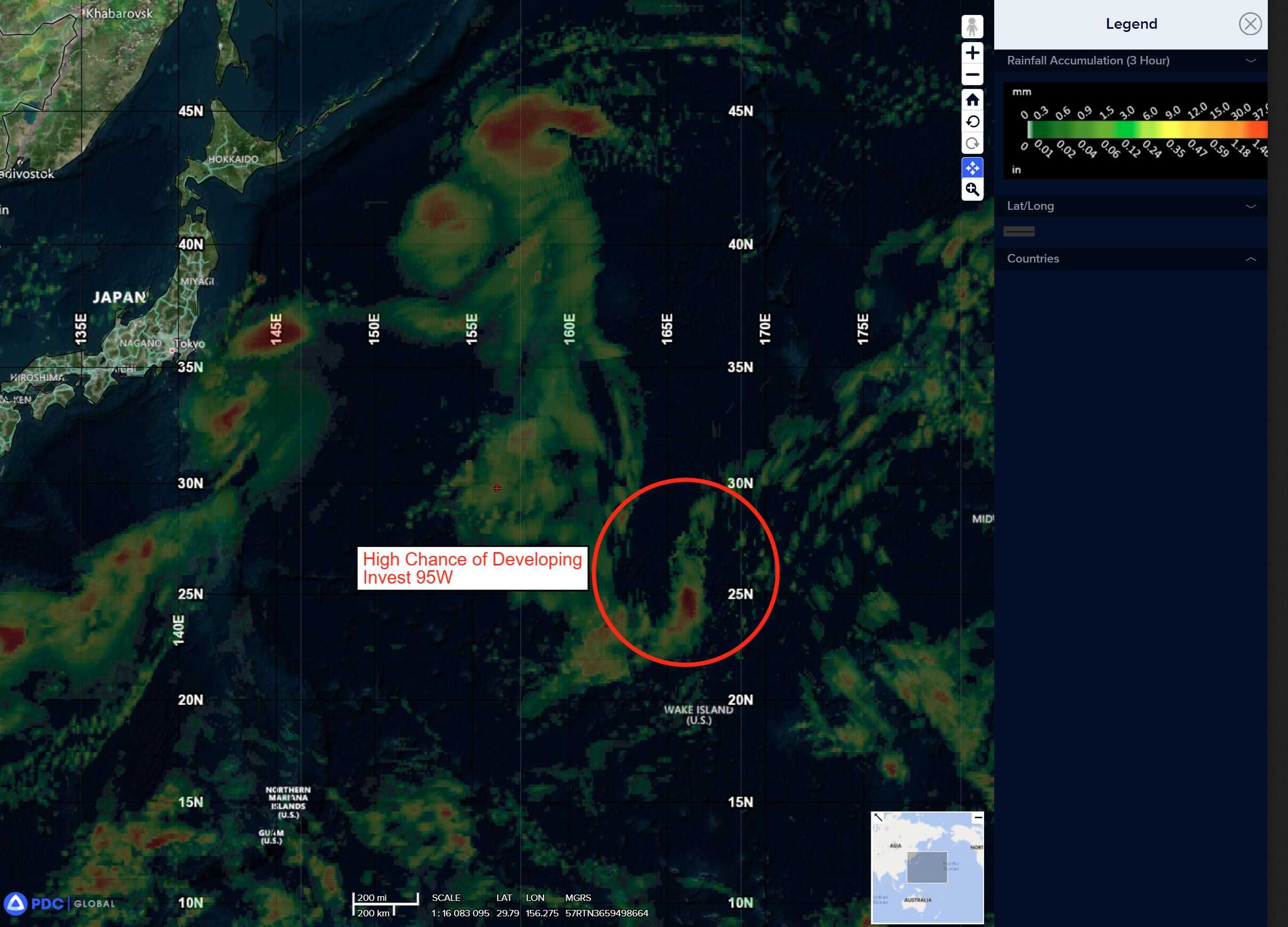
Tropical Cyclone 14W
According to the JTWC warning number 1 sustained winds are 25 knots with gusts to near 35 knots
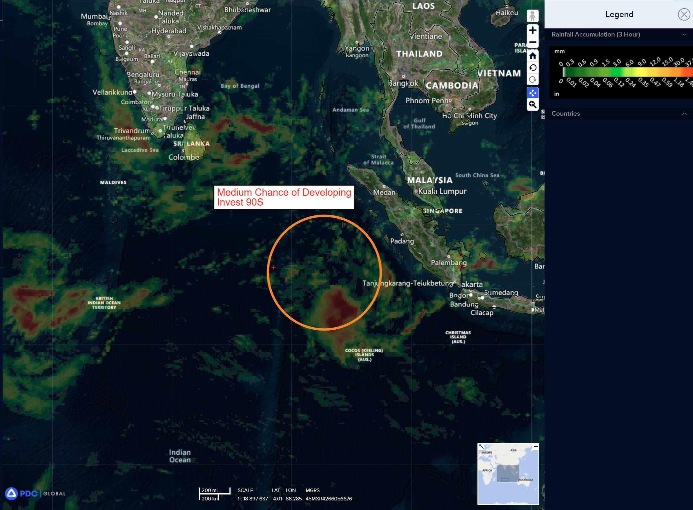
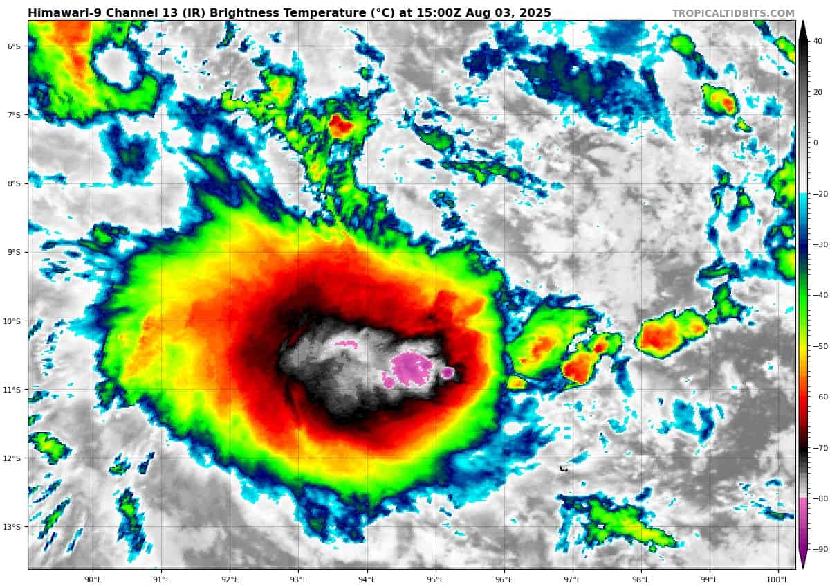
>>> There’s an area of disturbed weather being referred to as Invest 90S, which is located approximately 262 NM north-northwest of Cocos Islands
Animated multi-spectral satellite imagery (msi) depicts a slowly consolidating low level circulation center (llcc) with persistent deep convection to the southwest. A 030301z ascat pass reveals 25-30 knot winds surrounding a small llcc, with some pockets of higher winds, particularly under the convection to the southwest.
Environmental analysis for the area indicates marginally favorable conditions for development with moderate to high vertical wind shear (20-30 knots) offset by warm sea surface temperatures and moderate poleward outflow aloft.
Global deterministic models are in fair agreement that 90S will continue to track south-southwestward, with GFS showing increased signs of intensification over the other models, over the next 24-48 hours. ECENS and GEFS ensemble guidance also show mixed results with ECENS being more aggressive than the GEFS in developing the system.
Maximum sustained surface winds are estimated at 28 to 33 knots.
The potential for the development of a significant tropical cyclone within the next 24 hours is upgraded to high.