
")
Current Snapshot
For all the latest updates visit: DisasterAWARE
1800x1080e
flossie
291440_earliest_reasonable_toa_34
291440INTQPF_sm

06E_tracks_latest
epac7
10

98W_tracks_latest
By PDC’s Senior Weather
Specialist Glenn James

The Pacific Disaster Center’s (PDC Global) Sunday, June 29, 2025, Tropical Cyclone Activity Report…for the Pacific Ocean, the Indian Ocean, and adjacent Seas
Current Tropical Cyclones:
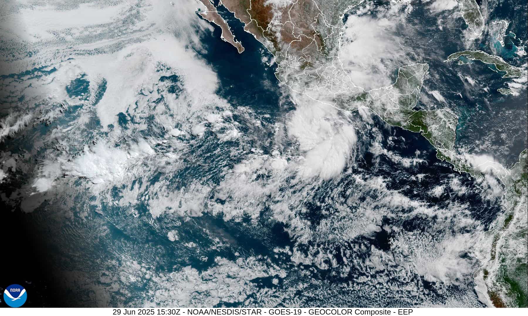
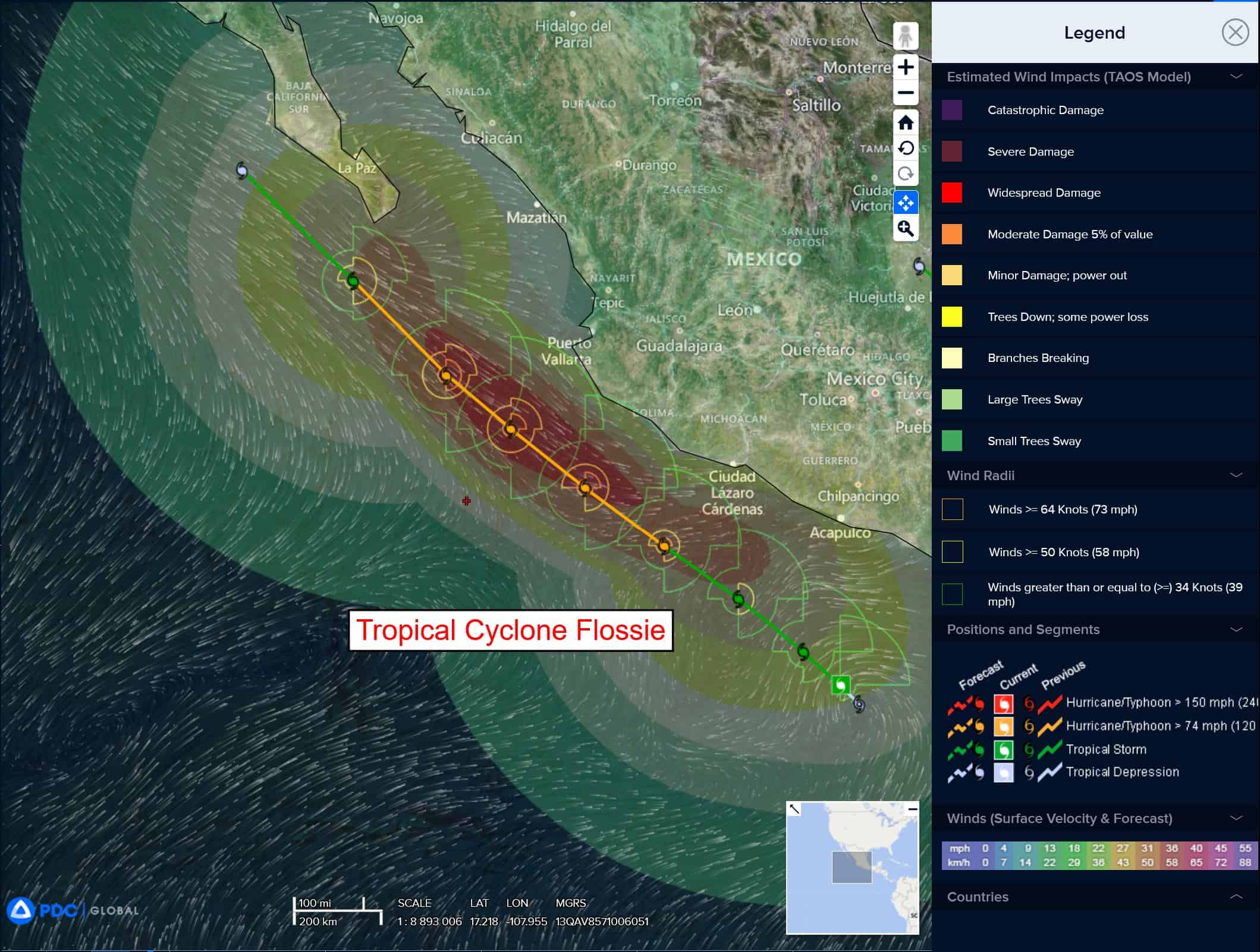
Tropical Cyclone 06E (Flossie)…is located about 375 south-southeast of Manzanillo, Mexico
Northeast Pacific Ocean:
Tropical Cyclone 06E (Flossie)
FLOSSIE STARTING TO STRENGTHEN…EXPECTED TO BRING AREAS OF HEAVY RAIN ALONG THE COAST OF SOUTHWESTERN MEXICO
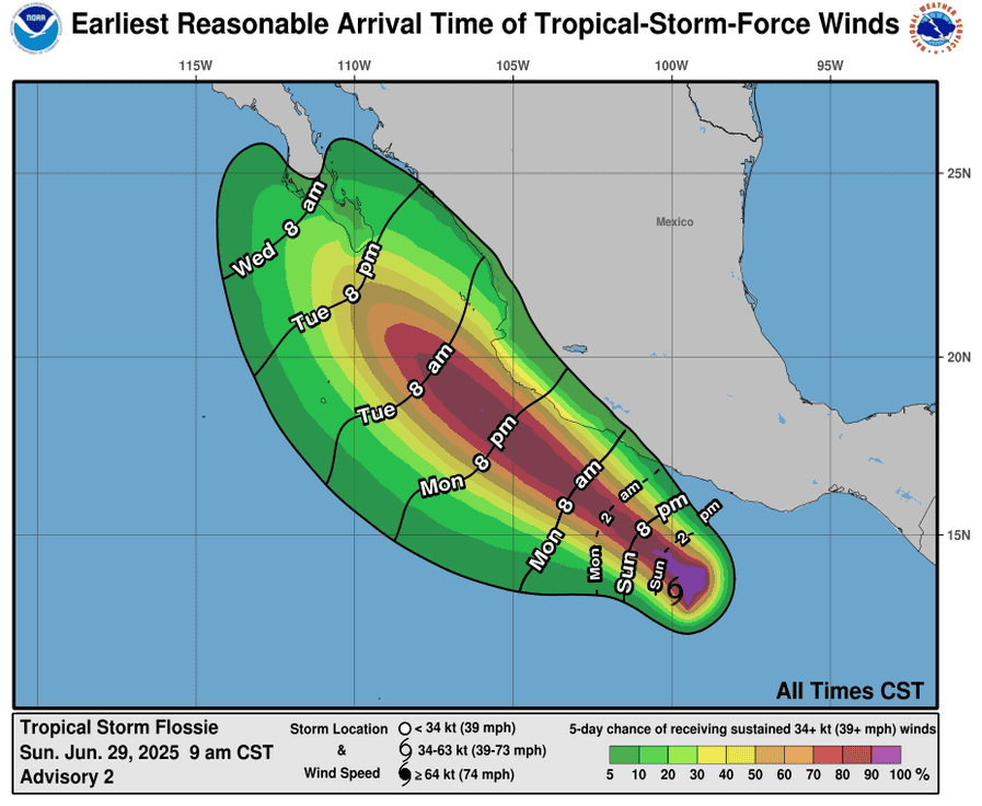
According to the NHC advisory number 4A
Flossie is moving toward the northwest near 9 mph (14 km/h). A west-northwest to northwest motion should continue over the next few days. Maximum sustained winds have increased to near 45 mph (75 km/h) with higher gusts. Steady-to-rapid strengthening is forecast during the next couple of days, and the system is expected to become a hurricane tonight or Tuesday. Tropical-storm-force winds extend outward up to 60 miles (95 km) from the center.
HAZARDS AFFECTING LAND
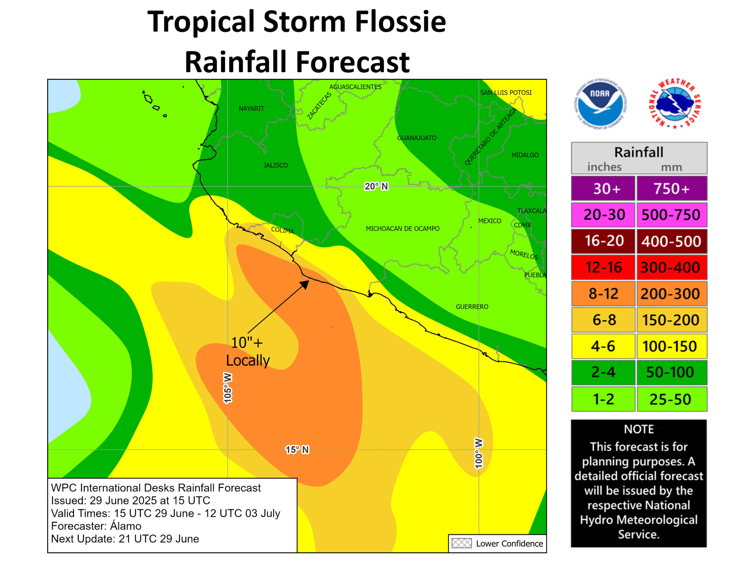
RAINFALL: Tropical Storm Flossie is expected to produce rainfall totals of 3 to 6 inches, with isolated maximum totals of 10 inches, across portions of the Mexican states of Oaxaca, Guerrero, Michoacán, Colima, and Jalisco through early this week. This rainfall may lead to areas of life-threatening flooding and mudslides, especially in areas of steep terrain.
WIND: Tropical storm conditions are possible along the coast within the watch area late Monday and Tuesday.
SURF: Swells generated by Flossie will affect portions of the coast of southwestern Mexico during the next few days. These swells are likely to cause life-threatening surf and rip current conditions.
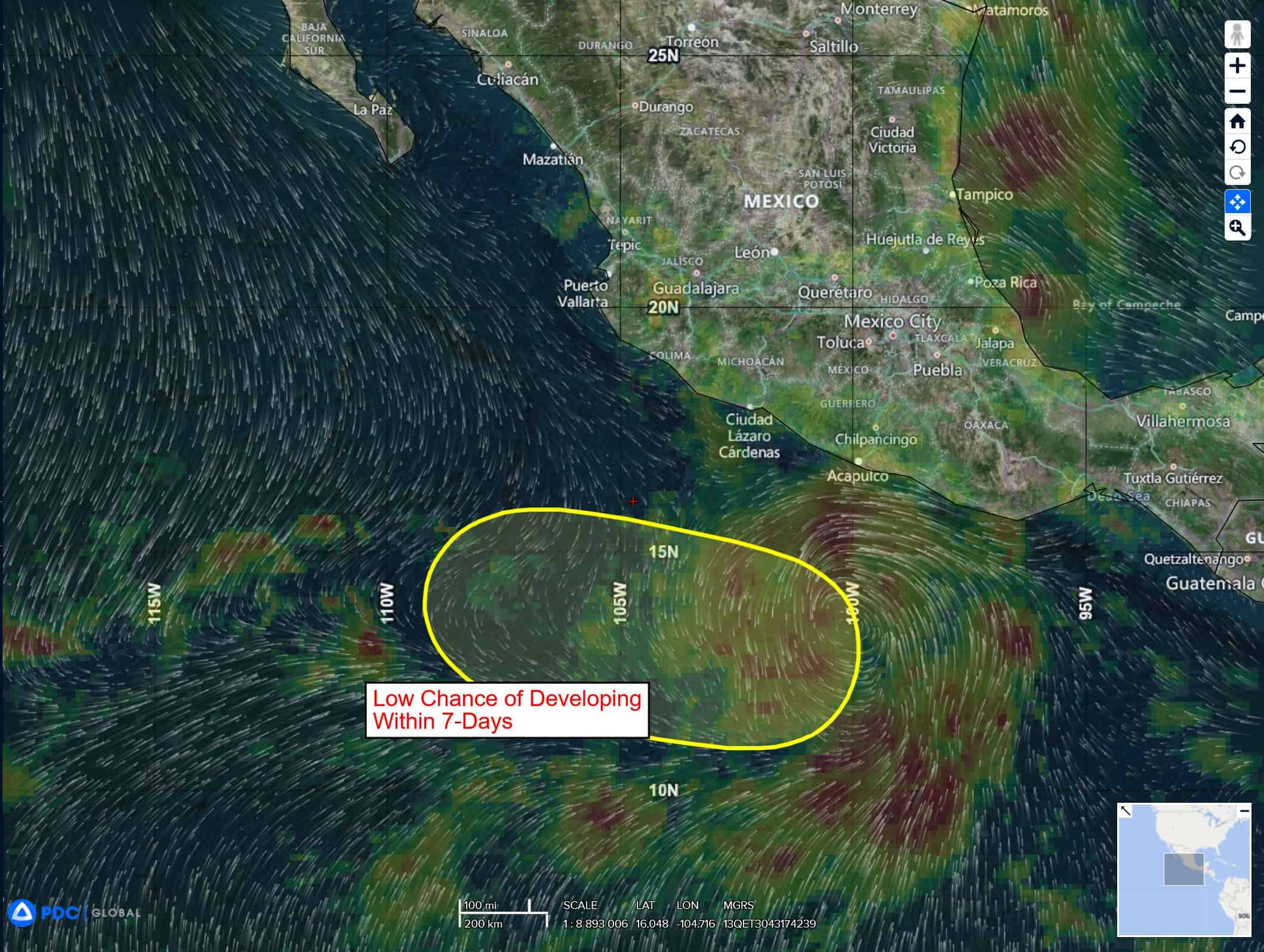
South of Southwestern Mexico:
>>> An area of low pressure could form several hundred miles offshore of southwestern Mexico late this week. Some gradual development of this system is possible thereafter while it moves generally west-northwestward.
* Formation chance through 48 hours…low…near 0 percent
* Formation chance through 7 days…low…30 percent
Central Pacific Ocean: There are no Tropical Cyclones
Tropical cyclone formation is not expected during the next 7-days.
Western Pacific, Indian Ocean, and adjacent Seas: There are no Tropical Cyclones
Western Pacific
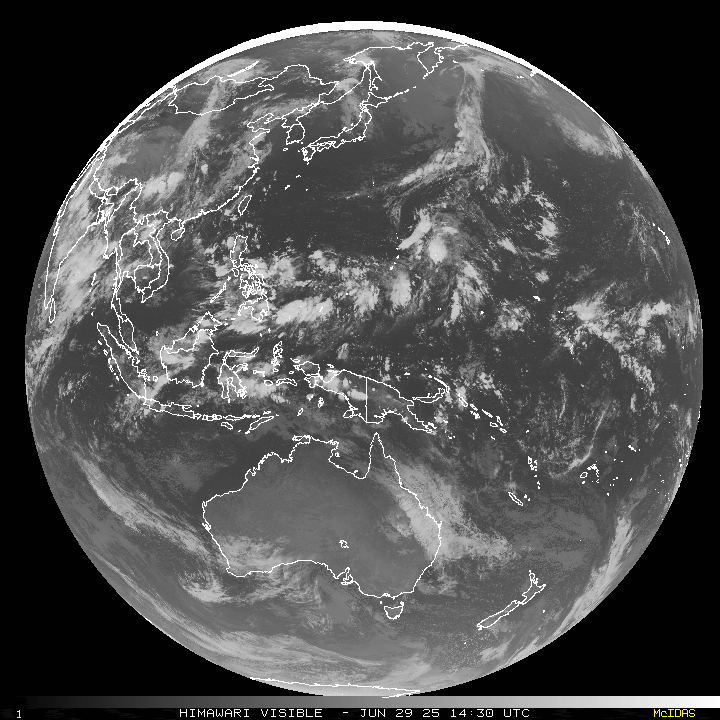
>>> An area of disturbed weather, which is being referred to as Invest 98W, is located approximately 677 NM east of Manila, Philippines
Multi-spectral satellite imagery (msi) depicts a slowly consolidating low level circulation center with building convection throughout the circulation. However, a recent ascat-c pass portrays the suspected area to be a broad area of troughing.
Environmental analysis reveals a highly favorable environment for development with low level vertical wind shear of 10-15 knots, good dual-channel upper-level outflow and warm sea surface
temperatures.
Deterministic and ensemble models indicate low likelihood of development over the next two days.
Maximum sustained surface winds are estimated at 18 to 23 knots.
The potential for the development of a significant tropical cyclone within the next 24 hours remains low.