
")
Current Snapshot
For all the latest updates visit: DisasterAWARE
flossie
1800x1080e
goes19_ir_flossie
301520_earliest_reasonable_toa_34
301520INTQPF_sm
06E_tracks_latest
7
98w
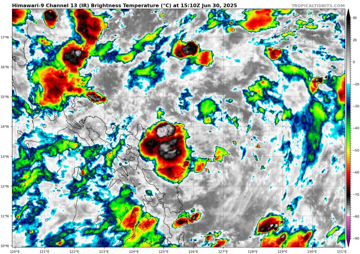
himawari9_ir_98W_202506301510_lat14.2-lon126.9

98W_tracks_latest
By PDC’s Senior Weather
Specialist Glenn James

The Pacific Disaster Center’s (PDC Global) Monday, June 30, 2025, Tropical Cyclone Activity Report…for the Pacific Ocean, the Indian Ocean, and adjacent Seas
Current Tropical Cyclones:
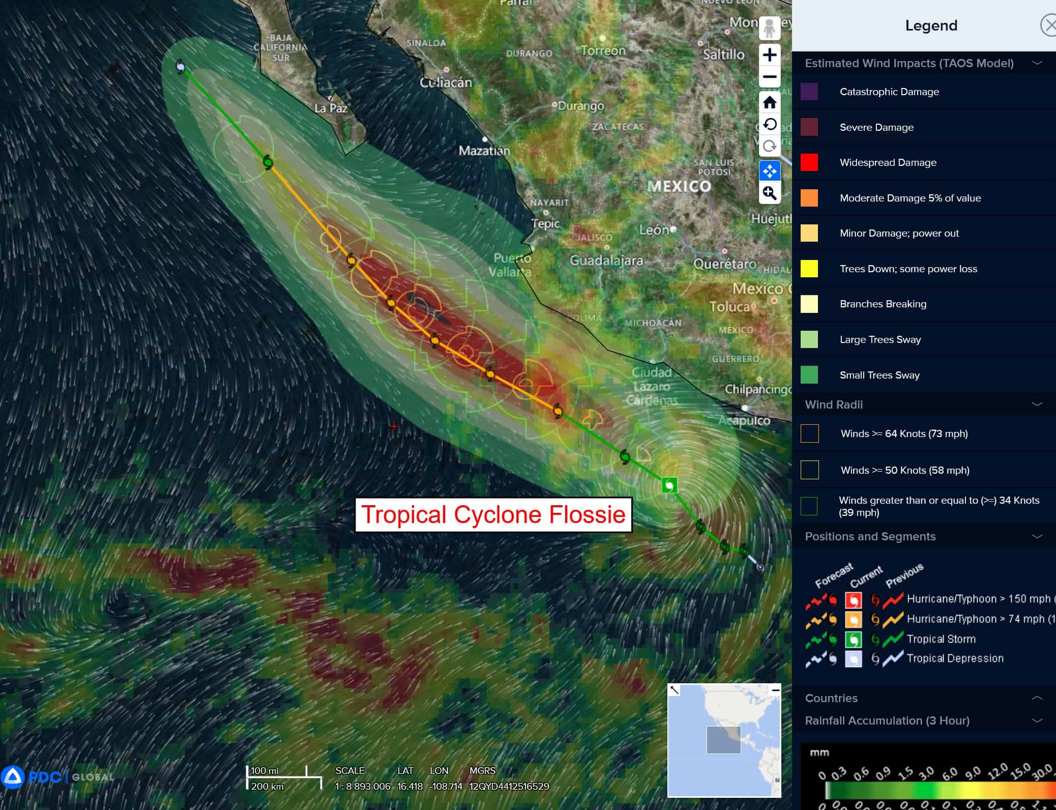
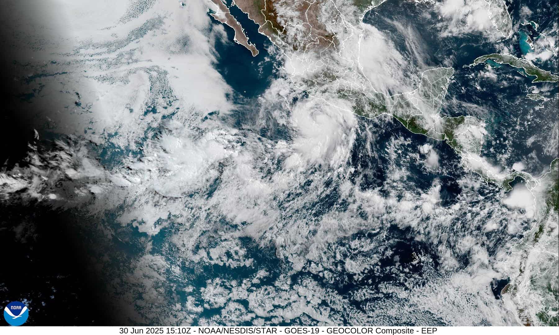
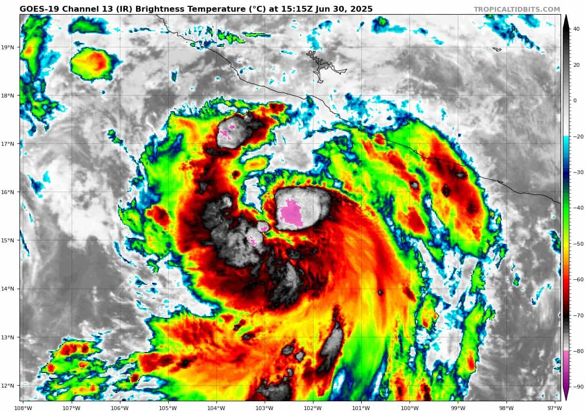
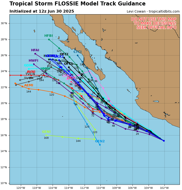
Tropical Cyclone 06E (Flossie)…is located about 175 south of Manzanillo, Mexico
Northeast Pacific Ocean:
Tropical Cyclone 06E (Flossie)
FLOSSIE STRENGTHENS SOME MORE OFFSHORE SOUTHWEST MEXICO
According to the NHC advisory number 8A
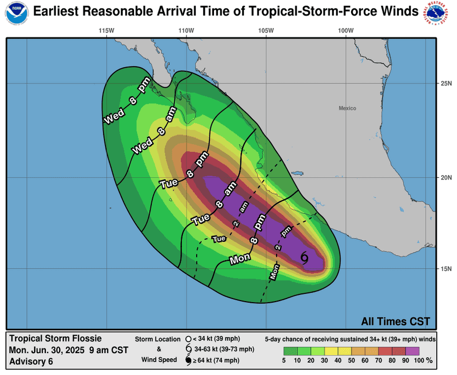
Flossie is moving toward the west-northwest near 10 mph (17 km/h). This general motion is expected to continue during the next couple of days, with a gradual slowing in forward speed. Maximum sustained winds are near 75 mph (120 km/h) with higher gusts. Some strengthening is forecast during the next 48 hours. Steady to rapid strengthening is forecast during the next day or so. Hurricane-force winds extend outward up to 15 miles (30 km) from the center and tropical-storm-force winds extend outward up to 115 miles (185 km).
SUMMARY OF WATCHES AND WARNINGS IN EFFECT:
A Tropical Storm Warning is in effect for…
* Punta San Telmo to Playa Perula
A Tropical Storm Watch is in effect for…
* East of Punta San Telmo to Zihuatanejo * North of Playa Perula to Cabo Corrientes
HAZARDS AFFECTING LAND
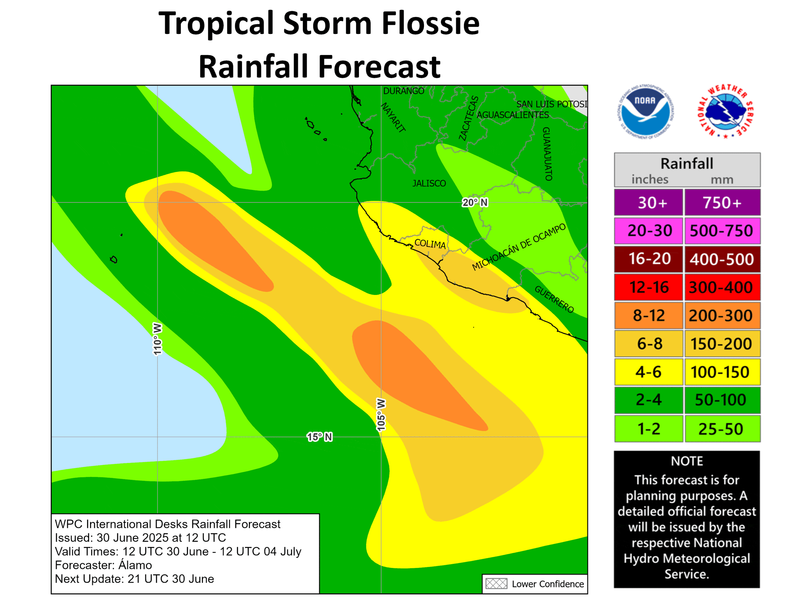
RAINFALL: Tropical Storm Flossie is expected to produce rainfall totals of 3 to 6 inches, with isolated maximum totals of 10 inches, across portions of the Mexican states of Oaxaca, Guerrero, Michoacán, Colima, and Jalisco through Wednesday. This rainfall could lead to isolated life-threatening flooding and mudslides, especially in steep terrain.
WIND: Tropical storm conditions are expected within the warning area, and are possible within the watch areas, tonight through Tuesday.
SURF: Swells generated by Flossie will affect portions of the coast of southwestern Mexico during the next few days. These swells are likely to cause life-threatening surf and rip current conditions.
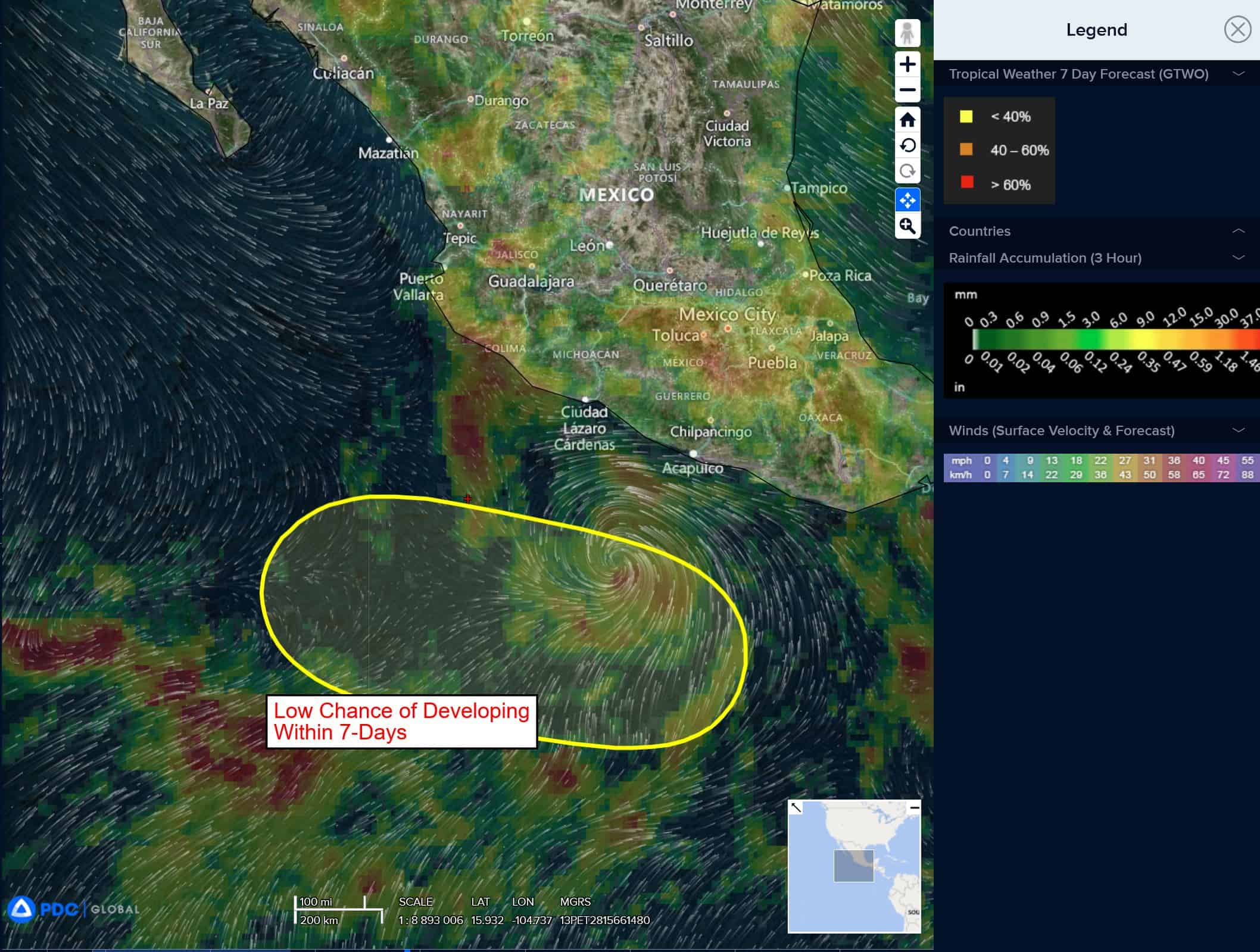
South of Southwestern Mexico:
>>> An area of low pressure could form several hundred miles offshore of southwestern Mexico late this week. Some gradual development of this system is possible thereafter while it moves generally west-northwestward.
* Formation chance through 48 hours…low…near 0 percent
* Formation chance through 7 days…medium…40 percent
Central Pacific Ocean: There are no Tropical Cyclones
Tropical cyclone formation is not expected during the next 7-days.
Western Pacific, Indian Ocean, and adjacent Seas: There are no Tropical Cyclones
Western Pacific
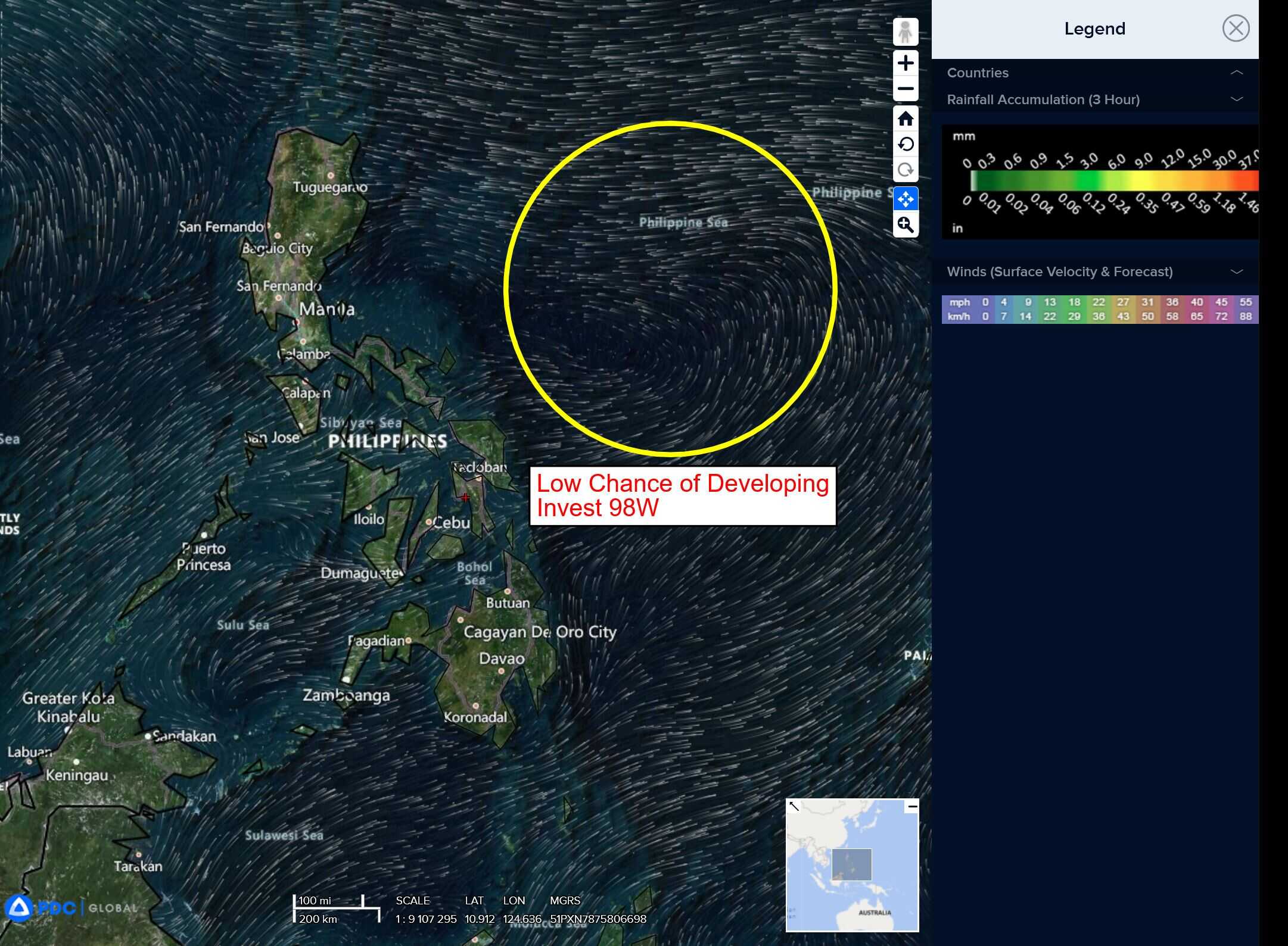
>>> An area of disturbed weather, which is being referred to as Invest 98W, is located approximately 232 NM east-northeast of Legazpi, Philippines
Multi-spectral satellite imagery depicts a slowly consolidating low level circulation center (llcc) with building convection throughout the circulation. However, a recent ascat-c pass portrays the suspected area to be a broad area of troughing.
Environmental analysis reveals a highly favorable environment for development with low level vertical wind shear (vws) of 10-15 knots, good dual-channel upper-level outflow and warm sea
surface temperatures (sst).
Deterministic and ensemble models indicate low likelihood of development over the next two days.
Maximum sustained surface winds are estimated at 13 to 18 knots.
The potential for the development of a significant tropical cyclone within the next 24 hours remains low.
>>> An area of disturbed weather, which is being referred to as Invest 90W, is located approximately 504 NM southeast of Iwo To
Animated multi-spectral satellite imagery (msi) and another image depict a poorly organized low level circulation center (llcc) obscured by flaring convection along the eastern periphery.
Environmental analysis for the area indicates marginally favorable conditions for development with low to moderate (15-20 knot) southerly vertical wind shear offset by warm sea surface temperatures and strong poleward outflow aloft. A tropical upper tropospheric trough (tutt) cell to the west of the llcc is the main cause of the elevated shear on the system.
Global deterministic and ensemble models are in fair agreement that 90W will continue north-northwestward with marginal development over the next couple of days, with the potential for the
formation of a monsoon depression.
Maximum sustained surface winds are estimated at 18 to 23 knots.
The potential for the development of a significant tropical cyclone within the next 24 hours is low.