
")
Current Snapshot
For all the latest updates visit: DisasterAWARE
1800x1080a
erin
goes19_ir_05L_202508141435_lat16.3-lon-48.9
141435_earliest_reasonable_toa_34

05L_tracks_latest
1000×1000
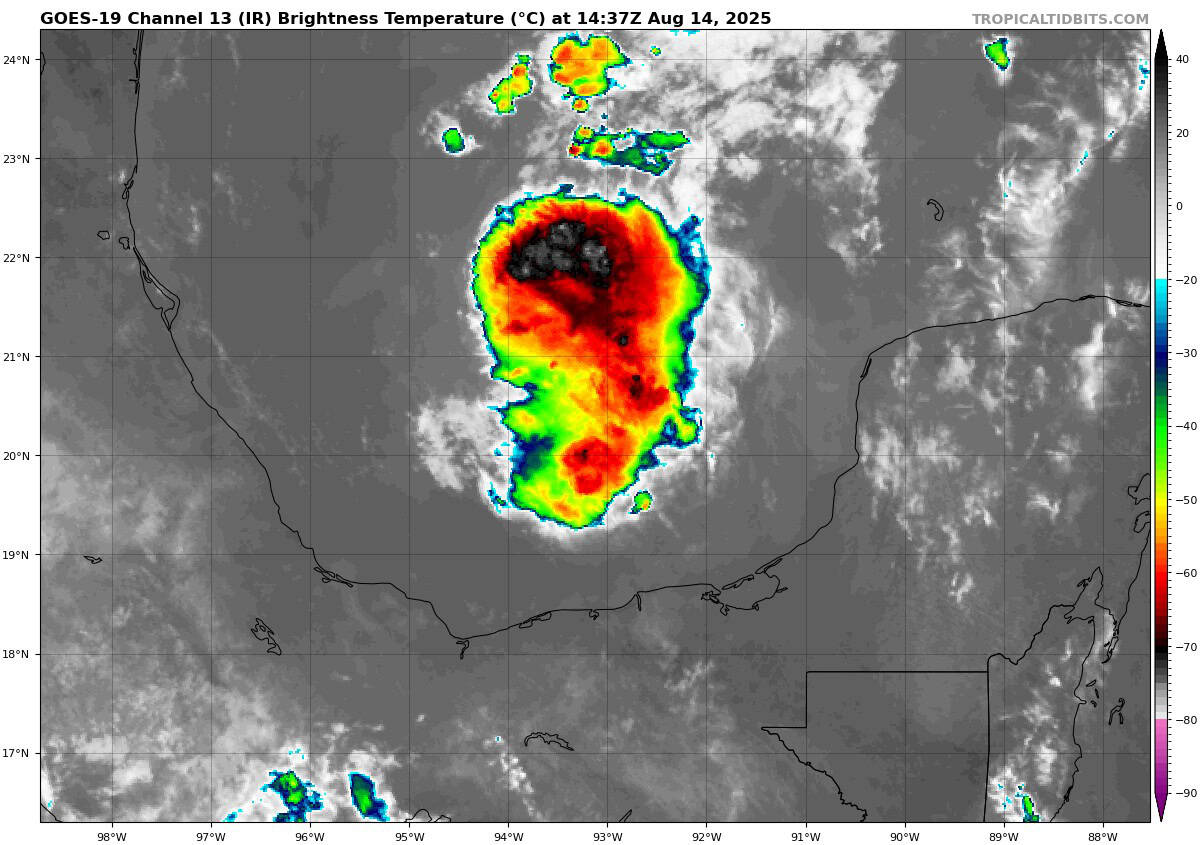
goes19_ir_98L_202508141437_lat20.0-lon-92.6

98L_tracks_latest
By PDC’s Senior Weather
Specialist Glenn James

The Pacific Disaster Center’s (PDC Global) Thursday, August 14, 2025, Tropical Cyclone Activity Report…for the Atlantic Ocean, the Caribbean Sea, and the Gulf of America
Current Tropical Cyclones:
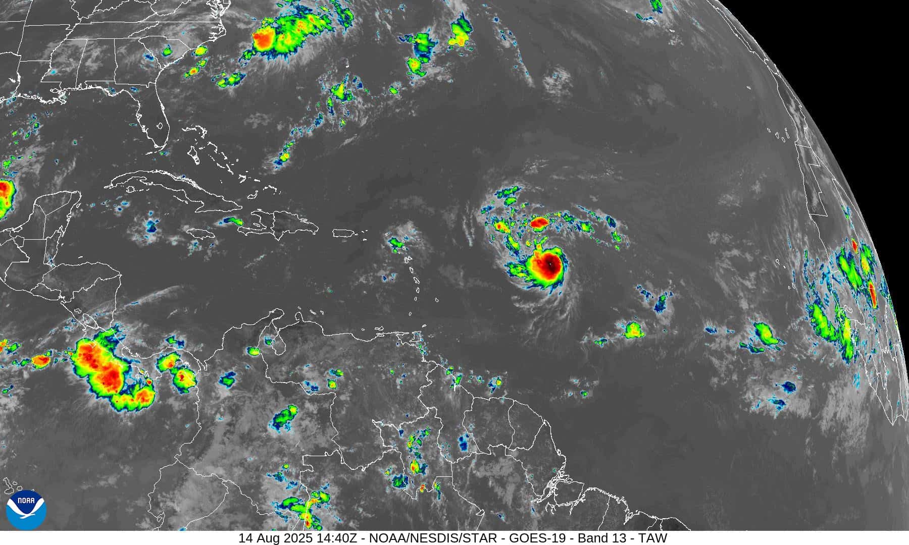
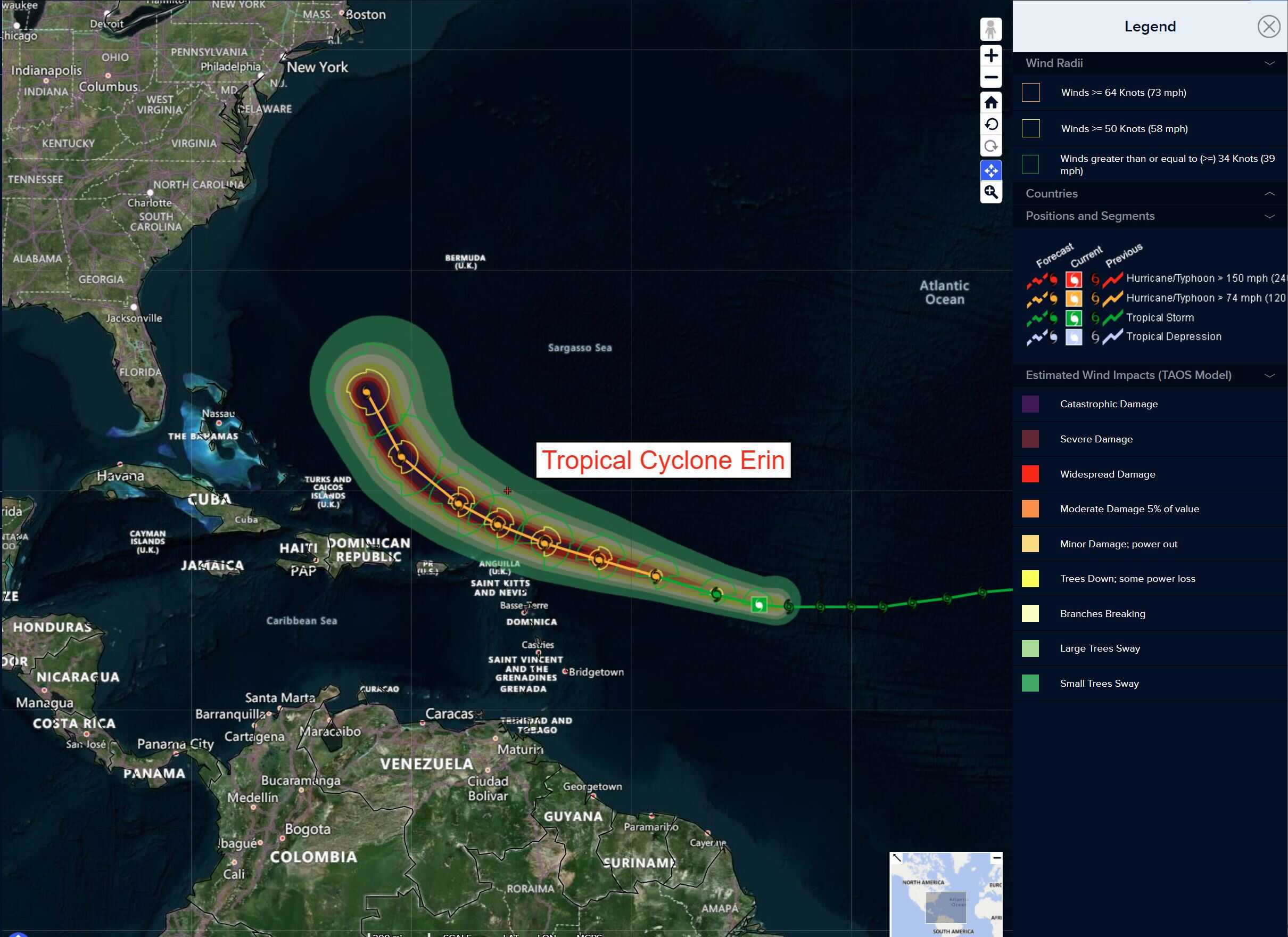
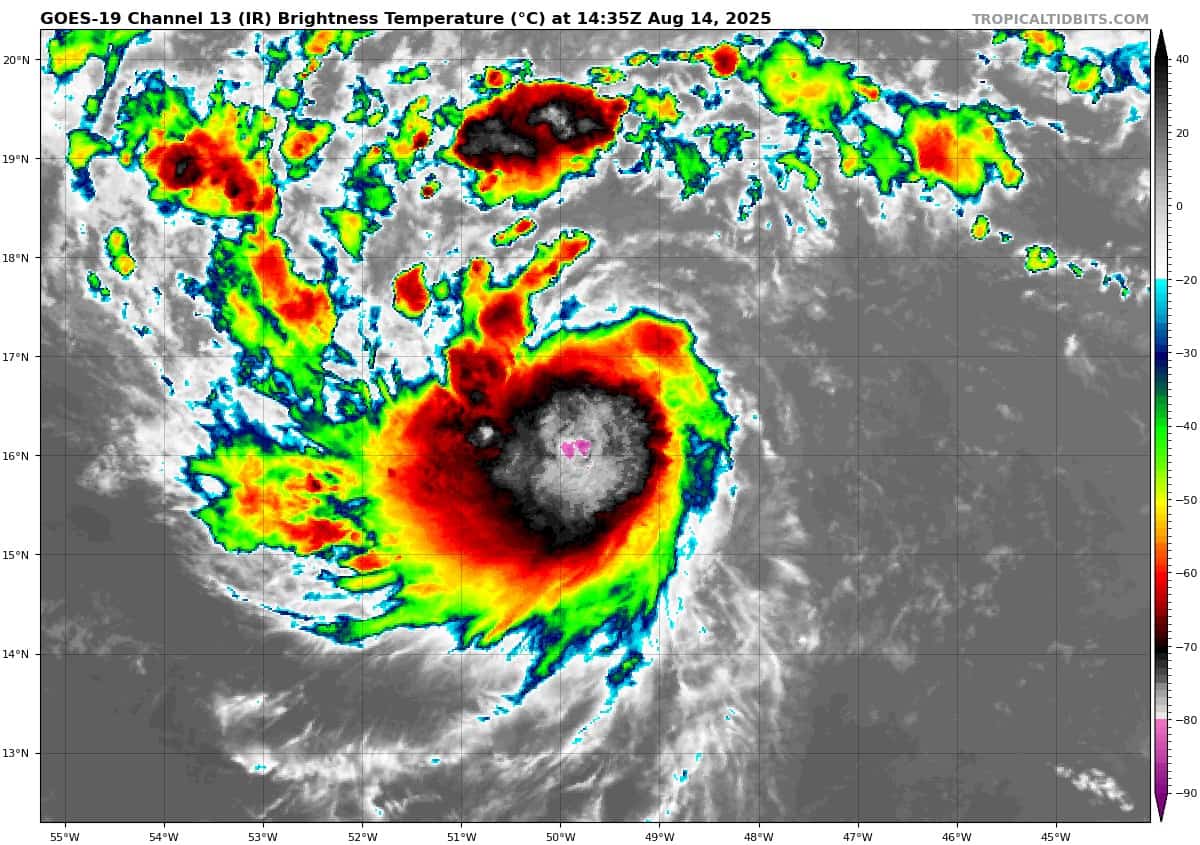
Tropical Cyclone Erin…is located about 665 miles east of the Northern Leeward Islands
Atlantic Ocean
Tropical Cyclone Erin
ERIN FORECAST TO BECOME A HURRICANE TODAY
According to the NHC advisory number 15A
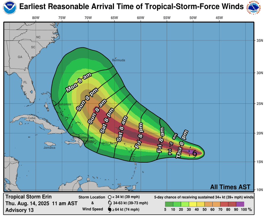
Erin is moving toward the west-northwest near 15 mph (24 km/h). This motion expected to continue into the weekend. On the forecast track, the center of Erin is likely to move near or just north of the northern Leeward Islands over the weekend. Maximum sustained winds are near 70 mph (110 km/h) with higher gusts. Additional strengthening is expected during the next few days and Erin is expected to become a hurricane today and could become a major hurricane by this weekend. Tropical-storm-force winds extend outward up to 70 miles (110 km) from the center.
HAZARDS AFFECTING LAND
RAINFALL: Tropical Storm Erin is expected to produce areas of heavy rainfall beginning late Friday and continuing through the weekend across the northernmost Leeward Islands, the U.S. and British Virgin Islands, as well as southern and eastern Puerto Rico. Rainfall totals of 2 to 4 inches, with isolated totals of 6 inches, are expected. This rainfall may lead to isolated flash and urban flooding, along with landslides or mudslides.
WIND: Tropical storm conditions are possible within the watch area by early Saturday.
SURF: Swells generated by Erin will begin affecting portions of the northern Leeward Islands, the Virgin Islands and Puerto Rico by this weekend. These swells are likely to cause life-threatening surf and rip current conditions.
Caribbean Sea: There are no active tropical cyclones
Tropical cyclone formation is not expected during the next 7-days.
Gulf of America: There are no active tropical cyclones
Southwestern Gulf
Invest 98L
>>> Recent satellite wind data indicate that the disturbance located over the western Gulf continues to lack a closed low-level circulation. However, shower activity has increased some over the past few hours and the system could become a short-lived tropical depression before it moves inland over northeastern Mexico or southern Texas this afternoon or evening. Regardless of development, locally heavy rainfall is possible along portions of northeastern Mexico and southern Texas over the next couple of days, and interests there should monitor the progress of this system. Another Air Force Reserve Hurricane Hunter aircraft is scheduled to investigate the system later this morning.
* Formation chance through 48 hours…medium…50 percent
* Formation chance through 7 days…medium…50 percent