
")
Current Snapshot
For all the latest updates visit: DisasterAWARE
1800x1080a
erin
goes19_ir_05L_202508111445_lat17.3-lon-27.3erin
111444_earliest_reasonable_toa_34

05L_tracks_latest
atlantic2
777777
goes19_ir_96L_202508111445_lat26.3-lon-52.6
goa
gulf
By PDC’s Senior Weather
Specialist Glenn James

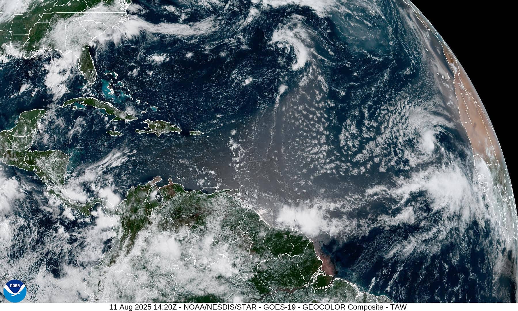
The Pacific Disaster Center’s (PDC Global) Monday, August 11, 2025, Tropical Cyclone Activity Report…for the Atlantic Ocean, the Caribbean Sea, and the Gulf of America
Current Tropical Cyclones:
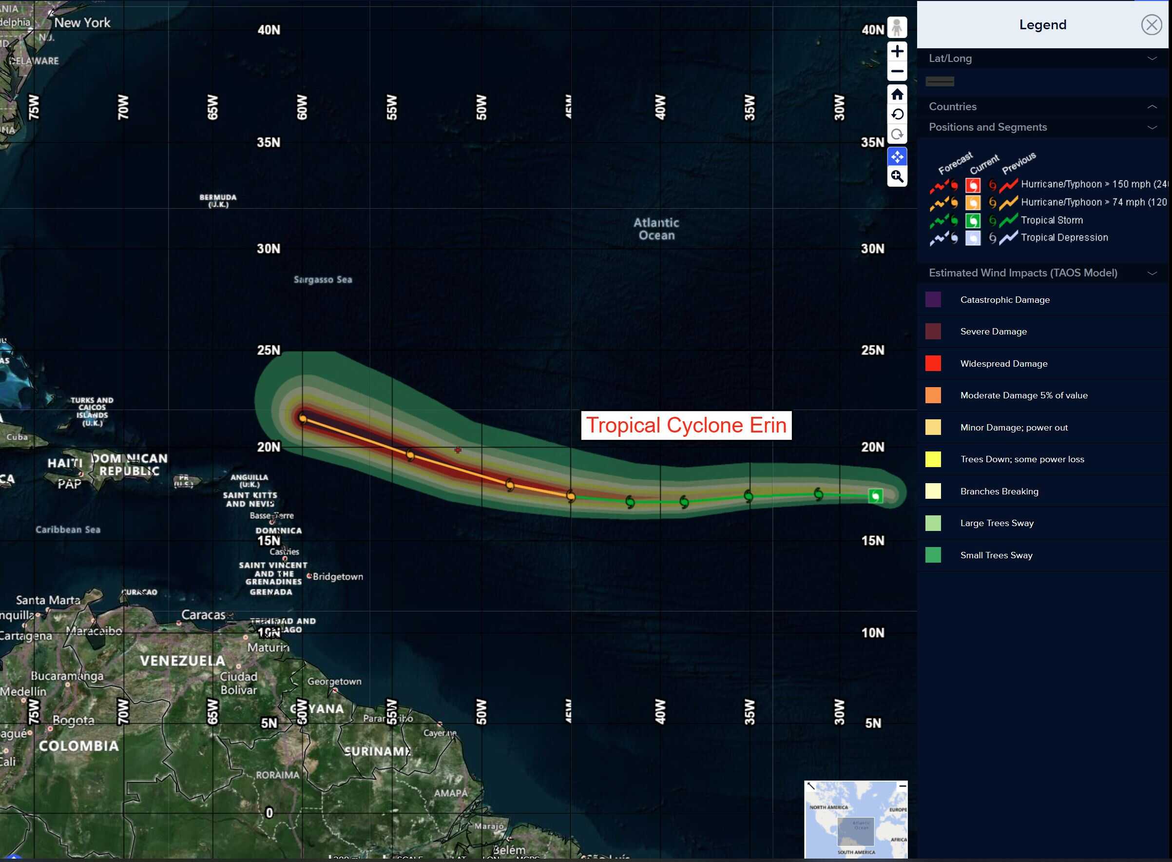
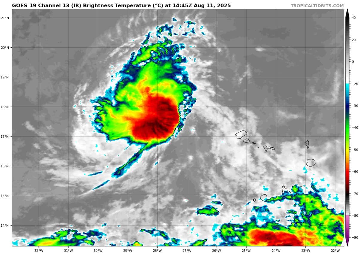
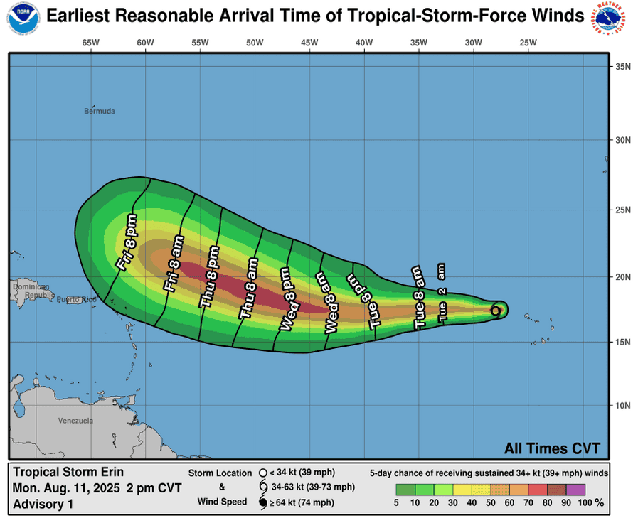
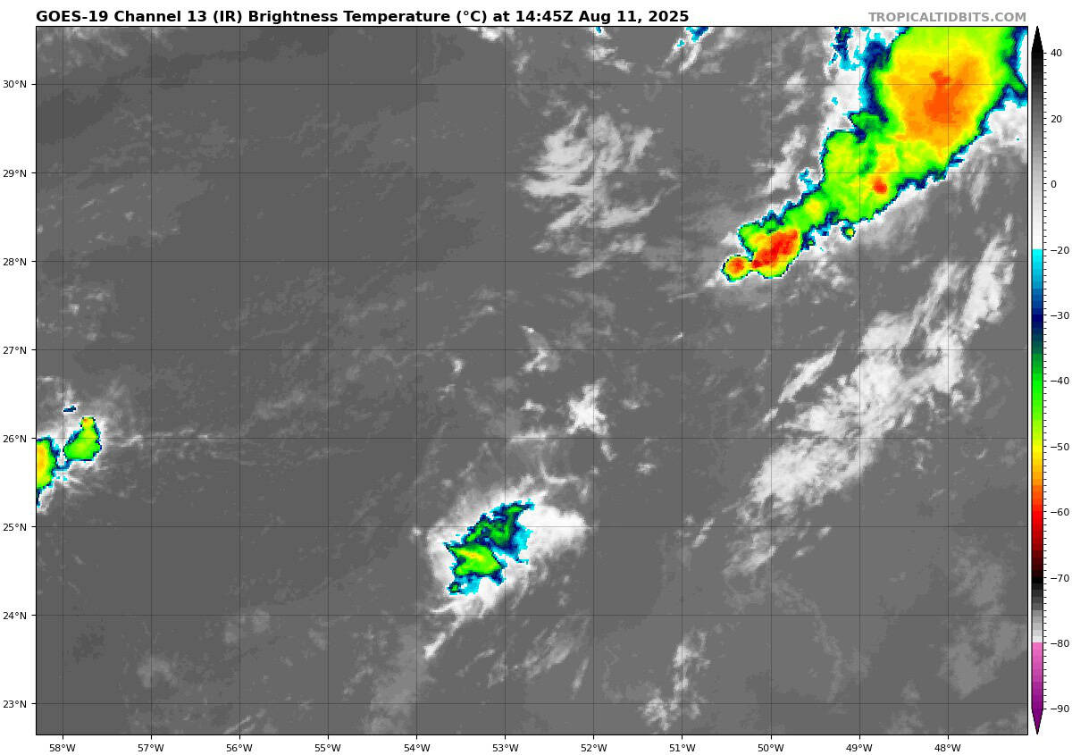
Tropical Cyclone Erin…is located about 2020 miles east of the Northern Leeward Islands
Atlantic Ocean
Tropical Cyclone Erin
ERIN MOVING QUICKLY WESTWARD…FORECAST TO BECOME A HURRICANE LATER THIS WEEK IN THE CENTRAL TROPICAL ATLANTIC
According to the NHC advisory number 3
Erin is moving toward the west near 22 mph (35 km/h), and this motion is expected to continue for the next several days with a gradual slowdown in forward speed. Maximum sustained winds are near 45 mph (75 km/h) with higher gusts. Gradual strengthening is forecast over the next several days, and Erin is expected to become a hurricane later this week. Tropical-storm-force winds extend outward up to 45 miles (75 km) from the center.
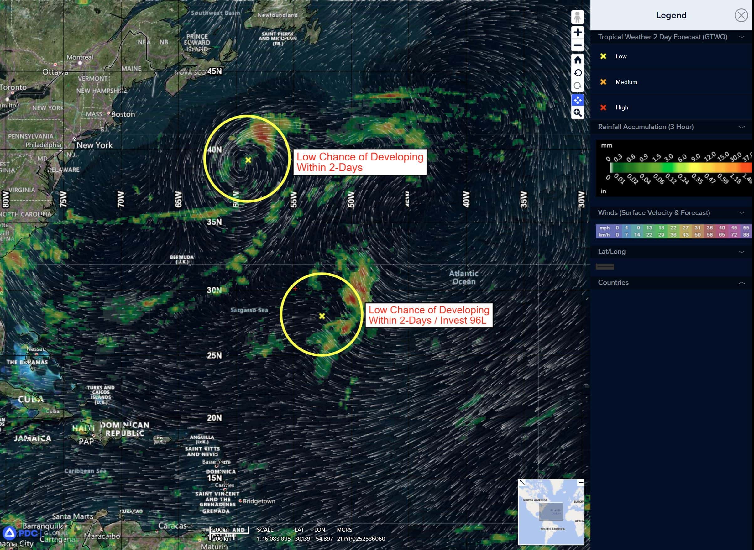
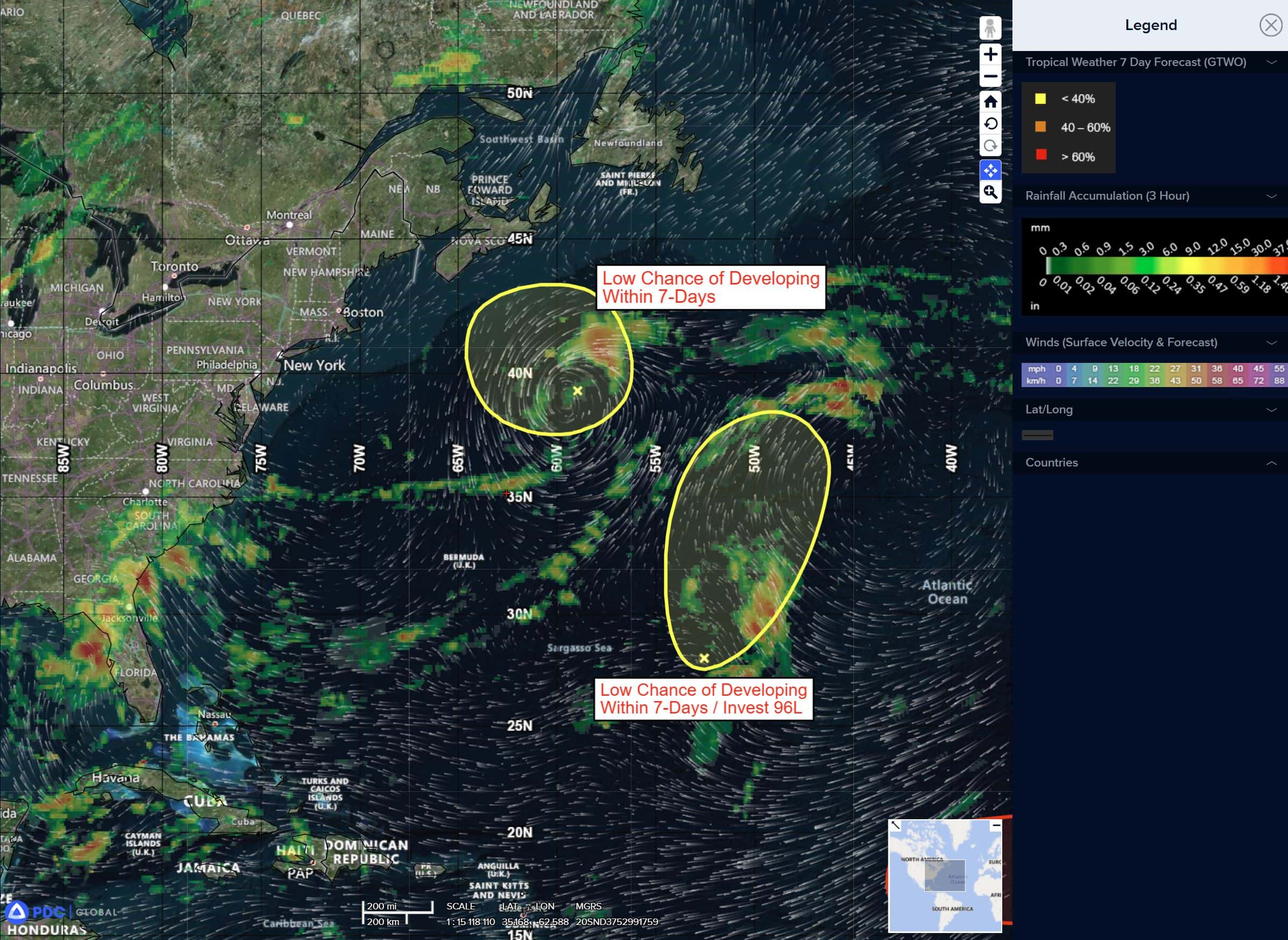
Northwestern Atlantic
>>> A non-tropical area of low pressure located a few hundred miles southeast of Nova Scotia, Canada is producing disorganized shower and thunderstorm activity to the west of its center. Some limited tropical or subtropical development is possible over the next day or so as the low meanders near the relatively warm waters of the Gulf Stream. By the middle of this week, the system is expected to move northward over cooler waters, ending its chances for further tropical development.
* Formation chance through 48 hours…low…10 percent
* Formation chance through 7 days…low…10 percent
Caribbean Sea: There are no active tropical cyclones
Tropical cyclone formation is not expected during the next 7-days.
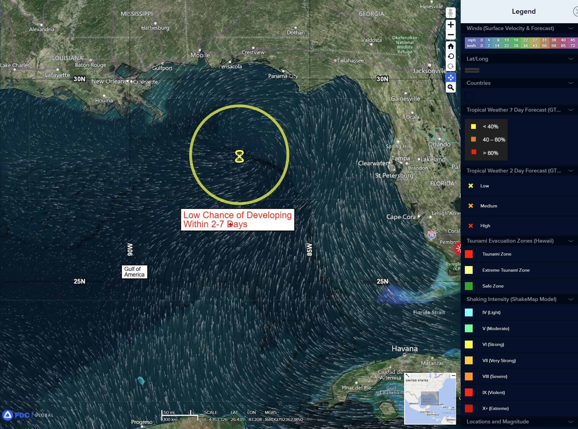
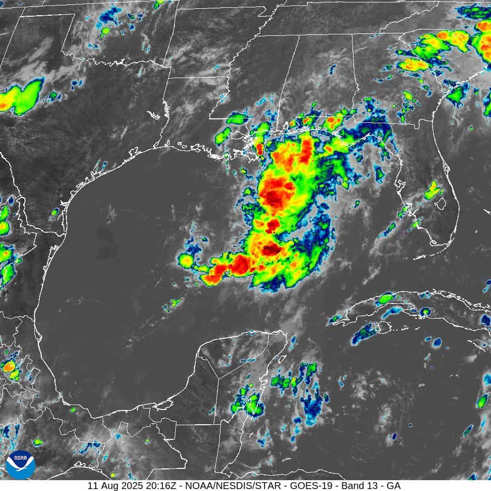
Gulf of America: There are no active tropical cyclones
Northeastern Gulf
A surface trough in the north-central Gulf is associated with a broad area of disorganized showers and thunderstorms. While development of this system is not anticipated before it moves inland later today, locally heavy rainfall could produce flash flooding across portions of the Florida Panhandle, southern Alabama, southern Mississippi and southeastern Louisiana over the next day or so.
* Formation chance through 48 hours…low…near 0 percent
* Formation chance through 7 days…low…near 0 percent