
")
Current Snapshot
For all the latest updates visit: DisasterAWARE
erin
GOES19-CAR-13-1000×1000
171150_earliest_reasonable_toa_34
171150INTQPF_sm

05L_tracks_latest
1800x1080a
By PDC’s Senior Weather
Specialist Glenn James

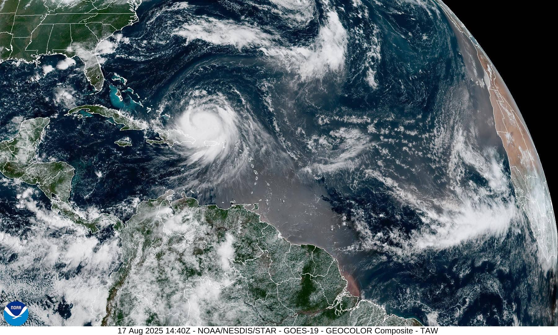
The Pacific Disaster Center’s (PDC Global) Sunday, August 17, 2025, Tropical Cyclone Activity Report…for the Atlantic Ocean, the Caribbean Sea, and the Gulf of America
Current Tropical Cyclones:
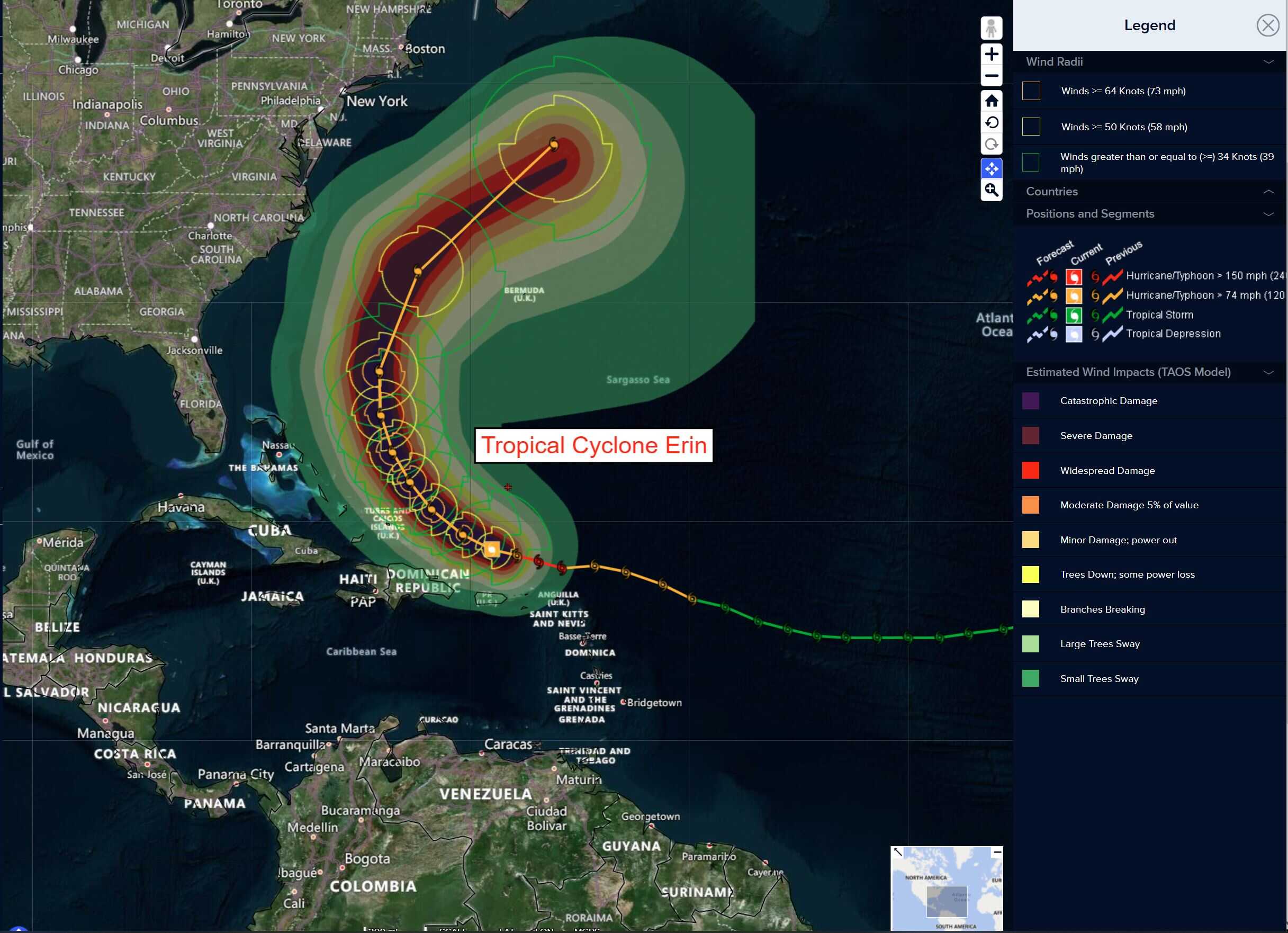
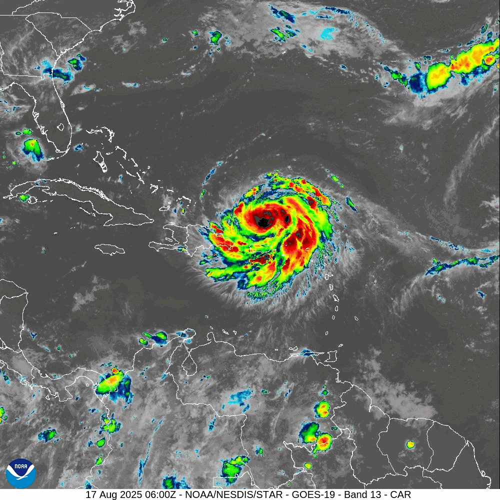
Tropical Cyclone Erin…is located about 935 miles south-southeast of Cape Hatteras, North Carolina
Atlantic Ocean
Tropical Cyclone Erin
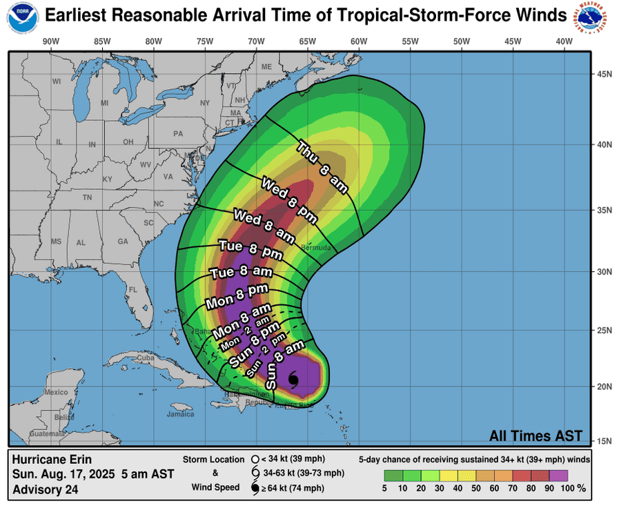
ERIN’S OUTER RAINBANDS BEGINNING TO AFFECT THE SOUTHEAST BAHAMAS AND THE TURKS AND CAICOS ISLANDS…LIFE-THREATENING SURF AND RIP CURRENTS LIKELY ACROSS THE U.S. EASTERN SEABOARD THIS WEEK
According to the NHC advisory number 27A
Erin is moving toward the northwest near 12 mph (19 km/h). A gradual turn to the north is expected later today and on Tuesday. On the forecast track, the core of Erin is expected to pass to the east of the southeastern Bahamas today and move between Bermuda and the east coast of the United States by the middle of the week. Maximum sustained winds are near 130 mph (215 km/h) with higher gusts. Erin is a category 4 hurricane on the Saffir-Simpson Hurricane Wind Scale. Some additional strengthening is expected today. Even though some weakening is forecast beginning tonight, Erin will remain a large and dangerous major hurricane through the middle of this week. Erin is increasing in size. Hurricane-force winds extend outward up to 60 miles (95 km) from the center and tropical-storm-force winds extend outward up to 230 miles (370 km).
HAZARDS AFFECTING LAND
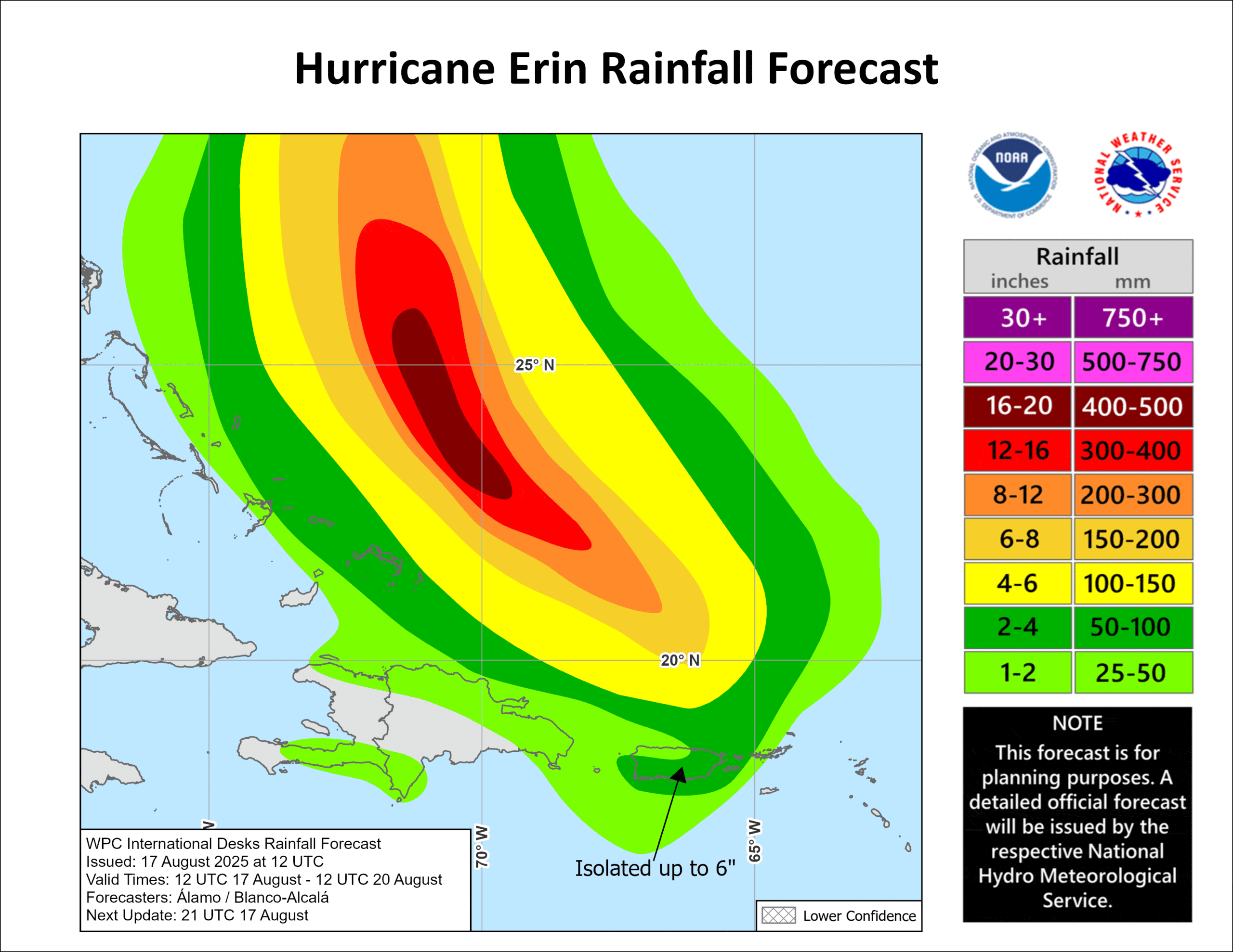
RAINFALL: Scattered showers and thunderstorms will continue to produce localized areas of heavy rainfall across Puerto Rico. Additional rainfall of 1 to 2 inches are expected across Puerto Rico today. Additional rainfall of 2 to 4 inches, with locally higher amounts to 6 inches, are forecast over the Turks and Caicos and the eastern Bahamas including San Salvador Island through Tuesday. Locally considerable flash and urban flooding, along with landslides or mudslides, are possible.
WIND: Tropical storm conditions are expected today across the Turks and Caicos Islands and the southeast Bahamas.
SURF: Swells generated by Erin will affect the Bahamas, Bermuda, the east coast of the United States, and Atlantic Canada during the next several days. These rough ocean conditions will likely cause life-threatening surf and rip currents.
STORM SURGE: Minor coastal flooding is possible in areas of onshore winds in the Turks and Caicos Islands and the southeast Bahamas. Near the coast, the surge will be accompanied by large waves.
Tropical Atlantic
>>> A large area of disorganized showers and thunderstorms over the eastern tropical Atlantic is associated with a tropical wave. Environmental conditions appear conducive for gradual development of this system, and a tropical depression could form during the latter part of the week while moving westward to west-northwestward at about 20 mph across the central tropical Atlantic, possibly approaching the vicinity of the Leeward Islands on Friday.
* Formation chance through 48 hours…low…near 0 percent
* Formation chance through 7 days…medium 50 percent
Caribbean Sea: There are no active tropical cyclones
Tropical cyclone formation is not expected during the next 7-days.
Gulf of America: There are no active tropical cyclones