
")
Current Snapshot
For all the latest updates visit: DisasterAWARE
epac
1800x1080e
koto
33W_280600sair
33W_tracks_latest
dit
05B_280600sair
05B_tracks_latest
04b
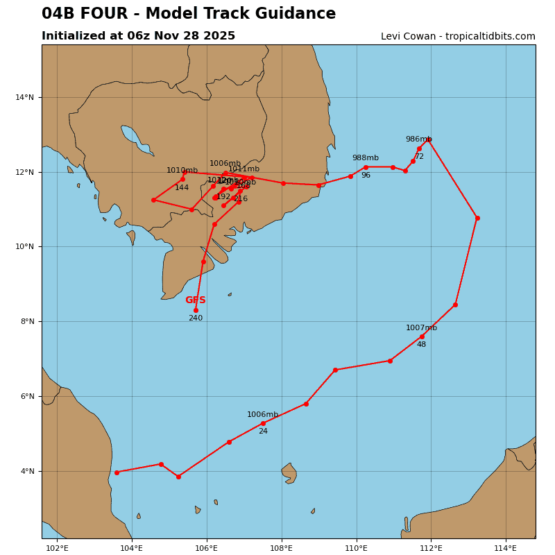
04B_tracks_latest
By PDC’s Senior Weather
Specialist Glenn James

The Pacific Disaster Center’s (PDC Global) Friday, November 28, 2025, Tropical Cyclone Activity Report…for the Pacific Ocean, the Indian Ocean, and adjacent Seas
Current Tropical Cyclones:
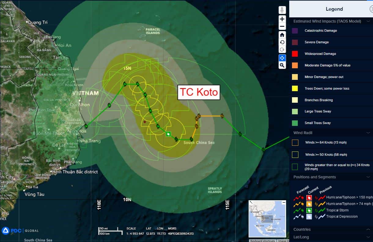
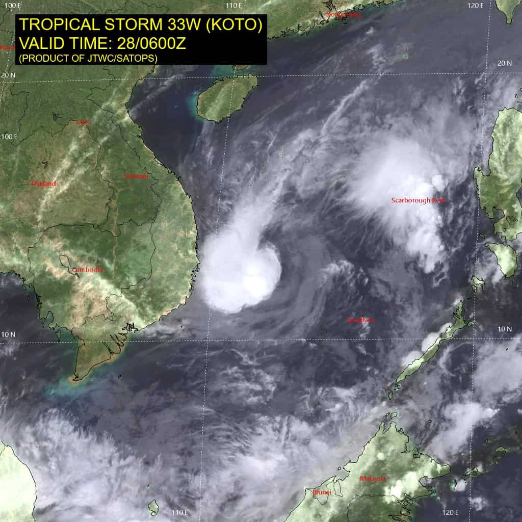
Tropical Cyclone 33W (Koto)…is located 331 NM southeast of Da Nang, Vietnam
Tropical Cyclone 05B (Ditwah)…is located approximately 958 NM south-southwest of Kolkata, India
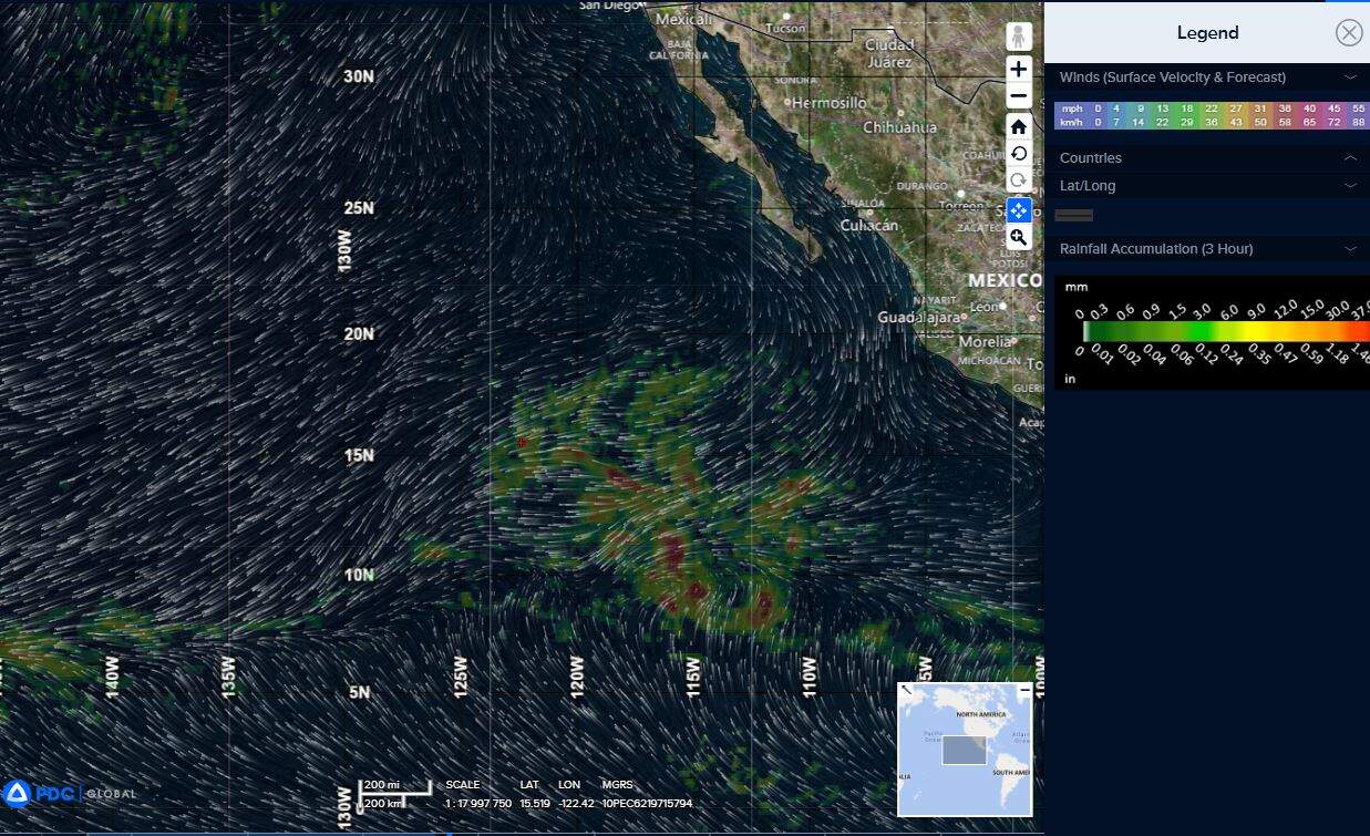
Northeast Pacific Ocean: There are no Tropical Cyclones
Tropical cyclone formation is not expected during the next 7 days.
Central Pacific Ocean: There are no Tropical Cyclones
Tropical cyclone formation is not expected during the next 7 days.
Western Pacific, Indian Ocean, and adjacent Seas:
Western Pacific
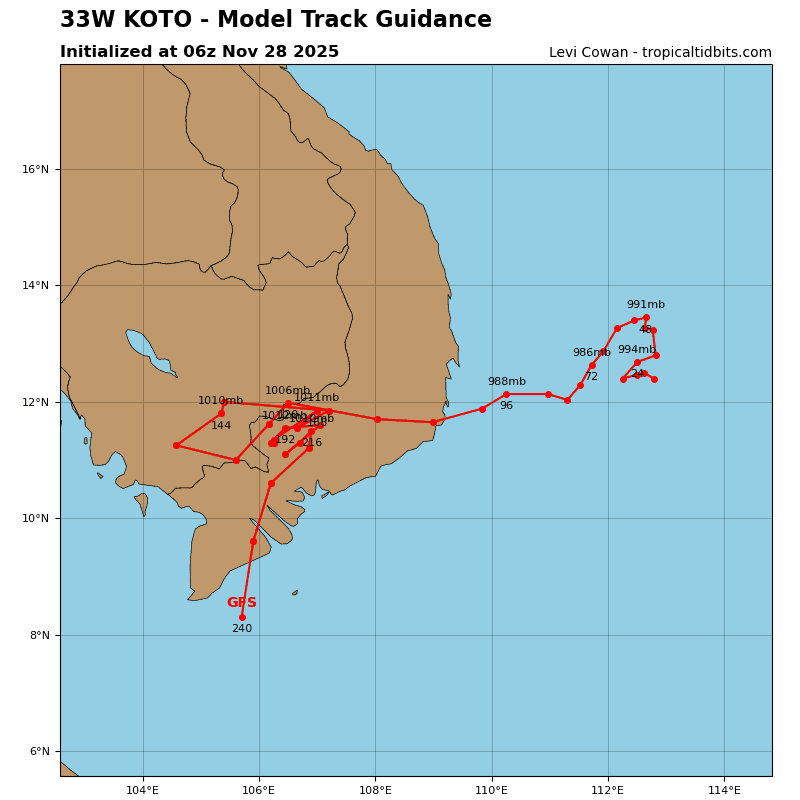
Tropical Cyclone 33W (Koto)
According to the JTWC warning number 15, sustained winds were 50 knots, with gusts to near 65 knots
Animated multi-spectral satellite imagery (msi) depicts an exposed, well-defined low-level circulation center (llcc), with deep convection rebuilding over the western semicircle. the initial position is placed with high confidence based on the msi. despite the marginal conditions, the overall convective structure is well-organized as indicated in the 280534z amsr2 36ghz microwave image, which shows tightly-curved banding wrapping into a defined llcc.
Tropical storm 33W is forecast to churn slowly poleward through 48 hours along the western periphery of the str positioned to the east. The system will maintain intensity near 50 knots due to dry air entrainment, persistent southerly vertical wind shear, and possibly cool upwelling water.
After 48 hours, the system is forecast to track southwestward under the steering influence of the western str, with steady weakening as the system approaches Vietnam.
North Indian Ocean
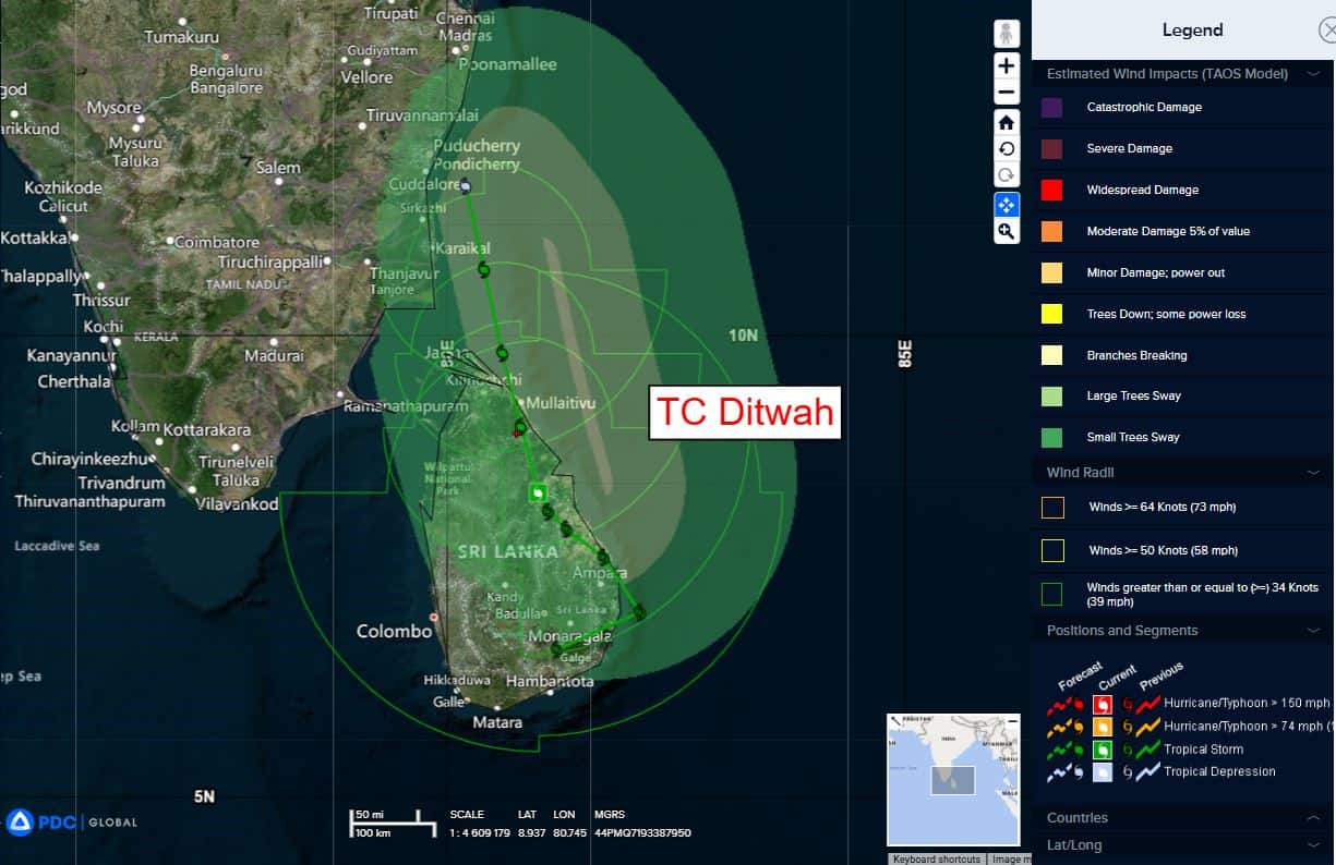
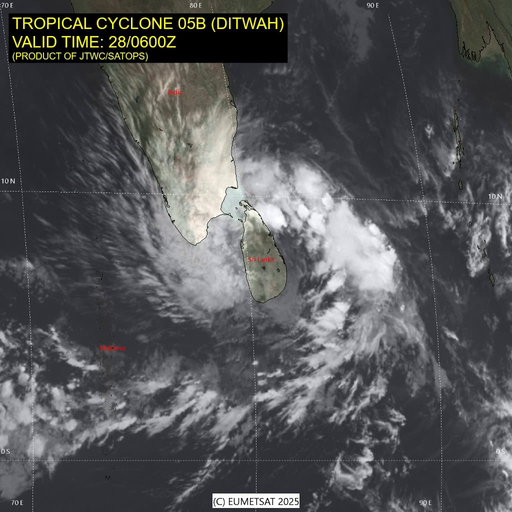
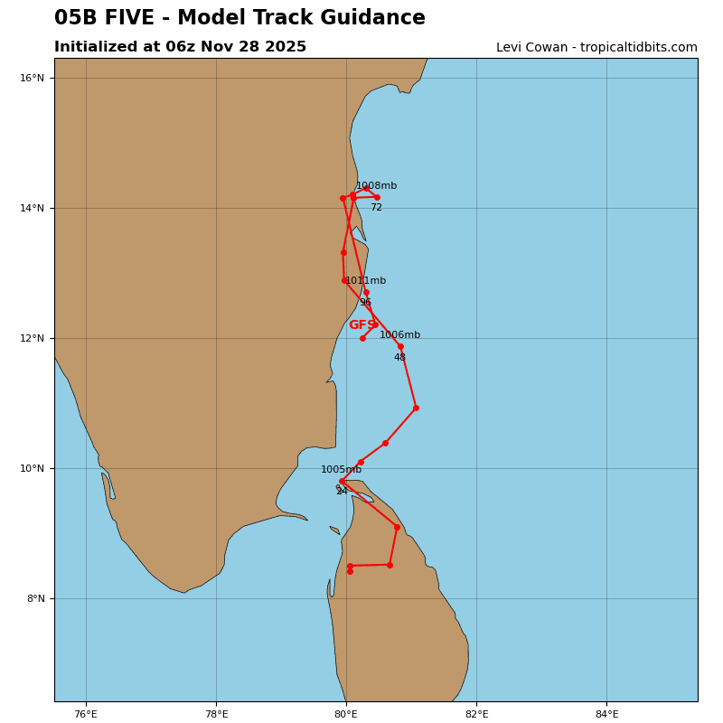
Tropical Cyclone 05B (Ditwah)
According to the JTWC warning number 6, sustained winds were 35 knots, with gusts to near 45 knots
Tropical cyclone 05B continues to track slowly poleward over the
northeastern region of Sri Lanka. Animated multispectral satellite
imagery (msi) depicts a broad, ragged low-level circulation center (llcc), with spiral banding displaced to the north and west over water. A 280150z ssmis 91ghz microwave image reveals extensive fragmented banding, with no organized or defined llcc evident. Limited surface observations show the broad circulation but are sustained at less than 10 knots reflecting the weak nature of the llcc.
Although robust poleward outflow continues to support the outer banding, frictional effects and dry air entrainment continue to seriously hinder core development.
TC 05B will track northward through the forecast period skirting the southeastern coast of India. The system will maintain intensity due to persistent frictional effects and dry air entrainment through 36hours, with dissipation anticipated by 48 hours when the system tracks under increasing southerly flow aloft with increasing vertical wind shear.
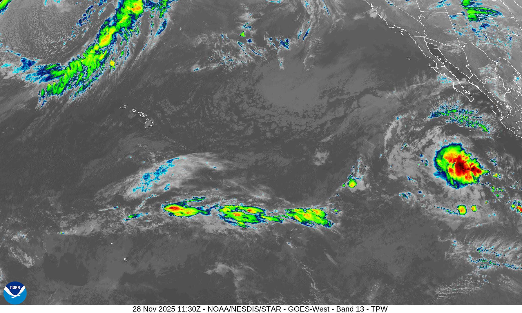
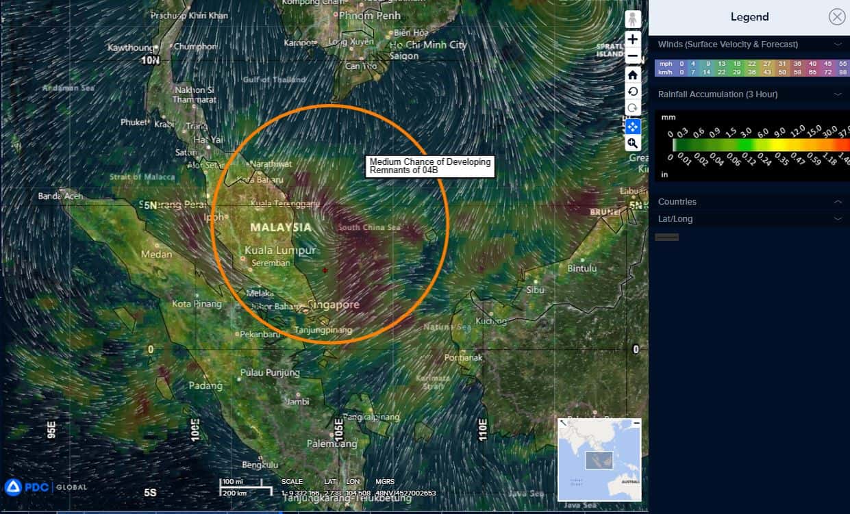
>>> There’s an area of disturbed weather being referred to as the remnants of 04B, which is located approximately 155 NM northwest of Singapore
Animated enhanced infrared satellite imagery (eir) as well as a 280608z gmi 89 ghz microwave image depict a very broad and
disorganized area of convection with formative banding along the eastern periphery.
Environmental analysis for the western portion of the South China Sea reveals a marginally favorable environment with warm (28-29 c) sea surface temperatures, low to moderate (15-20 kts) vertical wind shear, and persistent dual channel outflow in the upper levels.
Global deterministic models are in agreement that the circulation will consolidate over the next 24 hours with ecmwf being more favorable for a symmetrical system within 48 hours. GFS on the other hand remains hesitant on a well organized system with the remnants of 04B remaining relatively ragged throughout its life.
Maximum sustained surface winds are estimated at 18 to 23 knots.
The potential for the development of a significant tropical cyclone within the next 24 hours is medium.