
")
Current Snapshot
For all the latest updates visit: DisasterAWARE
epac
1800x1080e
fung
32W_101200sair
32W_tracks_latest
By PDC’s Senior Weather
Specialist Glenn James

The Pacific Disaster Center’s (PDC Global) Monday, November 10, 2025, Tropical Cyclone Activity Report…for the Pacific Ocean, the Indian Ocean, and adjacent Seas
Current Tropical Cyclones:
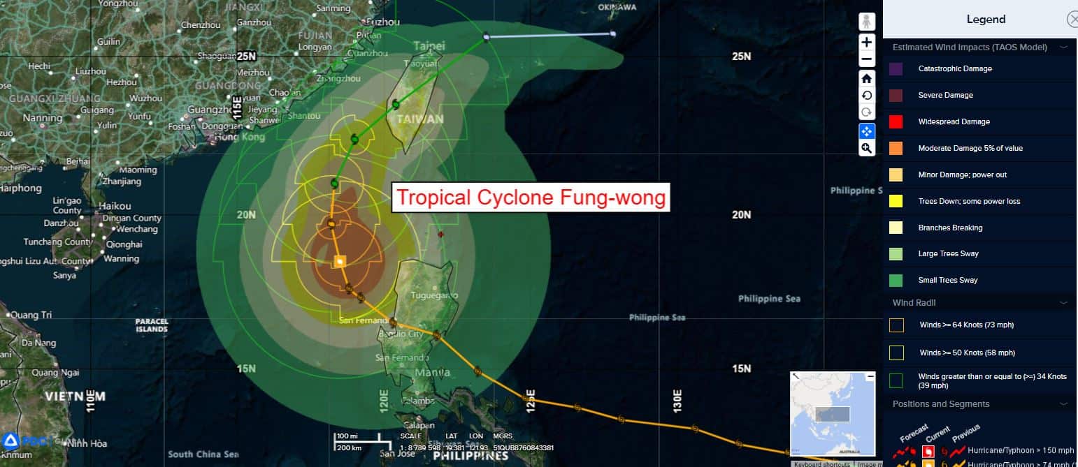
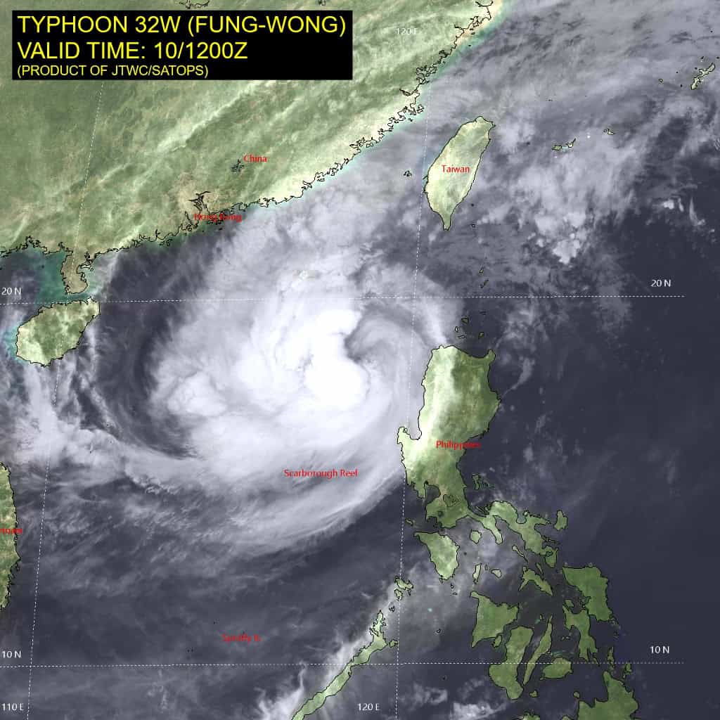
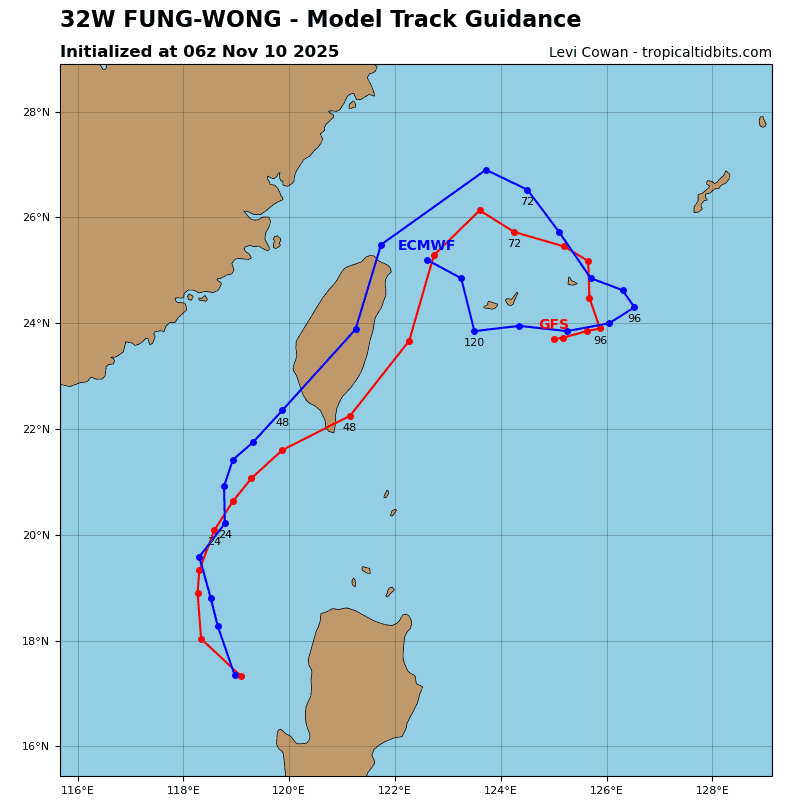
Tropical Cyclone 32W (Fung-wong)…is located 430 NM south-southwest of Taipei, Taiwan
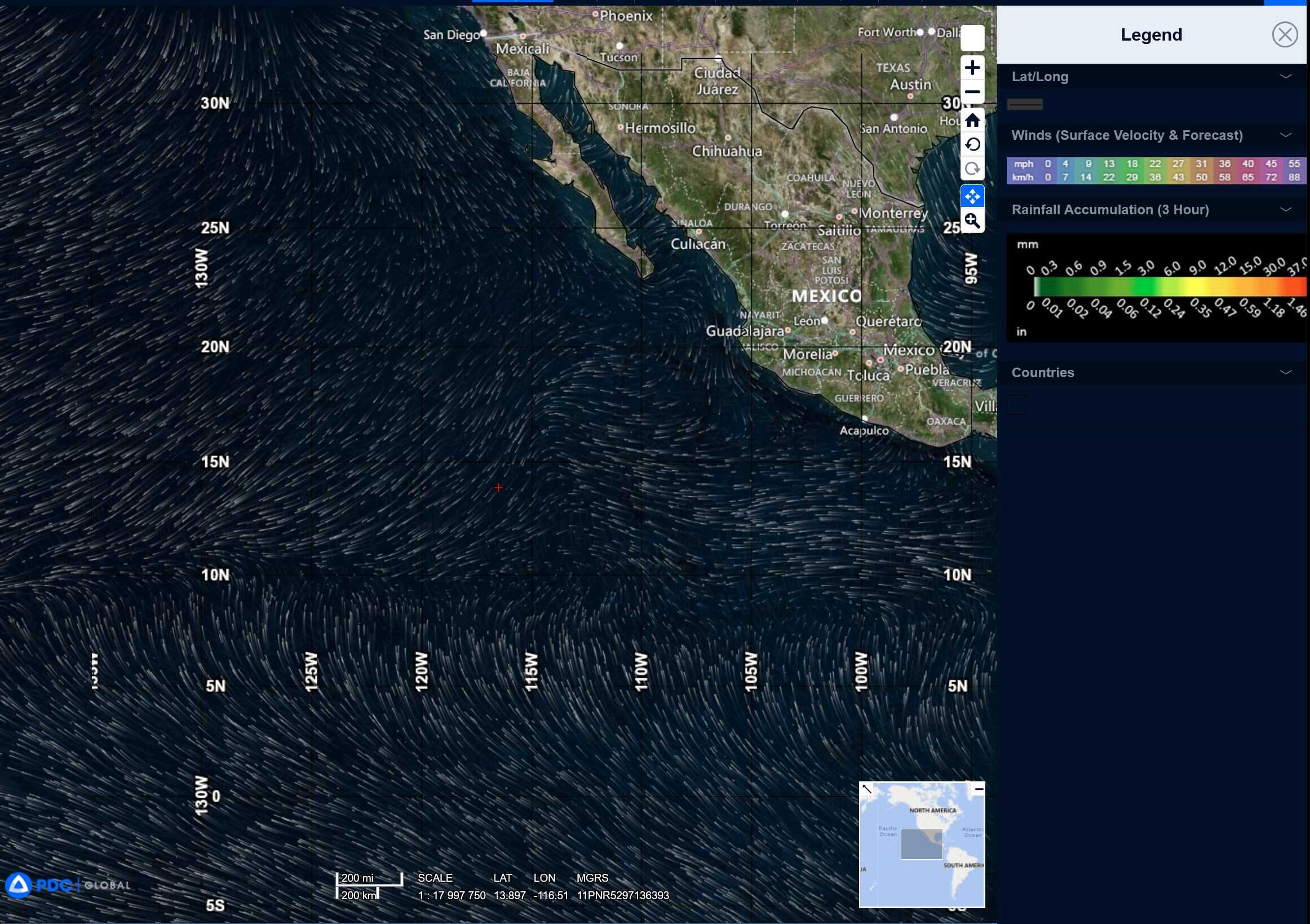
Northeast Pacific Ocean: There are no Tropical Cyclones
Tropical cyclone formation is not expected during the next 7 days.
Central Pacific Ocean: There are no Tropical Cyclones
Tropical cyclone formation is not expected during the next 7 days.
Western Pacific, Indian Ocean, and adjacent Seas:
Western Pacific
Tropical Cyclone 32W (Fung-wong)
According to the JTWC warning number 26…sustained winds are 70 knots with gusts to 85 knots
Animated enhanced infrared (eir) satellite imagery depicts typhoon 32W (Fung-wong) continuing to struggle to reorganize with its ragged eye feature now obscured and deep convection flaring
primarily over the western side of the circulation. Cloud top temperatures have remained largely unchanged over the past 6 hours.
The current environmental conditions are marginally unfavorable for continued development as TY Fung-wong has slowed down, resulting in cold water upwelling. Additionally, as the system tracks north, more dry air is being entrained into the core of the vortex.
TY 32W (Fung-wong) is beginning to round the axis of a subtropical ridge (str) centered to the northeast and heading towards Taiwan. Weakening will continue over the South China Sea as the system tracks over cooler sea surface temperatures while contending with dry air being entrained into the vortex structure. Additionally, vertical wind shear (vws) is expected to increase around 24 hours further contributing to the degradation of the structure of TY 32W.
Landfall is forecast around 48 hours over the southwestern coast of Taiwan. Frictional effects of the passage over the central mountain range of Taiwan will result in rapid weakening, as the intensity is expected to drop to 25-30 kts at the time of the system re-emerging over the East China Sea. TY Fung-wong will fully dissipate over water shortly after, and prior to 96 hours.